BraysAway Travels
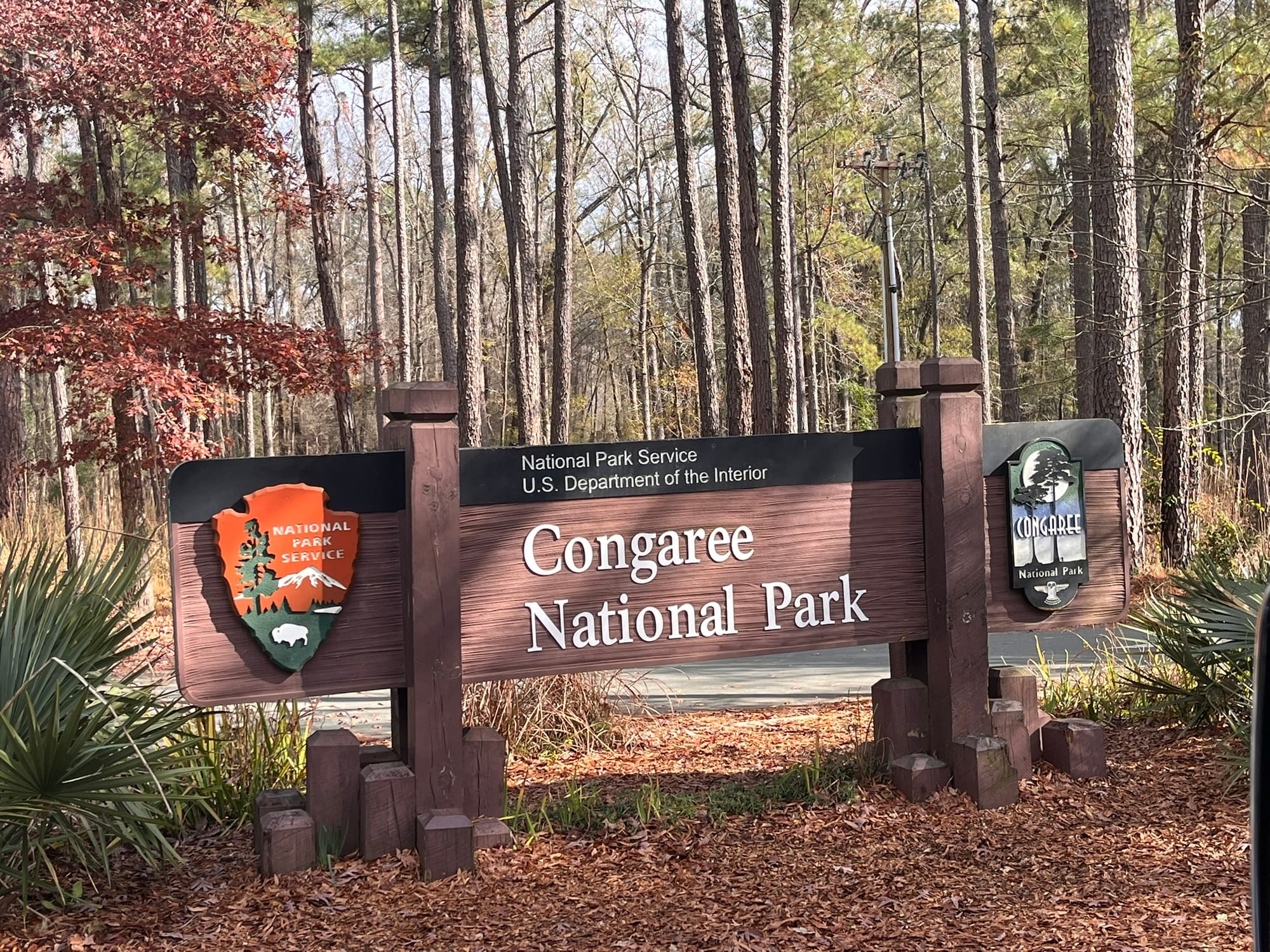
Congaree National Park, NC
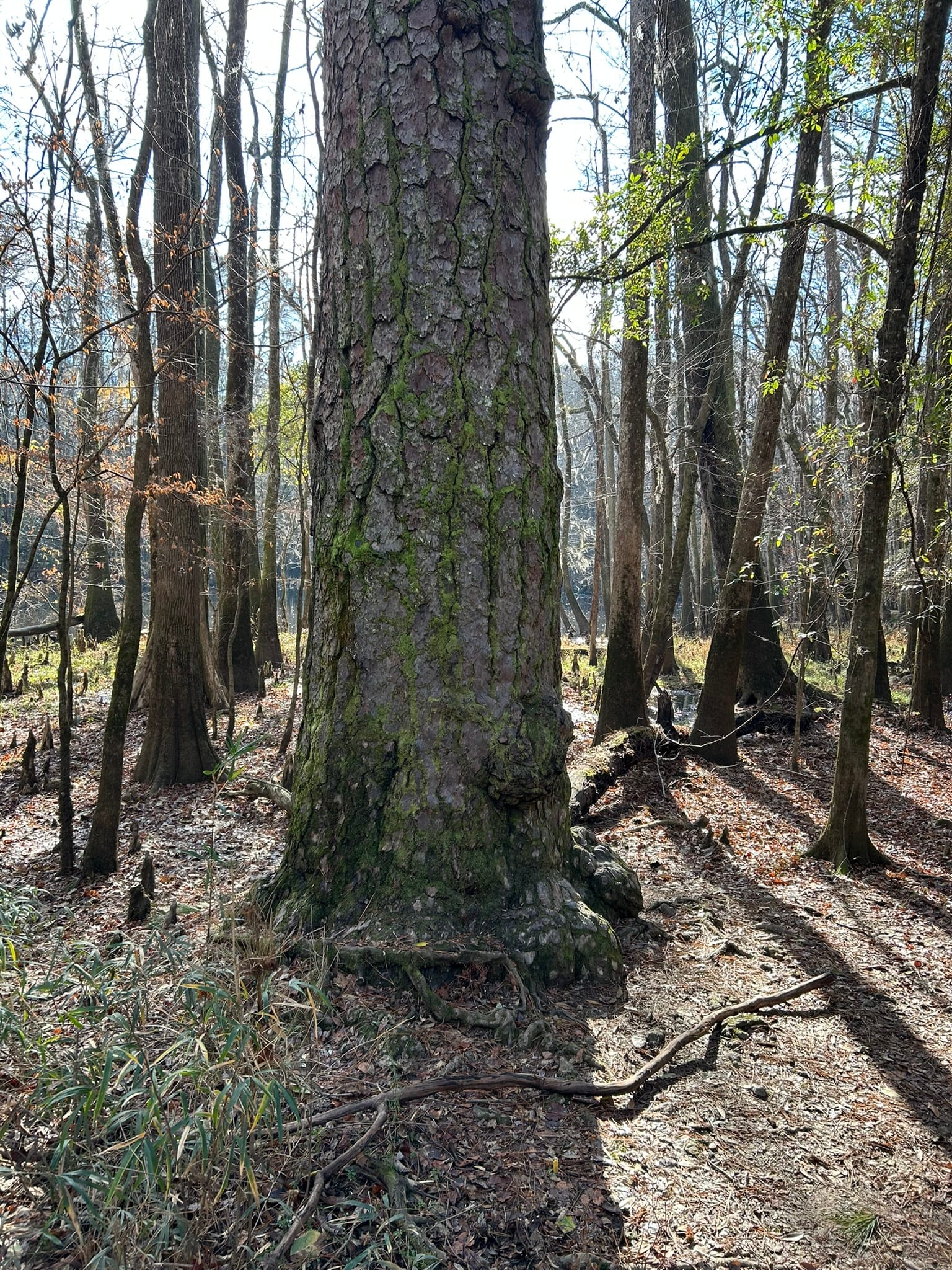
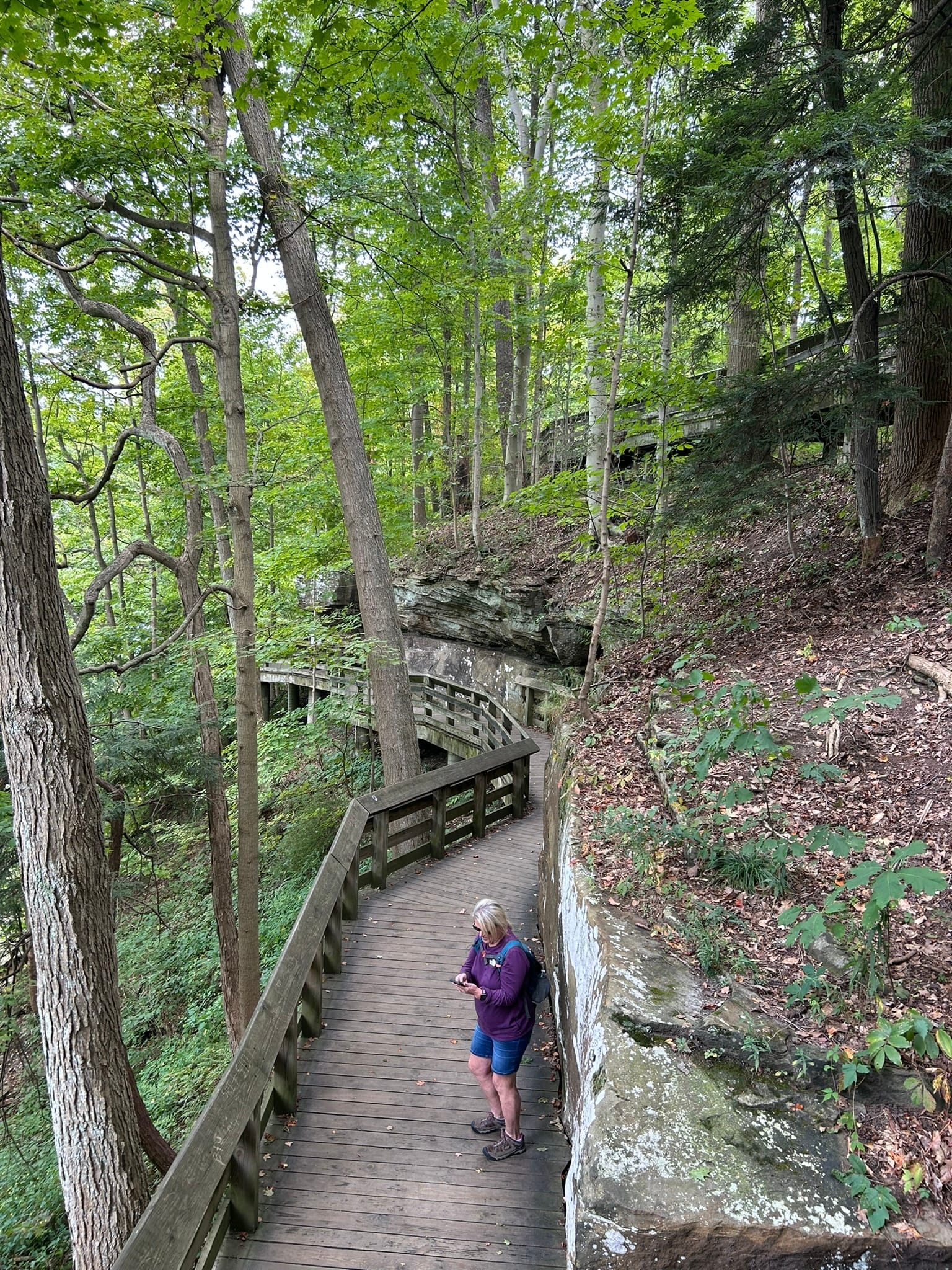
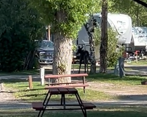
Congaree National Park protects the largest remaining old growth bottomland hardwood forest in the southeast. Much of the rest have been harvested over the years but this swampy lowland has protected much of the trees from being cut down. It contains a large concentration of state and national record holding trees and provides habitat for several endangered species. The park is named for the Congaree Indians who inhabited this region.
The main attraction is a 2.5 mile elevated boardwalk hike around the floodplain area where you can view the flora and fauna that call this swampy region home. We hiked the trail during the colder months and besides some birds and squirrels we didn't see many animals. The size of some of the Loblolly Pine trees were very impressive with one at least rising over 150 feet over our heads!
Overall, this isn't going to be one of our favorite national parks. I'm a bit partial to mountains and interesting geologic formations!
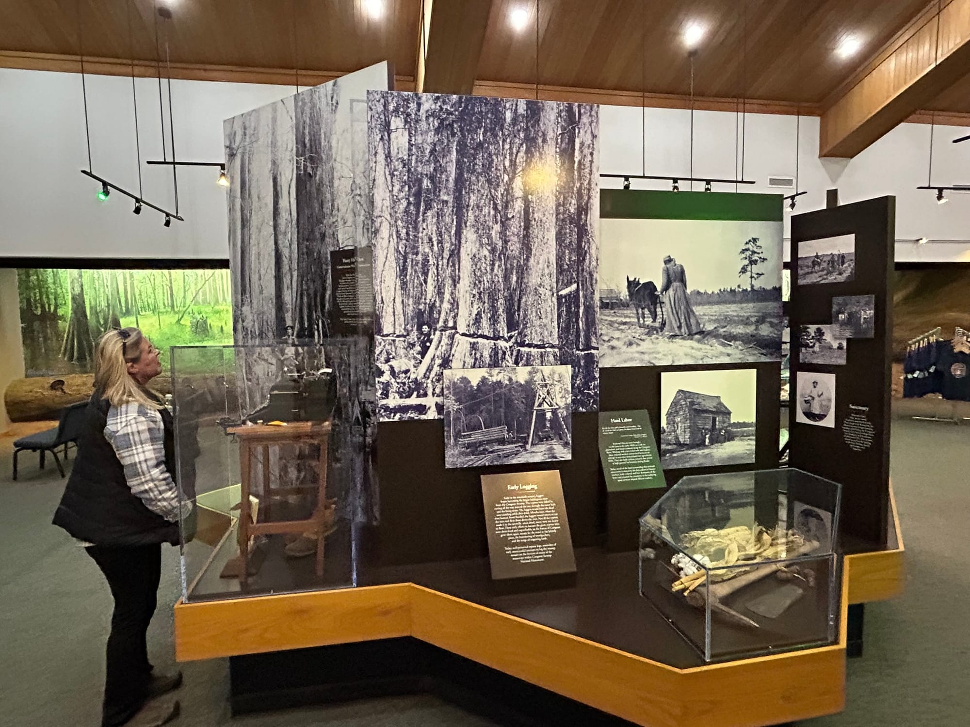
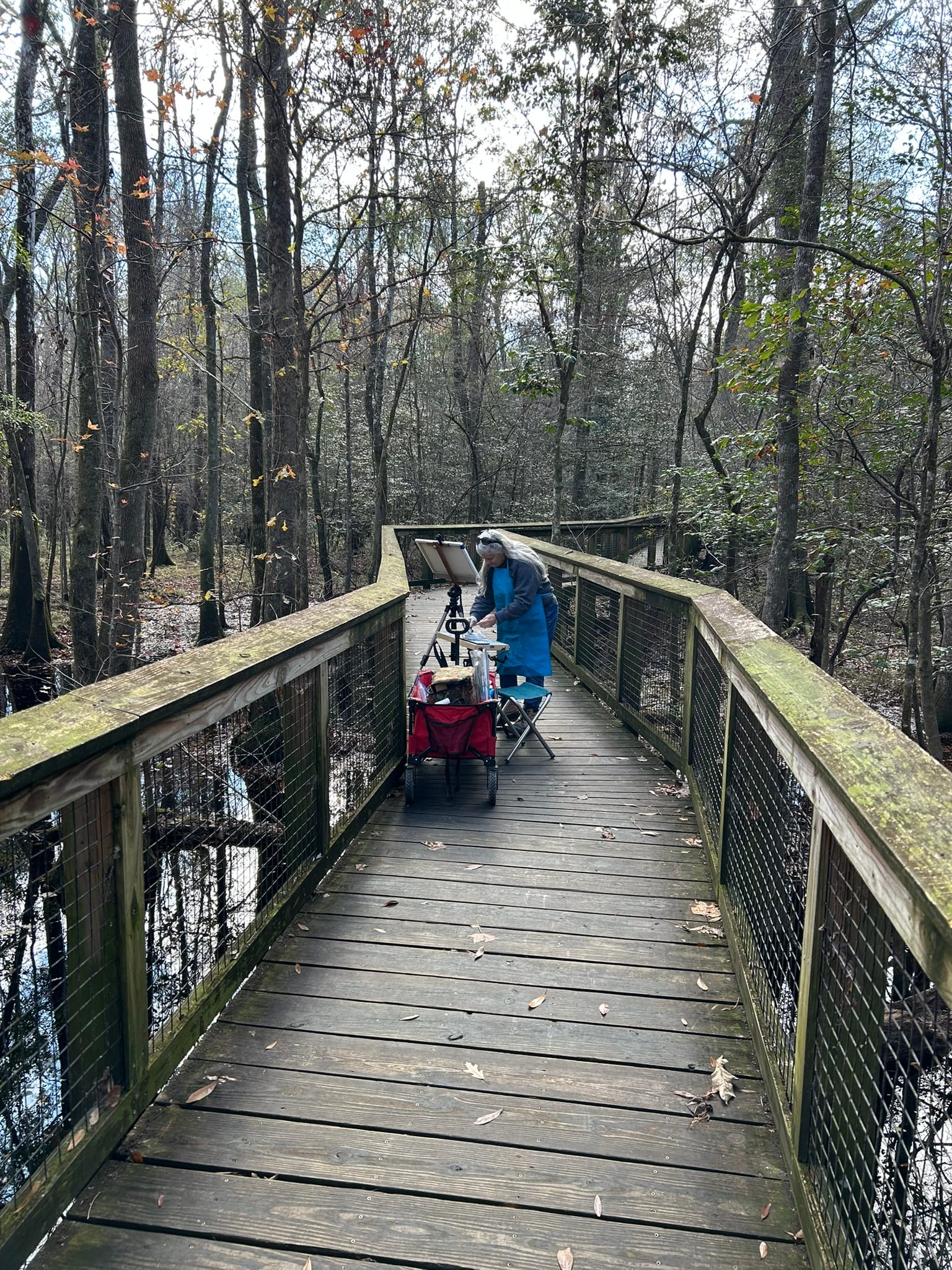
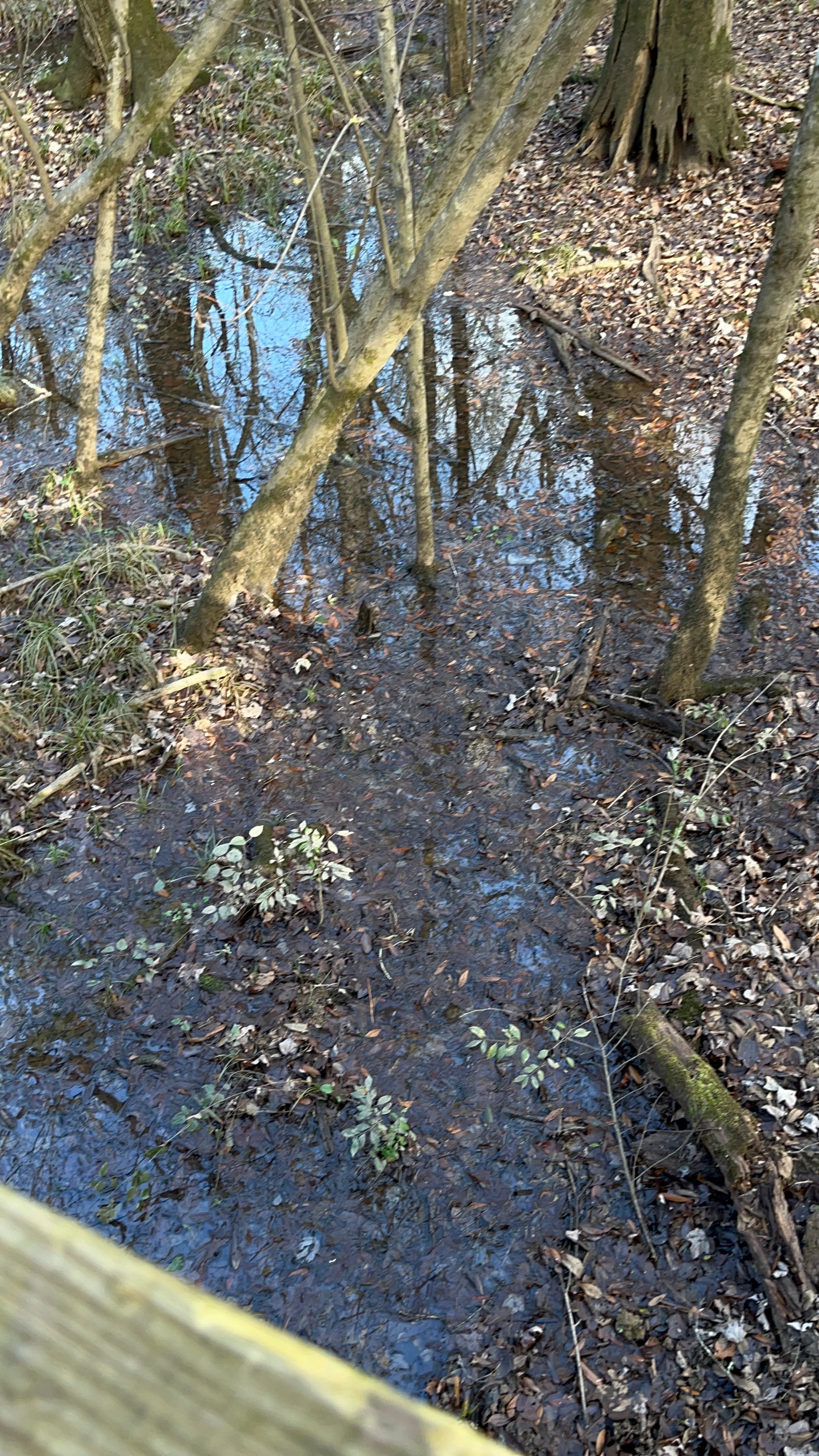
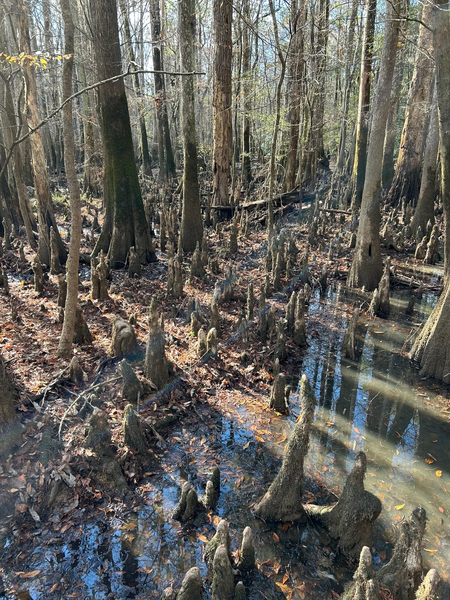
Sights around Congaree Boardwalk
Vicksburg National Military Park, MS
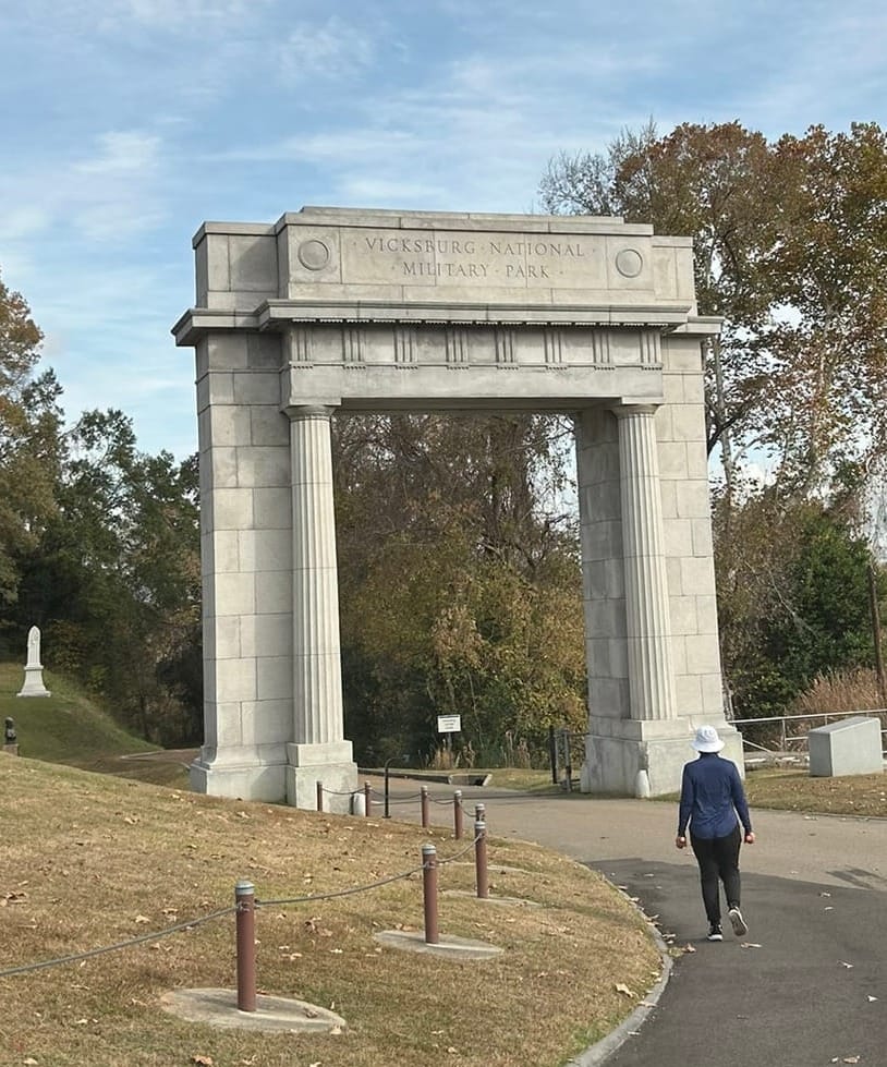
Today dawned cloudy and cool and we steeled ourselves for a somber day on the Hallowed Ground of Vicksburg National Military Park. I downloaded a driving tour on Action Tour Guide App. It was a short drive over to the Park Entrance and Museum where the tour starts. The museum was interesting and had a nice 15 minute or so overview of the battle that we watched and then walked around the other displays inside and headed back for our truck to begin the tour.
The tour begins by passing under the Memorial Arch and winds around the battlefield where so many Americans died in the battle for Vicksburg and subsequent control of the Mississippi River. If the Union Army under General Grant takes Vicksburg, they effectively cut the confederacy in half and break their main supply line. None of this was lost on the Confederate General Pemberton who had to hold it at any cost.
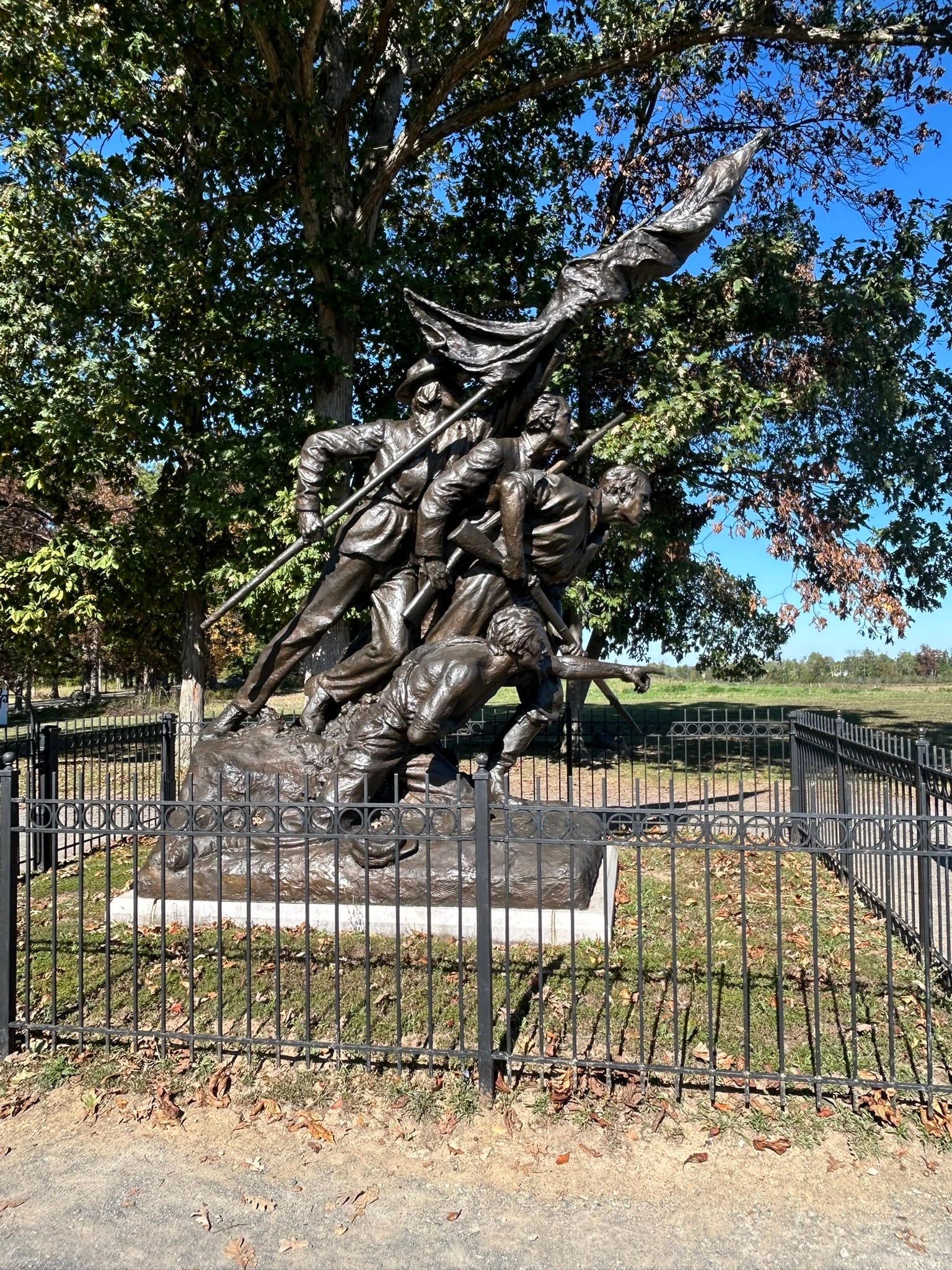
The tour takes you around the battlefield and points out the highlights of the battle that ultimately was won by siege and starved the Confederate army out after many failed Union attacks. There are countless amazing memorials to the units and soldiers from all the participating states.
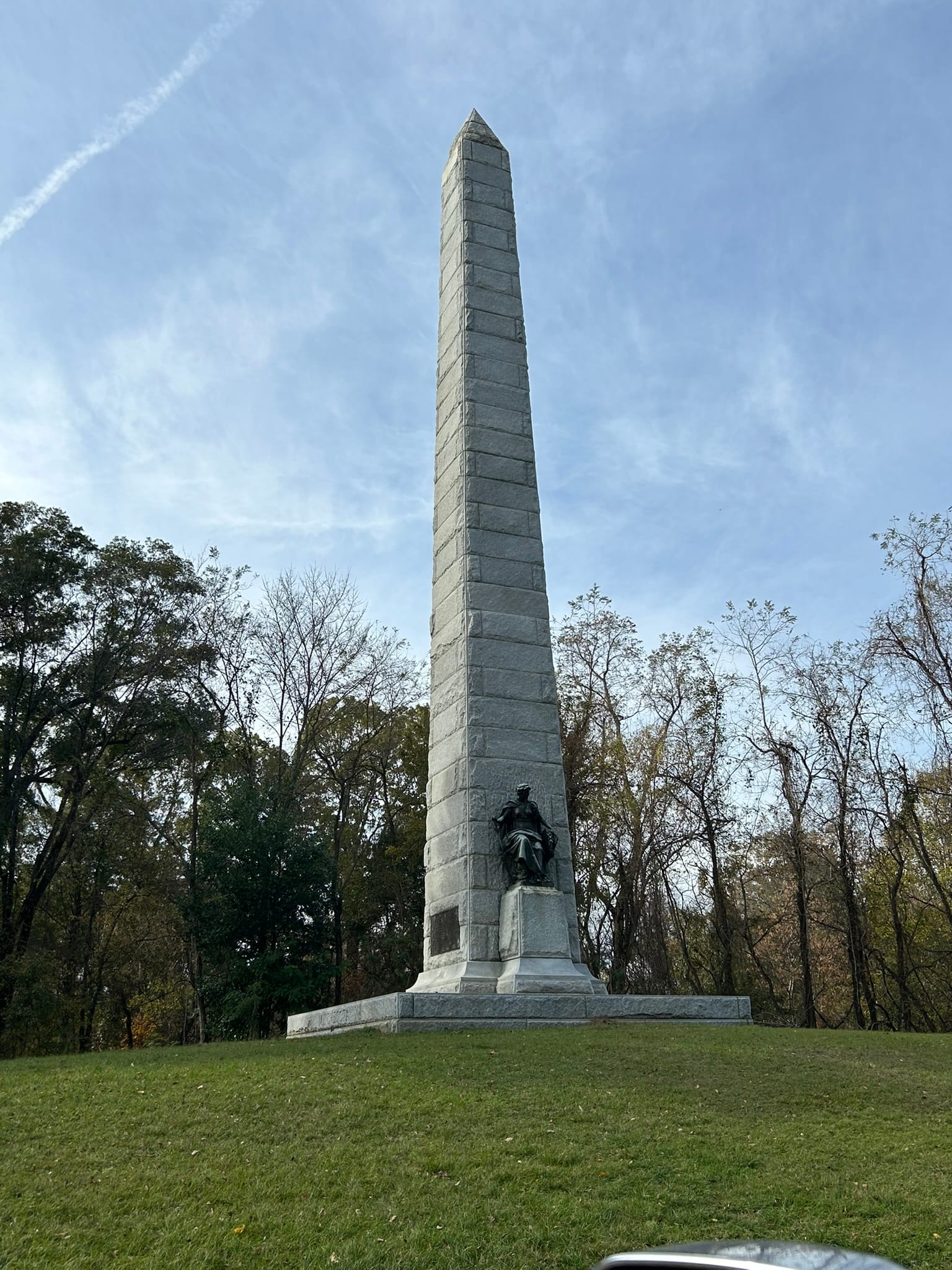


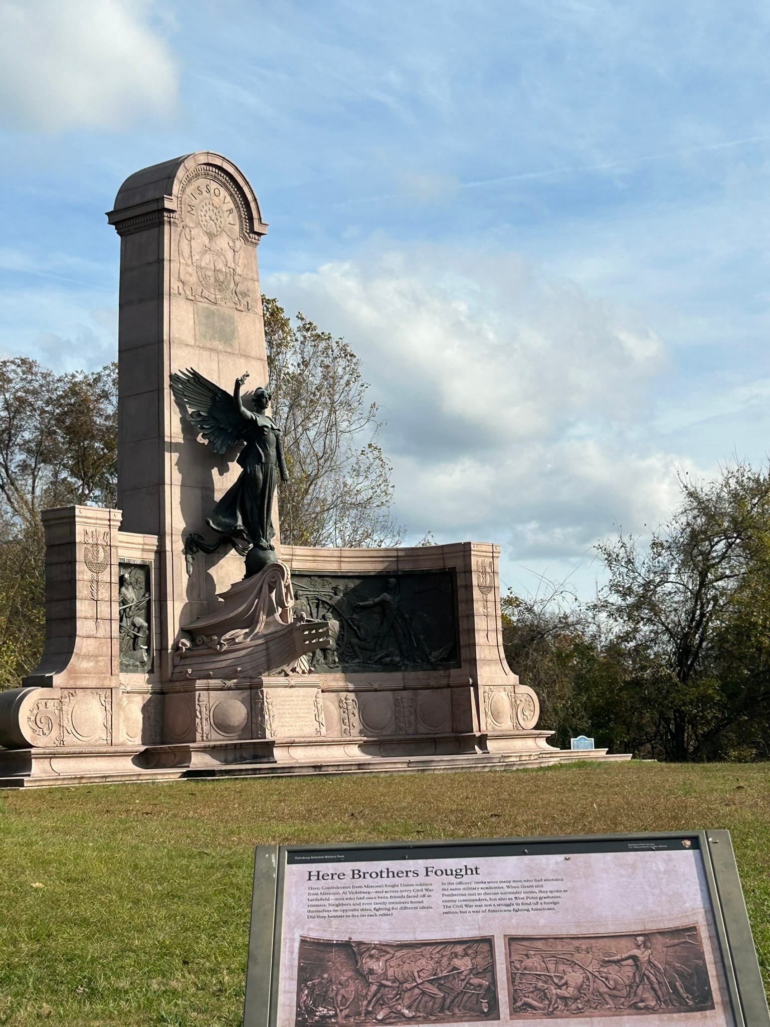
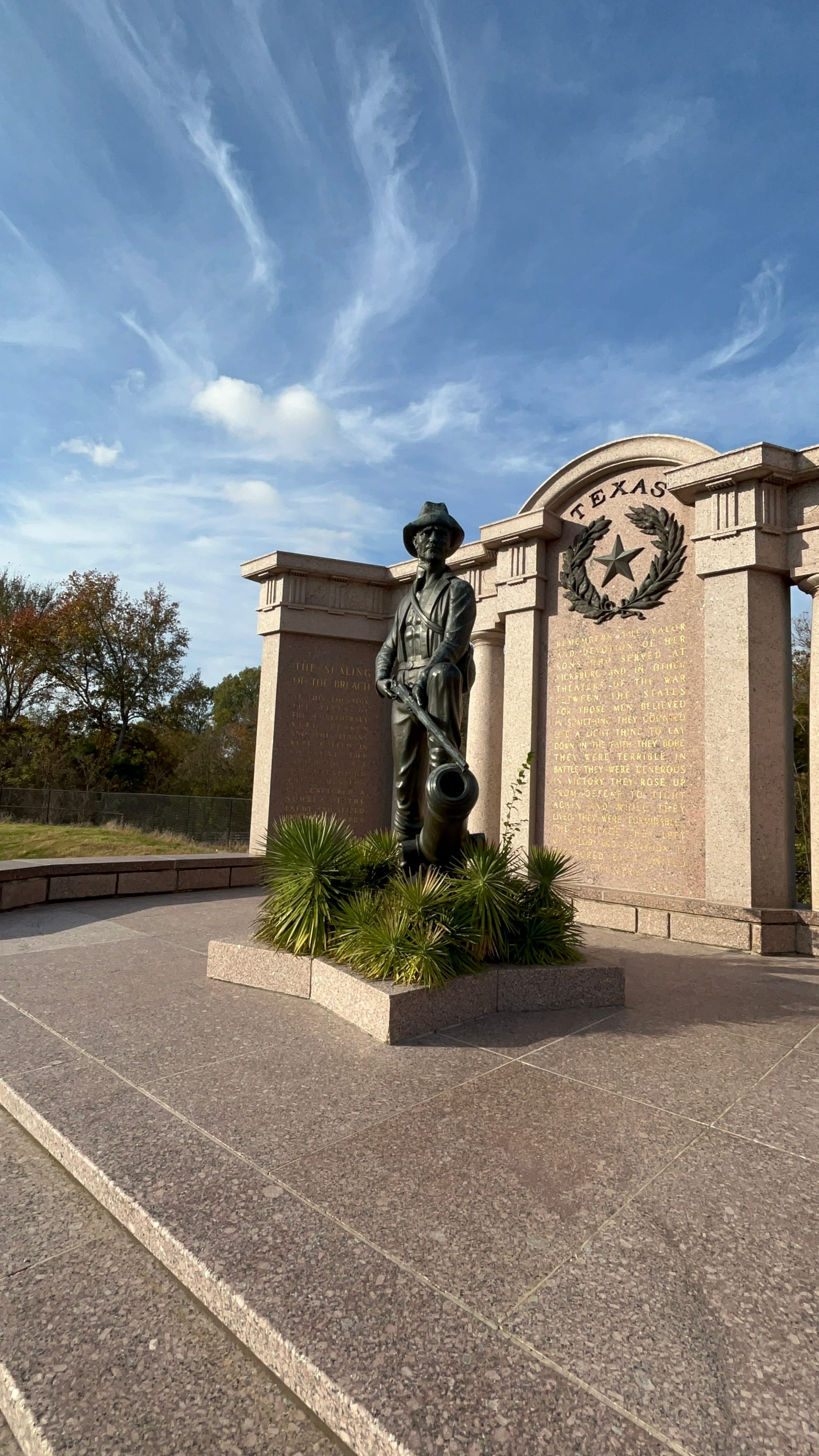
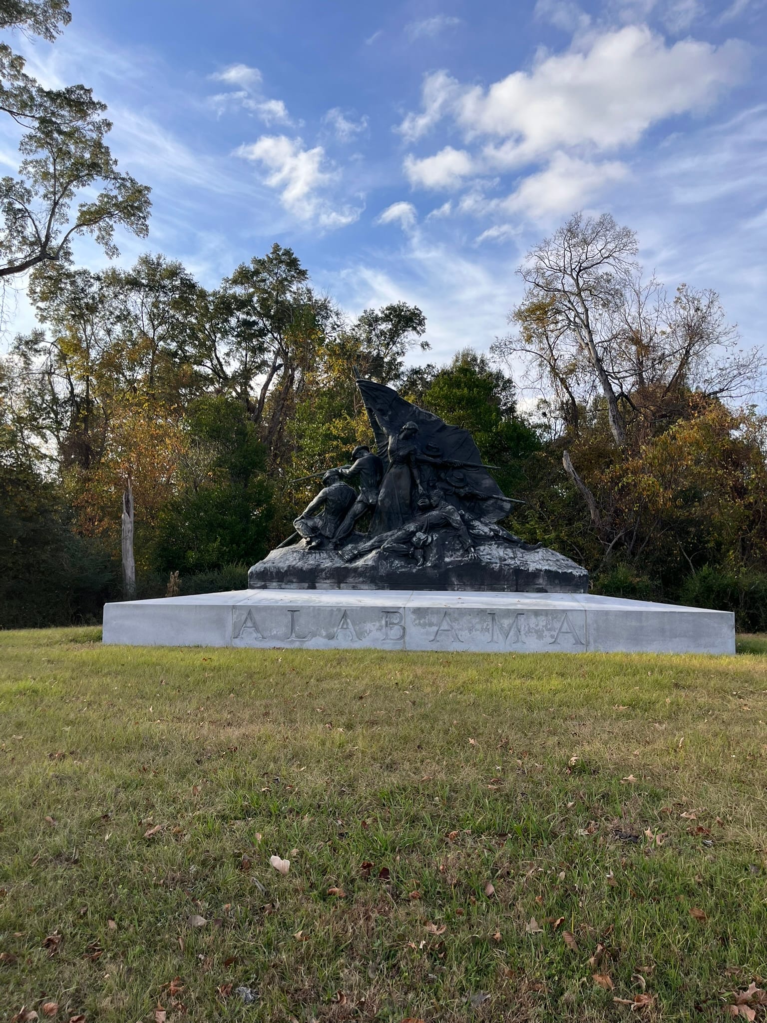
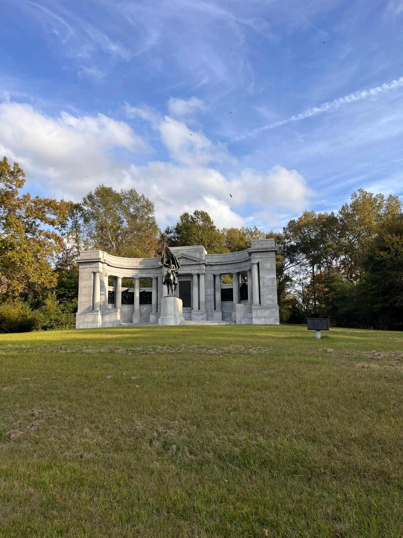
A Sample of Monuments in Vicksburg NMP
Of surprise to me, they also have the excavated and preserved remains of the USS Cairo, one of 7 iron clad warships that participated in the Civil War. It was a steam powered, paddle wheel battleship ultimately sunk by mines along the river. Vicksburg was, until WWII, the largest American amphibious operation. It's remains and the adjacent museum holding the remarkably preserved artifacts from within the vessel, are on the very northwest side of the park and are also near the National Cemetery where thousands of the fallen soldiers from the battle rest.

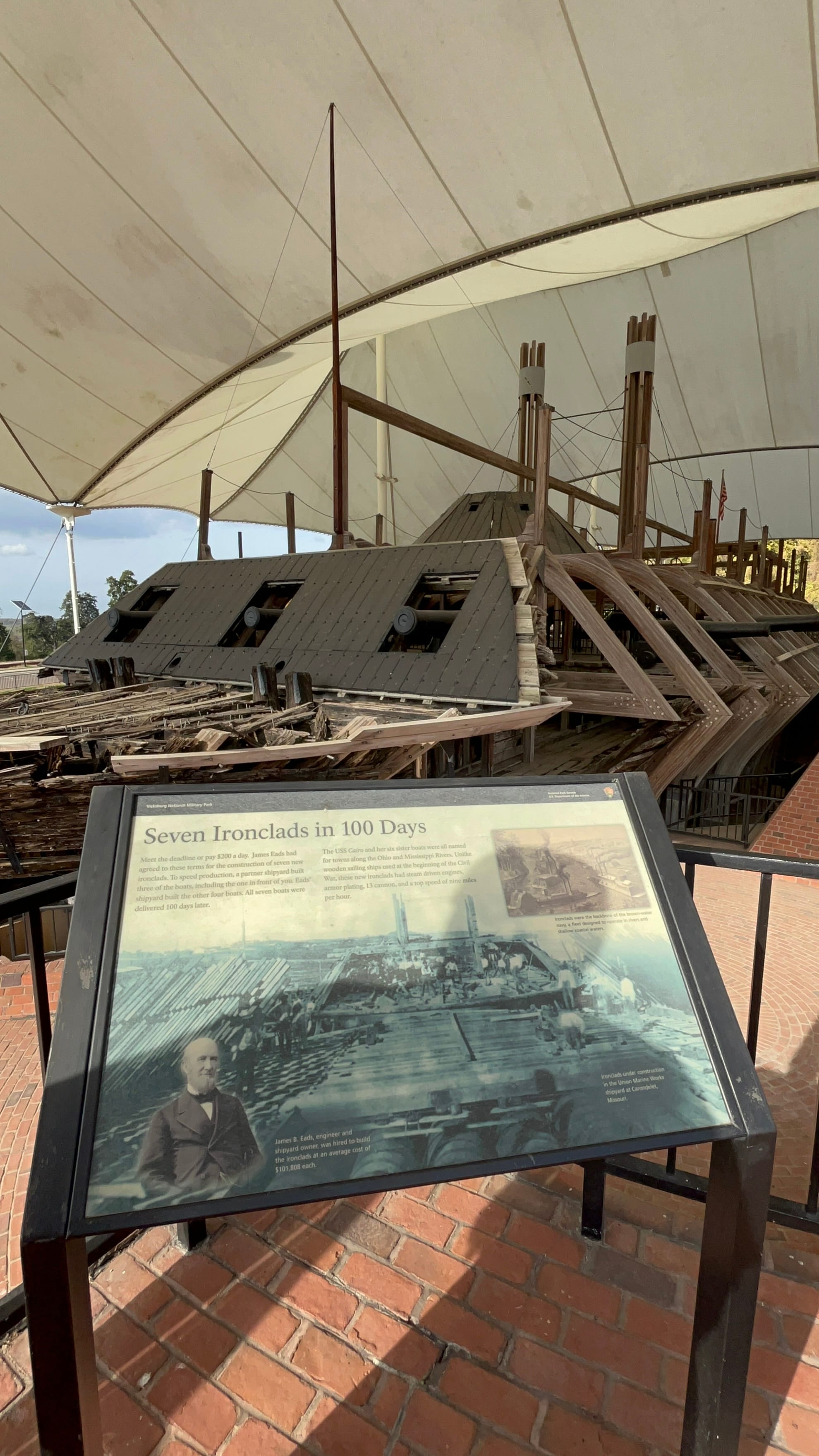
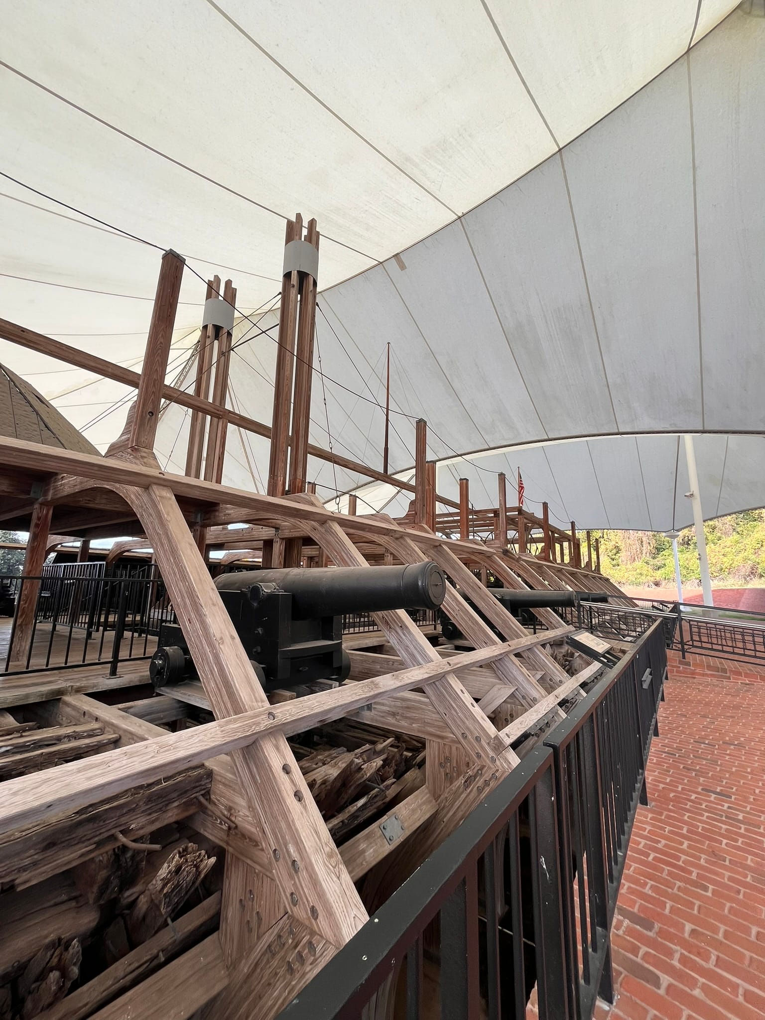
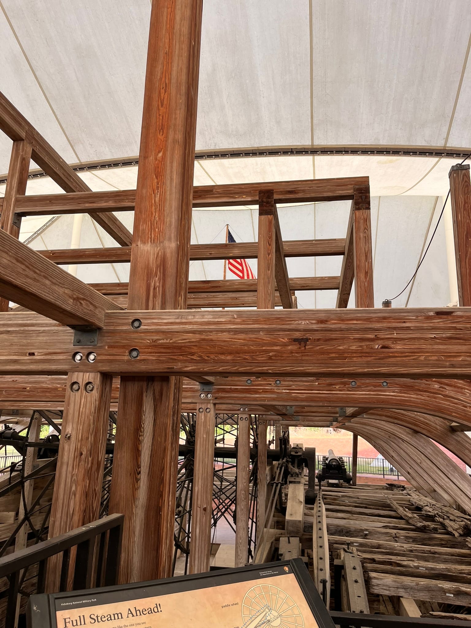
U.S.S. Cairo
Between Gettysburg and Vicksburg, the tide of the Civil War was turned and the Confederacy’s days were numbered.
I’ve really been enjoying our freedom to travel and visit historic sites like Gettysburg and Vicksburg!
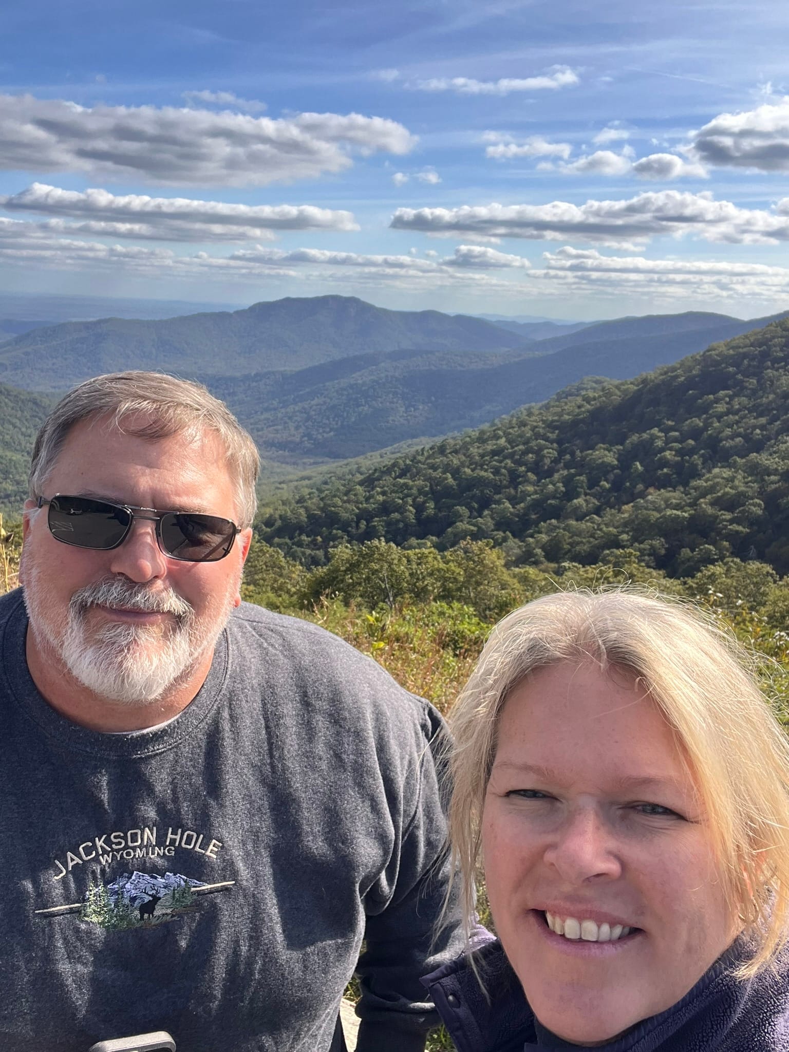
Shenandoah National Park, VA
Shenandoah National Park is located in the Blue Ridge Mountains of Virginia. It is a very large park filled with forests, mountains, valleys and scenic vistas! We drove Skyline Drive, a scenic road that follows the mountains north to south. It connects with the Blue Ridge Parkway near Waynesboro. The road has many scenic overlooks with turnoffs to take in the views of the valley's below. It has a lot of hiking and camping opportunities as well.
Due to the ongoing government shutdown, the welcome center was not open but you can access the park.
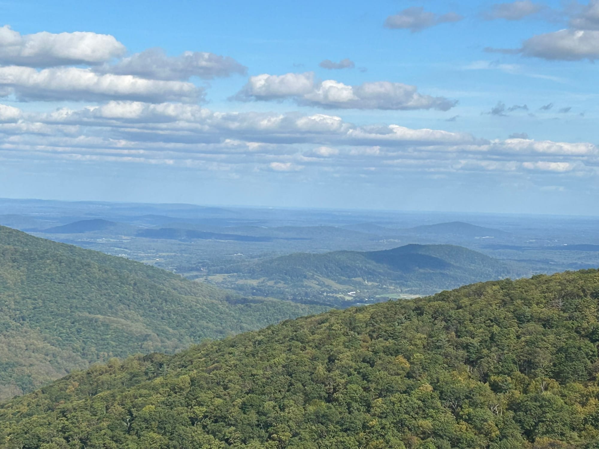
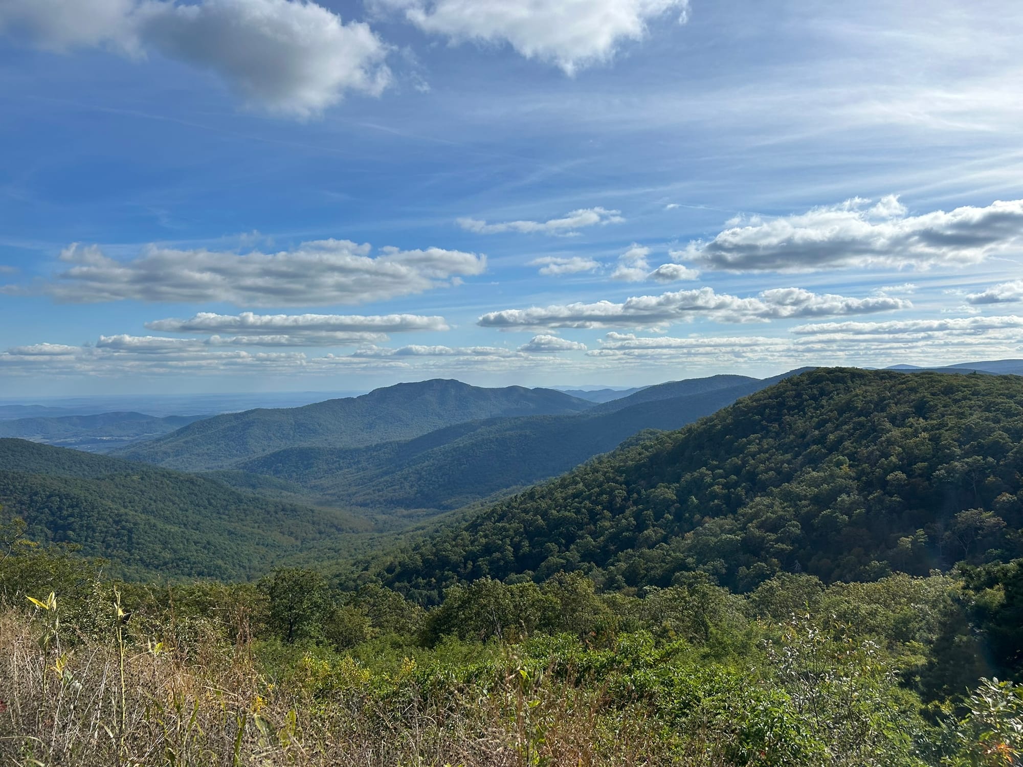
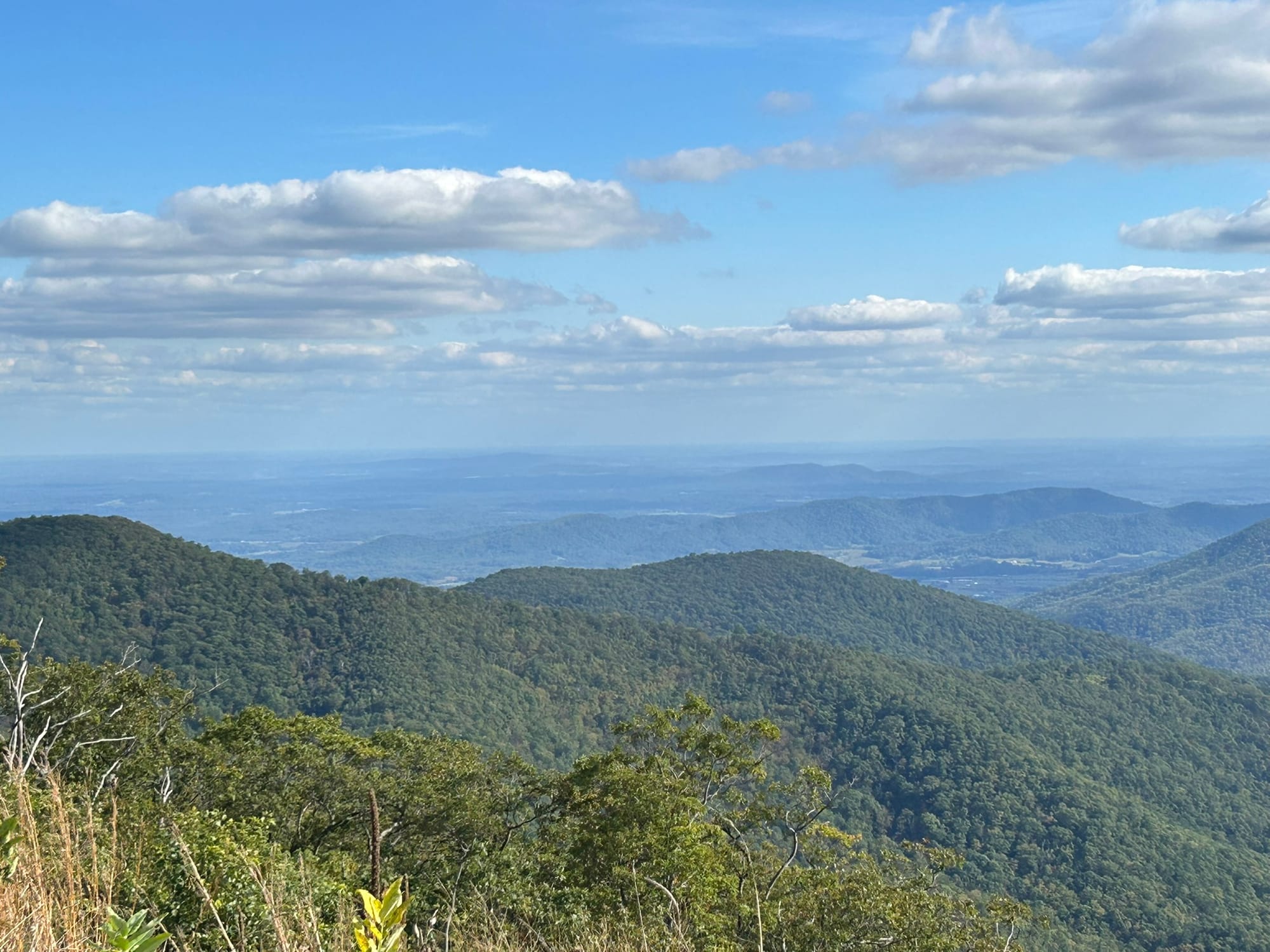
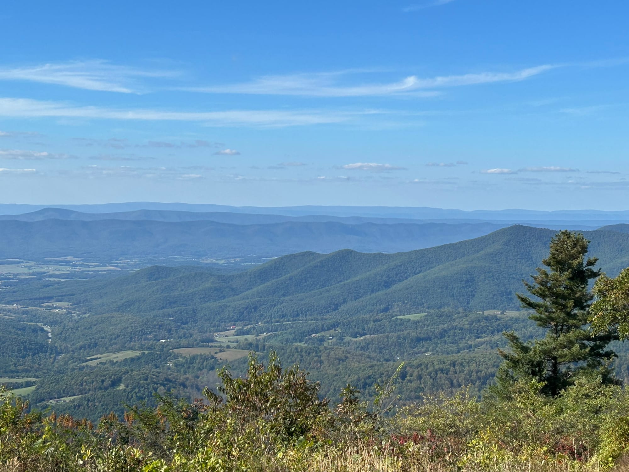
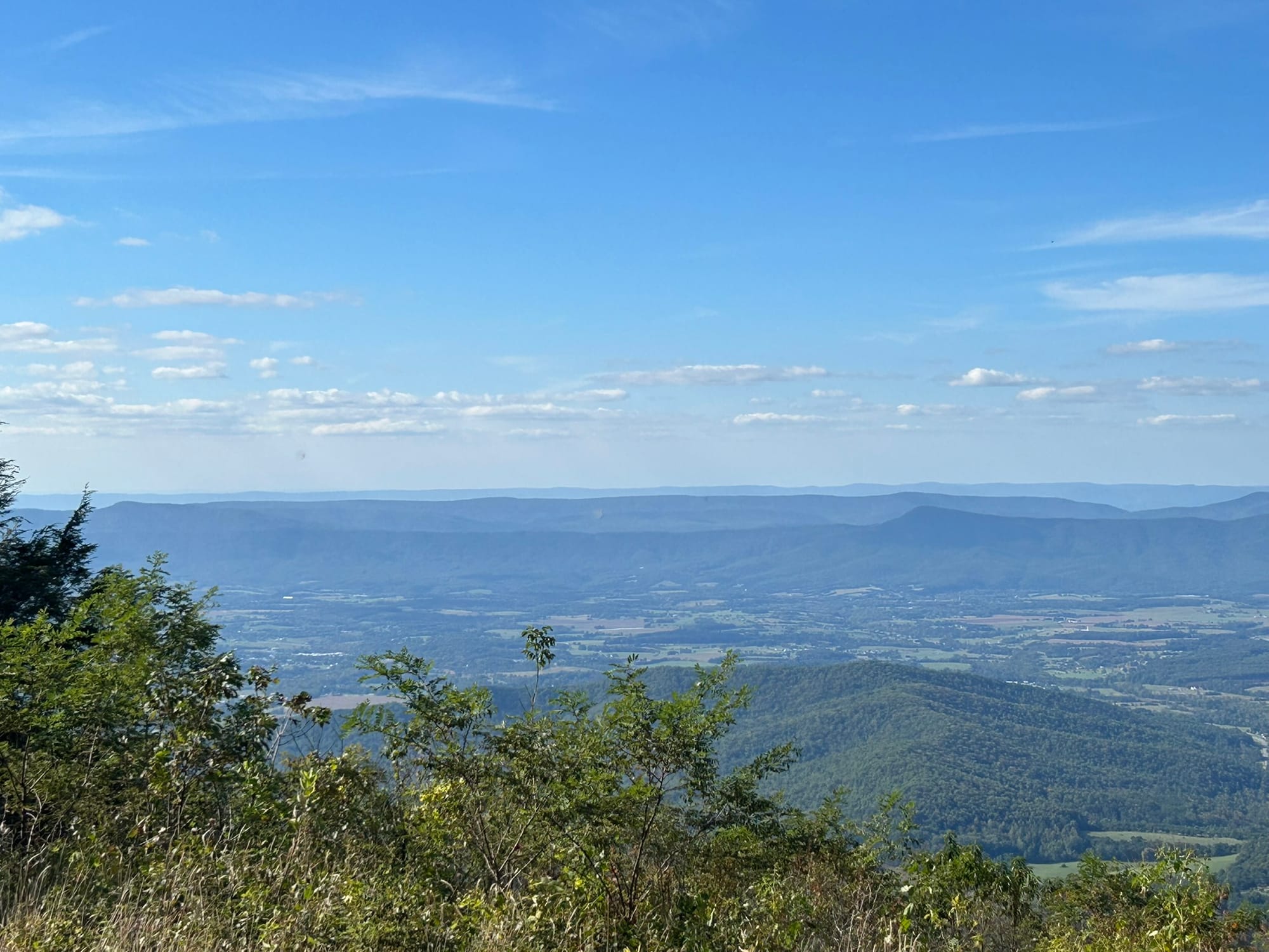
Views in Shenandoah National Park
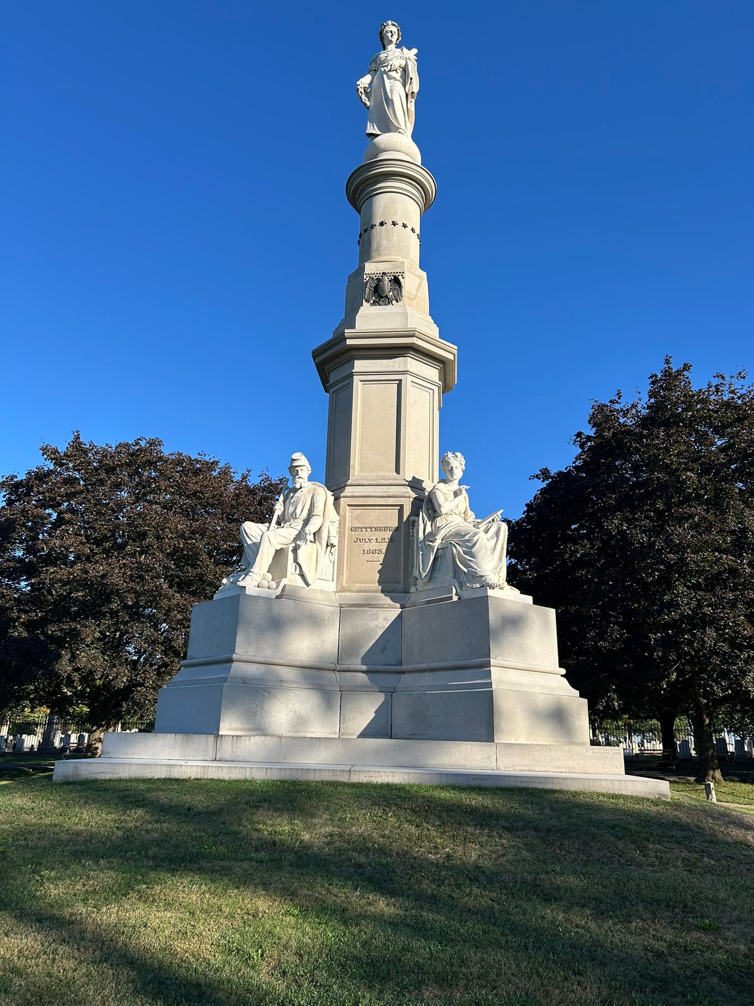
This Hallowed Ground - Gettysburg National Military Park, Pa
Four score and seven years ago our fathers brought forth on this continent, a new nation, conceived in Liberty, and dedicated to the proposition that all men are created equal.
Now we are engaged in a great civil war, testing whether that nation, or any nation so conceived and so dedicated, can long endure. We are met on a great battle-field of that war. We have come to dedicate a portion of that field, as a final resting place for those who here gave their lives that that nation might live. It is altogether fitting and proper that we should do this.
But, in a larger sense, we can not dedicate -- we can not consecrate -- we can not hallow -- this ground. The brave men, living and dead, who struggled here, have consecrated it, far above our poor power to add or detract. The world will little note, nor long remember what we say here, but it can never forget what they did here. It is for us the living, rather, to be dedicated here to the unfinished work which they who fought here have thus far so nobly advanced. It is rather for us to be here dedicated to the great task remaining before us -- that from these honored dead we take increased devotion to that cause for which they gave the last full measure of devotion -- that we here highly resolve that these dead shall not have died in vain -- that this nation, under God, shall have a new birth of freedom -- and that government of the people, by the people, for the people, shall not perish from the earth.
Abraham Lincoln
November 19, 1863
I had visited Gettysburg once before as a boy of about 10 years old. In the intervening years, it has changed immeasurably. I remember only a few snippets of things - a civilian woman killed, buildings with cannon balls embedded, a tower to climb and the field of Picket's Charge to name a few. Back then, we were driven around by a tour guide in my Aunt's station wagon. Driving around today, 50 years later, following an auto tour app and listening to the stories it told of the 3 day conflict, I can't say I recognized anything.
There are so many monuments now to the units or people that served there, that you could spend a week trying to read them all and still not have time to finish. The tour is a sobering and somber reflection of the battle that turned the tide in the American Civil War. Every life lost was an American one. My wife and I noted that the lessons of this battlefield and others, are something we forget all too easily today.
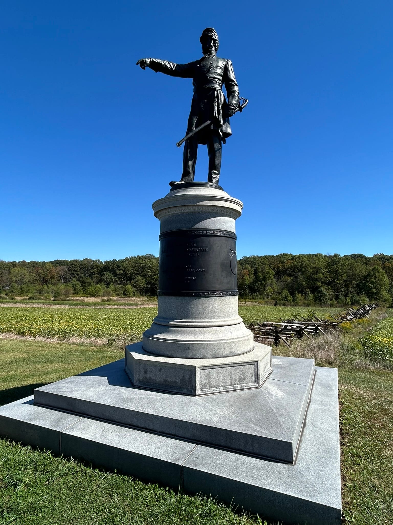
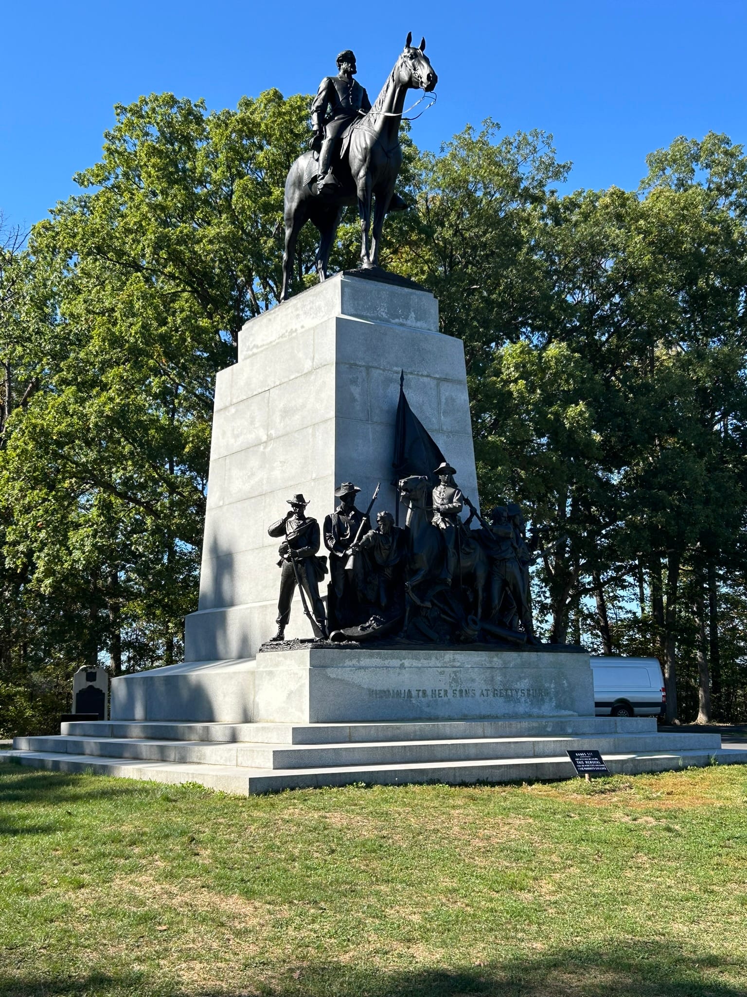
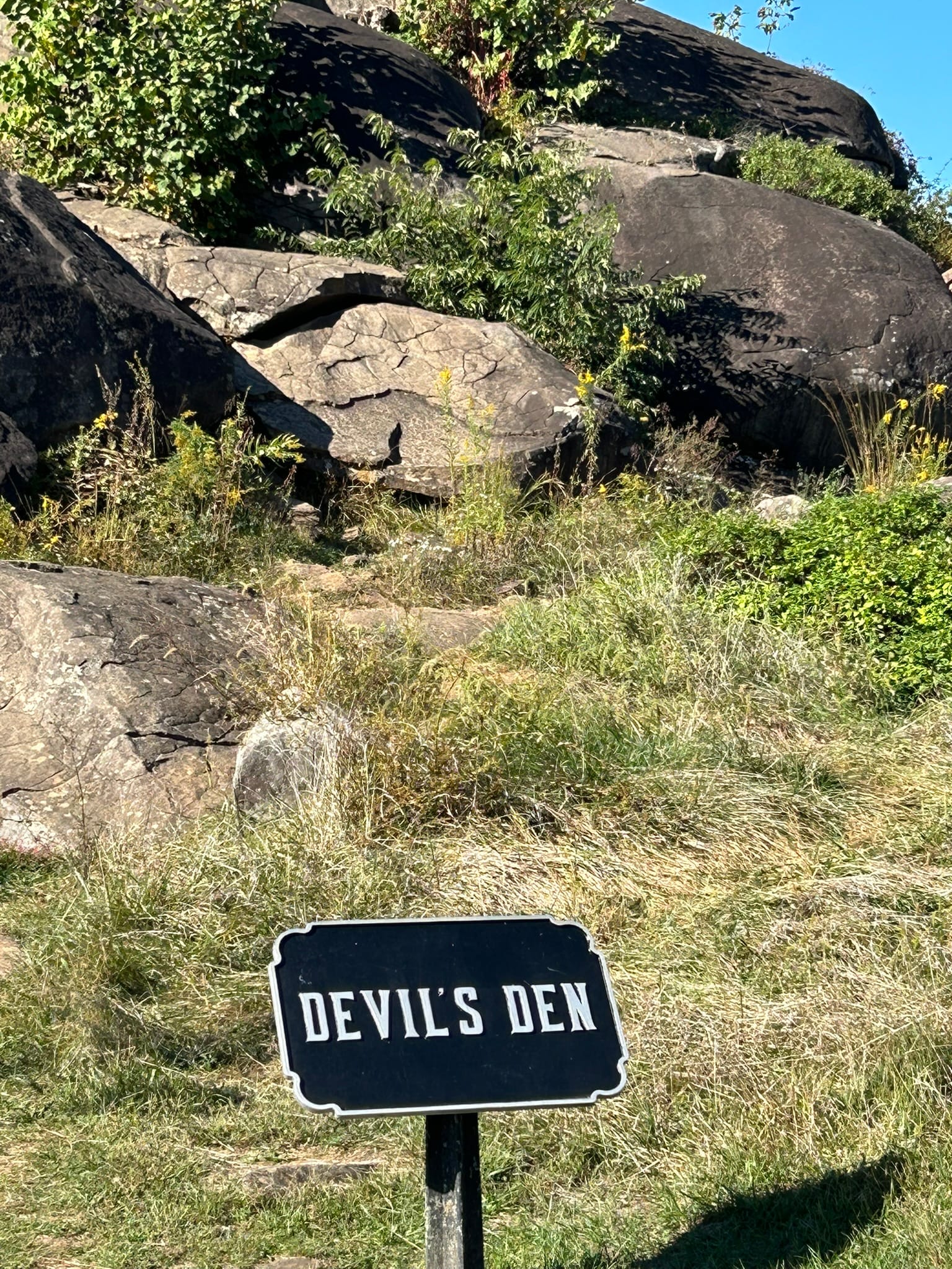
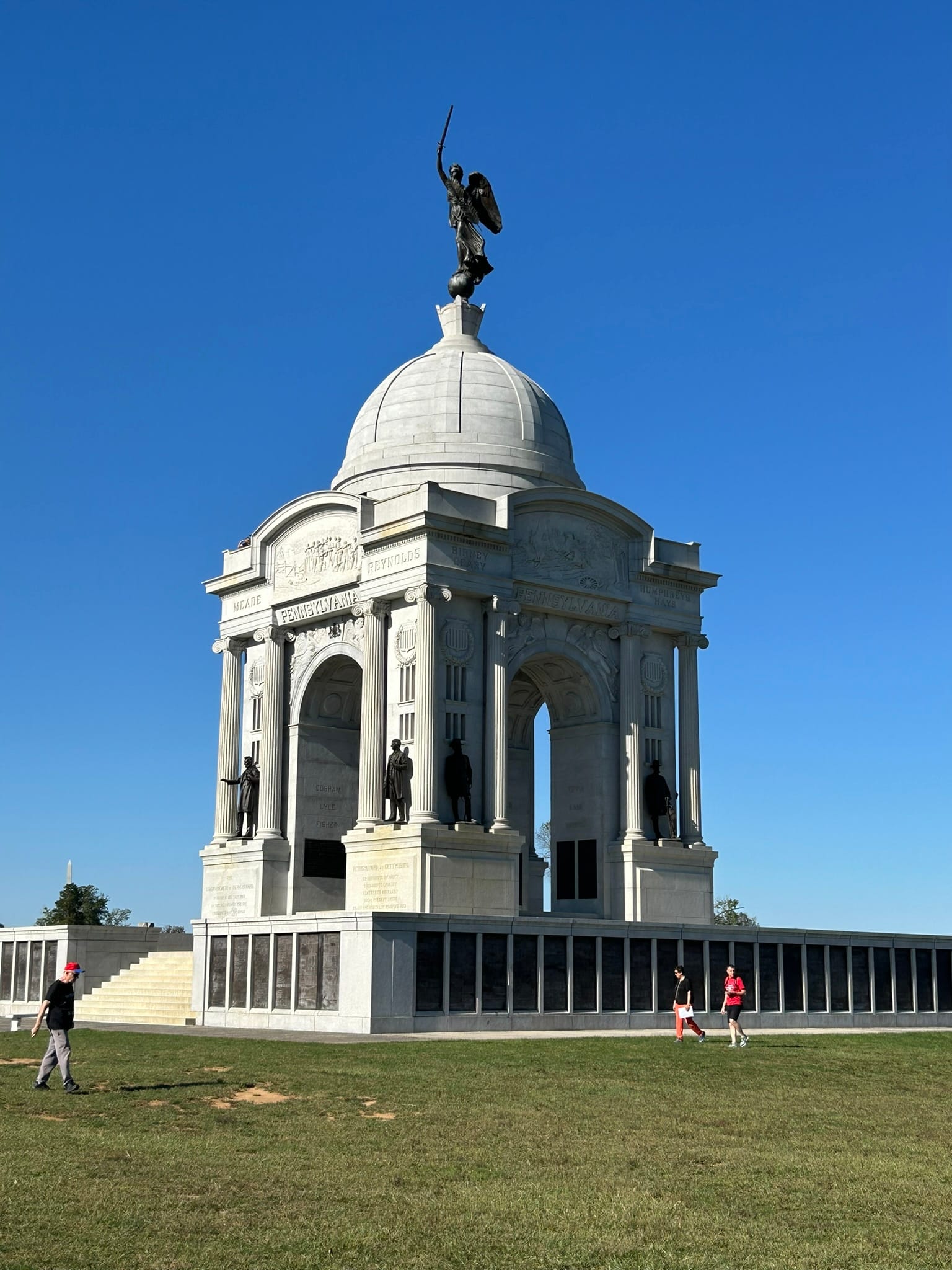
Sights from around Gettysburg National Military Park
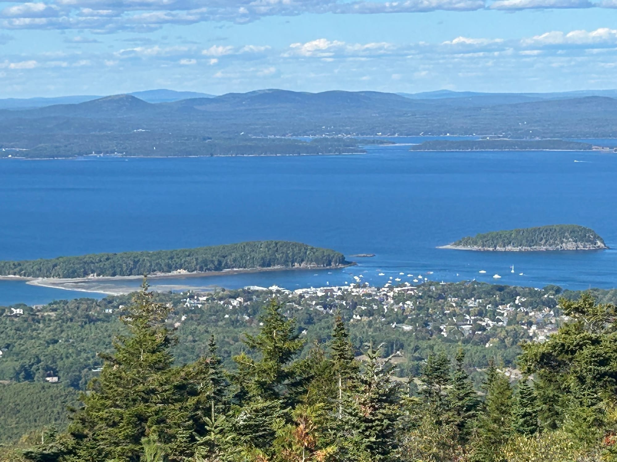
Acadia National Park, Maine
Acadia is a fairly large national park on what is basically a large island on the coast of Maine. It's a very wooded area and its coast is extremely rocky with just a couple of nice sandy beaches. There's a scenic loop called Park Loop Road that runs along the eastern coast of the island for a time and then cuts across the center of the island on the west side of the park. They have several lakes including Eagle and Jordan Lakes that are very popular. Sandy Beach and Thunder Hole are two of the most famous spots. Thunder Hole is a recessed cut in the rocks where the waves crash in and make a thunderous noise especially at high tide. We hit it at nearly low tide and it was still noisy but not so thunderous. There's several cruises that take you around the edge of the park to see the rugged coastline but we just drove around and stopped at many of the scenic turnoffs. The other very popular thing to do is drive up to the top of Cadillac Mountain, the highest spot in the park, and see the amazing vistas all around the island! You have to have a $6 time reservation to make the drive and they don't sell them at the entrance to the drive. You have to get them online and print them or have a photo because the connectivity is awful at the gate.
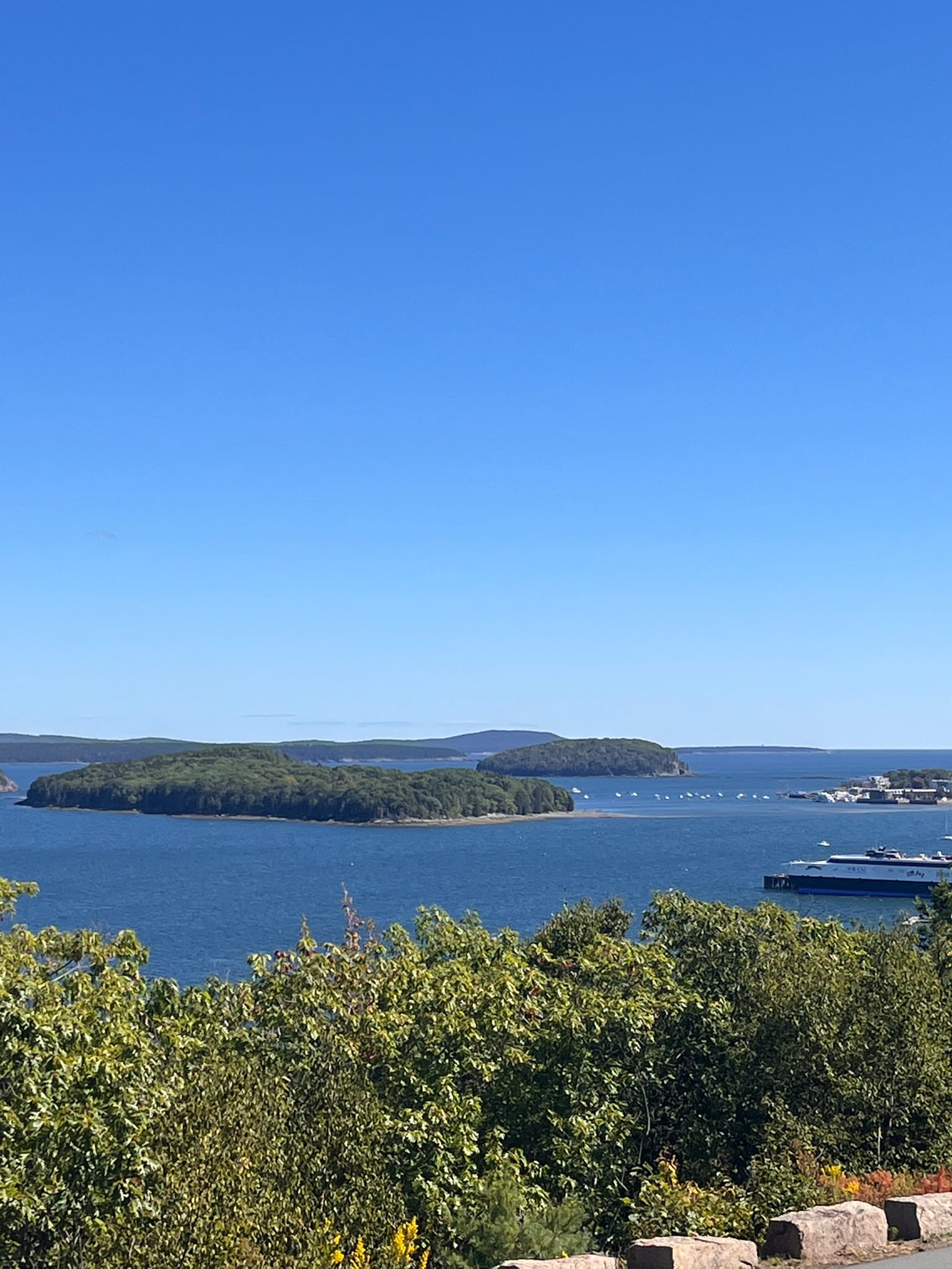
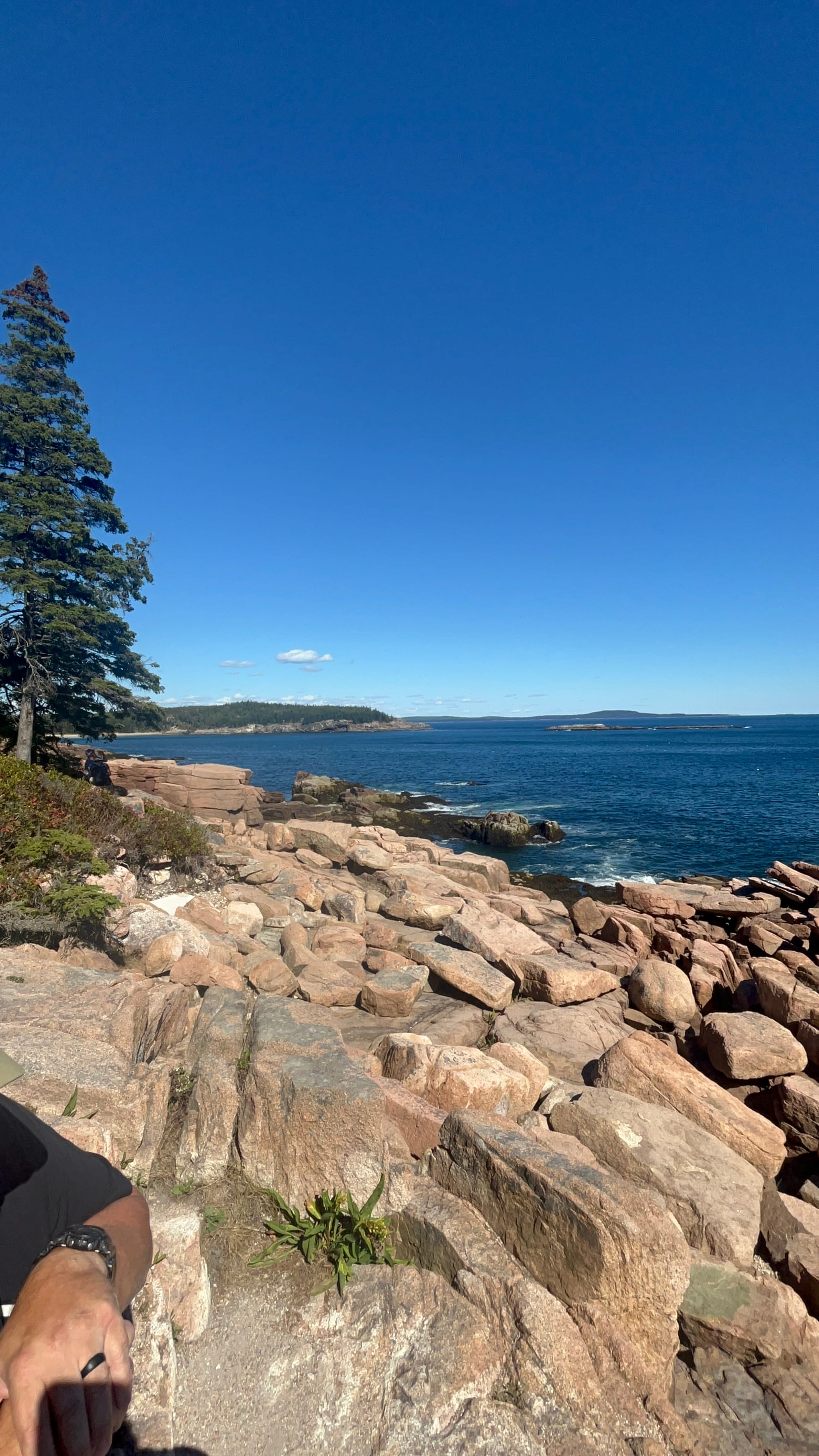
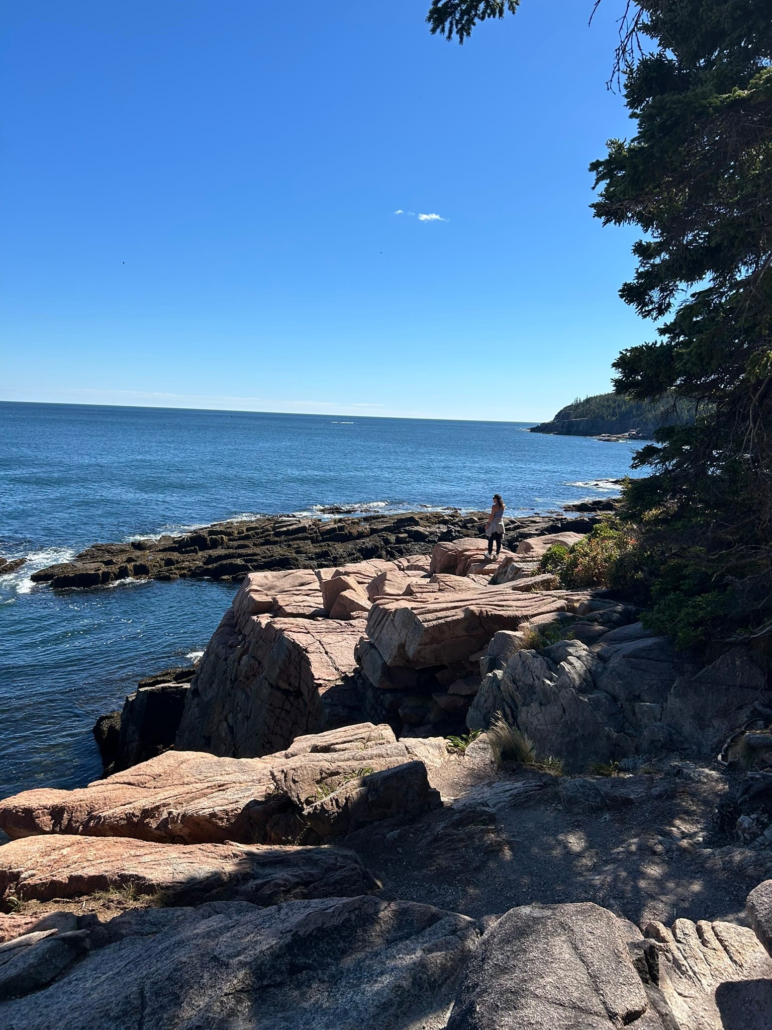
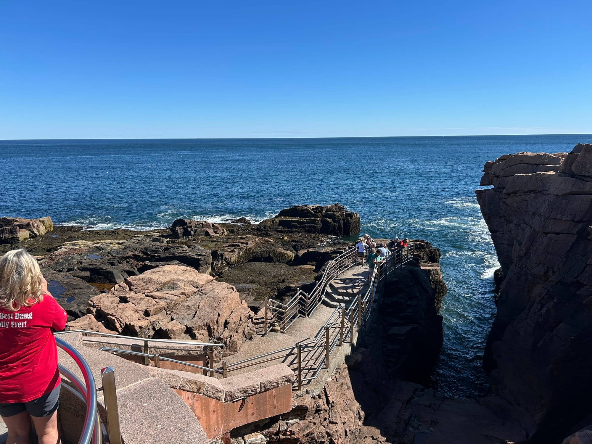
Scenic views around Acadia National Park, Maine
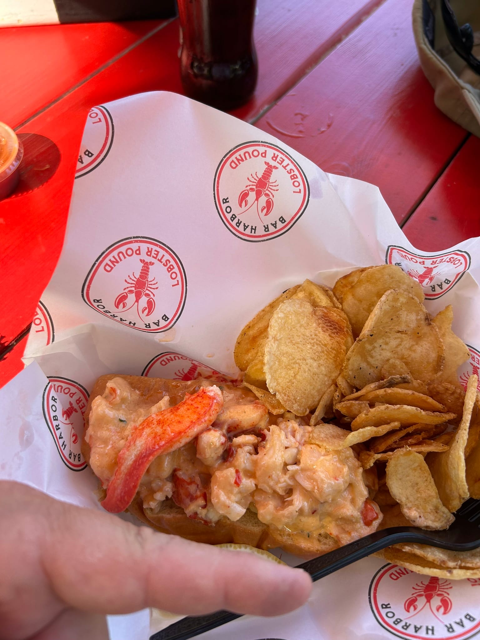
Before heading into the park, we stopped to get the iconic Maine meal - the Lobster Roll at a local cafe that had a line of people waiting outside. That's got to be a good sign the foods good! We each got their "most popular" Lobster Roll and in short, it was delicious, smaller than expected, much more expensive than expected ($33 ea.), but they did have financing available at a reasonable interest rate! I'll be paying for lunch in 6 monthly payments! LOL
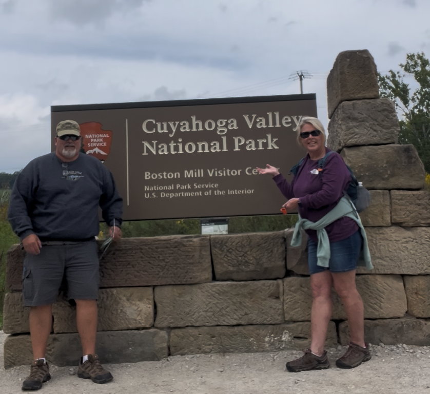
Cuyahoga Valley National Park, Ohio
Cuyahoga Valley National Park is basically a wooded valley with some falls, cliffs (not super high), old canals that don’t have water in them and a scenic train that runs through the park as it passes down to Akron. We hiked back to Brandywine falls, one of the most popular attractions and around the mile or so trail there. After that we went to the Ledges, another favorite site according to the staff. The Ledges are a section of exposed sedimentary rock that has weathered into some cliffs and other strange formations. We hiked another mile or so around portions of that section of the park.
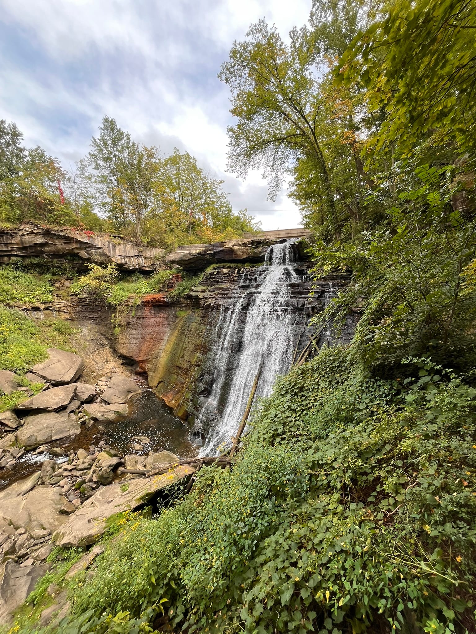
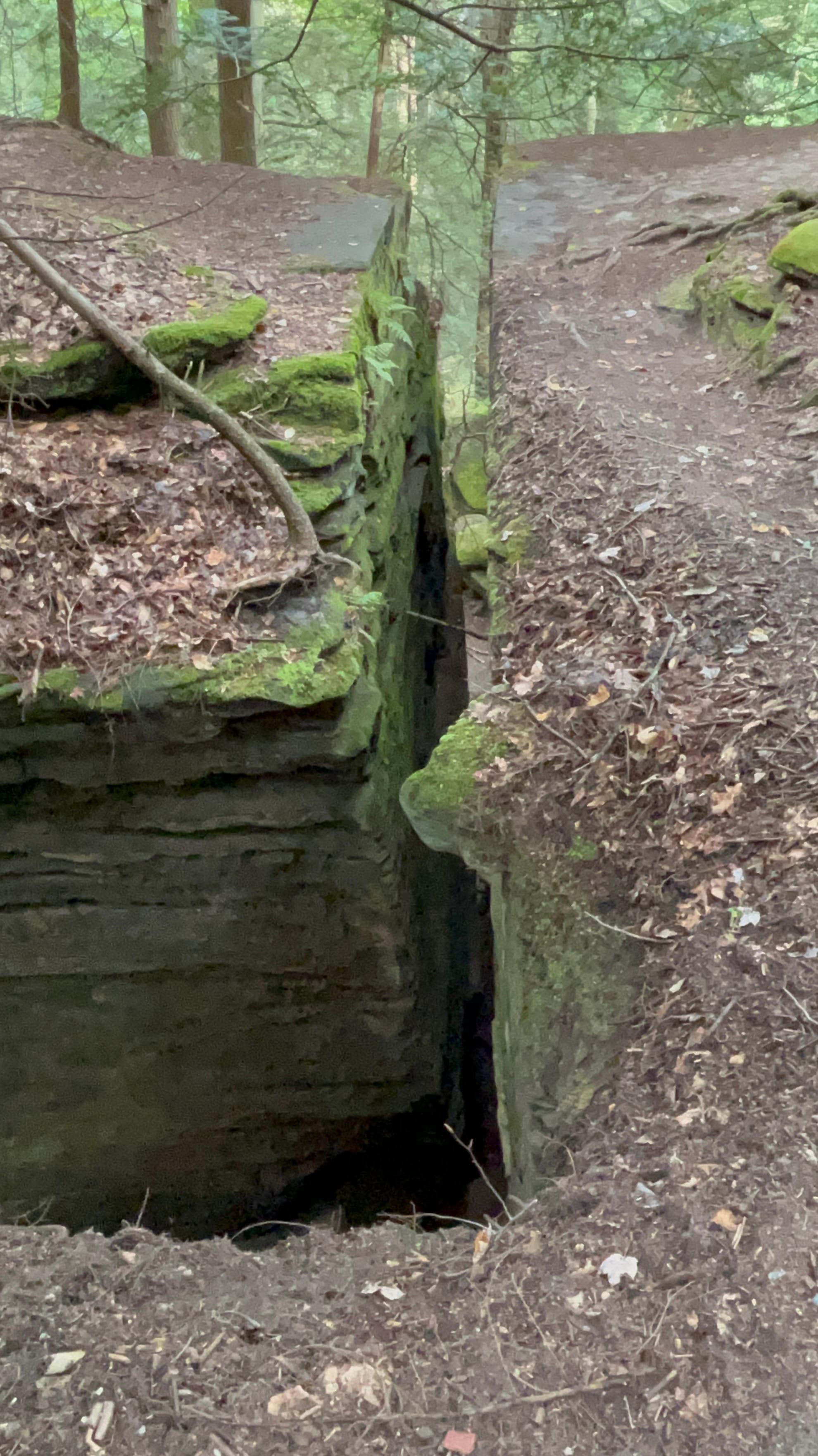
Brandywine Falls and the Ledges
It's kind of a strange National Park since there’s no fee, no border that you can see and you drive in and out of it as you move from one scenic spot to another. Very odd layout overall. It has some decent hiking trails though! It's probably not on my list of top 10 national parks but it's worth a stop if you are passing through.
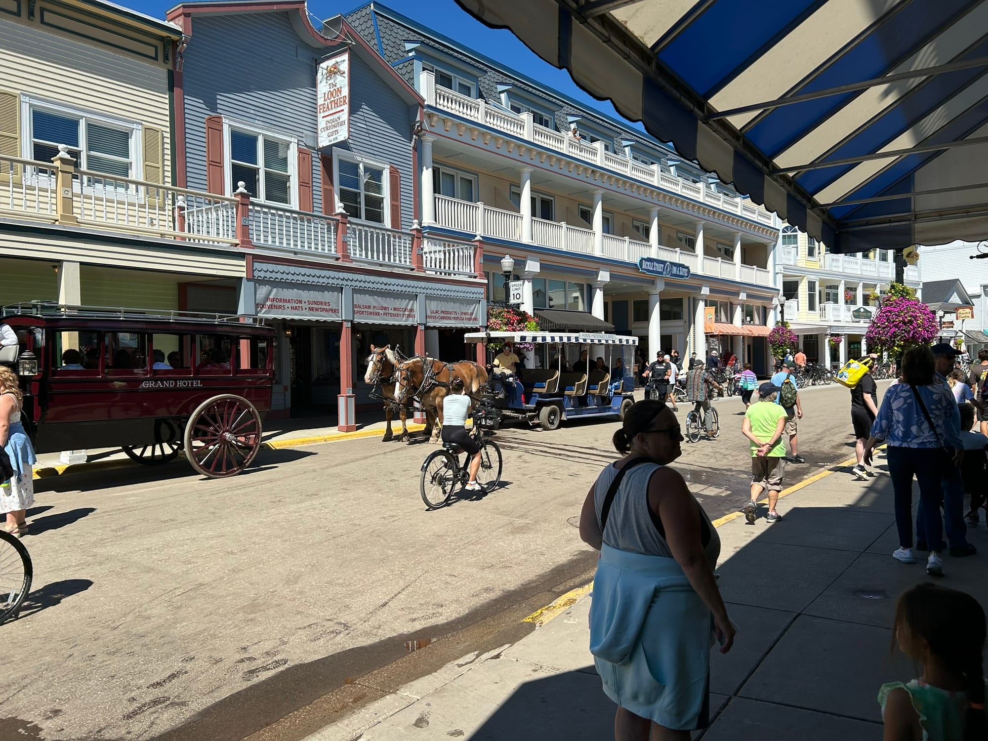
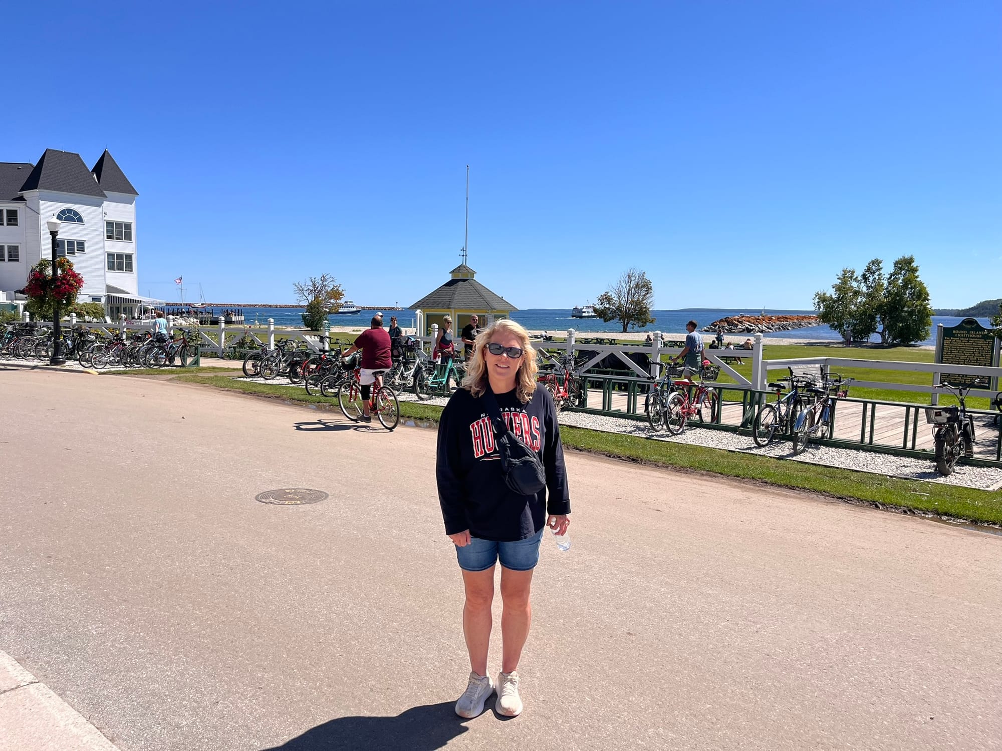
Mackinac Island, MI
We headed over to the docks to catch a ferry over to Mackinac Island around mid-day. Tons of other people were there waiting for the next boat which was probably predictable given that the weather had been cold, wet and windy for a few days and today was sunny. The ferry had an enclosed space on the bottom deck and open seating on the second. We chose the second deck for the breeze and view. It was about 17 minutes across.
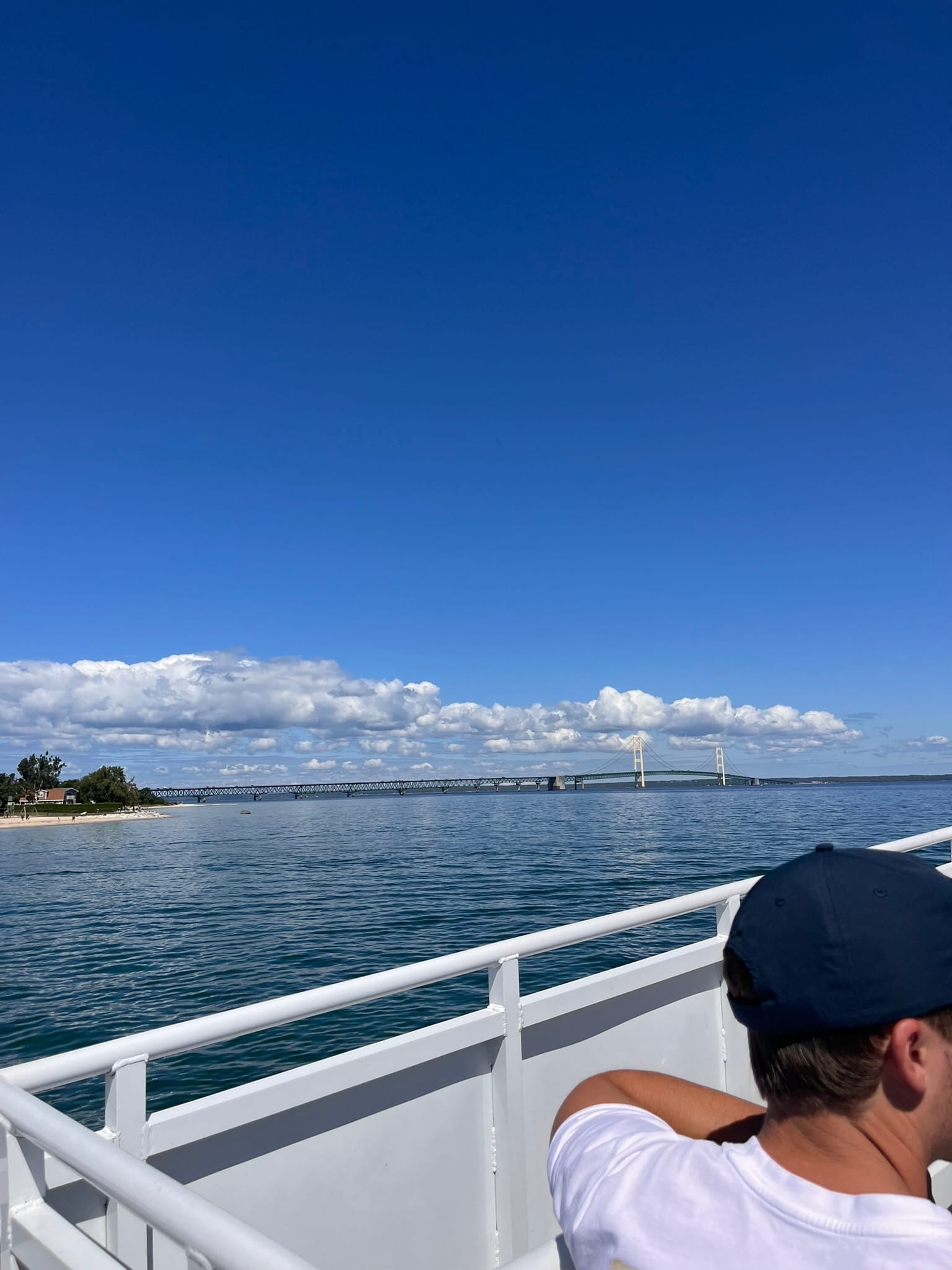
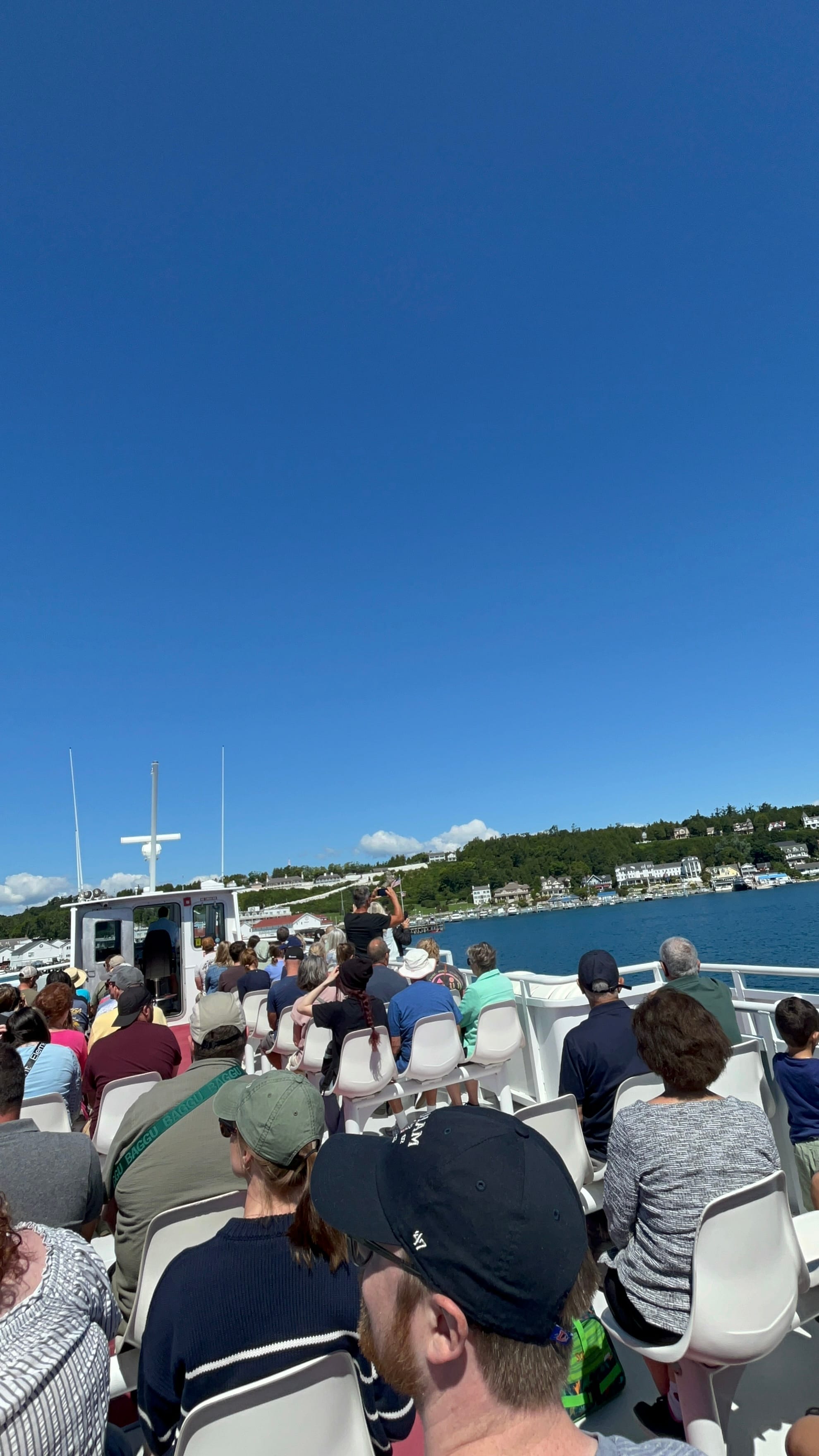
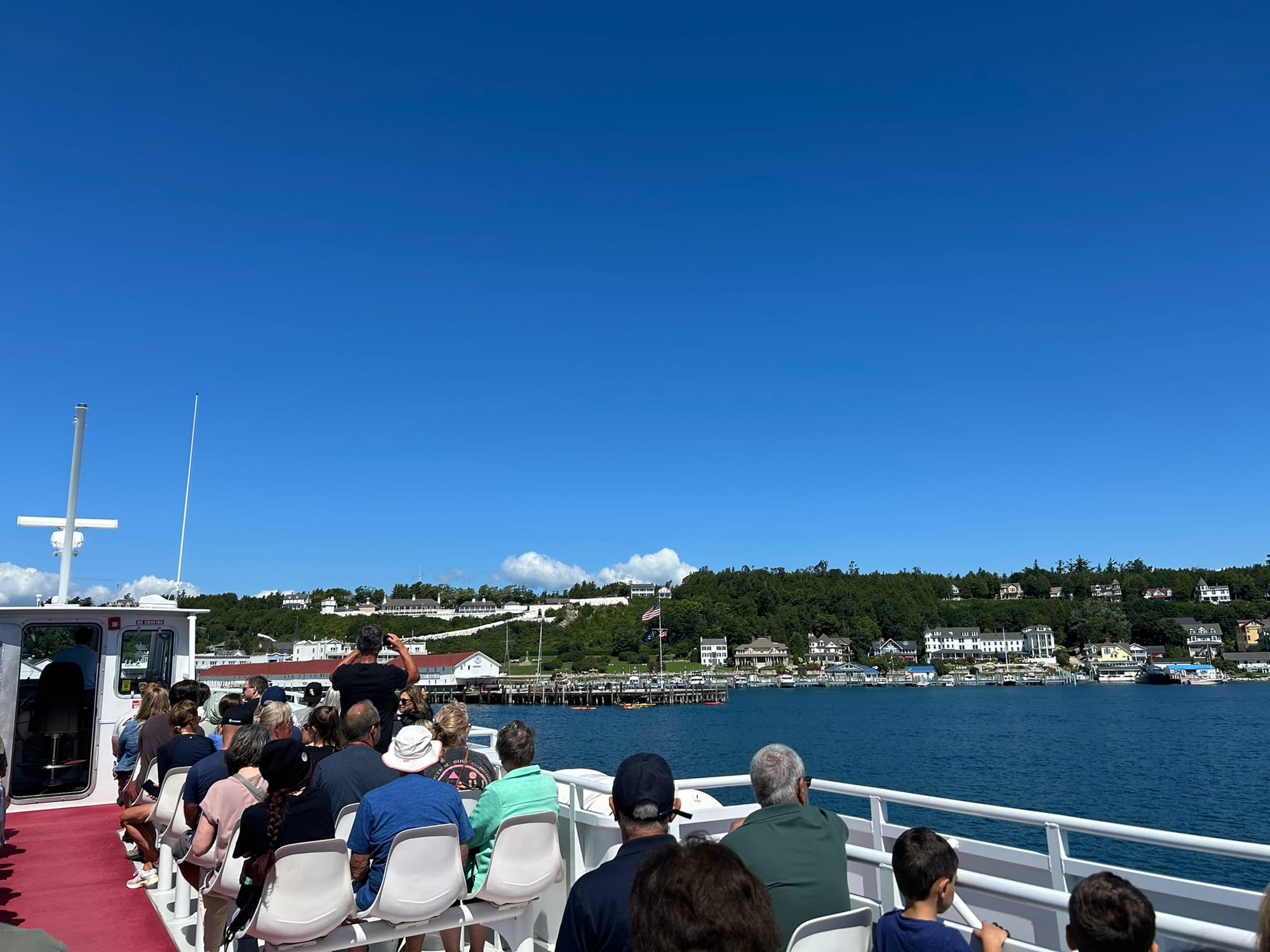
The Ferry ride and first views of Mackinac Island
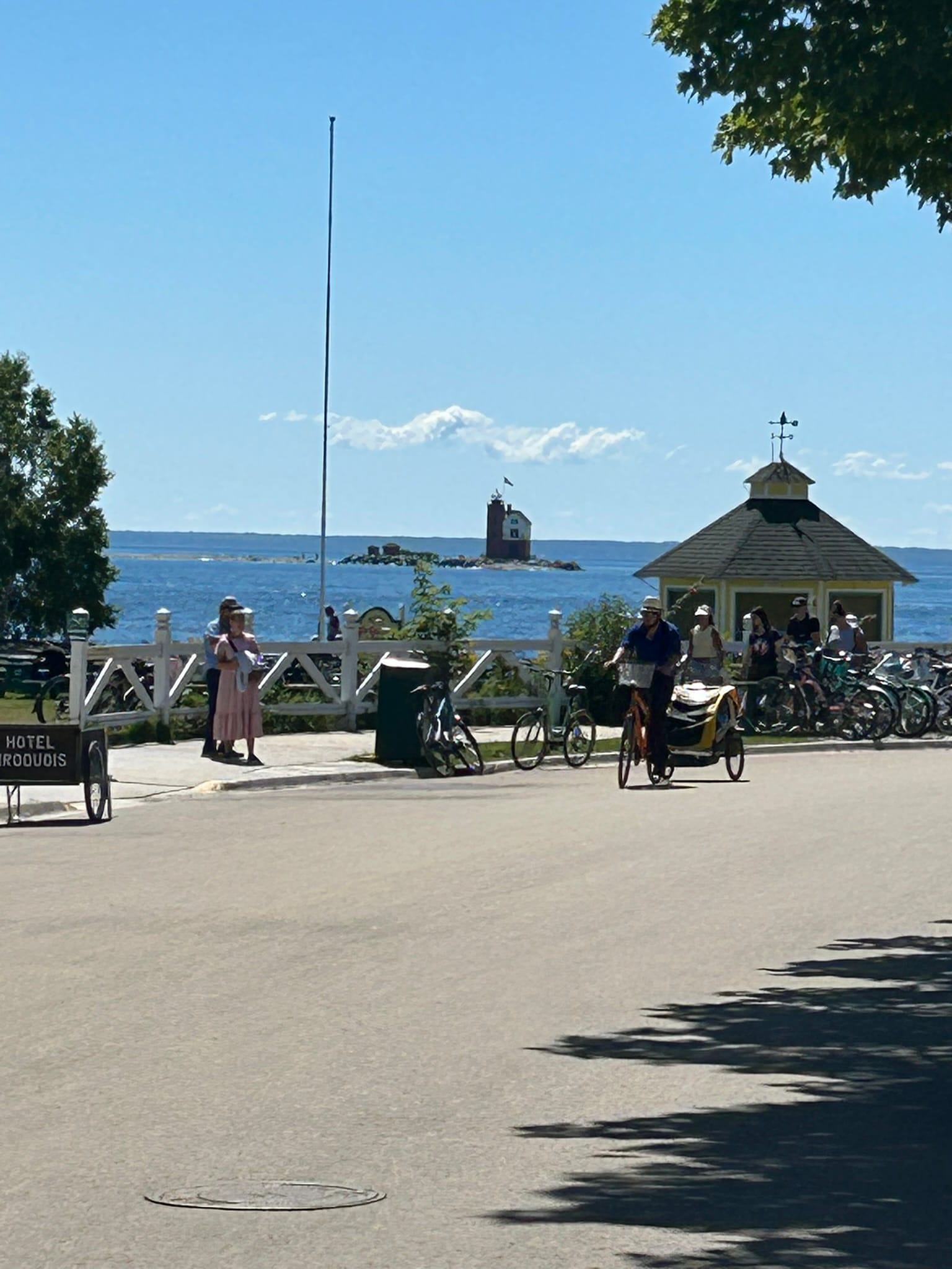
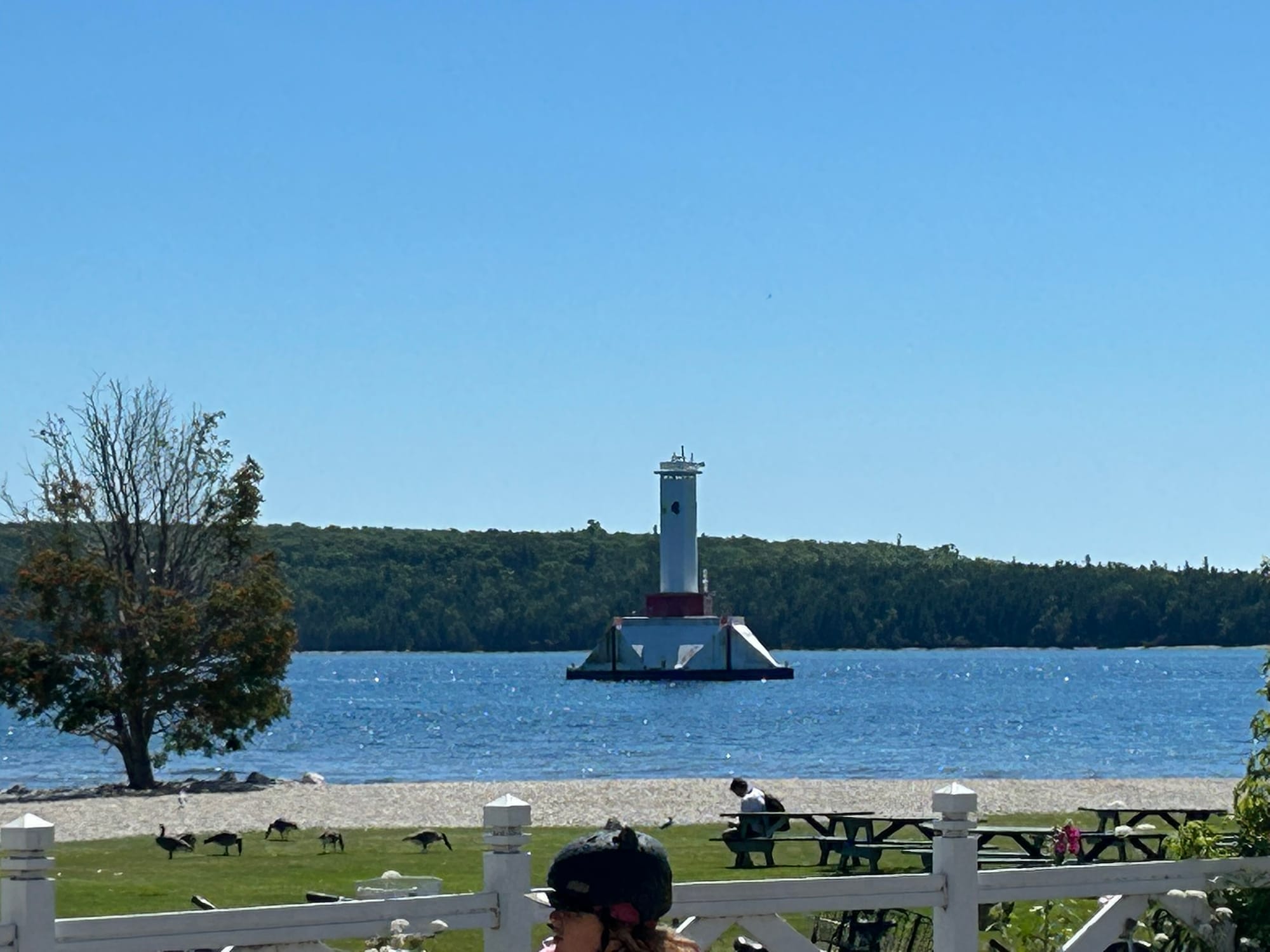
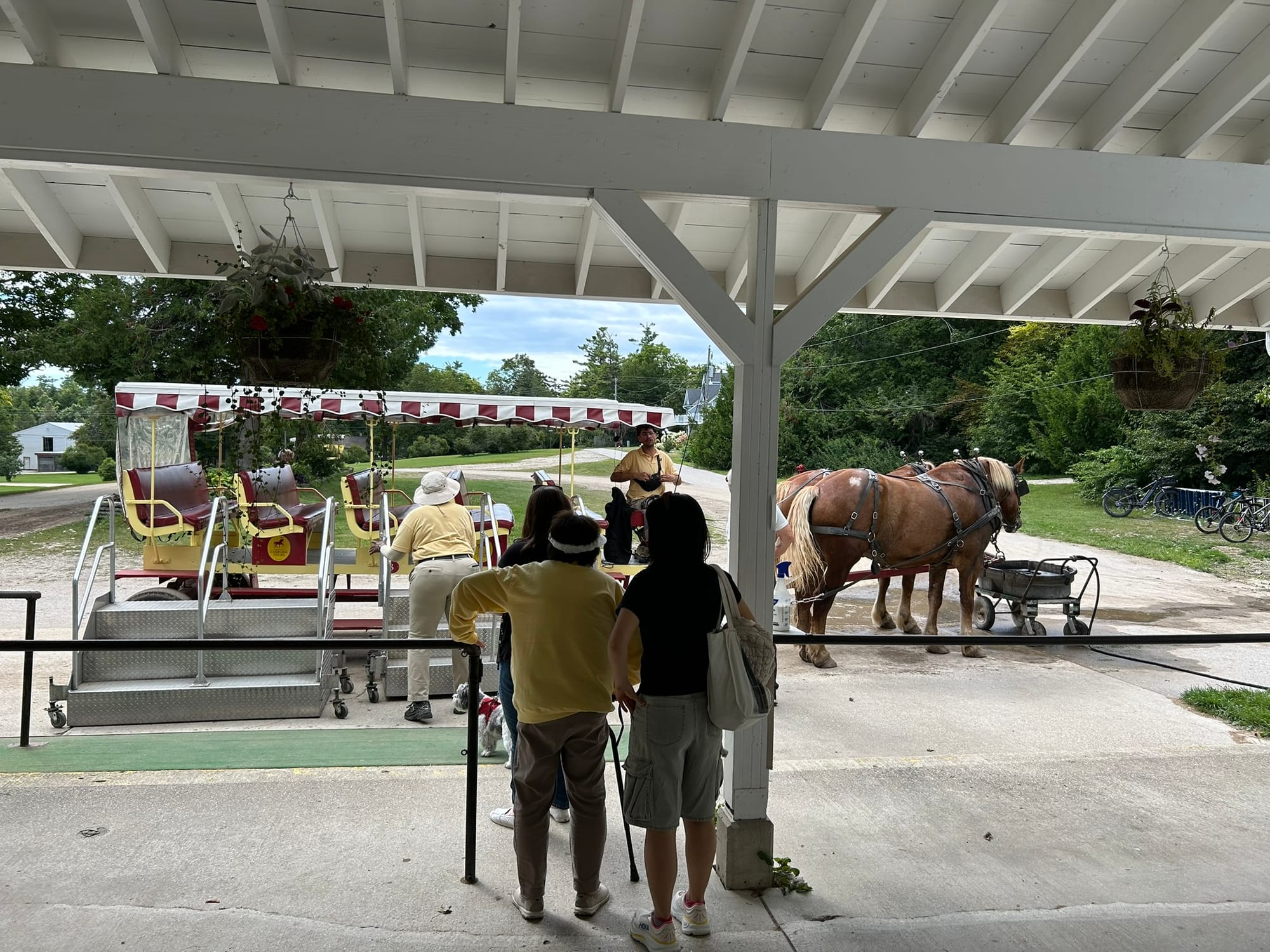
The dock on the island was right in the middle of town. The island is very pretty! It’s not very big, only 8.2 miles around. Only bicycles and horse drawn vehicles are allowed of course which makes it very quaint and smell like a barn. There’s nearly 400 horses on the island, each of which drops 60 lbs of poop daily. You do the math! Actually, they do a good job of picking it up relatively quickly. There’s a guy biking around with a bin, broom and shovel. You have to wonder what he did to annoy the powers that be! (Last guy to get to work is the "Pooper Scooper"?) The downtown section is about ½ mile long by 2 blocks wide and is full of shops and hotels mostly bike rental and fudge shops to be honest. These people have a serious fudge problem or think we do!
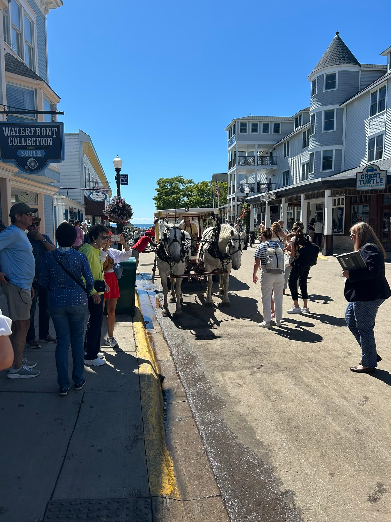
Horse drawn carriages
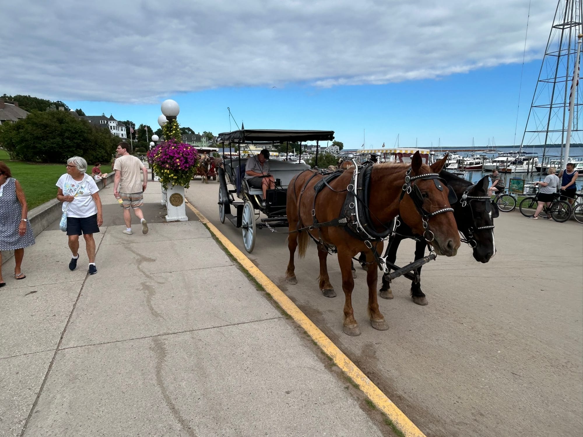
We walked down the main street towards the left and got some amazing views of light houses and the mainland and then turned back the other way to seek out some food. We finally found a hamburger place and ate on their deck overlooking the loading docks. It was interesting to see the horse drawn carts moving supplies off the docks to the various businesses. The town tries to recreate the feel of 1800's life and it is interesting to see that play out. Life is definitely slower on the island!
After that we walked up to Fort Mackinac which towers over the town once providing security for the island. It’s one of two on the island. The second, Fort Holmes, was created when the British snuck onto the northern part of the island to higher ground and started firing on the Americans in the fort below. They had people in costume reenacting various military maneuvers like marching and shooting muskets. They also have a cannon firing demonstration several times daily.
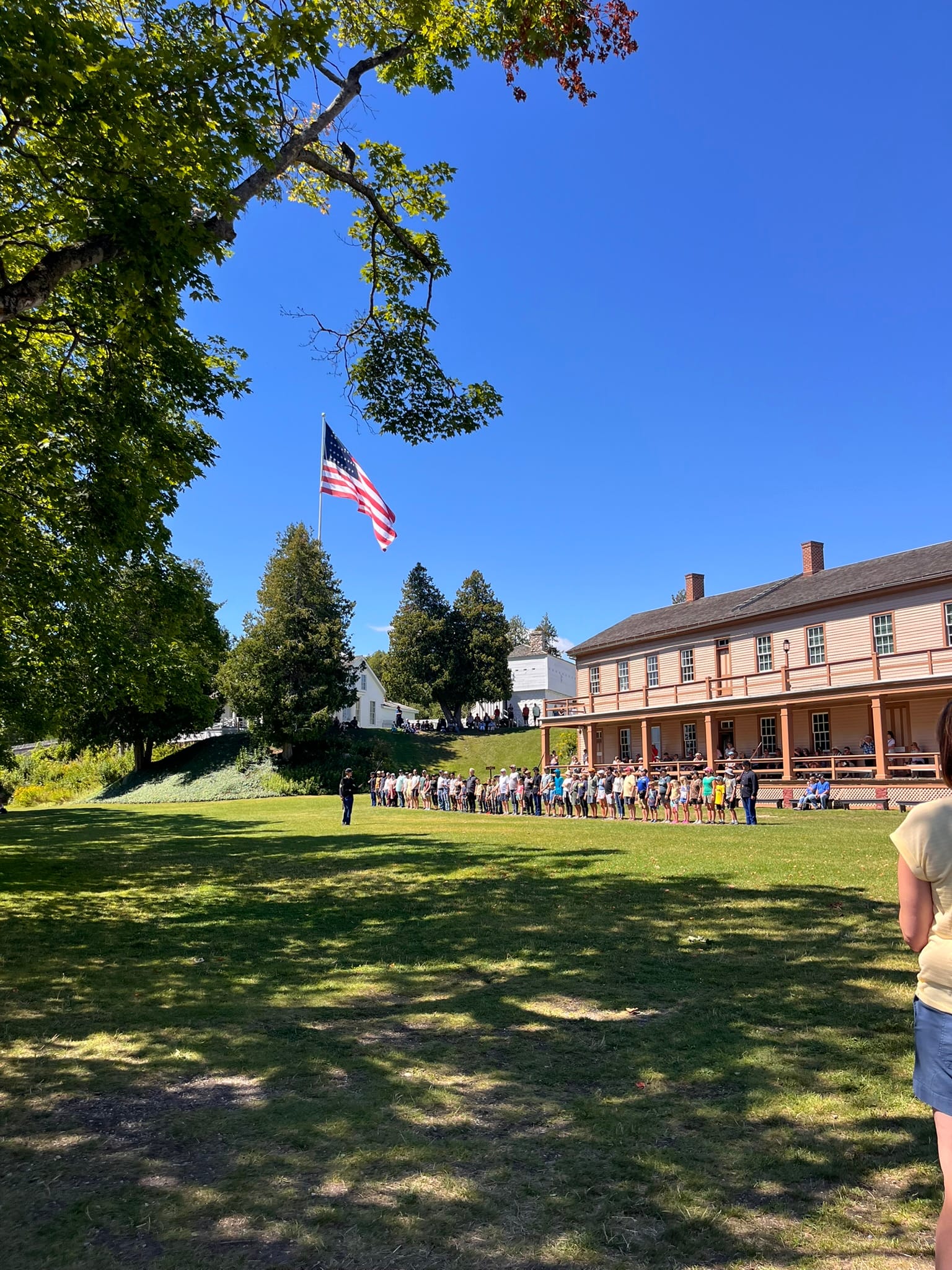
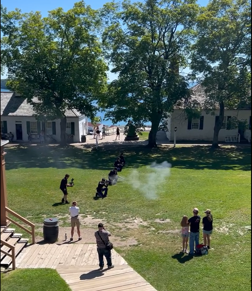
Fort Mackinac re-enactments
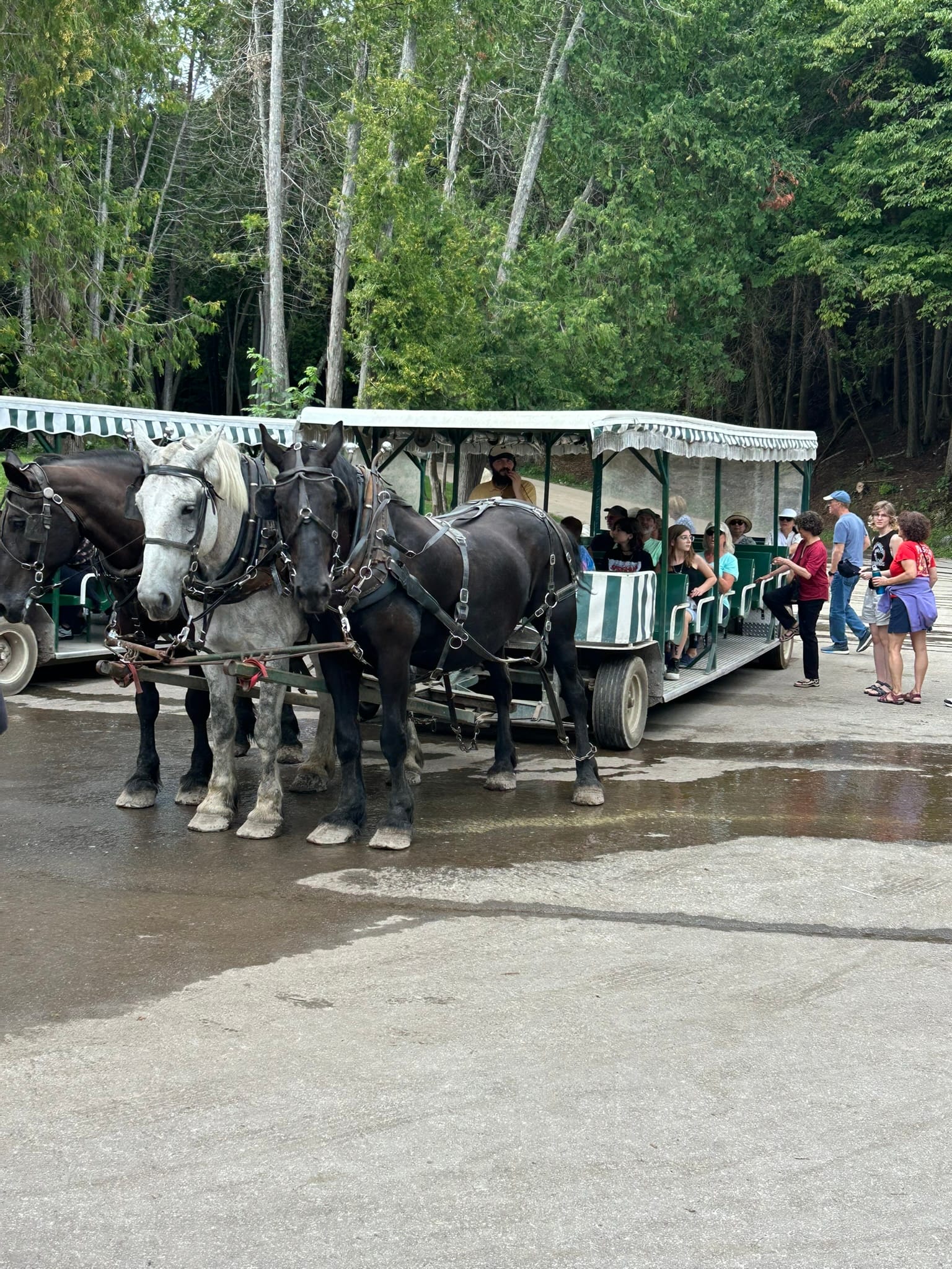
We wandered around the various buildings and then decided to take a horse drawn carriage tour of the island. The tour company we went with has a few options but we took the cheaper classic tour of the region around the town and the state park. We began the tour on a two-horse carriage. The guide was good and she told us about the buildings along the route and the history of the area but her jokes were cheesy. She took us to the half-way point of the tour which is near their stables, a butterfly house and some other attractions. The main building had restrooms, food and drink, memorabilia and old carriages on display. From there, you catch a larger cart with 3 horses for the tour through the state park. Our guide was a bit of a history buff and told us a lot more of the history of the island and the British invasion in the war of 1812. There are 4 places you can exit depending on where you want to be and we got off at the Governor’s mansion and walked two minutes down to the town again and then wandered out to the other side of town until the businesses ended and it seemed like all housing and then turned back, grabbed some fudge and ice cream and got in line for the trip back across to the mainland.
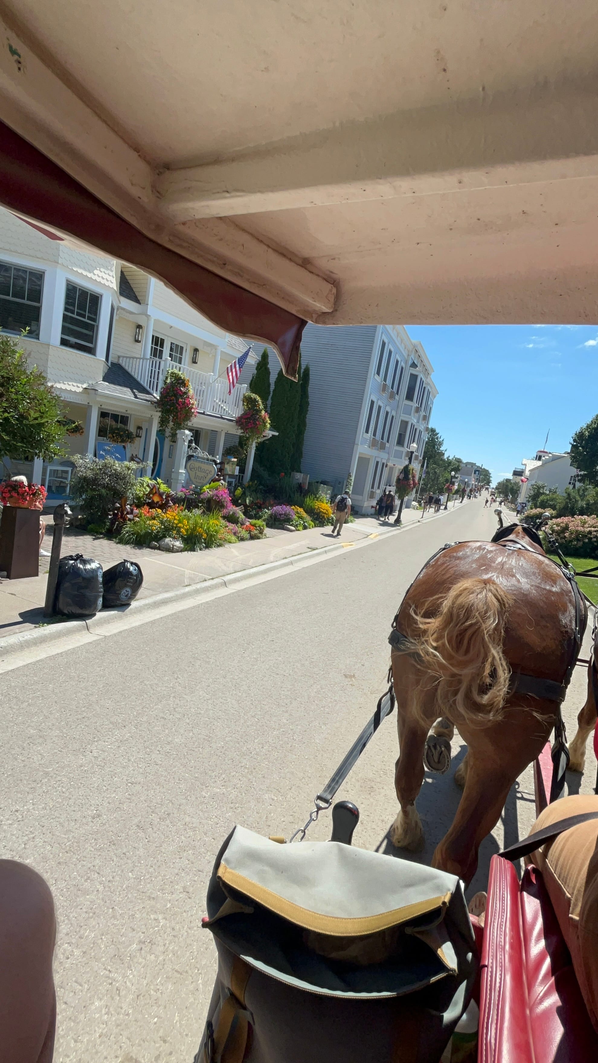
Views from the carriage ride
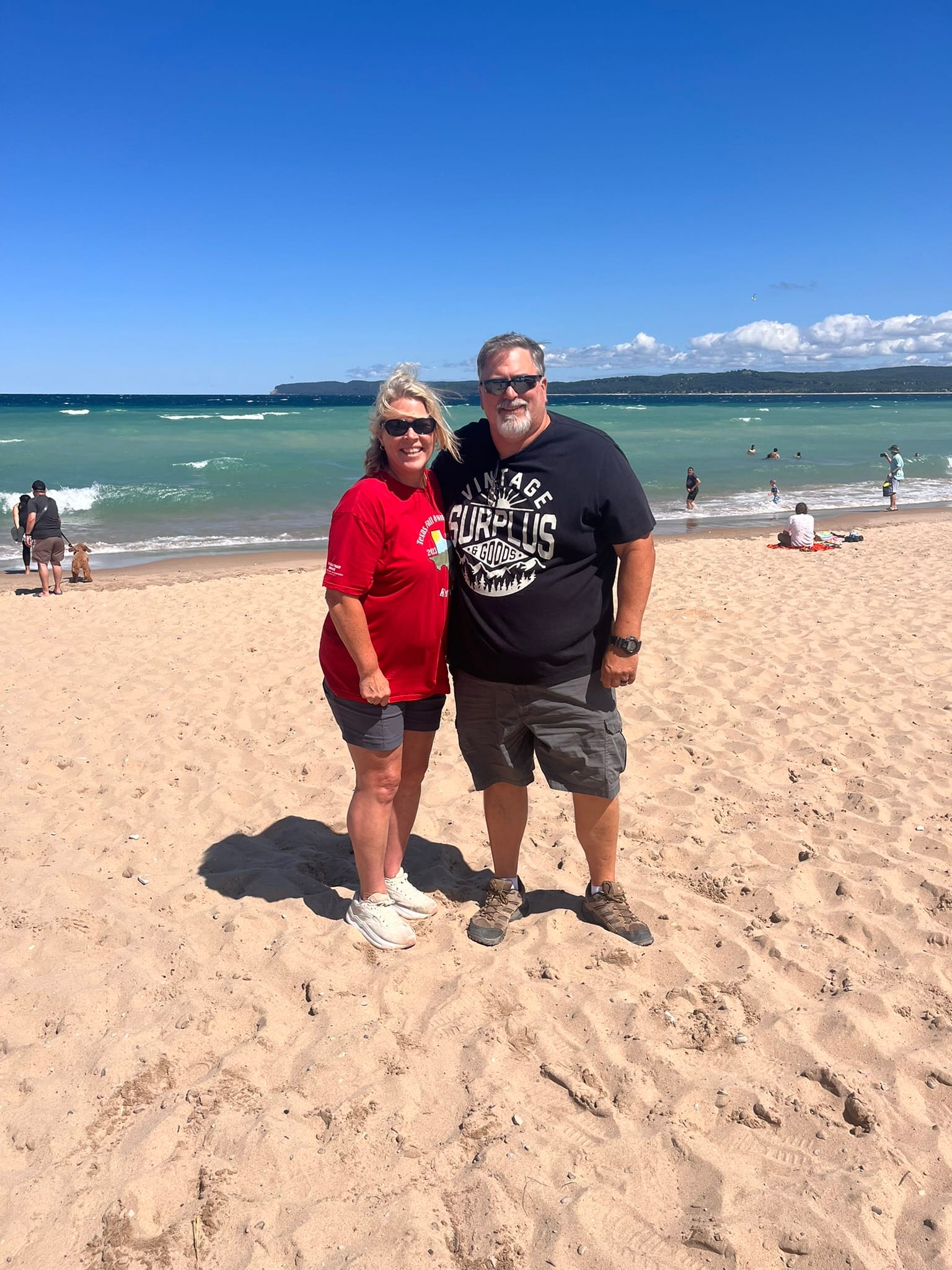
Sleeping Bear Dunes National Lakeshore, MI
Well, we didn't want to risk $3000 to be rescued so we declined the walk down the dunes! So, we went over to Sleeping Bear Dunes to see what all the fuss was about online regarding the height of the sand dunes. We figured it had to be an exaggeration given that we had just visited Indiana Dunes NP and they had some "huge" dunes there ... nope, they hardly count as "stout" after seeing this place!
We entered the park and turned onto the scenic drive which gives you some overviews of some of the lakes in the area and a nice cool drive through the woods which was a nice surprise for us about Michigan - woods everywhere! Anyway, we continued around until reaching what was obviously the most popular spot as judged by available parking spots that were nearly all taken and walked the short walk over to the view from the "Lake Michigan Overlook" stop. I had no idea we were so high up off the water! There is a big warning sign that you probably shouldn't go down to the water because it's a rough hike back up the steep and incredibly tall dune and they weren't kidding. I eased my way down to the steepest drop off where I could see the bottom and the people down there looked tiny! Those climbing back up were resorting to all fours in places and were taking forever to get back up! It was a magnificent sight with the deep blue of Lake Michigan as the backdrop!
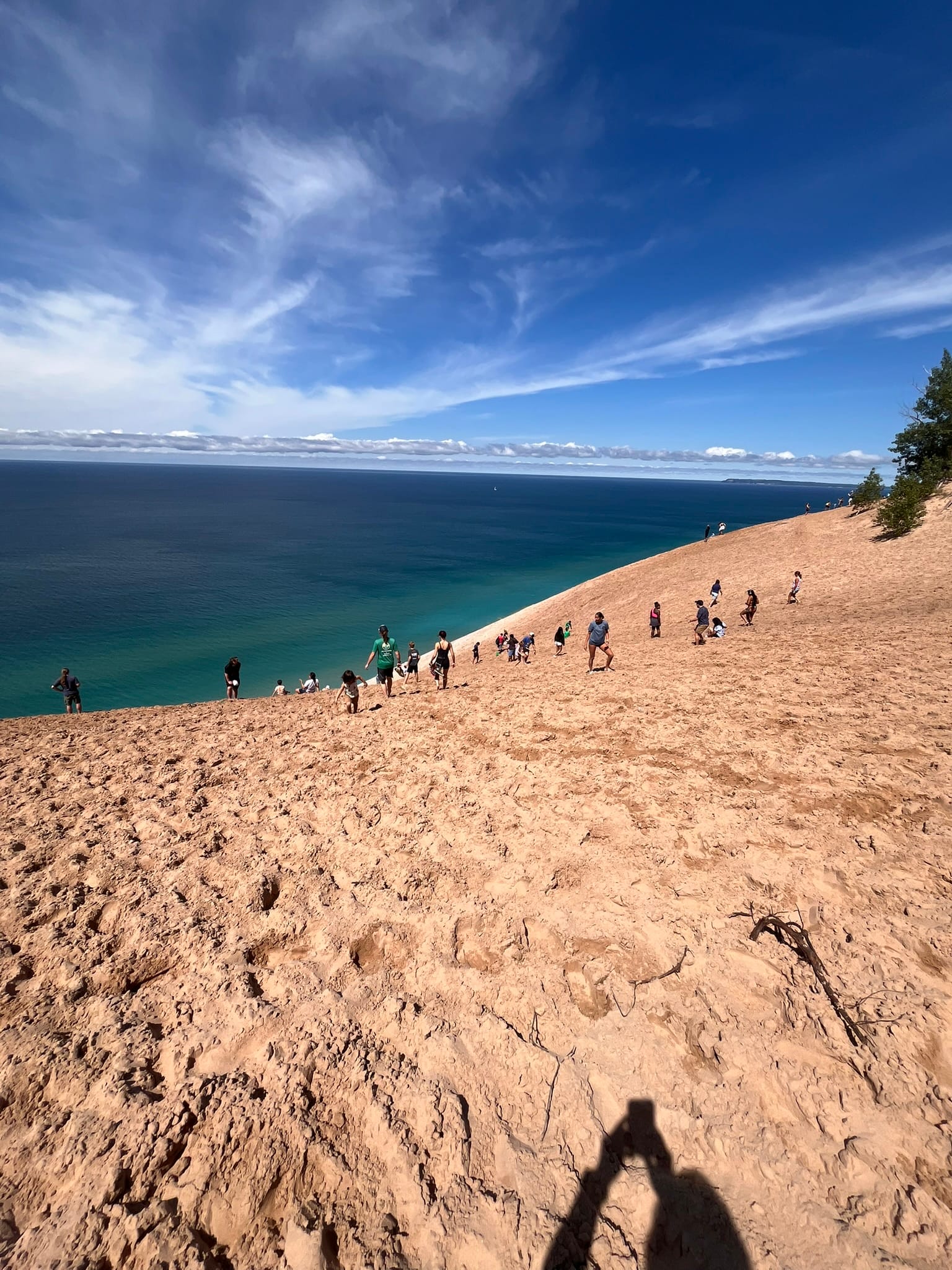
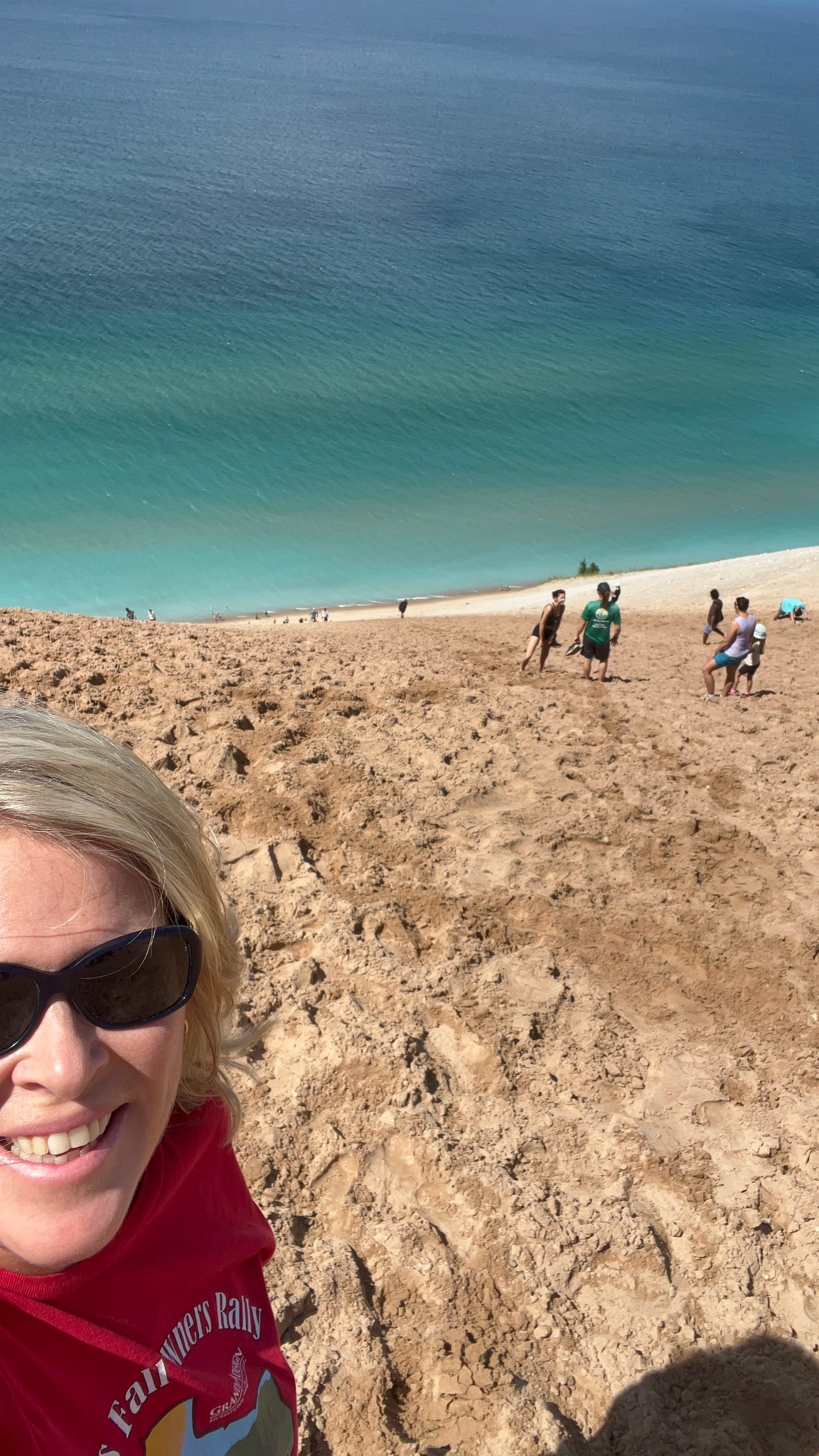
Views from the top of the Dune - those specs at the bottom are adults!
So where does the $3000 come in to the story, well, that's the rumored cost of "rescuing" you if you can't make it back up the dune!
After the scenic drive we continued around to the tame "Dune Climb" that us mere mortals could handle and then on into Glen Haven, a historic district where they had a shop and a working blacksmith to watch.
Glen Haven Historic District
All in all, it was an amazing day!
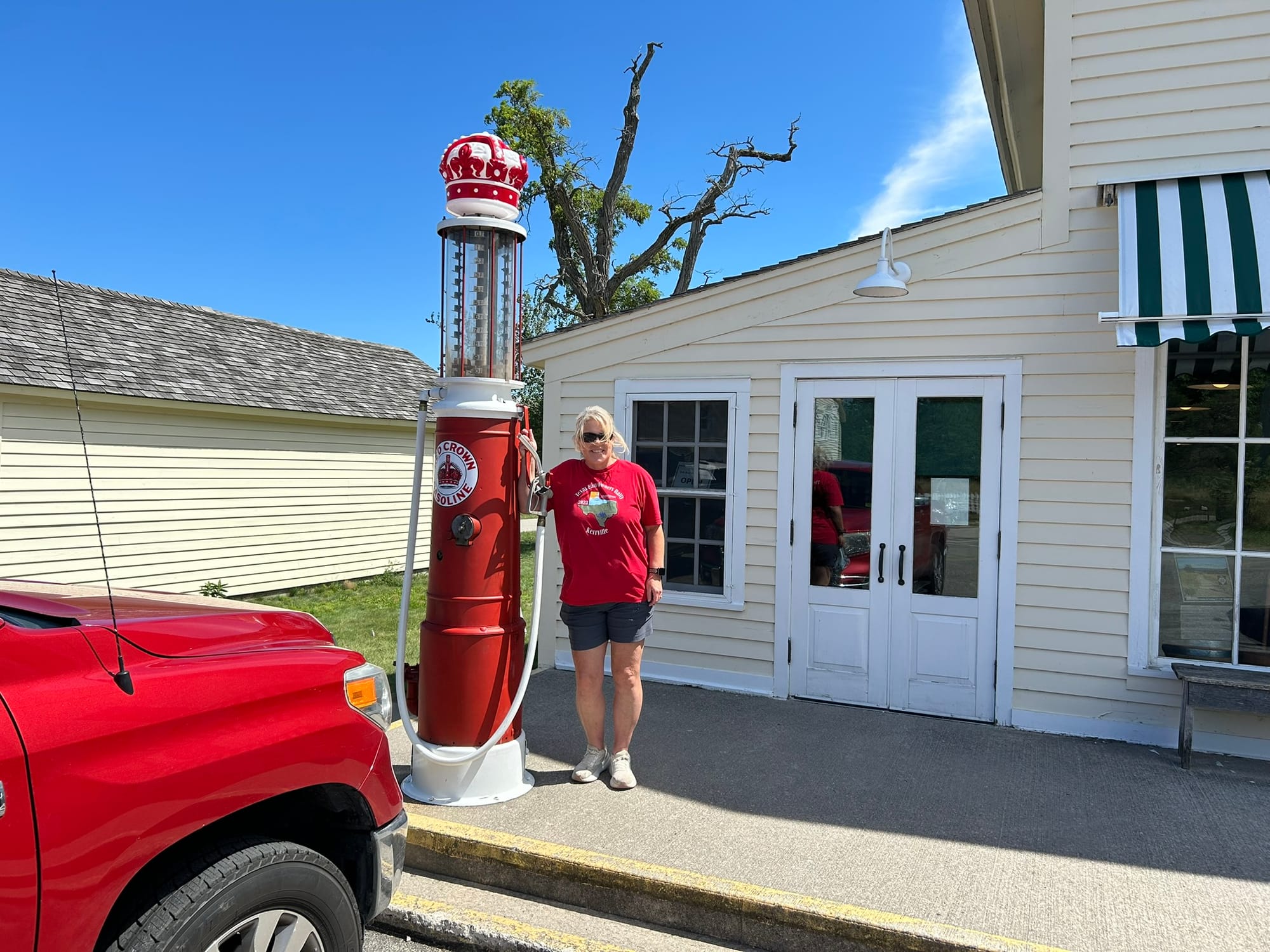
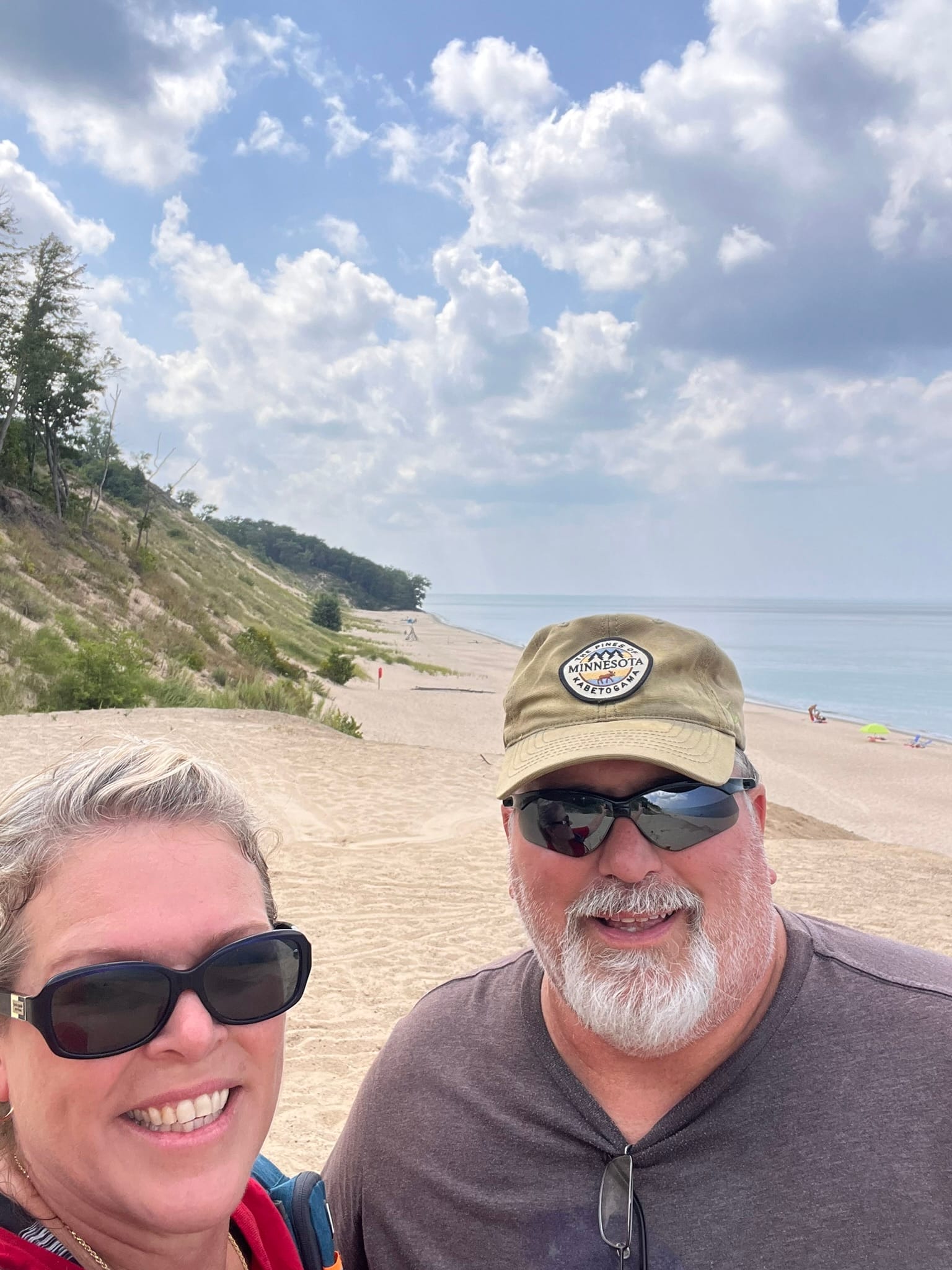
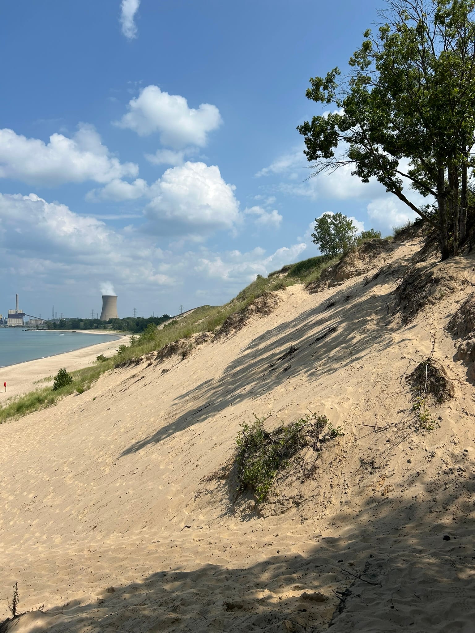
Indiana Dunes National Park, Indiana
This national park protects the amazing dunes along the south Lake Michigan coast. It's mostly sandy beaches with giant sand dune backgrounds. We stopped at the most easterly entrance called Mount Baldy which is a moving sand dune that is moving away from the water at up to 6 feet a year. It has already covered a building and the ranger said that they expect to lose another building in about 2 years and the entire parking area in 5. Kind of strange to think of the dunes migrating like that but that's what wind and sand will do!
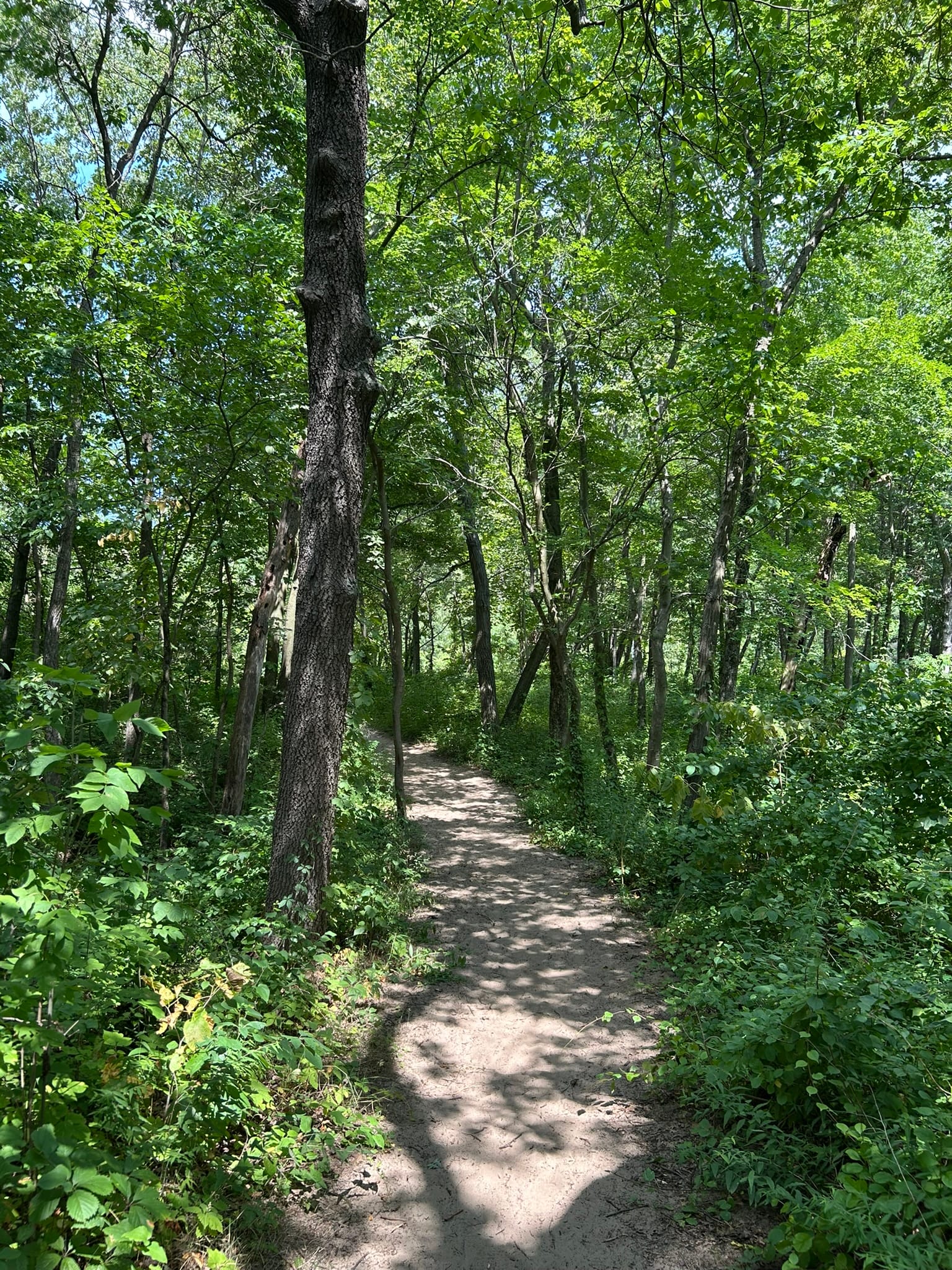
We hiked through the vegetation over the dune and popped out high above the waters of Lake Michigan. We had to go down to put a hand in the water or we just couldn't really say we'd been there! Even our dogs were enjoying the water though they aren't big fans of the water and hate the idea of swimming in it.
After that stop we moved to the next parking area called Central Avenue Beach to see if there was anything else to be seen. Still high dunes and the seemingly endless waters of Lake Michigan as far as you can see. It was an extremely hot and humid day and we aren't "lay in the sun and sizzle" type of folks so we headed back to the truck and went to the Visitor Center to pick up our patch.
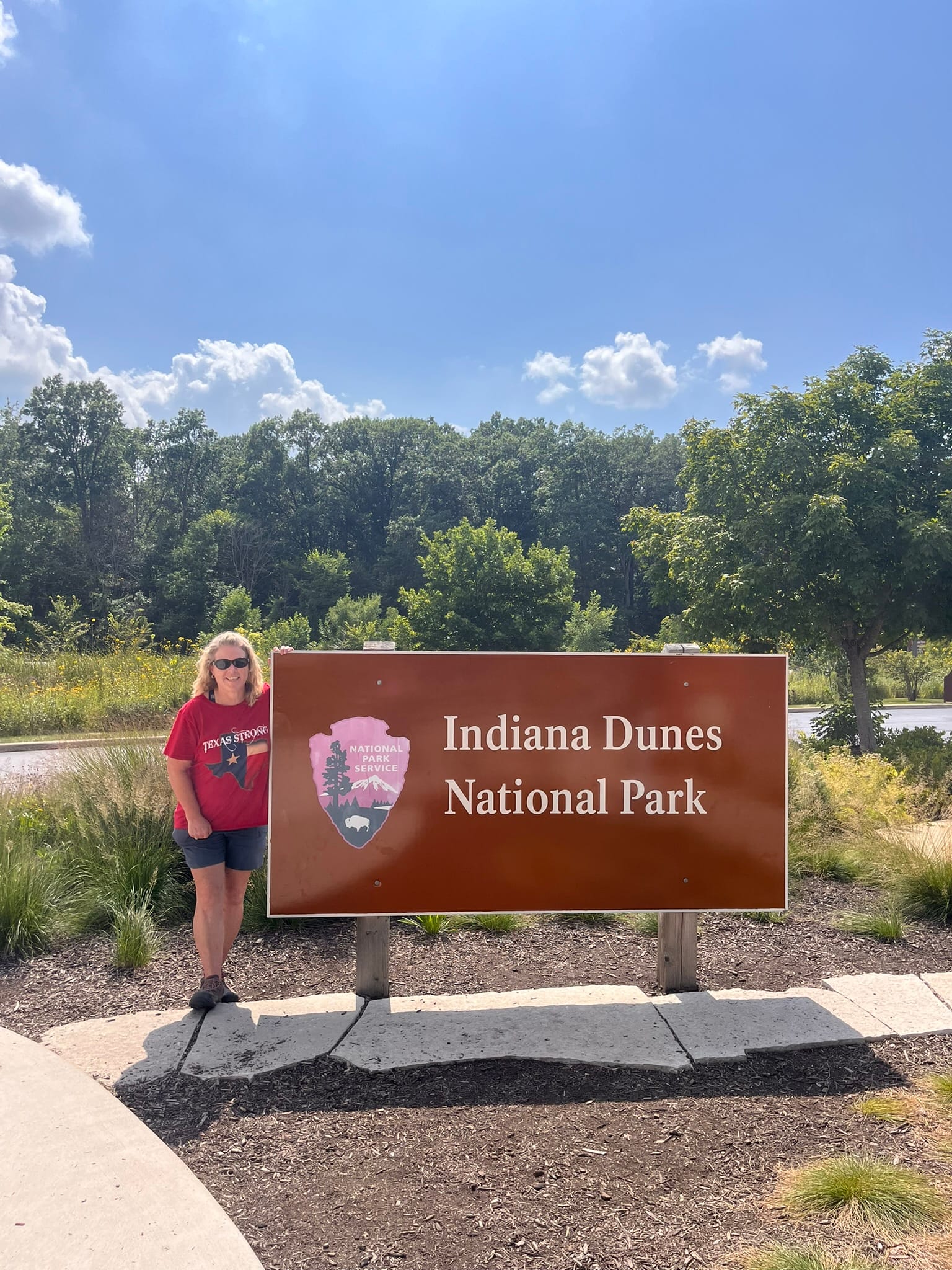
Indiana Dunes National Park
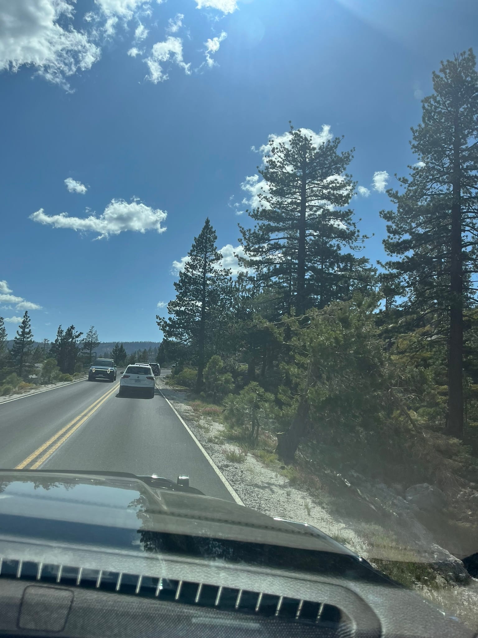
Kings Canyon National Park, Giant Sequoia National Monument, and Sequoia National Park, CA
For those keeping count, this is number 9 and 10 of the 10 national parks we are planning to hit on this trip! We drove into Kings Canyon National Park on day one and had to drive through the Giant Sequoia National Monument on highway 180, the King's Canyon Scenic Byway, first and both are amazing places to see! Kings Canyon is the last third of the drive out to the end of 180 which dead ends there.
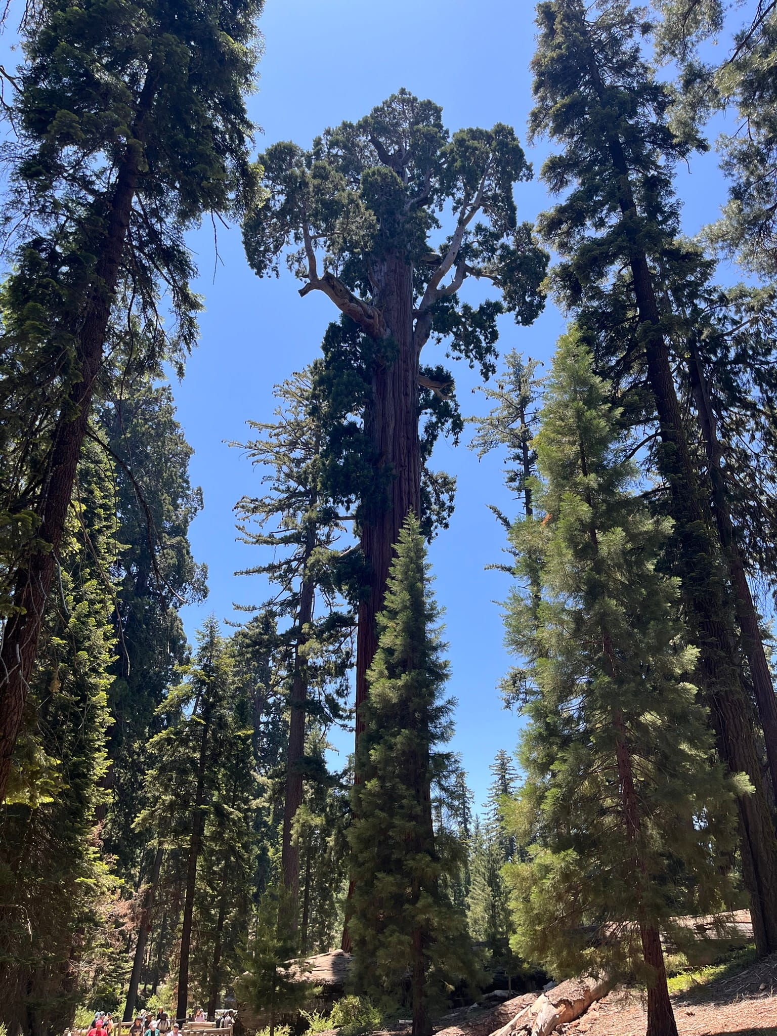
As we left the RV site heading in, we first climbed up to over 4000’ and the temps dropped from mid 90’s to upper 70’s which was a very pleasant change! The drive snakes up along the edges of mountains that are lightly forested with a lot of dry grassy areas also. As you approach the Giant Sequoia National Monument on 180 you start hitting dense forests with very large pines. Not far in, you turn north to follow 180 and very quickly hit the turnoff for the General Grant Tree, the second largest tree in the parks. It’s in an amazing grove of giant sequoias, all of which dwarf anything we have ever seen before! We found a parking spot and hiked up to the General Grant Tree which is over 40 feet around and it just overwhelms you! Even in the parking lot there were giant trees towering overhead. We learned that Sequoias are larger than Redwoods in total volume but Redwoods can be taller and thinner.
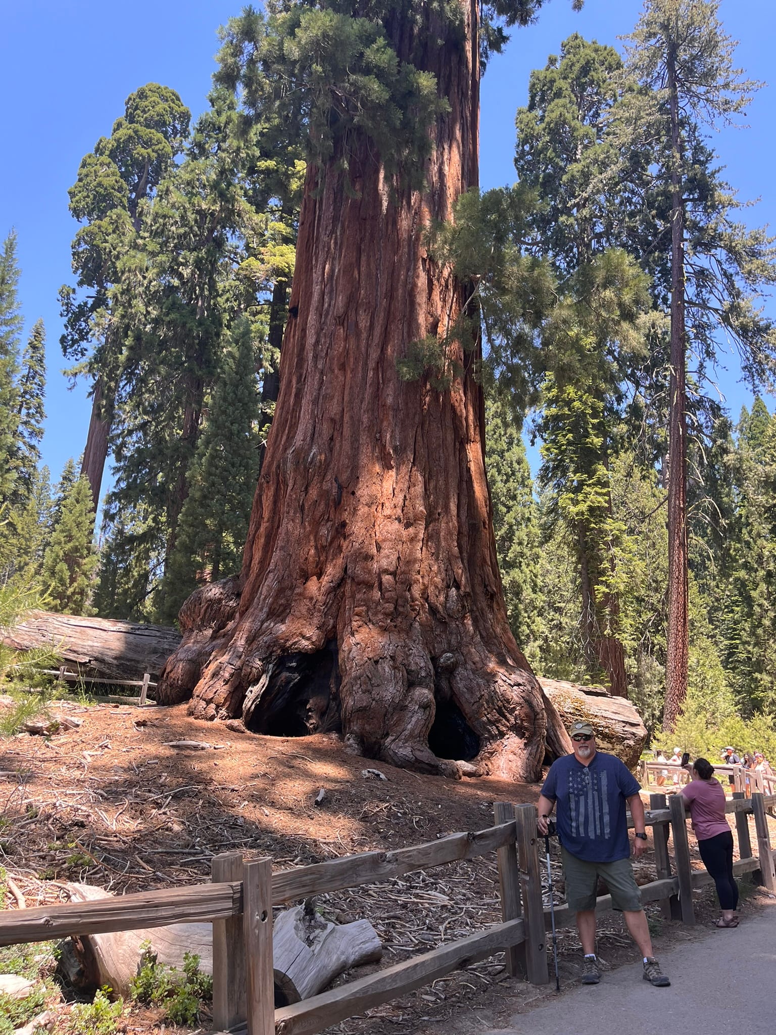
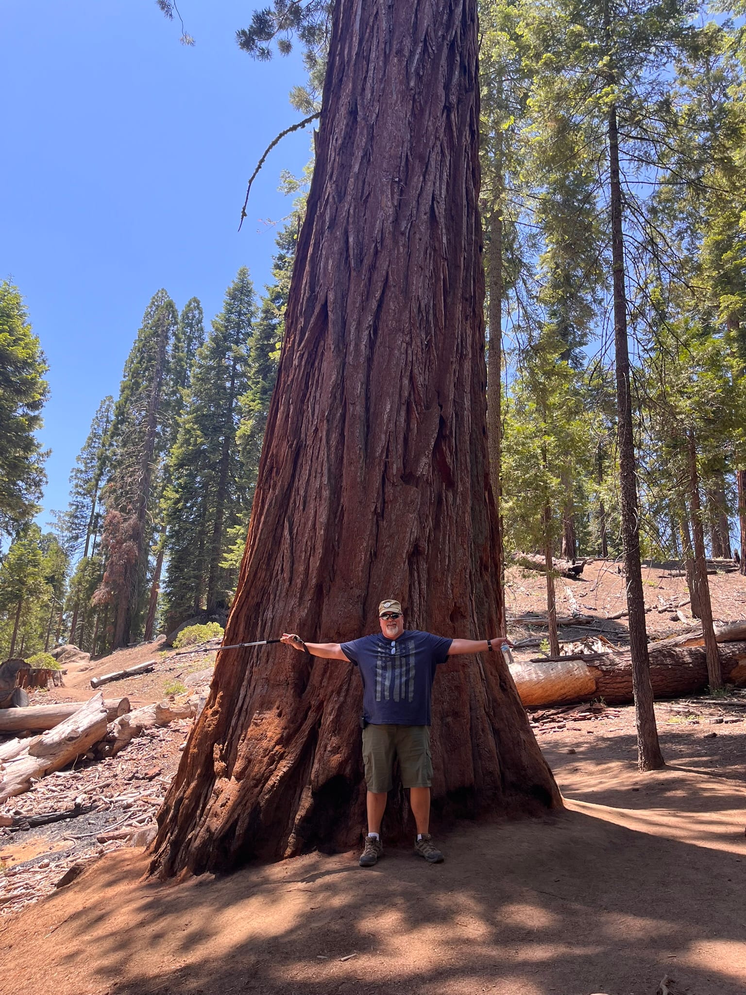
The General Grant Tree and another "small" Sequoia
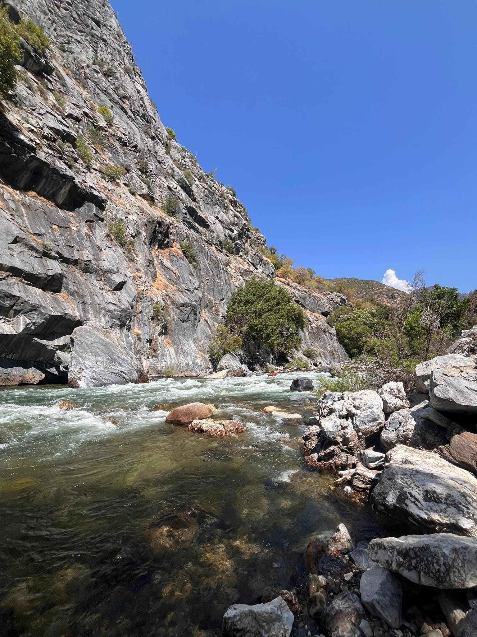
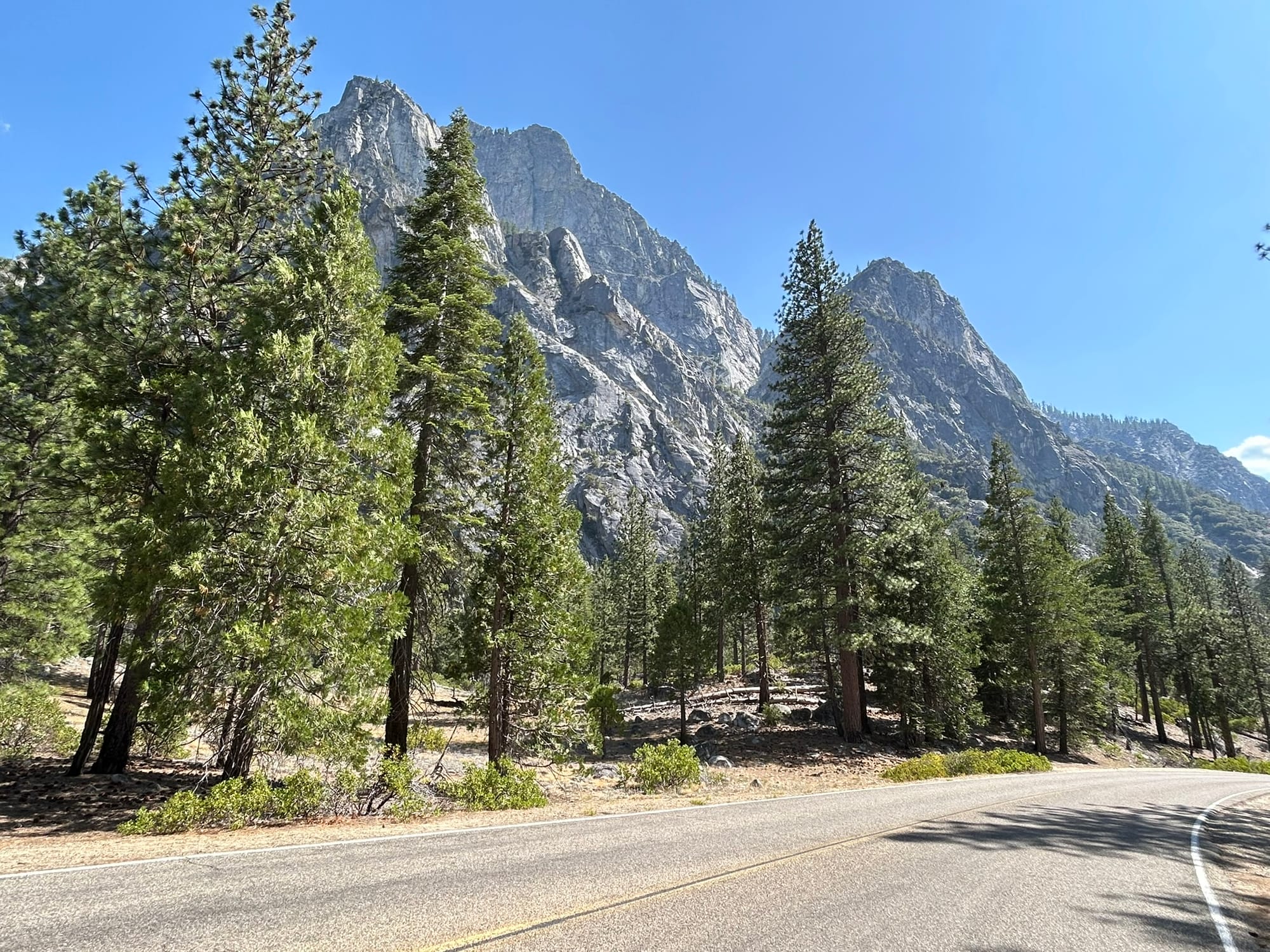
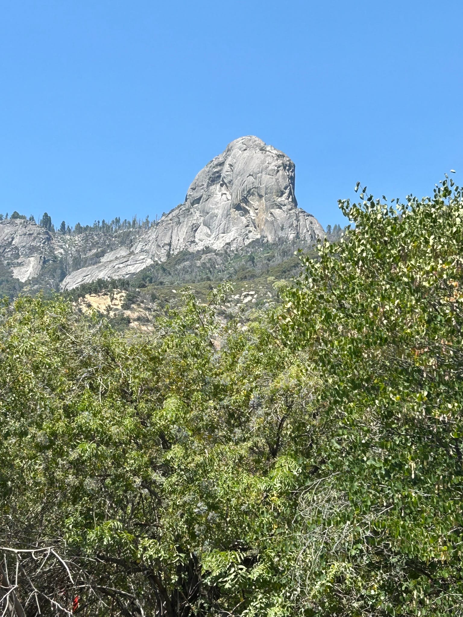
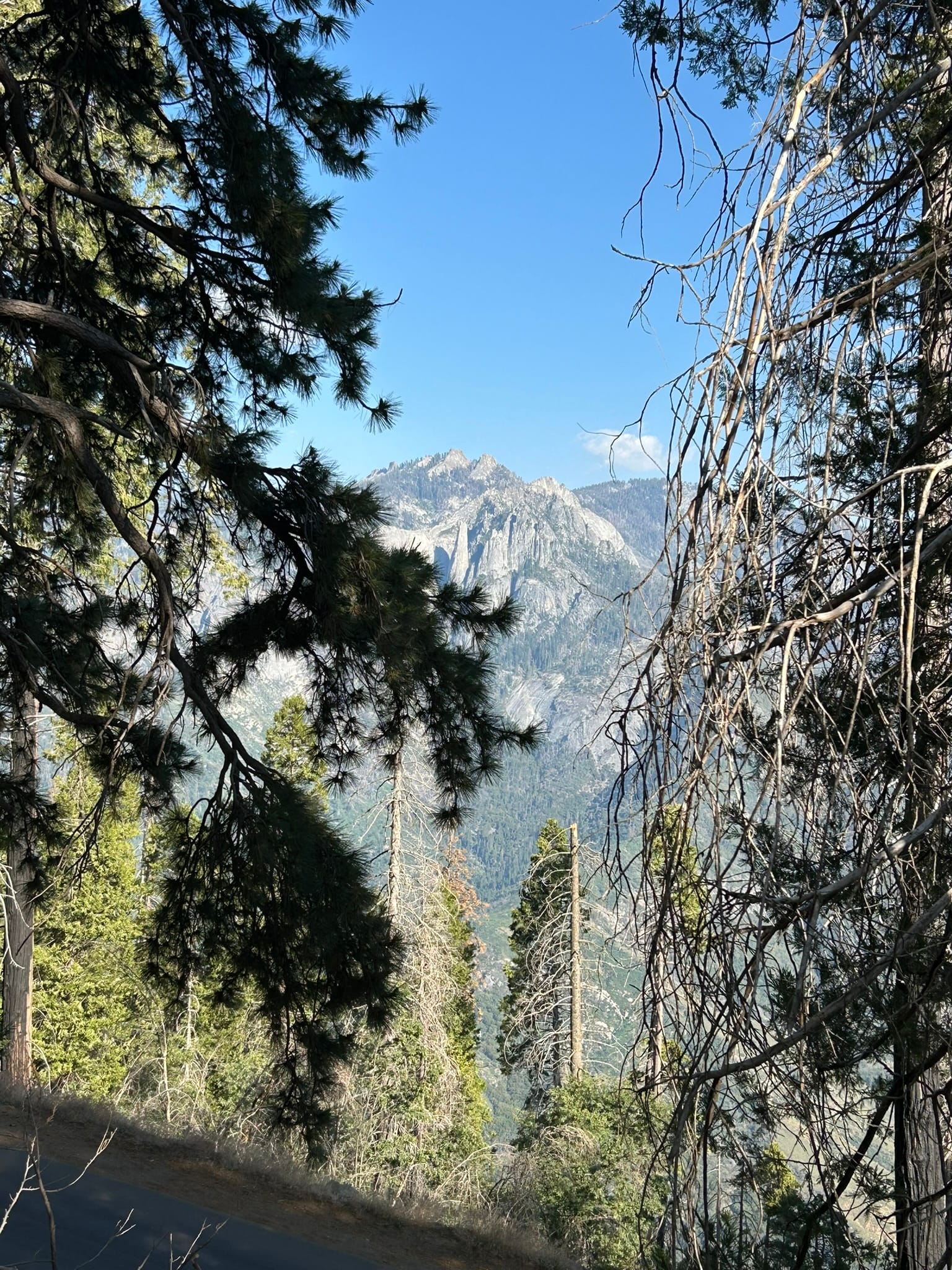
We wandered around the grove a bit and then headed out to continue the drive on the Kings Canyon Scenic Byway. We climbed up some more mountains and then popped out on the side of some serious cliffs overlooking a river canyon and wound our way through the canyon slowly descending while working our way back. The scenery in this section was beautiful! Towering mountains around us, granite walls of the canyon, beautiful falls and every now and then a glimpse of the river that created it all!
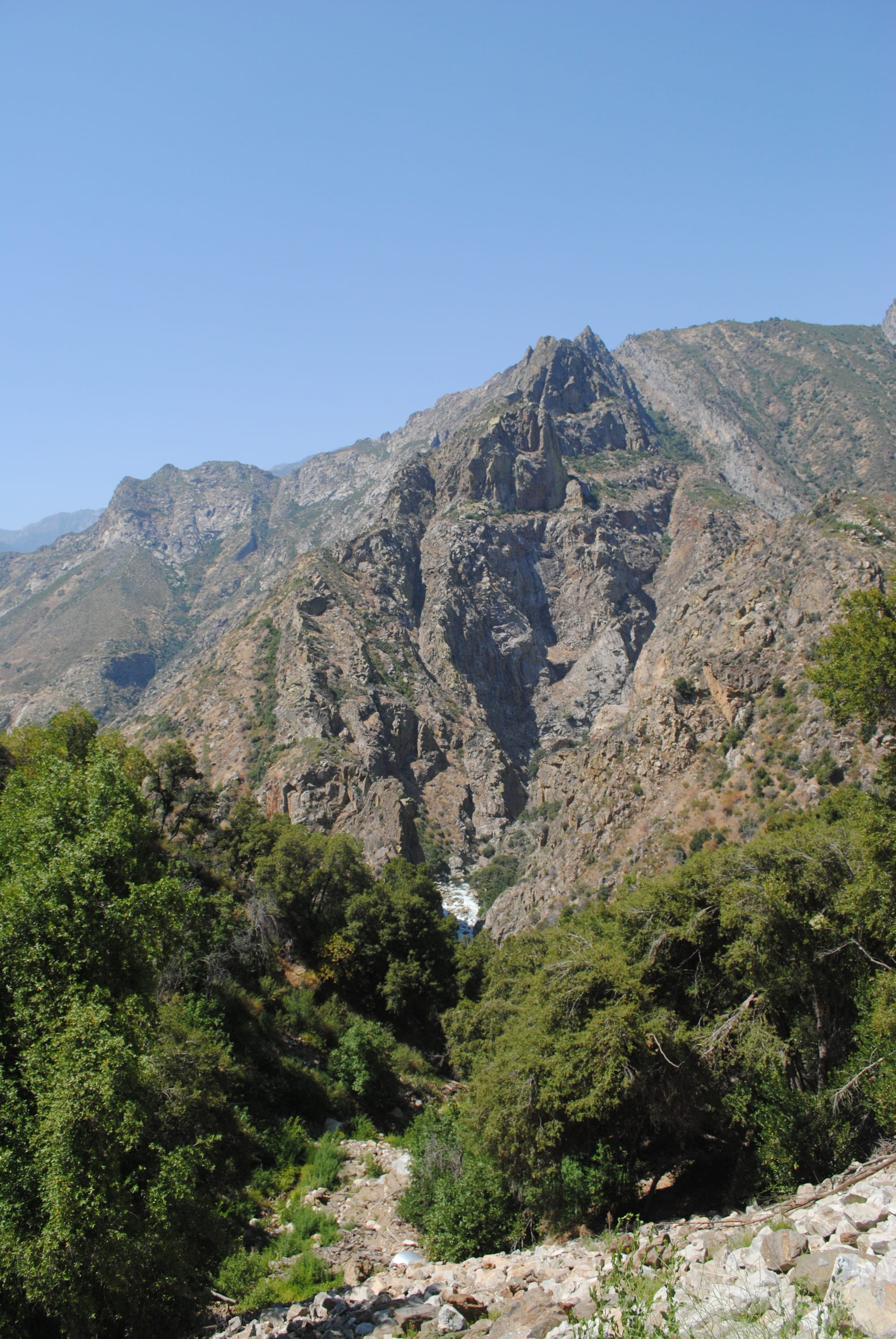
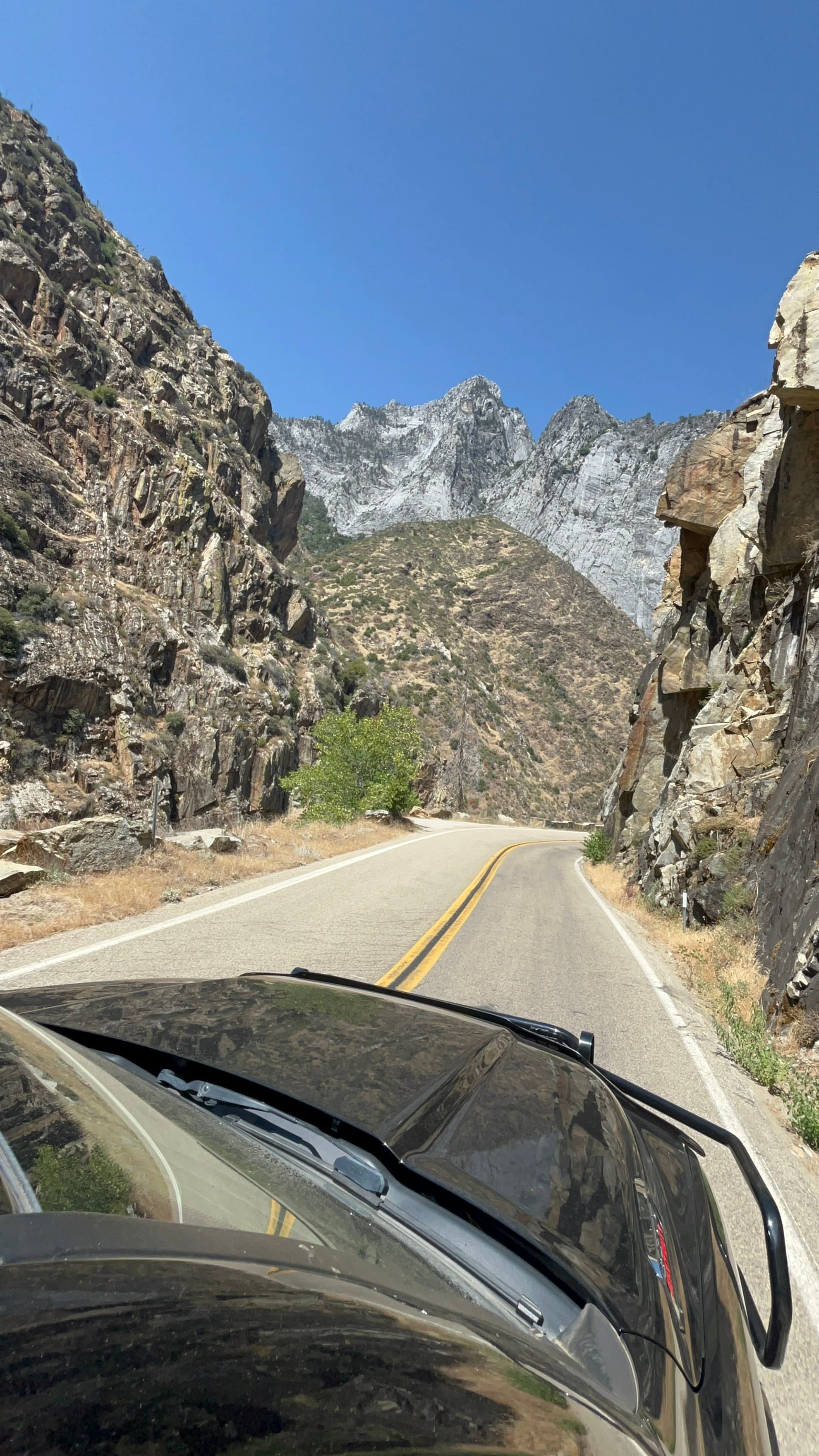
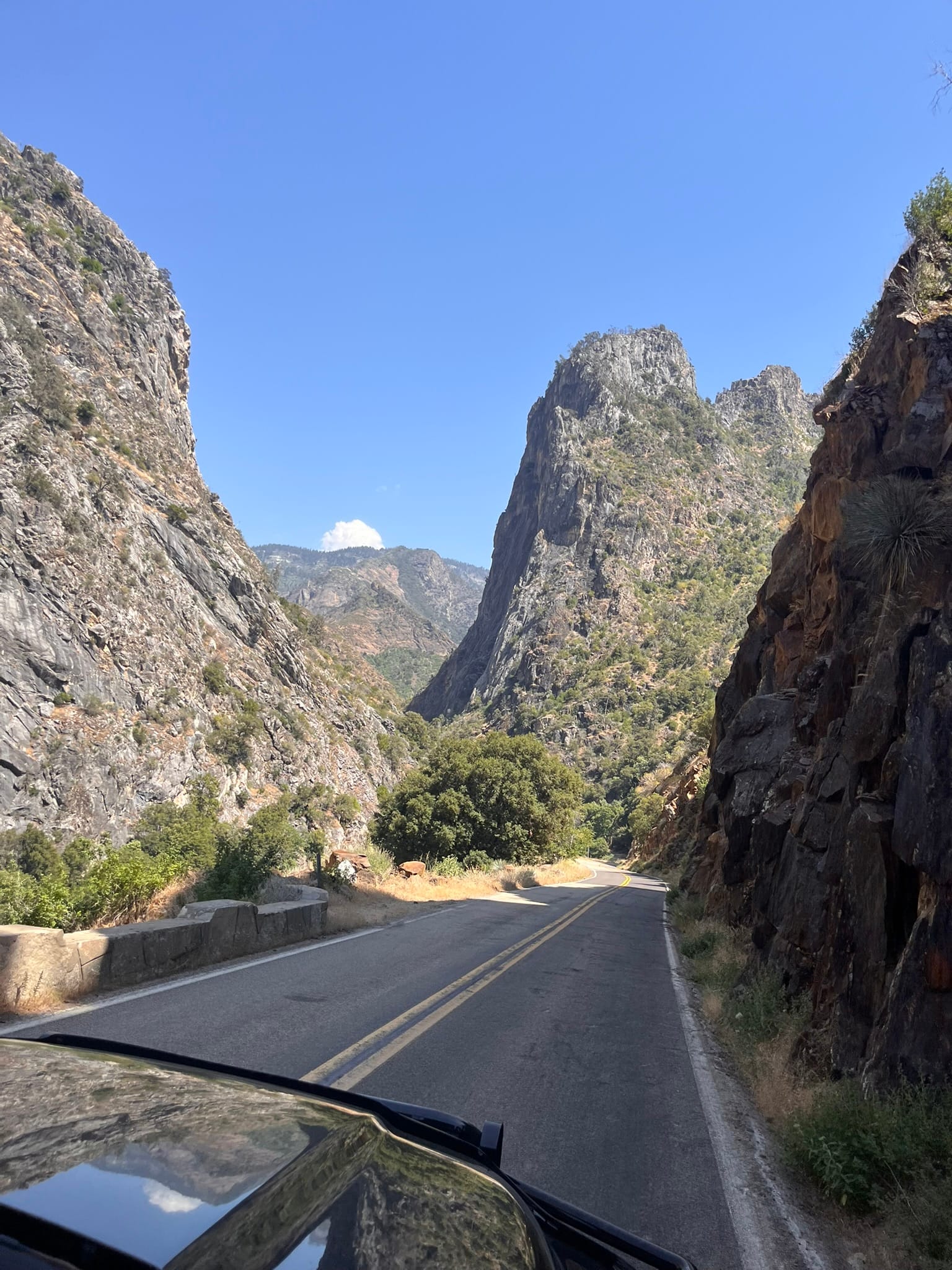
Views on the drive through Giant Sequoia National Monument towards Kings Canyon National Park
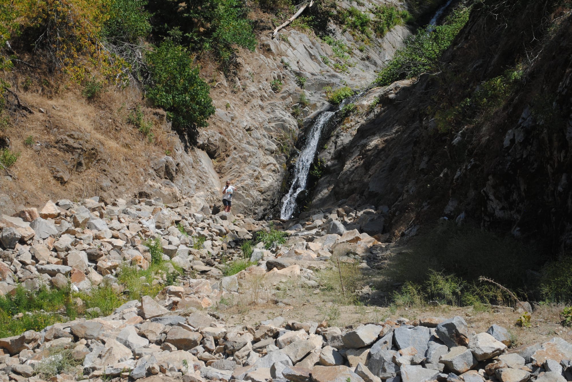
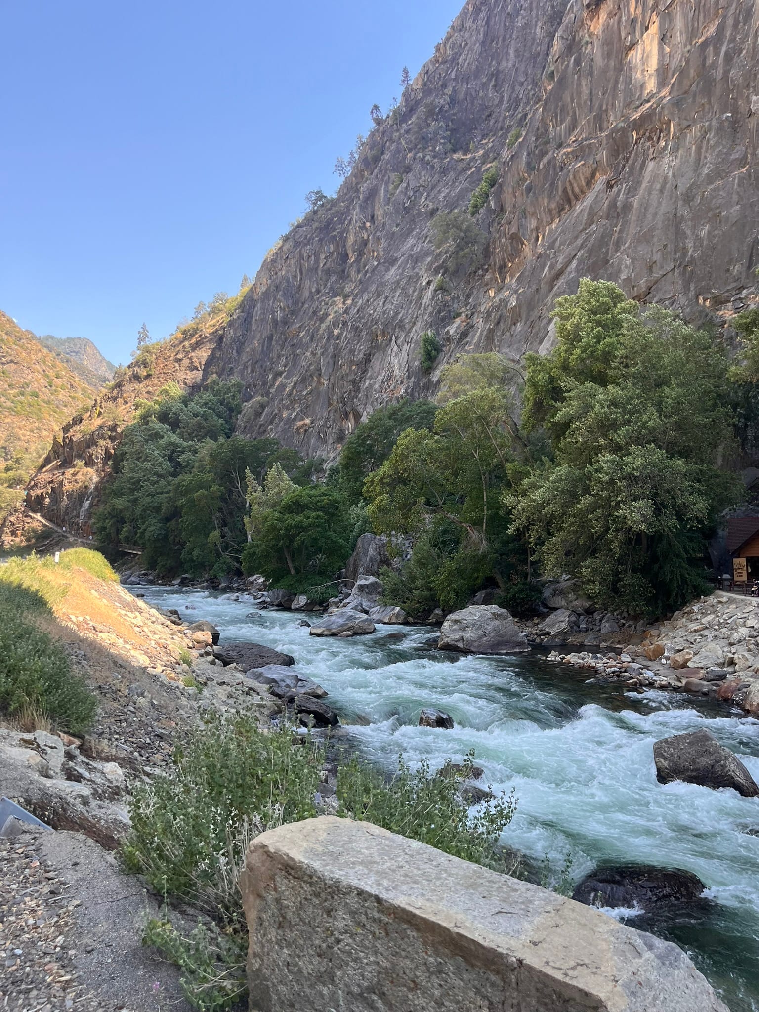
After what seemed like forever, we reached the bottom of the canyon, passed Boyden Cavern and soon hit the welcome sign for Kings Canyon National Park. This part of the canyon wasn’t as intimidating as the earlier sections but was a spectacular sight of it’s own! The road followed the river up stream slowly climbing past several waterfalls including Grizzly Falls and Roaring River Falls both of which we hiked up to and they were wonderful to see!
Views of Kings Canyon National Park
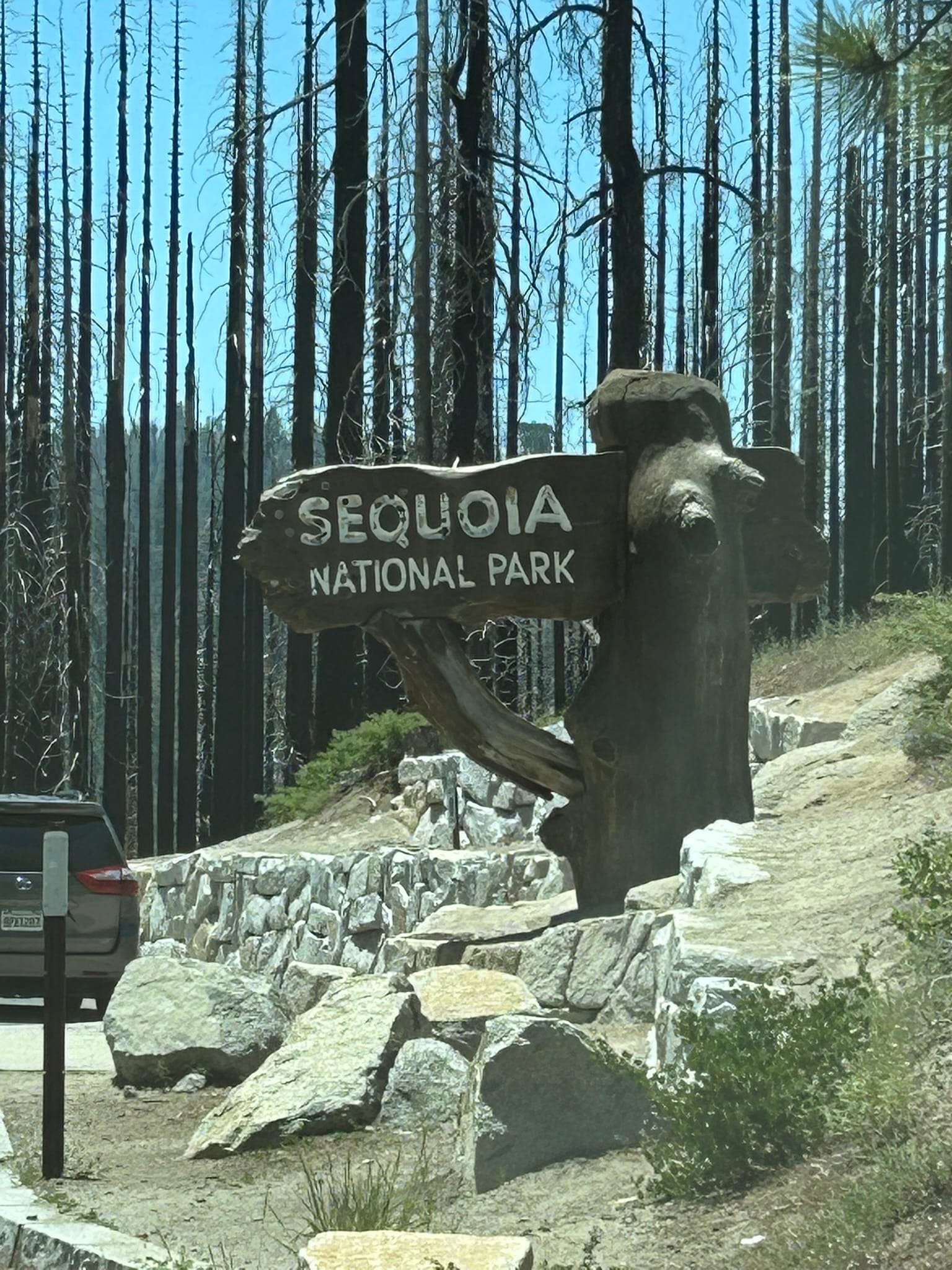
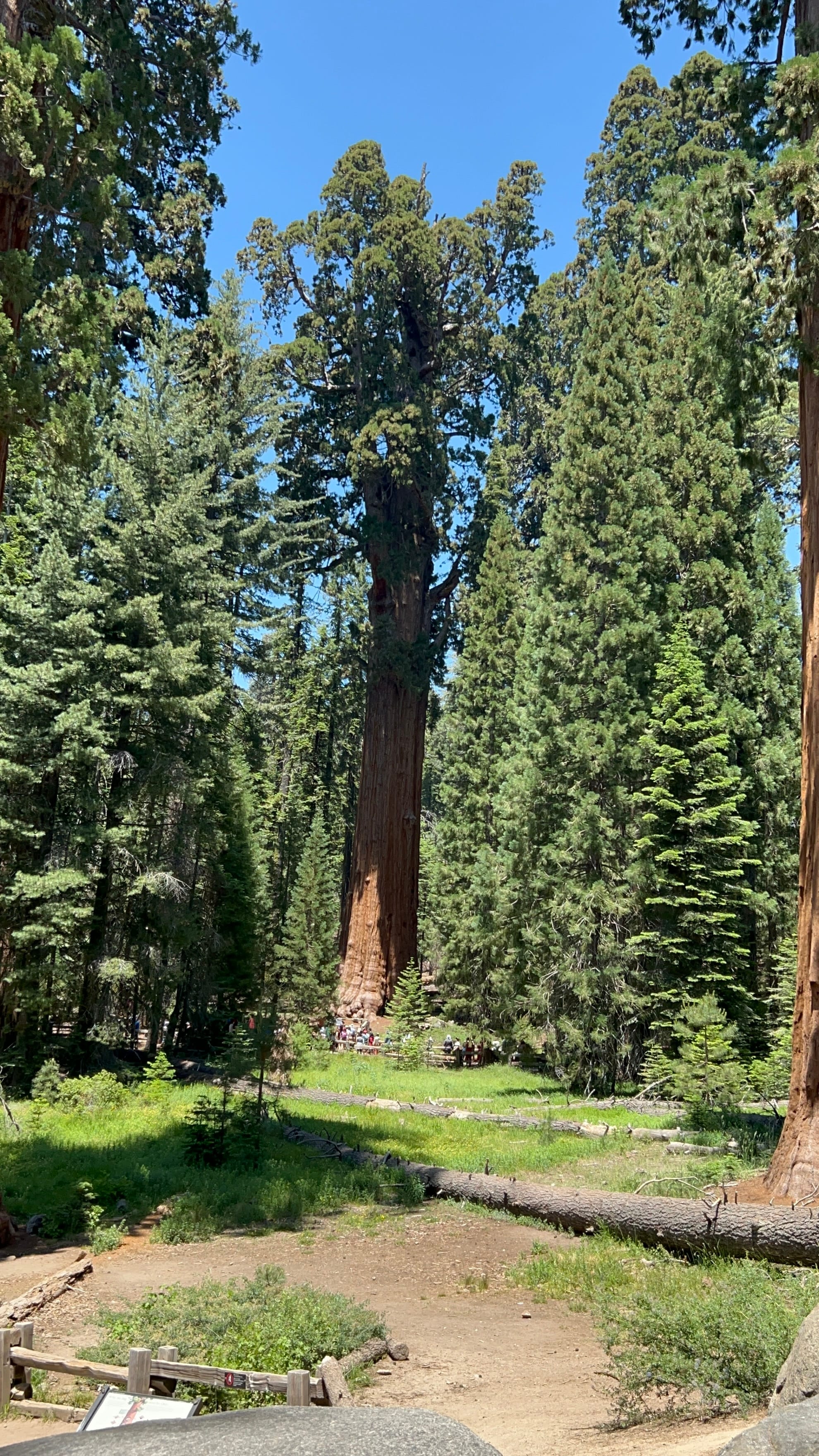
On day 2, we headed back up 180 along the switch backs and into Giant Sequoia National Monument again but this time turned south towards Sequoia National Park. It’s a bit of a drive south through the Sequoia National Forest to reach the beginning of Sequoia National Park. We continued through the park looking at the huge Sequoias that seemed to just spring up randomly along the road until we hit the parking lot for the The General Sherman Tree, the largest tree by volume, on the planet! The parking lot is uphill well away from the tree itself. They have a handicapped parking lot much closer but we had to hike the ½ mile down about 200’ elevation change into a grove of magnificent giant Sequoias to reach the General Sherman! It is an IMMENSE tree and just seems like it should be fake!
Views in Sequoia National Park
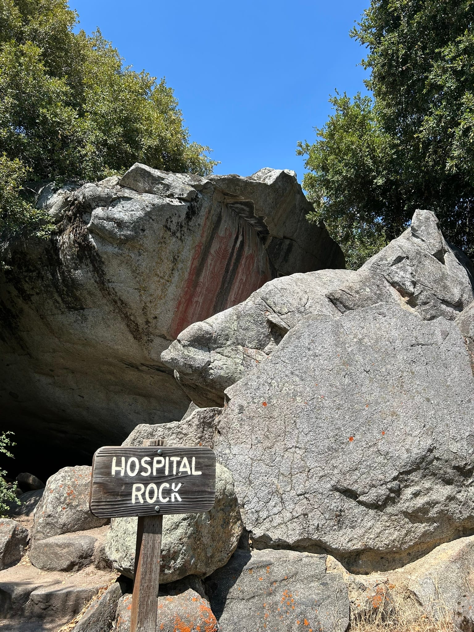
After we hiked back up to our parking lot we headed south again planning to stop at the Giant Forest Museum/gift shop and Moro Rock parking area but traffic and parking were so bad we bypassed it and continued south to see Hospital Rock and Tunnel Rock. Hospital Rock is covered with ancient pictographs from the native peoples who lived there. One rock near the river has mortars carved in them for use grinding acorns into flour for bread and other food stuffs. We had a picnic lunch there and then continued to Tunnel Rock which isn’t used as a road anymore much to our disappointment and probably good luck because our truck probably wouldn’t have passed under it too easily!
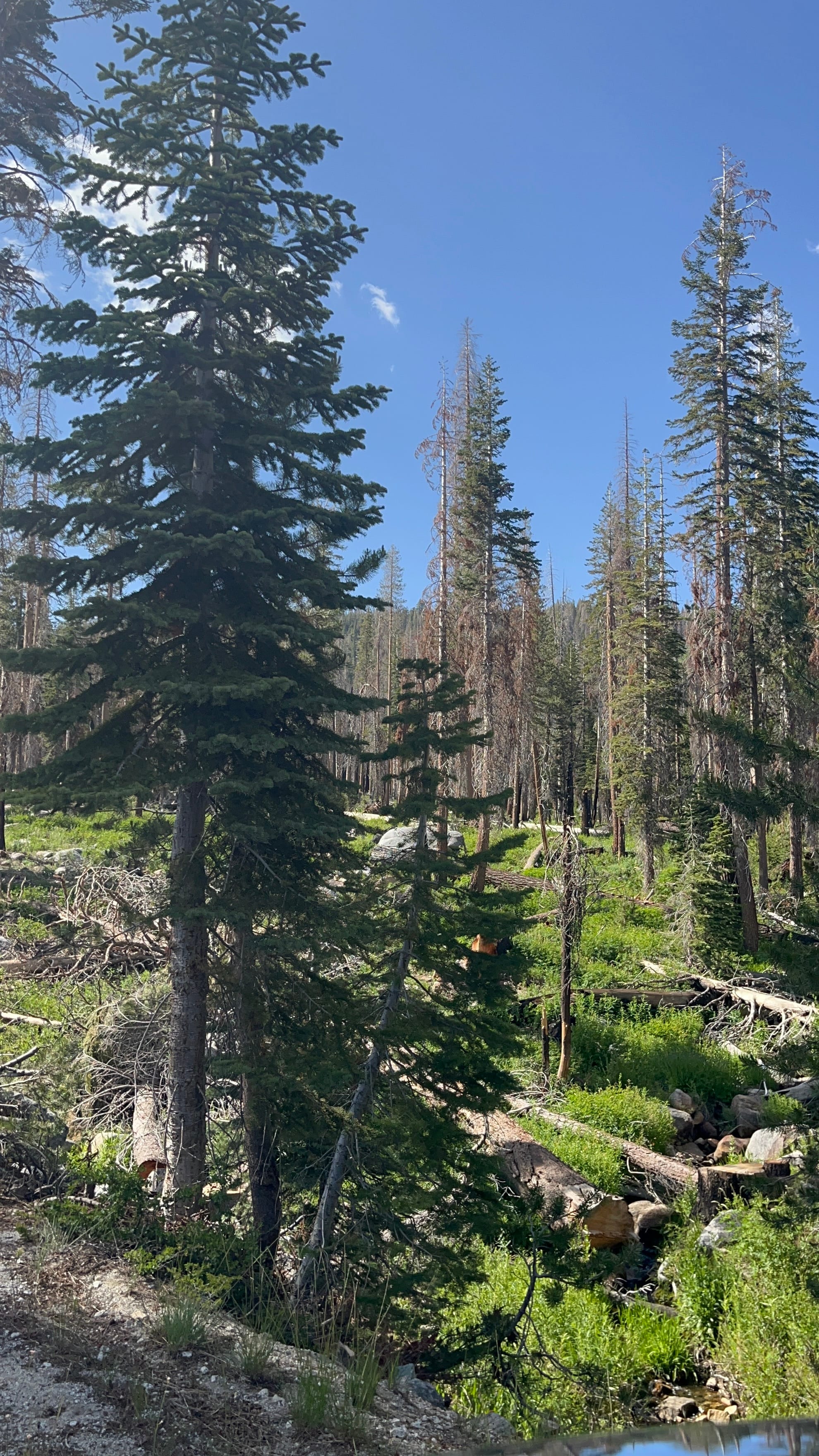
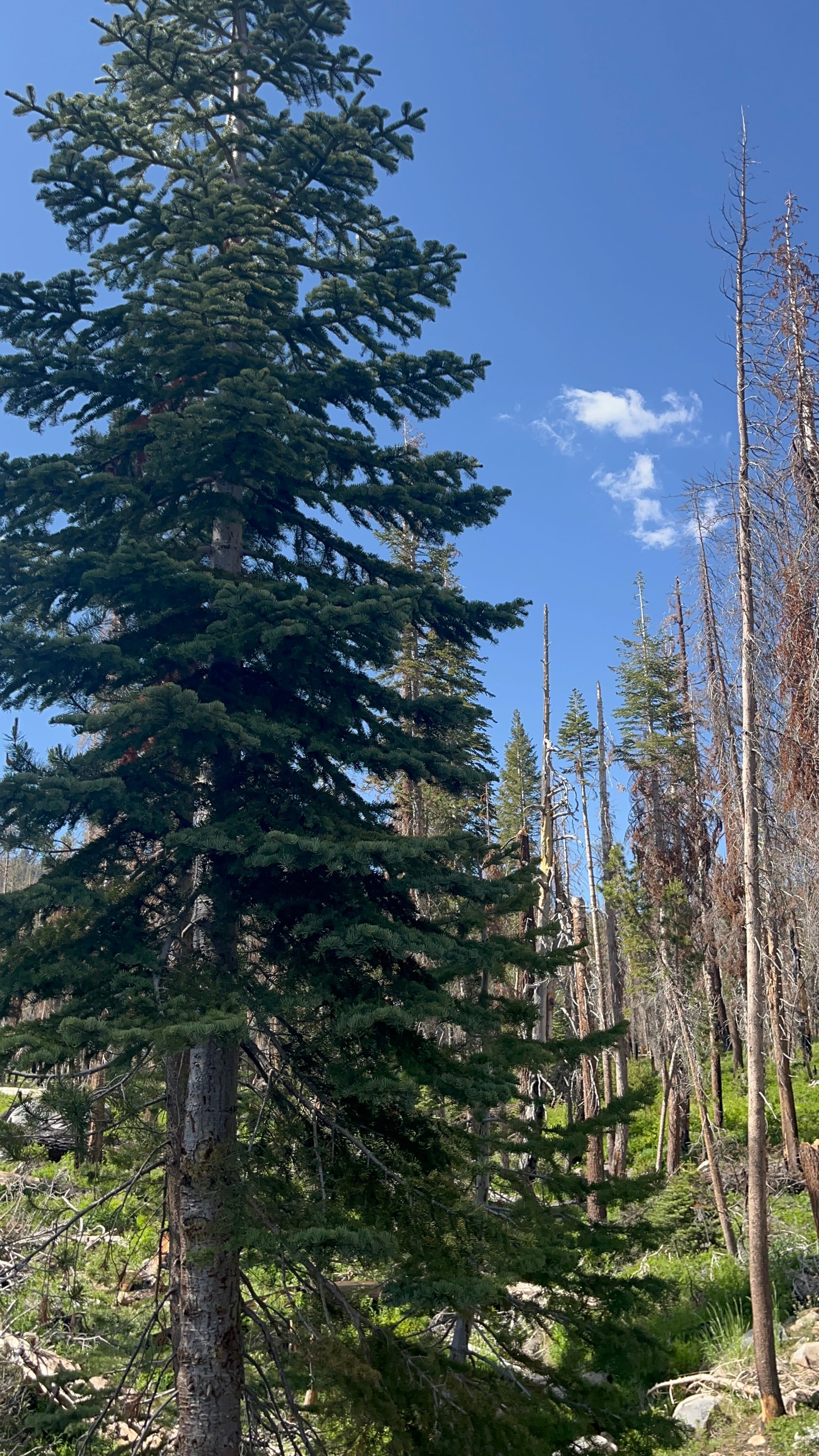
We turned around and headed back up the winding canyon wall to reach the parking area for the museum and Moro rock. After looking around a while we finally found the entrance to the overflow parking lot well down the hill and found a spot there. We had to hike up to the museum which had some nice displays on the lifecycle of the giant Sequoias and how fire is an integral part of that cycle. The giant Sequoias have up to a foot of thick protective bark that protects them from most fires but they can’t survive the hottest ones. Humans have learned to let the underbrush burn in smaller less hot fires that clear out the clutter under the trees and allow the seeds of the giant Sequoias to grow. It’s hard to believe these trees are so old, many over 1000 years!
We headed out from the museum and followed the Moro Rock trail which turned out to be much longer than we thought based on the map we saw! It was probably a 2 mile hike. About ¾ of a mile in, we lost all contact with other humans. There had been a family behind us but they dropped back so far we couldn’t hear or see them and the loneliness of backcountry hiking hit us. We suddenly realized that this was prime bear country and later found out that the hill we were hiking was called “Bear Hill”! Which was prophetic because on the bus ride back we saw a Grizzly next to the road we had just hiked! Yikes! For those counting, that’s the second hike on this trip that involved being way to close to a bear!
The hike was actually pretty smooth given the nearly 7000' altitude and we made decent time until we finally reached Moro Rock which is more of a granite dome on the edge of a cliff overlooking a huge valley! There’s steps up to the very top but we only went up about ½ way where the view opened up and the height of our climb became very real! Beautiful spot if you don’t mind huge drop-offs in every direction! We headed down since it was almost 6 and rumor was that the buses stopped at 6pm and we were NOT about to hike back another 2 miles or so. The bus took us around the loop at the top and we were also able to see Tunnel Log which is a downed giant tree with a tunnel carved through it. We were so tired and fearful of losing our seats we stayed on the bus and just headed back.
The three parks protect a lot of giant Sequoia trees and a lot of beautiful natural wilderness most of which is only accessible by hiking! There wasn't what I perceived as a natural demarcation between the parks so it's hard to pick a favorite. We really enjoyed seeing the amazing Sequoias and the incredible mountains and valleys of the Sierra Nevada Mountain Range! All are well worth your time to visit ... and bring your bear spray!
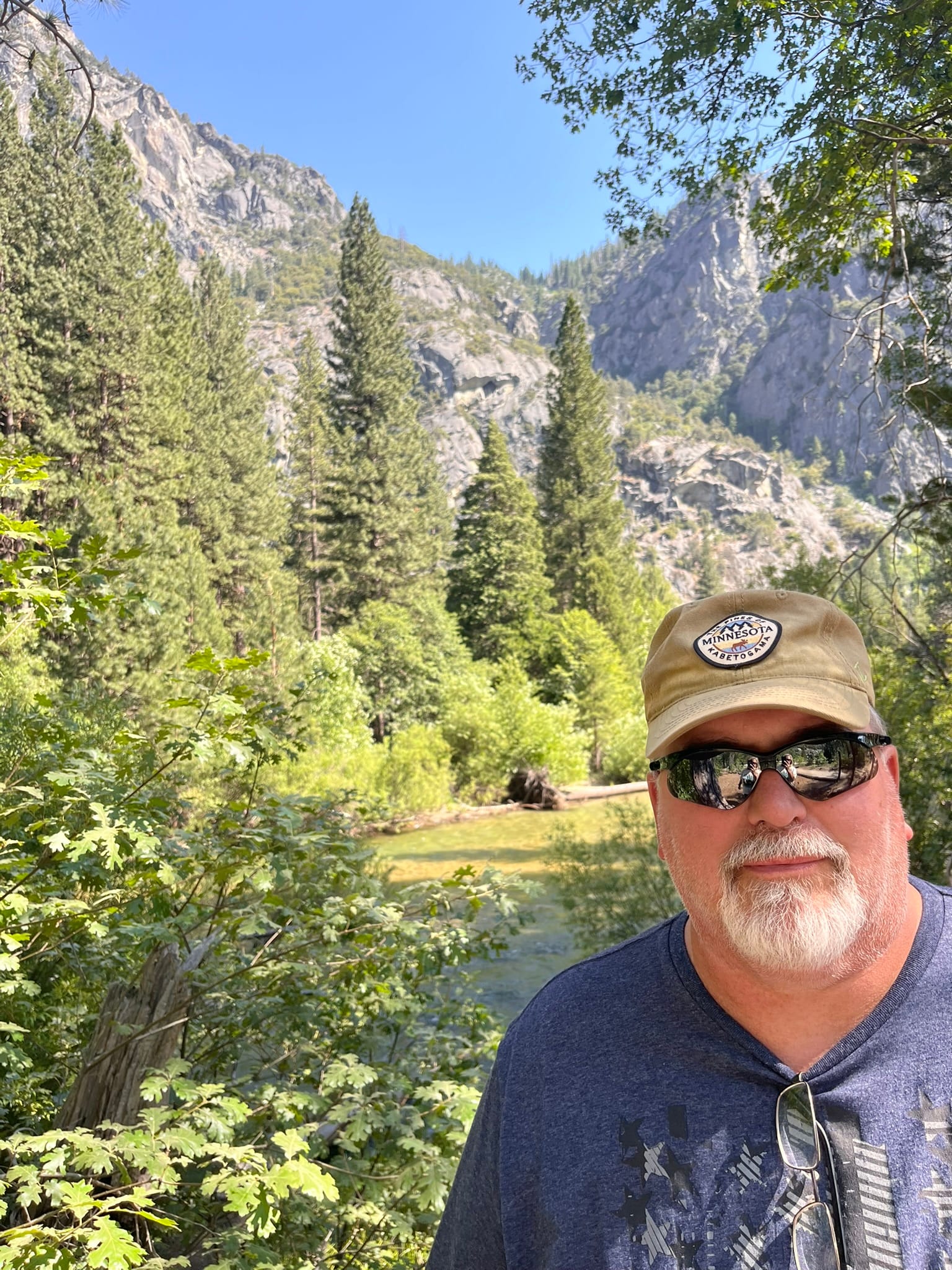
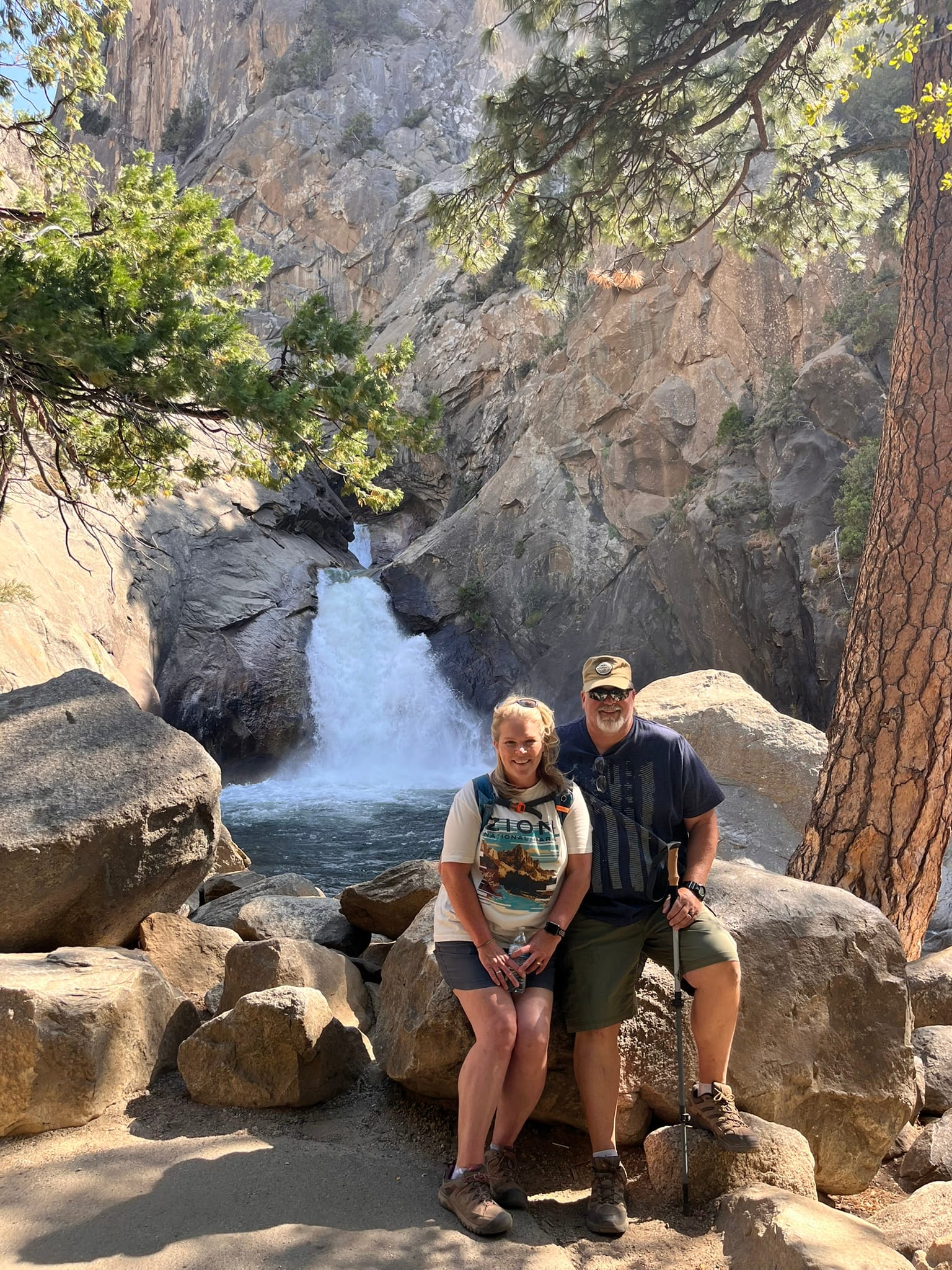
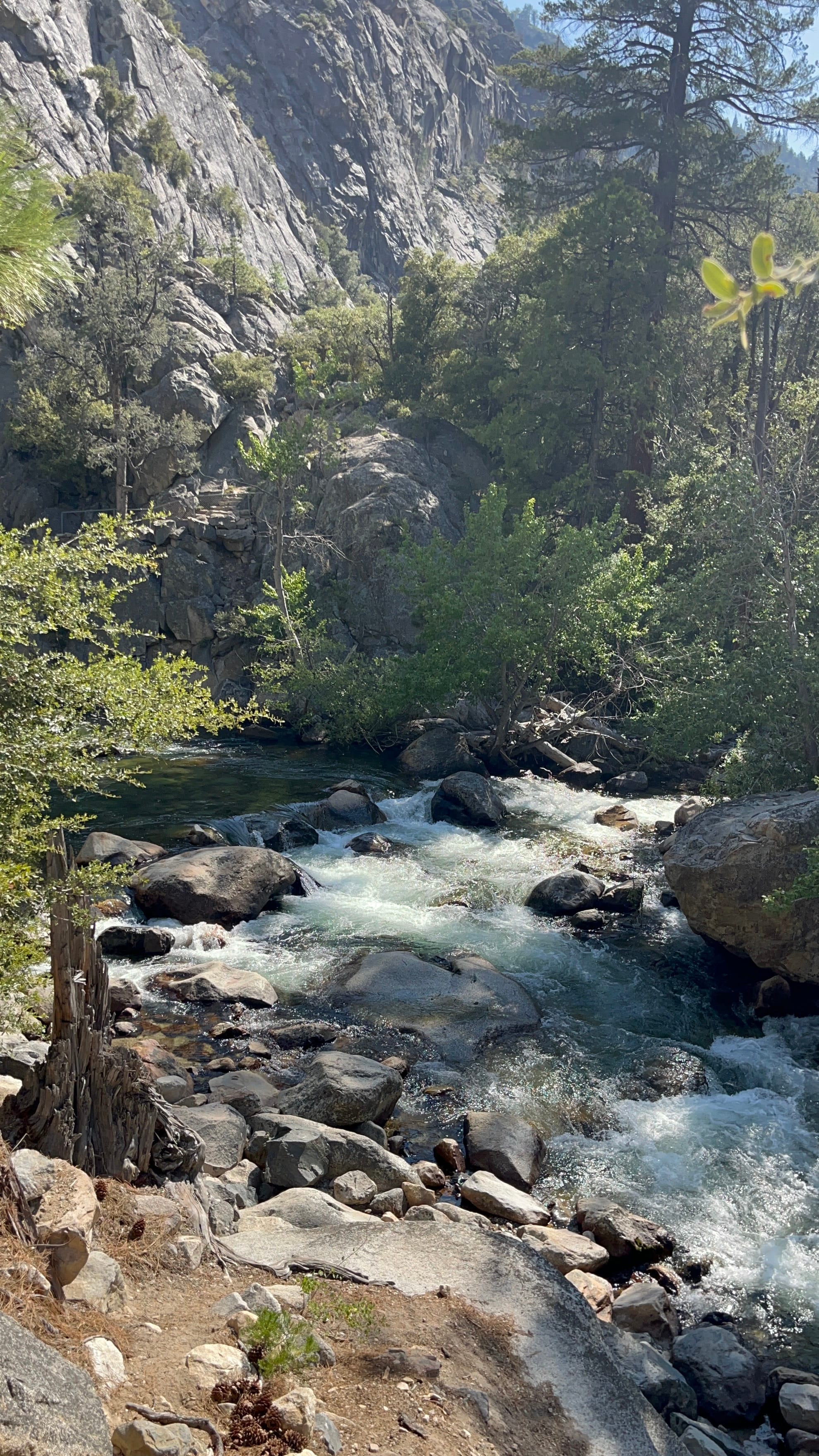
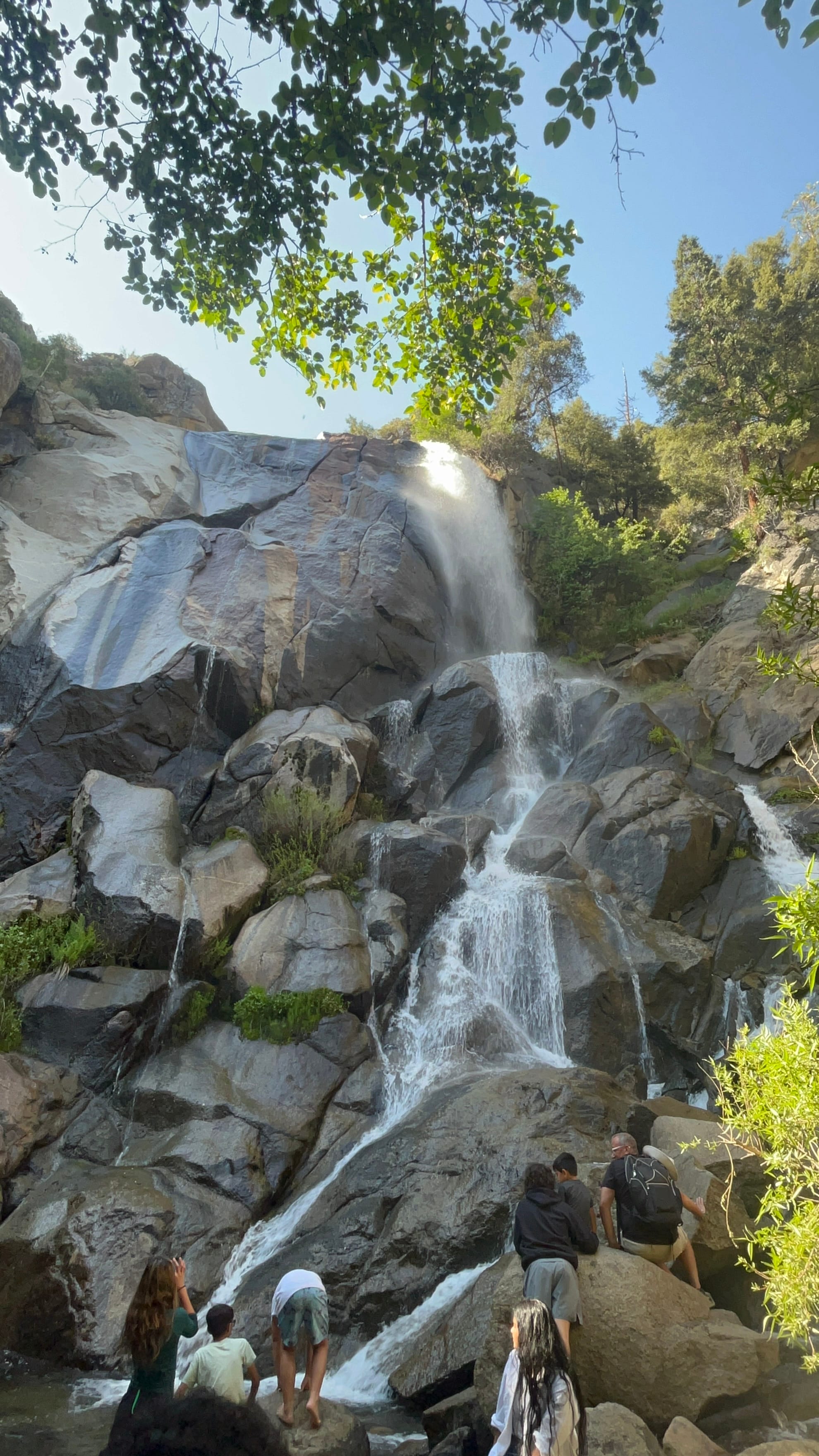
Yosemite National Park, CA
On the way into the area, we saw a highway sign saying that Yosemite required a reservation to get into the park between 6 am and 2 pm which wasn't advertised when we were planning this trip because we checked all the parks and only Arches had that listed for this timeframe! Kim jumped online and there were a bunch of reservations available for the next couple of days which we thought was odd for this time of the year. The pass is good for three days which is perfect.
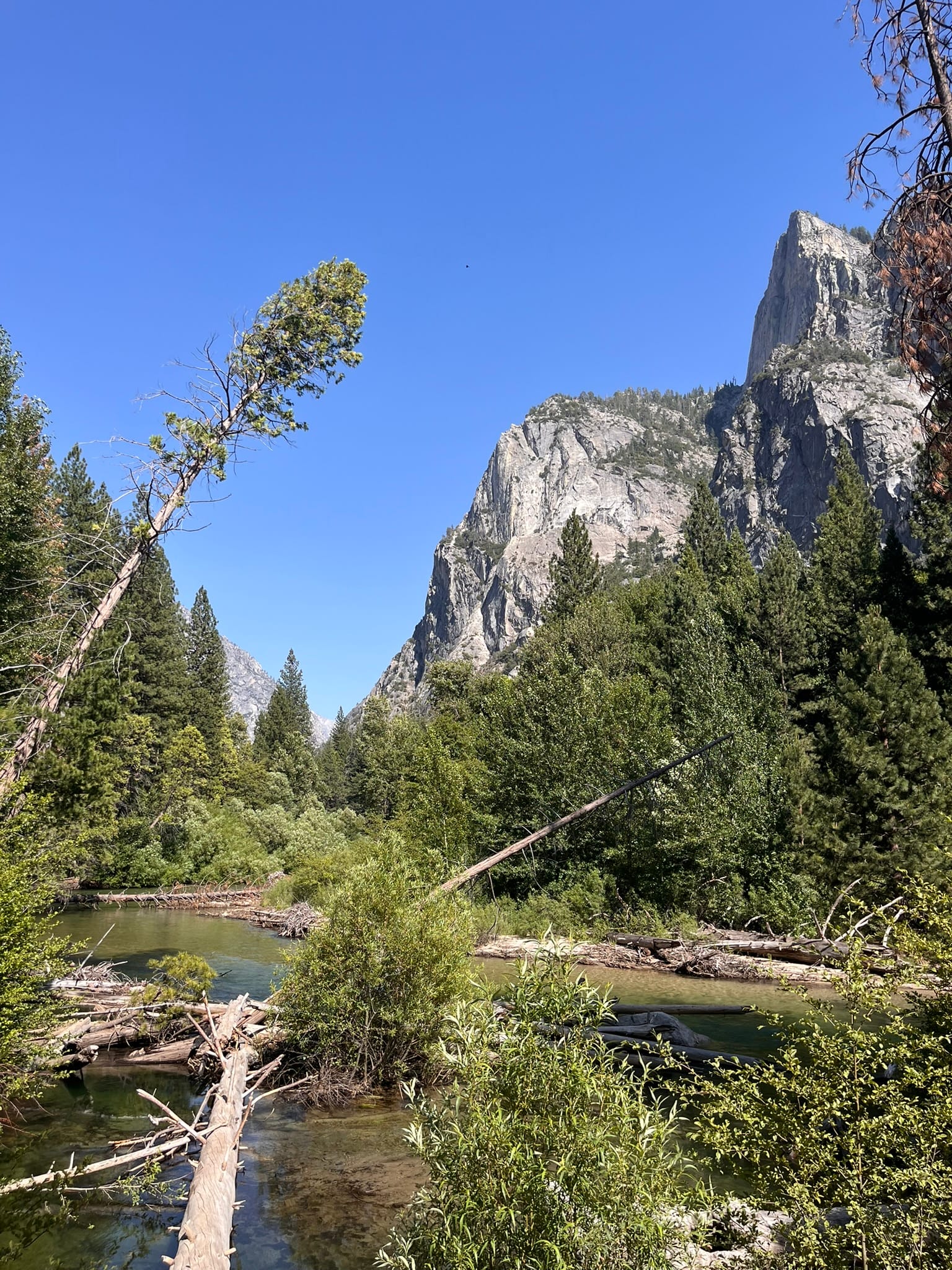
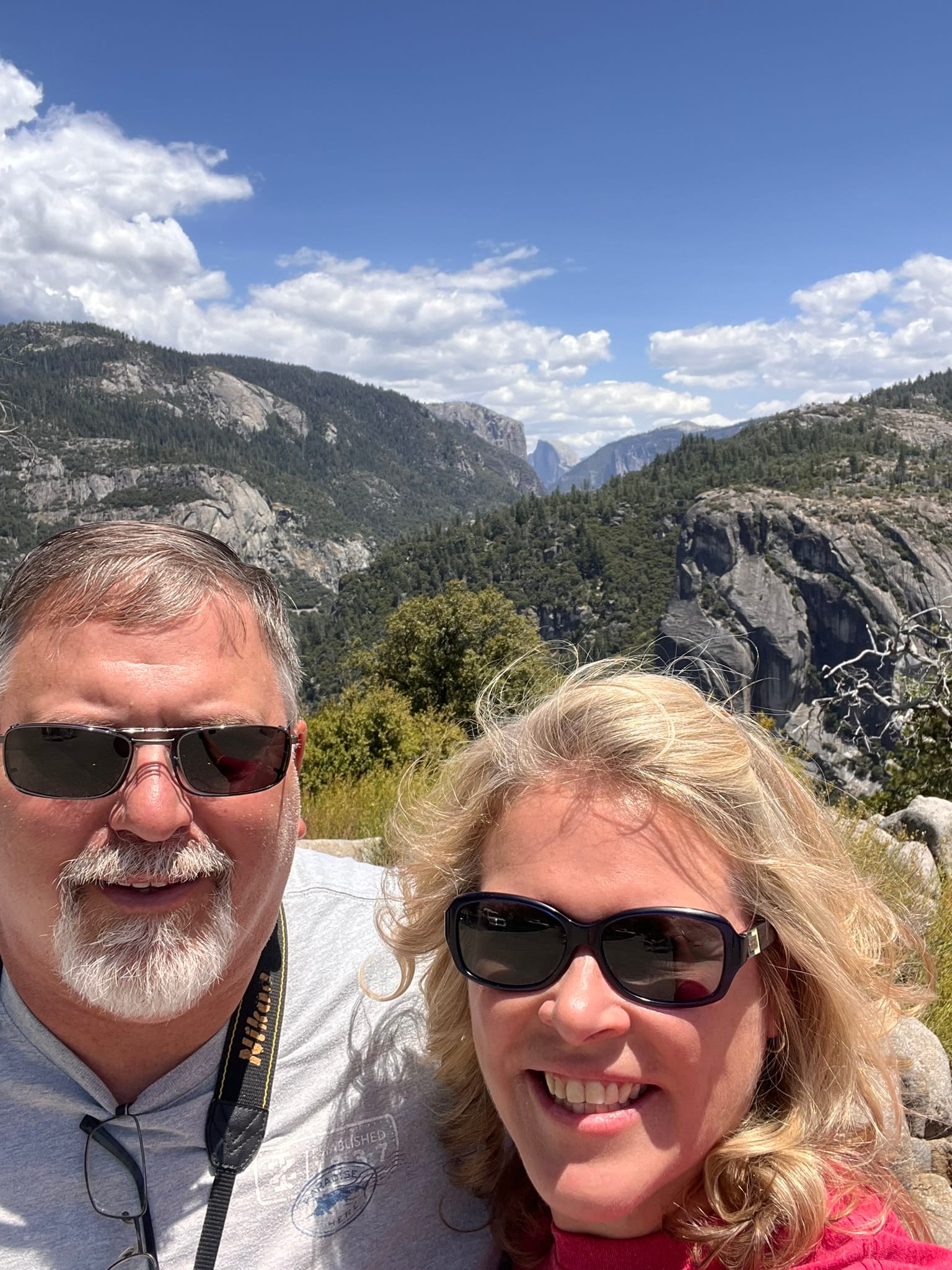
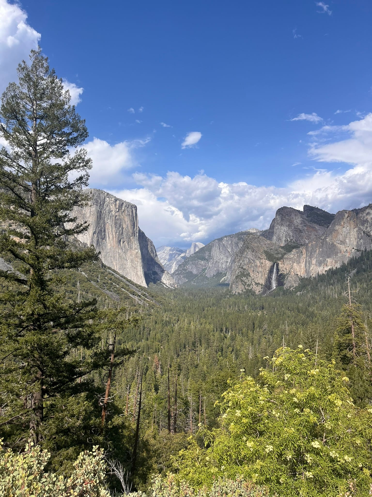
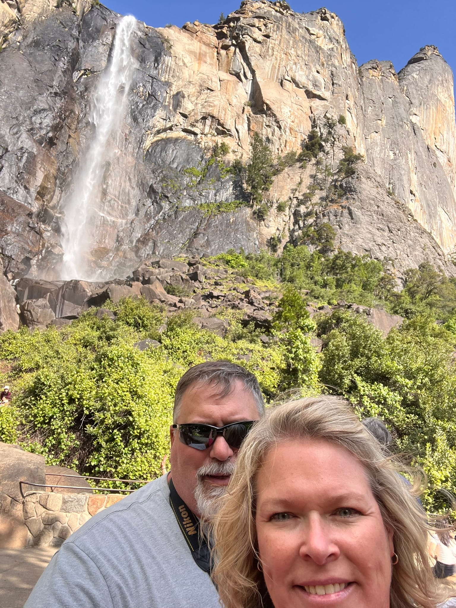
We spent 2 days exploring Yosemite National Park and it was beautiful! On the first day, we headed out around noon and the lines weren’t too bad getting into the park on hwy 120. We went towards Yosemite Valley and passed a couple of falls and then were floored by our first view of Yosemite proper with Bridalveil falls to the right and Half Dome straight ahead! It was majestic!
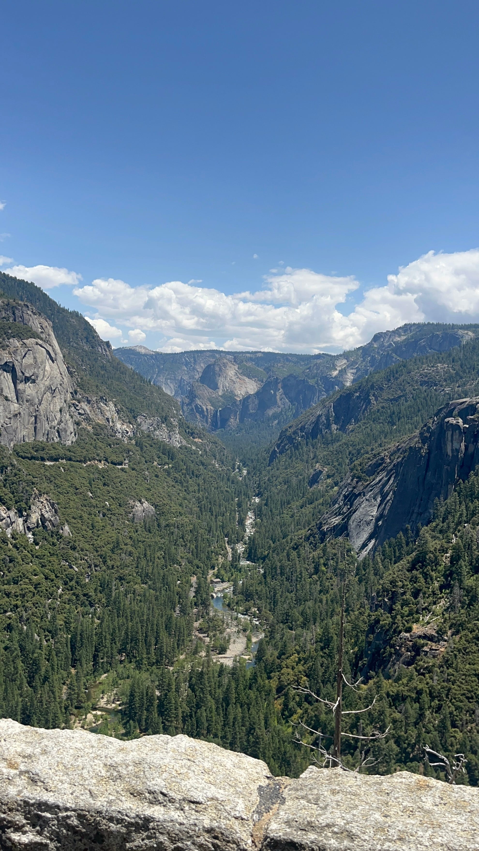
First Views of Yosemite National Park
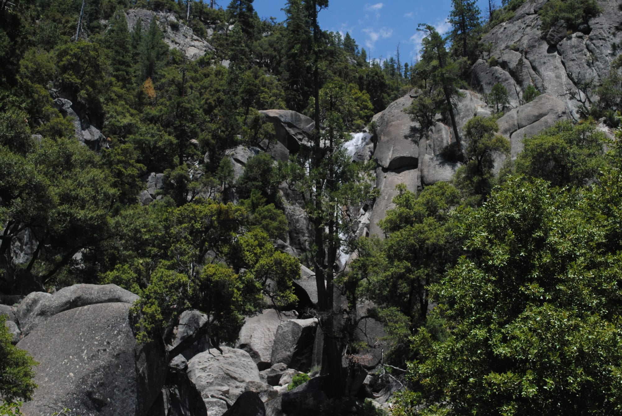
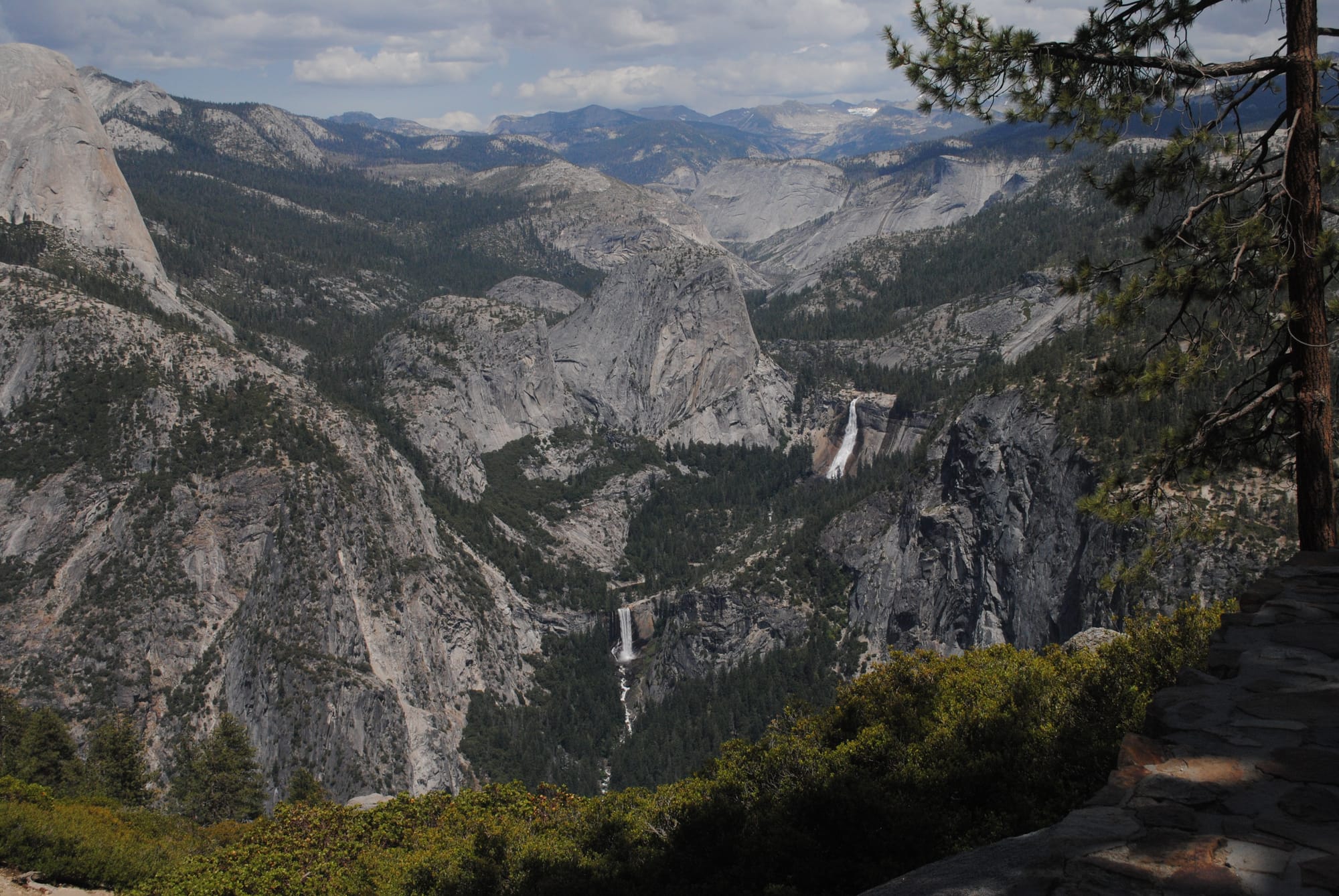
We decided to go up to Glacier Point, which I knew from a visit long ago, would give us a good panoramic view of the valley. It was a much longer drive than I remembered from 35 years ago, but it was a pretty one. It looks like there were areas where there had been a fire a few years ago but otherwise it was amazing.
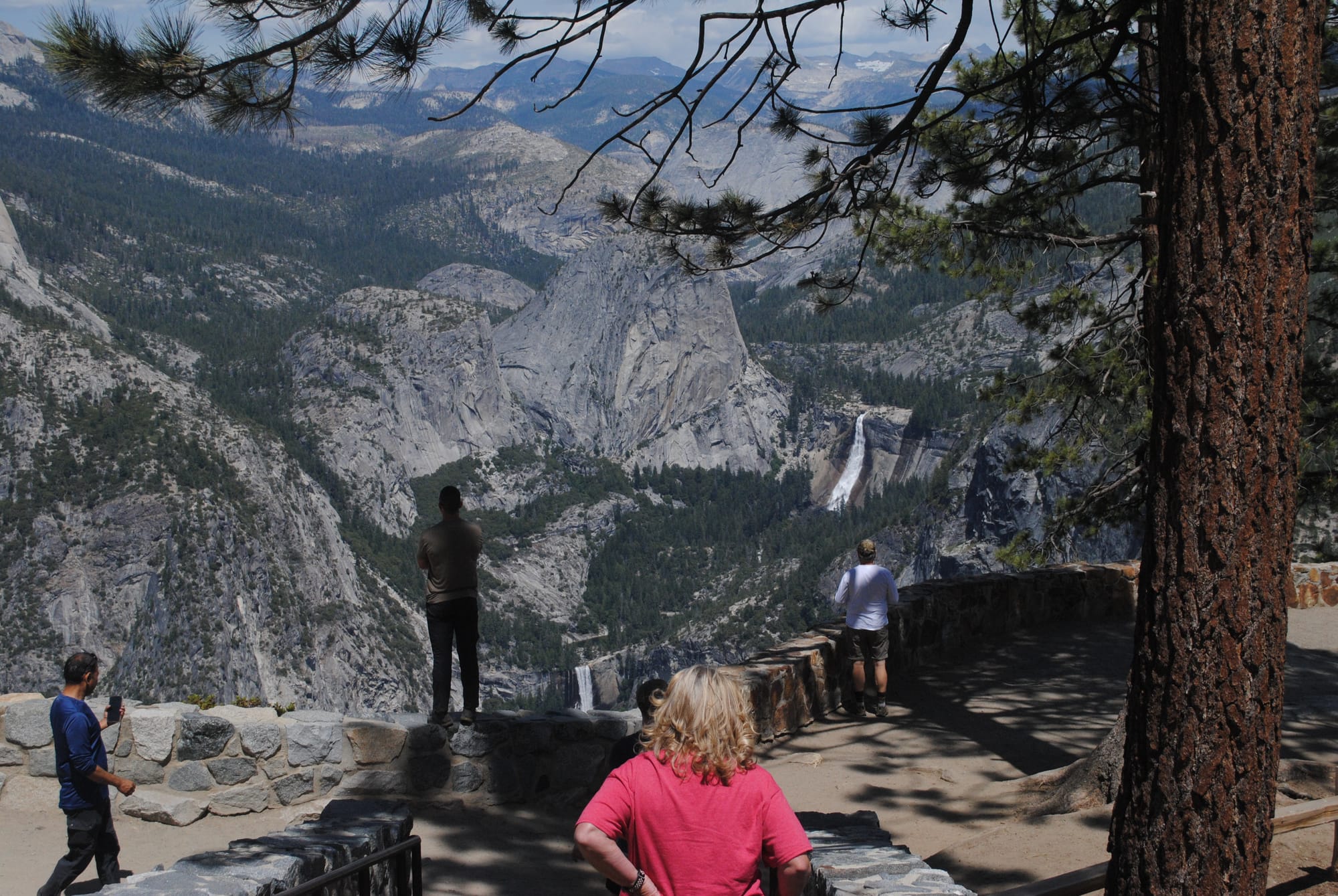
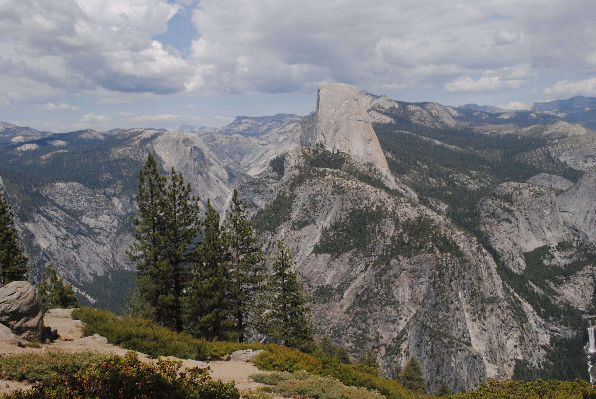
Glacier Point wasn’t anything like I recall it. I just remember a big open area and a low wall over which was a sheer cliff to the valley floor thousands of feet below! Today they have added a metal railing to raise the wall another foot or so but still, it made me a little overwhelmed looking over this time! It’s all built up now with a store and paved walkways all over. The views were fantastic, and to our right we could see Vernal Falls and beyond them Nevada Falls. They had a ton of water running over them this early in the year probably still some snow melt. Nearly straight across was the imposing granite dome of Half Dome so appropriately named! We were using our binoculars and could see climbers on top of Half Dome which was cool and scary to see. (Scary for me to consider being on the edge of a cliff like that one!)
Views from Glacier Point
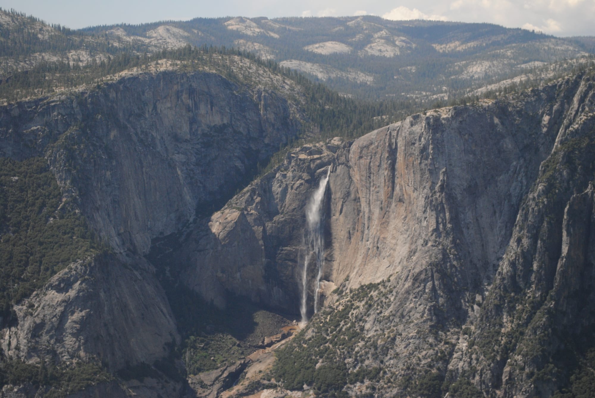
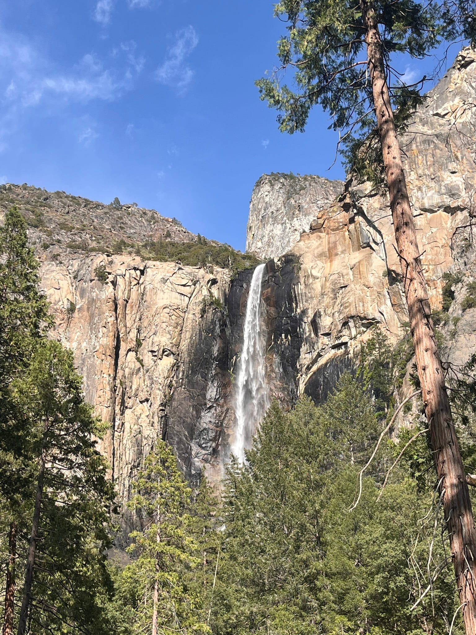
On the way back down from Glacier Point, we stopped at the Tunnel View which is the first view of the valley you get after coming out of one of the tunnels. Once again there were amazing views there with Bridalveil Falls and Half Dome. We then drove down the rest of the way into the valley floor and stopped at Bridalveil Falls to take the short walk up to the base where we could feel the cool misty air rushing around us and listen to the sound of the falling water and the rushing stream it creates below! Lastly, we drove around the loop and headed back to our campsite.
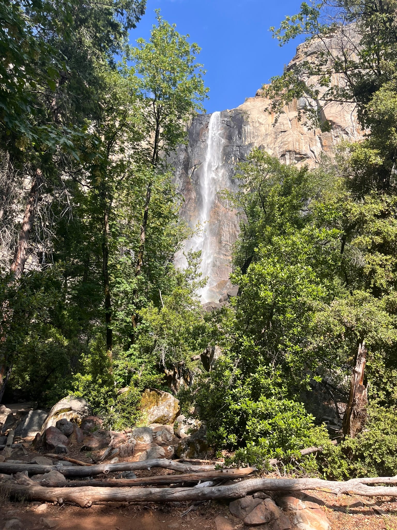
Tunnel View, Bridalveil Falls and Yosemite Creek
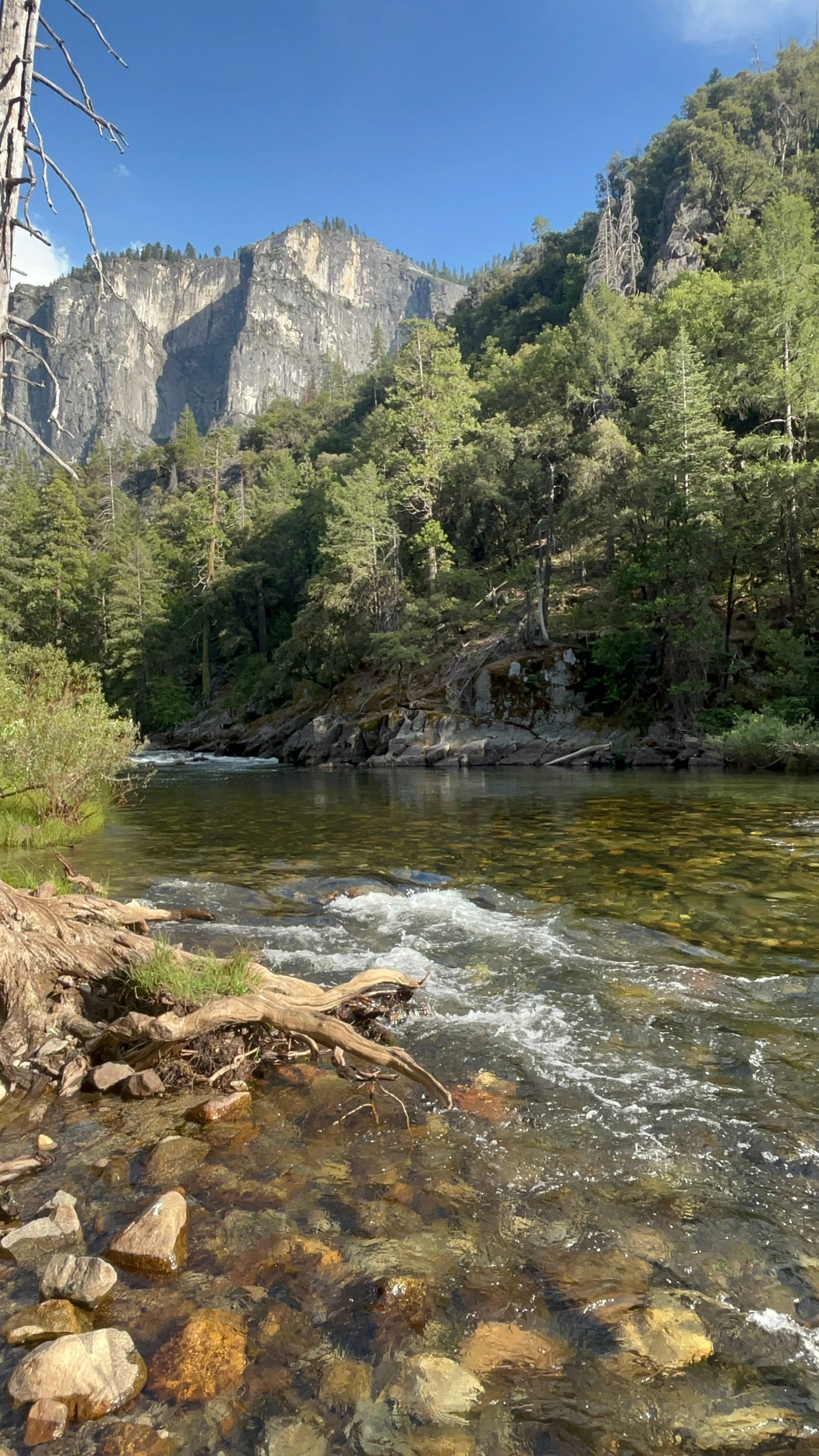
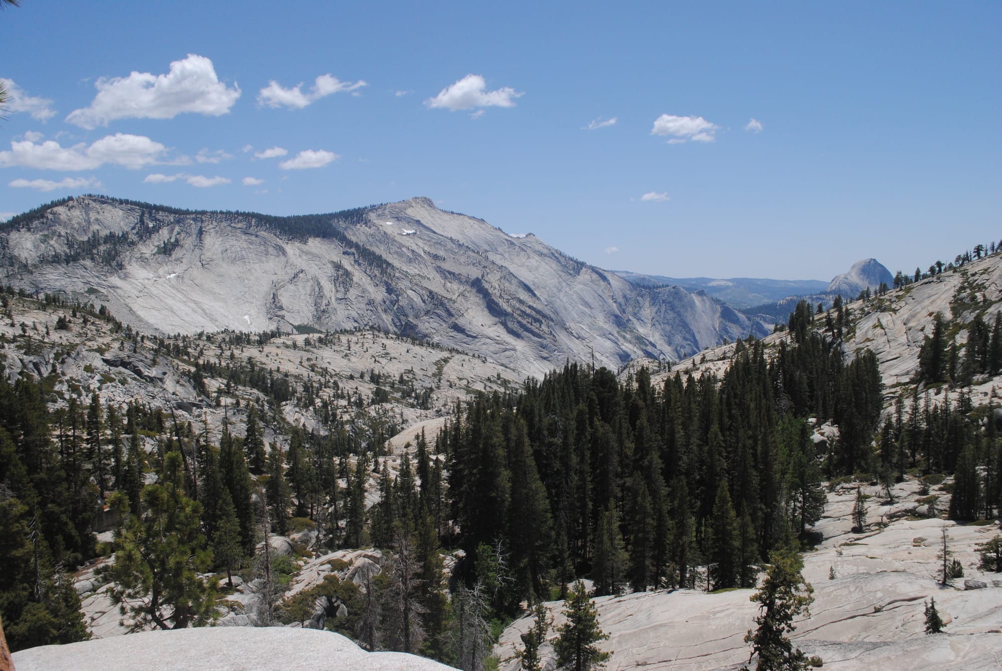
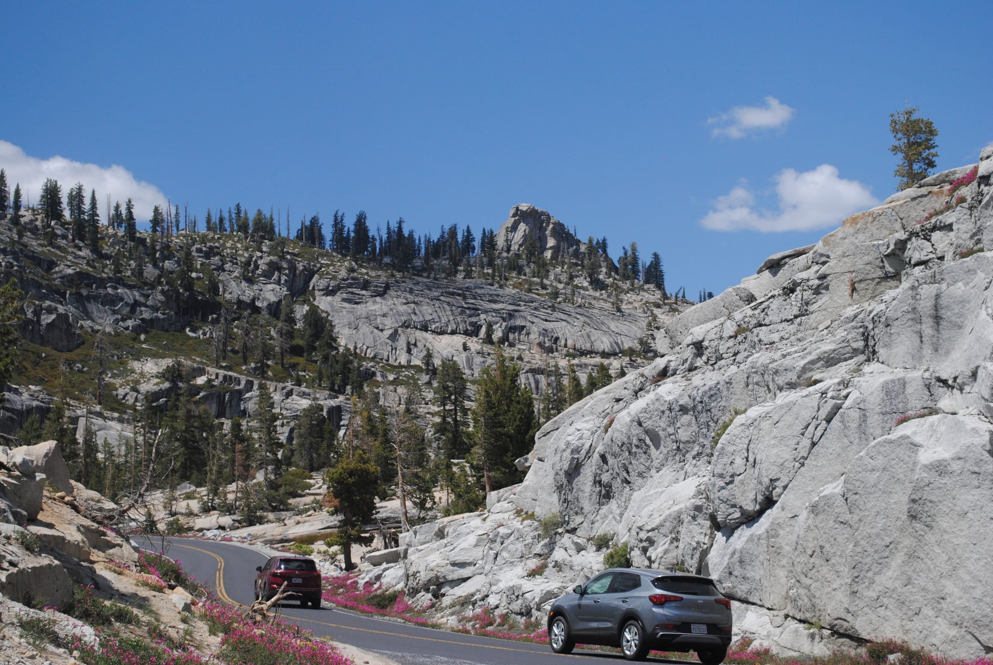
On our second day exploring Yosemite National Park, Kim decided she wanted to drive out to Tuolumne Meadows but also wanted to see Hetch Hetchy Reservoir. We asked the Ranger at the gate which would be best and she definitively said “Tuolumne for sure this time of year” so off we went! It was a very long drive but also very beautiful! The road was narrow and didn’t have a shoulder or any kind of guardrail the whole way out which at times was scary I have to admit since you climb up several thousand feet along cliff edges overlooking some of the most beautiful valleys and forests we'd ever seen!
You wind your way up through the pine forests higher and higher until they thin out a bit and you start to see the granite domes all around you. It's amazing to see the pine trees hanging onto what appears to be bare granite all over this area!
There are some lakes along the way that are amazingly beautiful and we stopped for a picnic at Tenaya Lake. The lake is fairly large and the road runs along the northern side. I had also stopped there 35 or so years ago so it was nice to have a picnic there with Kim. Lot’s of families and some paddle boarders were enjoying the cold lake waters!
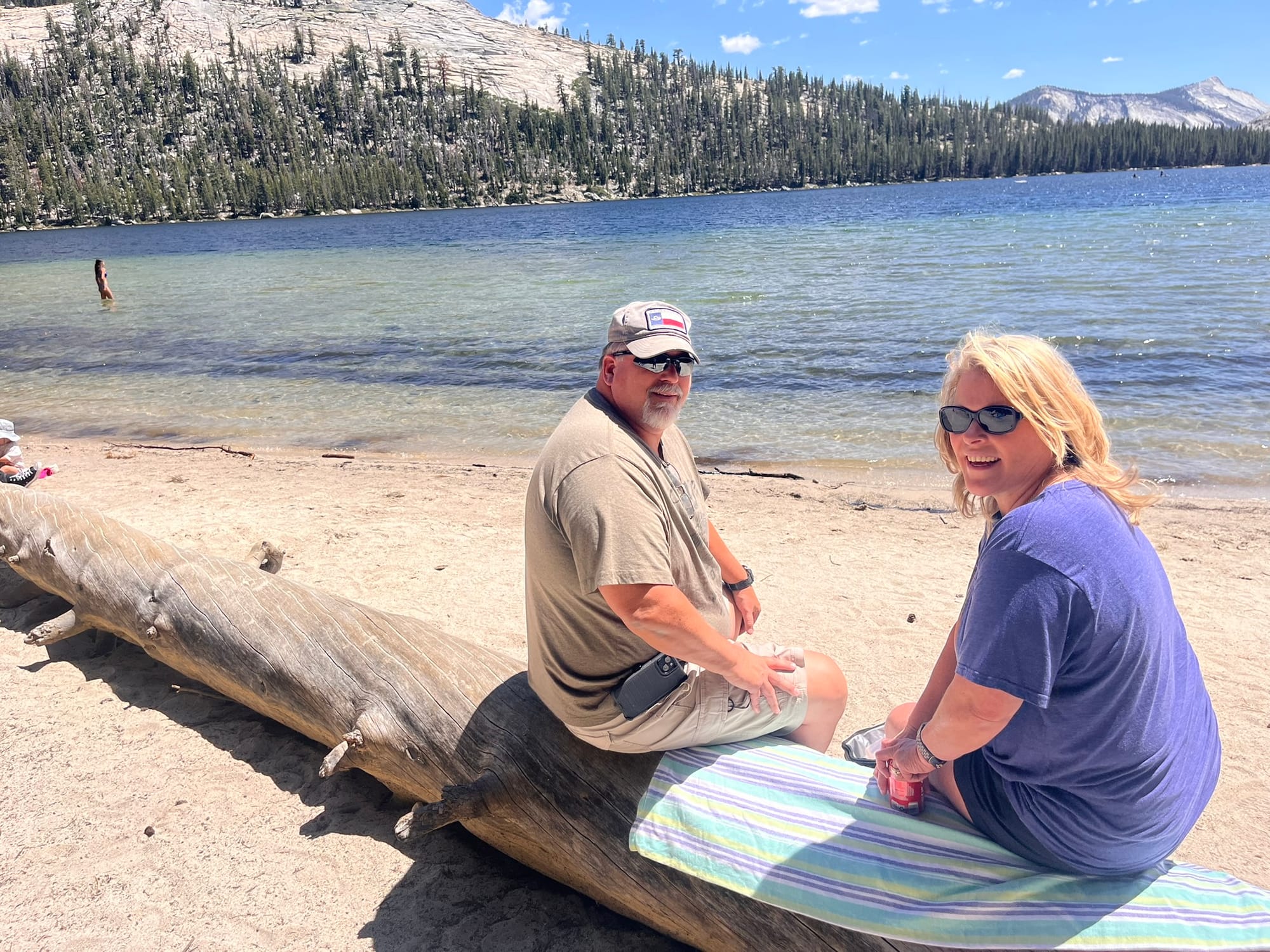
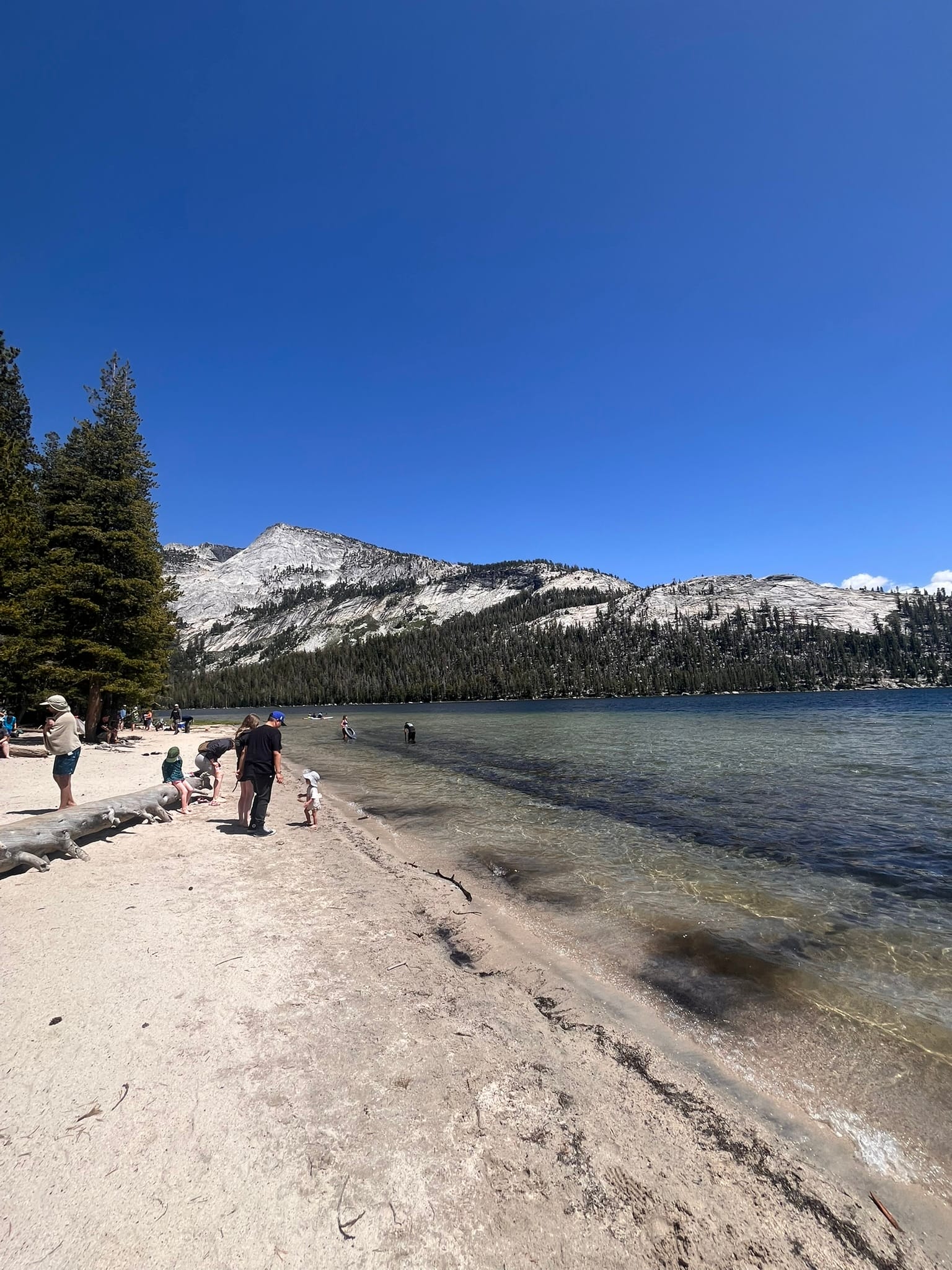
Tenaya Lake
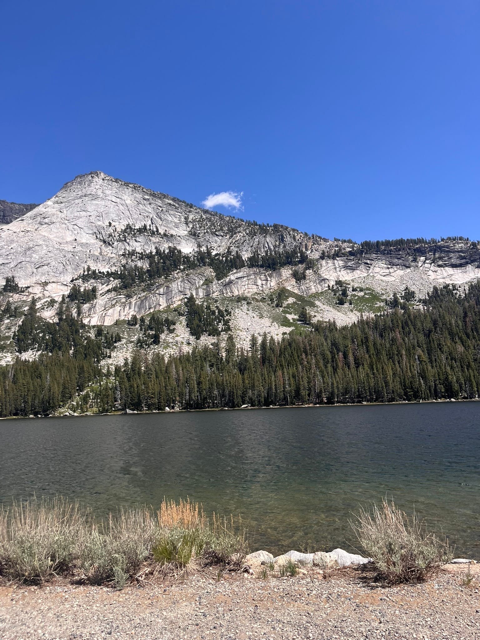
On the way, there’s also a very scenic overlook called Olmsted Point where you are basically looking back down the Yosemite valley from the far other side and you can see the back of Half Dome and all the other granite domes along that stretch of the valley. It was amazingly beautiful!
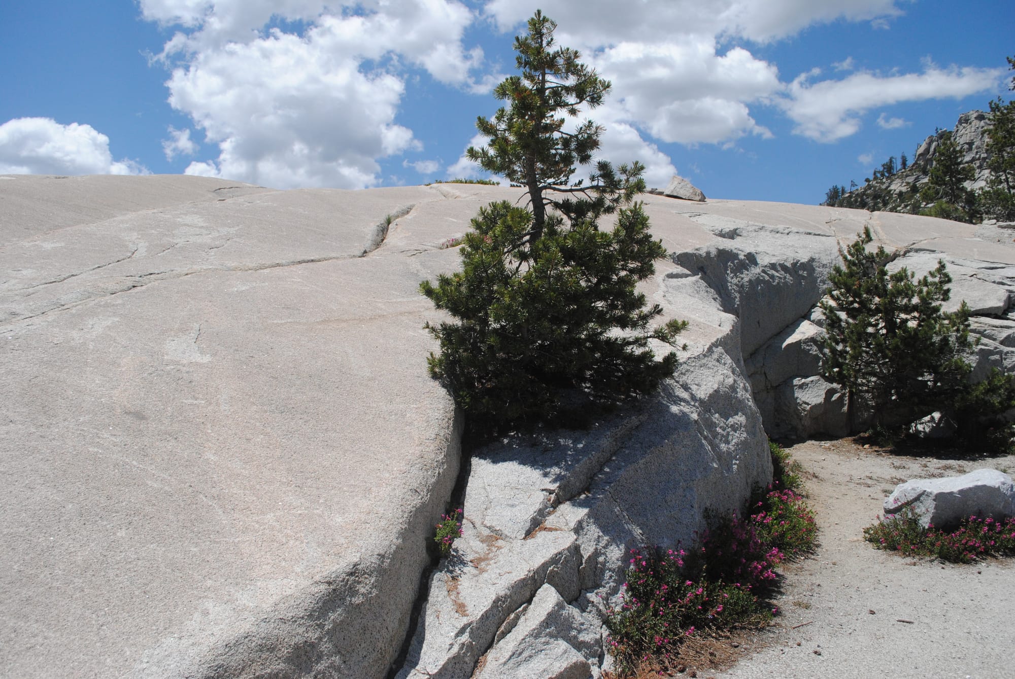
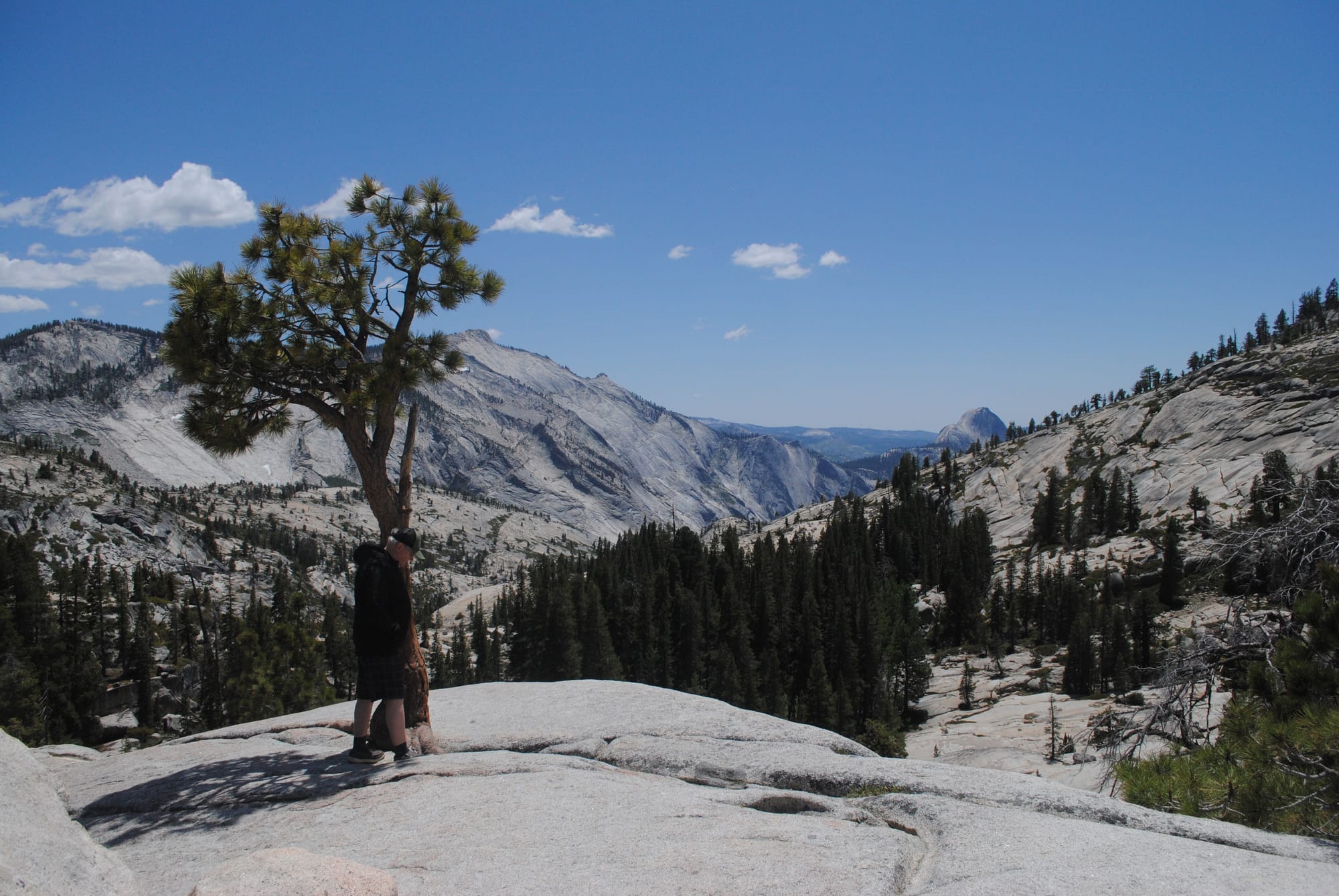
Olmsted Point
One thing I noticed as I was driving up was that there’s a type of Pine tree that looks just like a fake Christmas Tree! There were whole groves of them along the road and the trees had all their branches coming straight out of the exact same location in all directions every 6-8 inches and so on to the top. It was just like a fake Christmas tree that way, so much so, that it messed with my eyes! On the way back I tried to find some good examples so we could take photos. A little internet search revealed that these groupings of branches up the tree are called whorls and are present in several species of pine.
Whorled Pines
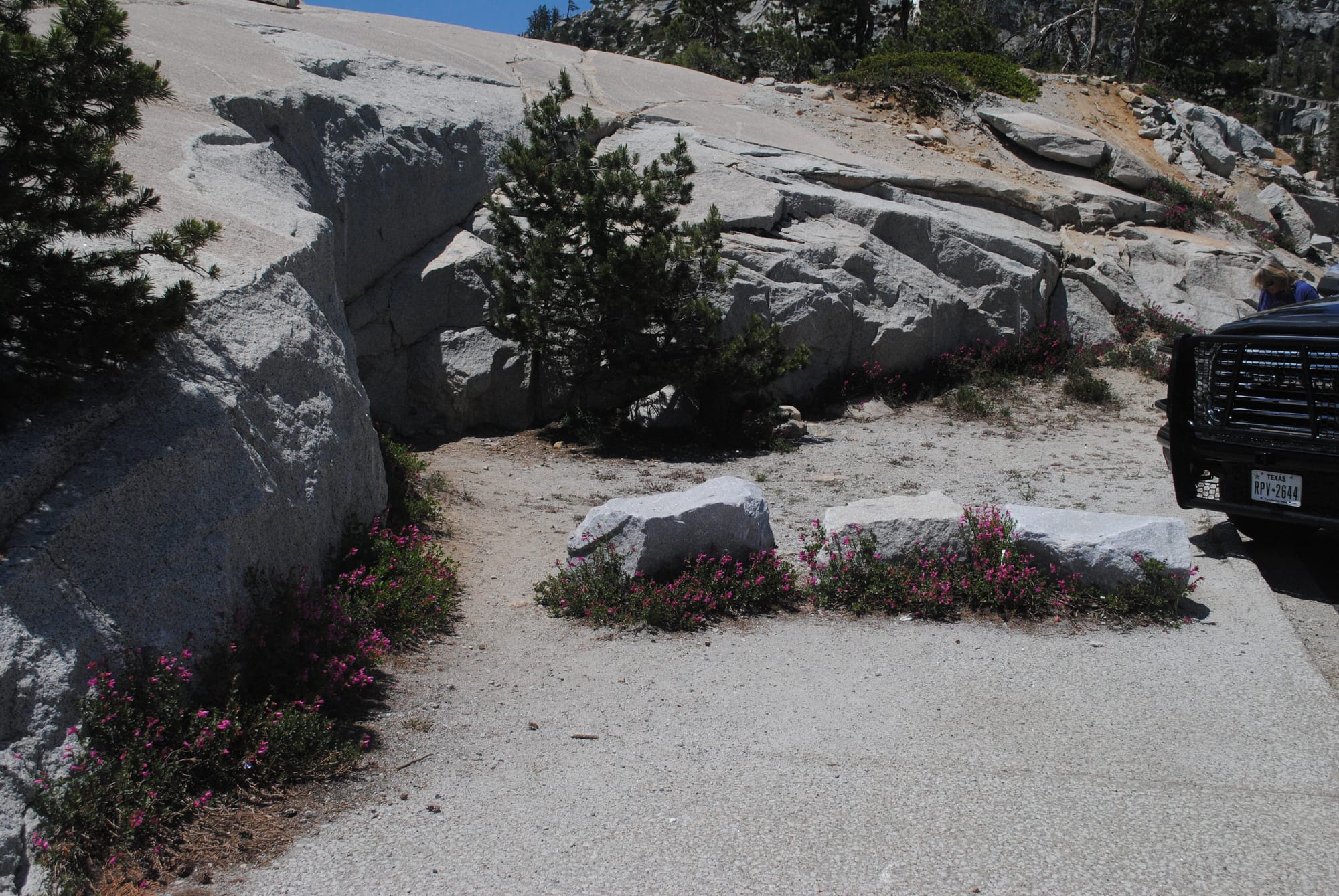
We finally arrived at Tuolumne Meadows and of course it only looked slightly familiar. My memories from 35 years ago aren’t trustworthy! The “small” dome I climbed and got so out of breath doing so, was much larger than I remembered and looking at it, I knew I’d be out of breath even without the 9900’ elevation! There were many more trees than I remembered also but in 35 years, trees can mature a lot! I had hoped to climb it with Kim but there was no parking anywhere near it on the way in and the area in front of the dome was cordoned off because the field was completely flooded.
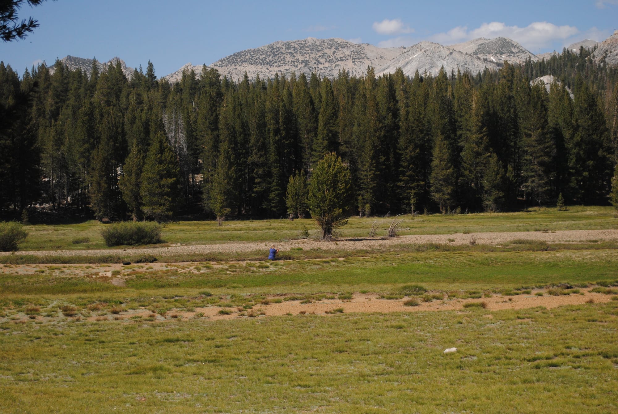
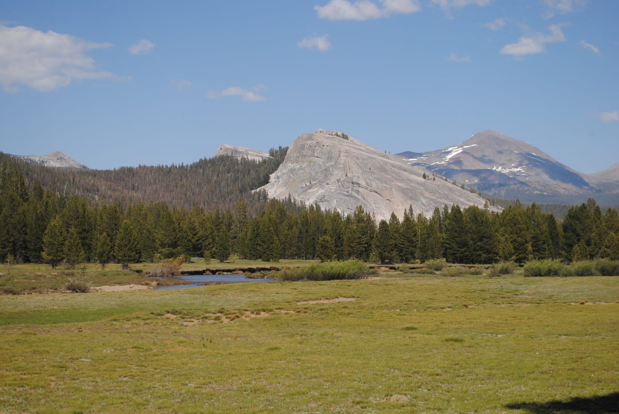
Tuolumne Meadows
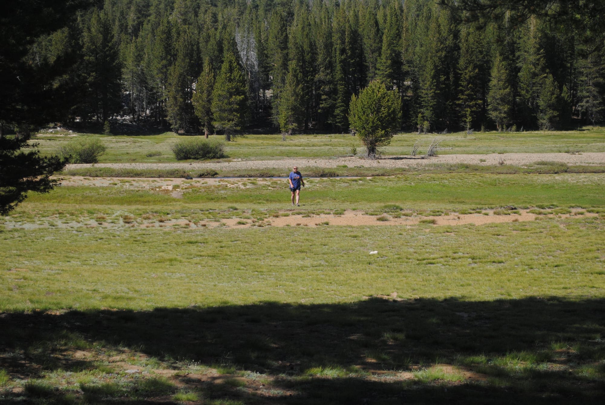
We continued up around the last few miles until we hit the gate to the NP and turned back and we had to head back along the beautiful drive down to near the floor of Yosemite Valley. We had a great time and managed to see several deer in the meadows and some came down off the granite along the highway to pass in front of us.
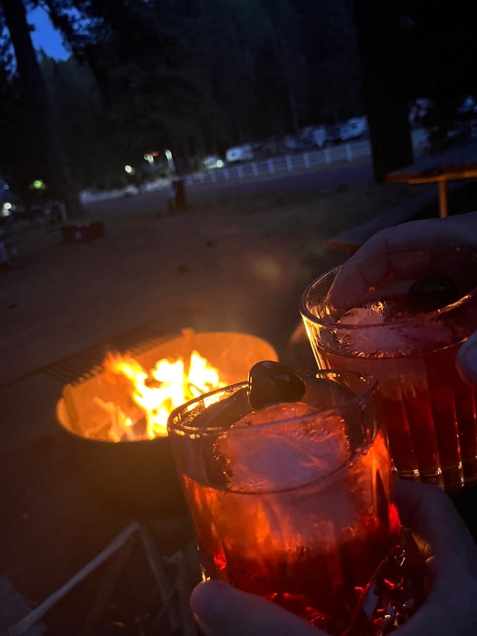
That evening we bought some firewood and had a good old fashioned campfire and a drink to celebrate our 8th National Park on this trip! If you haven't been to Yosemite National Park it should definitely be on your bucket list to do so! I'd recommend spring or fall as the weather was warming up fast in mid-June!
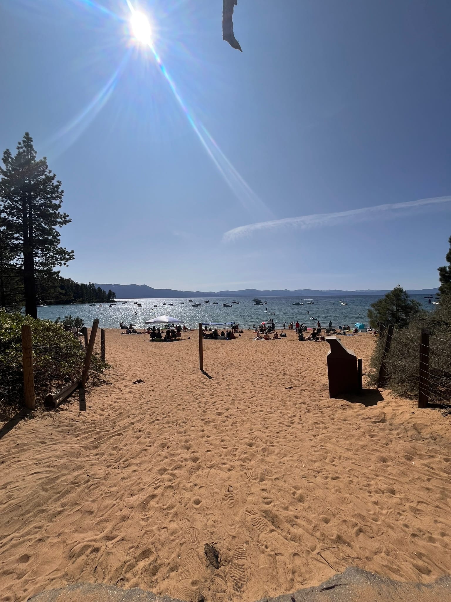
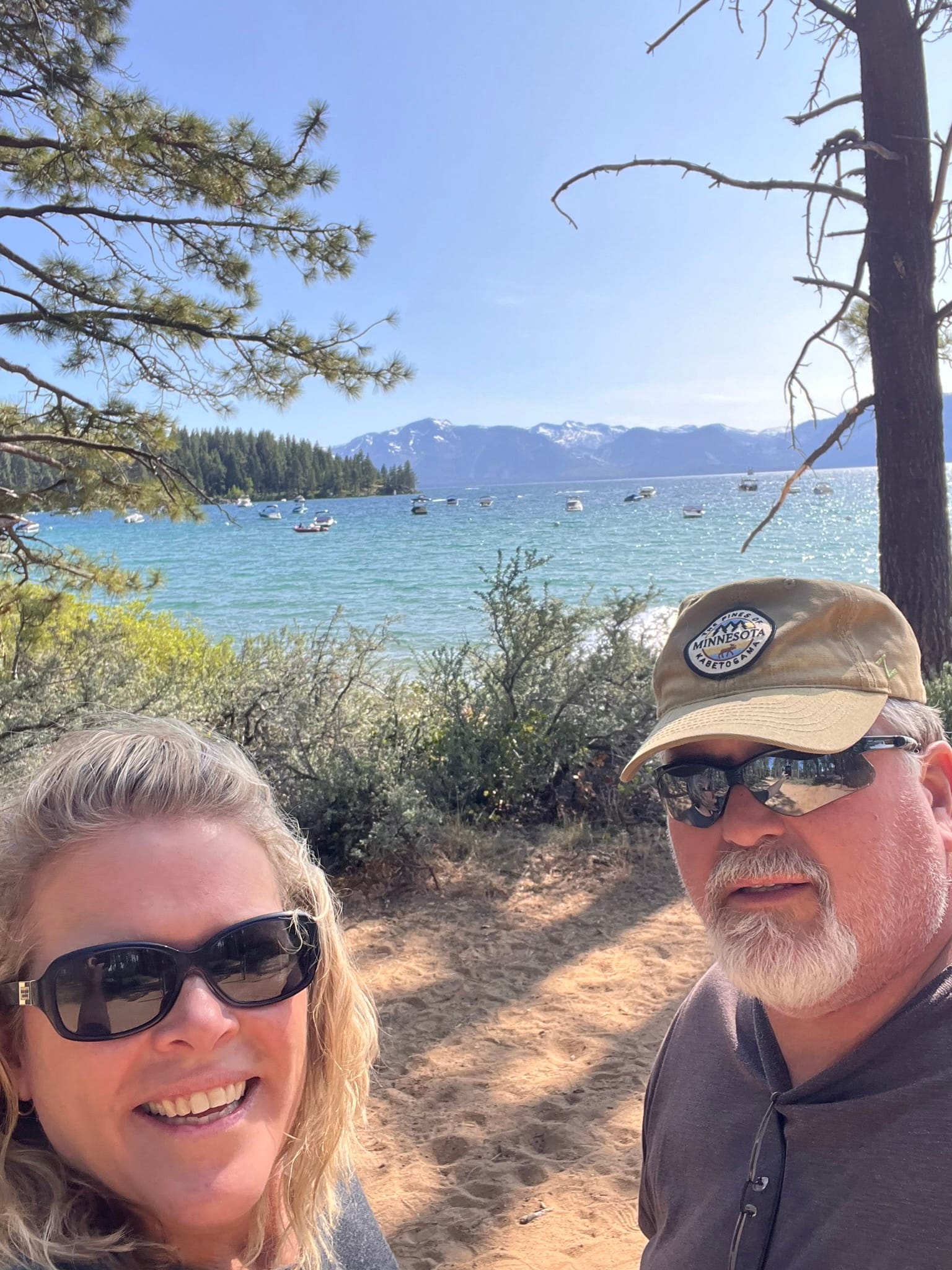
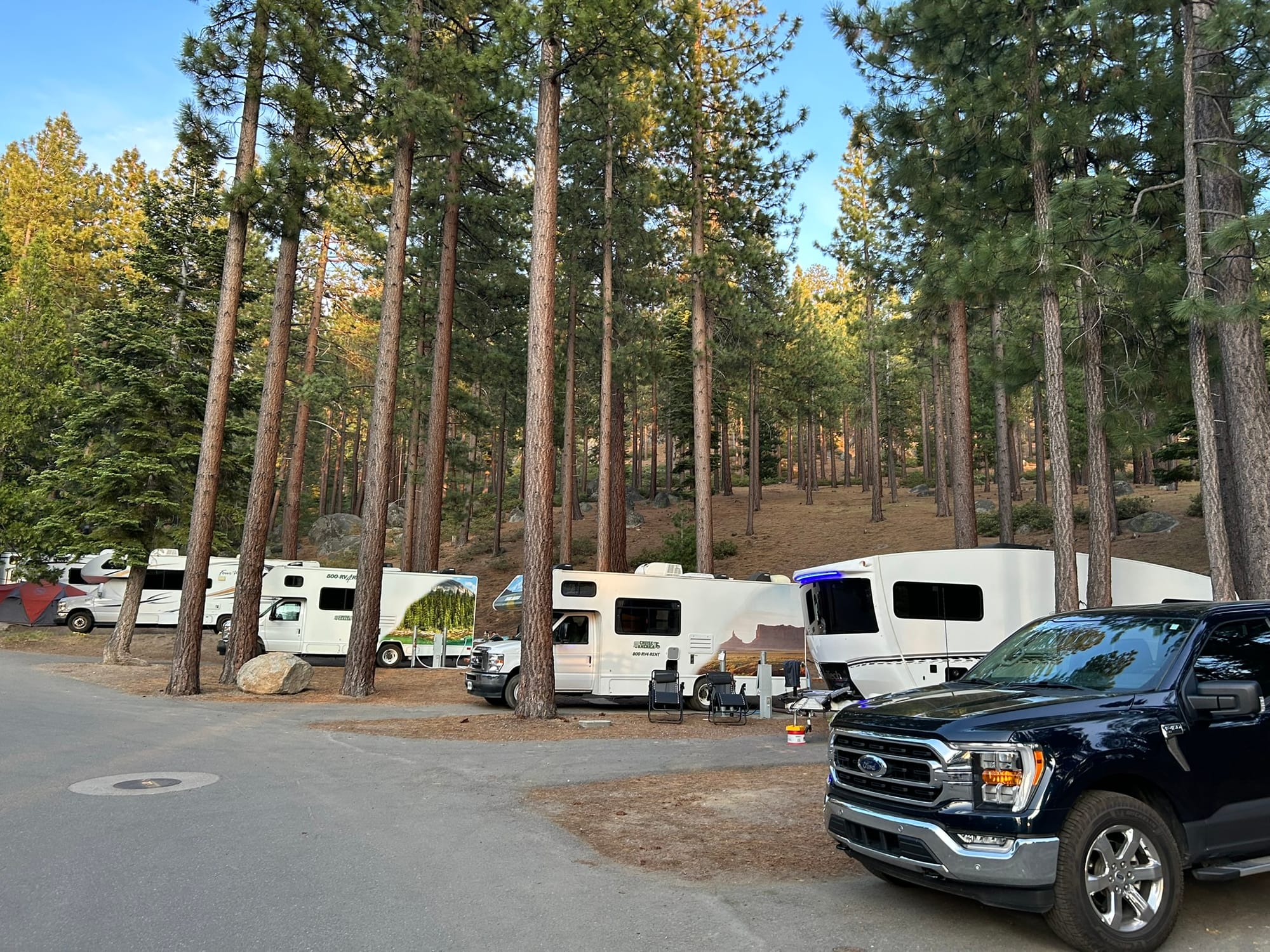
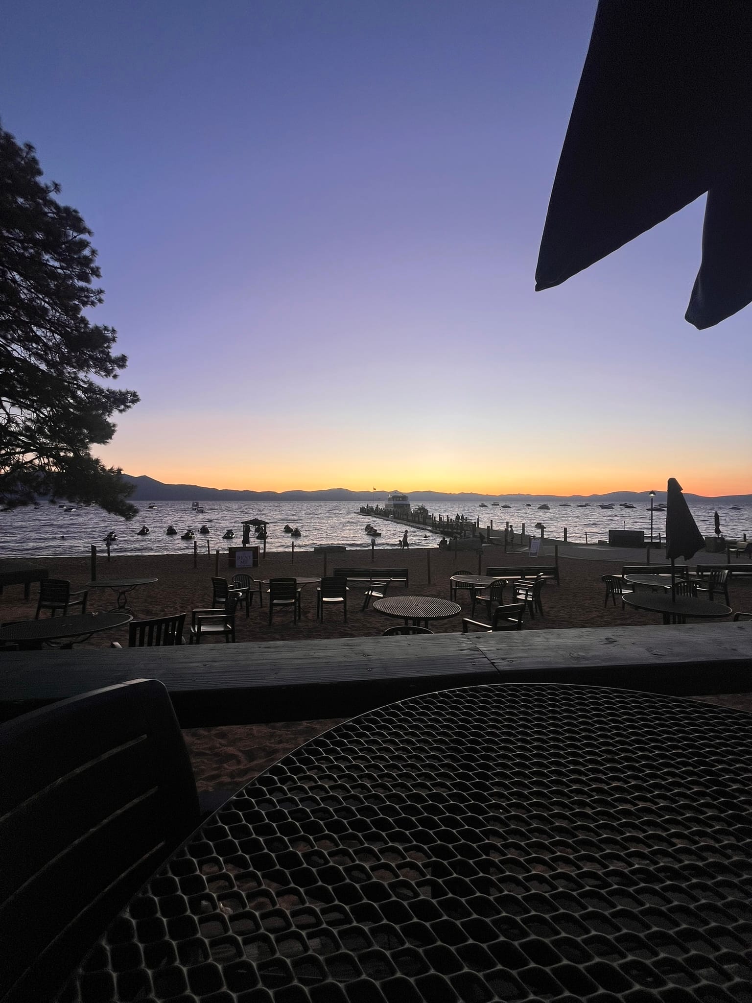
Zephyr Cove RV Resort on Lake Tahoe, NV
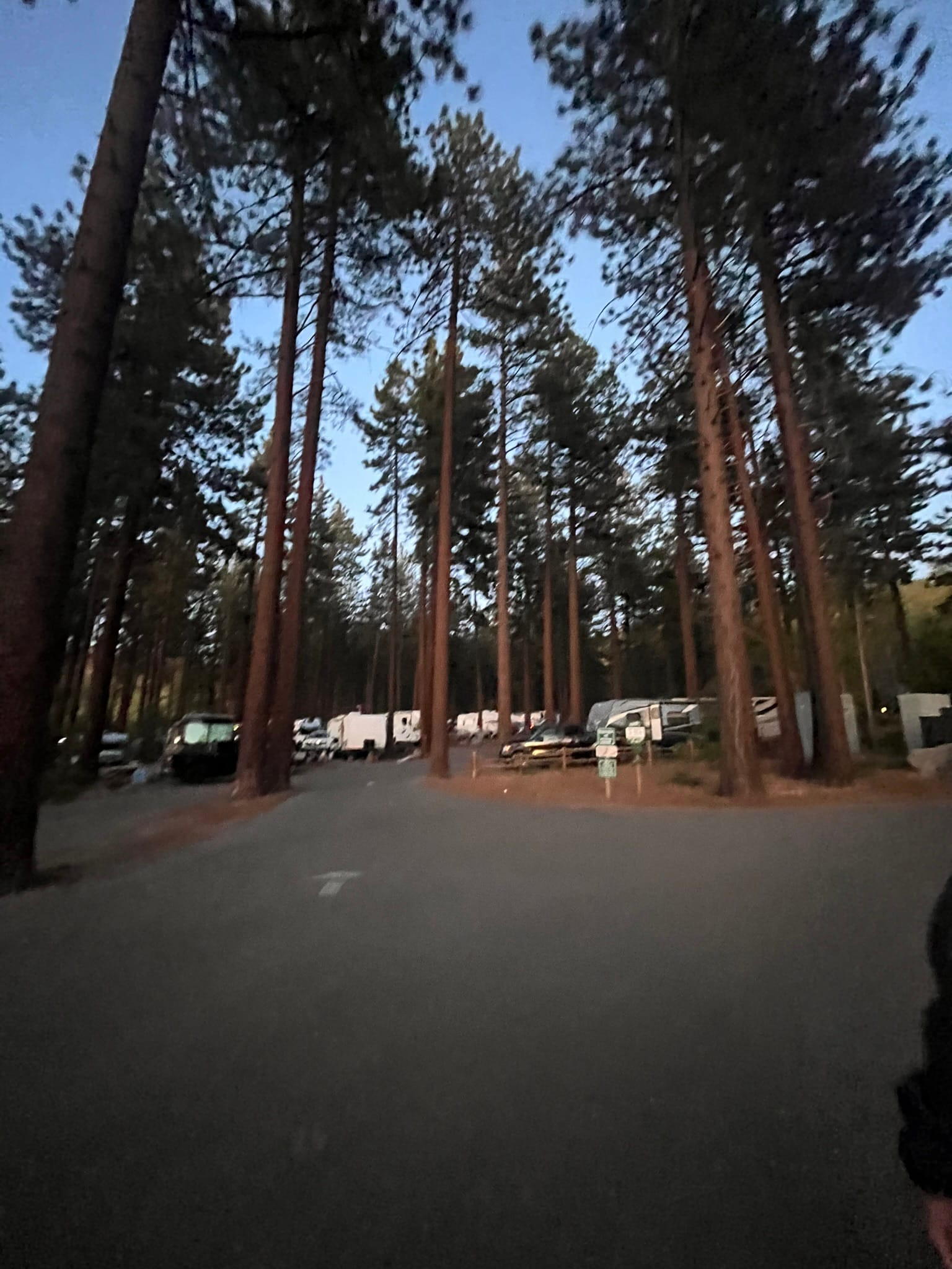
After three travel days back to back across Idaho and Nevada, it felt great to climb back up into the mountains around Lake Tahoe and pull into our campground at Zephyr Cove RV Resort!
The drive was pretty boring across most of Nevada with little to see but some hills and scrub brush for the most part, but it started to get a bit more interesting once we got within about 20 miles of Lake Tahoe and the mountains started to build and the forests came into view and we started climbing up from about 4000 feet up to a high of 7000 feet as we went through the pass and started down the other side. The GPS said our campsite was on the right but it was on the left and I had to cross 2 lanes of traffic to get to it. I am a hated man in Nevada for blocking a lane but I am blaming the GPS!
The Zephyr Cove campground sits up on a hillside nestled among very tall pine trees looking out on Lake Tahoe. We don’t have a direct view, but we can kind of see the lake a little here and there through the trees. We walked the dogs down to the lake and along the path by the shore. Dogs aren't allowed on the beach itself. They have volleyball courts, a pier and a bunch of buoys with boats tied up to them a bit out further in the lake. It was all very picturesque with the snowcapped mountains in the background!
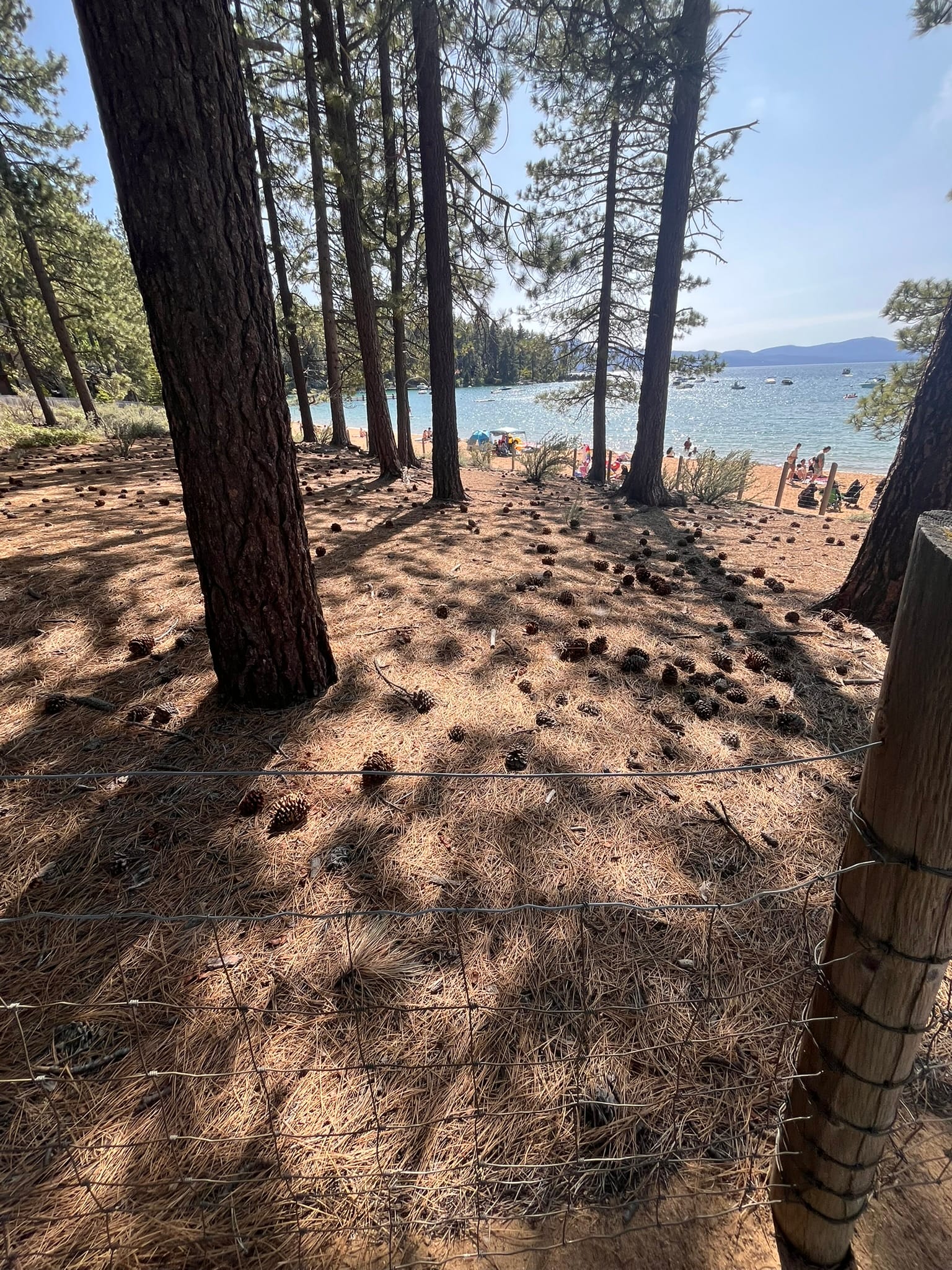
Views from Zephyr Cove RV Resort
The next afternoon we went down to the beach to enjoy some lake time. It wasn’t too crowded at first but as the afternoon wore on, it became more crowded until nearly all the beach sand was taken. You could rent jet skis and paddle boards from the looks of it. They had a little beach bar and separate snack shack with hamburgers, hot dogs, chicken strips and other quick food. We ate lunch there and had a drink. There’s also a faux paddle wheel ship that has wine tasting or a dinner cruise out on the lake and we saw it arrive and depart a few times while we were there.
After dinner we returned to the lake for sunset where we met another family doing the same who were also camping in the park. The weather was actually kind of chilly as the sun went down. Got to love and enjoy the altitude’s affect on the temperatures!
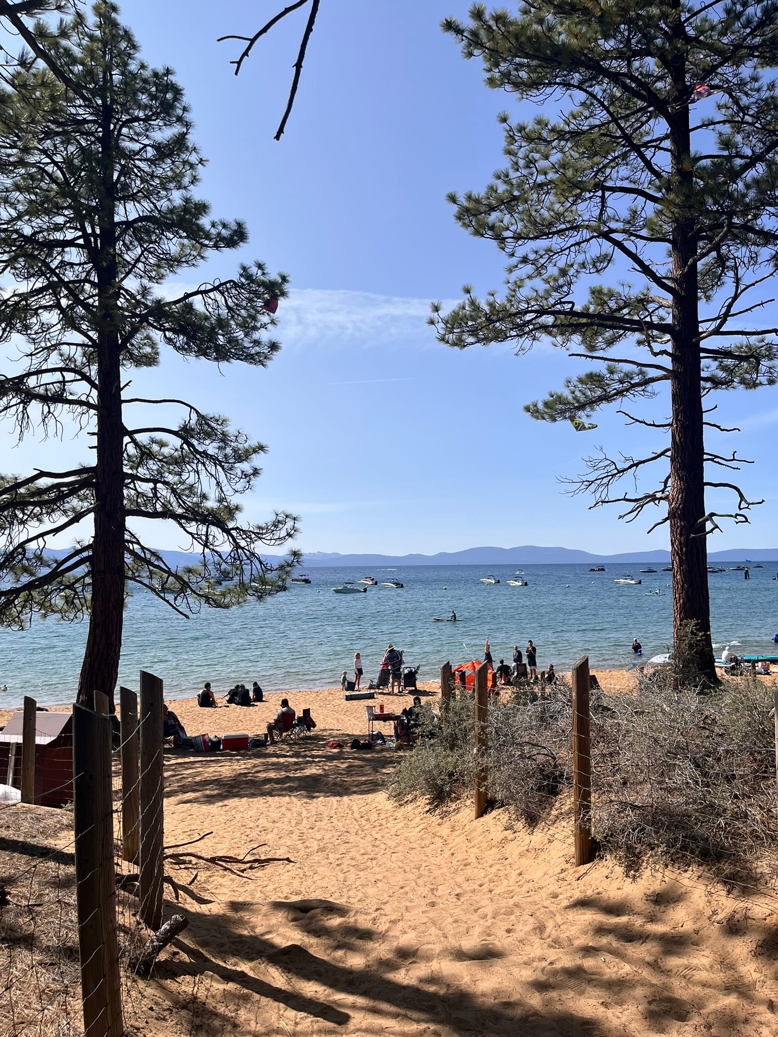
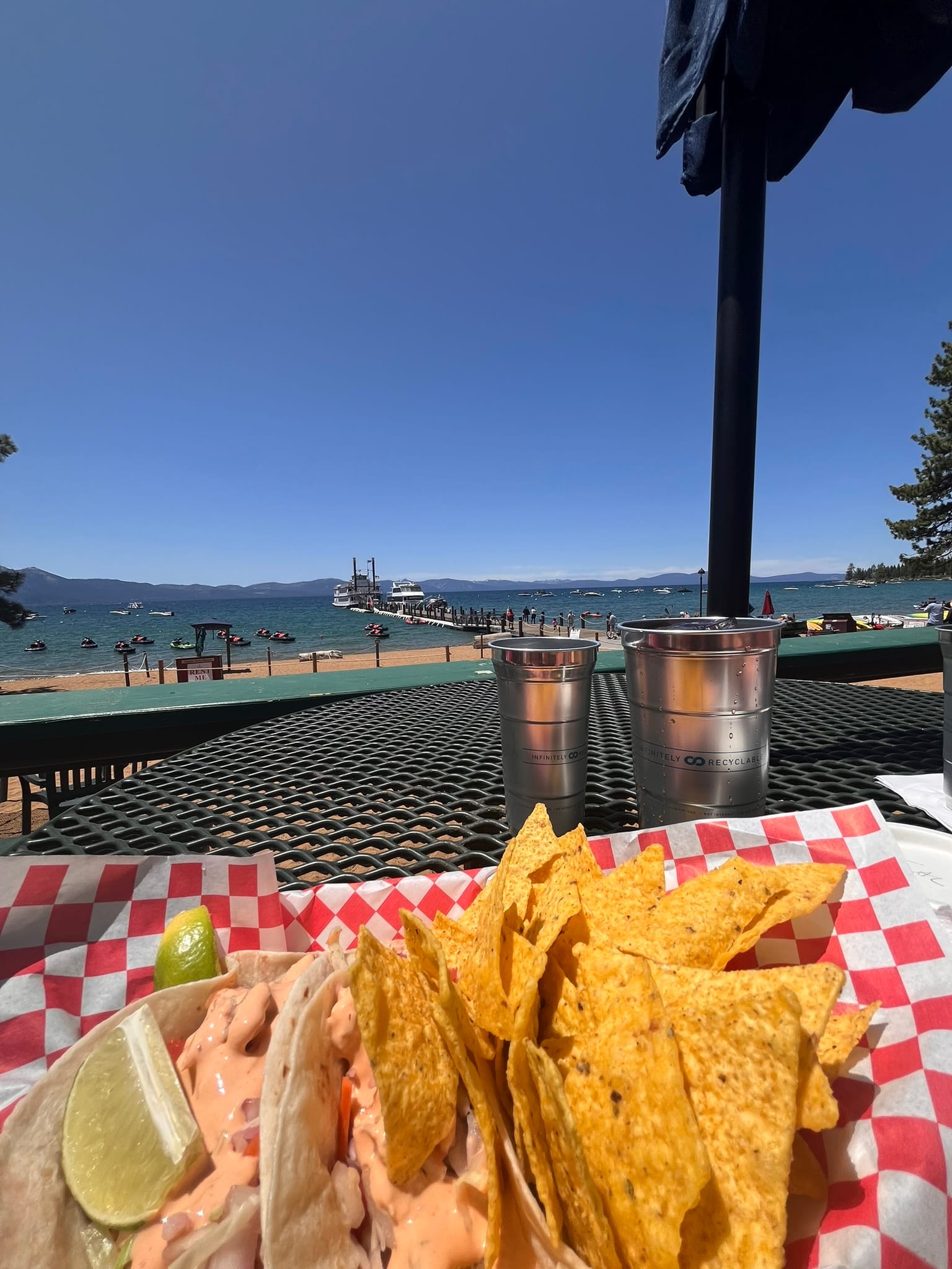
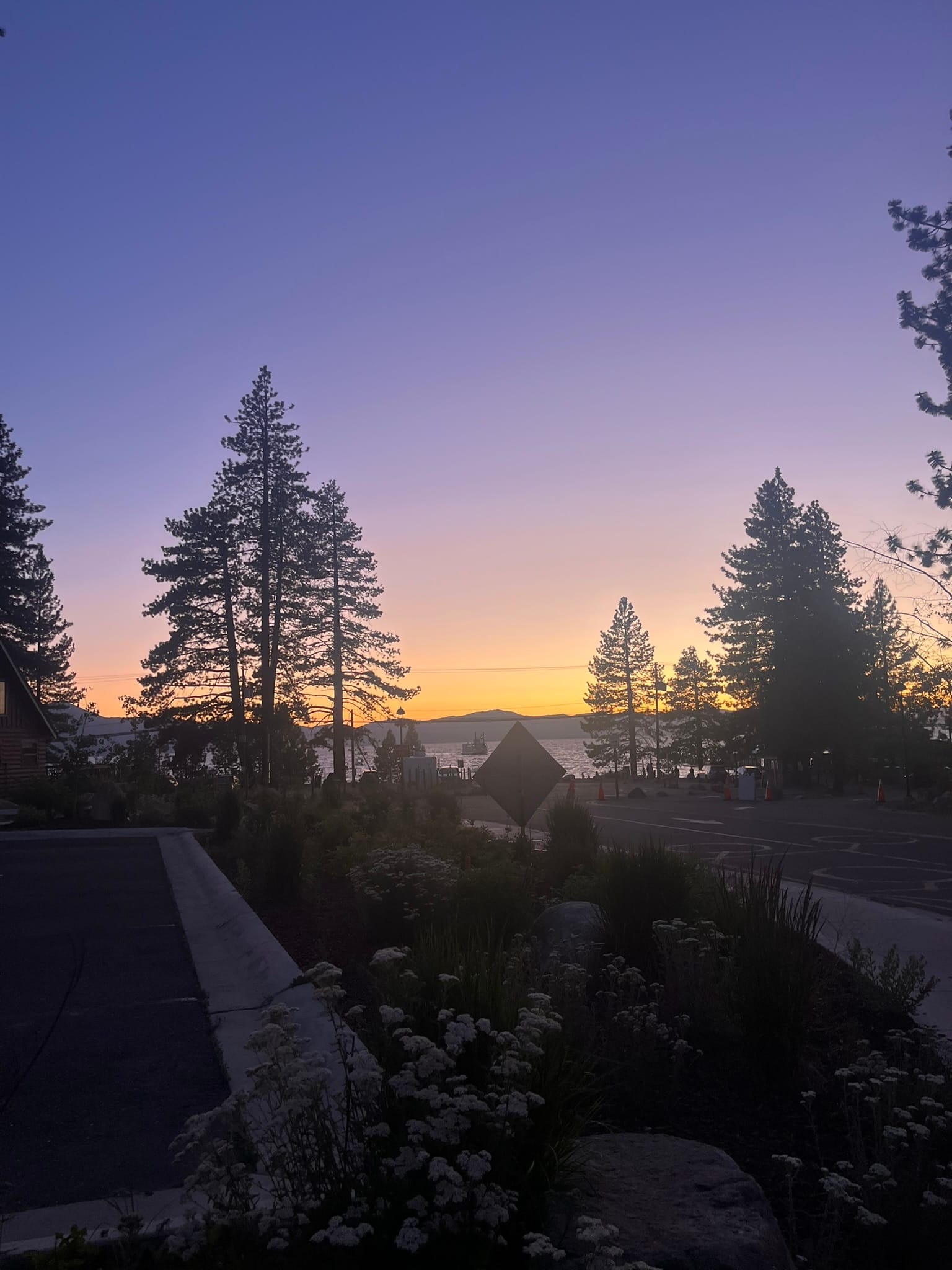
Lake Tahoe Views
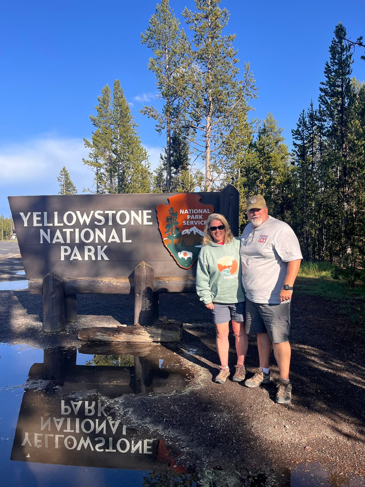
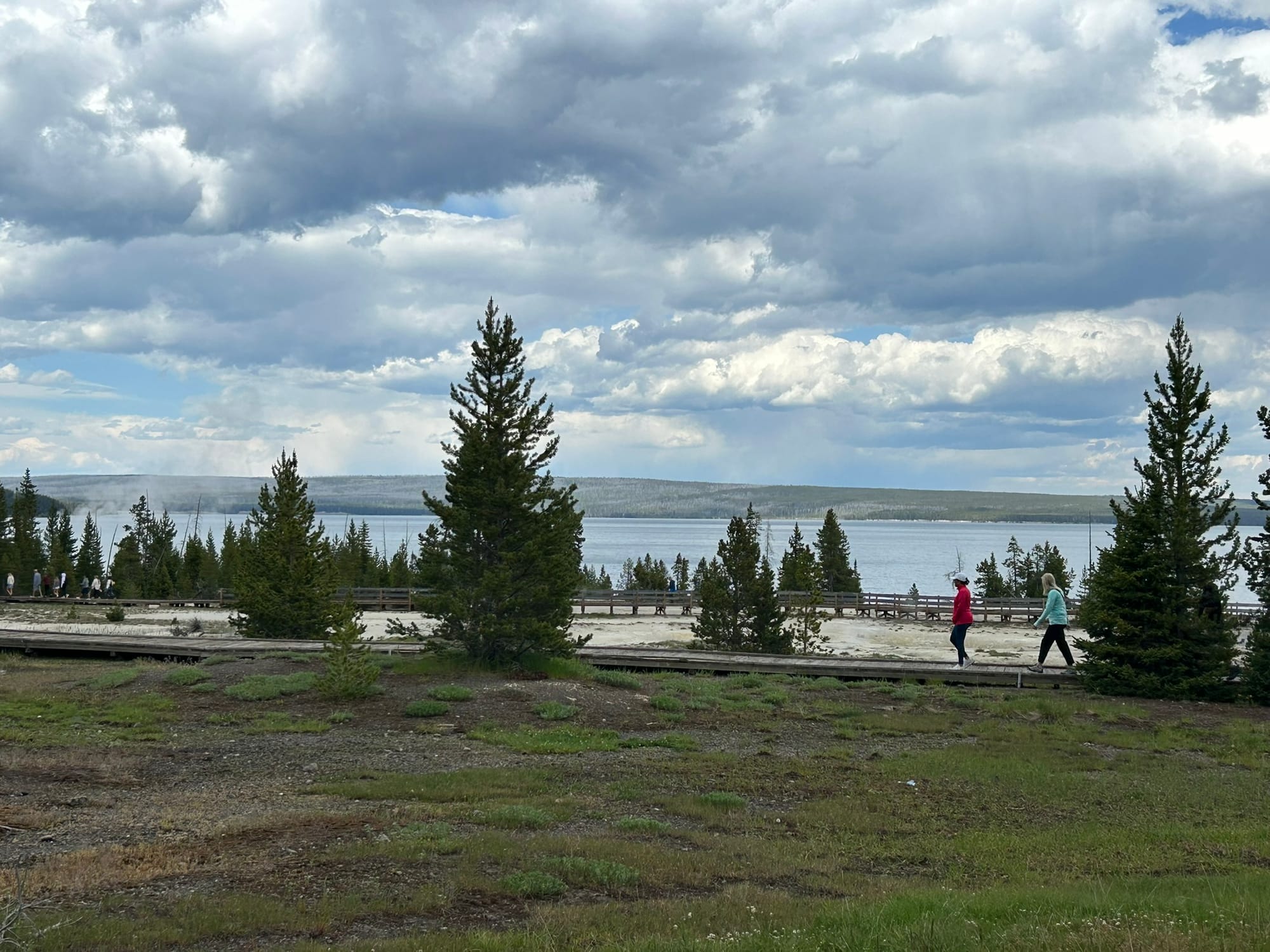
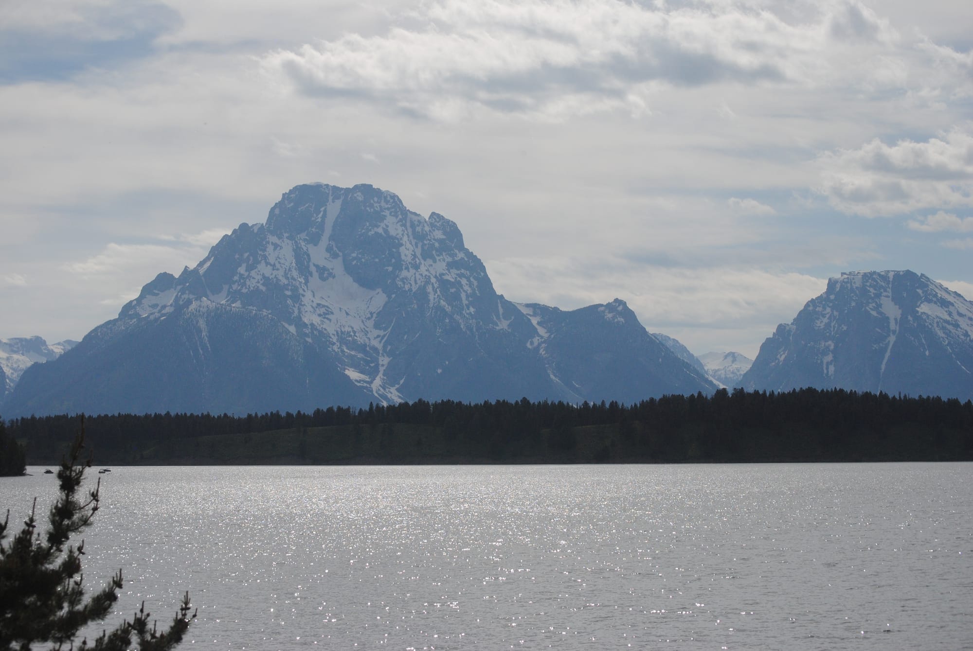
Yellowstone National Park, WY/ID/MT
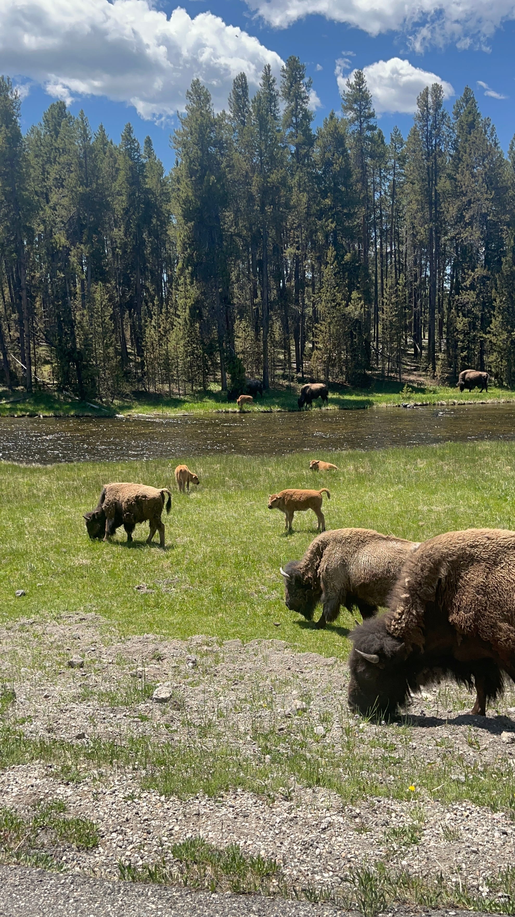
We visited Yellowstone National Park and it was amazing to see! Kim had been there 35 years ago but I had never been here at all. Since we are camping on the west side of the park we entered into the west gate and it doesn’t prepare you for what you are about to see! The gate is less than a mile from West Yellowstone and entering the gate you are in a low lying area with a creek and some rolling hills around you but as you drive deeper into the park, the mountains and canyons get much steeper and the geology gets much more interesting! You suddenly see steam vents and geysers all over the place. During our visit we stopped at at least 5 areas where there were many clustered vents and geysers but saw many more as we went around what I’ll call the inner loop.
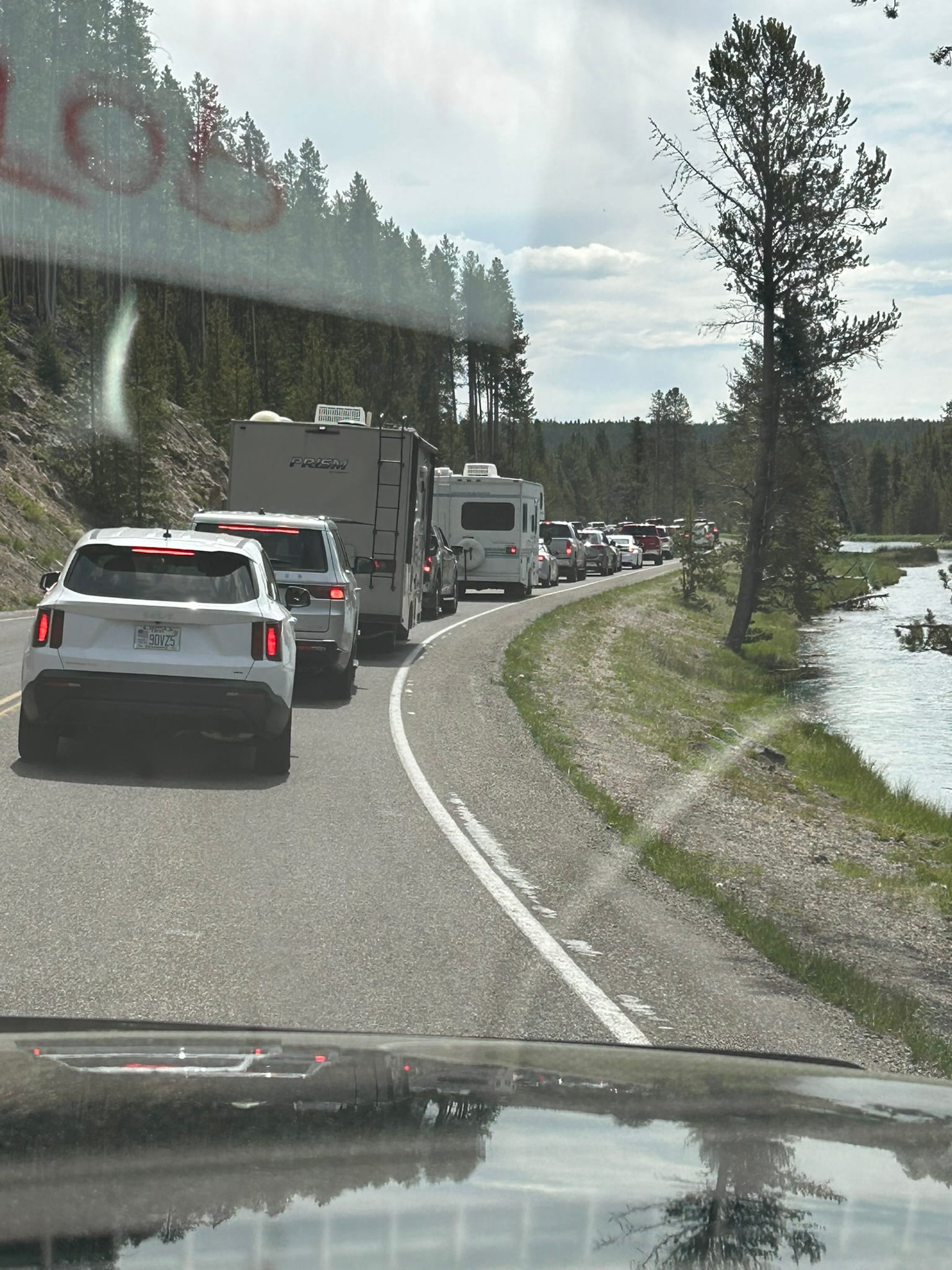
At the first intersection we hit, we turned south towards the big stuff like Old Faithful which pretty much lived up to its name within a minute or two! On the way down towards the turn off for Old Faithful, we ran into traffic that was just crawling along and it went that way for a couple of miles seemingly without any reason. We learned why when we got to the front and there was a herd of Bison right along both sides of the road and some were even crossing in front of us.
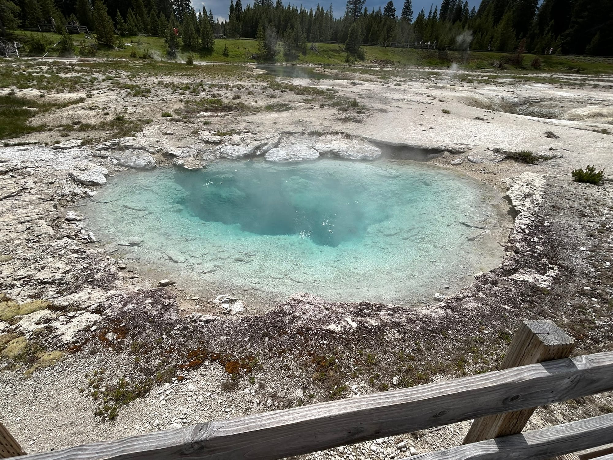
Also on the way to Old Faithful, we passed the parking lot for the Grand Prismatic Pool but it was so crowded we skipped it and went on to Old Faithful. That exit was like Disney Land. There were huge parking lots, lots of buildings, shops, a General Store, Visitor Center with huge windows looking out on Old Faithful and a huge fenced off boardwalk around the geyser and a bunch of other geysers that were all in a field together. We waited about 20 minutes for OF to do it’s thing and it was extremely impressive!
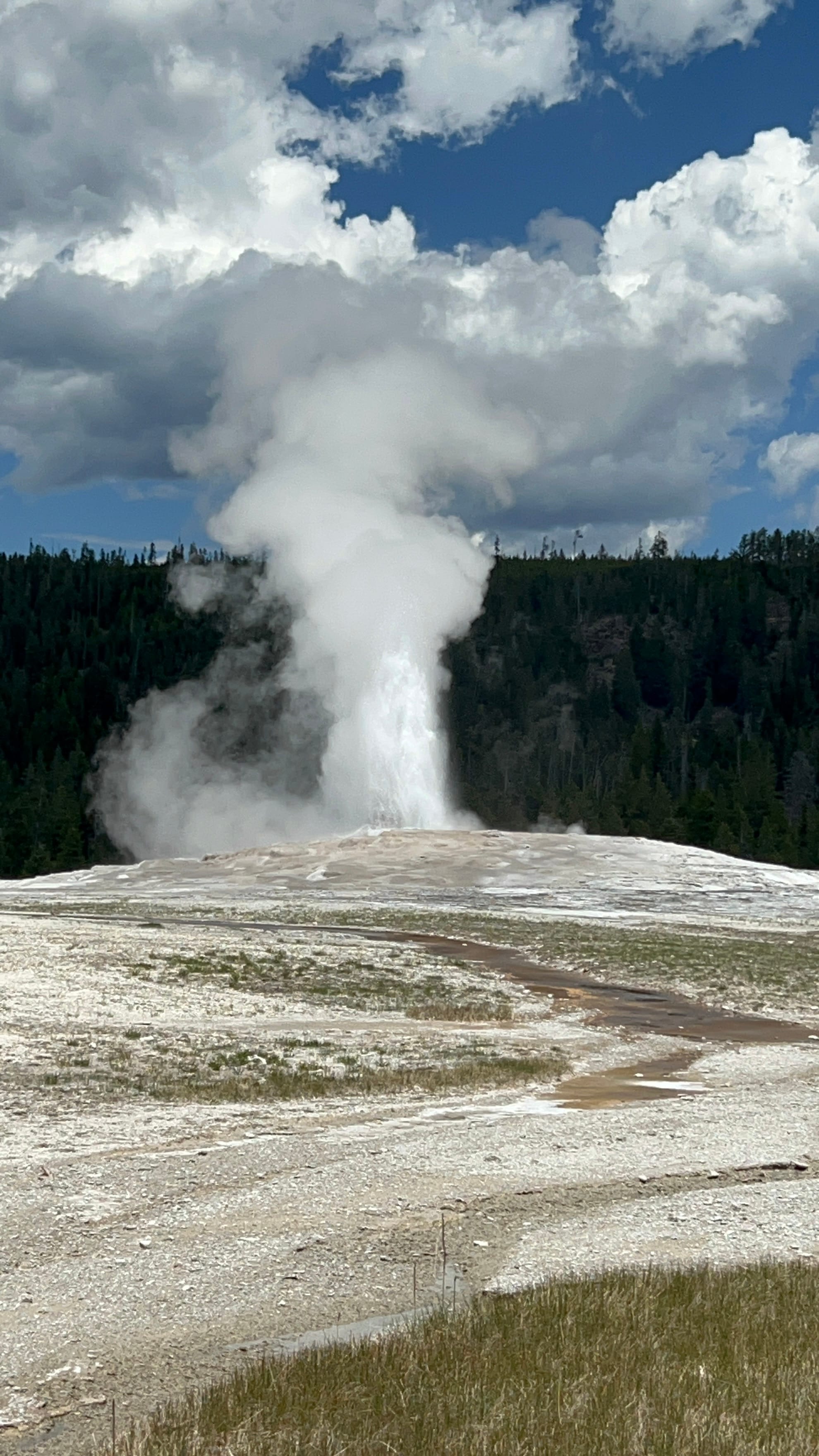
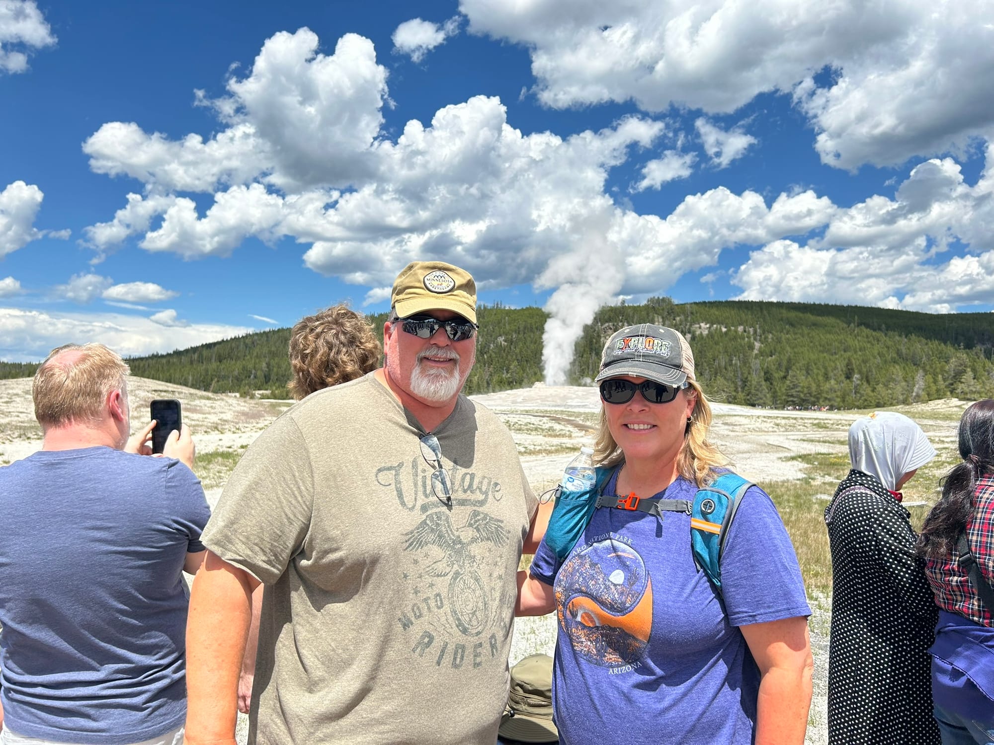
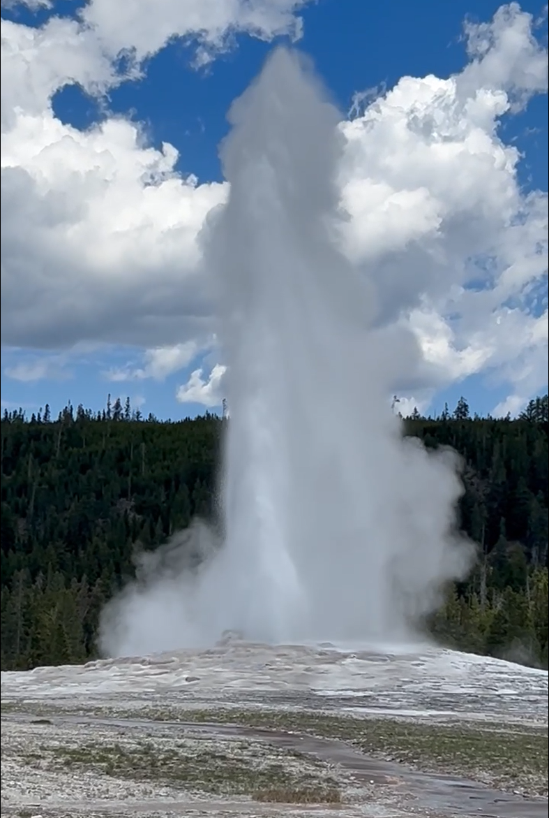
Old Faithful Erupting
We continued our loop by heading around towards Yellowstone Lake where we saw a bunch more geysers and hot springs at what’s called the West Thumb but they weren’t the blowing up kind like OF. It was amazing to see how much heated water was constantly bubbling up from some of these and how big they were. The highlights from this stop included Bluebell Pool, Lakeshore Geyser, Big Cone, Abyss Pool, Hillside Geyser, Twin Geyser, Thumb Geyser, and Painted Pool!
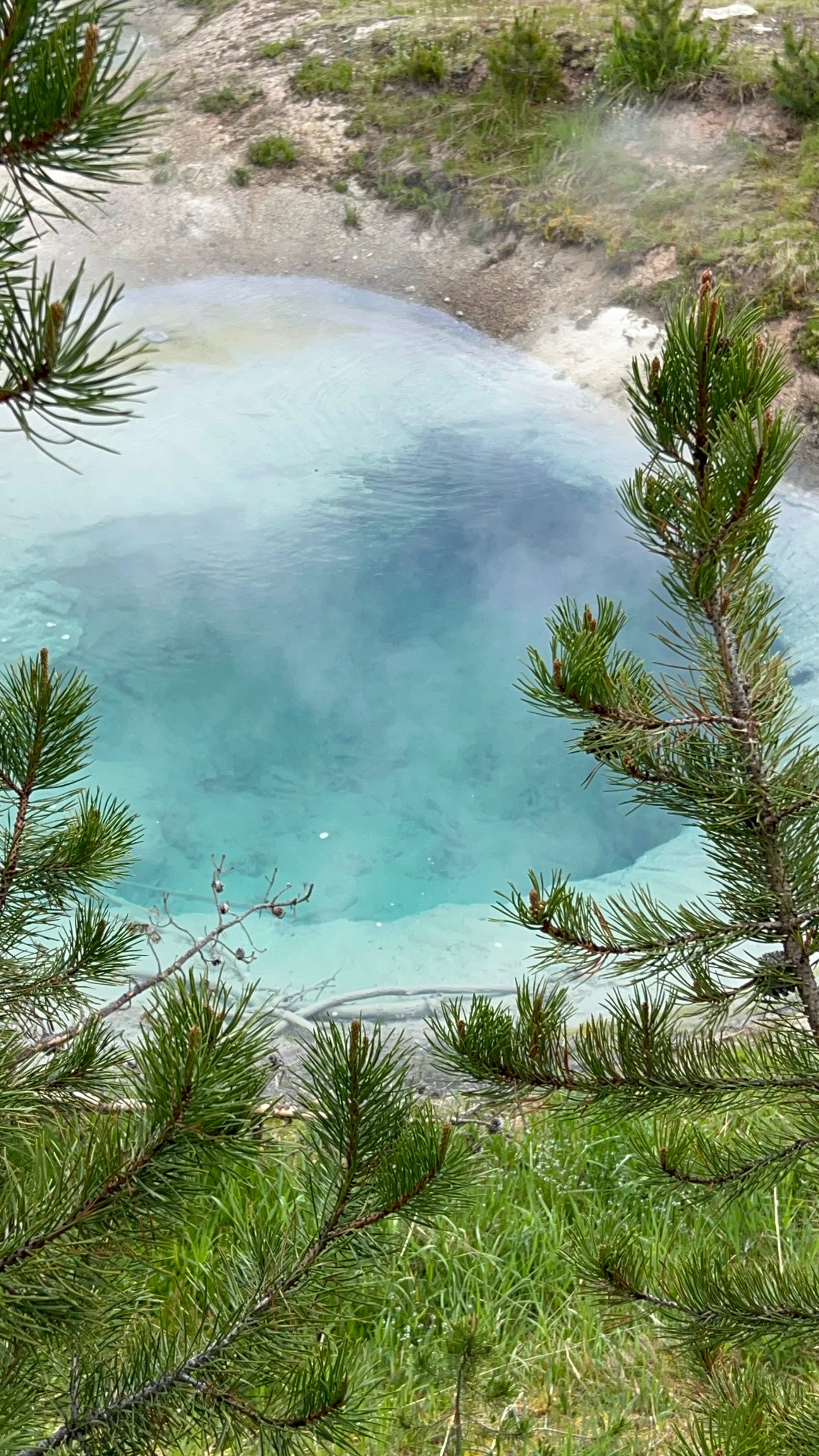
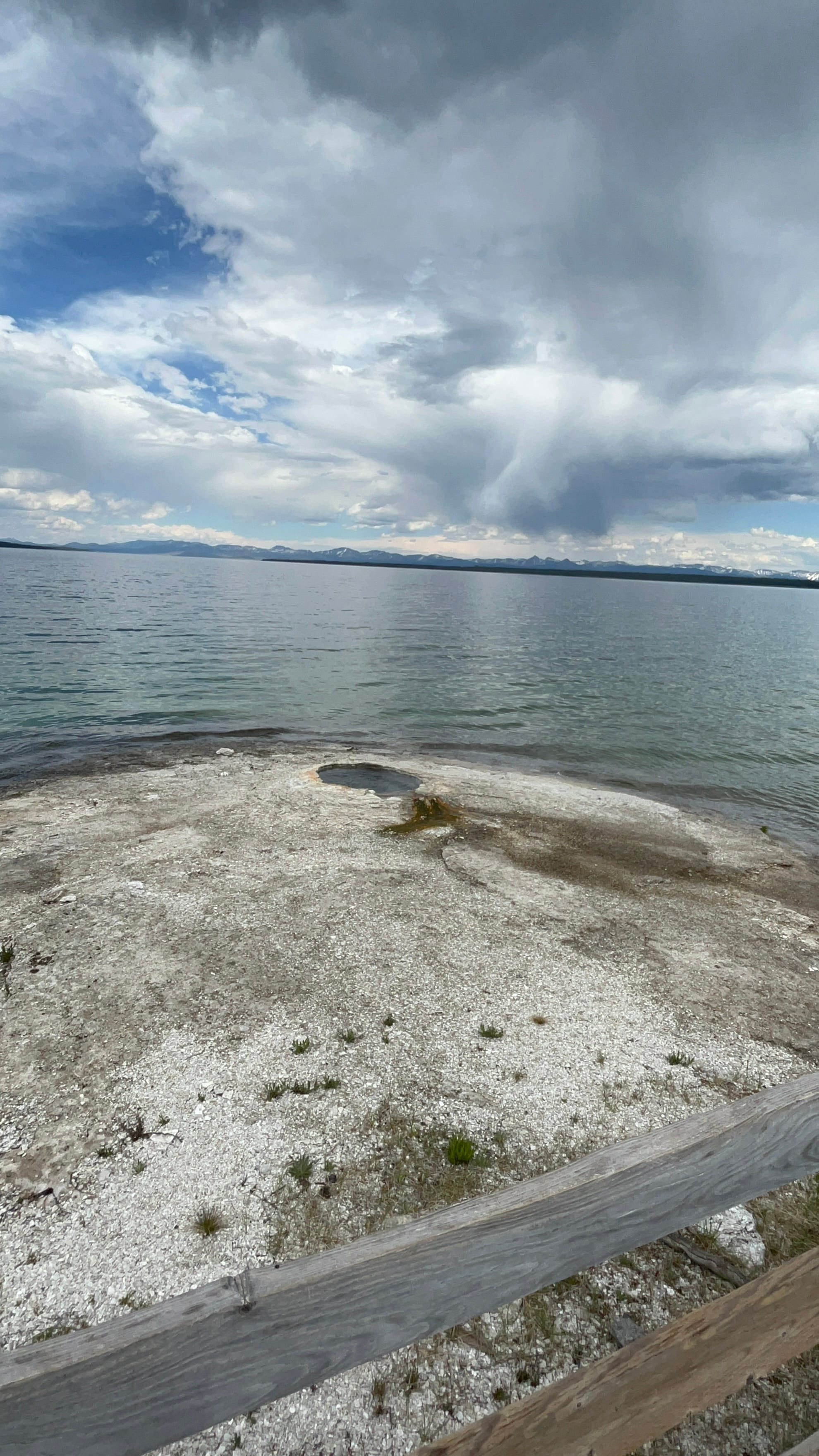
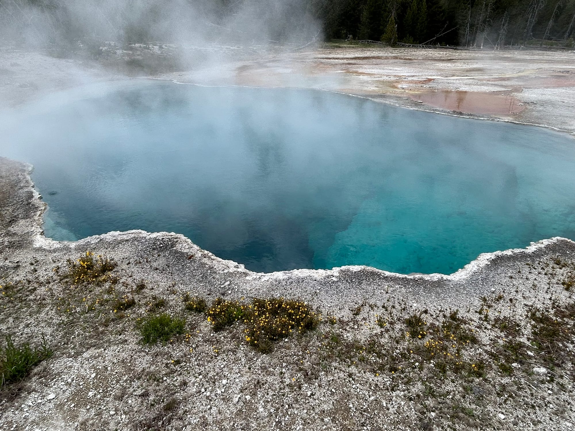
Yellowstone Lake's West Thump
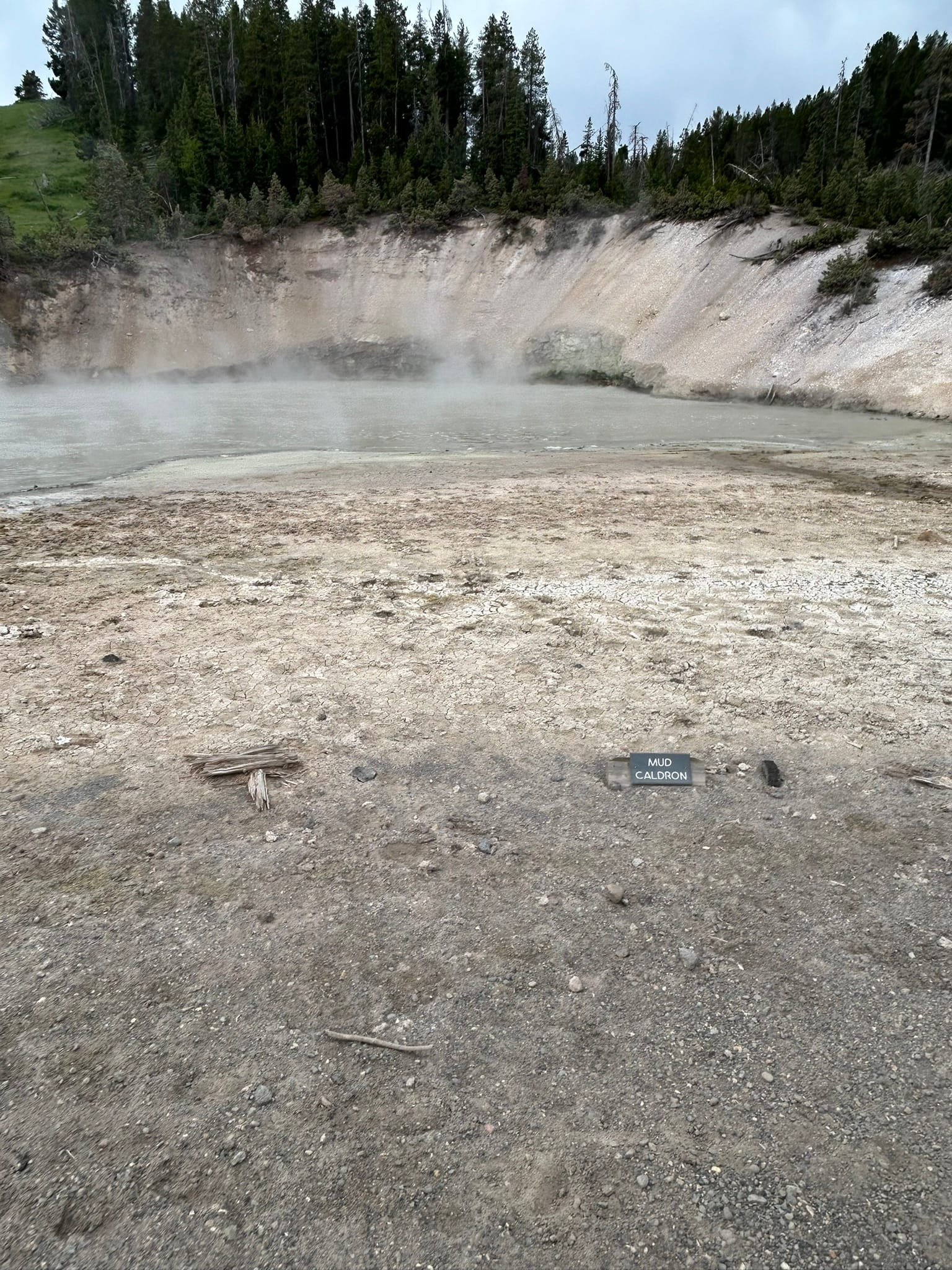
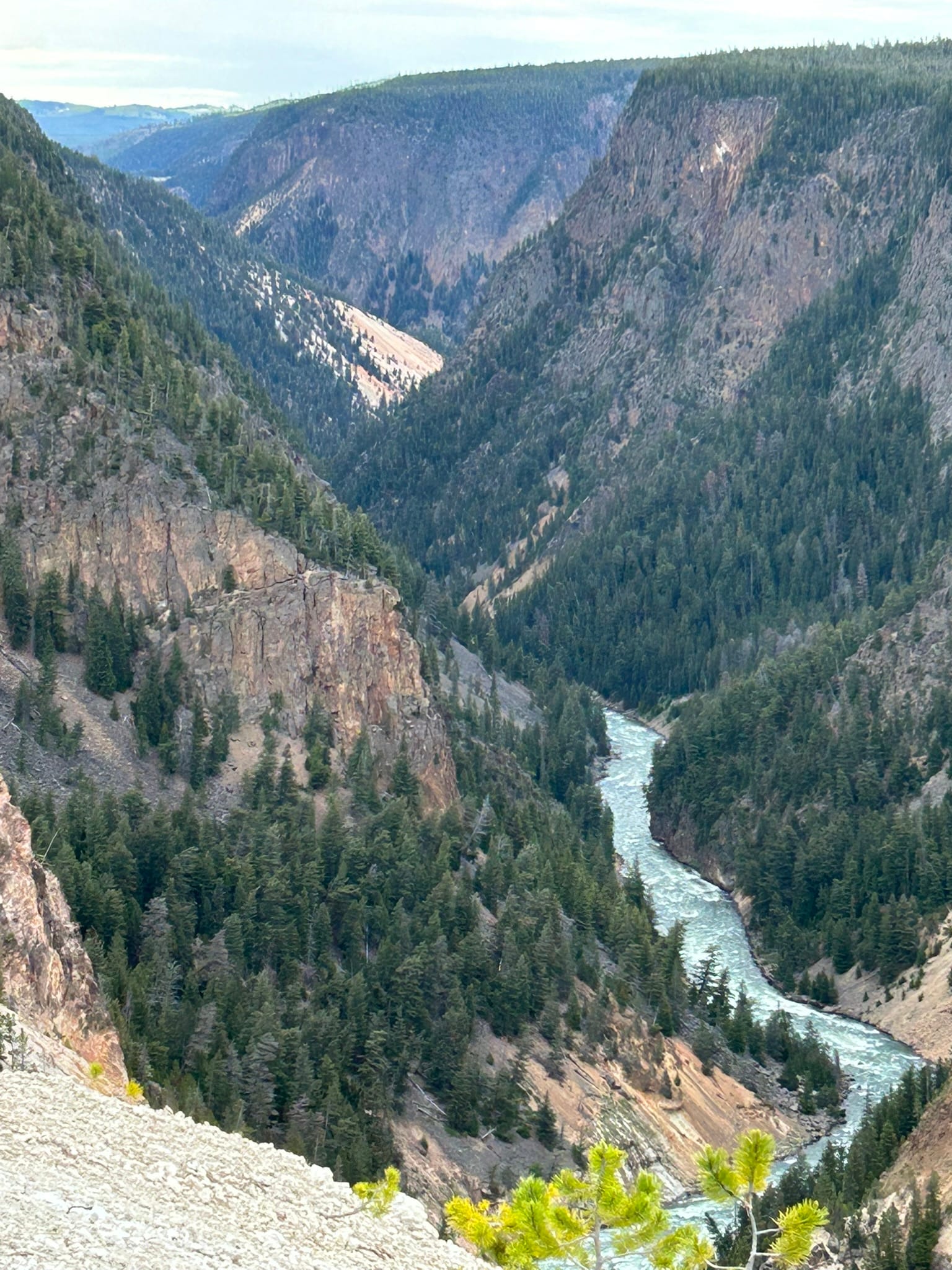
Continuing around the loop and heading northeast we came to another stop that had a mud volcano and several hot springs that were very large and impressive, including the Black Dragon’s Caldron. The last thing we did as we reached the far northeast corner of the loop was to visit the Grand Canyon of Yellowstone which was an impressive canyon to see. It's very deep with steep cliffs on both sides but the best part was the Upper and Lower Falls within it! They are two huge falls that you could hike to and see from various vantage points. We hiked down to the Brink of Lower Falls which was a series of switchbacks down into the canyon to end up right at the edge of the falls so you could watch the water drop hundreds of feet deeper into the canyon! It was loud and cold with all the mist and breeze from the rushing water. It was a steep climb back out that was taxing but it was worth the view that’s for sure. I never knew there were such stunning water falls in Yellowstone!
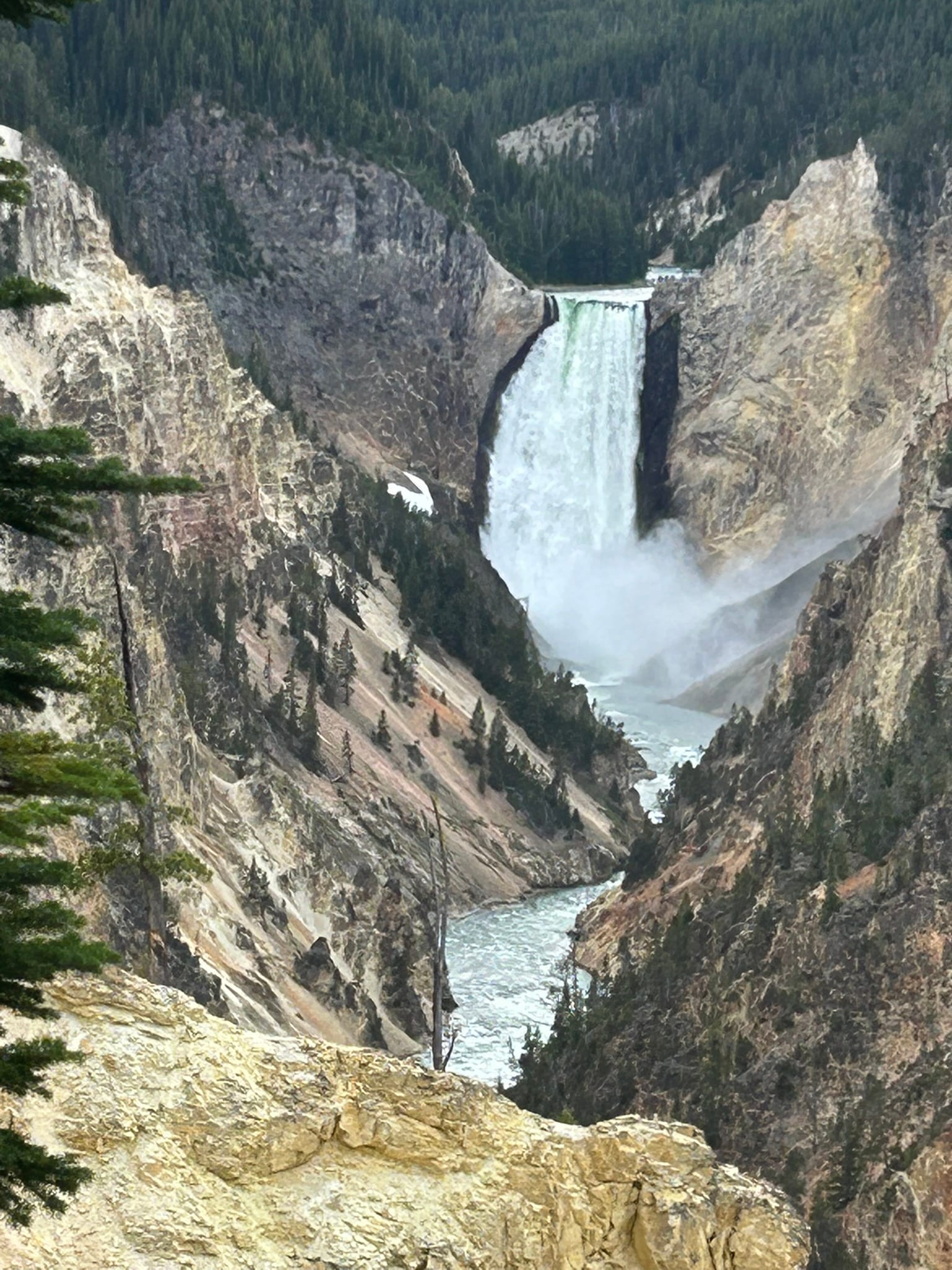
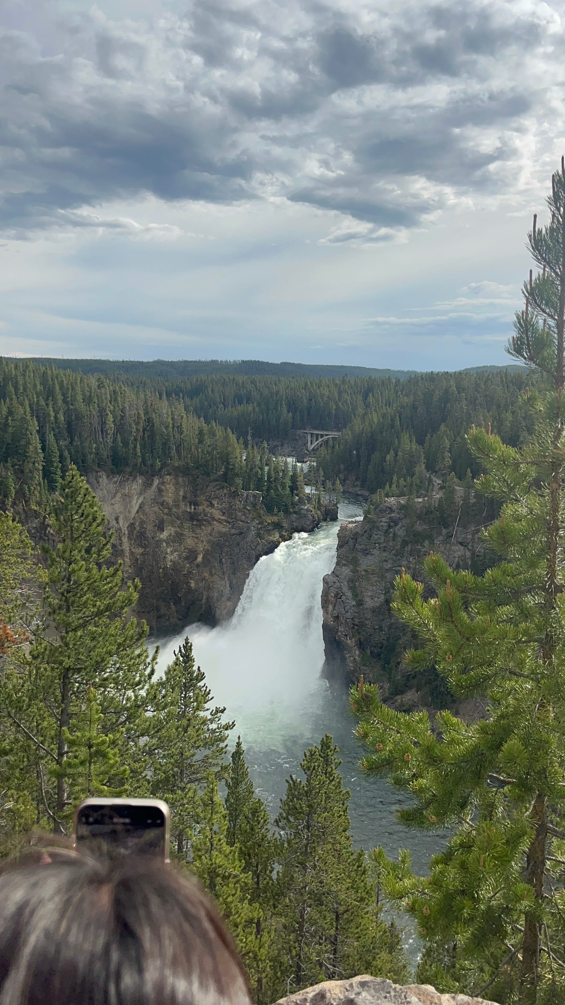
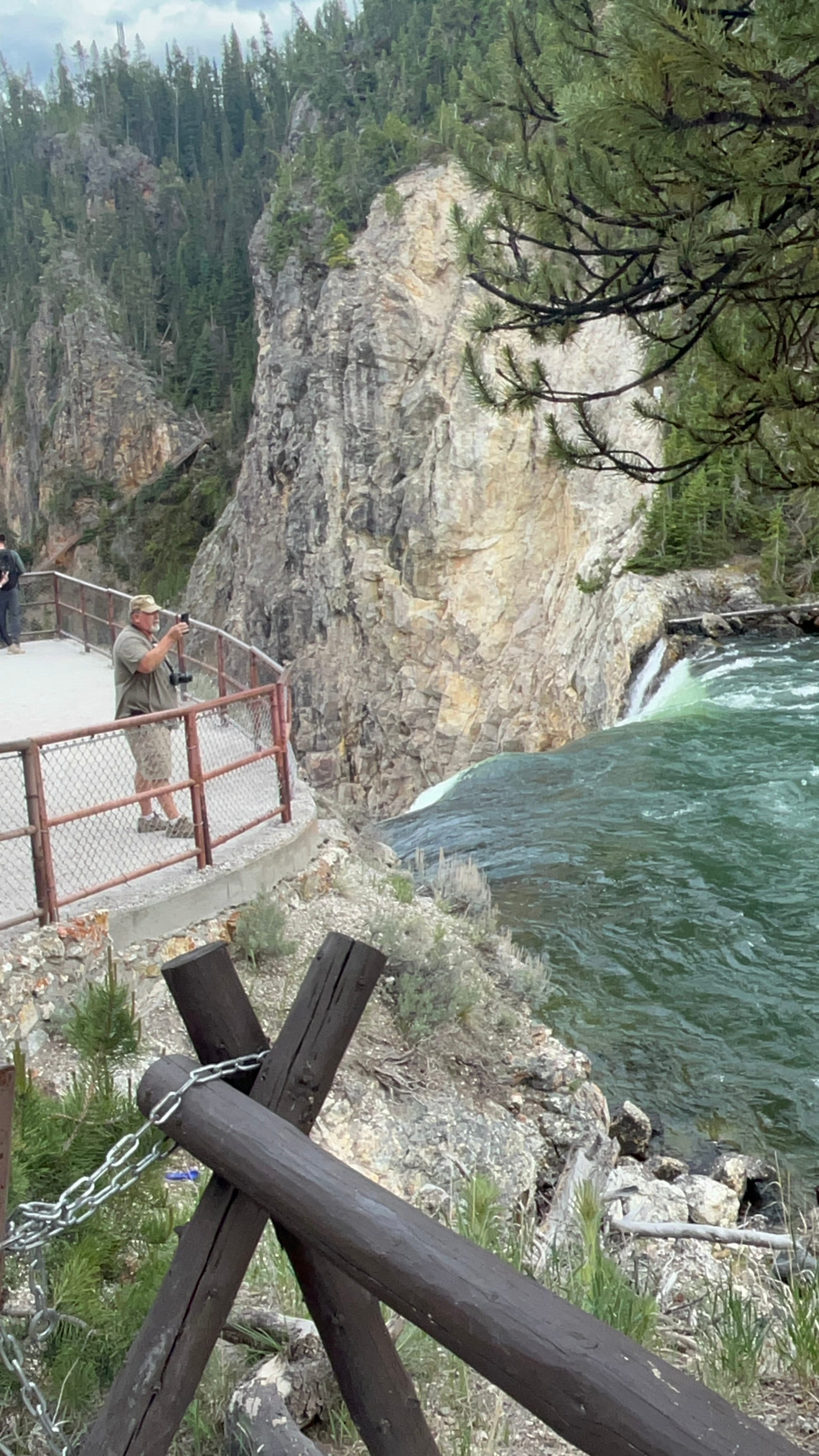
Upper and Lower Falls and the "Brink of the Lower Falls"
On the way back we saw more Elk and Bison and there were a bunch of people on the side of the road all excited because there was a Grizzly Bear walking down the other side of the river.
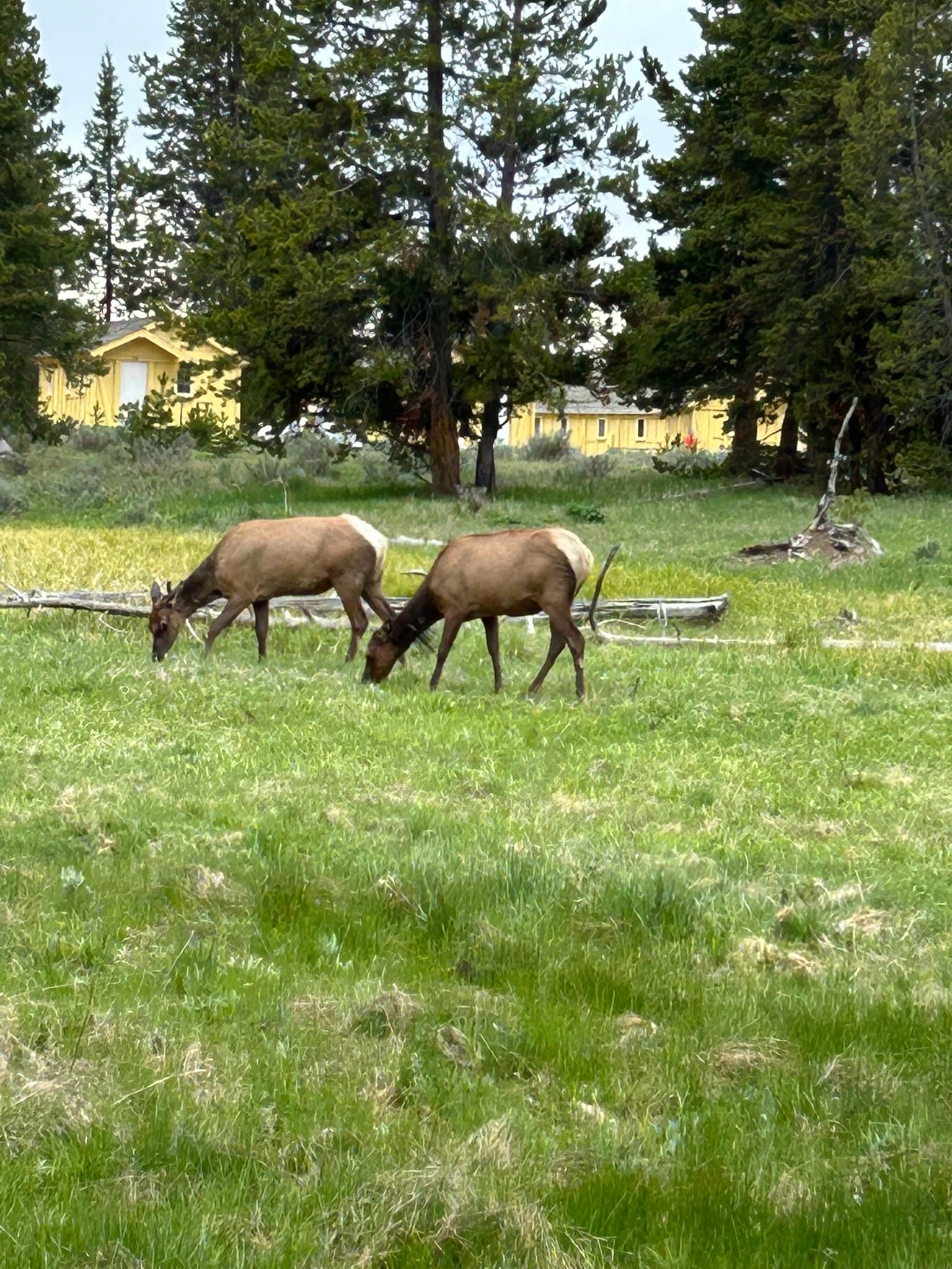
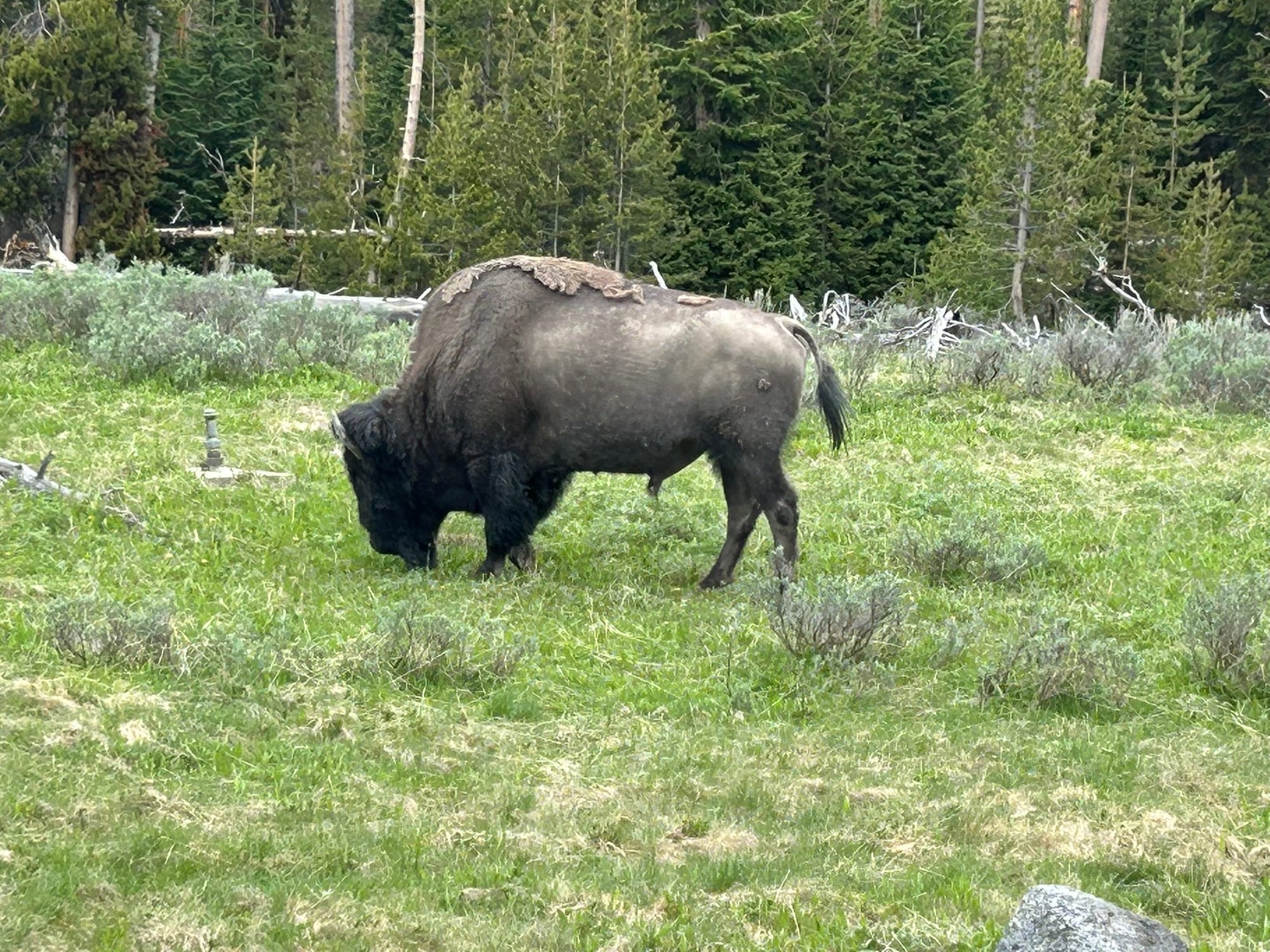
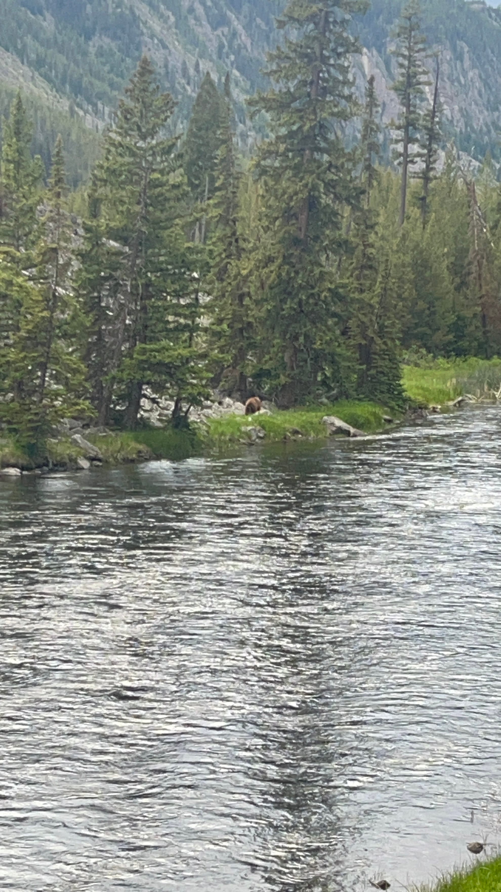
Elk, Bison and Grizzly Bear!
So far on this trip, we’ve seen a moose, black bear momma and 2 cubs, elk including a bull elk, hundreds of bison, and two grizzly bears. I was the only one who saw the moose though, so we have to find one for Kim!
Yellowstone day 2! We woke up to the sound of my phone chirping a weather warning about rain and it rained fairly steady for the next couple of hours. We took our time getting ready to head out and did so around 1 pm when the weather improved somewhat. We drove back into Yellowstone to see some of the areas we had missed from the day before so we turned north towards Mammoth and drove up to this area which is a giant travertine formation created by hot water carrying minerals to the surface and building up huge step like features! There clearly have been many other active sections around the area in the past since there were many structures where there didn’t seem to be any active water flowing.
We hiked around the formation which was fairly high. We had parked at the lower section of the formation and had to climb around the lower section and then climb steps to the upper sections.
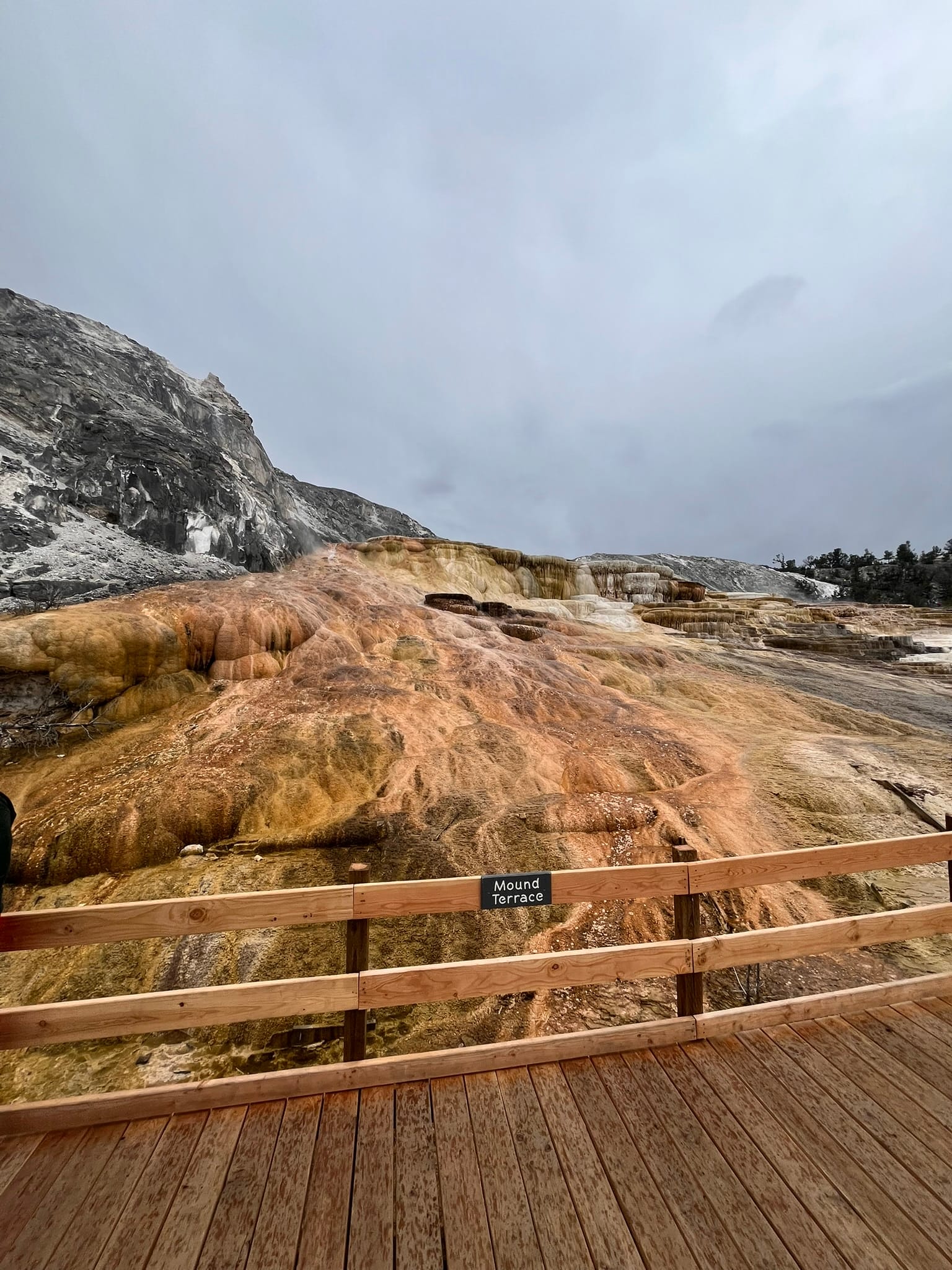
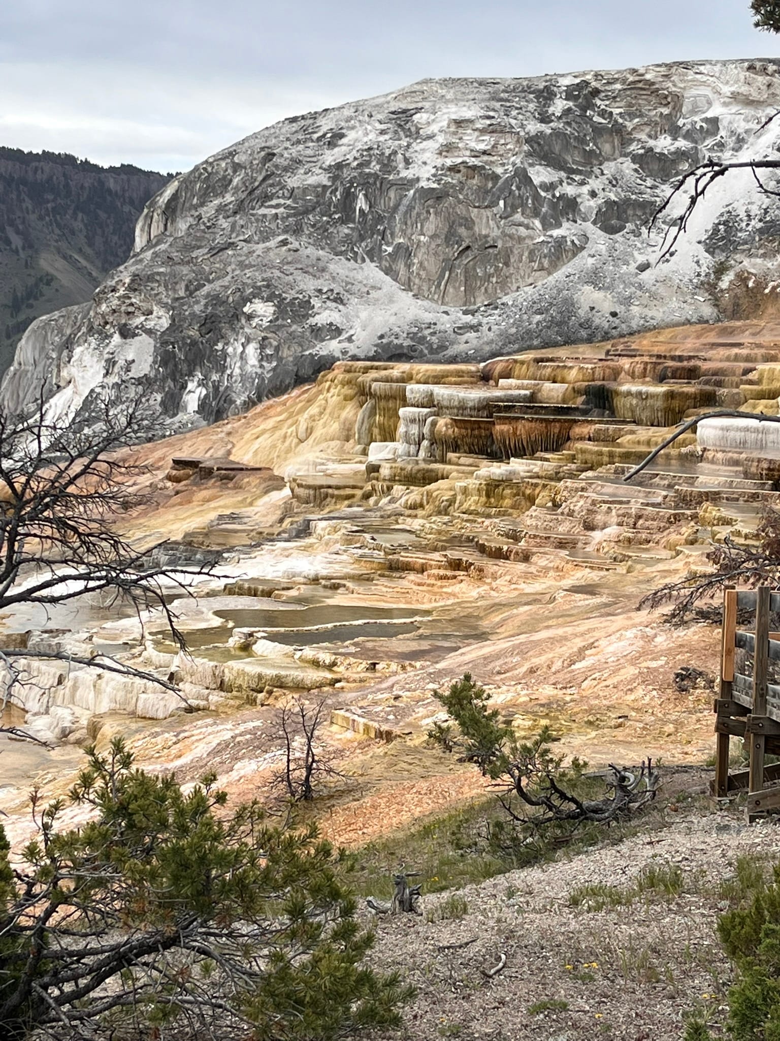
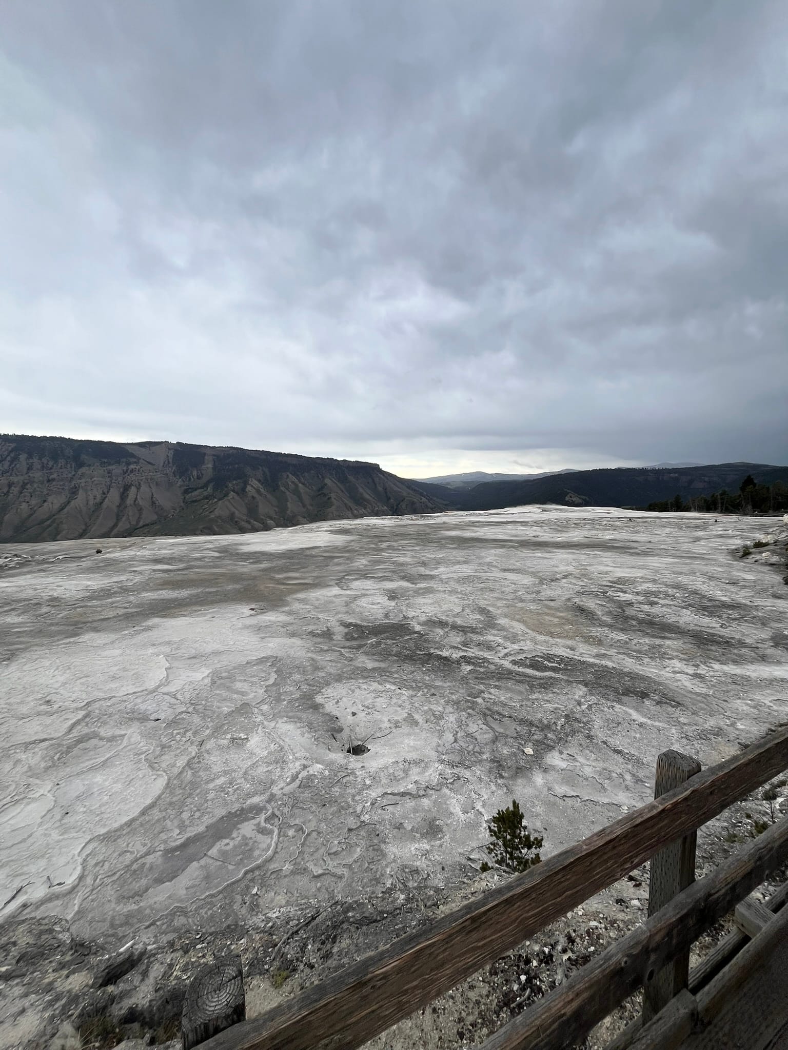
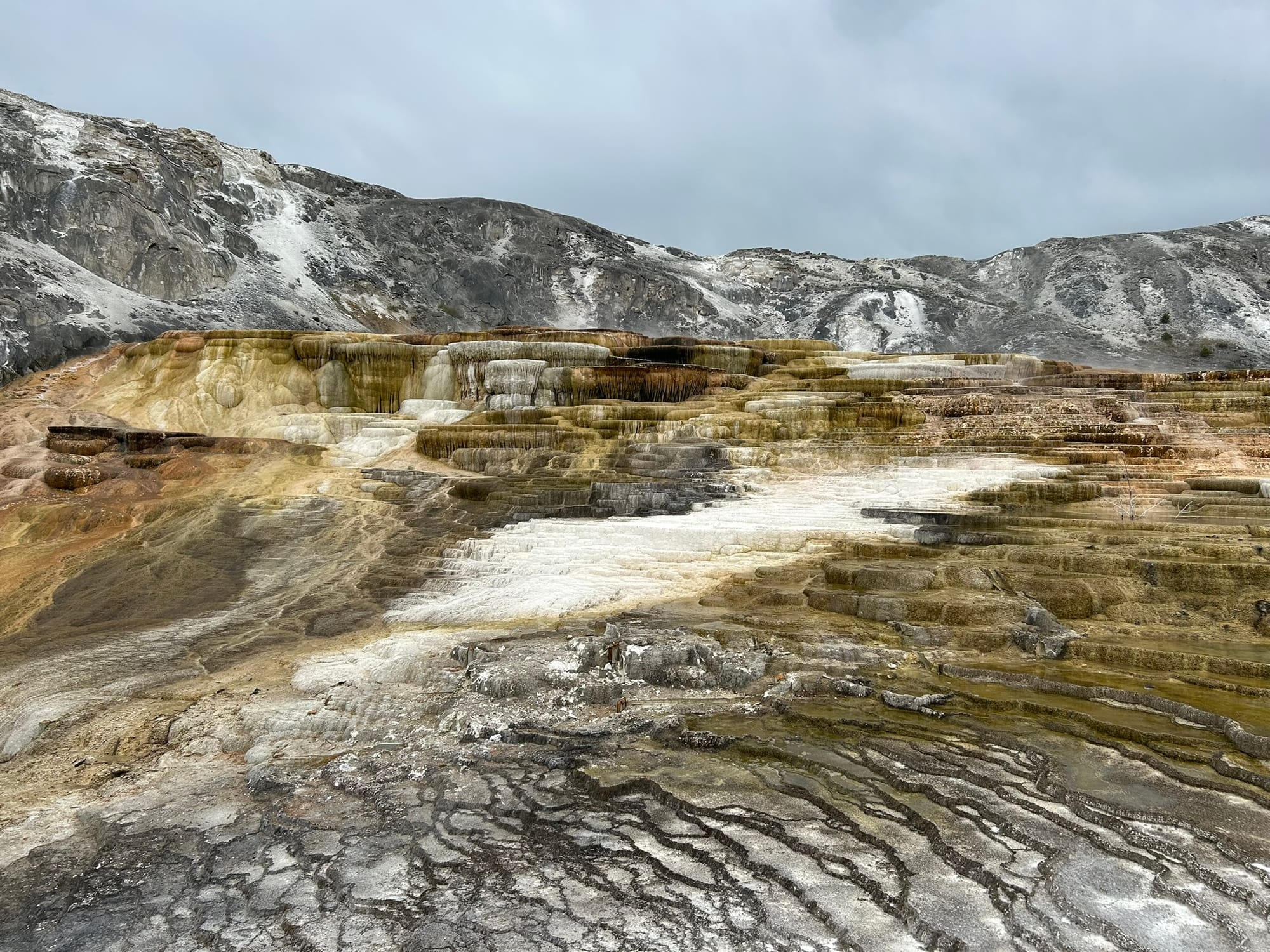
Views of Mammoth Travertine formations
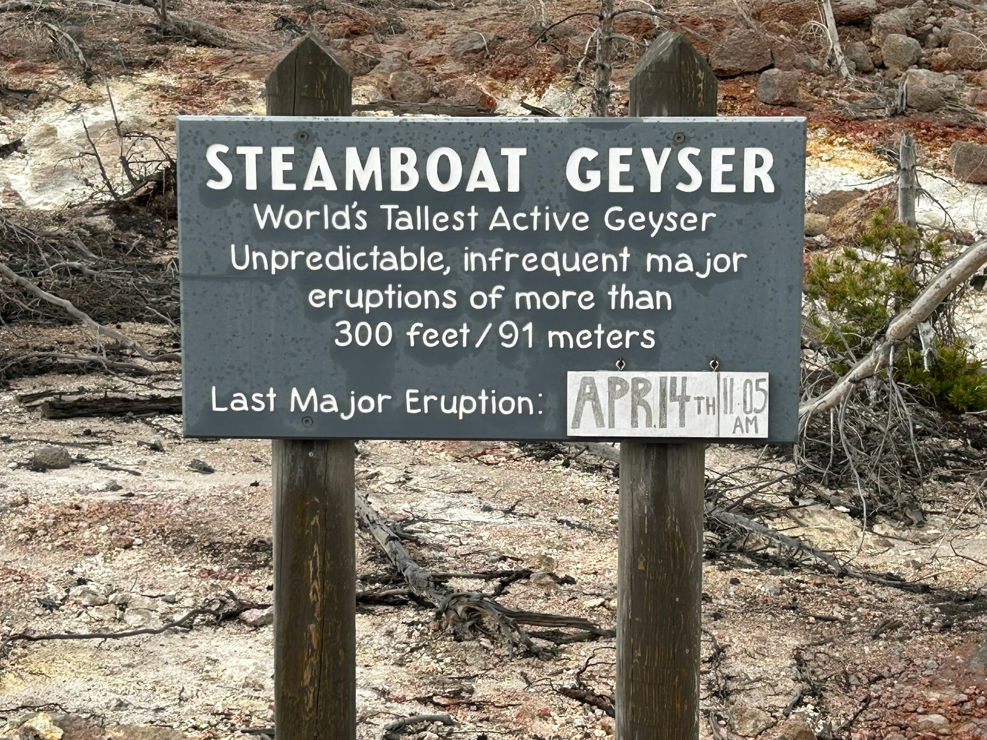
After that we headed back towards the Norris Geyser Basin which we were told was the hottest part of the park. It is filled with geysers, hot springs and steam vents. We hiked about a mile and a half through the basin to see the most famous and highest erupting active geyser in the world, Steamboat Geyser, which can shoot water hundreds of feet in the air! It hasn’t erupted since April 14th so it’s not super active nor predictable. It was bubbling and spraying a bit while we were there though. After that we headed back to our campsite all the while looking out for any wildlife.
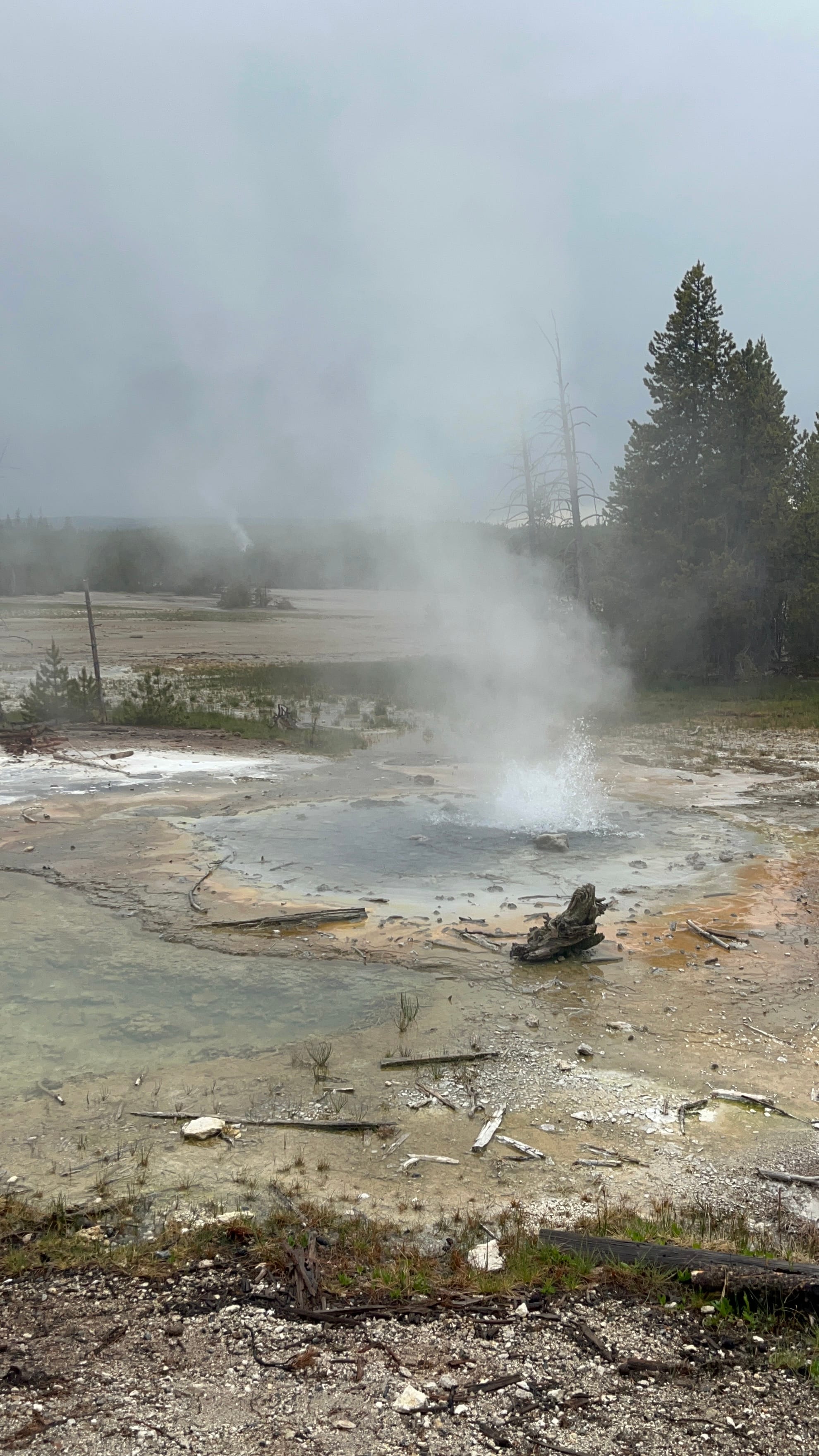
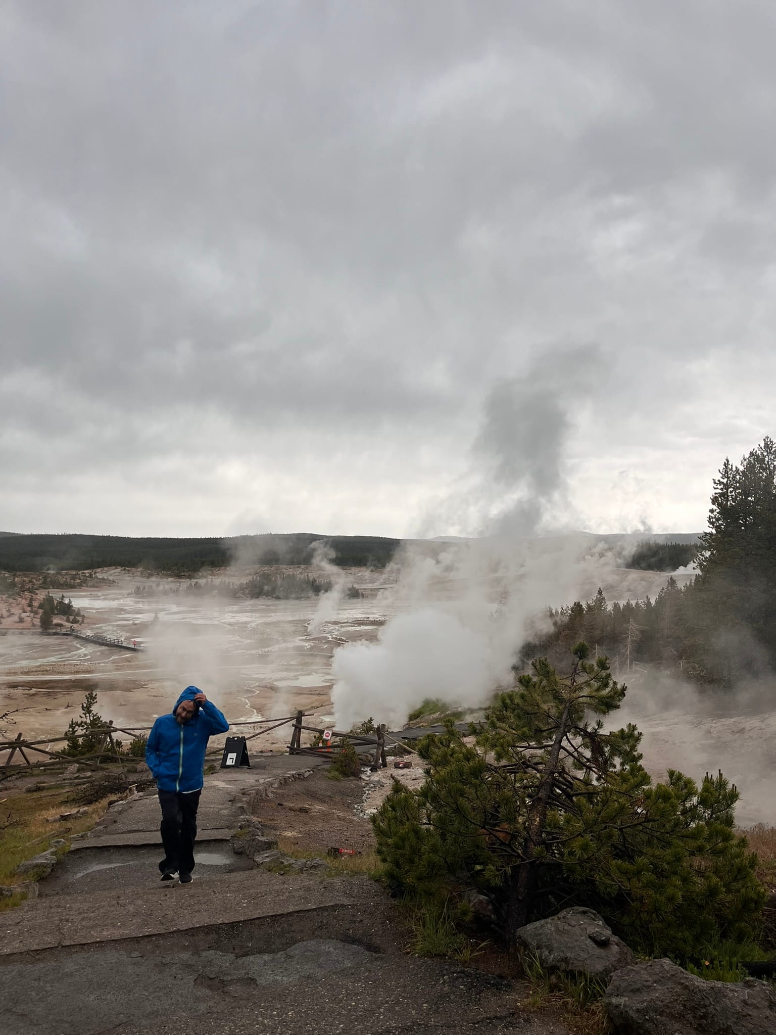
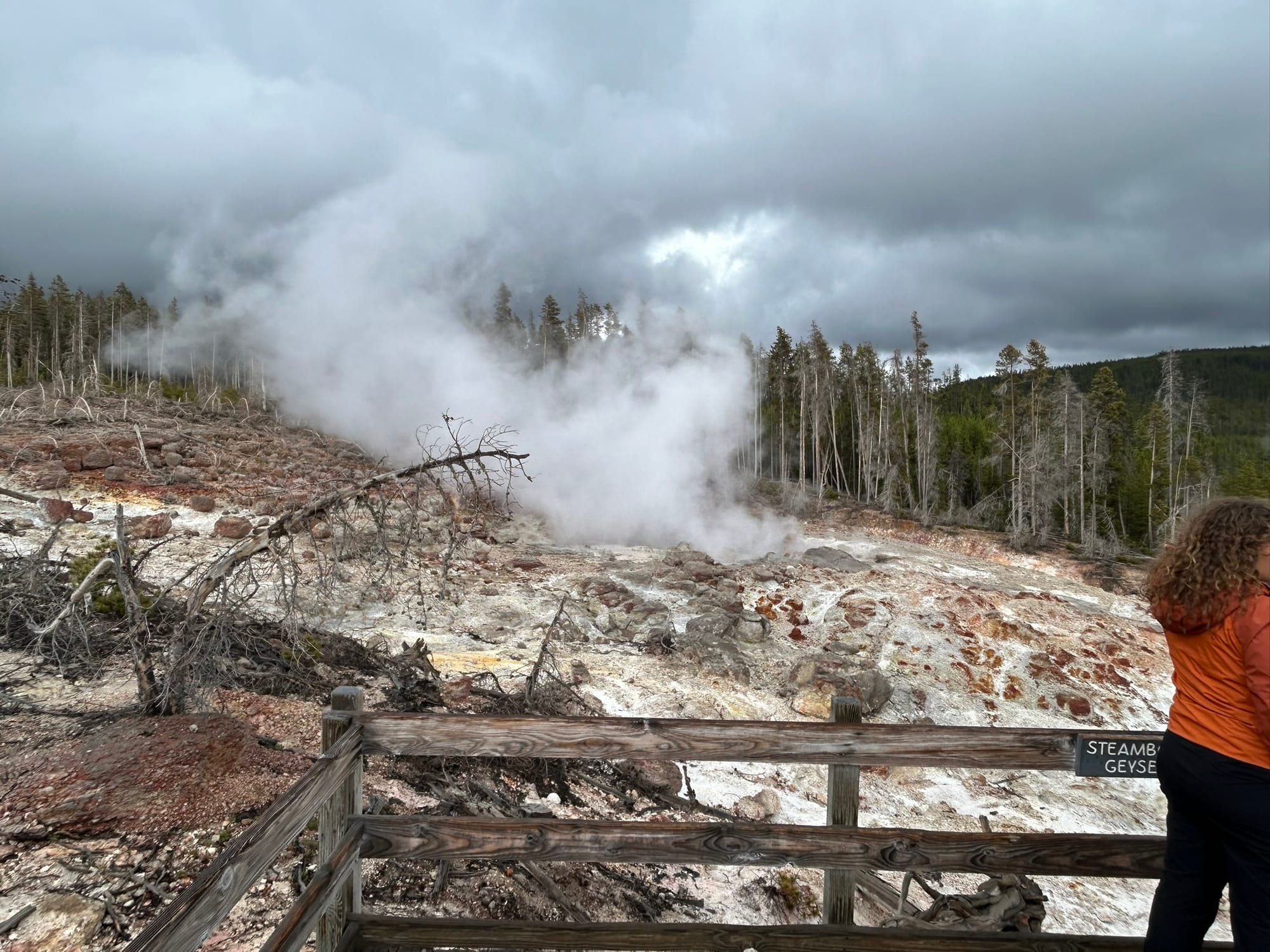
Norris Basin Geysers
Yellowstone is an amazing park! It has mountains, forests, canyons, falls and wildlife like other parks but what makes it particularly unique is the active geology underneath that creates the fascinating and beautiful geysers, hot springs, pools and steam vents! The only downside is that it is a very popular park and there can be large crowds and trouble finding parking at the most iconic spots.
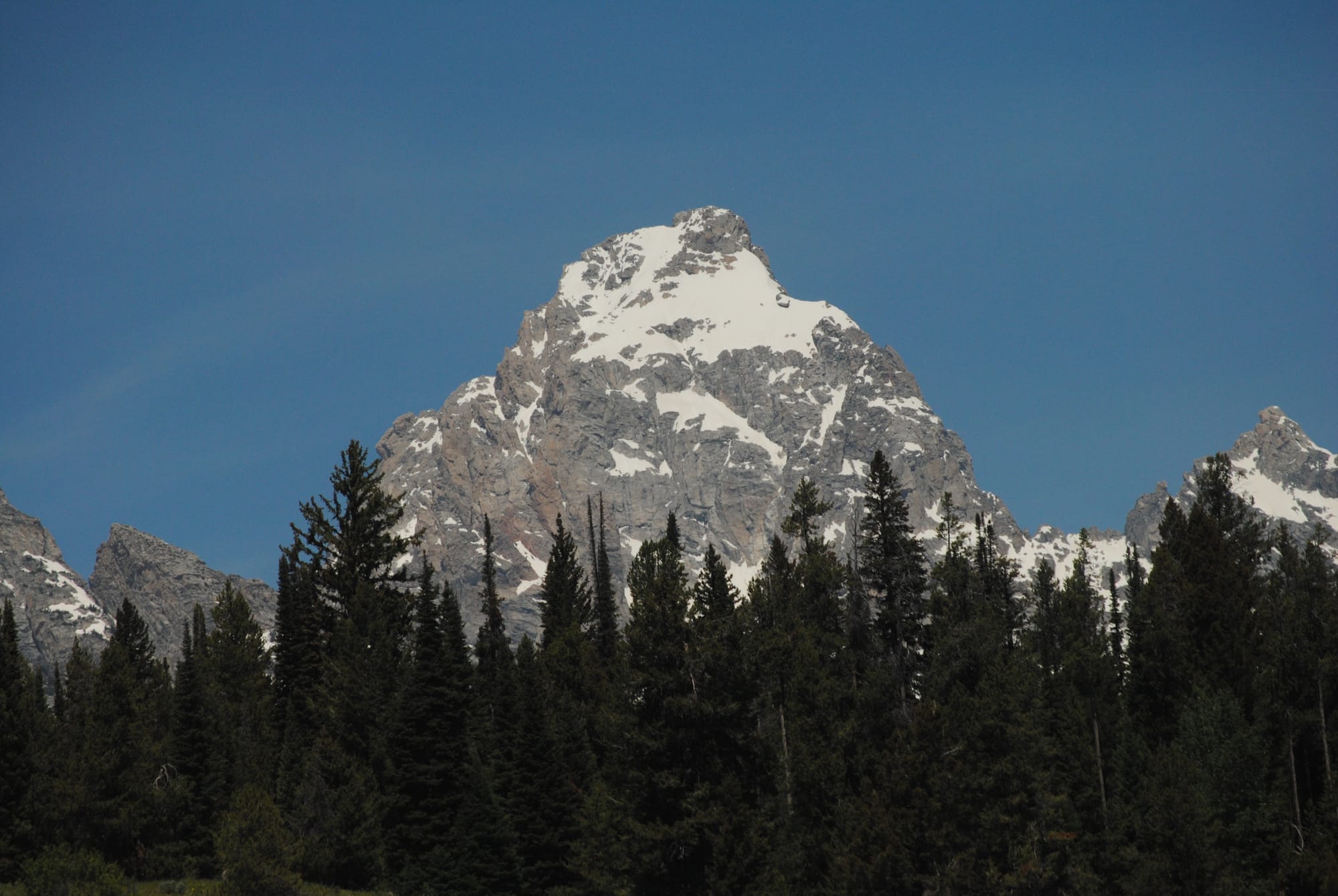
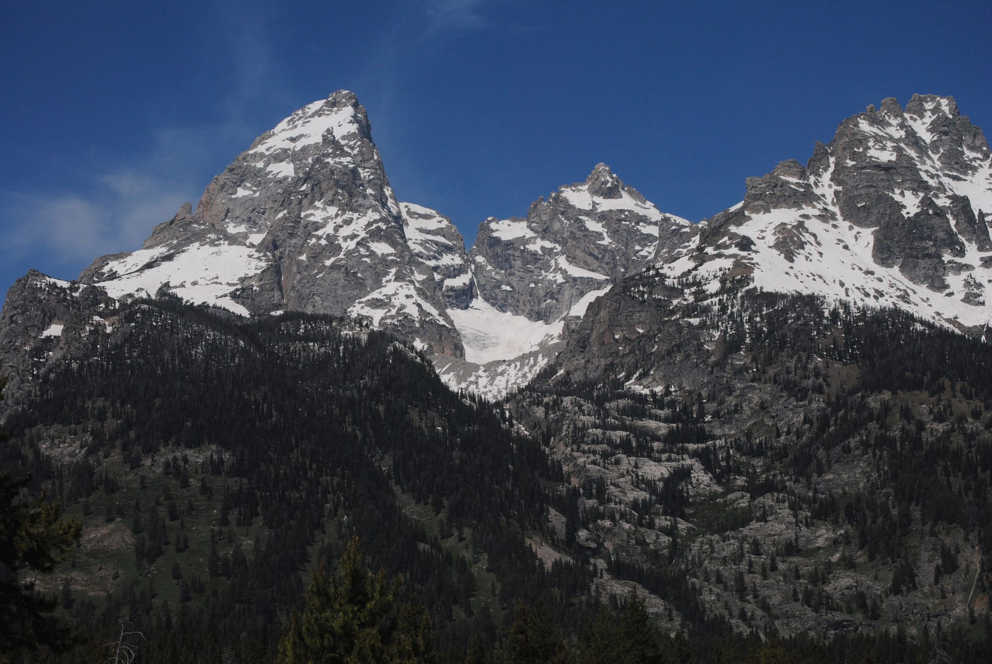
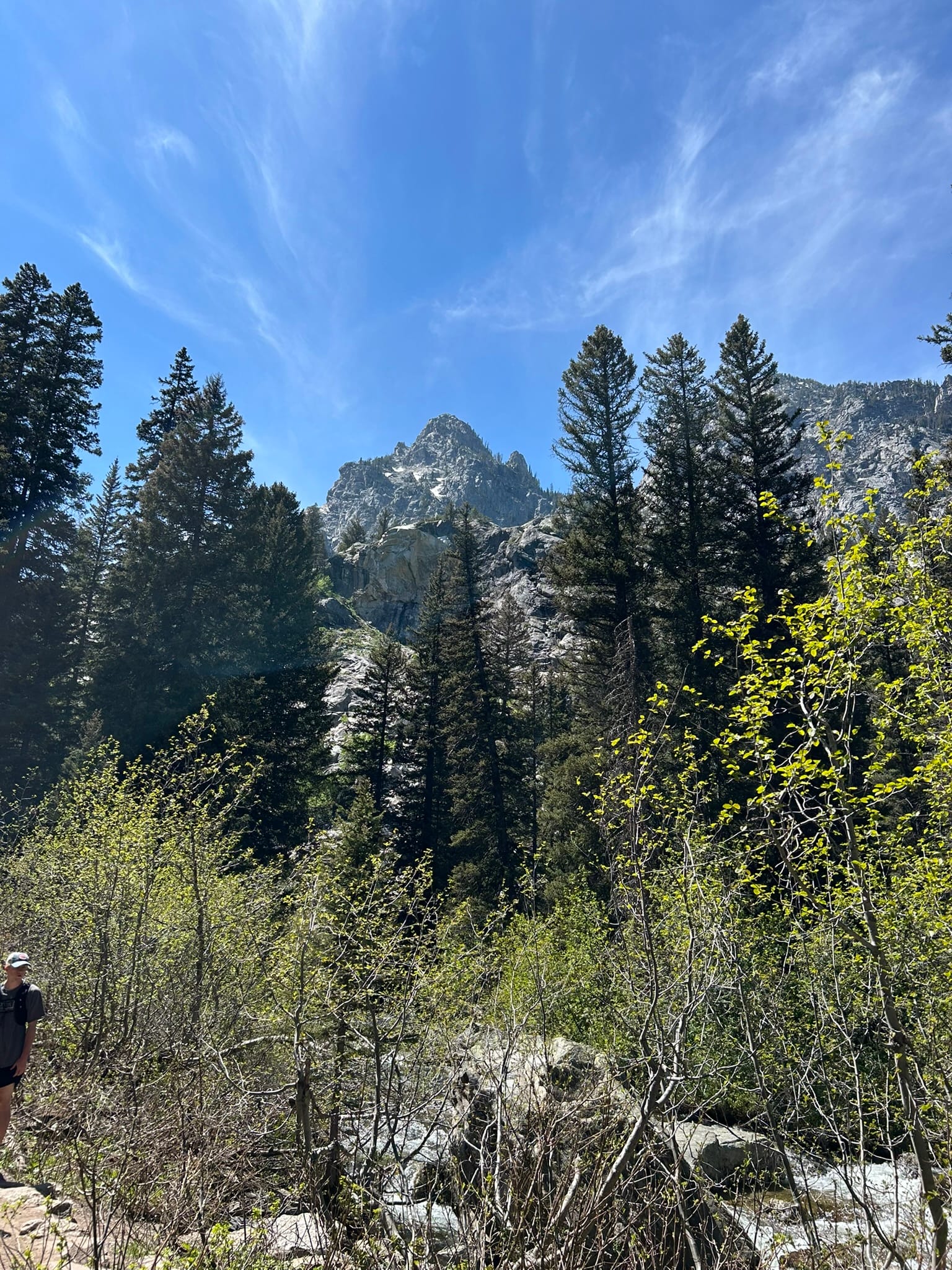
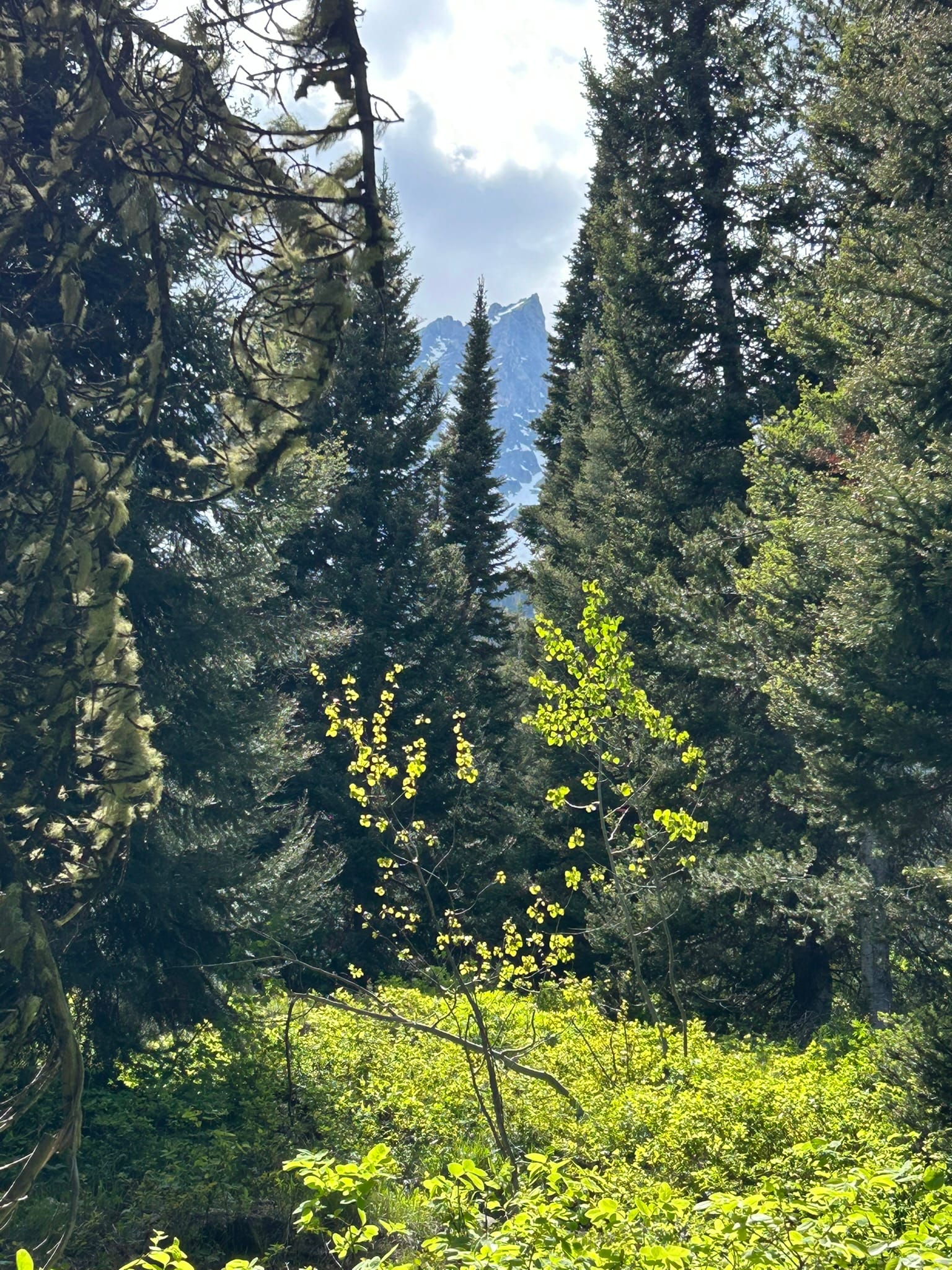
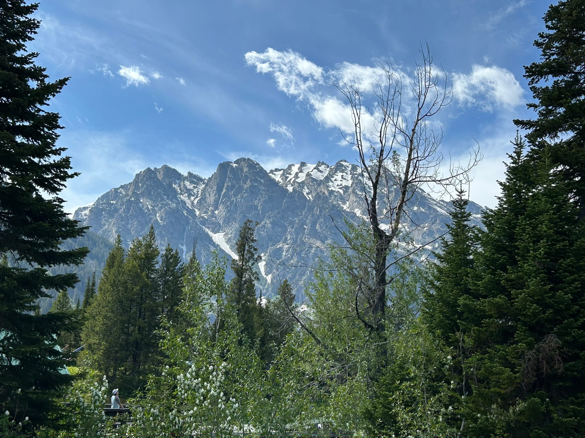
Grand Teton National Park, WY
Today we got up and went into Grand Teton National Park. But first, I had to take care of our dogs. I fed them and took them for a walk around the campground as usual. As we rounded the corner, I spotted something moving on the other side of the hedge and froze. It looked kind of like a deer but didn’t walk like one. Then it stepped out into the road 15 yards or so ahead of us and it was a juvenile moose! He looked around and proceeded to wander across the campsite! I saw several people up at that hour, filming him as he made his way across. Incredible way to start the day!
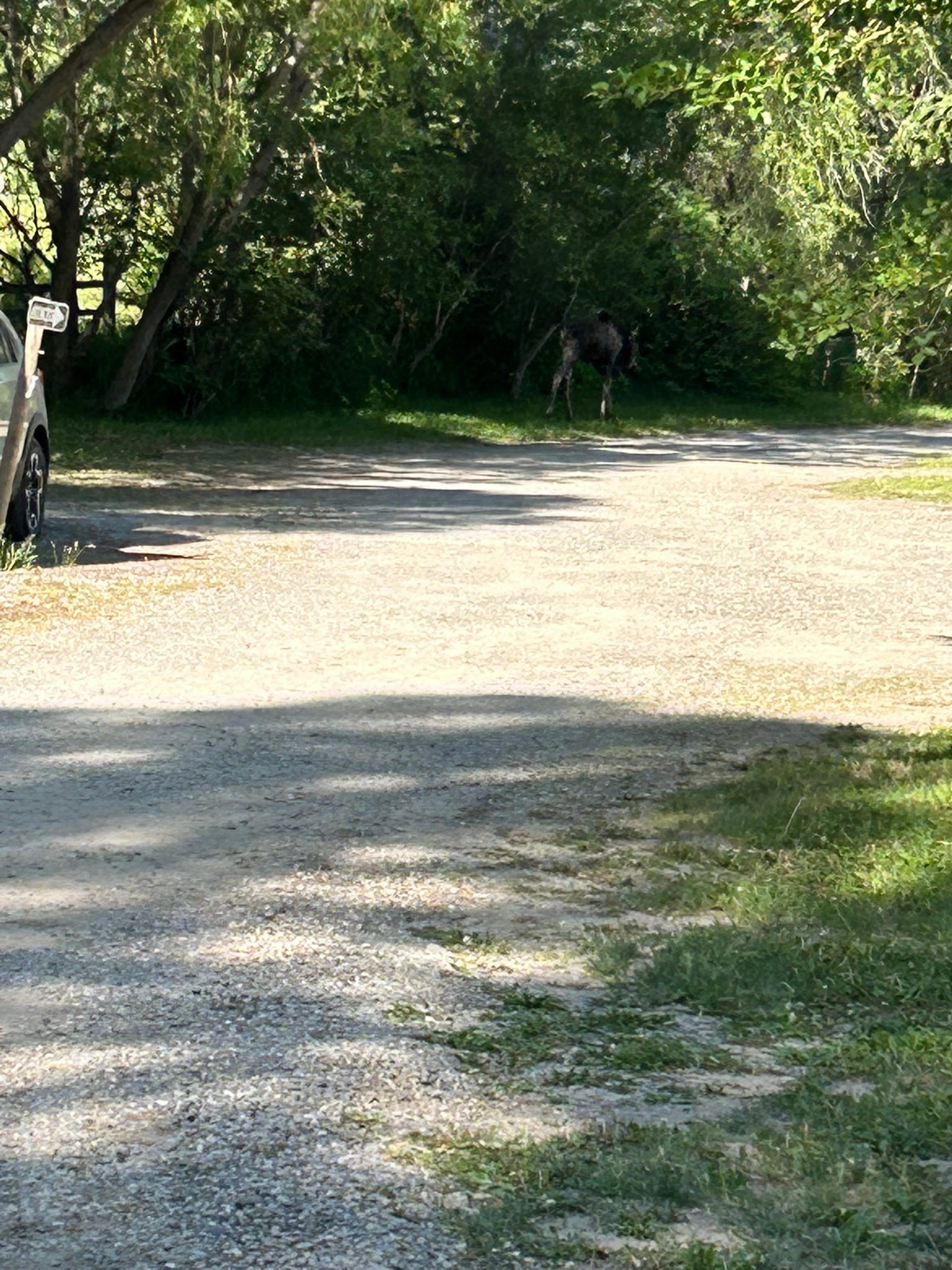
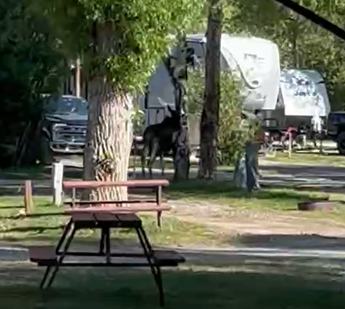
Juvenile Moose wandering the campsite
After we got ready for the day, we headed into the national park with plans to drive the scenic loop and maybe if we felt up to it, hike back to Hidden Falls on the backside of Jenny’s Lake. It was a windy day so the lake wasn’t the often pictured mirror with the Tetons reflecting down in it but it was a majestic sight with the Tetons right on the other side of the lake just jutting up out of the ground!
We headed around the lake on our 5 mile hike (our longest to date!) and actually enjoyed the trek. It was a bit strenuous with some relatively short climbs especially as we approached the Hidden Falls. The snow melt was gushing down the mountain in a spectacular set of falls that filled the area with a cool wet breeze that felt really refreshing! It was an awesome place to stop and take a break!
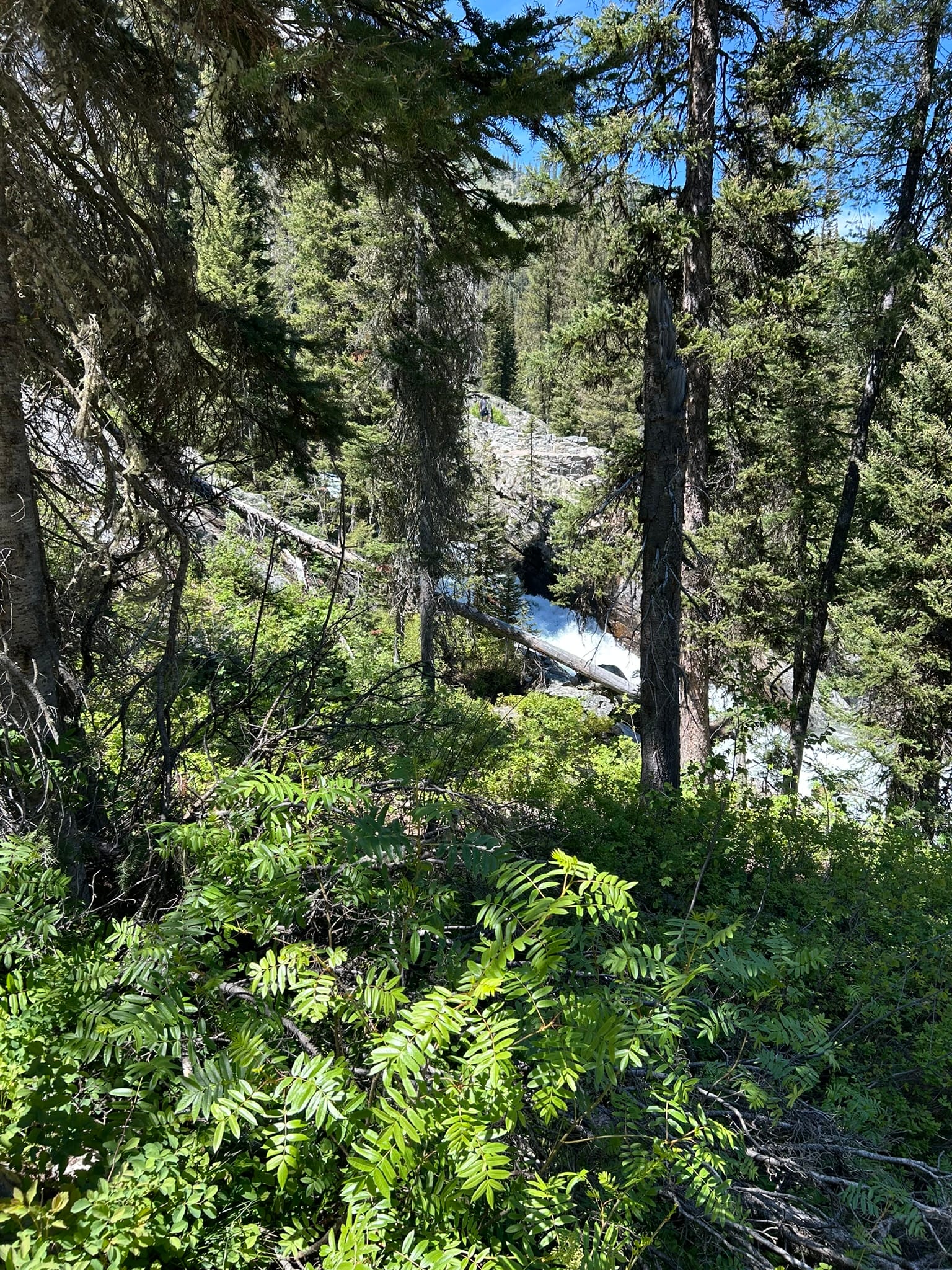
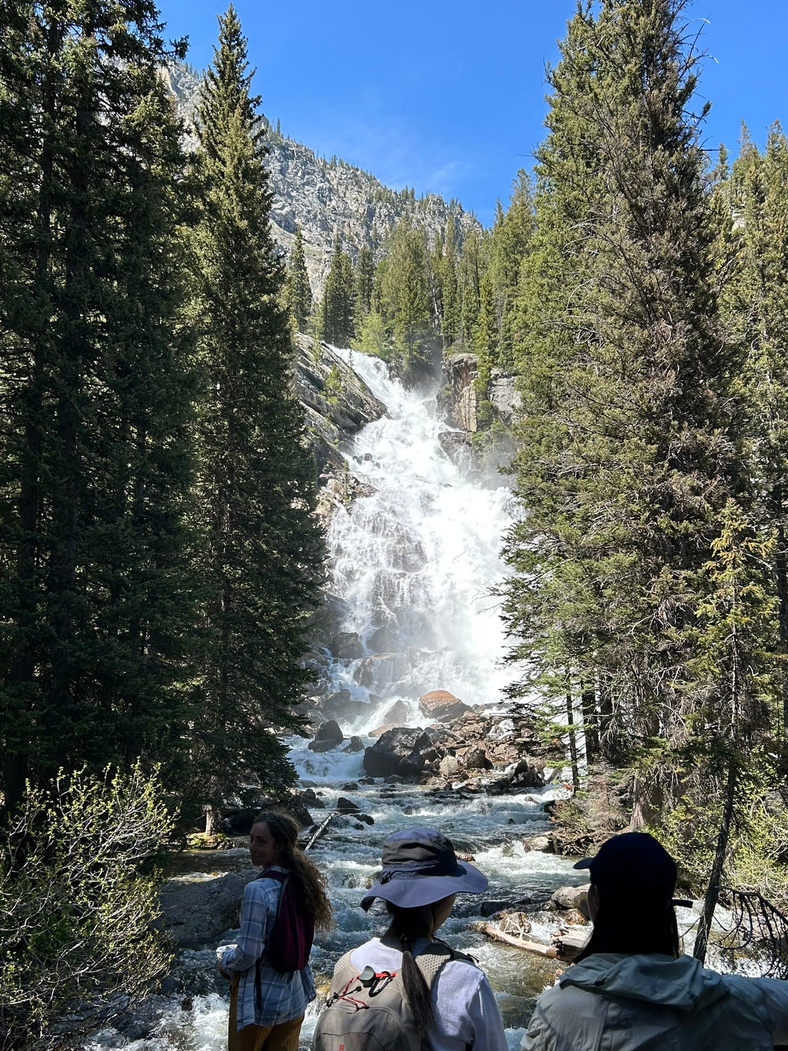
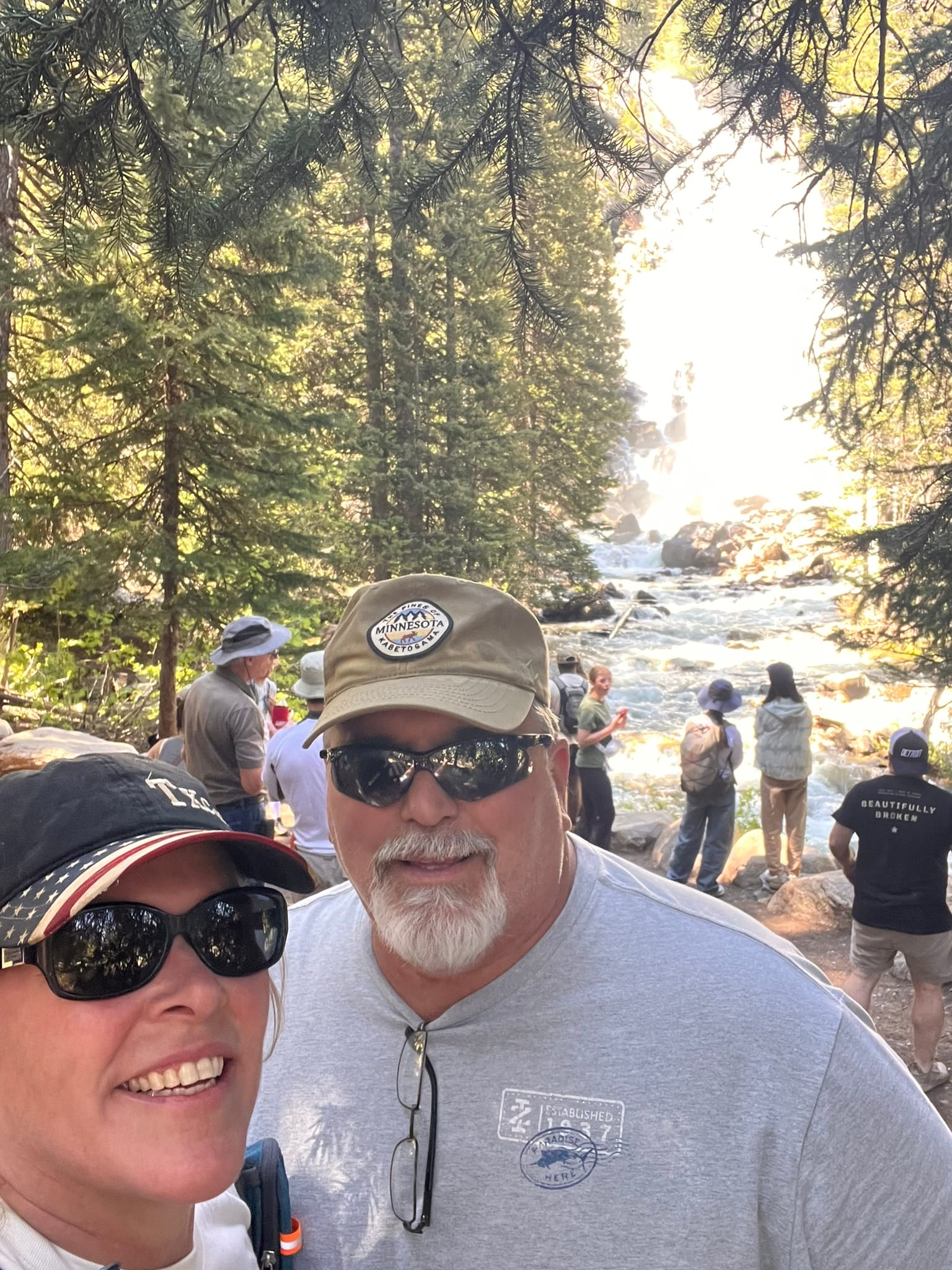
Hidden Falls behind Jenny Lake, Grand Teton National Park, Wy
On the hike back, we ran into a group of people stopped on the trail and saw that there was a momma black bear with 2 brown cubs climbing around on the rocks about 20 yards above the trail! Beautiful to see!
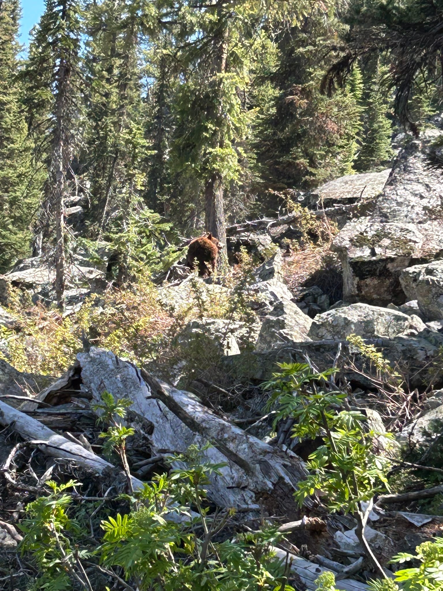
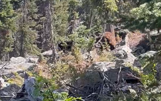
Momma Bear and Cub
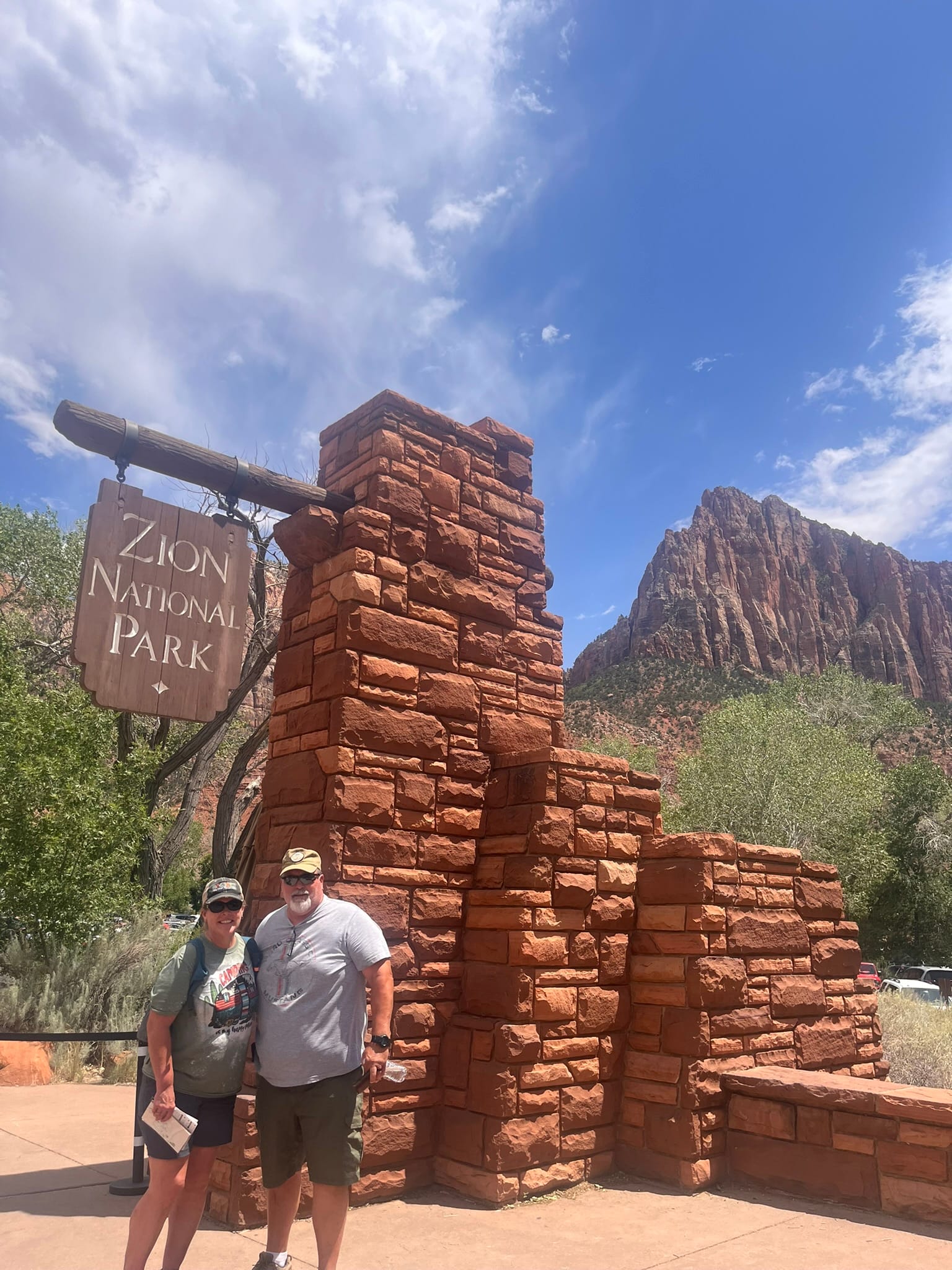
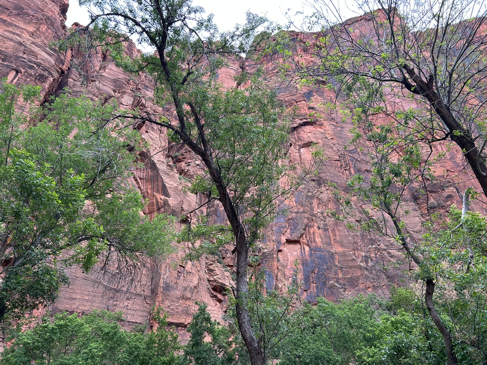
Zion National Park, UT
We drove over to Zion National Park to complete the "Utah Big 5"! The park is about an hour and a half away from our campsite near Bryce so it was a 3 hour round trip. We left around 11:30 and got to the park around 1:00 PM. The drive into the park on highway 9 from the east was very scenic! Amazing canyons that looked sculped and the rocks initially looked like a giant mason had troweled them. You could see sweeping lines in the rock. The road in has huge switchbacks down into the canyon that are amazing to see and drive!
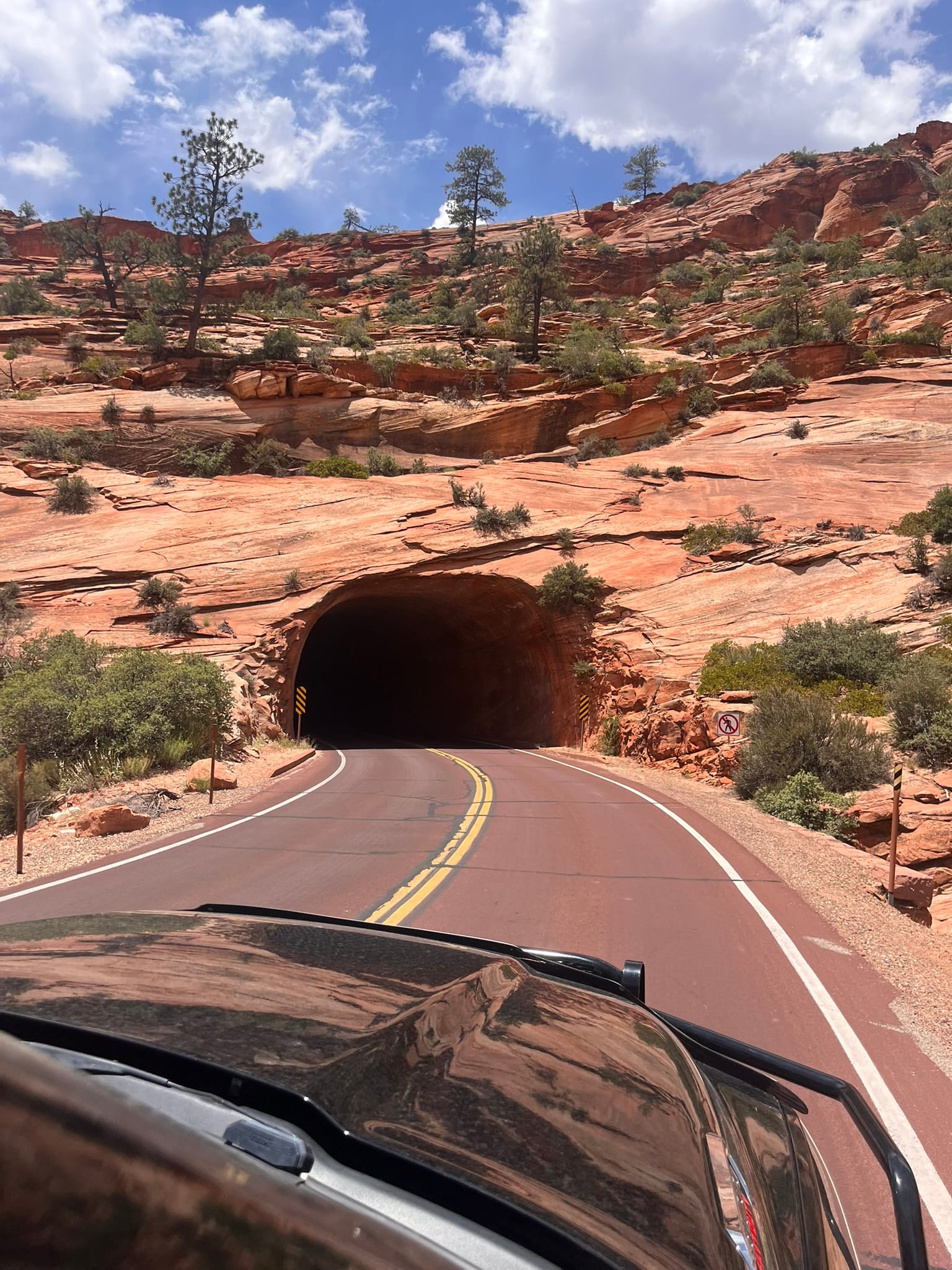
We had to pay extra for a permit because we were driving a dually and it was too wide to be able to go through the famous tunnel with traffic moving in both directions. To handle the wide or tall vehicles, the rangers alternate traffic flow when a wide/tall vehicle needs to pass through. That way we can basically drive down the middle to ensure we have enough clearance.
Even so, the drive was pretty amazing. Unfortunately, all the parking in the park was full and all the signs said to go to Springdale to park which was out of the park on the far west side. The town is basically laid out along the canyon and parking was tough to find. We finally found a place as we were heading out of town on the far side. The only saving grace was that the buses in town were all free and stopped every couple of blocks. They took you to the Visitor’s Center where you transferred to a National Park Bus for the trip into Zion. During the busy months of the year, the only vehicles allowed on the scenic drive are the buses and bicycles. It was like Disney land in there. You had to wait in lines to get on the buses which were pretty crowded. I can't imagine what this park is like later in the Summer!
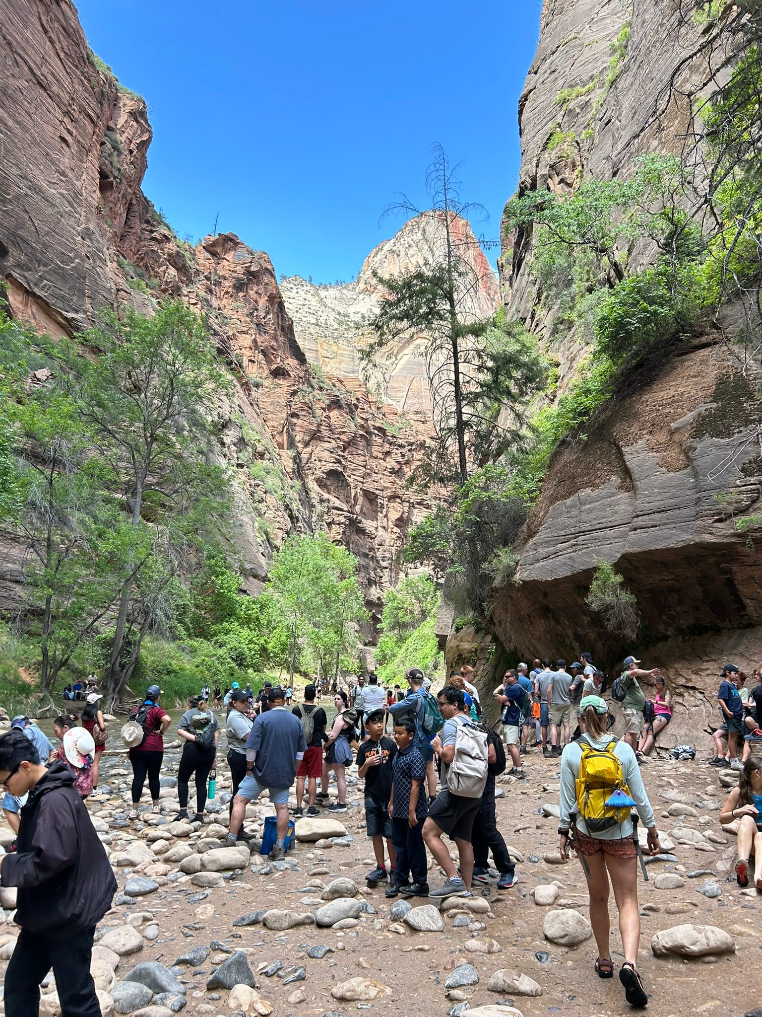
We took the bus all the way to the last stop on the Scenic Drive which is the Temple of Sinawava. That's where the trail for The Narrows begins and it's about 1.1 miles back in to the point you had to start walking in the creek. We turned around there and headed back to the bus stop and caught the bus down to The Grotto stop where we took a trail down to the Zion National Park Lodge and picked up another bus to take us back to the Visitor’s Center. We picked up our souvenirs and discovered that since it was well after 4:30 pm we were not allowed to drive back up through the tunnel at all and had to drive all the way around the long way which took 2.5 hours instead of 1.5 hours and wasn’t nearly as scenic.
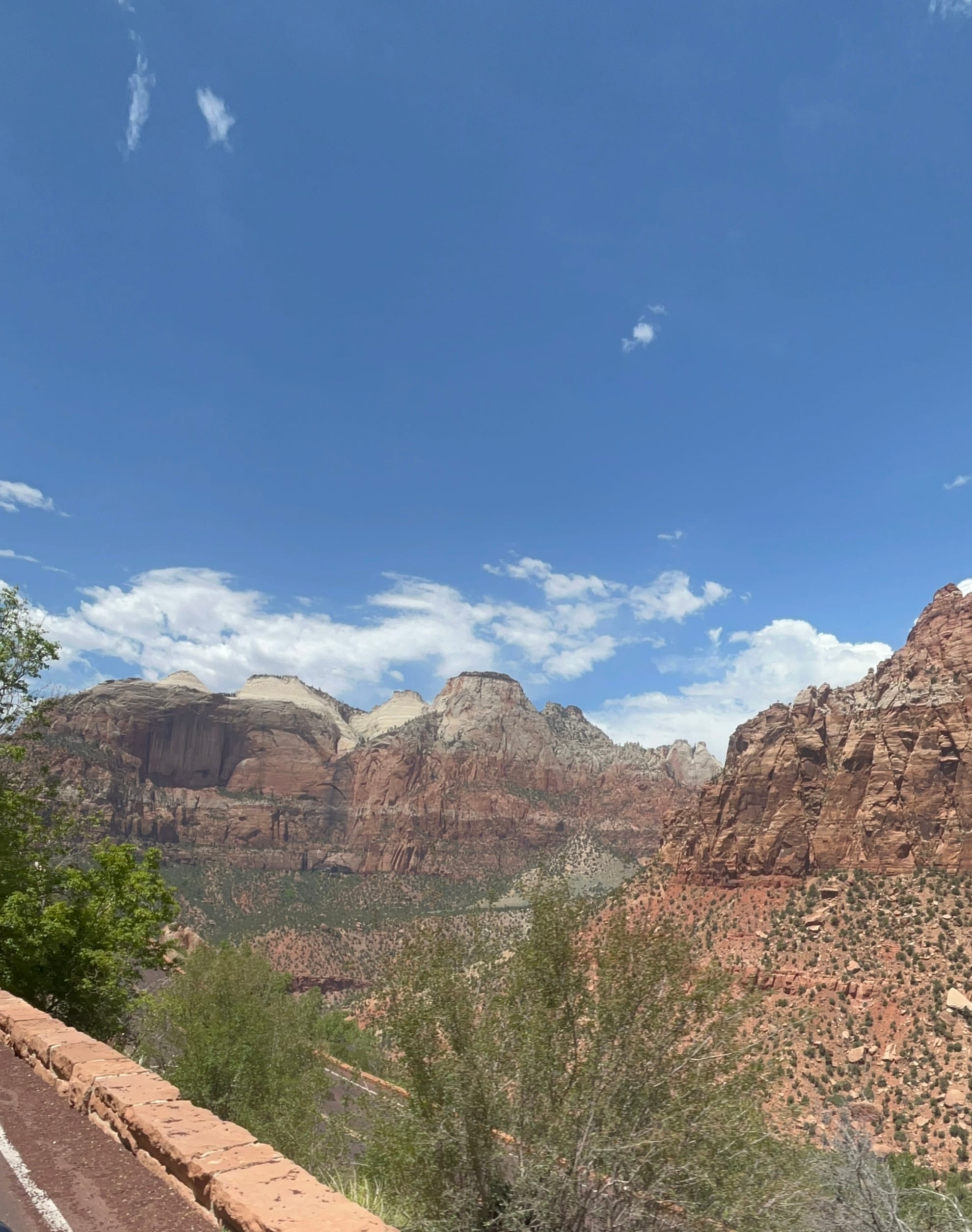
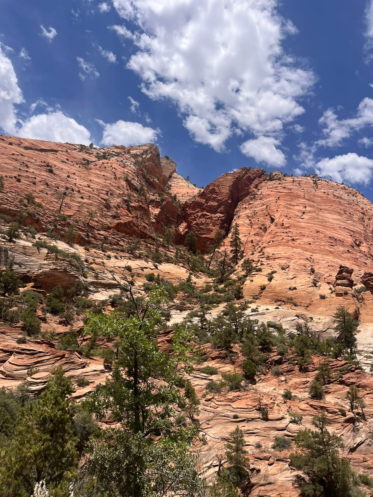
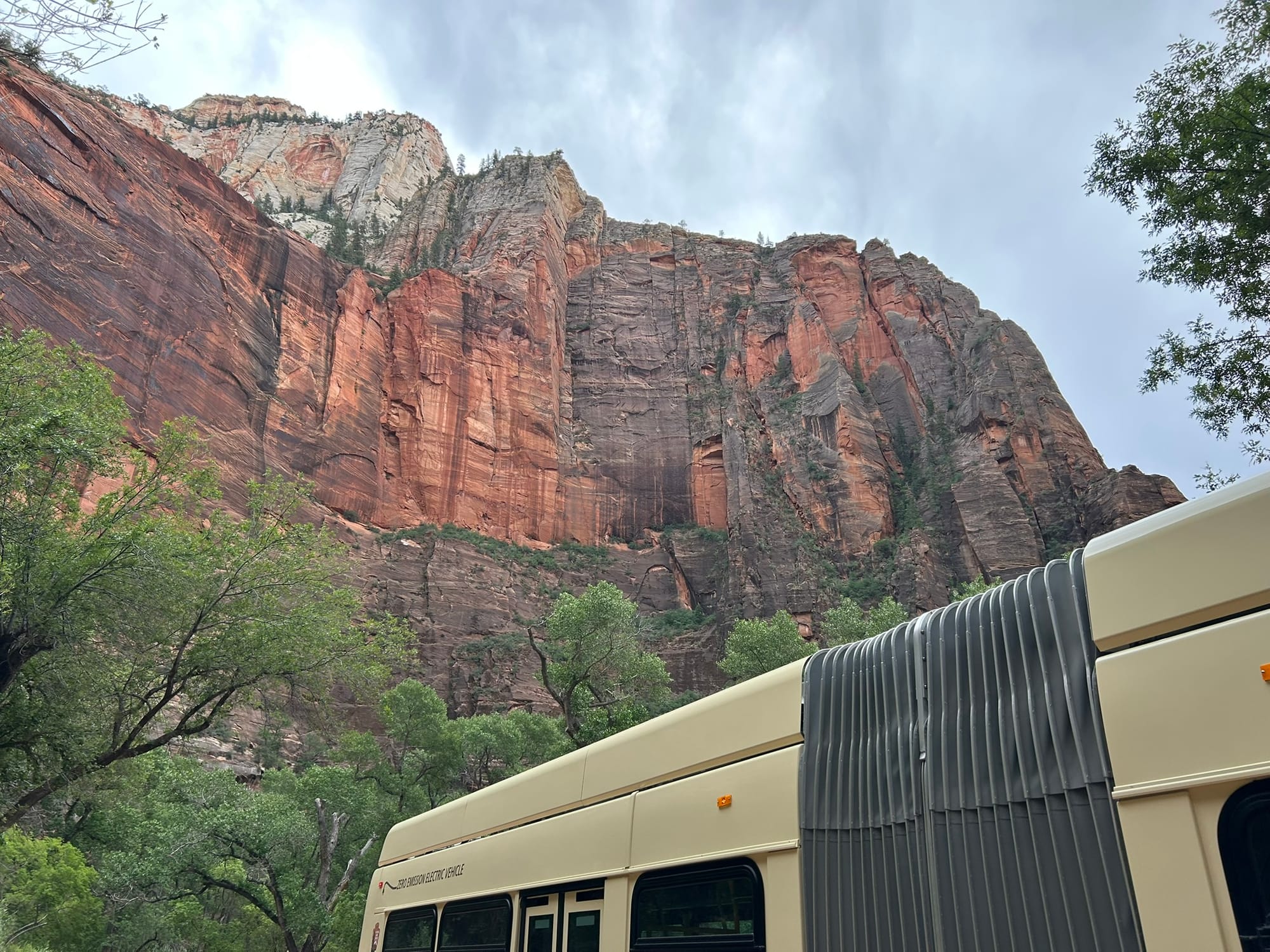
Zion National Park Scenery
Note to anyone going in: the website gives a maximum vehicle width of 7’10” to not need a permit and our truck is 7’8” but we were told “all duallys are too wide and need a permit” and we weren’t told that after 4:30 we couldn’t return back to the east on 9 at all. They really need to work on their website!
Overall, this was probably our least favorite Utah NP. It was a beautiful canyon with huge towering walls all around it but unless you are really into hiking, there’s not much for you to do except look at the canyon walls. My favorite part was the drive in from the east because it had the most interesting rock formations!
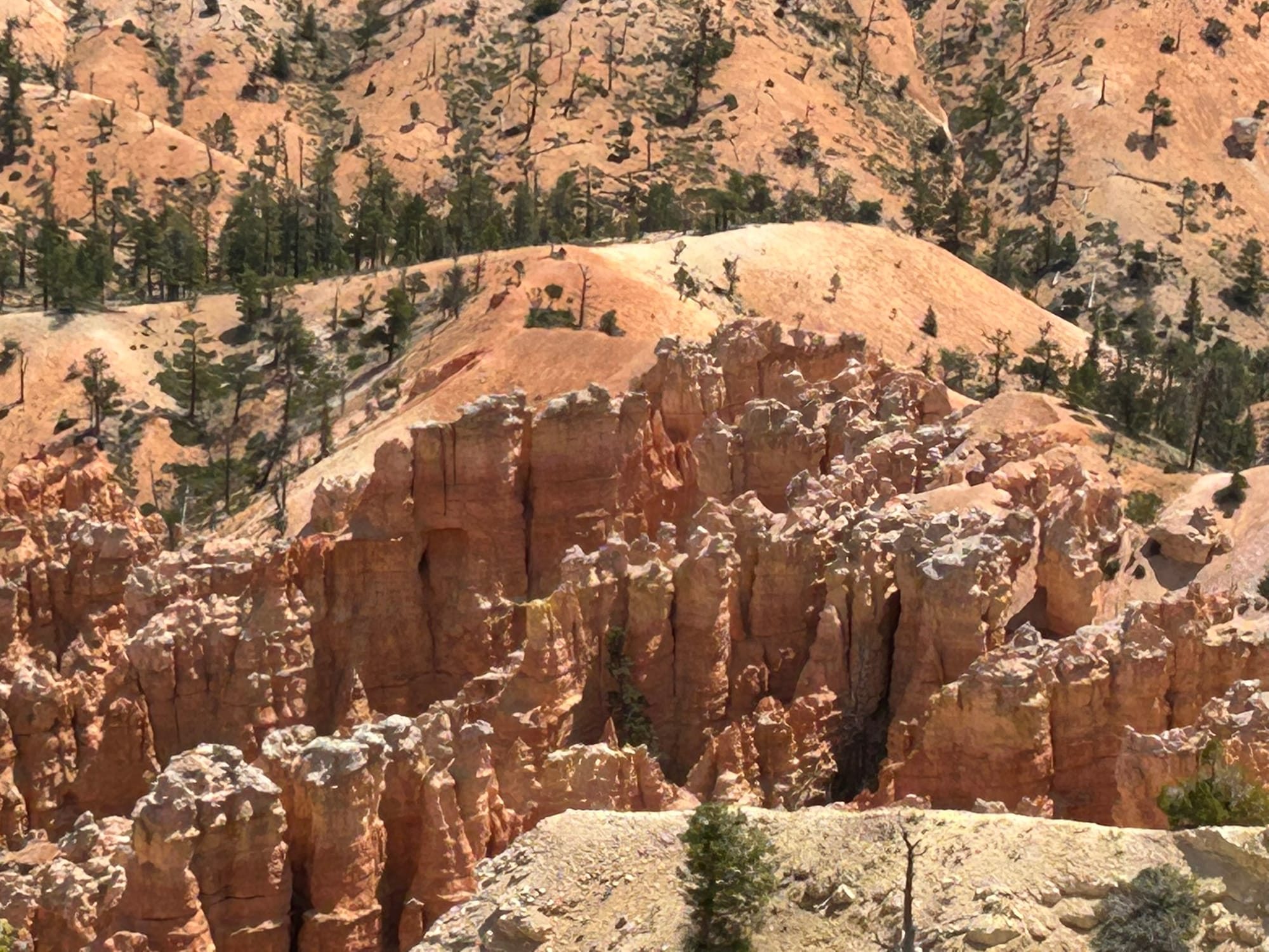
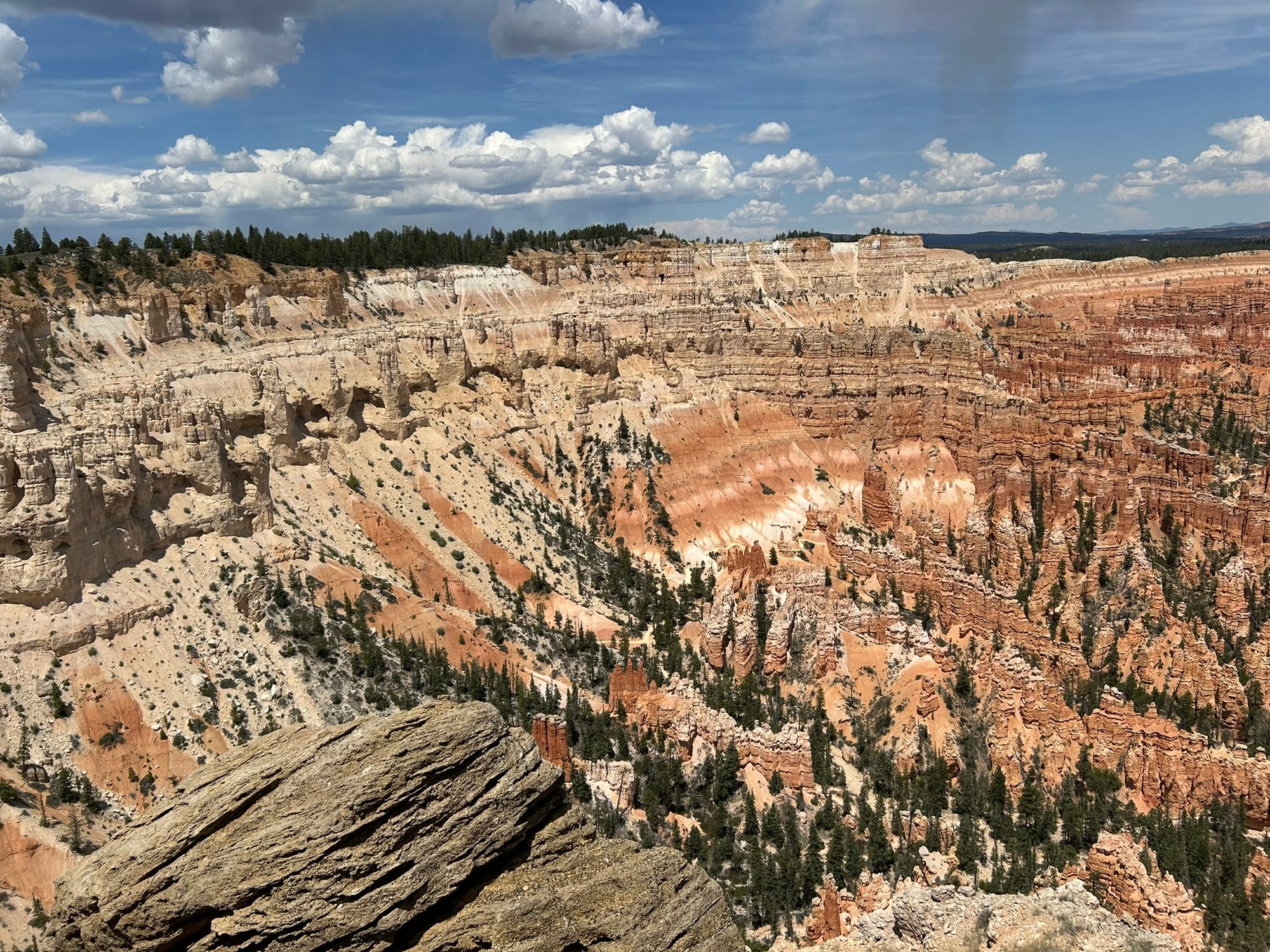
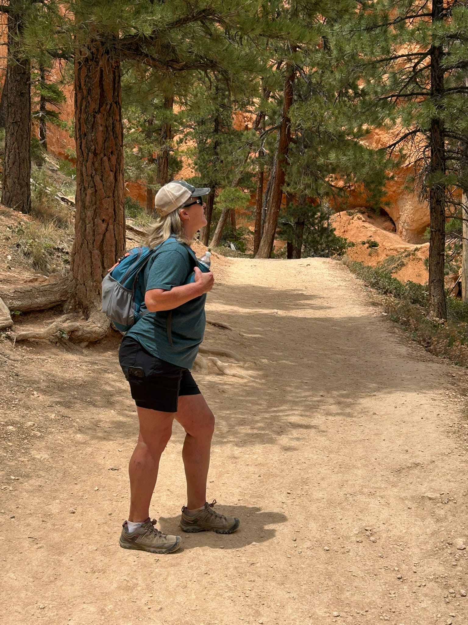
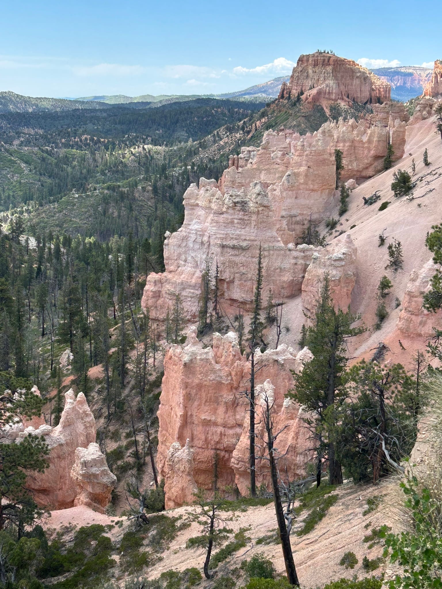
Bryce Canyon National Park, UT
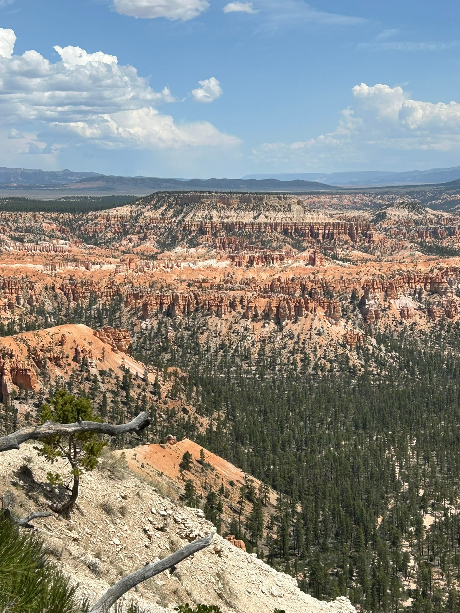
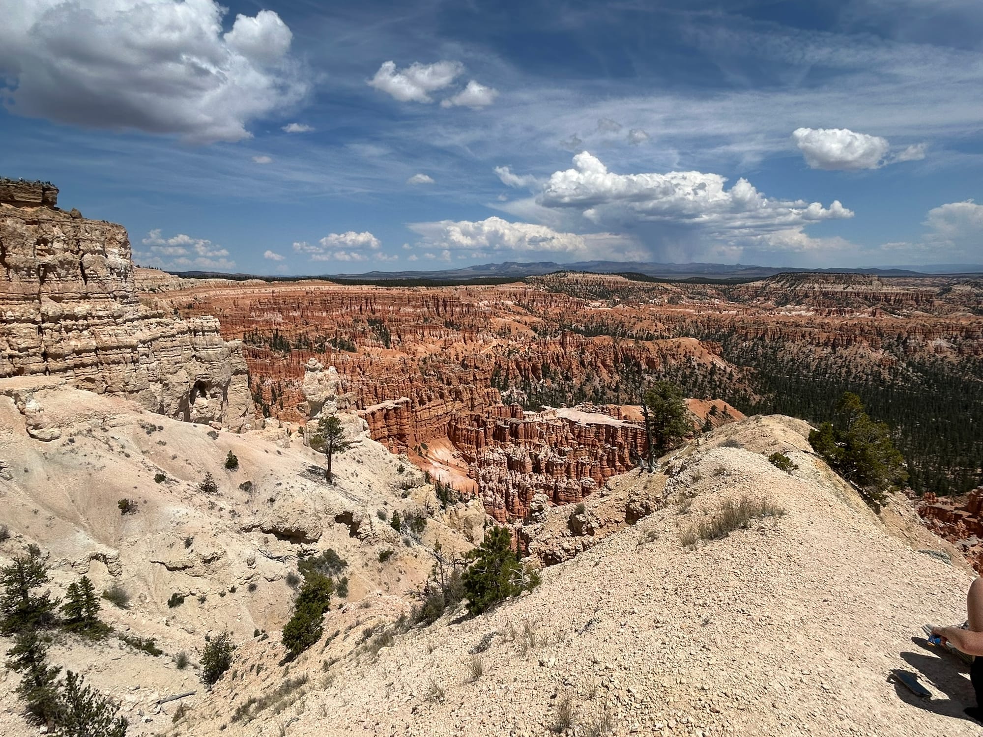
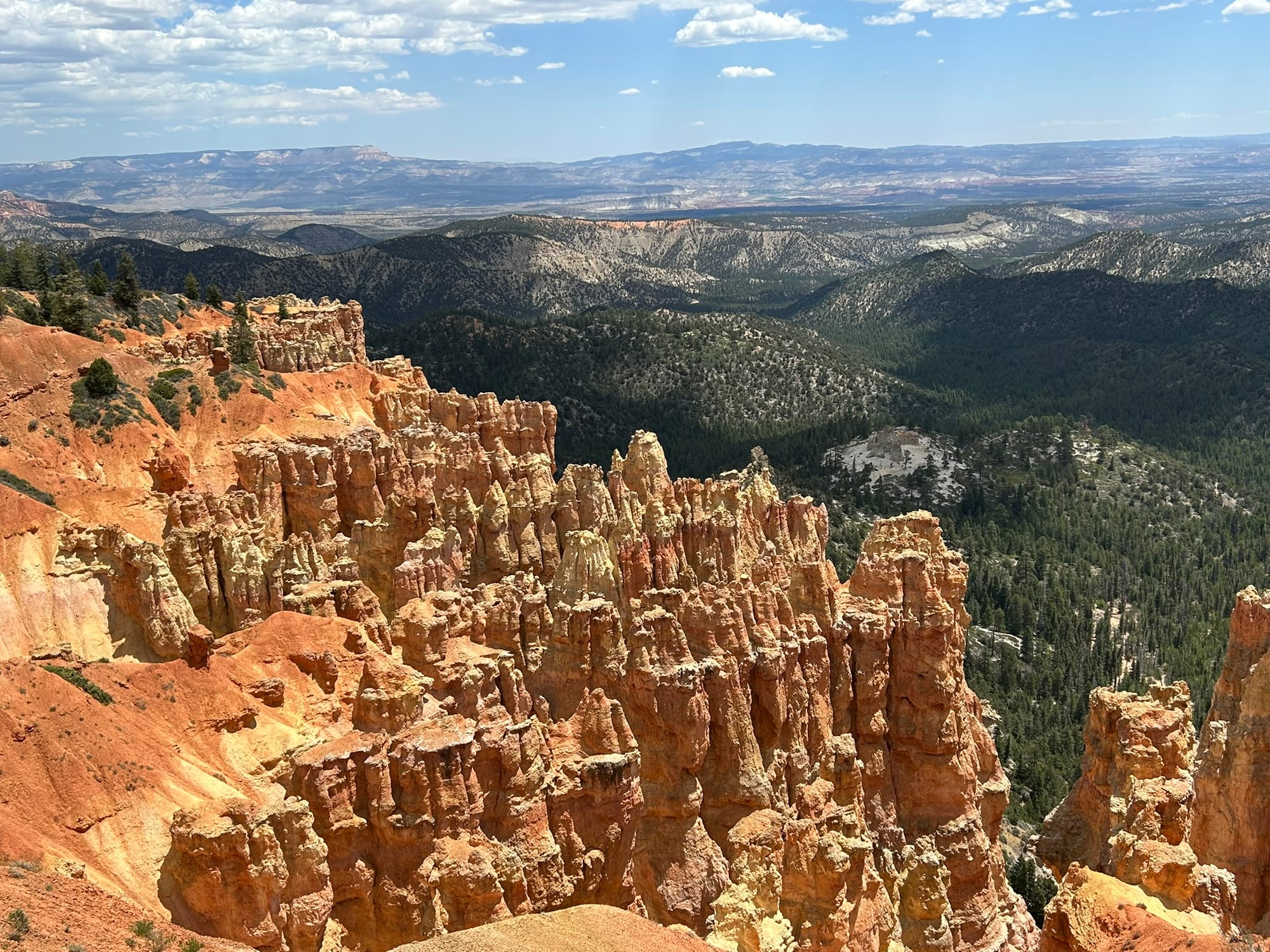
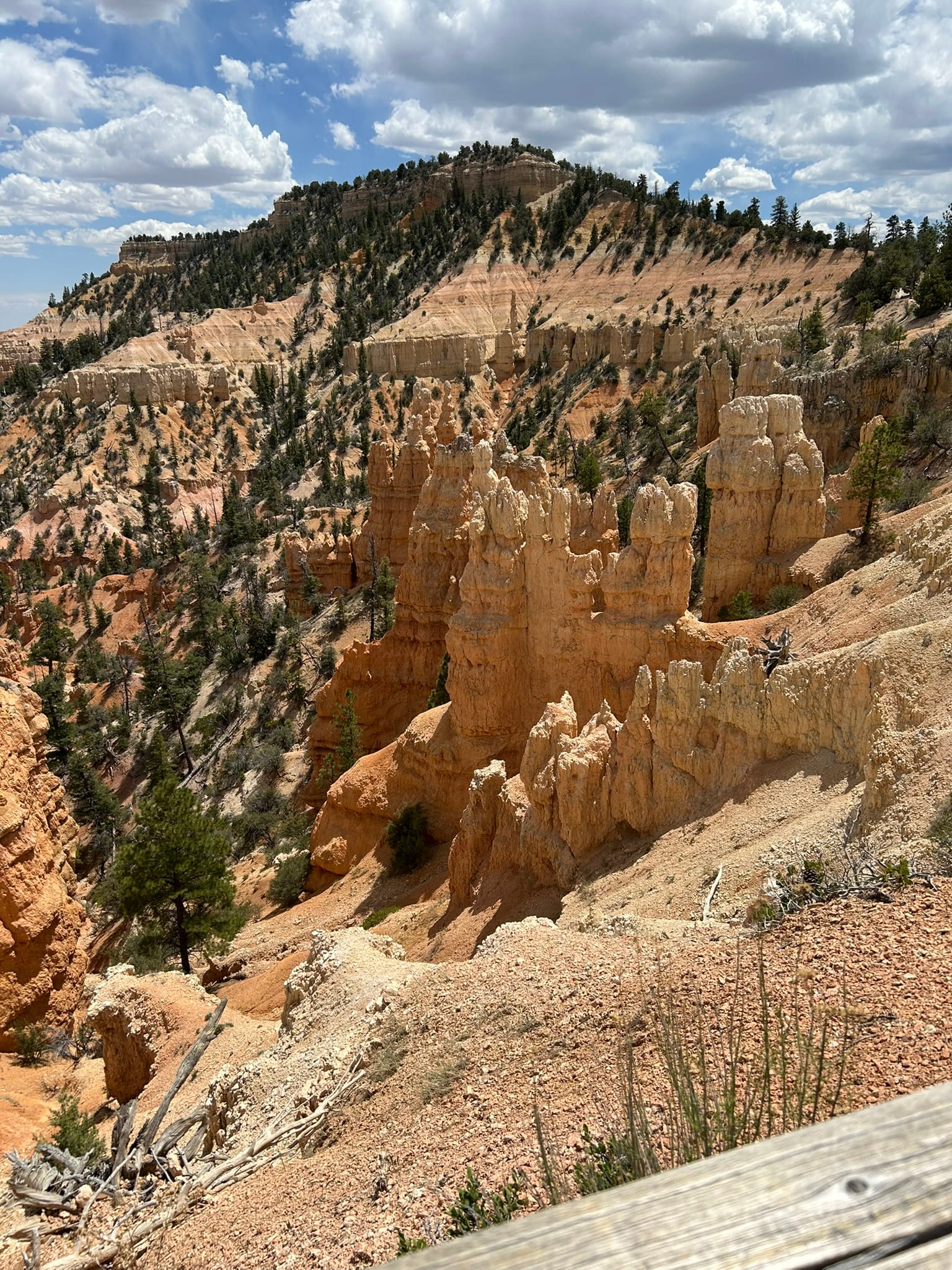
If you are counting, this makes 4 of the "Big 5" Utah National Parks! We headed out about 11:00 for Bryce Canyon National Park to see what all the buzz was about. From our campground just outside the park we caught a National Park bus in. I had reviewed some Pinterest posts yesterday about what the “don’t miss” points of interest were so we looked over the bus route and went straight down to Bryce Point which overlooks the Bryce Amphitheater. That's their name for the large bowl like structure in which there are an incredible amount of crazy rock formations! The finger-like, or chimney-like formations are called Hoodoos and there were thousands of them all over the park! Most of the hikes from this spot were long and difficult so we chose to just walk down a little ways on a trail to get a better and closer look at the formations. There was a young lady out there all by herself and she had one of the best views around! Kim and I had kind of figured that if someone had parked themselves at a spot like that, it must have been spectacular and it definitely was!
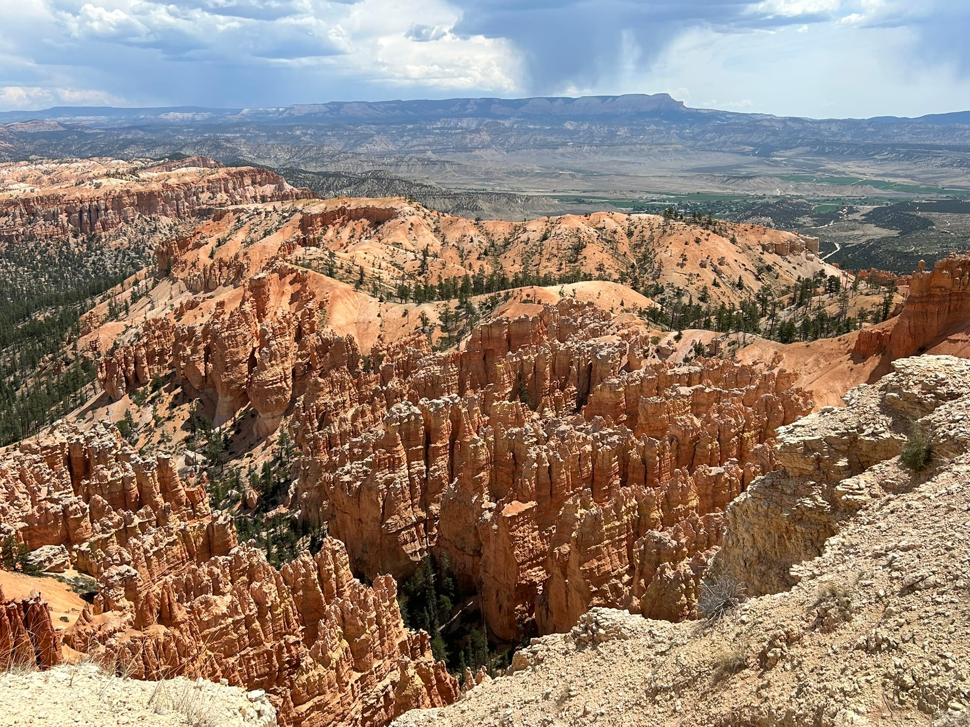
The views from Bryce Point
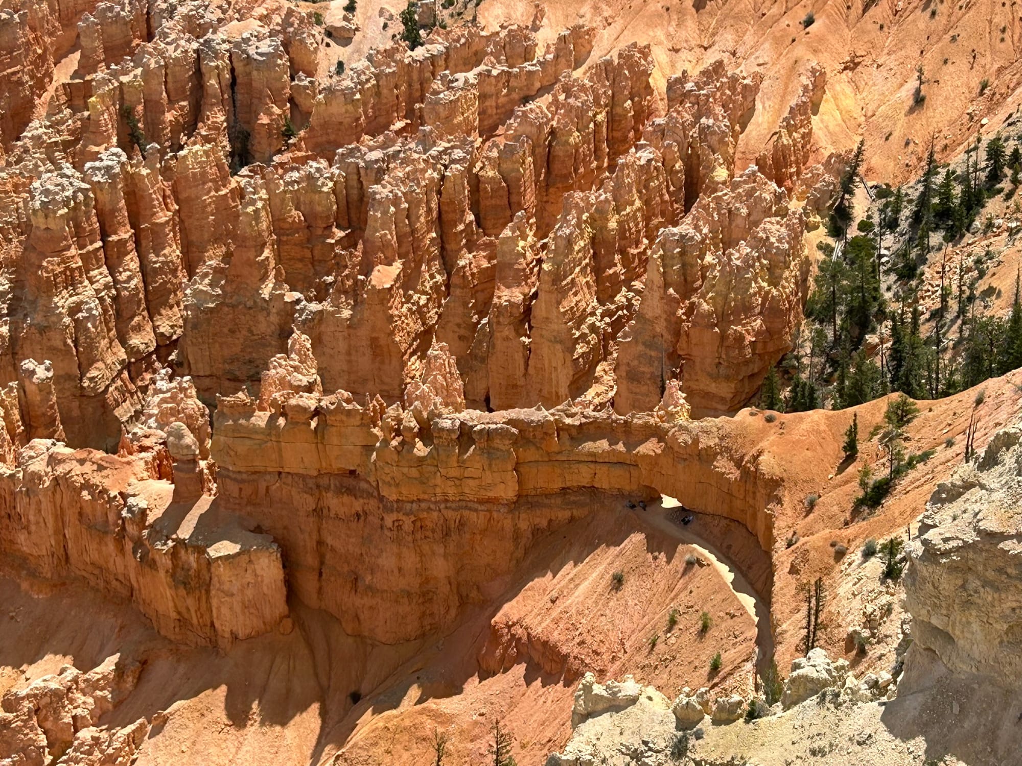
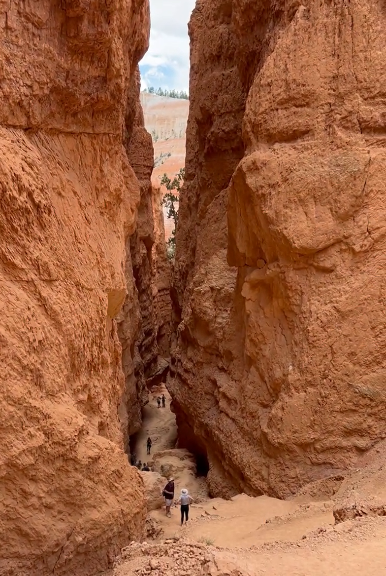
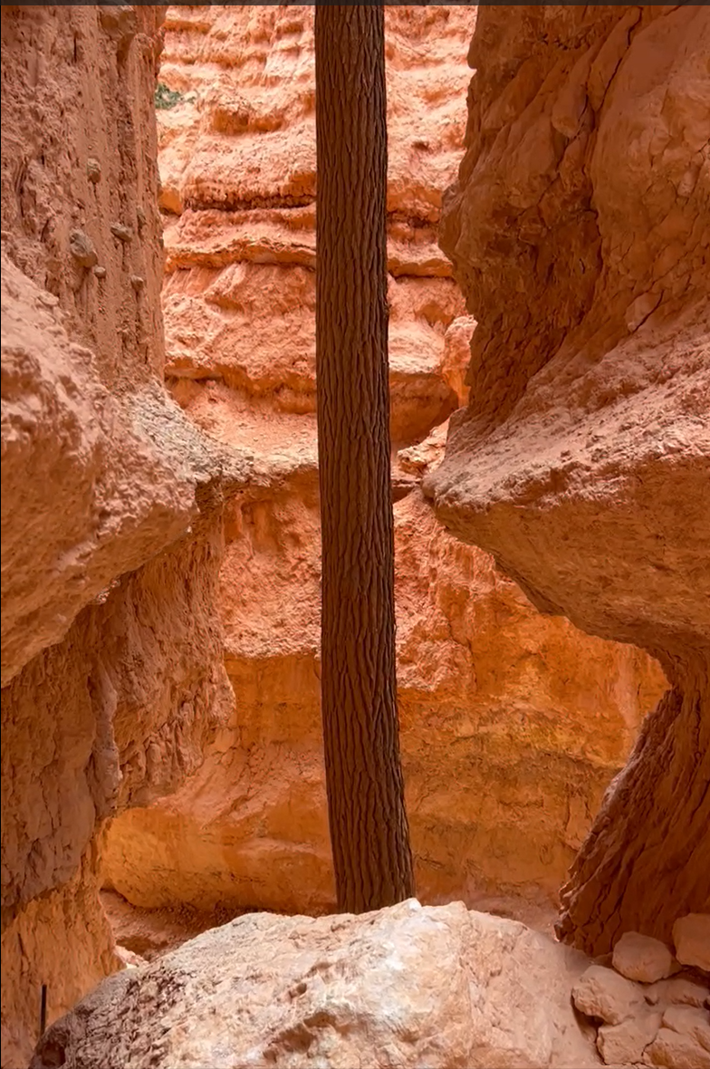
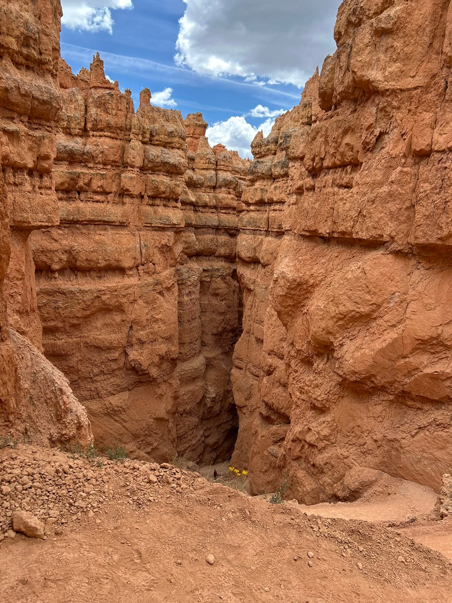
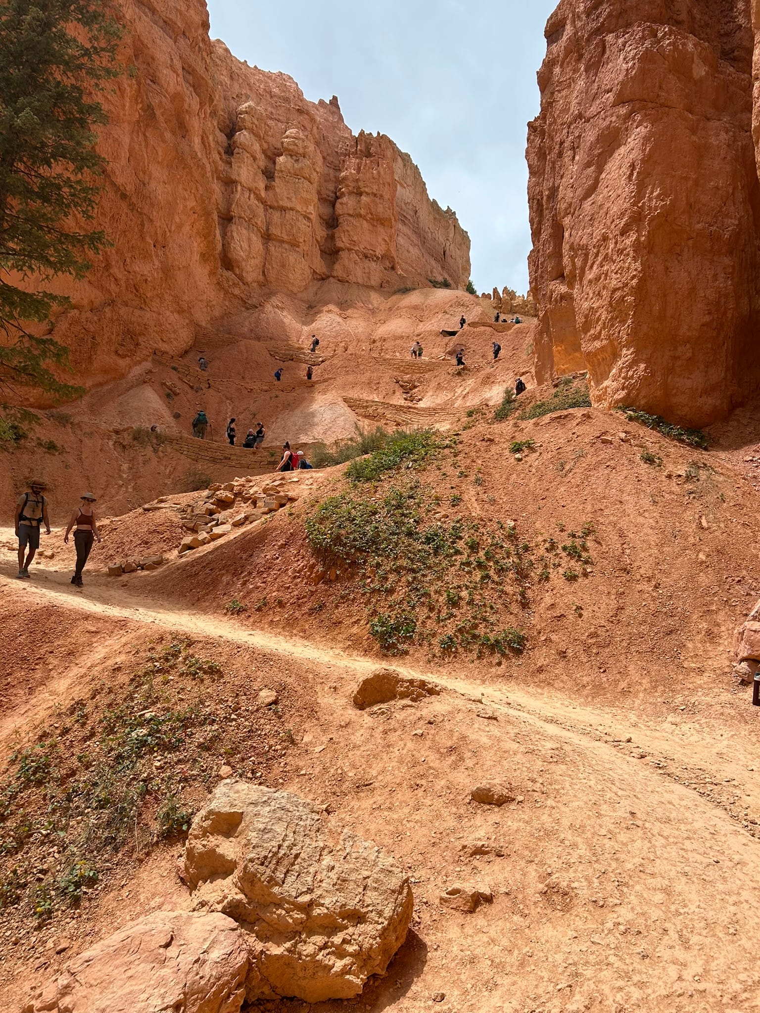
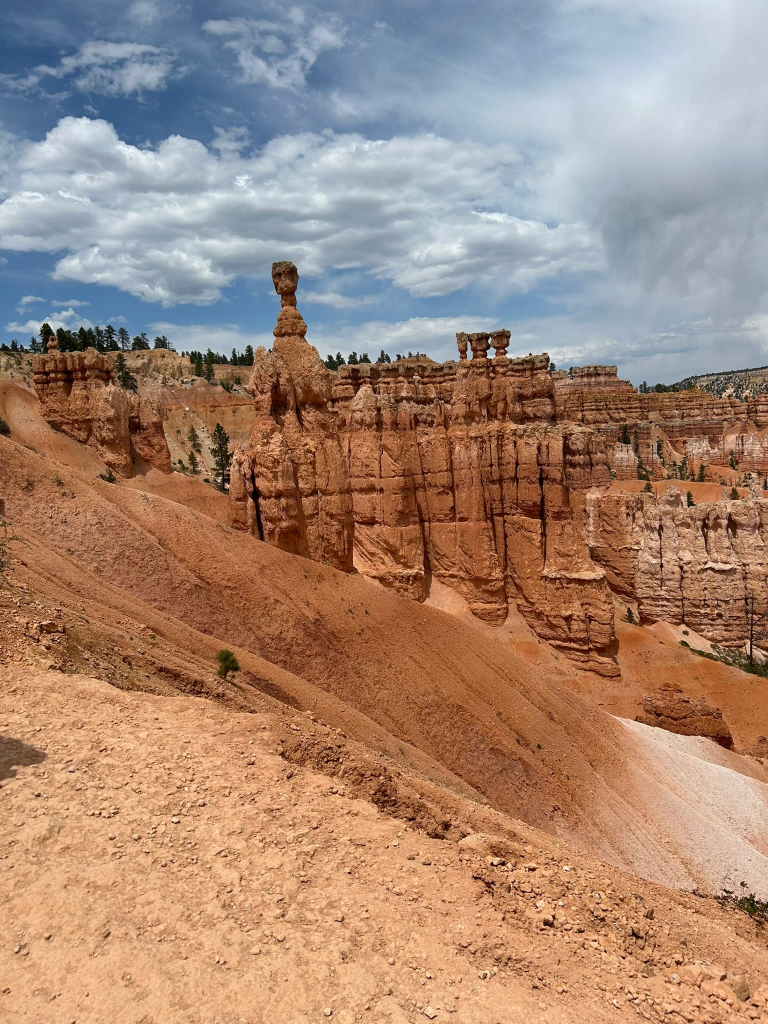
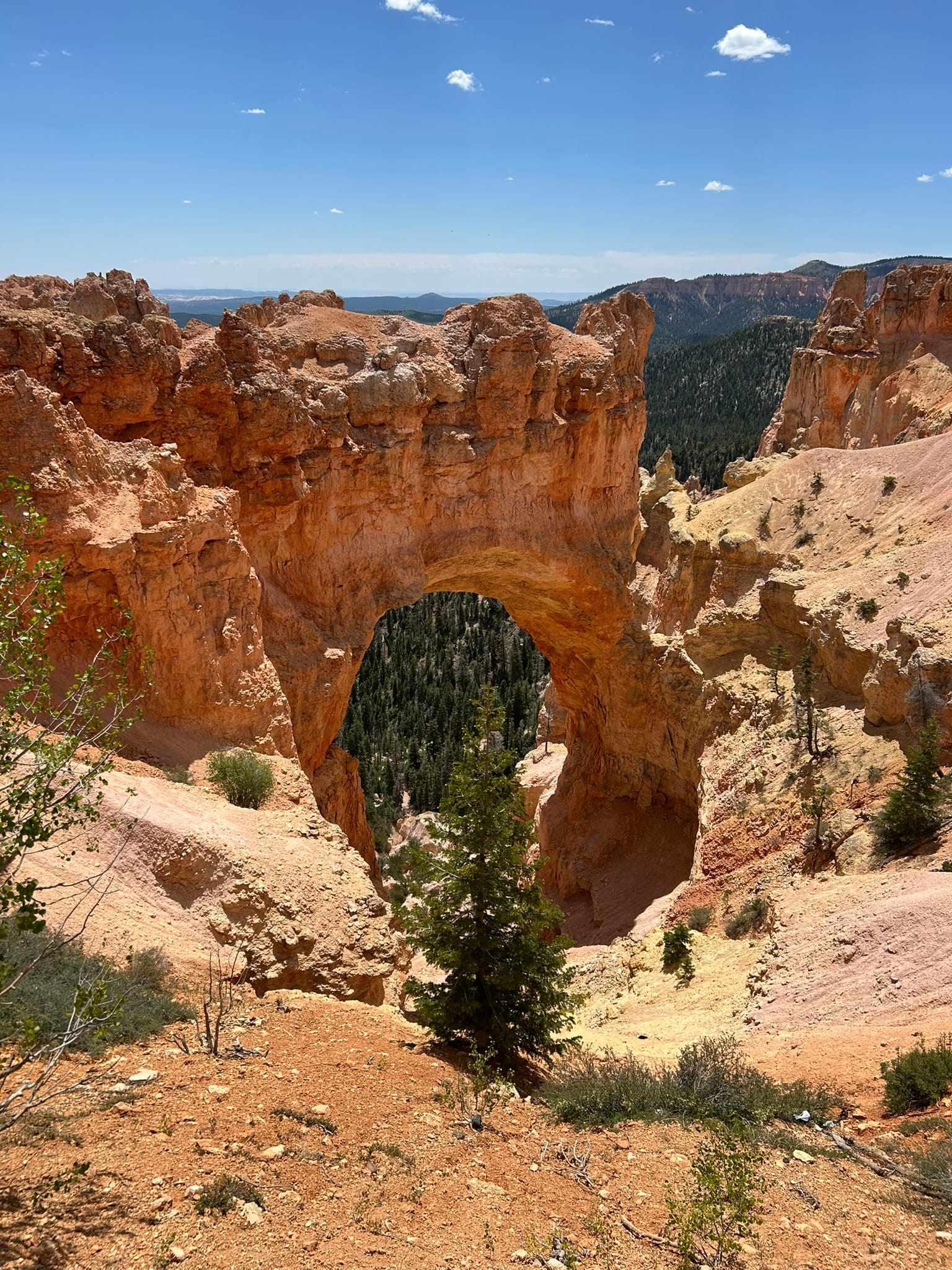
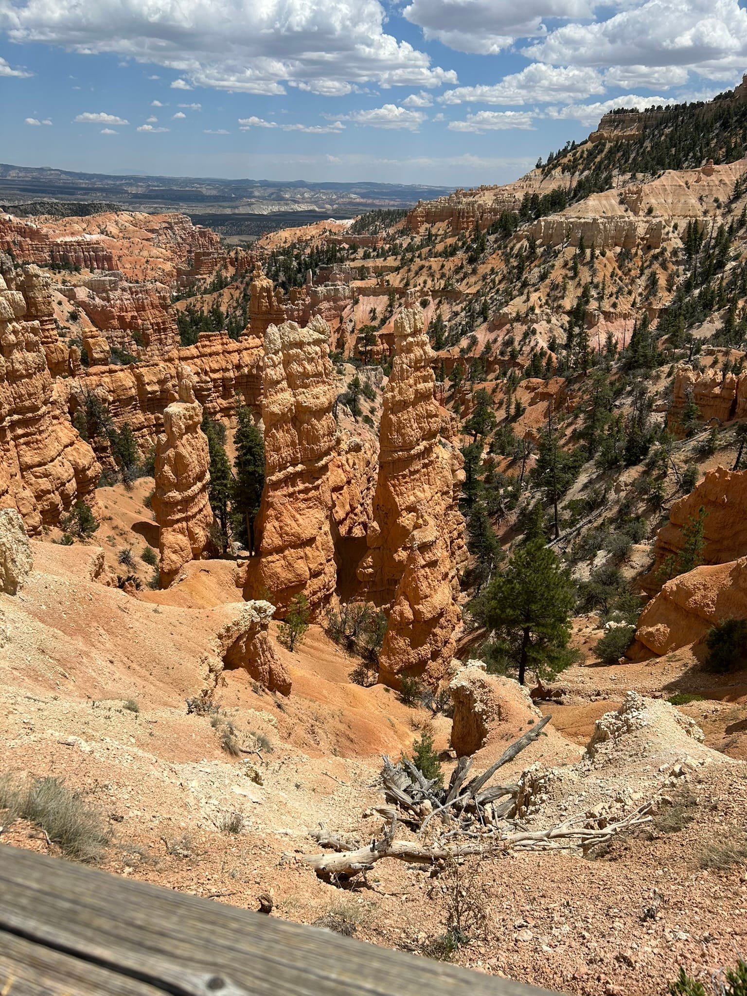
We headed back up and caught the next bus and passed on Inspiration Point since it overlooks the same formations and got off at the next stop – Sunset Point. We had seen some photos from the Navajo Loop hike that began there and the photos were amazing. We walked around the rim at this location looking at all the amazing rock formations and then started down the Navajo Loop trail towards Wallstreet first. It’s basically switch backs down into a slot canyon between the Hoodoos towards the floor of the canyon 560 feet below! As we neared the bottom there were 3 or 4 huge pine trees growing up between the Hoodoos in the slot canyon that were just astounding to see! I can’t get tomatoes to grow in fertile planting soil and here these trees are thriving in this kind of rock!
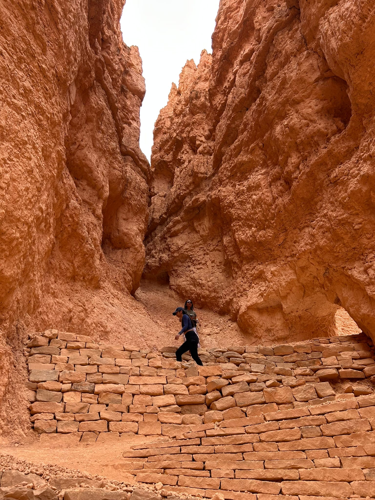
The descent into Wallstreet
As we exited the slot canyon, the forested floor of the canyon was laid out before us. We continued to descend though at a slower pace until we hit the split where the Navajo Loop headed back up the canyon walls and a different trail led off across the floor of the canyon. That climb back up to the top of the canyon nearly killed me! We got good photos though (and no ambulance was needed, at least for me!)
The views on the Navajo Loop Trail
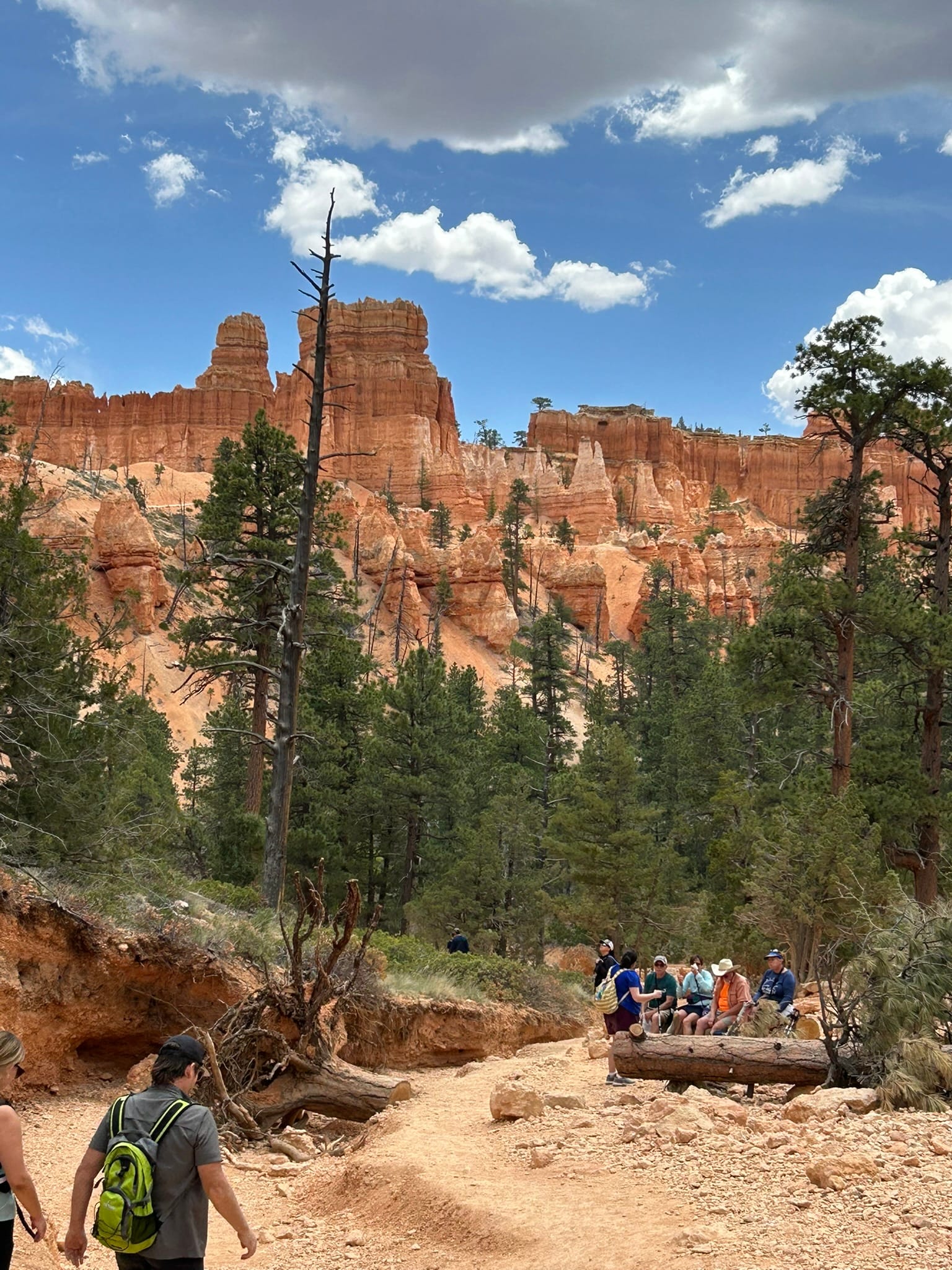
After that we rested for a bit and caught the next bus for the Visitor’s Center to get our patch and some gifts and finally caught the bus back to our campground where we rewarded ourselves with some ice cream! All said, we walked 2.2 miles almost all switchbacks down and up the canyon walls. Not bad for a couple of rookies!
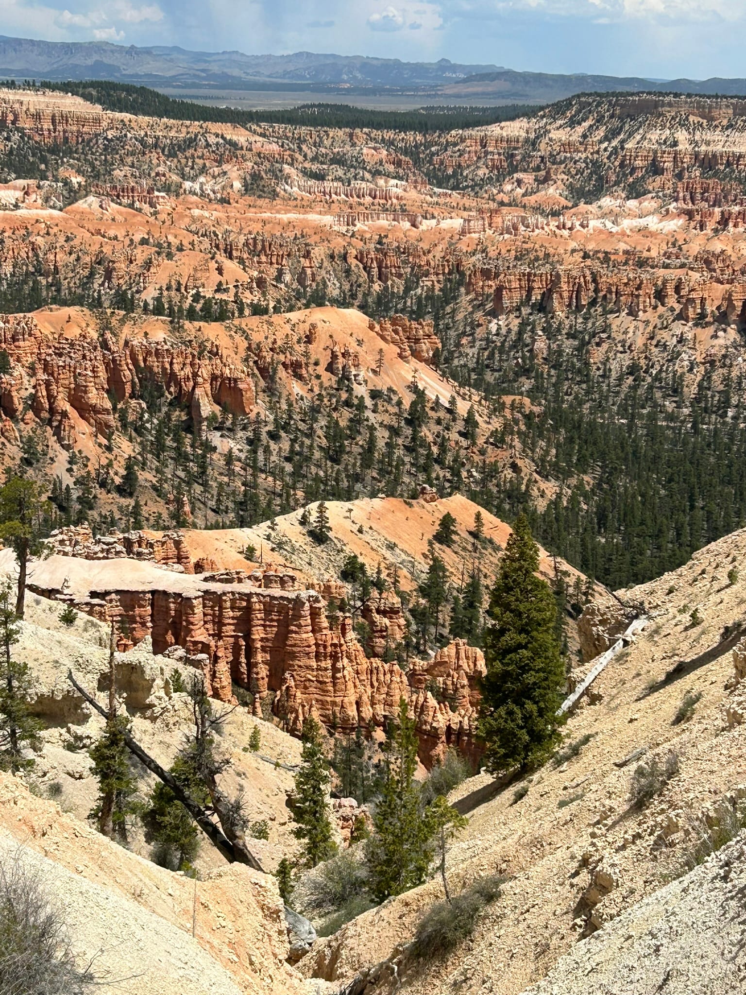
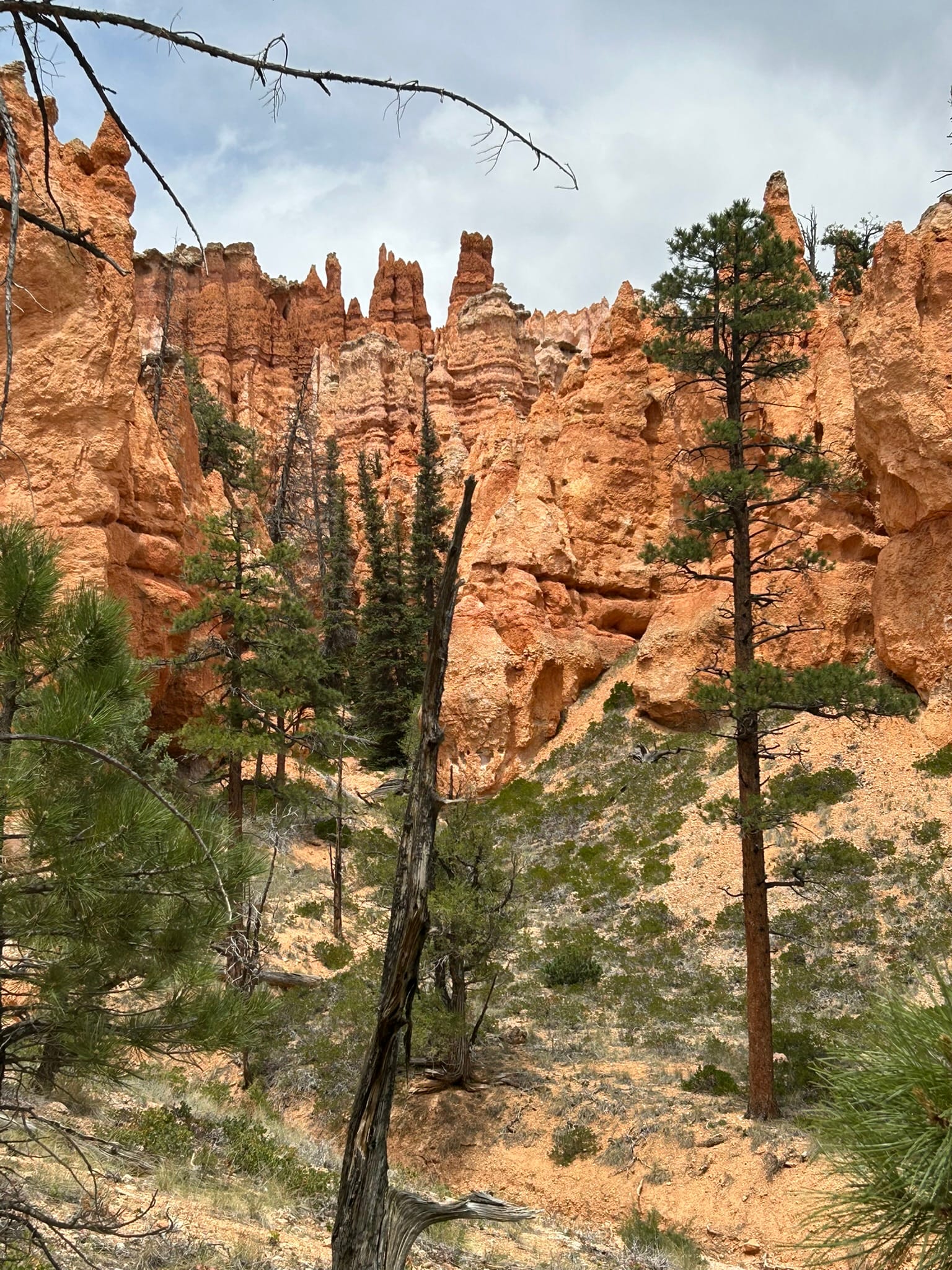
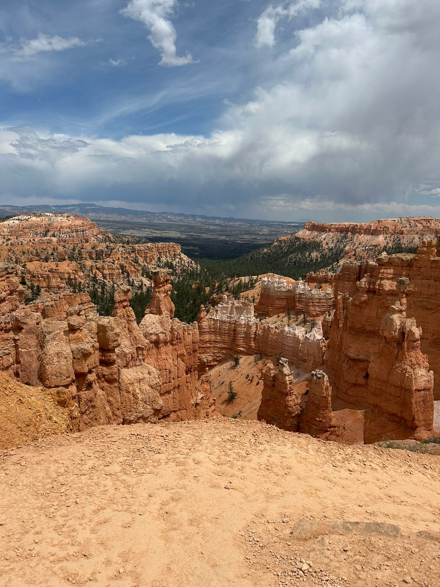
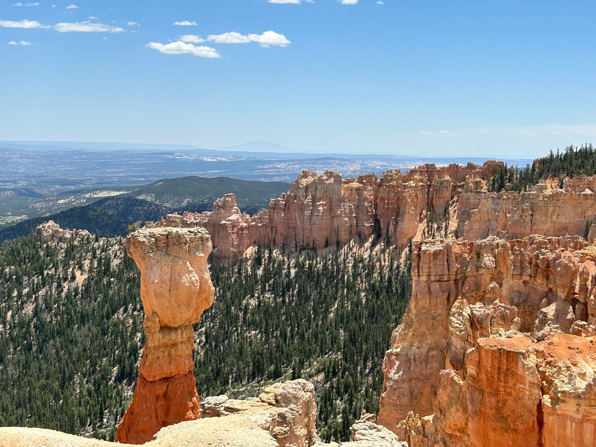
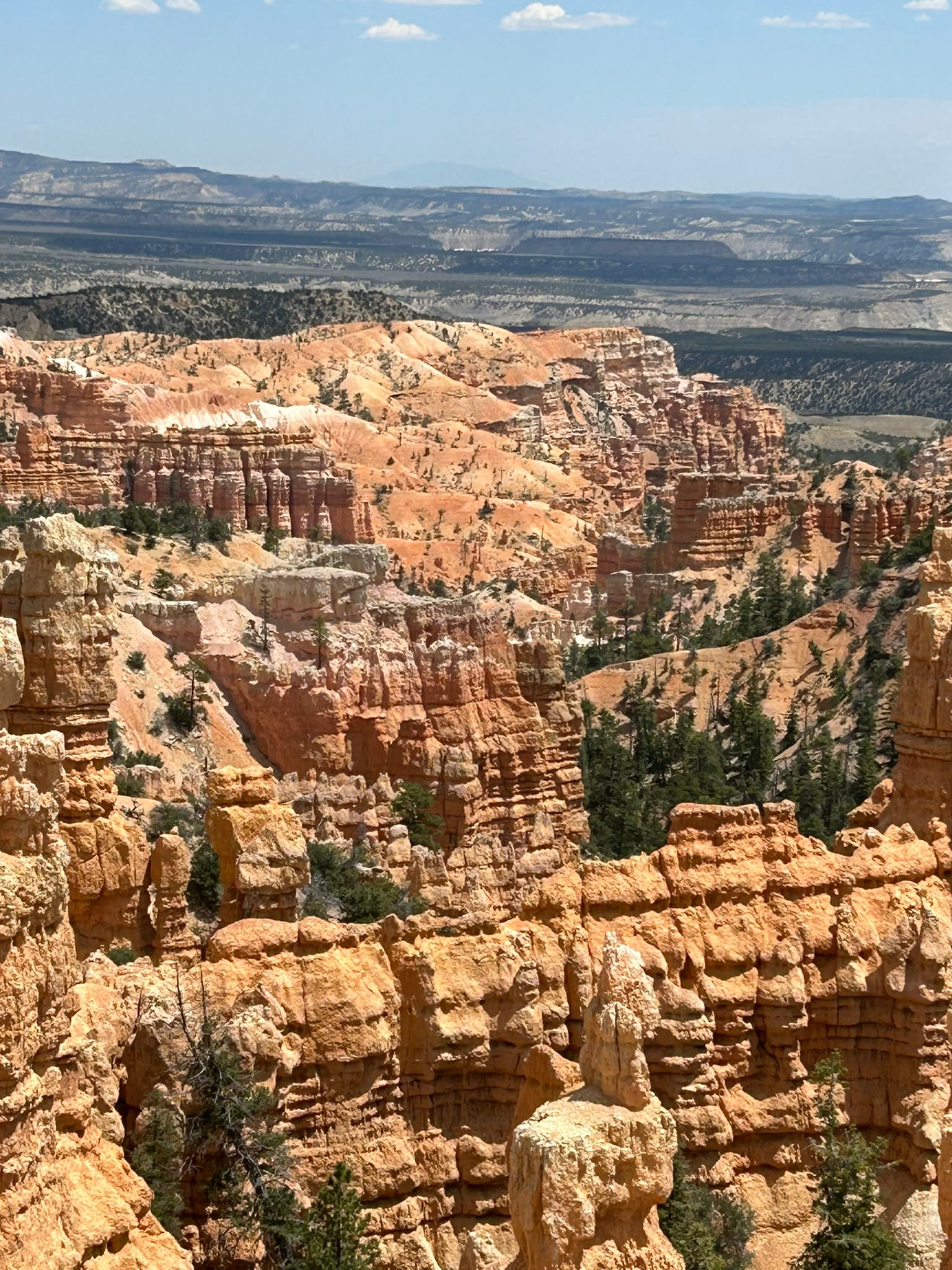
The buses don’t go to all the cool overlooks so even though they try to get everyone to take the buses into the park, to see all the stuff you have to drive yourself. So the second day, we drove into the park and headed all the way down to the end stopping at almost every overlook. The whole park feels like it's along the edge of a huge cliff from which the Hoodoos are eroding over time. As we went further back toward the Natural Bridge and Rainbow Point the altitude got higher until we were over 9100 feet. Each viewpoint has additional views of the huge canyon with Hoodoos and other rock formations that are just beautiful. They are spread out a lot more at this end so I can see why the buses don't run all the way down to the end. It's 18 miles from the park entrance sign to the end of the road at Rainbow Point. The buses only cover the first 5 miles or so.
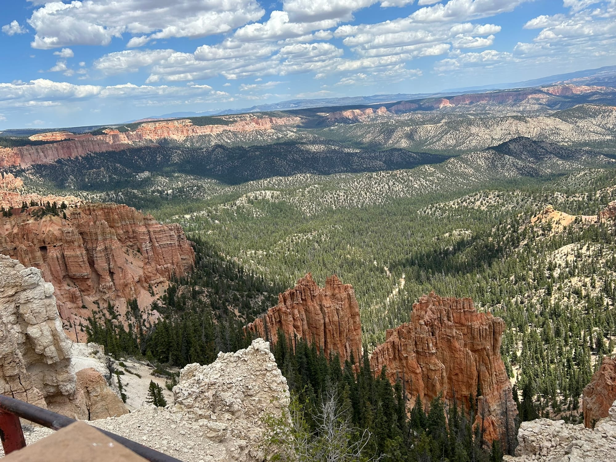
Views from the southern most end of Bryce Canyon including Natural Bridge and Rainbow Point
There's also an area called Fairyland Point whose turnoff is before the park entrance and it leads to another amazing area of spectacular views. We stopped there on the way out of the park on the second day.
Views from Fairyland Point
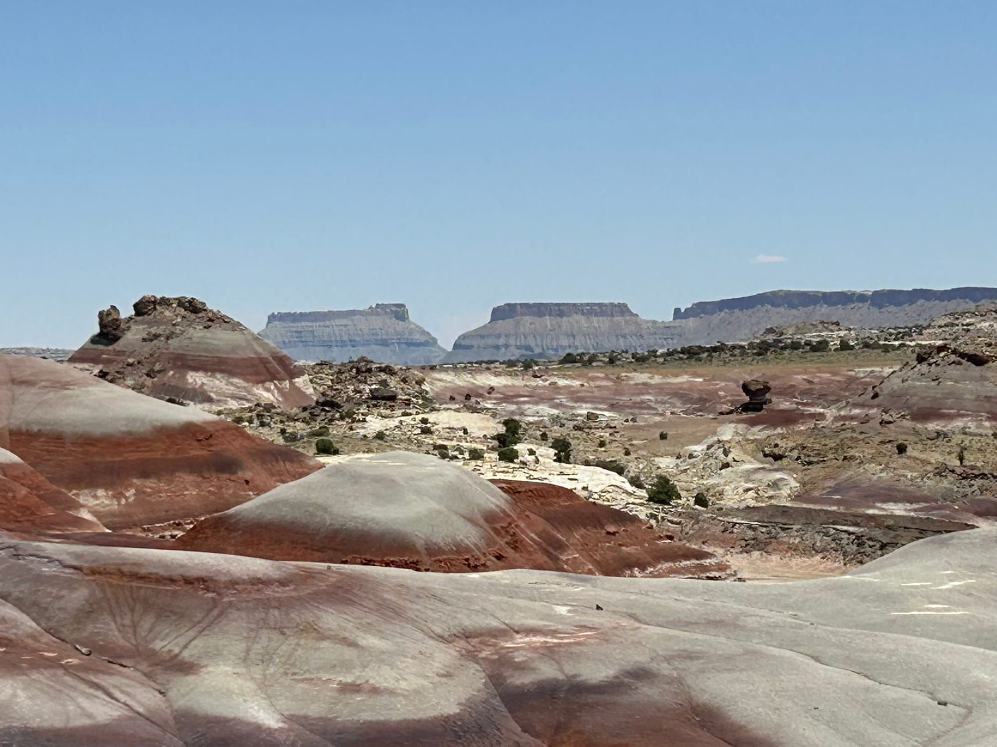
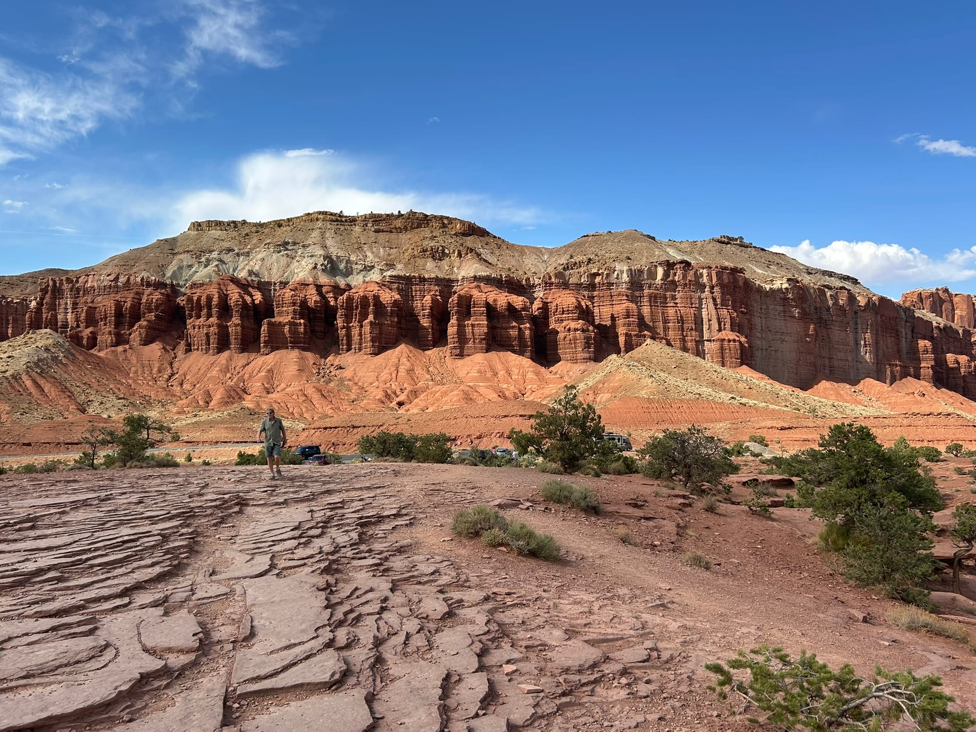
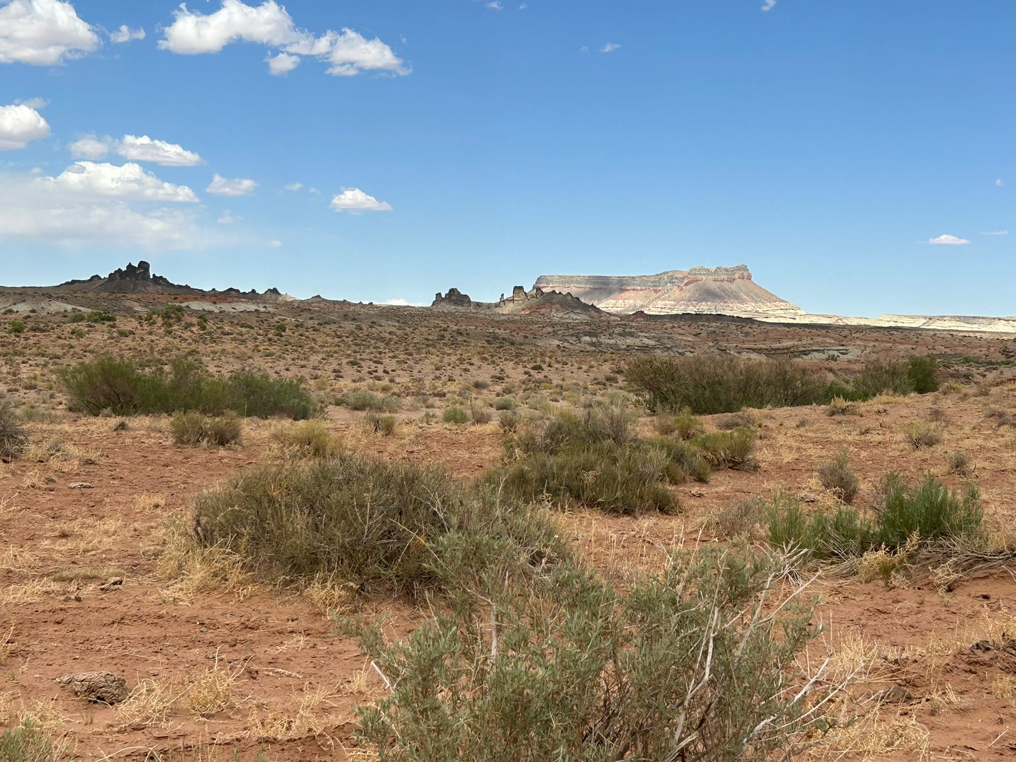
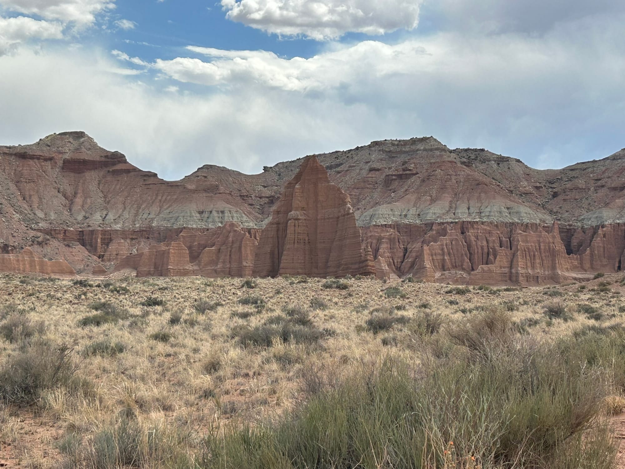
Capitol Reef National Park, UT
Utah continues to wow us! We took the rented Jeep out for a ride through Capitol Reef National Park today. We dropped by the visitor center and they recommended we drive the Cathedral Valley loop road so we decided to pass on the short hike to a natural bridge nearby and do the drive. First though, we followed the suggestions of many friends who have been here and drove down the road next to the visitor center to Gifford House where they sell homemade fruit pies! We wanted to try one but wound up with three!
After that we backtracked a bit to top off our gas tank before heading out for the “6 to 8 hour drive” according to the ranger at the VC. We had to head back to the east about 15 miles to the “River Ford” location which was the nearest entrance to the drive. As the name suggests one of the first things we had to do was cross the river. Luckily, it was only about 6-8 inches deep and we had seen a smaller vehicle come across in the other direction so we knew we could do it and that there was no drop offs in the area where he drove.
The drive was really rough most of the way around. The dirt road alternated between complete cobble, washboard for miles, sand pits and then you’d get a short smooth section of road that you could drive at a reasonable speed. The 45 mile loop dragged on interminably between the scenic sections I have to admit. It wasn't like the Monument Valley drive where every step of the way there were amazing monuments to see. It was a fun day “Jeeping” even so! Some areas looked like the Badlands with all the mounds of rainbow colored soil, some sections looked like Monument Valley with the majestic buttes and still other sections looked like Canyonlands with it’s massive walls of rock. It was a beautiful drive but by the end, 4 long hours later, I was tired of the bumps and my ab muscles had had a pretty good workout! I am very glad we rented a Jeep and didn’t take the 3500, Kim would have been yelling at me to slow down the whole way!
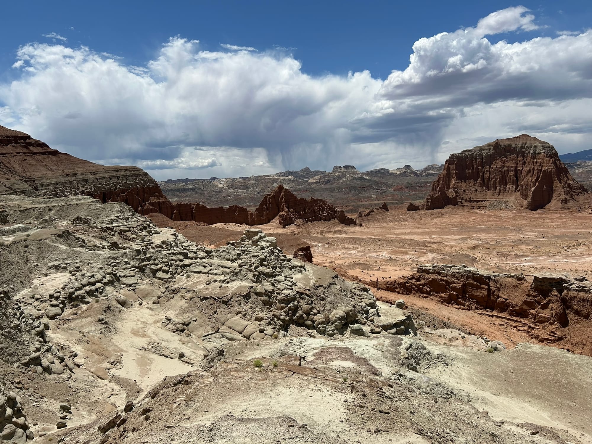
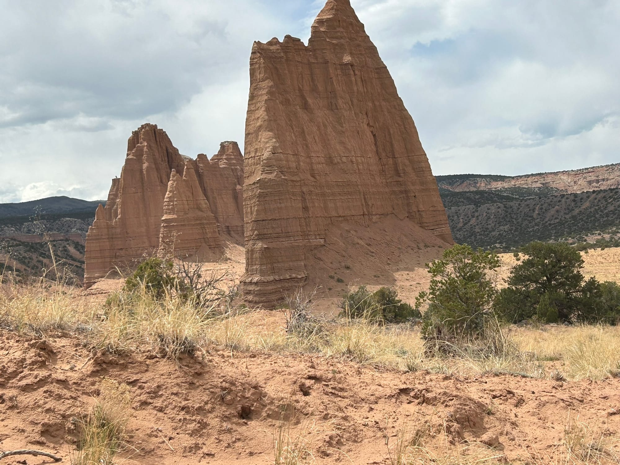
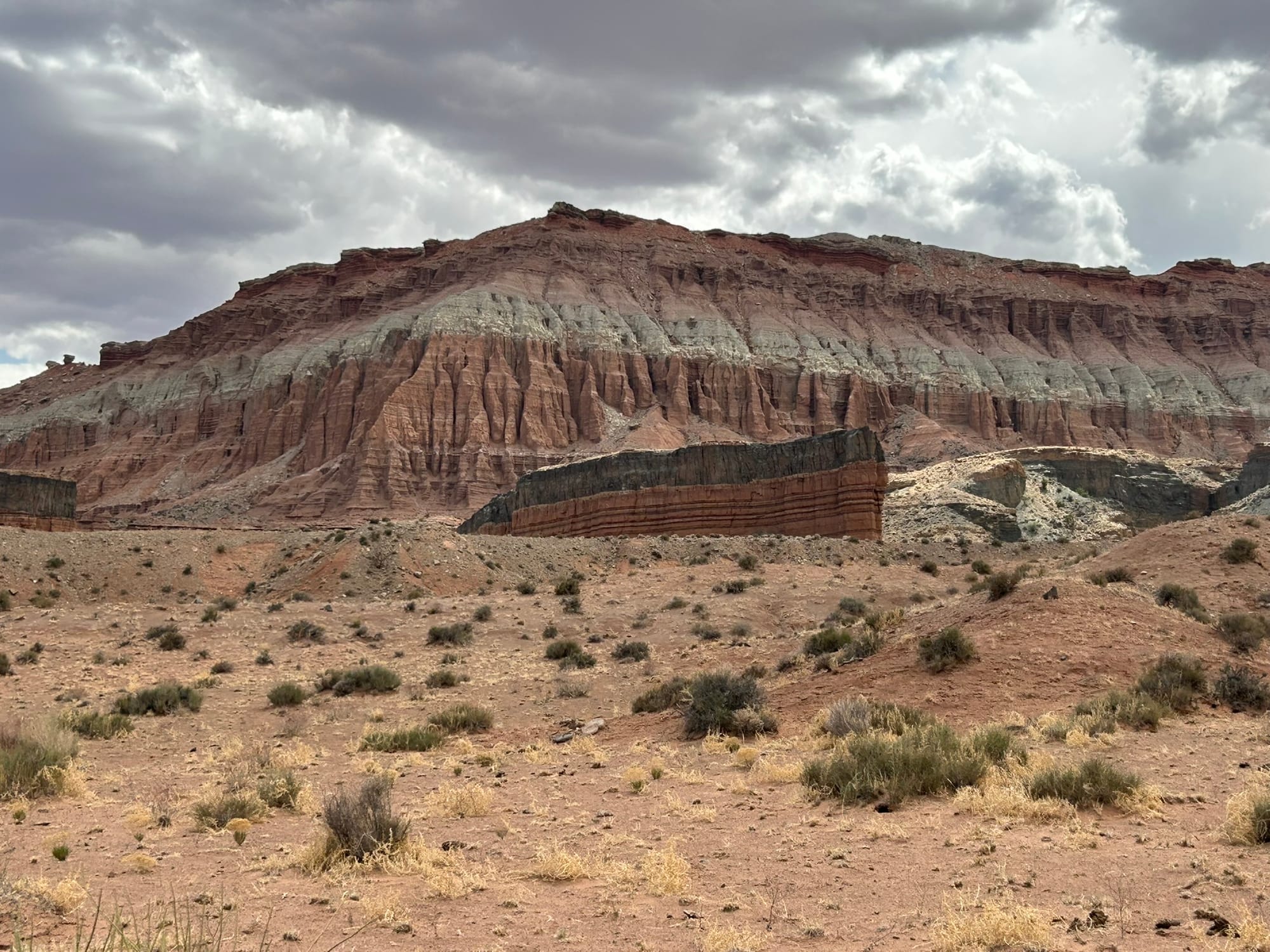
The Views in Capitol Reef National Park
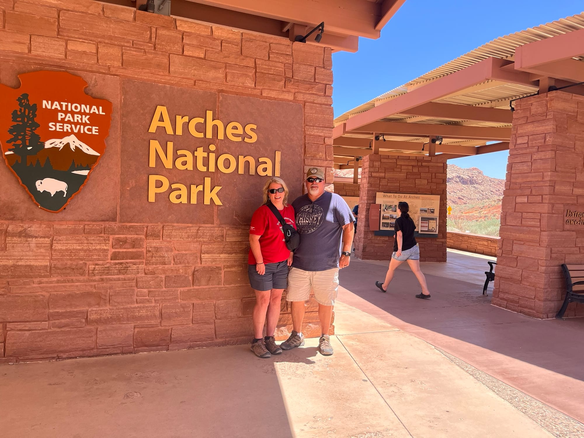
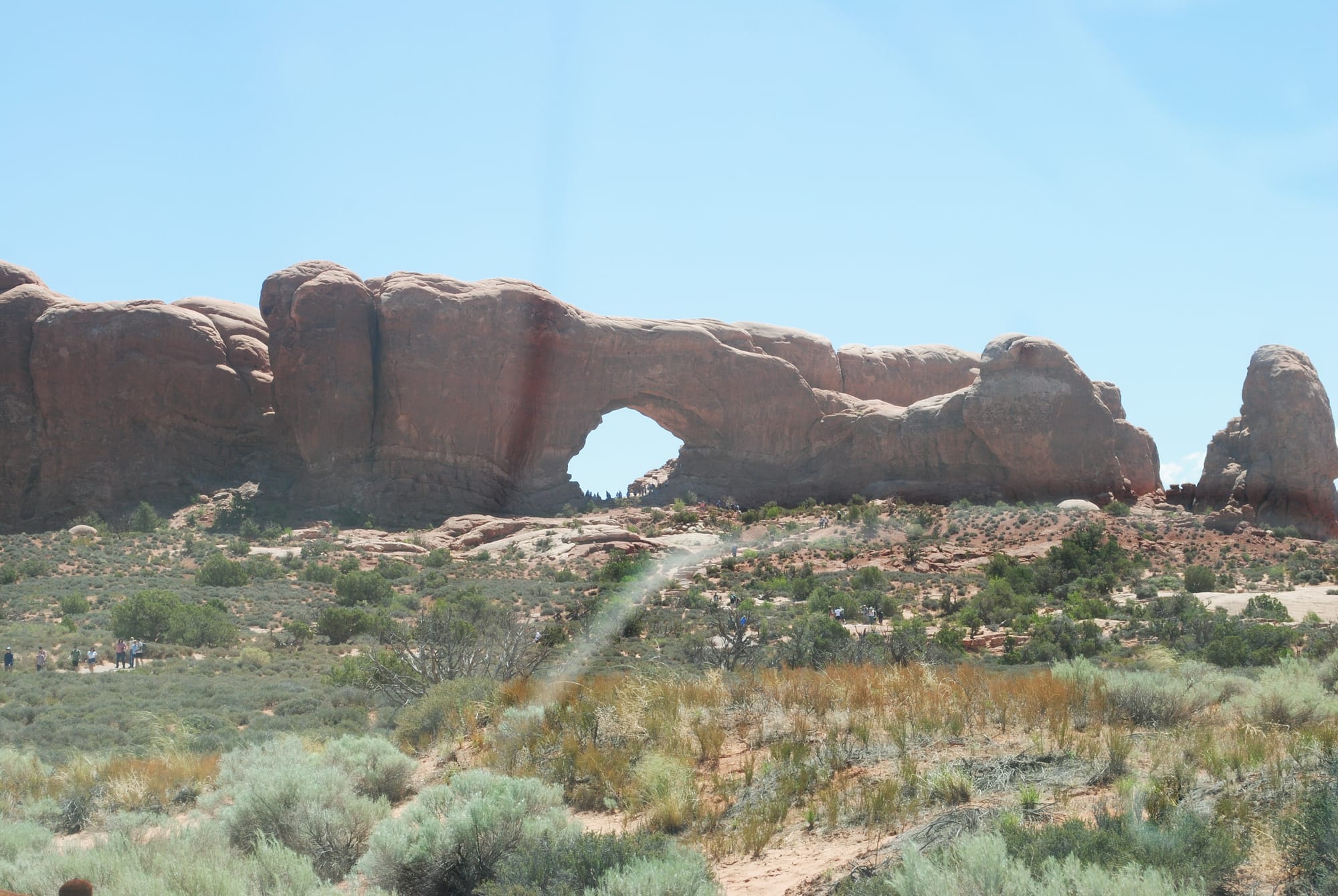
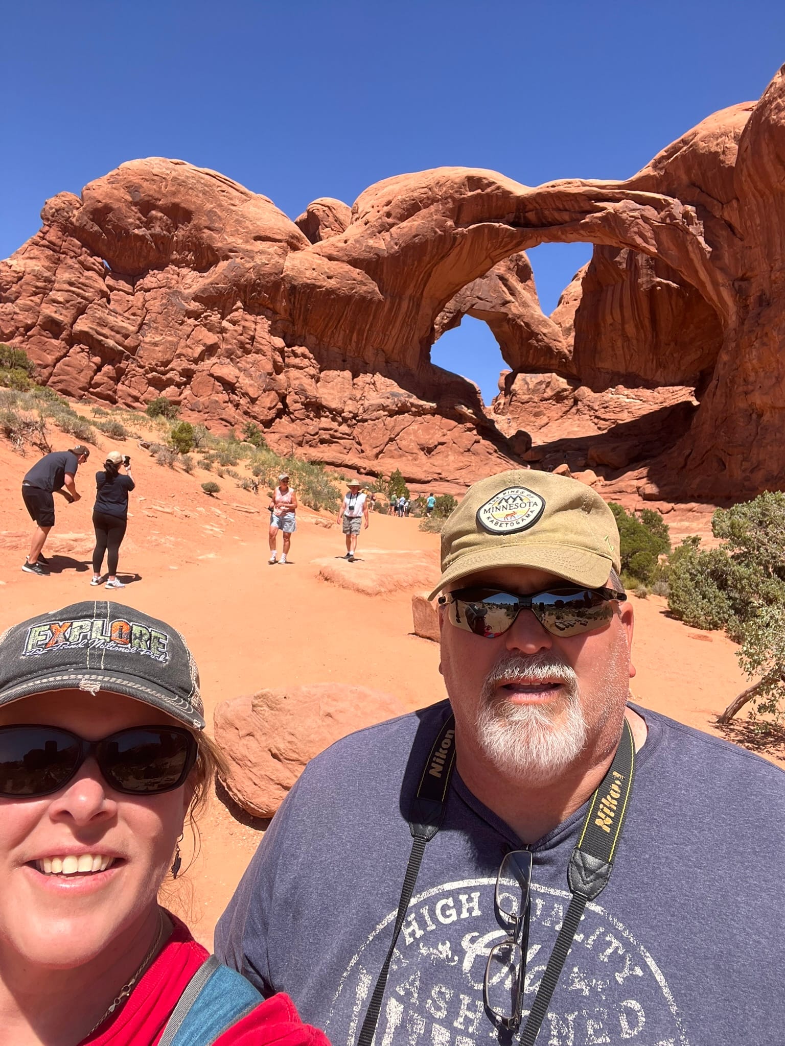
Arches National Park, UT
We got up early to get over to Arches NP entrance at least a half hour before our 9 AM reservations like people had told us to do. Arches is the only park we know of in Utah where you have to have reservations to get in. We got there at 8:15 and there wasn’t much of a line at all so we wound up at the ranger station before 8:30 and I thought we’d be turned away but they just waved us in. I guess the crowds weren’t that bad yet. Even so there was a long line of cars following us back into the park.
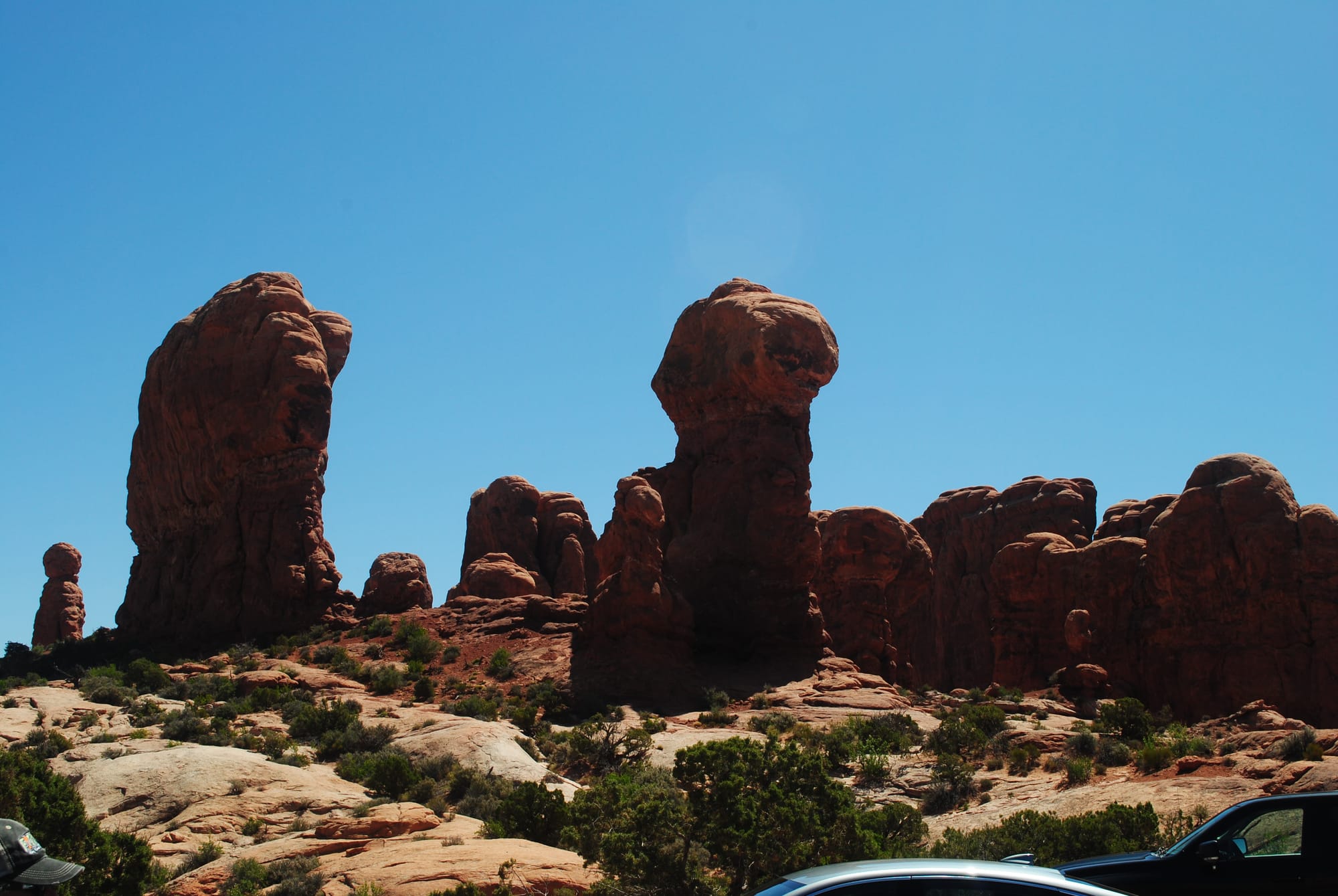
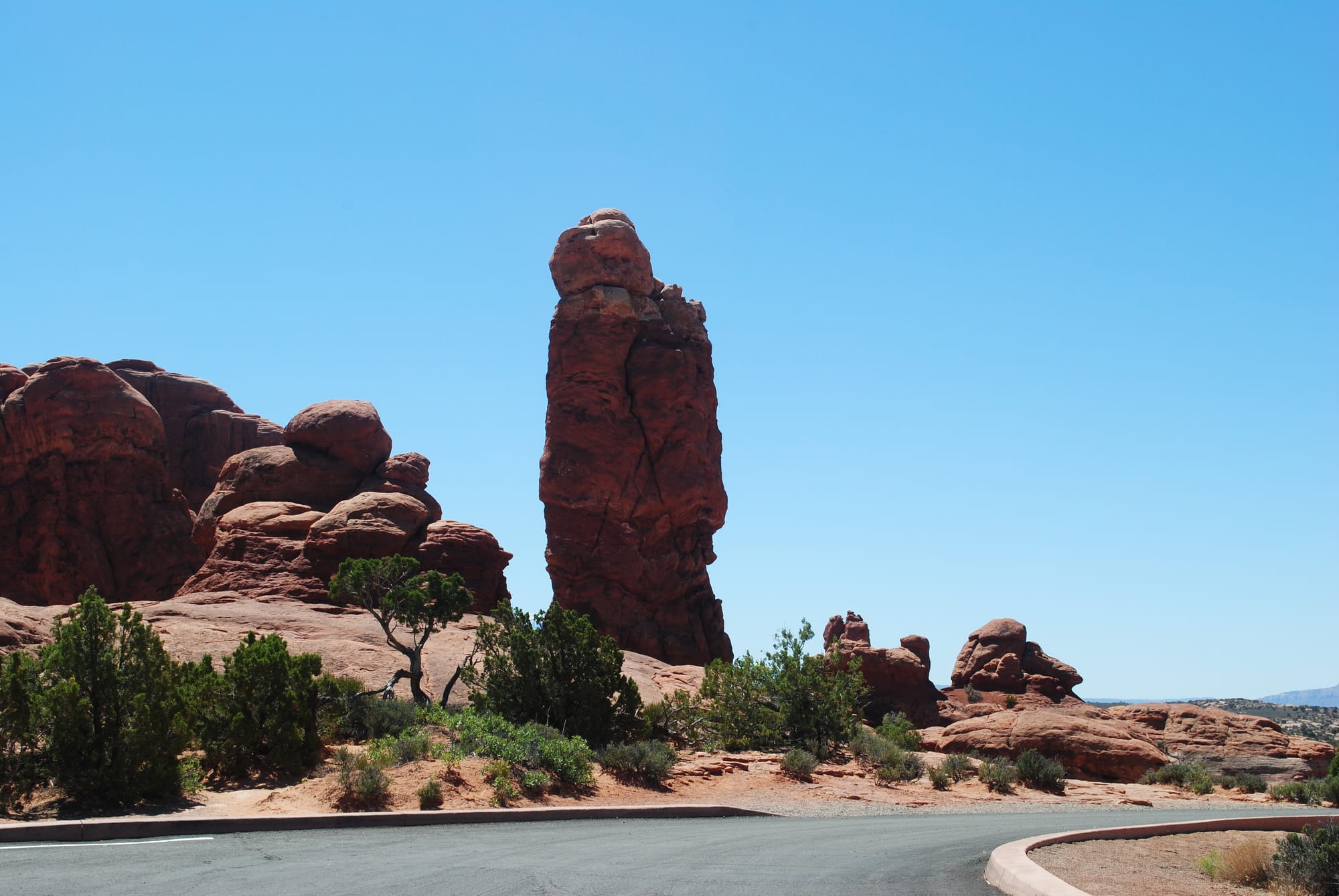
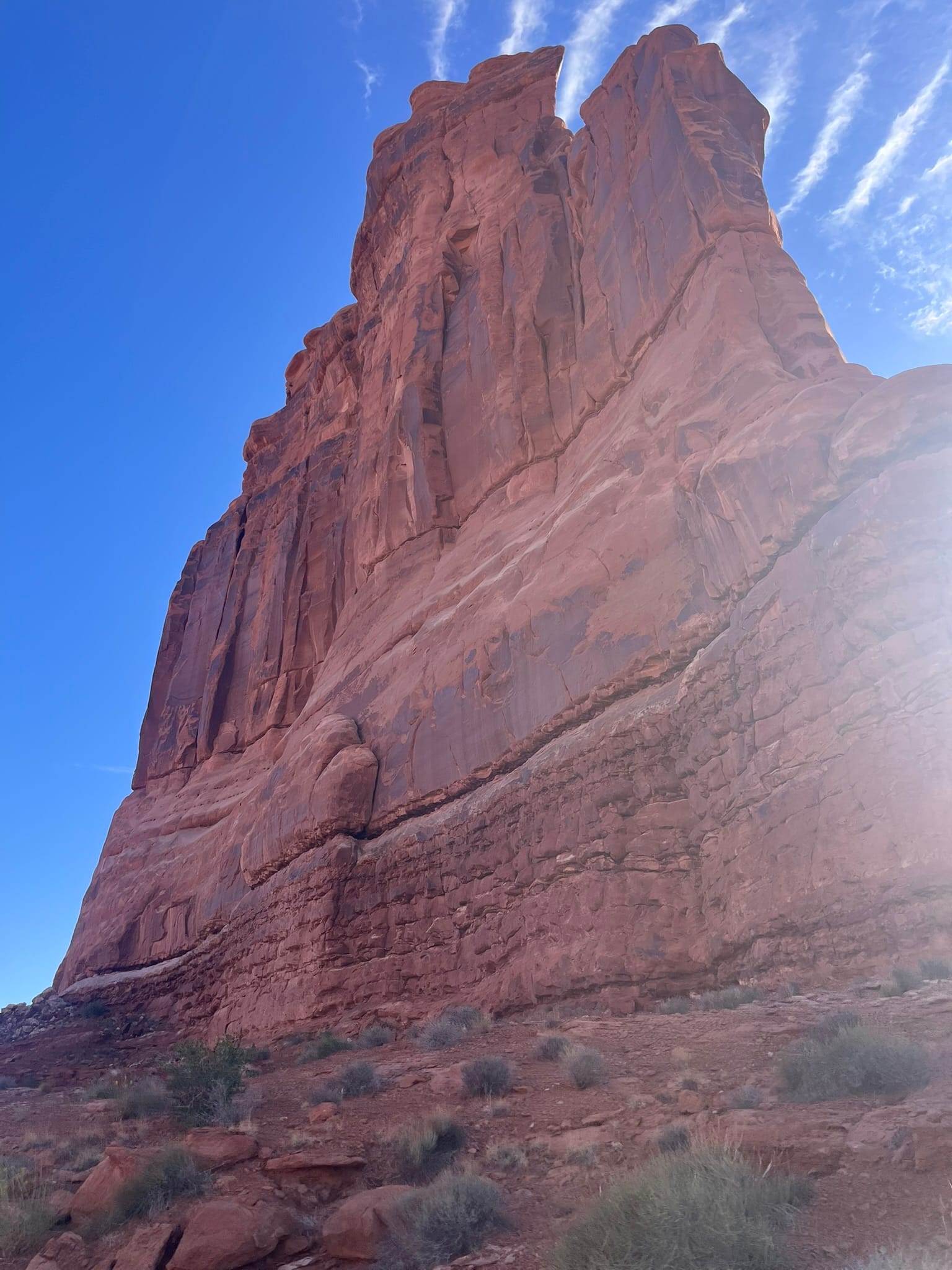
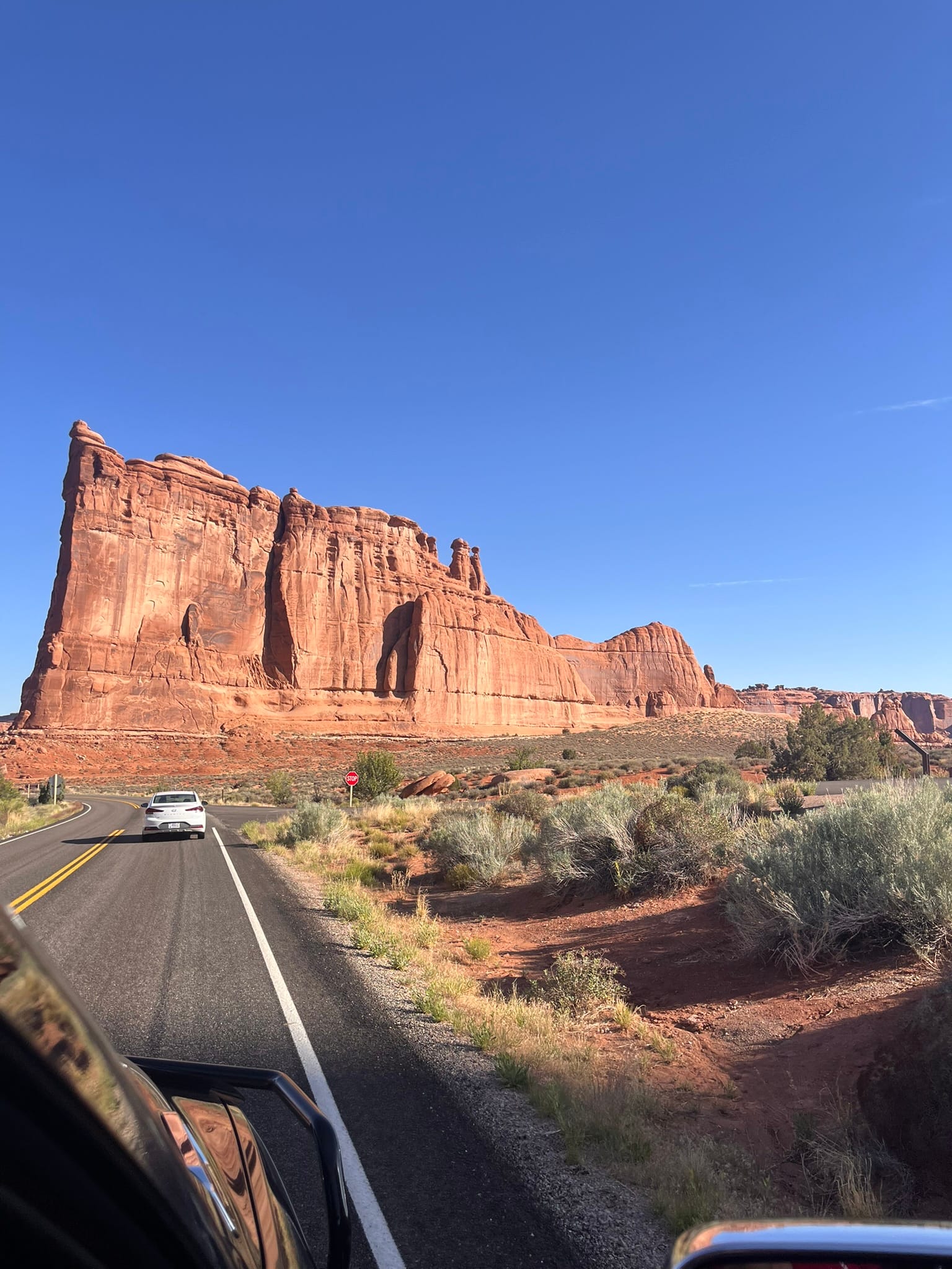
Majestic rock formations in Arches NP
We decided to go straight back to the longest hike we wanted to make which was a 3 mile round trip “difficult” hike back to see Delicate Arch. We figured that would get crowded much quicker than others since it was a long hike and parking would become an issue as the morning wore on. We were right about that but when we arrived at the parking lot there was still plenty of spaces towards the back.
We doused ourselves with some sunscreen, packed up some waters and headed out. The first part was fairly level. Then we had to climb up and back down a small hill only to confront what was the worst part of the entire hike – a huge bare stone dome to walk up. It was pretty steep for hiking and we had to take a bunch of breaks to make it up. After that the ground leveled a bit and the smaller hills and rocks we had to scramble over were much easier to do. Finally, we had to go up a rather narrow walkway around a rock formation behind which was Delicate Arch. There was a nasty drop on the left side of the walkway so you needed to be careful.
Delicate Arch is amazing to see! It just sort of sits there unsupported by other rock formations on the sides like other arches in the park have. There were probably 30 or 40 people all sitting around taking pictures and resting. Kim and I drank a bunch of water, had a snack and helped others take pictures of their whole group before heading back down. All in all it was a very nice but extremely tiring hike and my feet were hurting and my legs were shaky by the time we got back to the truck. Kim’s phone says we did 3.5 miles in around 2 hours. Not bad for a couple of amateur hikers!
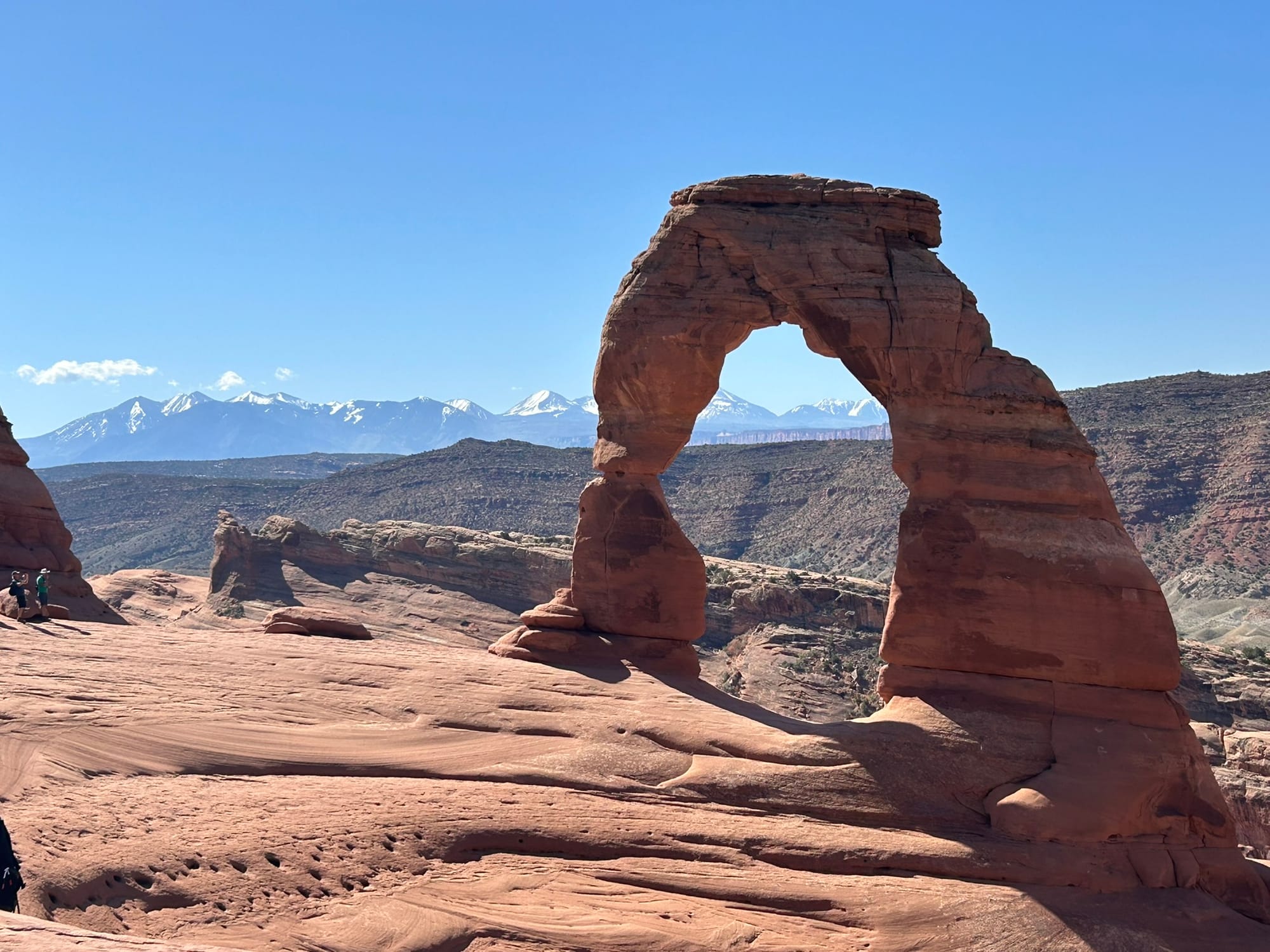
The hike to Delicate Arch
After that we headed back towards the entrance a little to see The Windows arches and Double Arch which were off on their own road. We didn’t hike over to the Windows, instead opting to go to the much more impressive Double Arch. Parking was very scarce at this location and cars were circling around looking for places to park. Luckily, we continued around the tear drop to the Double Arches side and there were a couple of spots left. Double Arches as the name implies is actually two arches that share a support on the left side. There’s several other arches around them and a couple of what I would call caves that will likely become arches themselves once they erode open in the back. Beautiful and mystifying all at the same time! This was a short walk back to see them and we got close but didn’t climb up on the rocks like others. It was magical to just stand back and take it all in!
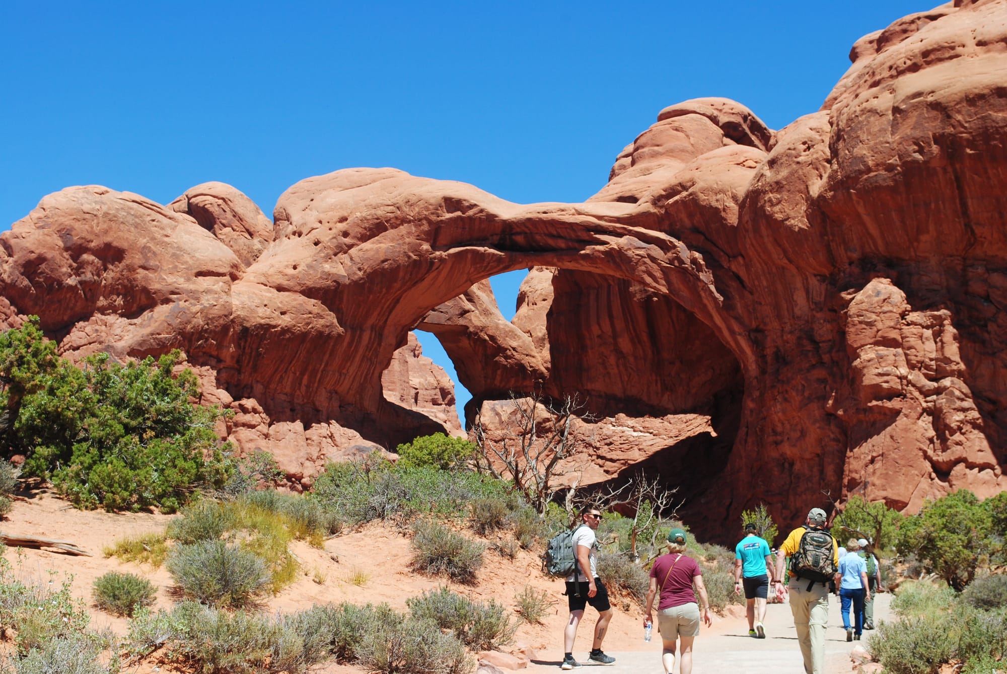
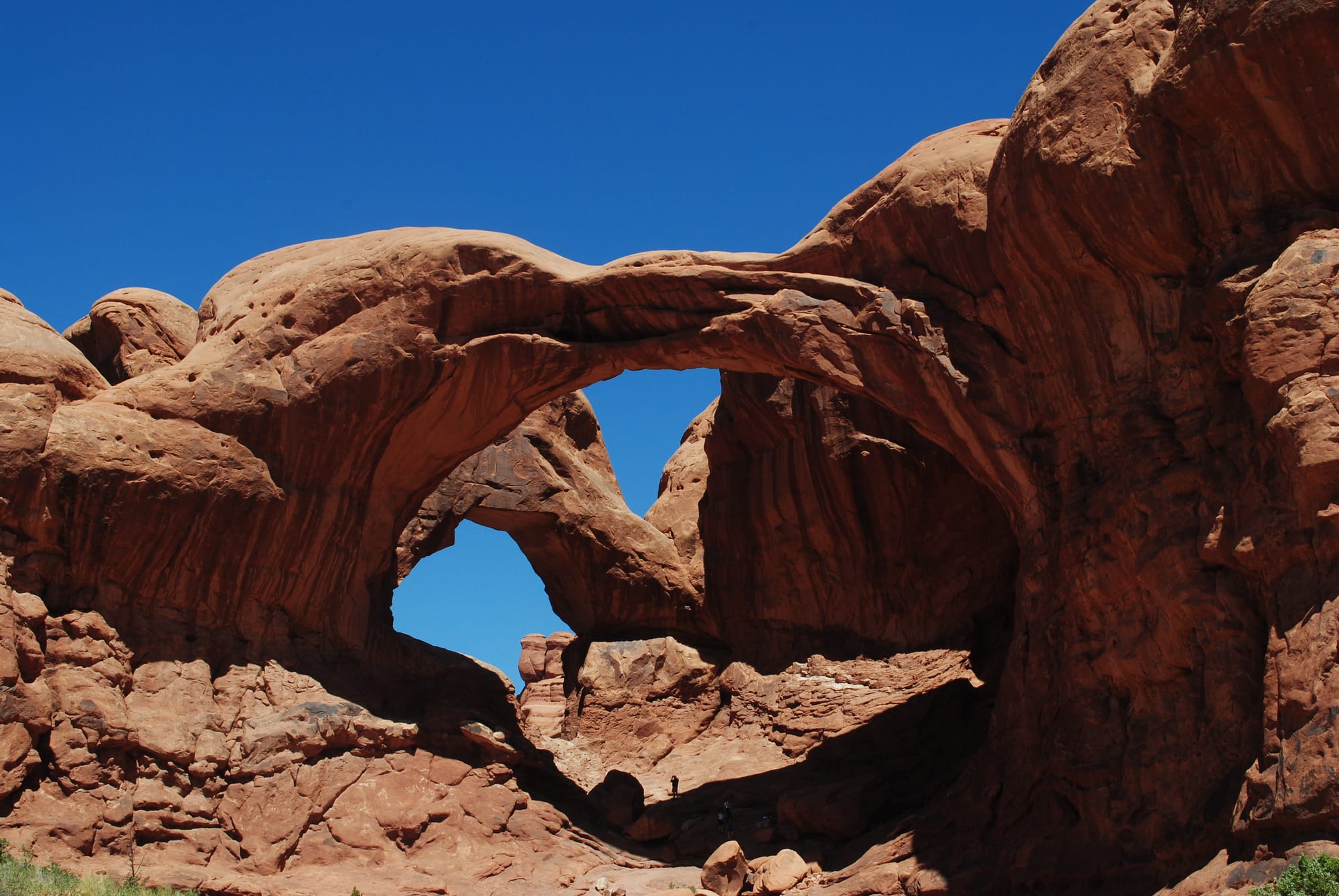
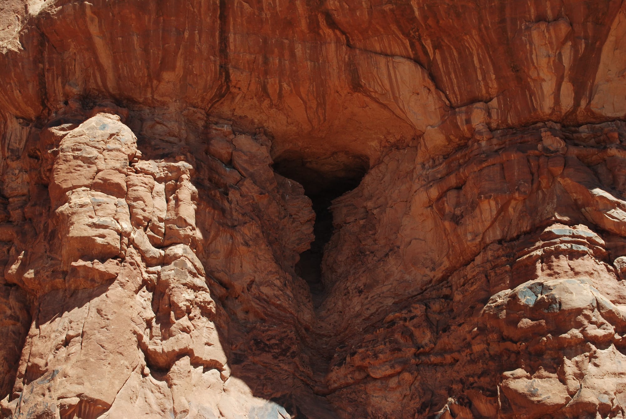
One of The Windows and Double Arches
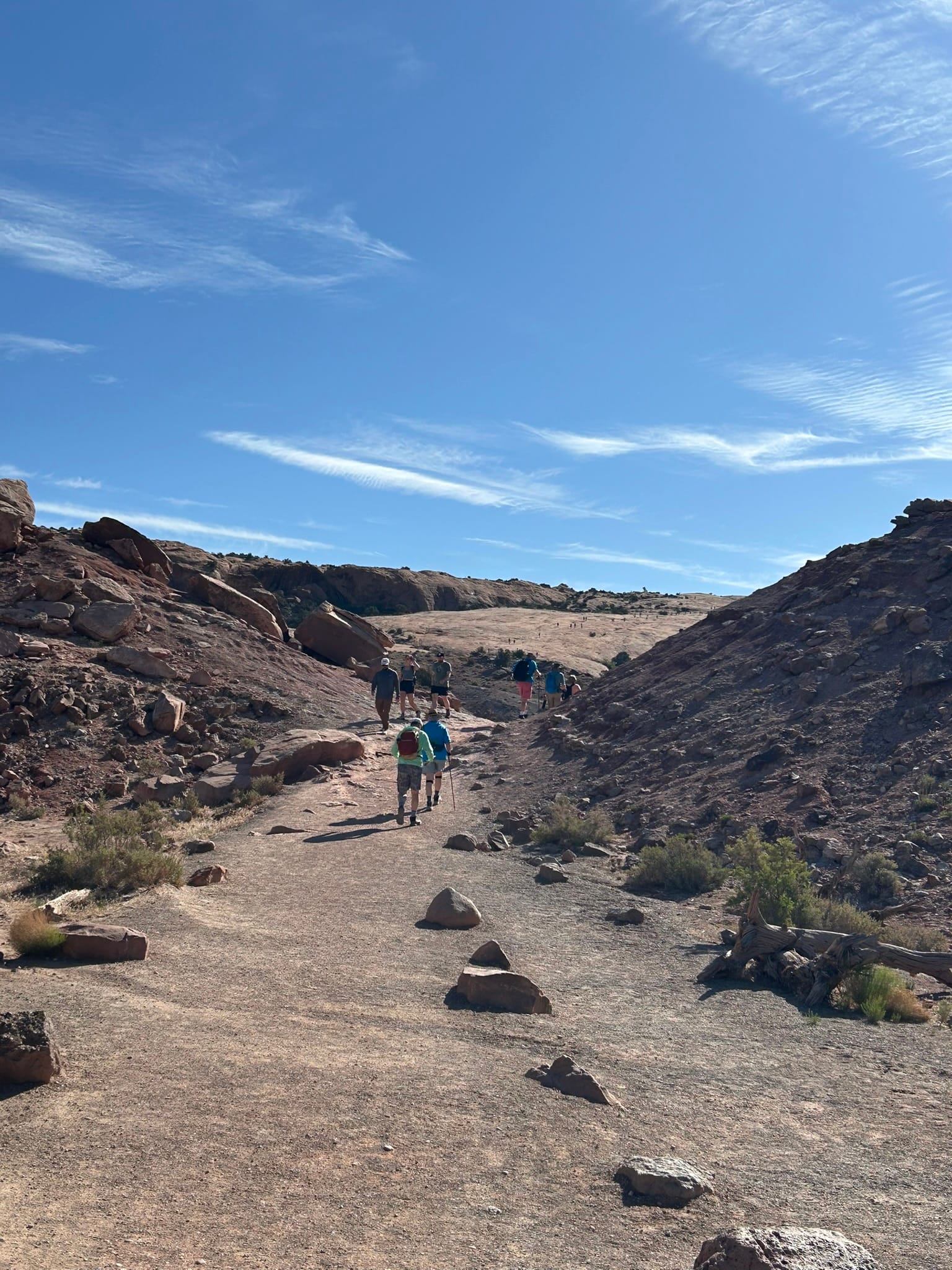
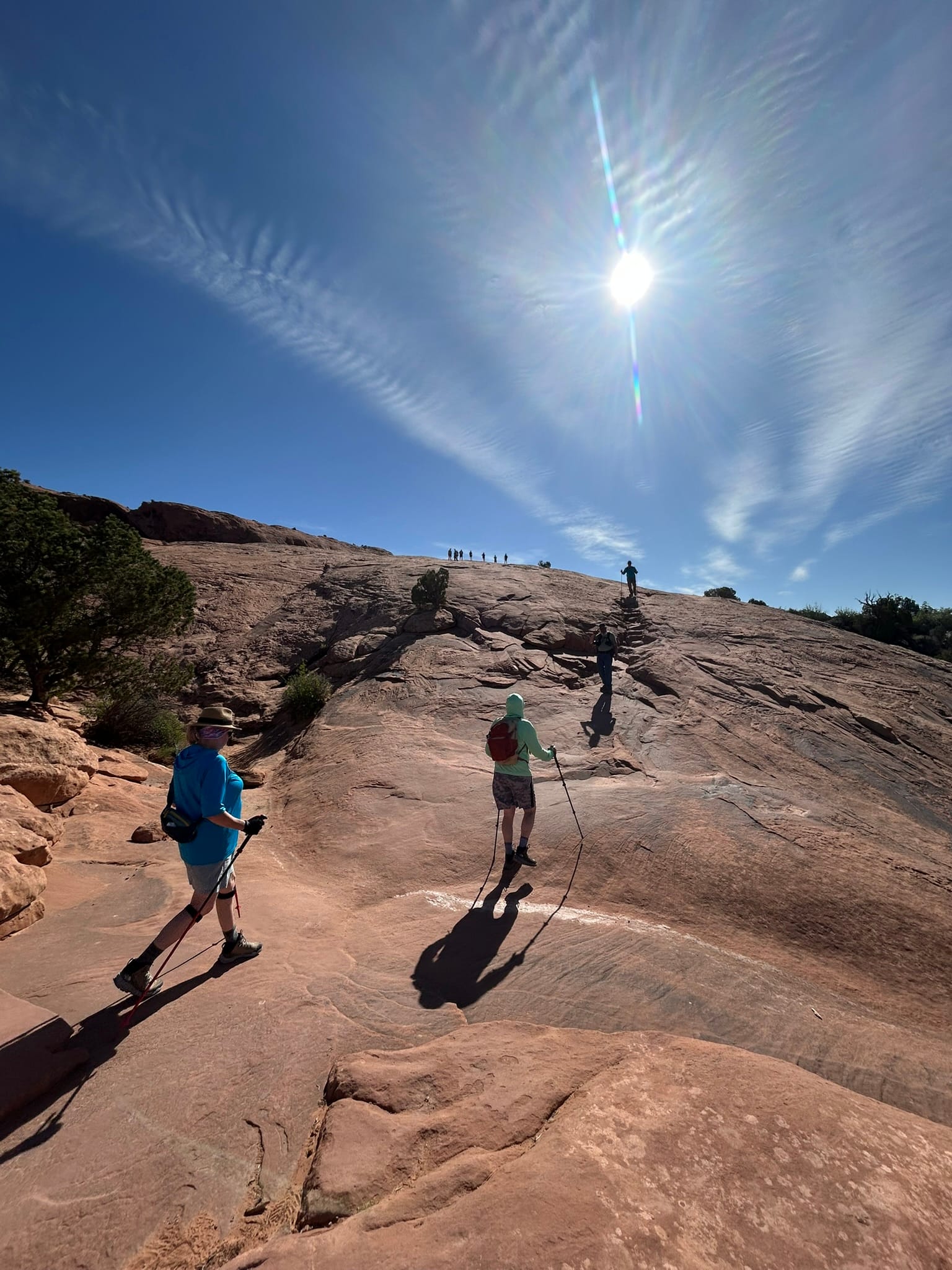
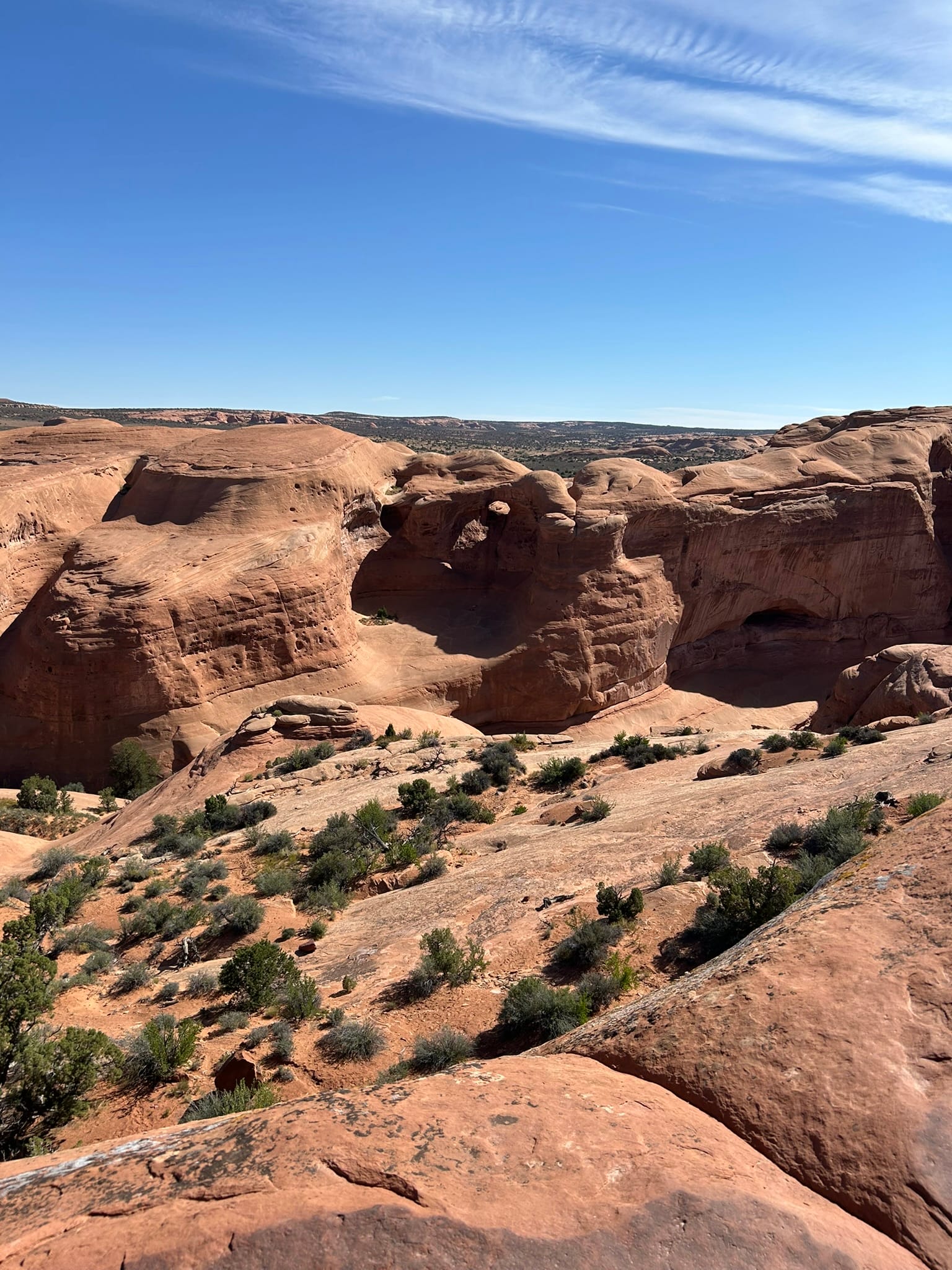
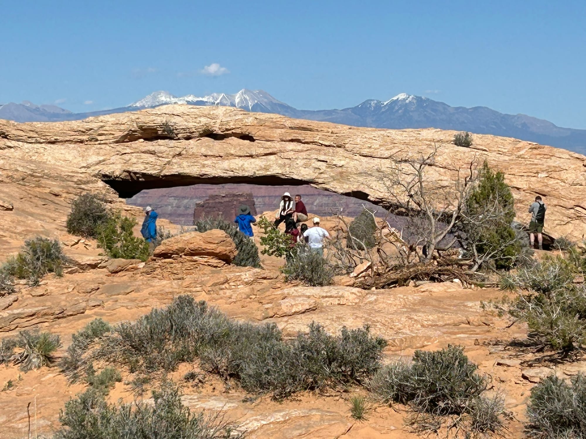
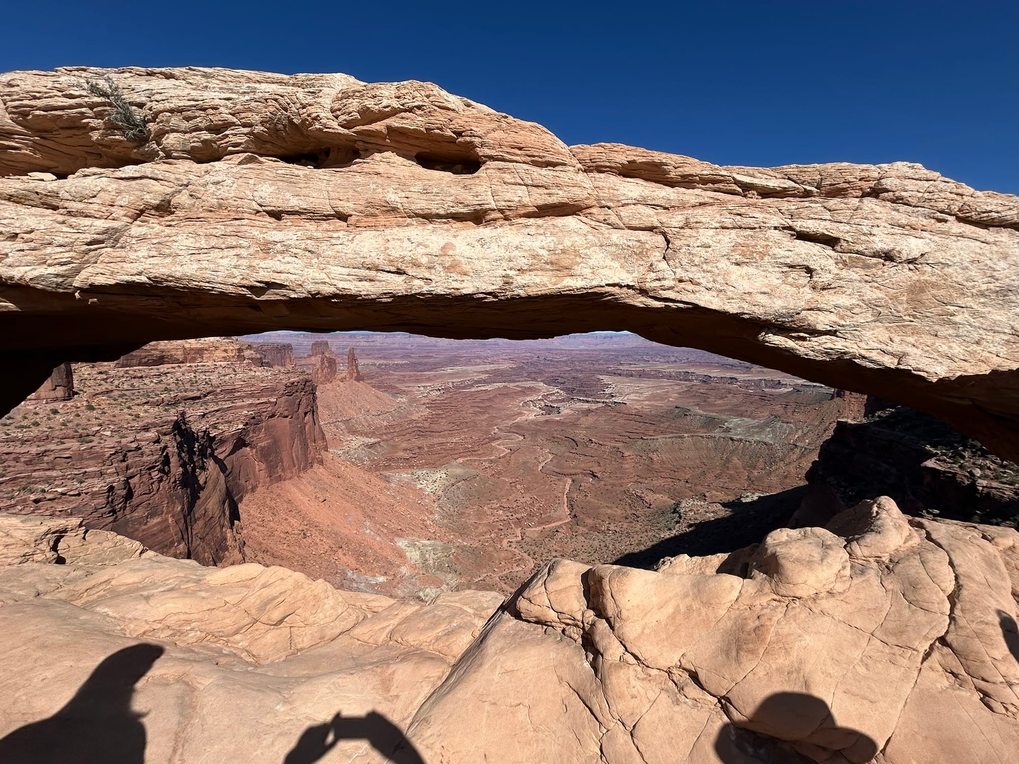
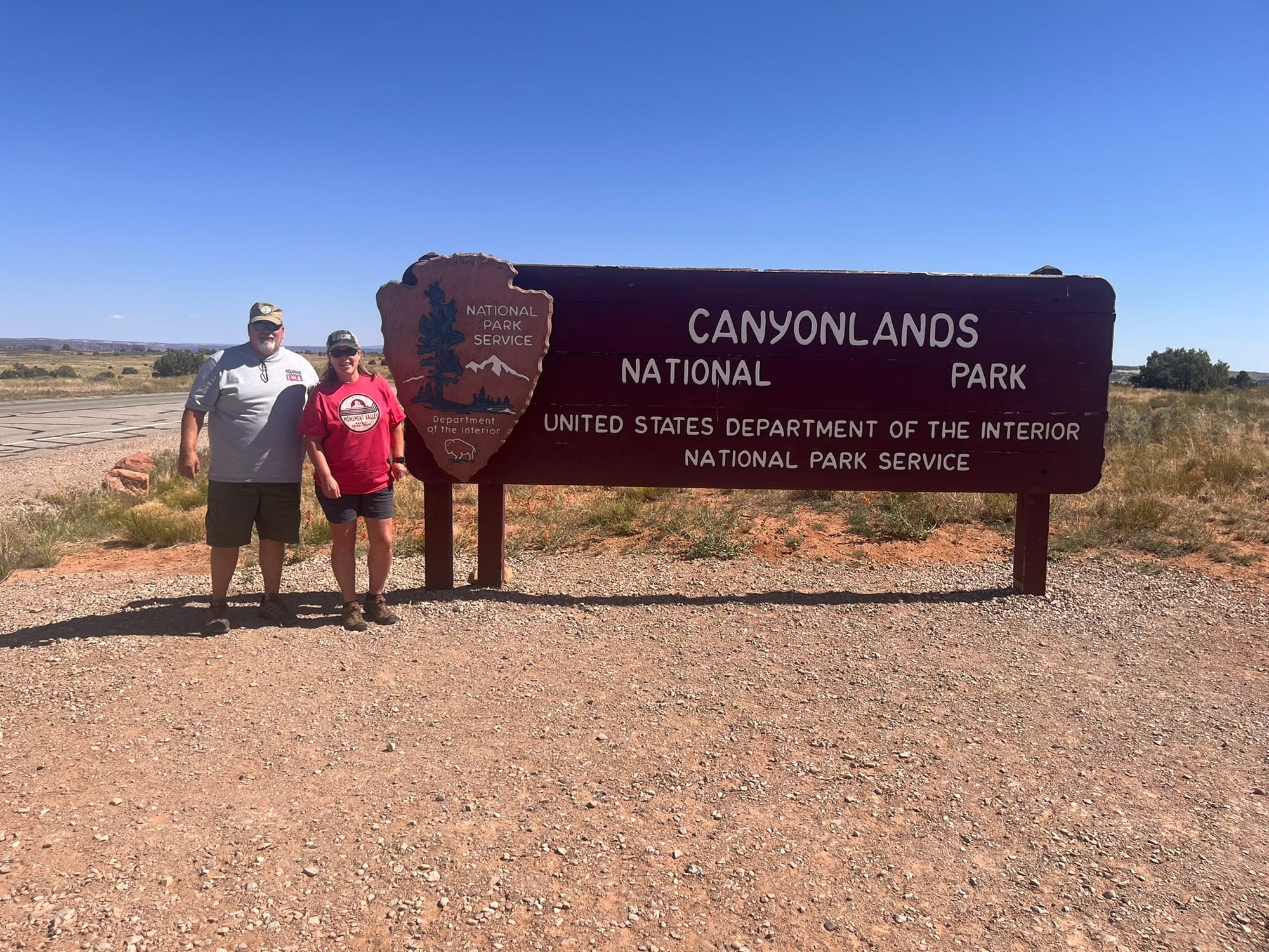
Canyonlands National Park, UT
We headed to Canyonlands National Park to see what it was about after a second visit to Dead Horse Point State Park (DHPSP). Canyonlands basically picks up to the west of Dead Horse Point State Park and continues west and south for a huge distance! It’s broken into separate sections and from the side we were on we could only get to the Island in the Sky portion which is very similar to DHPSP only much bigger! I would say it was more impressive due to the size of the canyons that just reach out to the horizon, but having seen the state park first kind of reduced the impact on us. Don’t get me wrong, it was beautiful! We did two hikes down to see some of the overlooks and a long walk down to Mesa Arch which was very impressive and sat right on the edge of a very sheer cliff! I have to admit that after seeing so many sheer cliffs I was a bit shell shocked and couldn’t really get comfortable standing near them anymore. I guess I’m feeling my age and my mortality!
Our last stop of the day was at Grand View Point Overlook at the very south end of the road. If we wanted to see anything further south we had to go back to 191 and drive about 50 miles south to the next entrance.
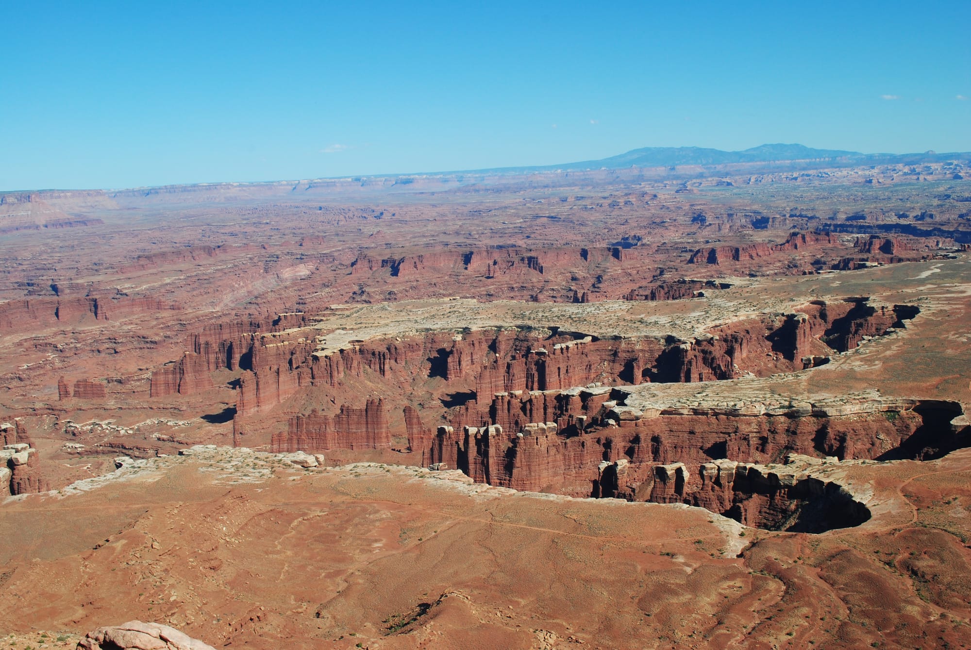
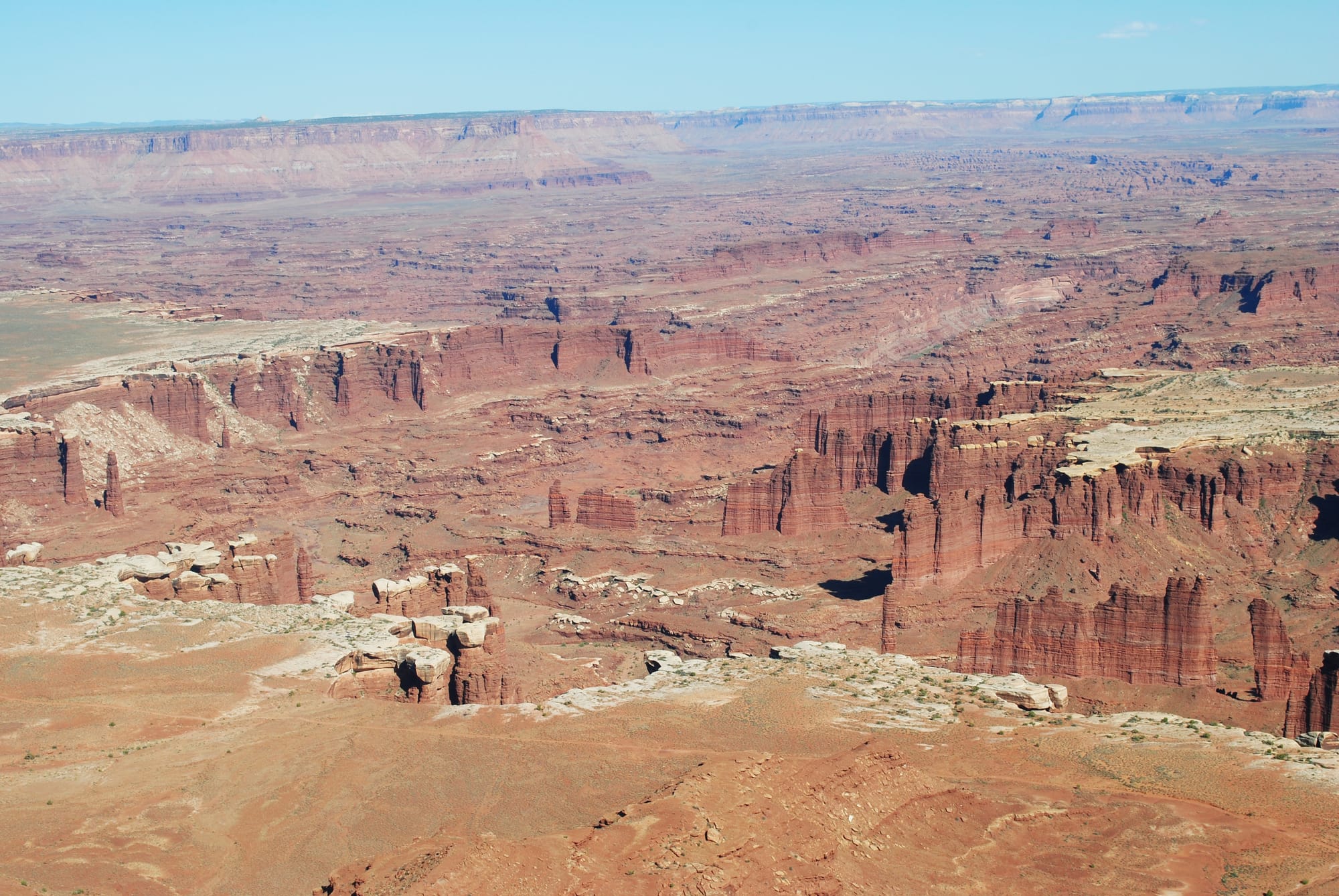
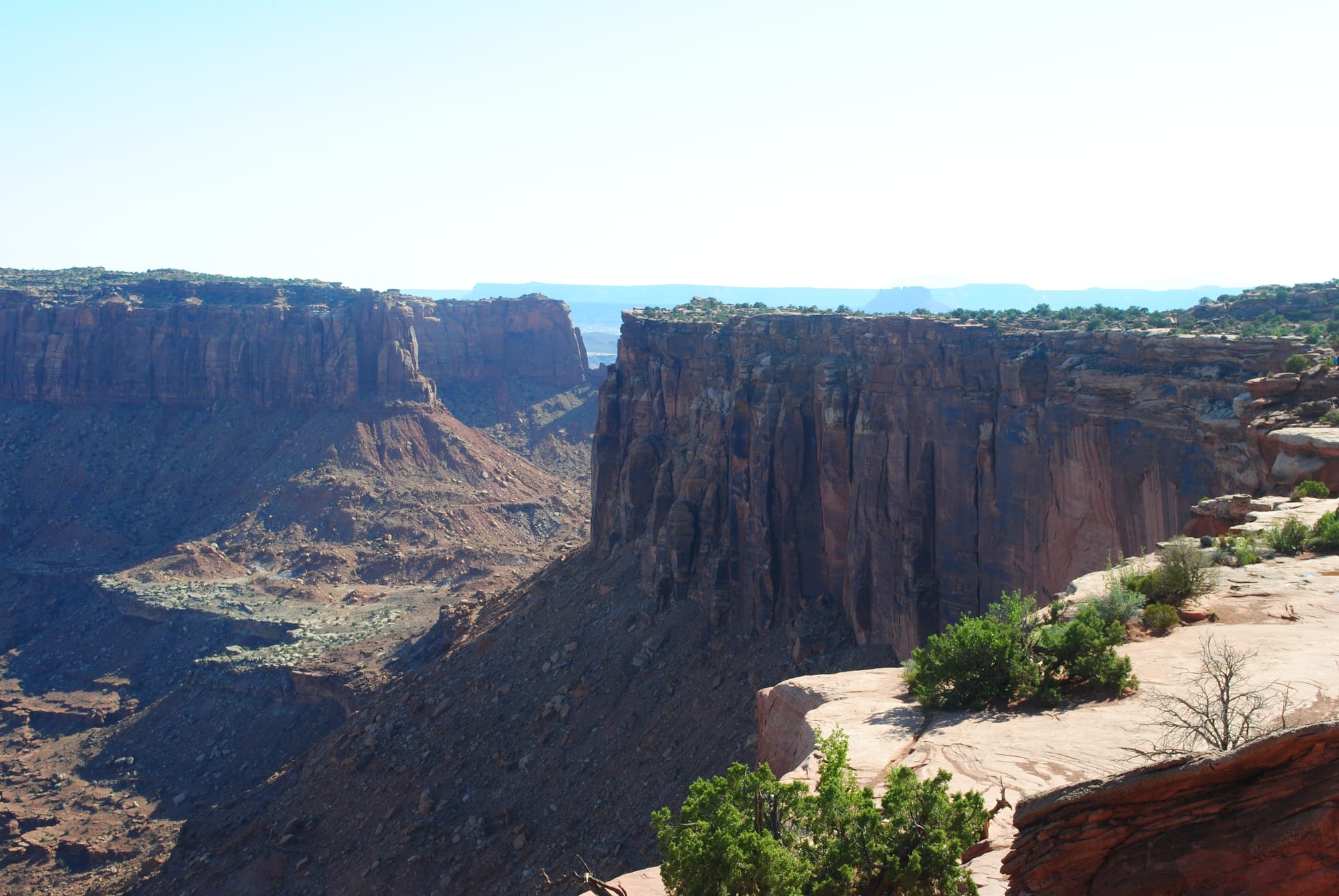
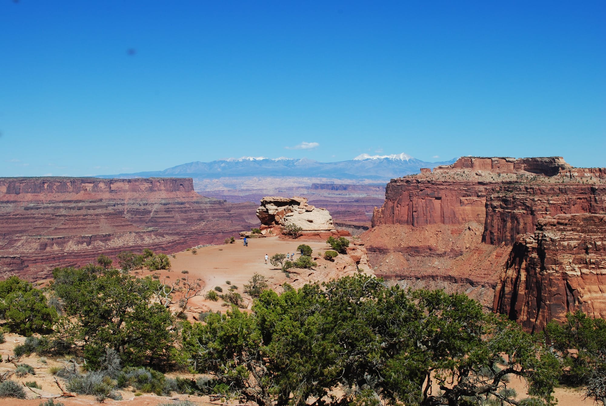
Canyonlands National Park Scenery
Dead Horse Point State Park, UT
We had a quick dinner this evening and decided to head up to Dead Horse Point State Park to catch the sunset. Kim had been told by a lot of folks not to miss that at any cost. We drove up and arrived about 15 minutes before sunset and joined about 50 people who had also come up to watch it including two newly married couples having their photos taken here. I was stunned by the view from the point!
You don’t really get any idea what you are about to experience until the last ¼ mile of the drive before the parking lot when you get a tiny inkling that there's a canyon ahead. As you walk to the point, the totality and the immensity of the canyon that’s opening up before your eyes is upon you! It’s like walking up to the rim of the Grand Canyon without knowing you are about to reach it. I am totally lost for words! The Colorado River meanders around 1700 feet below you and heads off into the distance with sheer cliffs right along your side in both directions. It’s intense and not for those who fear heights (my mom would have died!). For me it wasn’t about the sunset as much as the enormity of the canyon before me. I had no idea such a beautiful place existed! It was truly awe inspiring! We will go back tomorrow to see it all in the daylight!
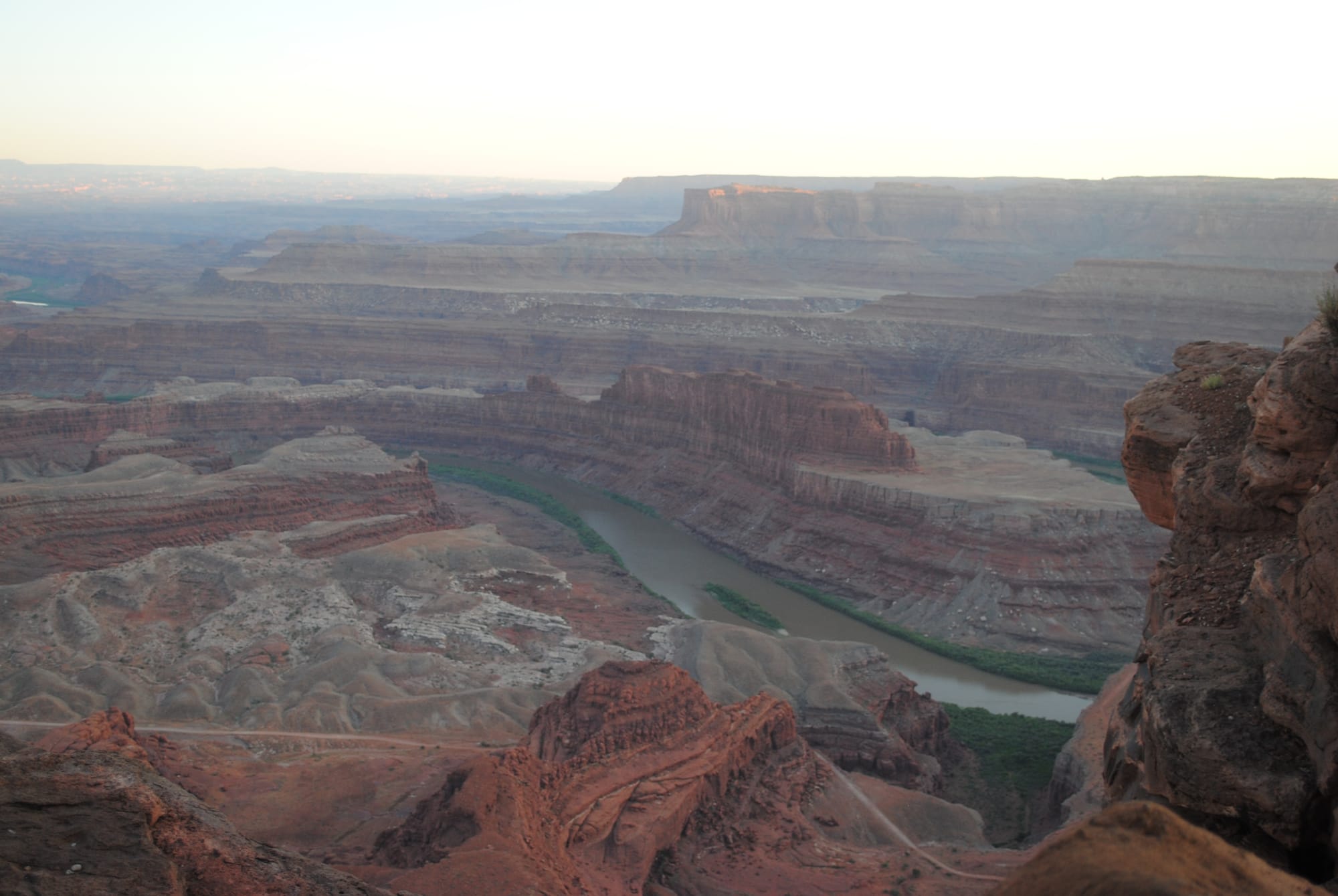
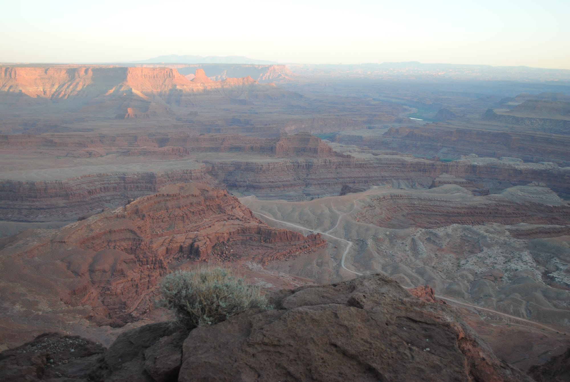
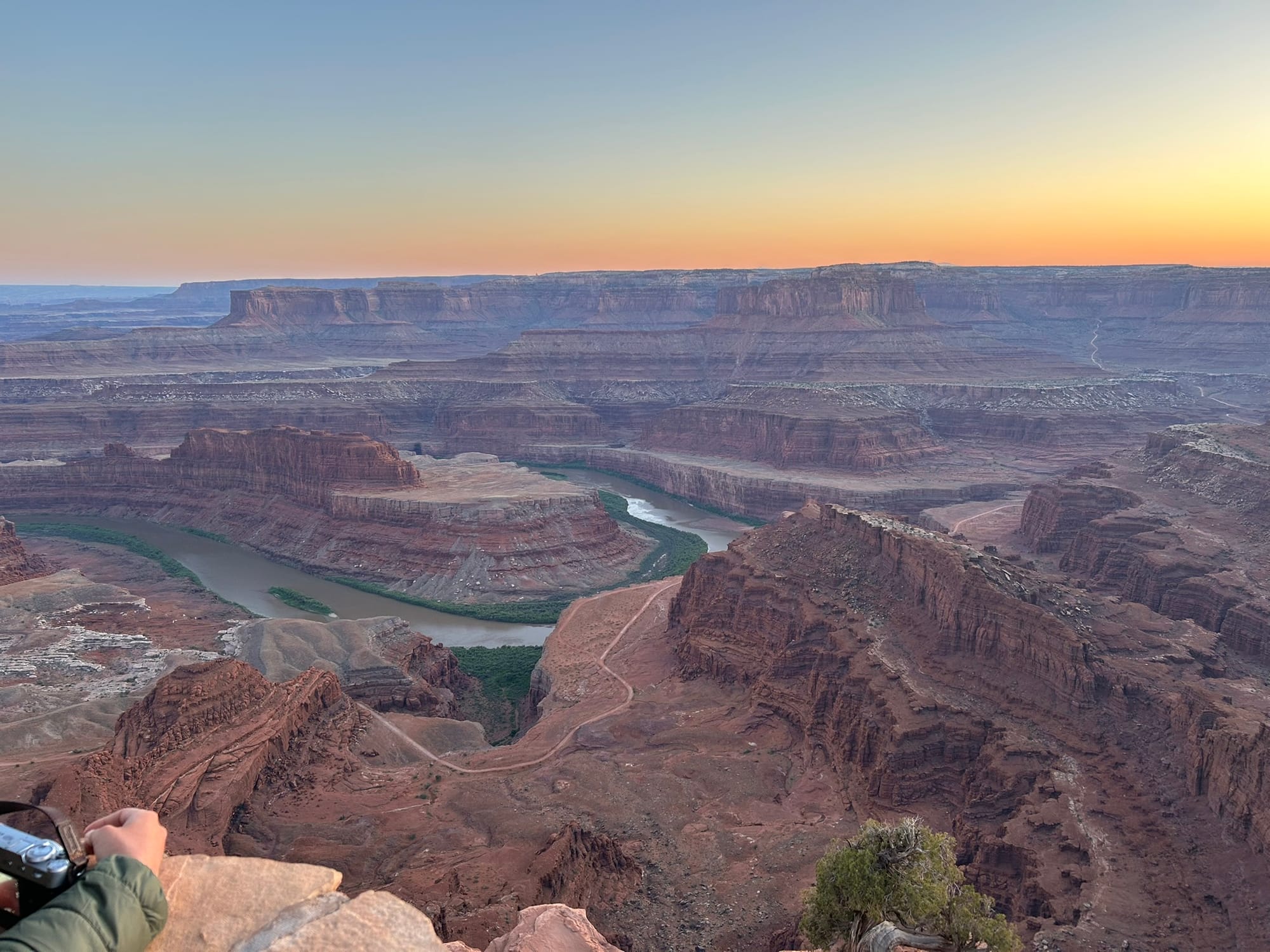
Dead Horse Point State Park View
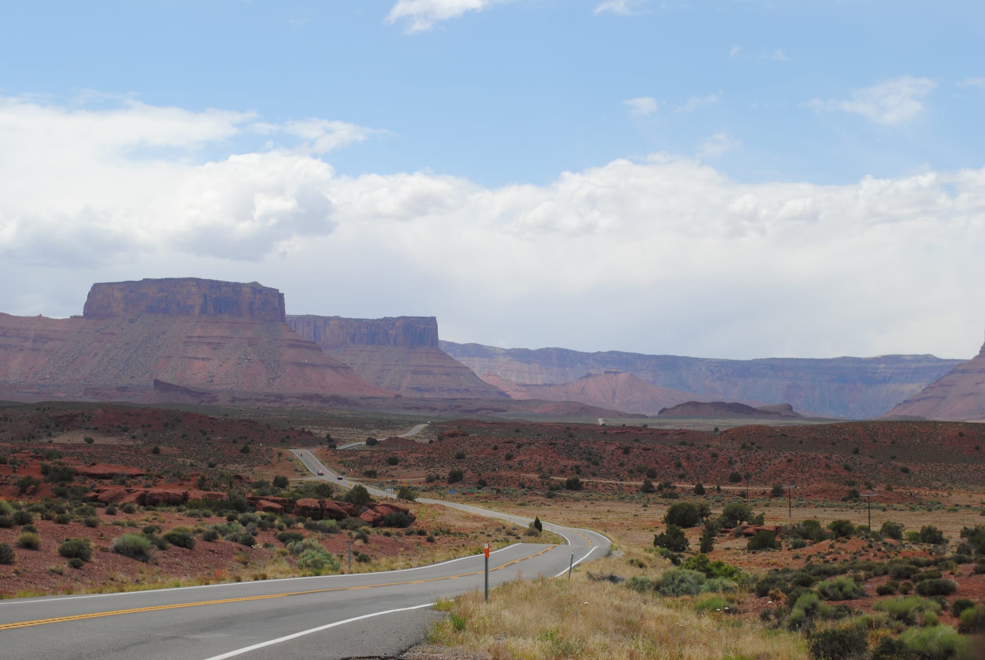
Highway 128 Scenic Byway, Moab, UT
Today dawned bright and cool with a very chilly breeze but after yesterday’s very cold rain and wind, it felt much warmer. We decided since it was so chilly, that we should take a scenic drive up Hwy 128 scenic byway. It follows the Colorado River from Moab northeast to I-70. It’s about 26 miles from Moab to I-70. It was an amazing drive! The road runs alongside the Colorado River through the deep canyon that’s sheer red rock cliffs on both sides in many places. Towards the end of the drive, the rocks turn gray and the landscape flattens out as you climb up on a plain.
We turned around at that point and headed back for the reverse view and stopped at a bunch of places along the river to take photos. We also stopped at the Big Bend Campground which is a BLM site where you can boondock along the river. Definitely going to add that to places we want to stay in the future. We can certainly boondock a few days in a place as beautiful as that!
All along this trip in these beautiful places, I have wondered how these monuments, canyons, mesas, buttes and other natural wonders could possibly have been created and on this drive I was given a glimpse of the process. We had a moderate level of rain and wind the day before and it was windy again this morning. As we drove up Hwy 128 we saw places where red soil had washed down from the walls of the canyon and sitting on the edge of the lane was a small rock about 3 inches square. To our left was the strong river running fast with red muddy waters. It didn’t hit me then, but has since, that that combination of rain, wind and running water was the answer I was seeking! The rain washed loose dirt down the slope a ways, some of it making it to the river causing the red, muddy color of the water. Small loose stones moved slowly down the mountainside until they wound up by the river. The wind blowing dust and sand up and down the canyon would scour out other particles of dust and sand from the sandstone sides like mild sandpaper. In the winter with freezing temperatures, water would seep into cracks in larger stones, freeze and eventually break it down into smaller stones. I thought, “now, multiply that effect across the entire square footage of the canyon walls and add in the tons of silt being carried away by the river hourly and multiply that across 100’s of millions of years” and there was the answer right at my feet. The processes that God set in motion all those years ago are still at work making the canyon even more spectacular every day millimeter by millimeter! Our lives are so short and erosion is so slow, that we don't often realize just how enormous the impact is over time. Time and erosion are powerful forces to behold and this region of the country lays it bare before you!
Now, let's take that a step further. The canyon walls here were all sandstone made from other soil that eroded from somewhere else, that had been carried here and laid down to form these sandstone rocks and that as they, themselves erode and are carried down stream, they will become sediment that forms the new rocks of some future ground that then erodes … and the cycle continues forever!
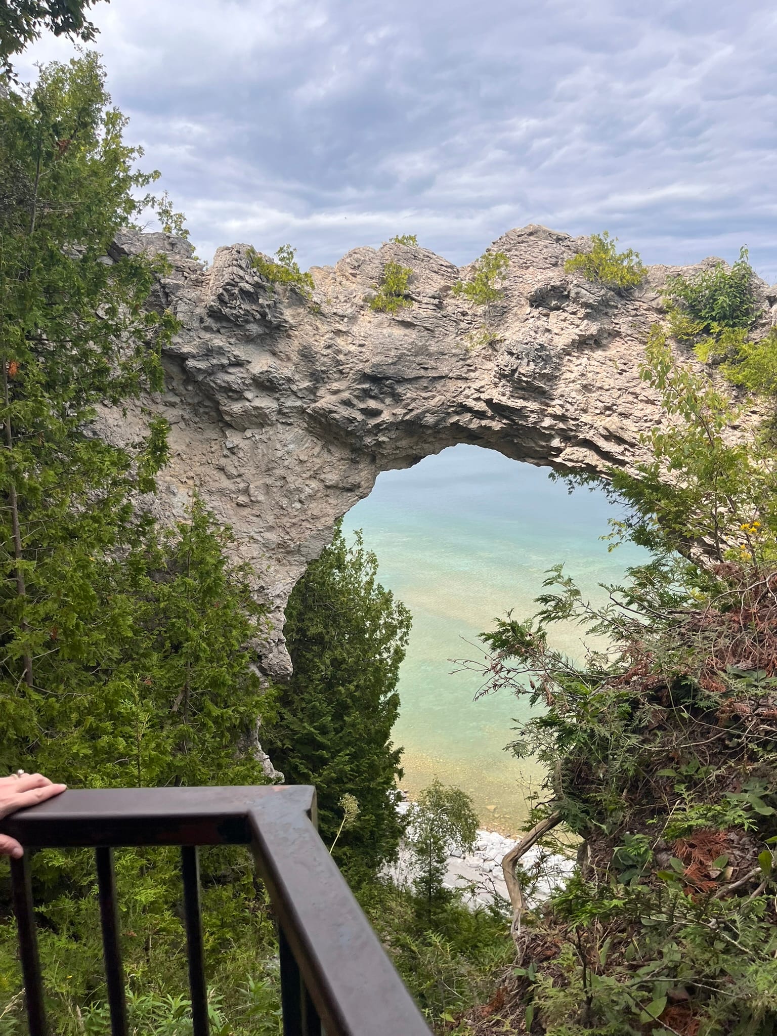
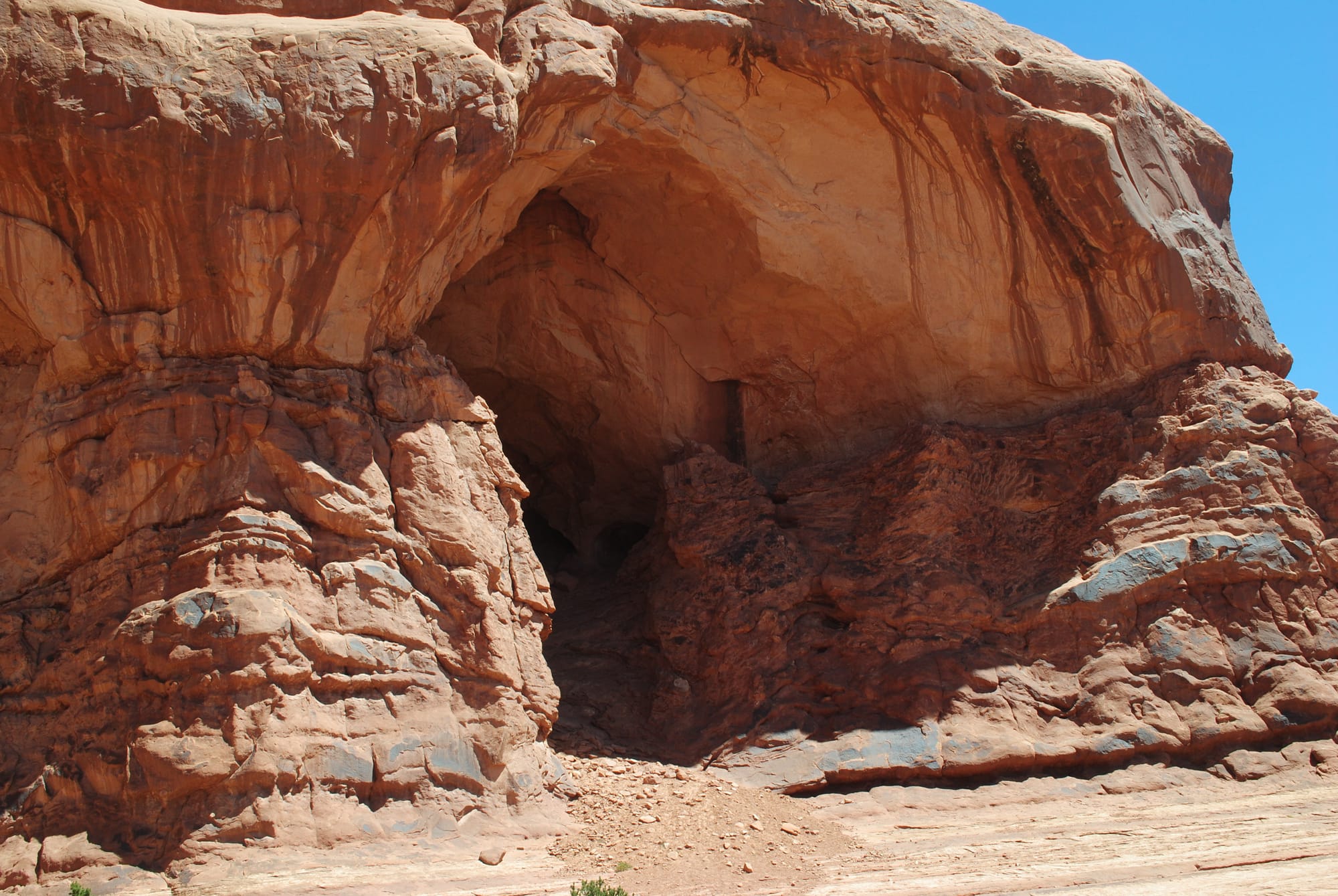
Natural Bridges National Monument, UT
Natural Bridges National Monument is very beautiful! It’s basically comprised of a river canyon in which the river has carved 3 rock bridges from which it gets its name. The three bridges in the order you come upon them are Sipapu, Kochina and Owachomo (the most recognized one). Each bridge has an observation point (short walk) and a related hiking path down into the canyon to see it up close (longer walk). The first two’s hikes looked too difficult for us but the third seemed doable and we went down to get some closeups of Owachomo since it is the largest and most famous bridge in the park and Kim guilted me into it!
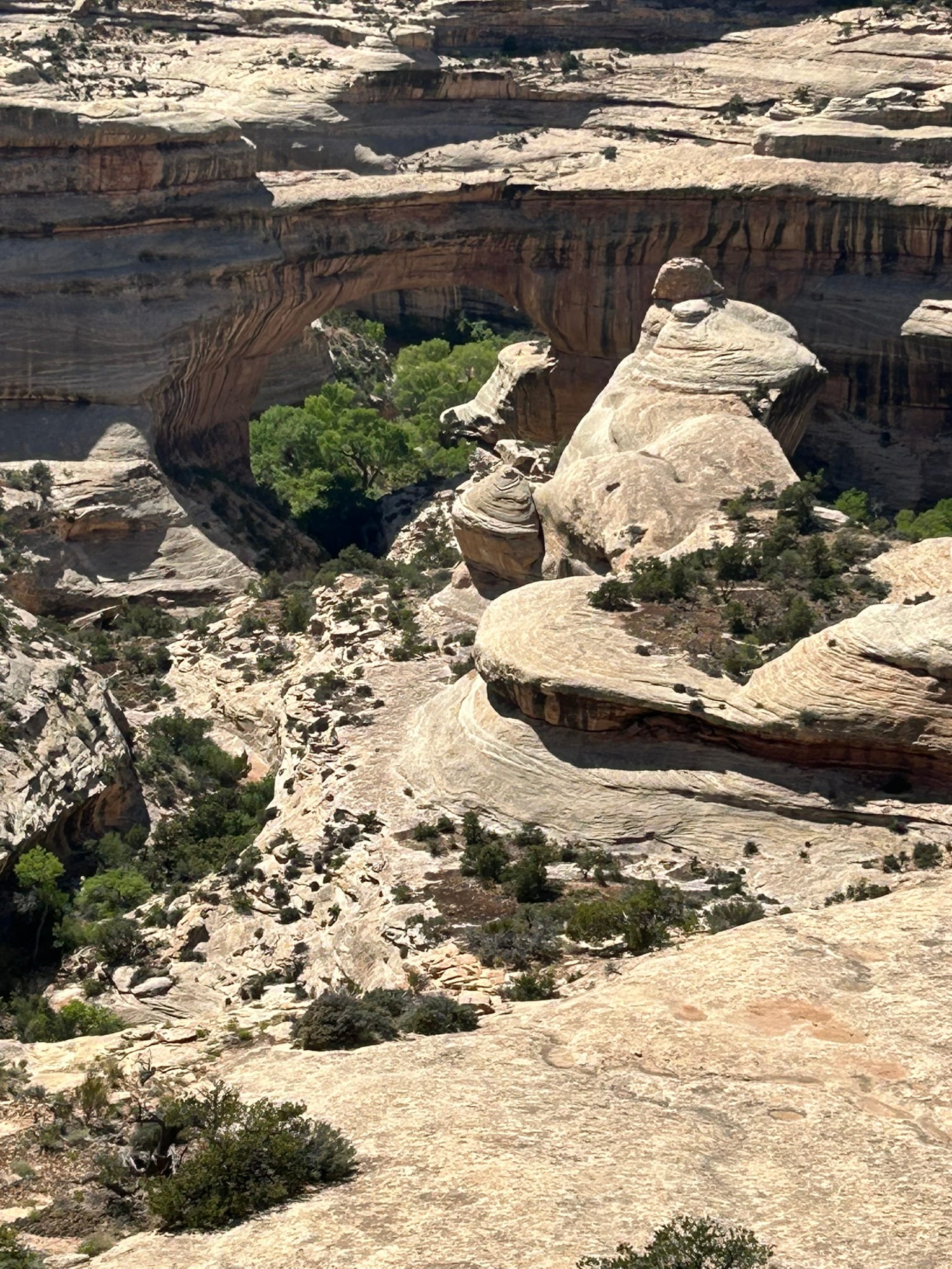
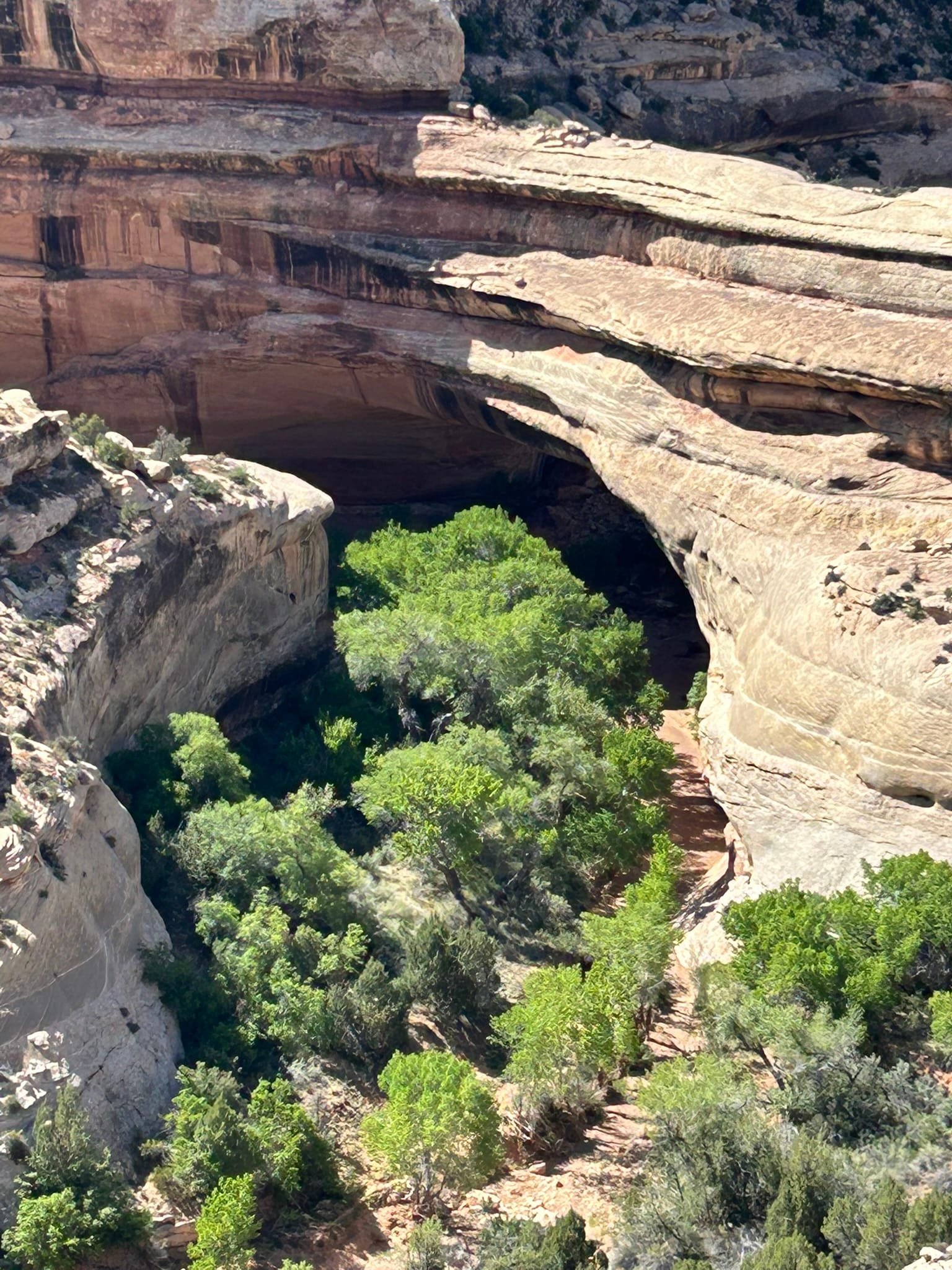
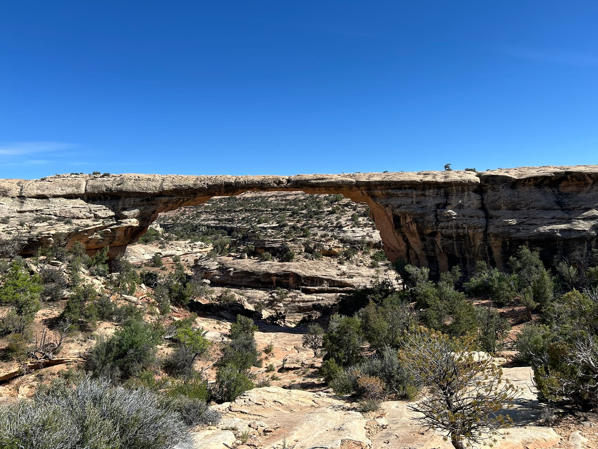
Sipapu, Kochina and Owachomo Bridges
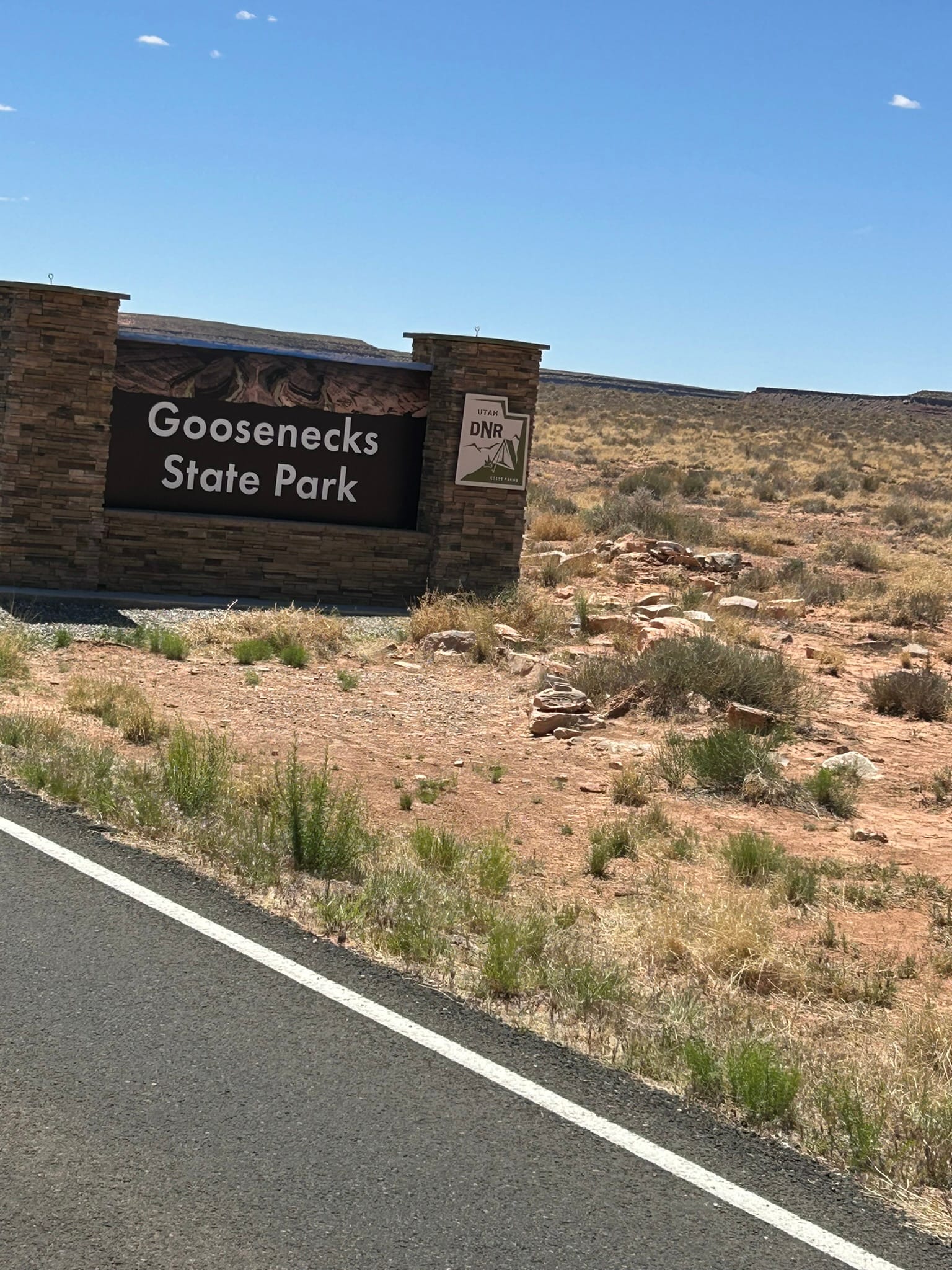
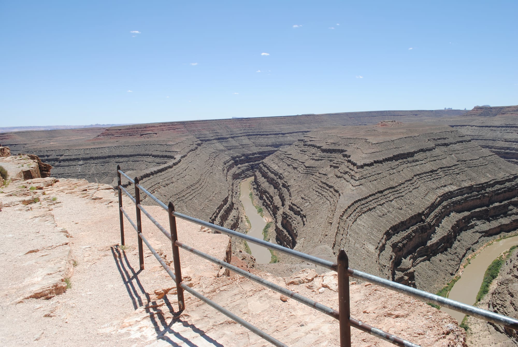
Gooseneck State Park, UT
We packed up midday and headed out Hwy 163 to 261 and then took a quick left into Gooseneck State Park which is located on an extremely windy part of the San Juan River. At the entrance, the ranger said that if you flew straight over this section it was about 5 miles long but with all the twists, the river travels 12 miles! It is one of the best examples of an entrenched river meander which happens when a river starts out flowing on top of a relatively flat plain that allows the river to meander. As the area was pushed up, the river cut its winding path into a vast canyon basically locking the meander in permanently. It’s truly beautiful to see the river zig zag past your observation spot 3 times like an old-fashioned piece of ribbon candy!
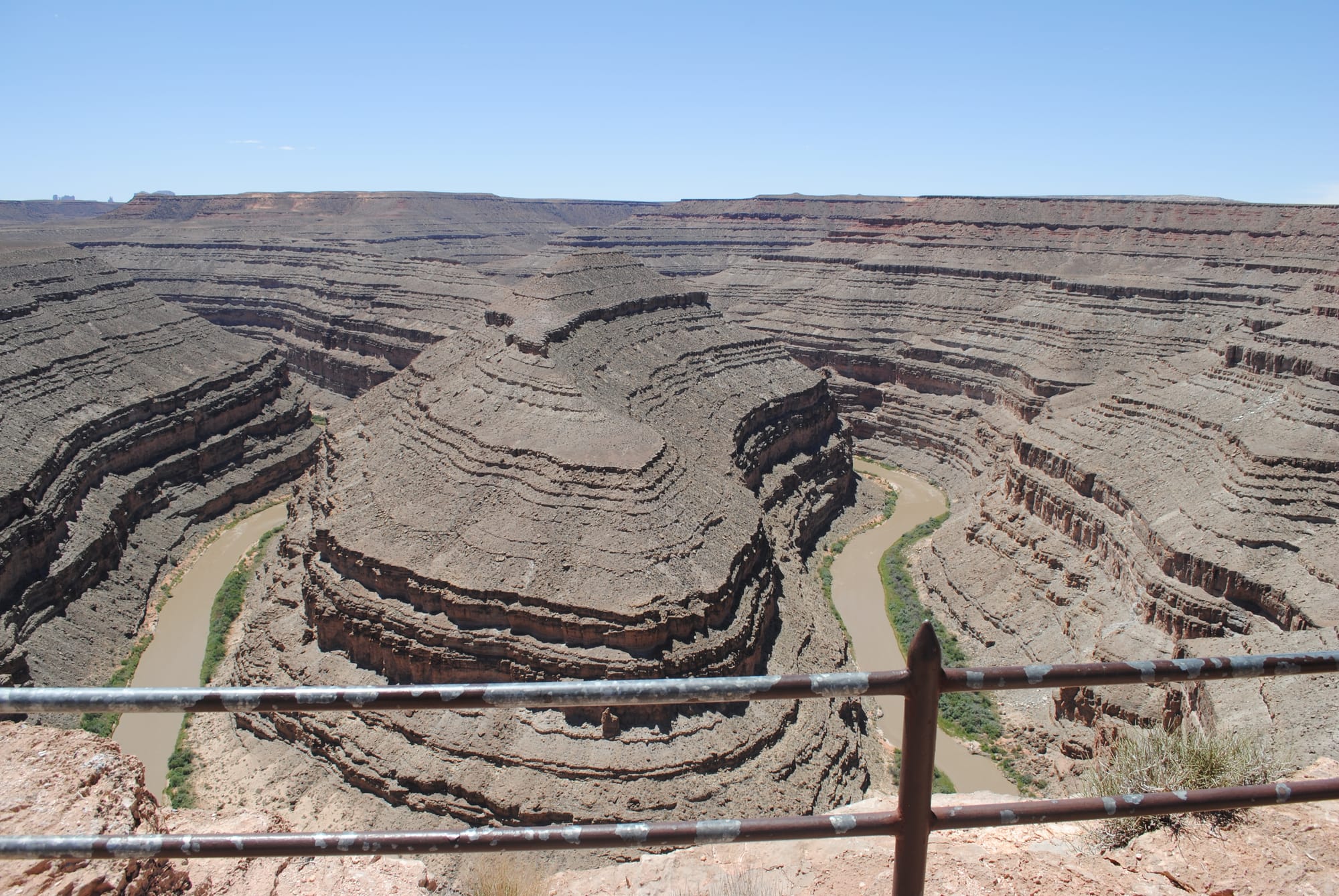
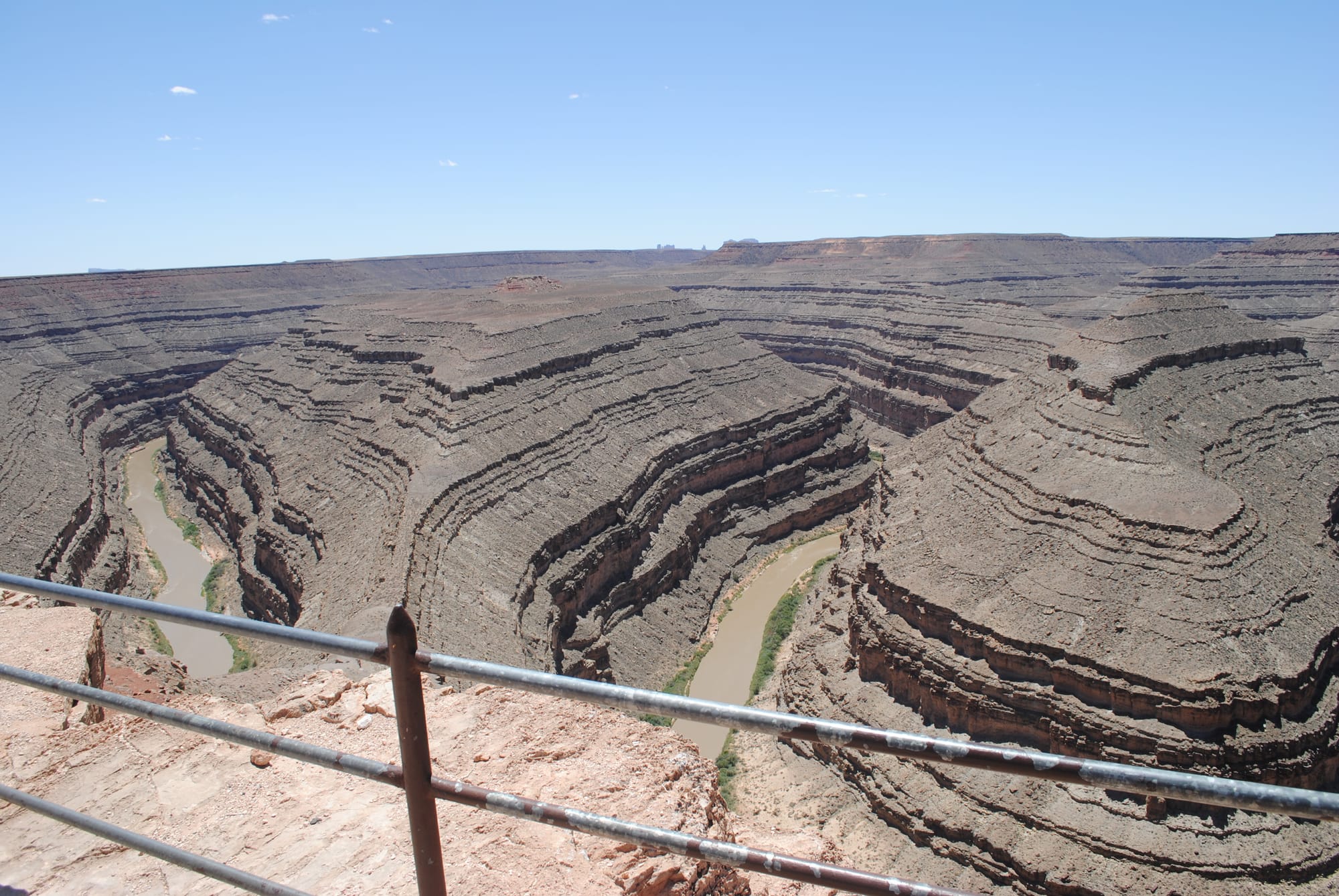
Gooseneck State Park (photos from right to left)
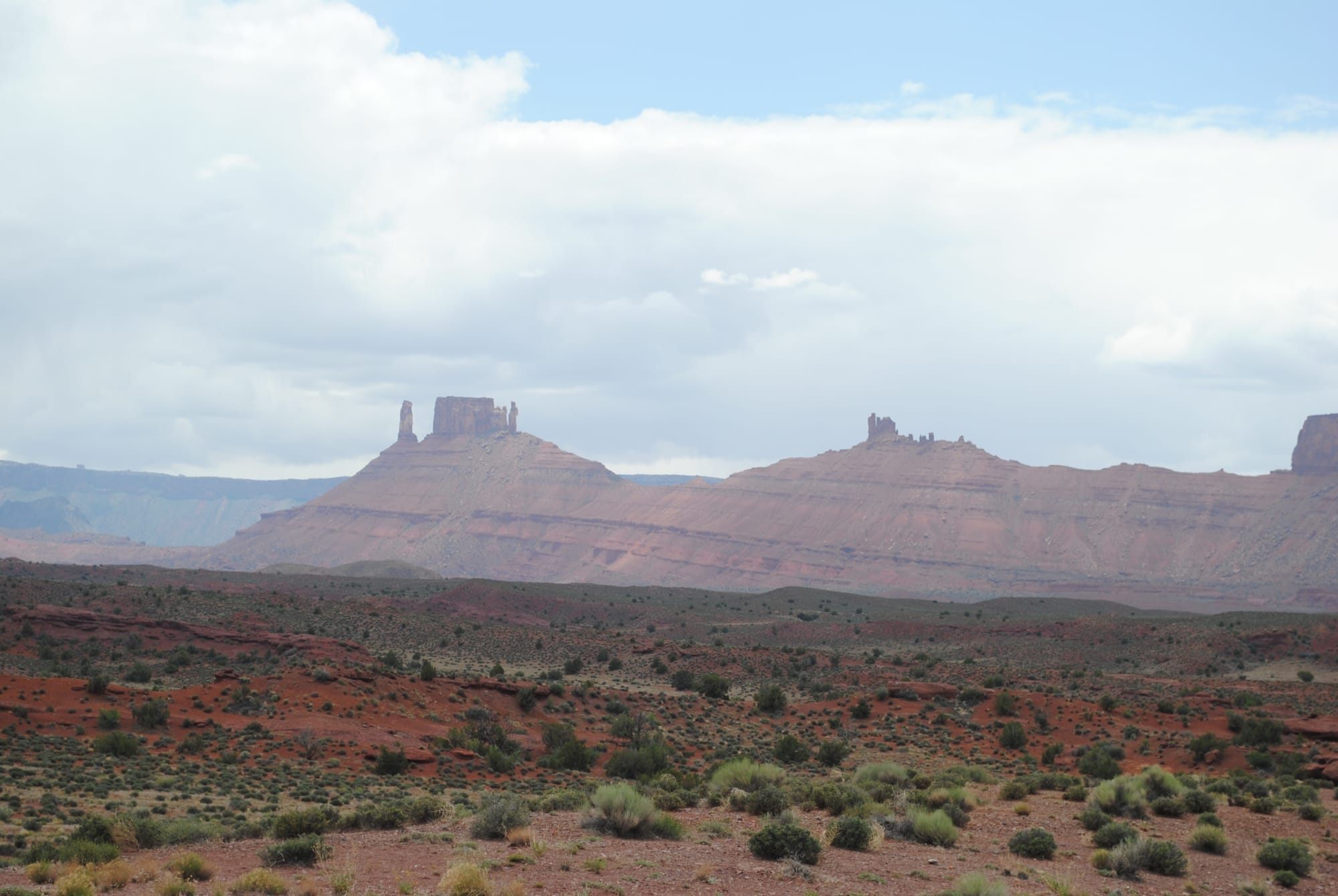
Valley of the Gods, UT
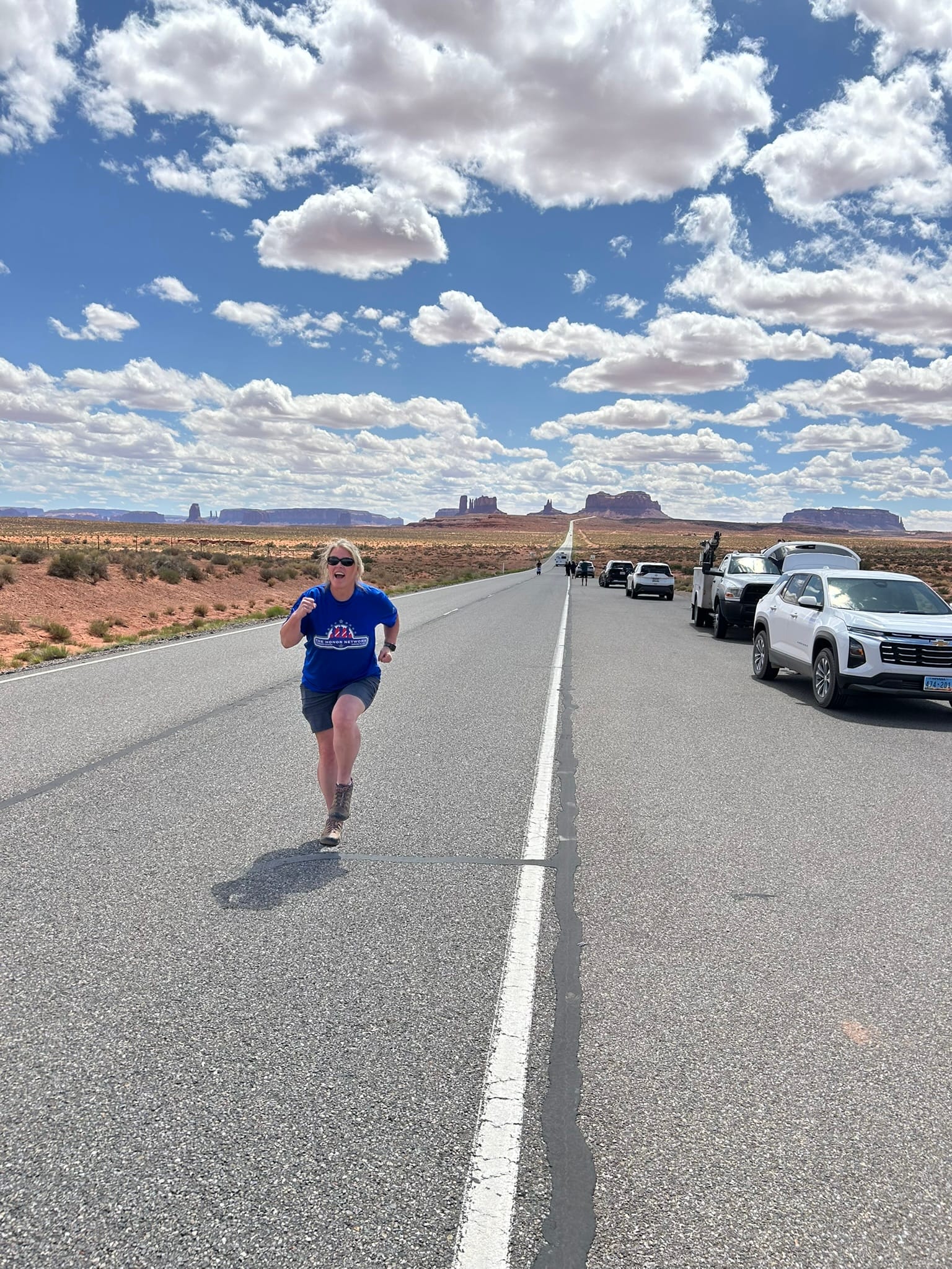
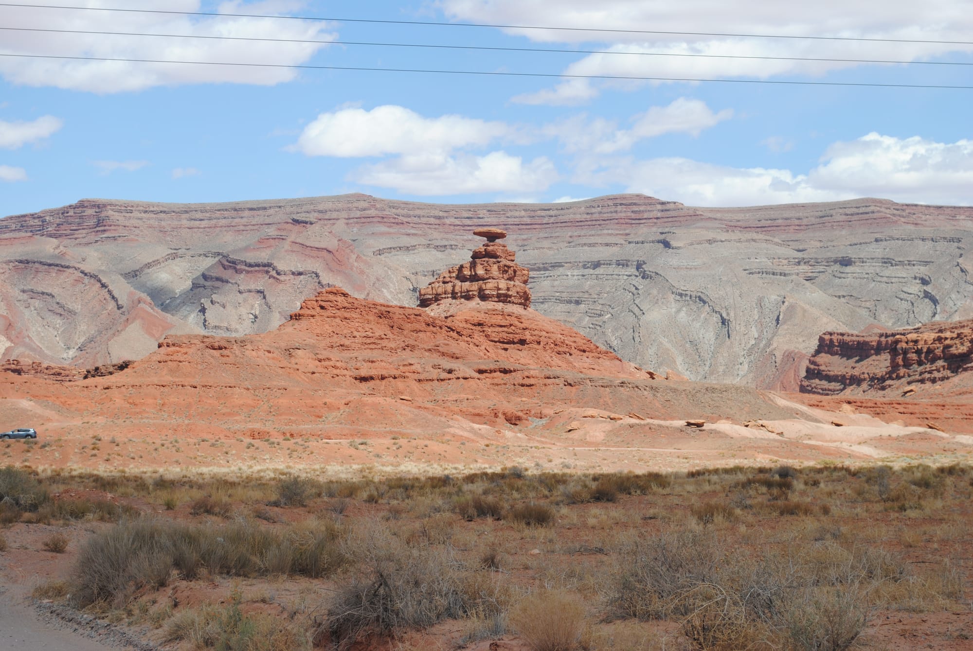
Once we left Monument Valley, we headed north on 163 to see some other sights along that route. The first stop was at the “Forrest Gump” spot which was featured in the movie where he decided to quit running. It’s a beautiful location. Kim recreated some running photos like everyone else was doing in the middle of the road and we moved on to the Mexican Hat Rock formation which is a delicately perched rock on top of a pyramidal formation. It was cool to see but not a long stop.
Forrest Gump spot and Mexican Hat Rock
We then headed on into the Valley of the Gods which is another valley full of formations like Monument Valley but most aren't as tall. Even so, the drive was much longer, very rough in spots and bumpy almost all the way around. There were people with campers pulled over and boondocking throughout the area. It was very beautiful in it’s own right to see and experience!
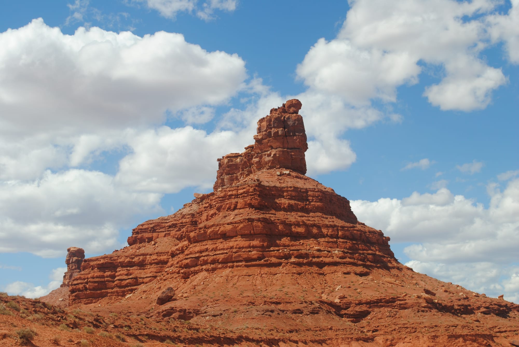
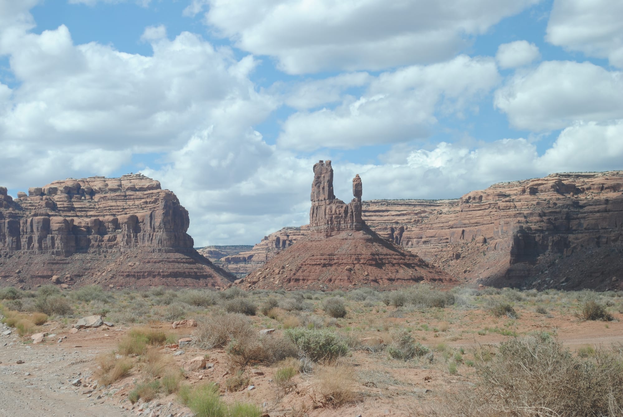
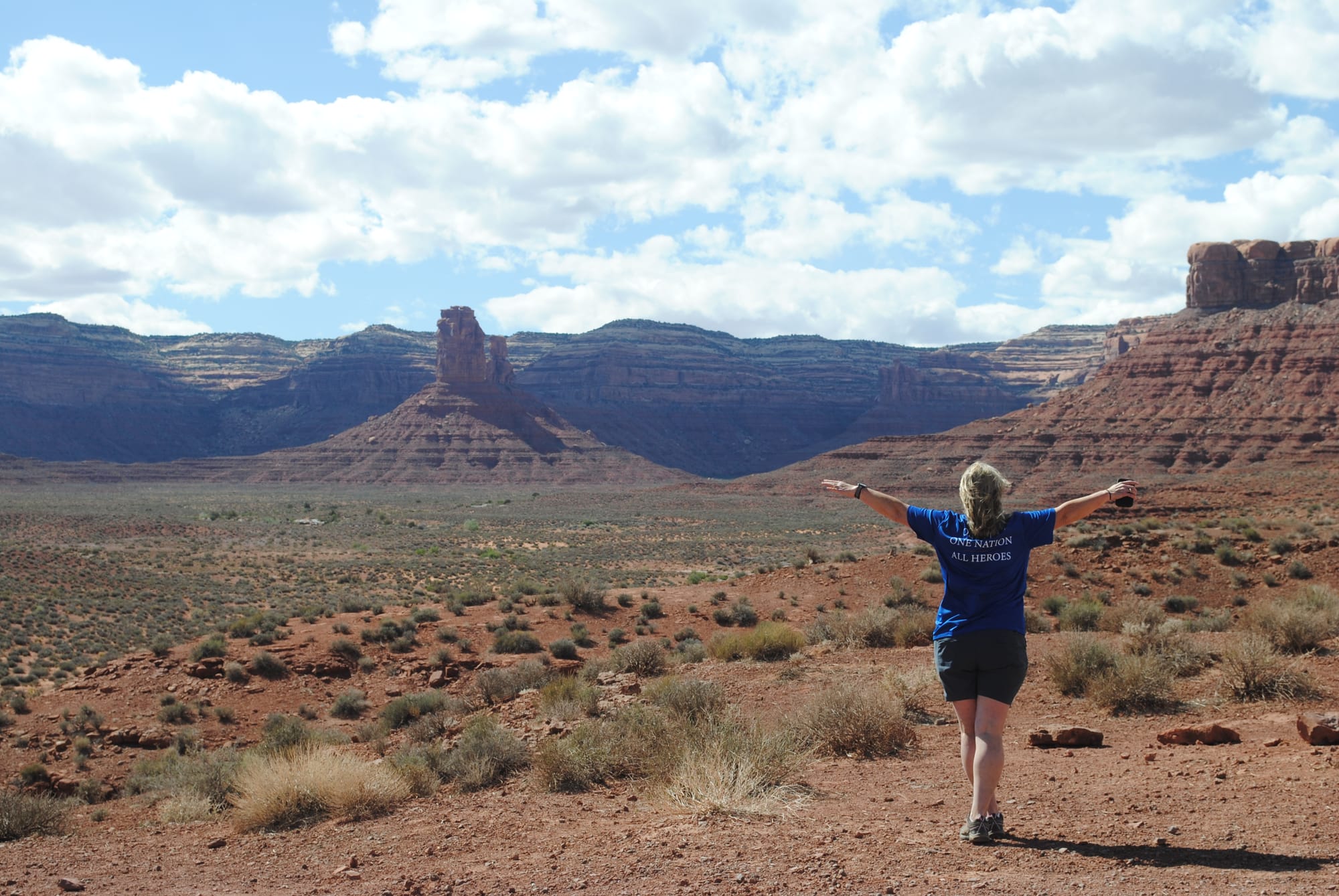
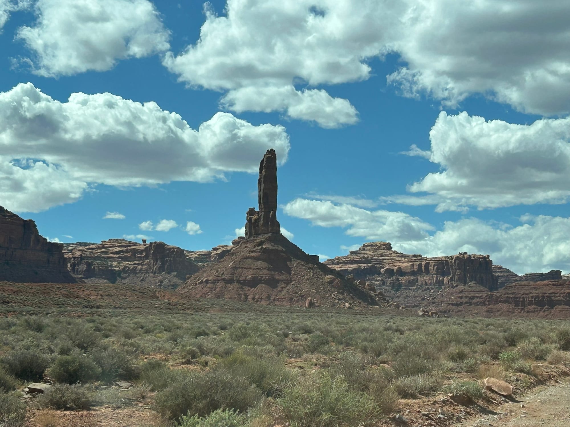
Valley of the Gods Monuments
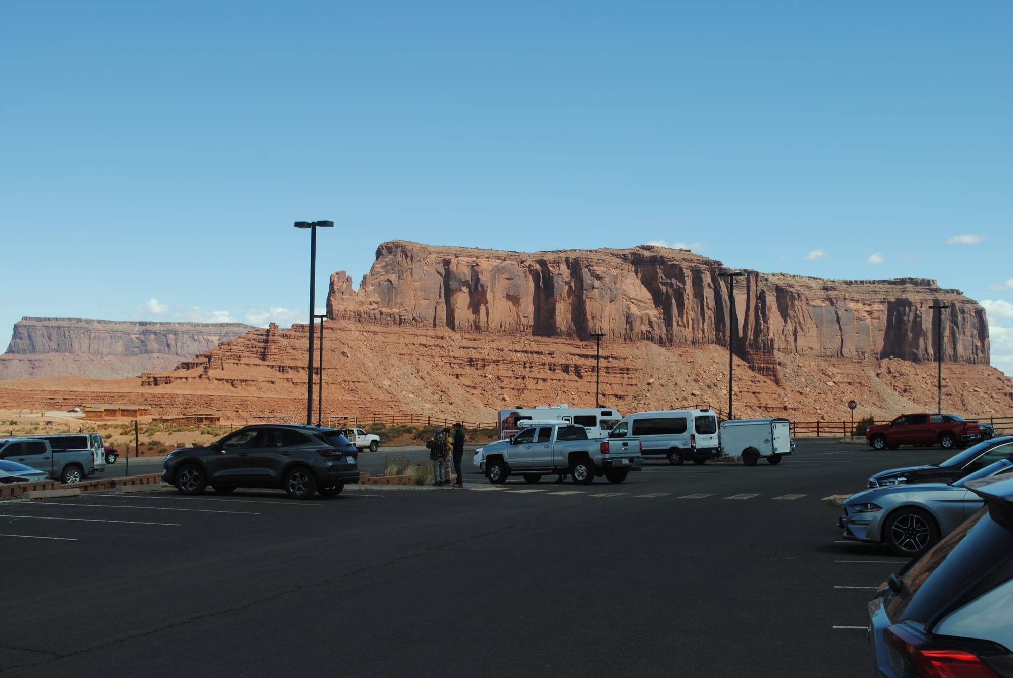
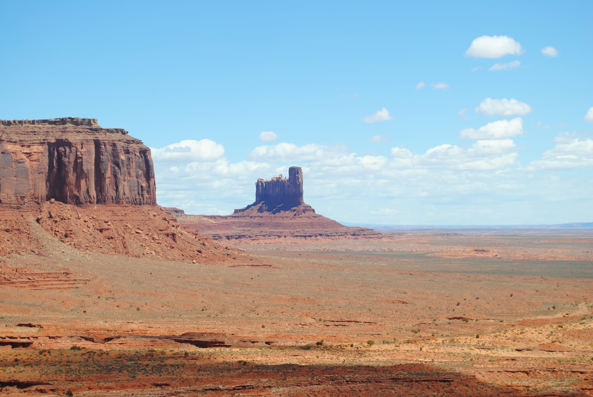
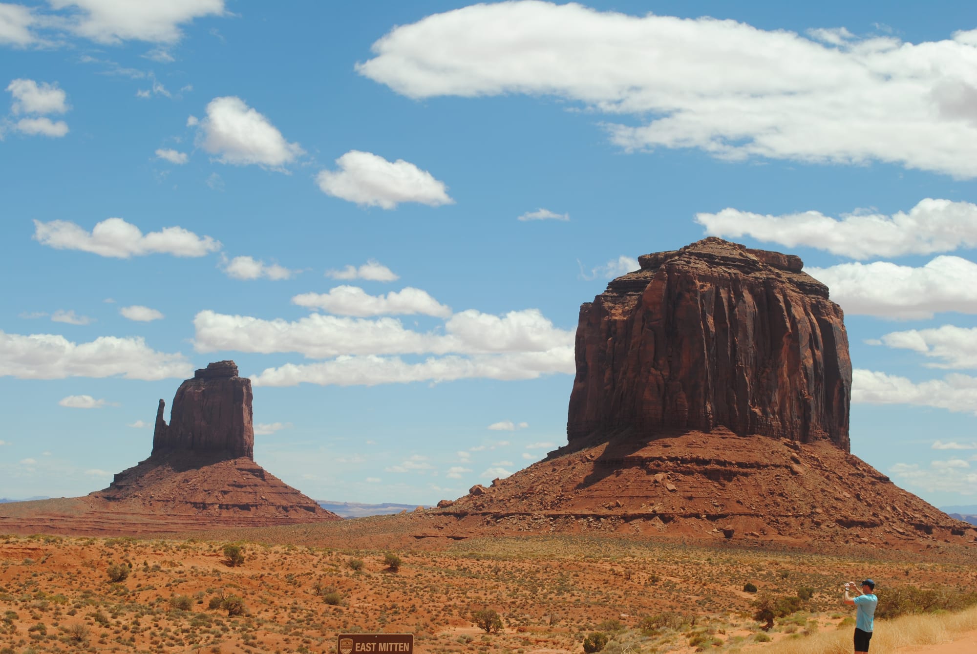
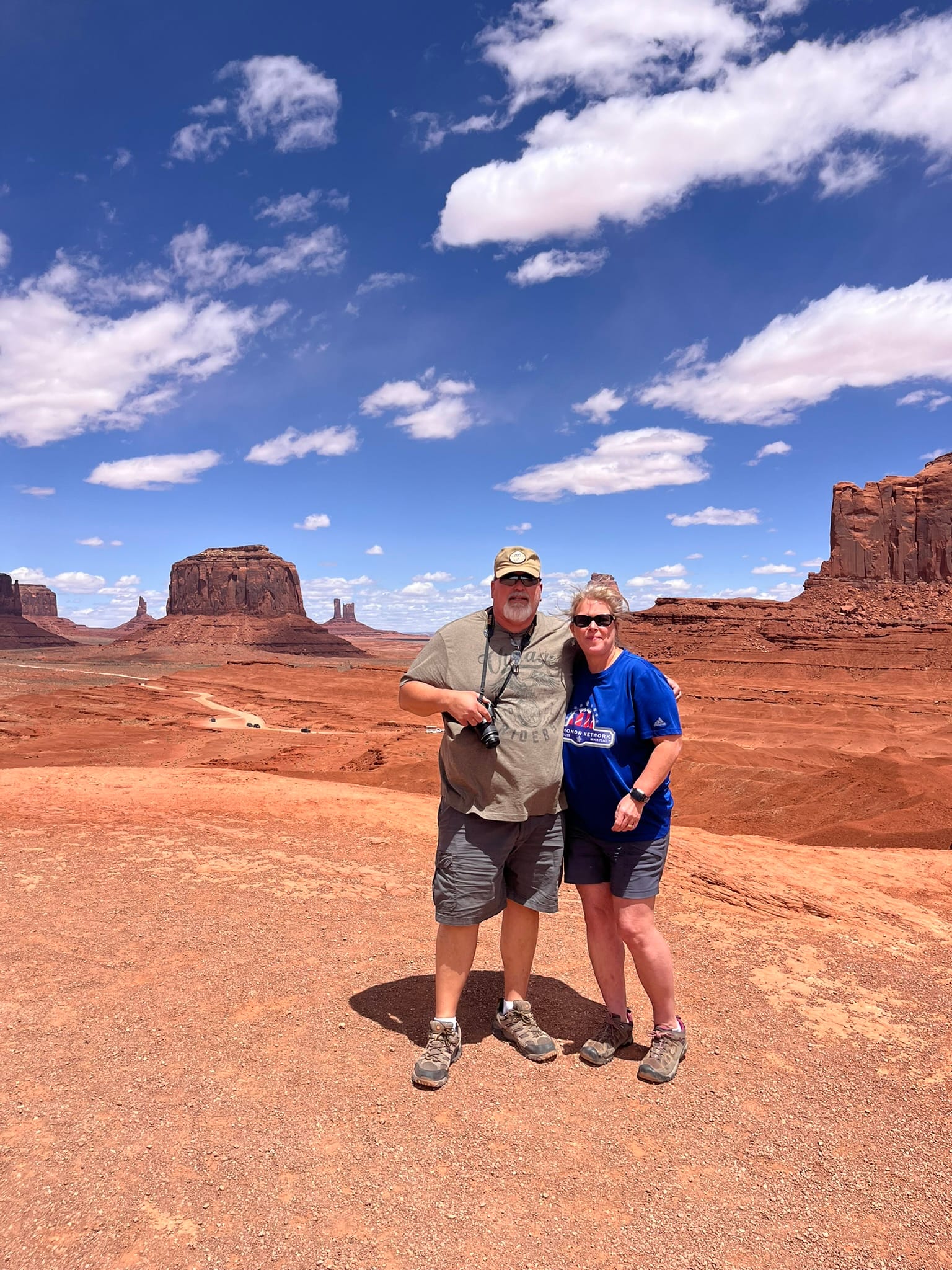
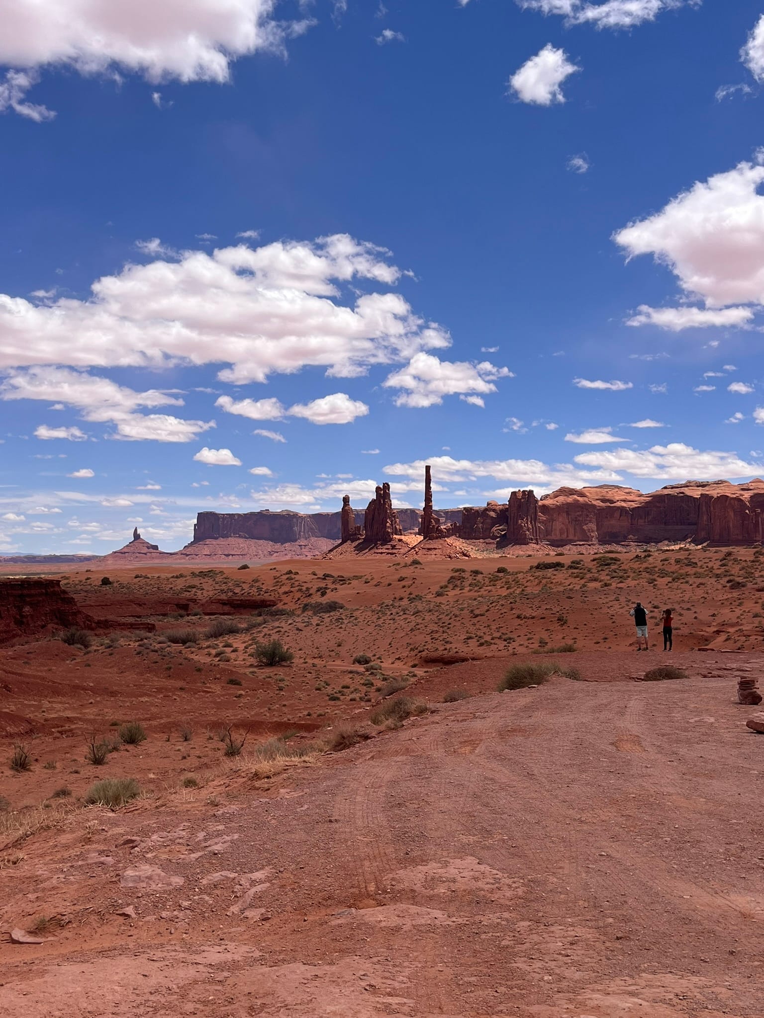
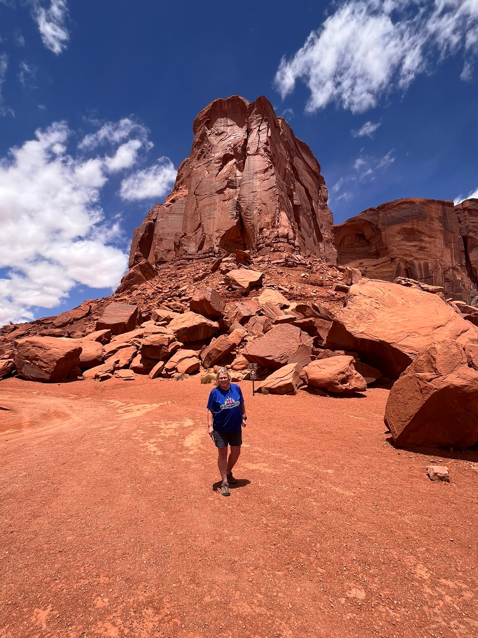
Monument Valley, AZ/UT
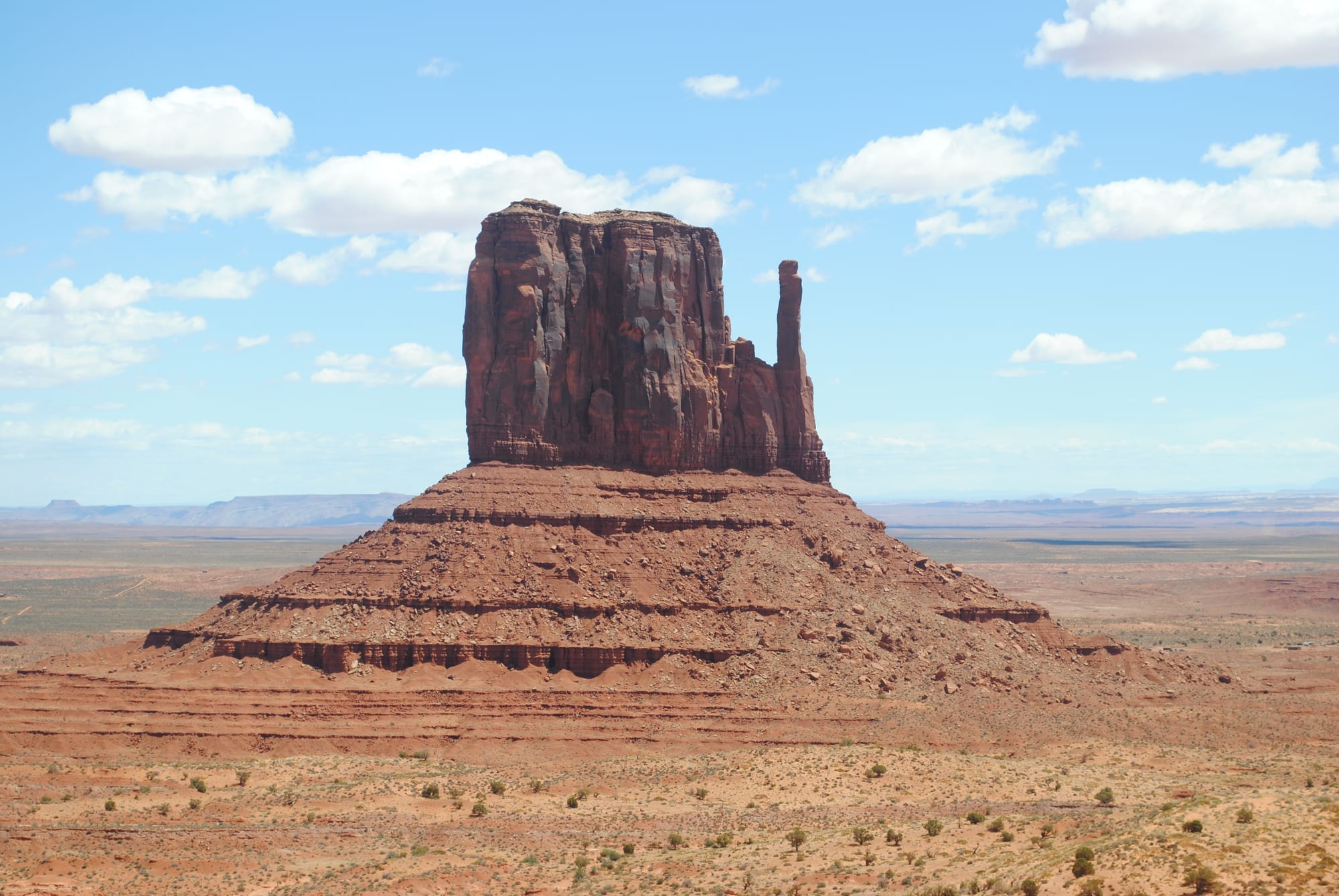
It was a very short drive from our campsite over to Monument Valley and we just followed signs for the Visitor’s Center. There’s a kiosk along the road collecting money for the self-guided tours. After paying, we parked at the Visitor’s Center and went in to check it out. They have a really nice viewing gallery along the cliff edge that drops into the valley beyond with stunning views of some of the closest monuments like the Mittens. They also have some interesting displays on Navajo life, the Code Talkers and a gift shop.
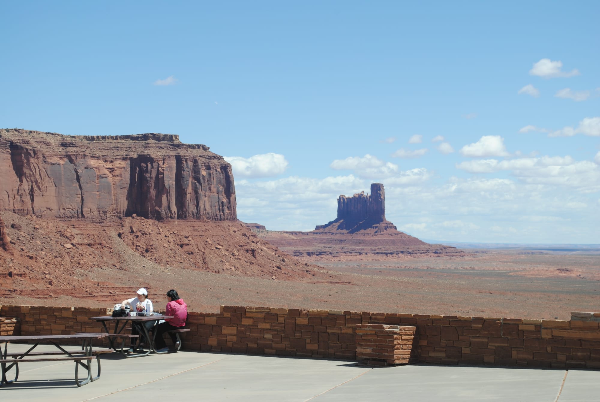
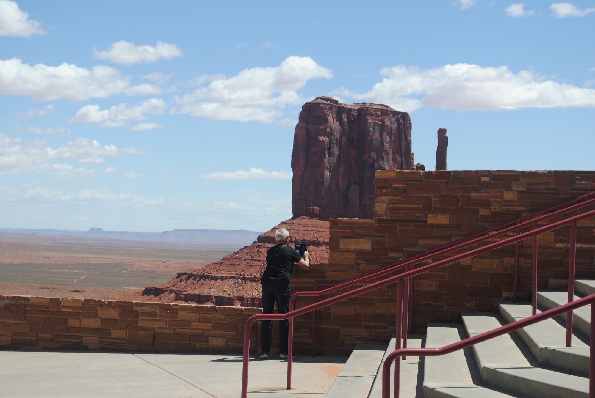
Views from the Visitor's Center
We headed back to the truck and followed signs onto the tour route. The initial descent was extremely bumpy and everyone had to go slow. Once we were down on the bottom, things got a bit better but the whole route was a bit bumpy with really rough spots sprinkled in to mix things up.
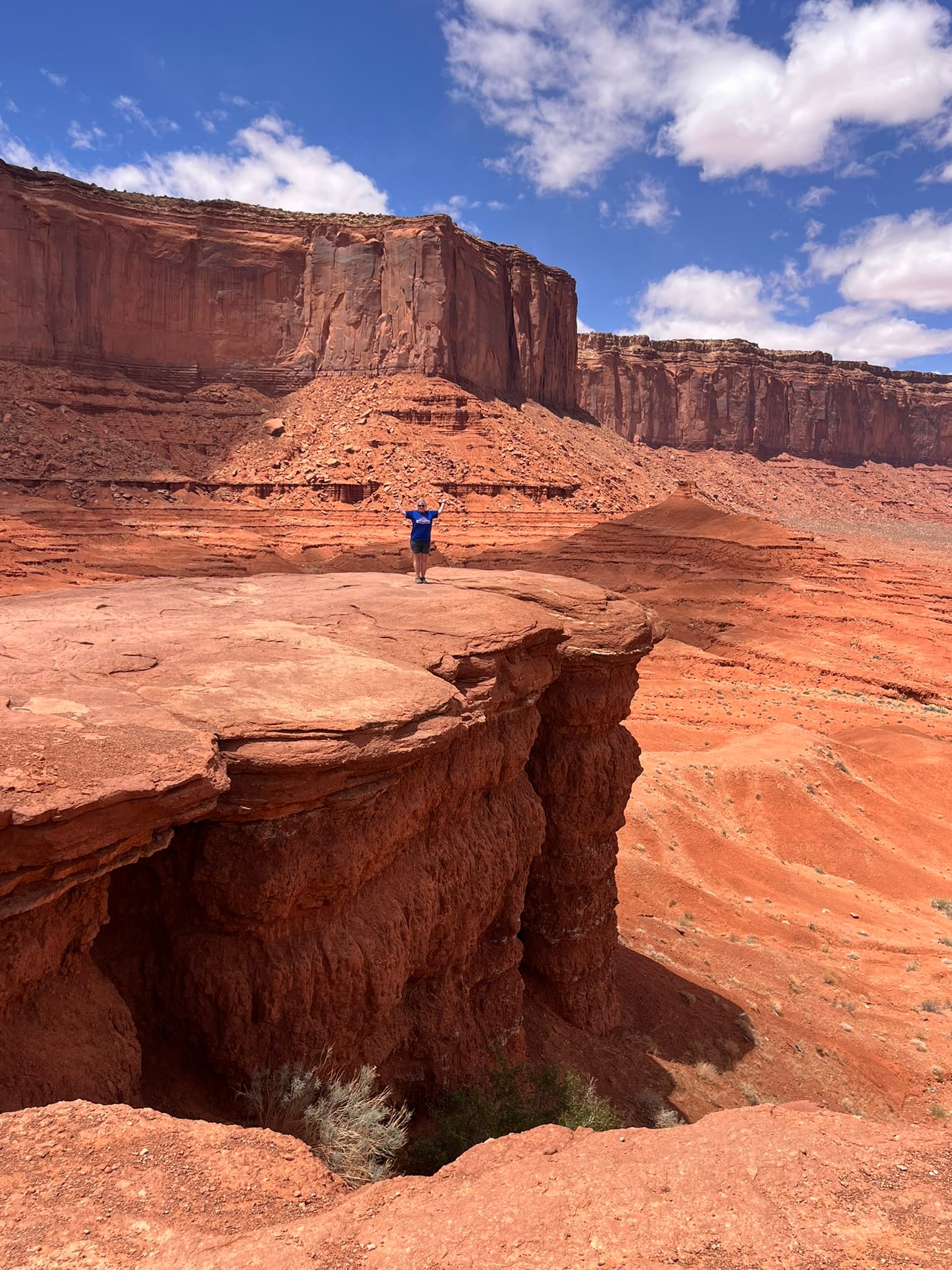
All around us were the monuments and formations that give the area it’s name. I had downloaded a guided tour from the internet that gave a running description of the various monuments and how the region formed. Supposedly, it was all a huge inland sea for eons while the various layers of sediment formed covering the entire region. These sediments having themselves eroded from a mountain range predating the current Rockies! Then the area uplifted and erosion removed all the material between the remaining monuments. It’s tough to comprehend how erosion could have so completely removed every trace of rock between the monuments this way. You have all these spires, buttes and mesas with a tiny bit of rock right at their base and absolutely no trace of rock between them for the most part. It just seems as though the rest of the rock was magically disintegrated or something because the whole area was 1000 feet deep in rock and there’s a HUGE amount of that rock missing! There’s just huge empty spaces between the formations and very little sign of having been flowing water or other natural erosion forces. Truly mind-boggling! A mind-numbing amount of time and a slow trickle of erosion has created these beautiful formations and we thank God every day that we have the opportunity to take in his Creation!
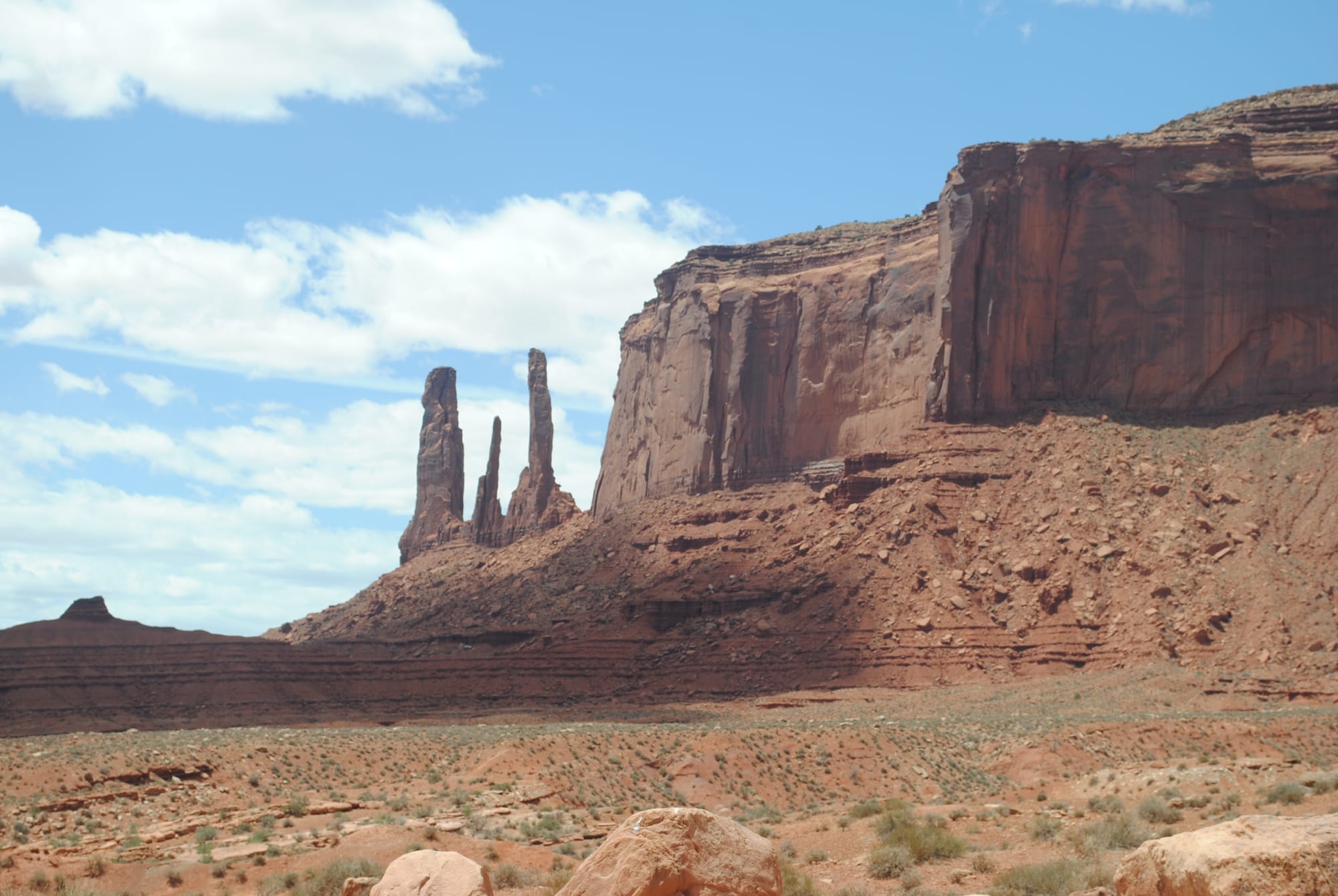
Many of these formations rise 700 to 1000 feet above the floor of the valley which is itself part of the huge Colorado Plateau itself over 5000 feet in elevation. The sedimentary rock is made up of primarily 4 layers that are exposed. The lowest layer is the Organ Rock Shale, the middle is de Chelly Sandstone, and the top layer is the Moenkopi Formation capped by Shinarump Conglomerate. The bottom is the hardest rock and forms the wider conical base since it erodes so much slower. The central portion that makes up most of the exposed formation is shale and erodes into steep cliff like formations and the top layer the conglomerate is the materials that provided the protection from erosion that allowed the formation to survive this long. I guess that layer wasn’t consistent across the entire region so other sections of the overall area wore away much more quickly.
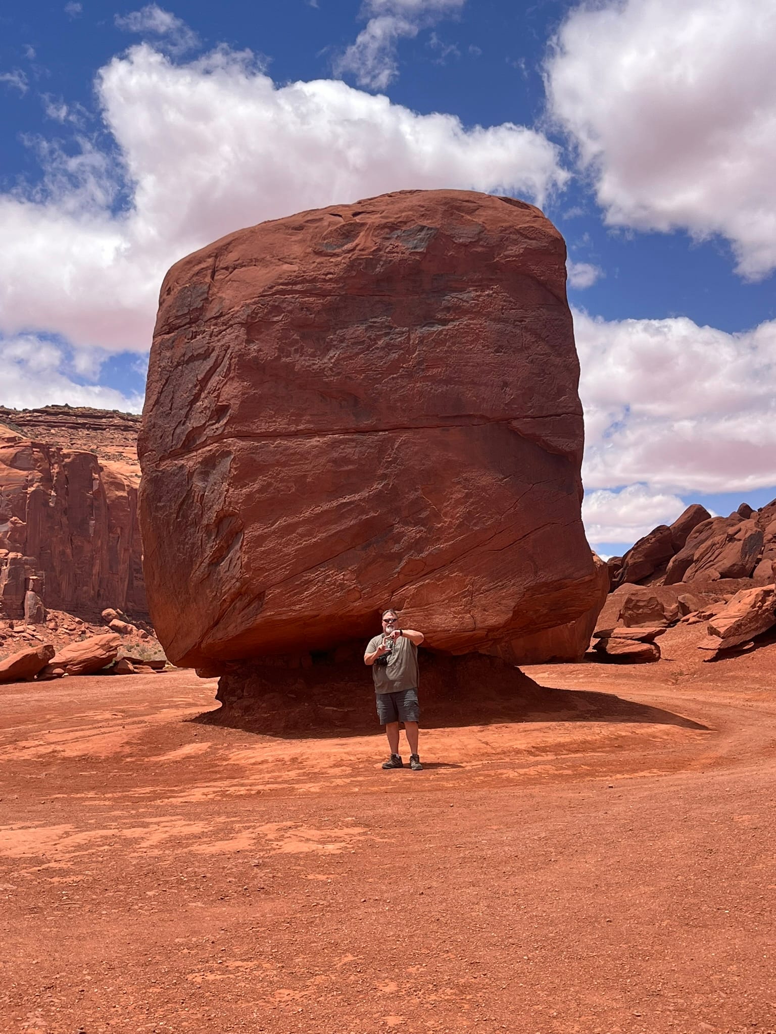
We stopped at John Ford point for some photos and our guide said we had to try the Fry bread. While I was in line, we met our camping neighbors who also said his guide (different from ours) said the same thing. We headed out to the “point” of cliff and had to deal with influencers hogging the point for photo after photo!
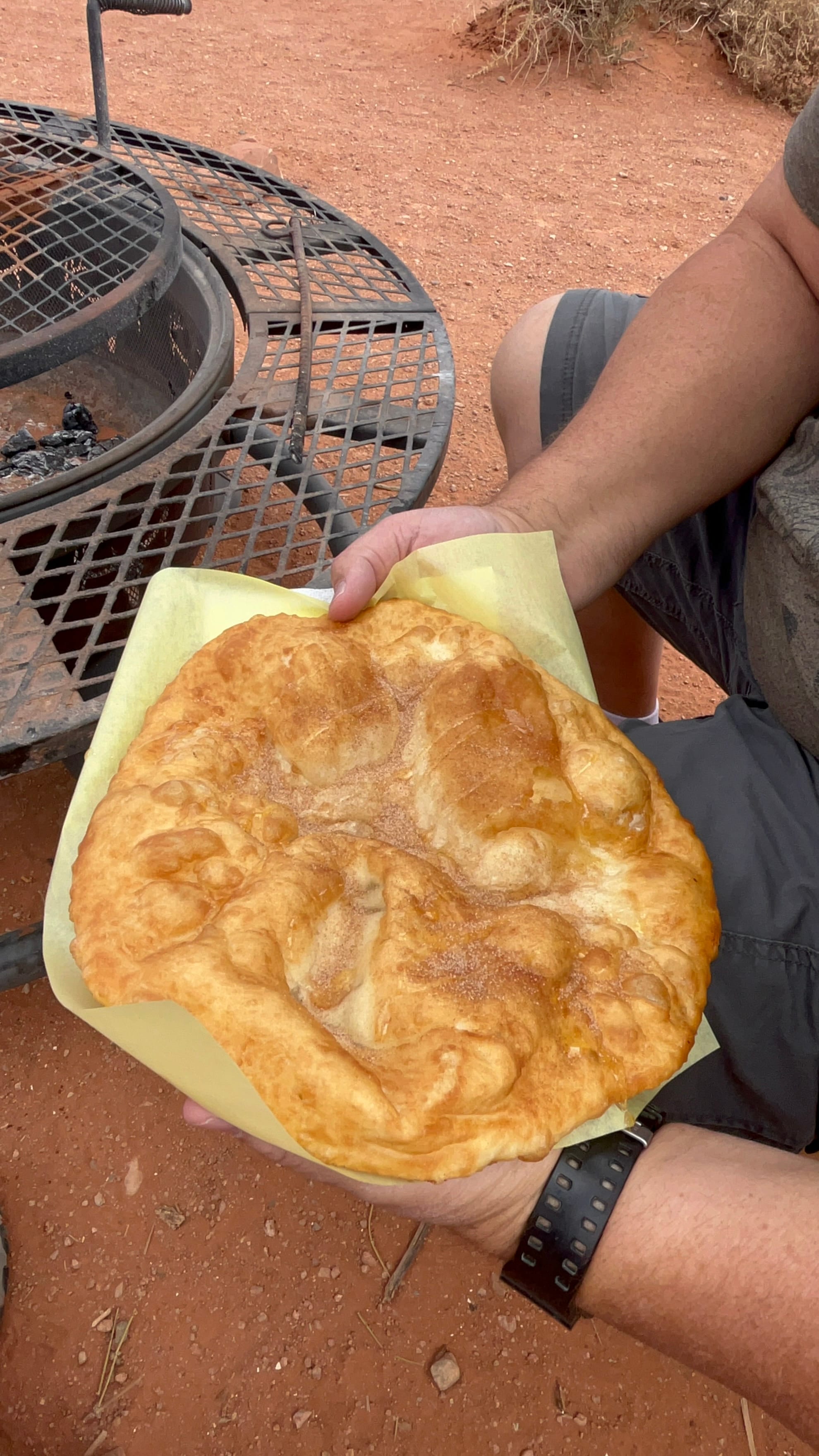
Fry Bread and John Ford Point
While we were finishing up our 17 mile loop around the formations, we spotted a C-130 flying a low level out in the distance in the valley and as we made our way back to the main road, it suddenly came screaming around the formation in front of us, flew beside us and banked around the formation to our left. The loading ramp was down so I know they were enjoying the view! It happened so fast that we couldn’t get our cameras out to capture it but our new dash camera caught the first part of the flyby!
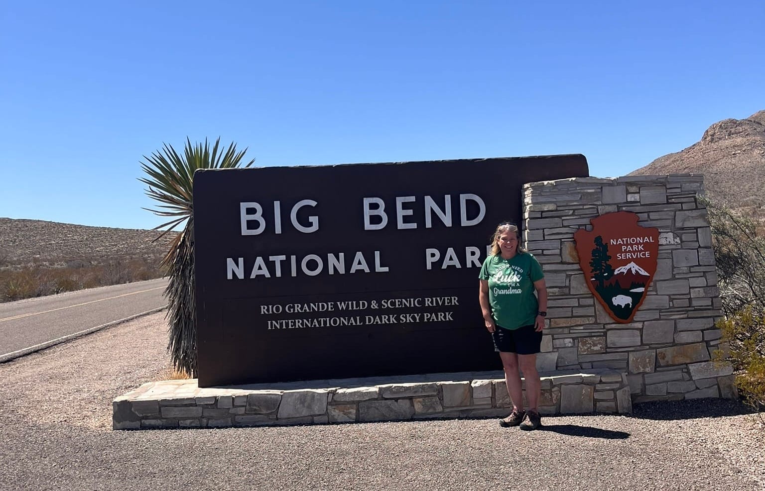
Big Bend National Park, Tx - April 2025
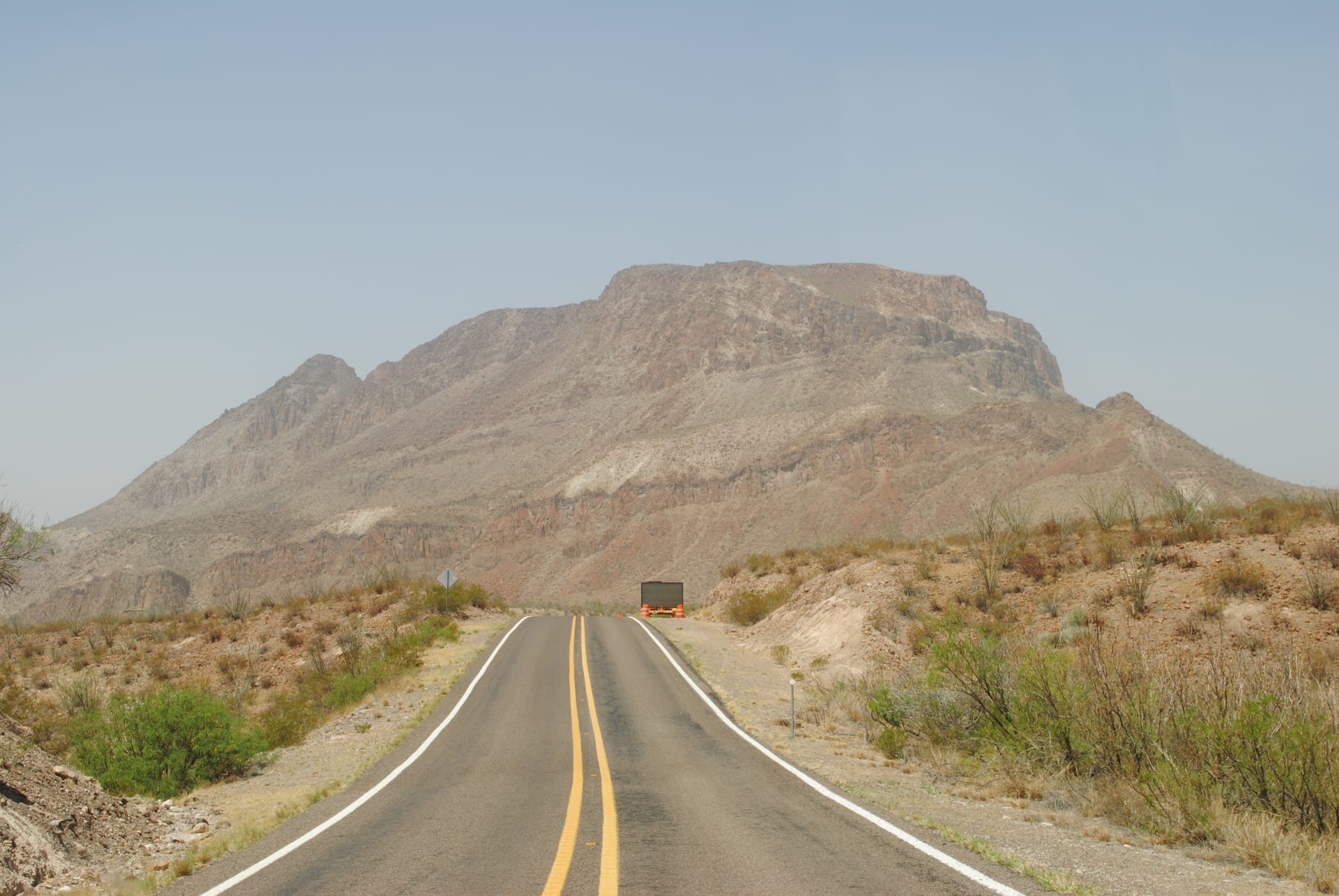
We headed into Big Bend National Park around 12:30. We could see the beautiful Chisos Mountains from Terlingua and Lajitas. In fact, we could see the Santa Elena Canyon though we didn't realize that was what it was until the way back out!
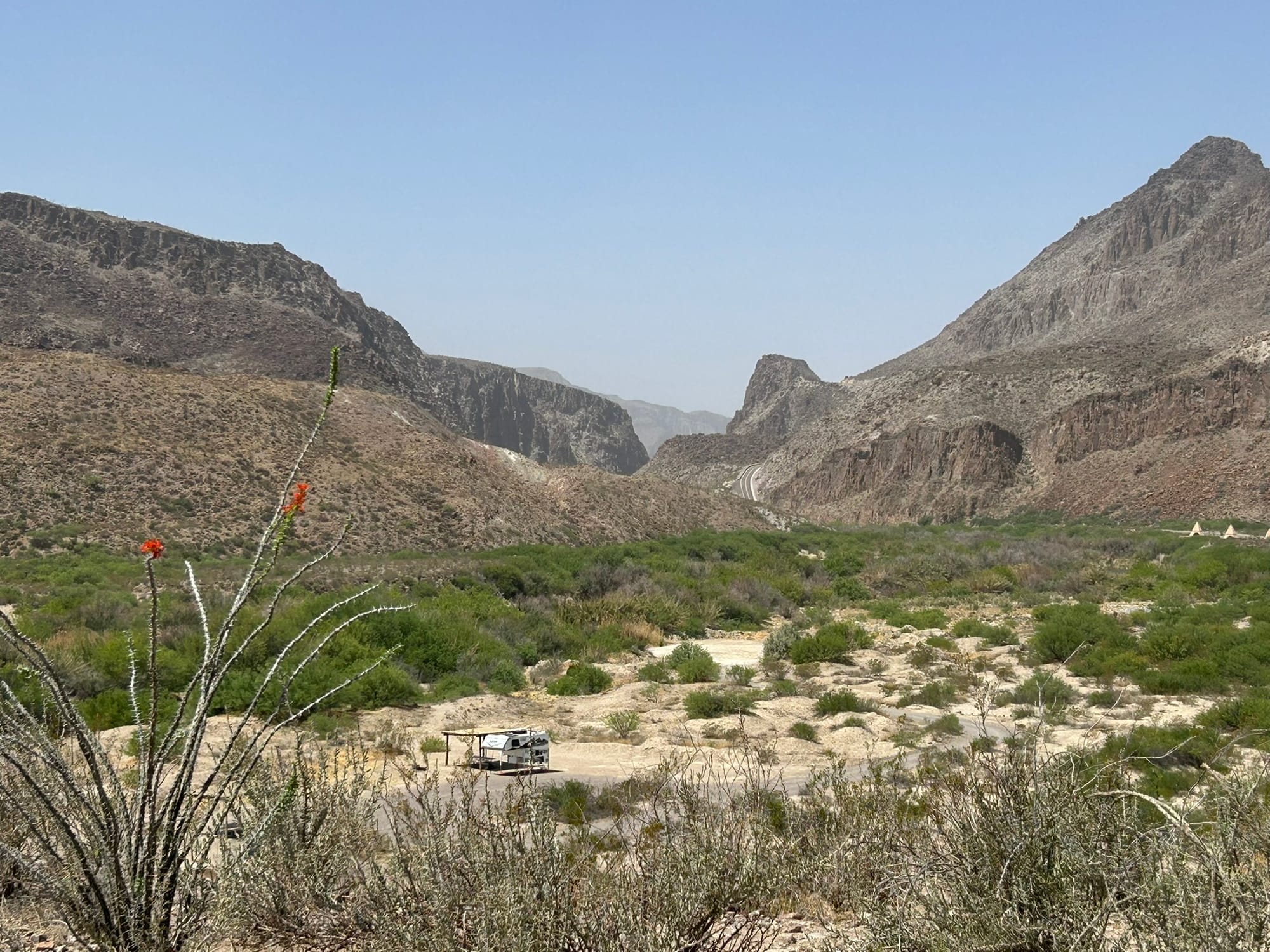
We had decided to drive the Ross Maxwell Scenic Drive which is named for the first Superintendent of the park, Ross Maxwell, who scouted the route to show off the natural beauty of the park. It's basically the second right turn you can take after entering the west entrance. The first turn being a dirt "shortcut" to Santa Elena which isn't recommended for anything less than 4-wheel drives.
The scenic route takes you past a lot of varied geology including along the west side of the Chisos Mountains in the park. Pull offs along the way have presentations that describe the plants, animals, and geology of the region. One of these discussed the formation of the Chisos Mountains in the area by volcanic extrusion where magma breached the surface to spread out and form some of the features you are seeing. In a few areas there had been magma intrusions along cracks in the underlying rock that created walls, called dikes, that hardened and have been uncovered by erosion over the millennia. Those were some of the coolest formations we saw along the way! We also got to see an ash layer of material that reminded me of the painted desert in it’s variety of colors and the way it eroded into drooping piles. There’s also a mountain formation called the Mule Ears which was rather photogenic!
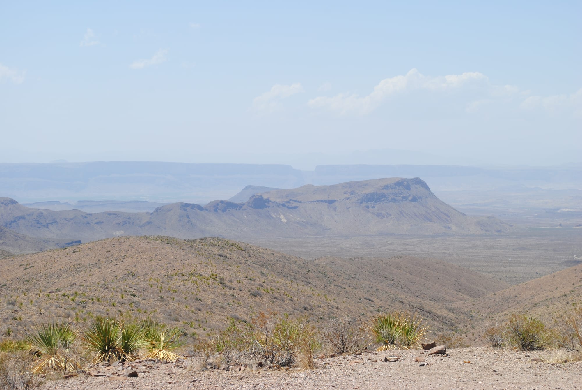
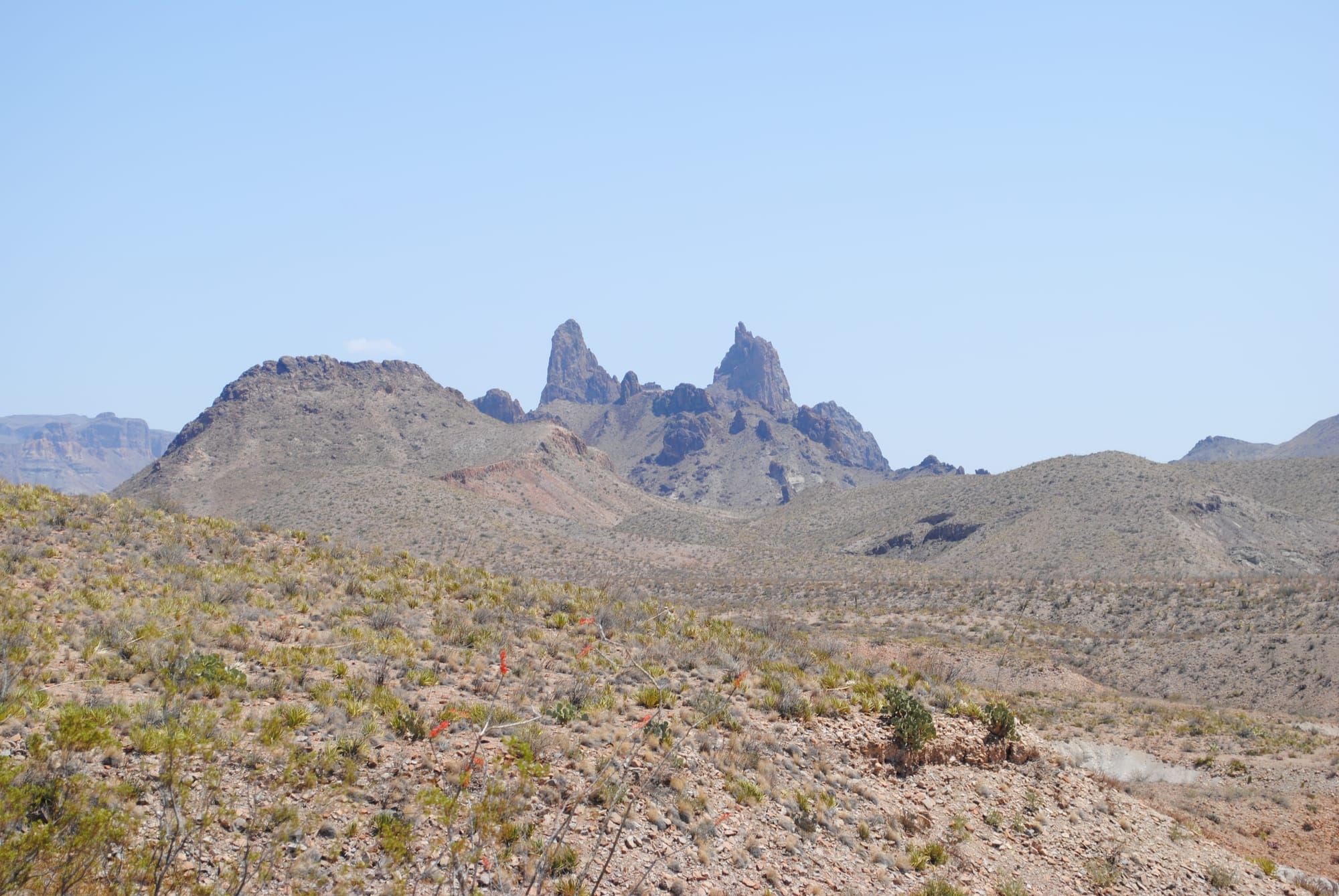
Scenery along the Ross Maxwell Scenic Drive
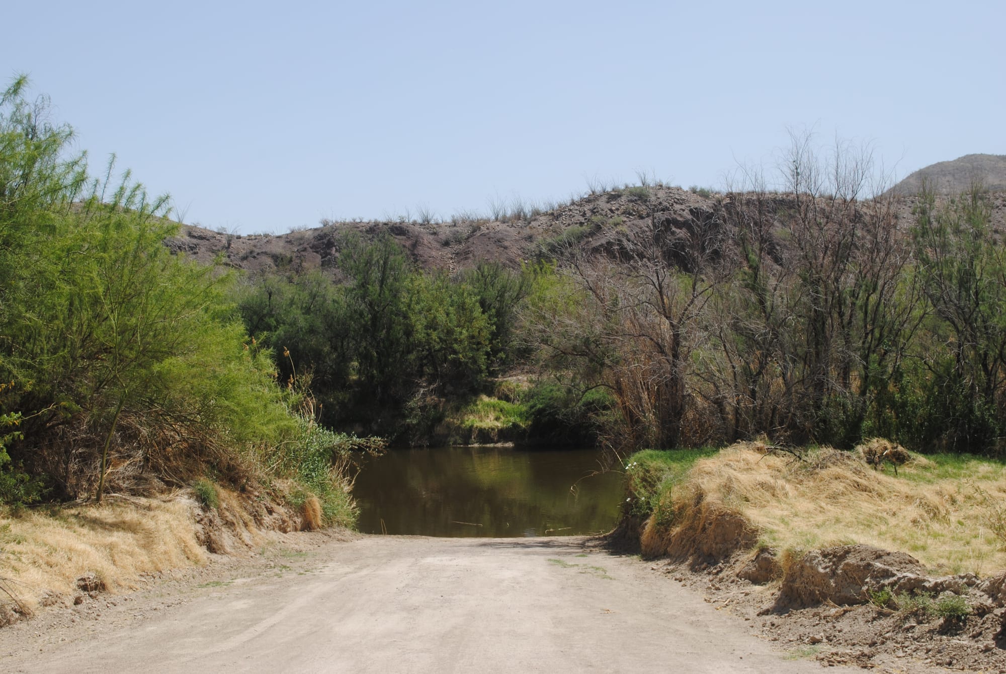
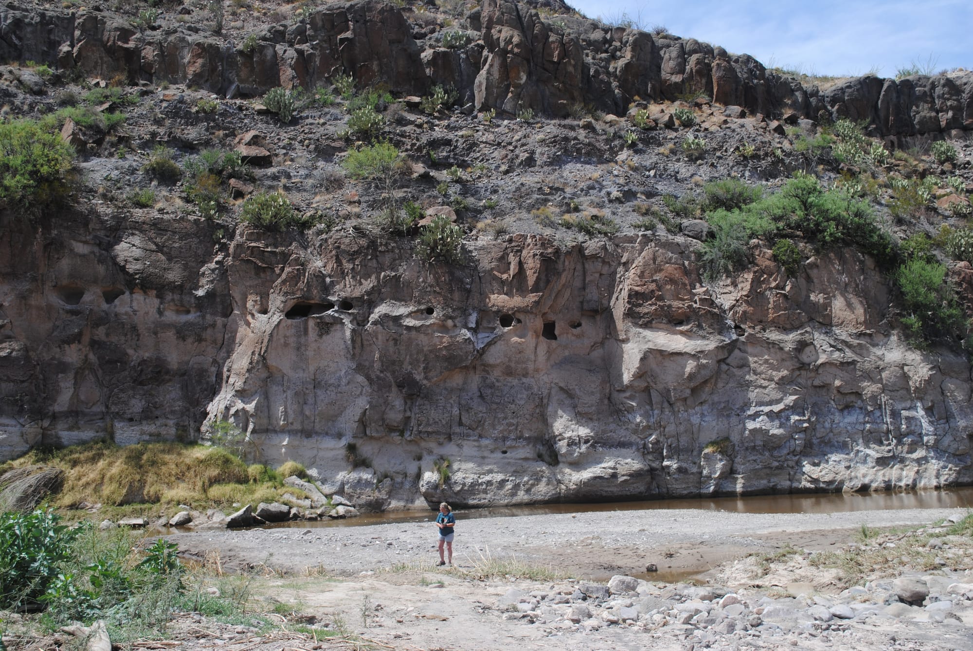
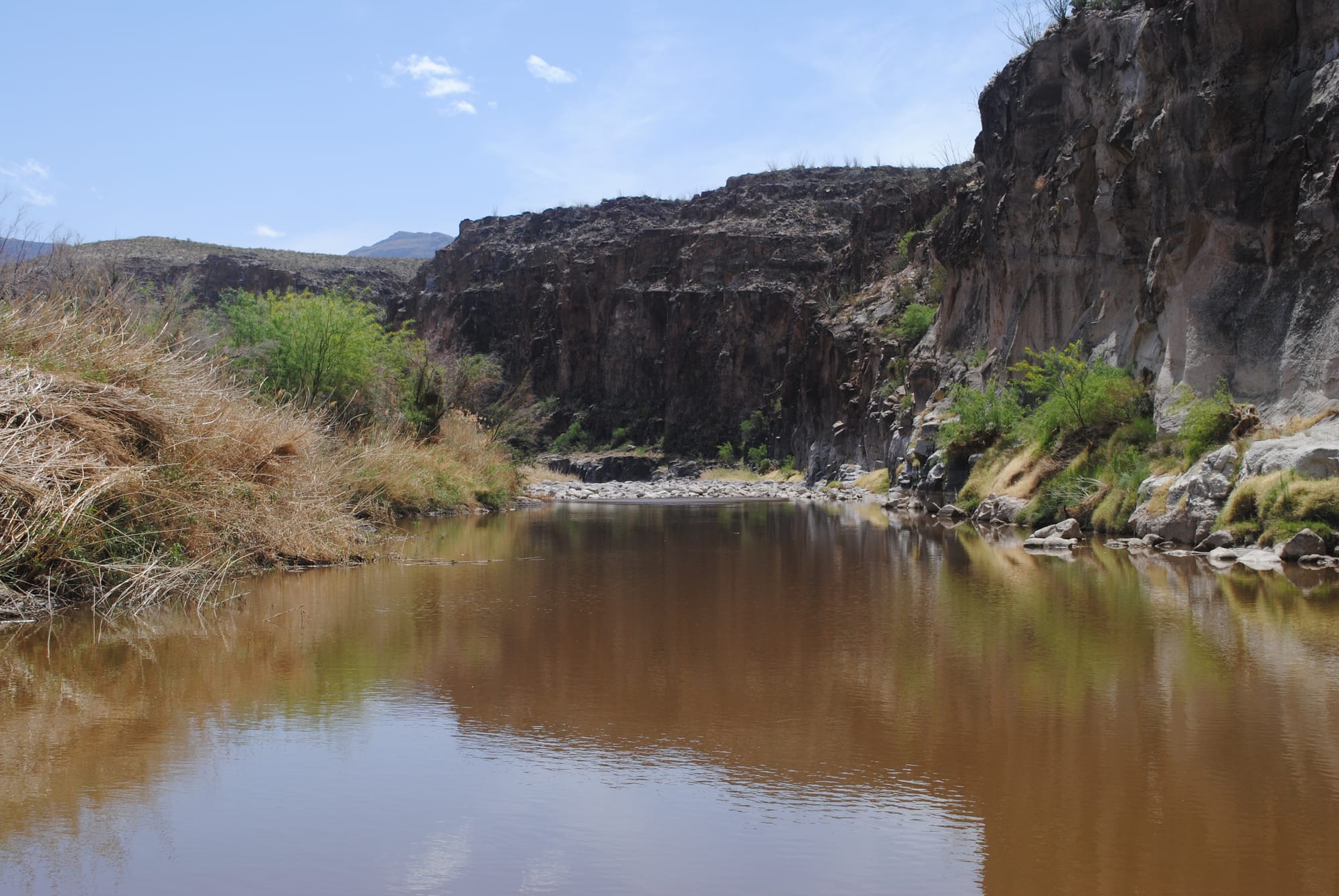
Ultimately, after passing a huge variety of mountain formations we found ourselves down at the end of the scenic road at Santa Elena Canyon, the quintessential photo spot in Big Bend! It’s a huge fissure in what appears to be a sold wall of rock rising out of the ground on the Mexico side of the Rio Grand. It’s like the Ice Wall in GOT. The Rio Grand comes out of the mountain face in the canyon and is joined by the Terlingua creek running along the wall face to the west. I couldn’t believe how vertical the faces of the rock wall were! There didn't seem to be a way to explain the erosion. There was clearly a lot of material that had eroded but very little piled up at the foot of the mountain wall. I guess that speaks to the power of the Rio Grand when it's running.
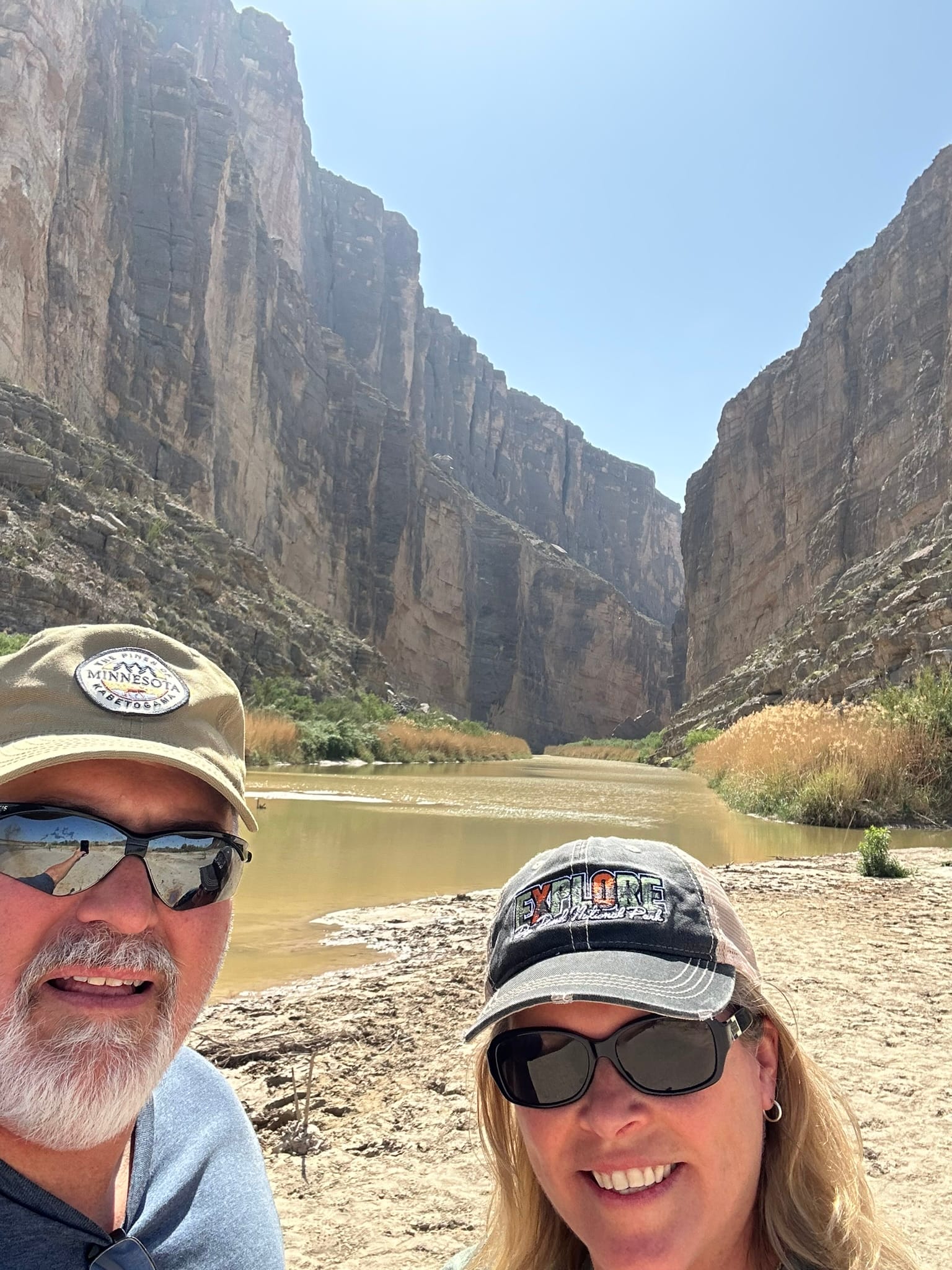
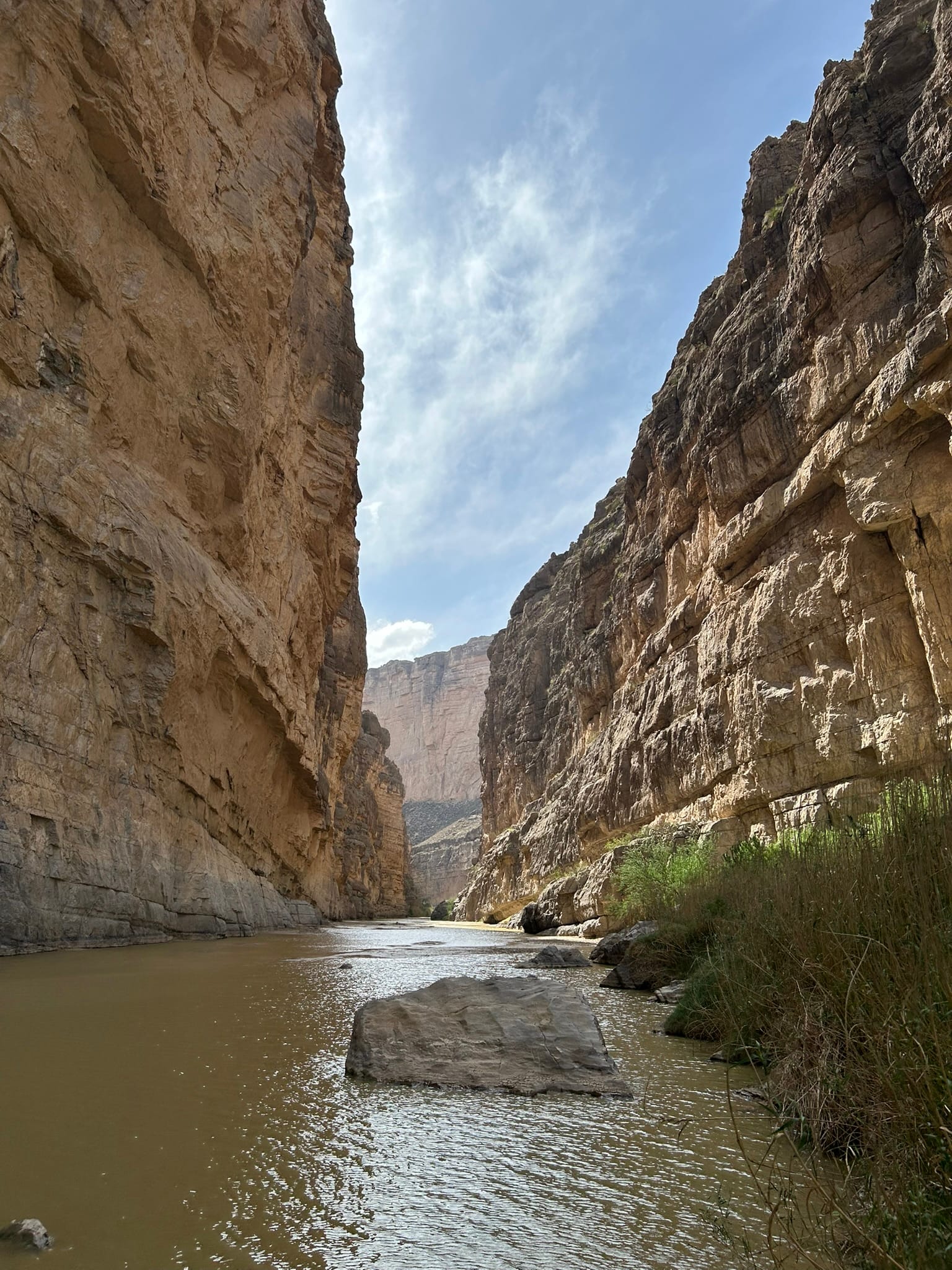
Santa Elena Canyon
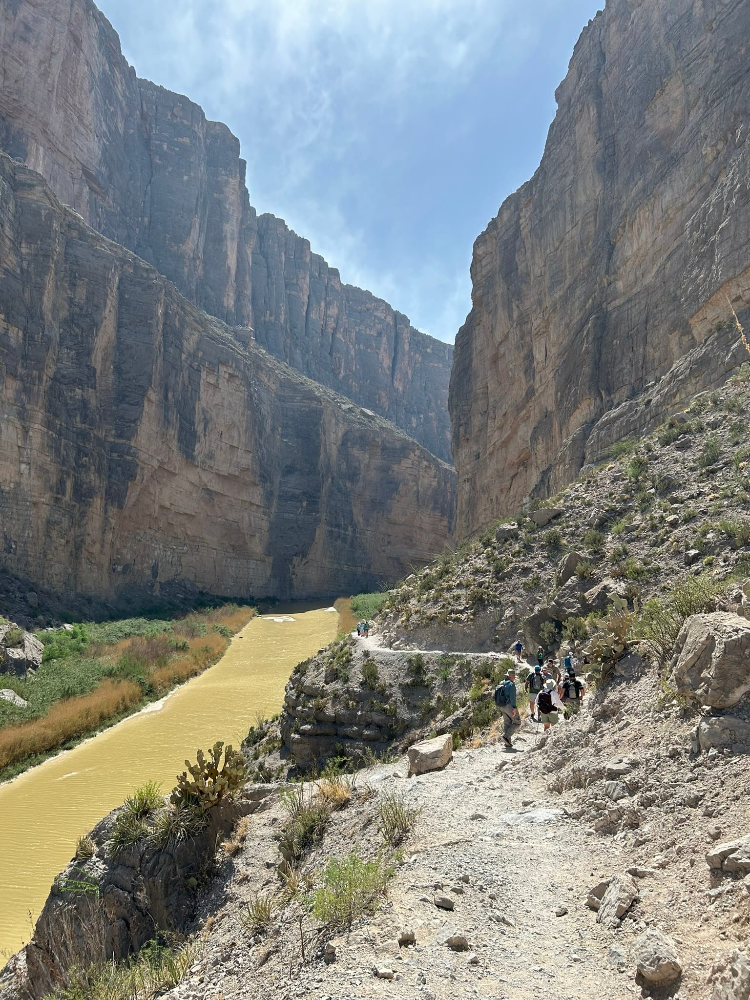
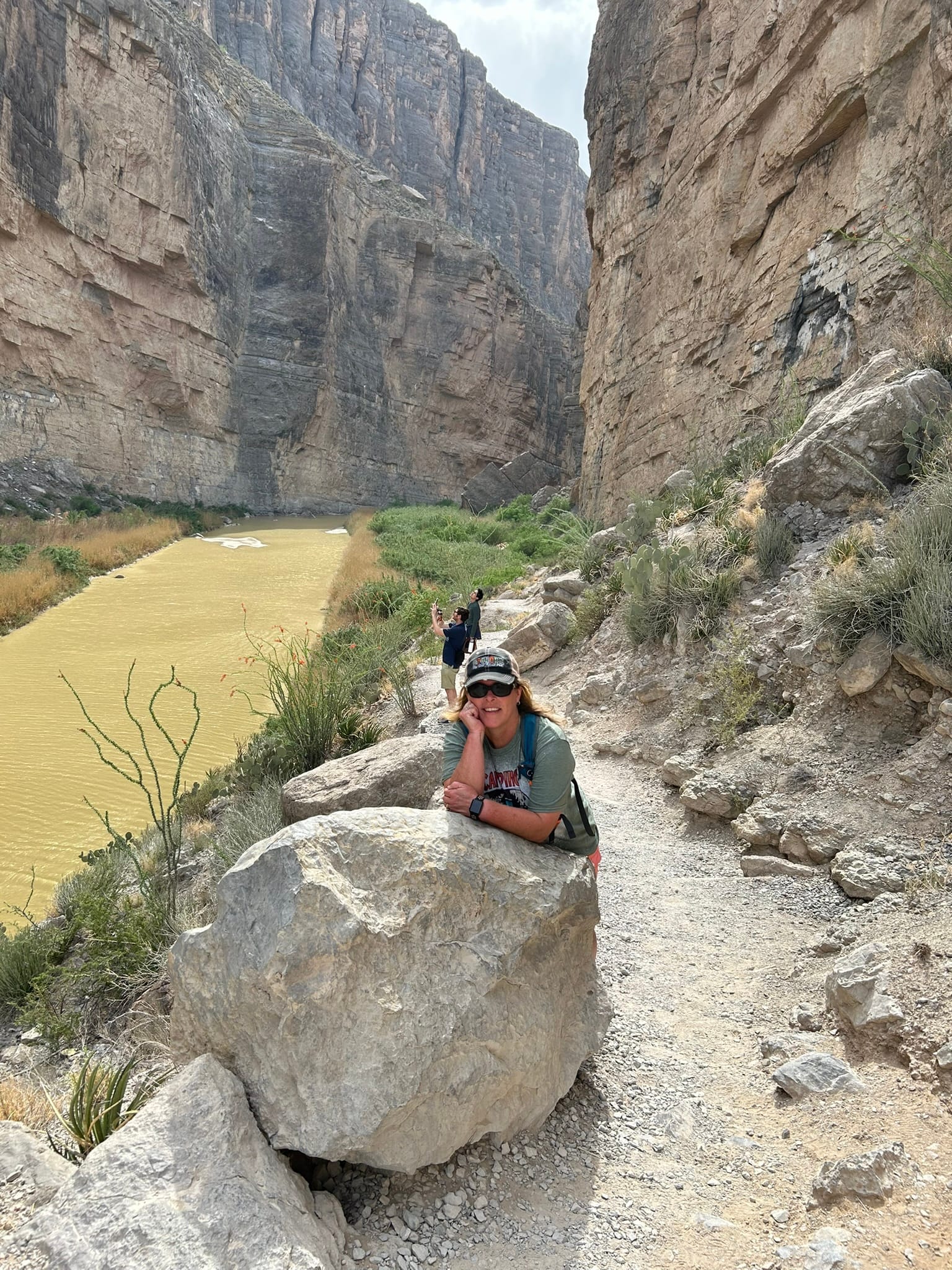
At Santa Elena Canyon there’s a 1.7 mile round trip hike back into the canyon which is really a must do! It's very popular so you may have to literally walk it in a line of other hikers. First, you go a bit west to find a dry spot to cross the Terlingua Creek and then climb up the bank and head back to the entrance of the canyon and start climbing switch backs up the wall until you can meander back into the canyon a ways to get even better pictures of the canyon walls back there. Right now, there’s water by the mouth of the canyon but by the time you hike back a ways, it’s you realize that the water is very shallow and not running fast if at all. Very sad for such a magnificent river and canyon. The drought in the American Southwest is really hitting things hard!
As we retraced our drive back to the west entrance we could look south and see the massive mountain wall with the Santa Elena Canyon gap clearly visible. We didn't get to travel to the east side of the park which gives a different perspective to the central mountains and access to the Basin, so that will await another trip back to explore some more of this amazing park!
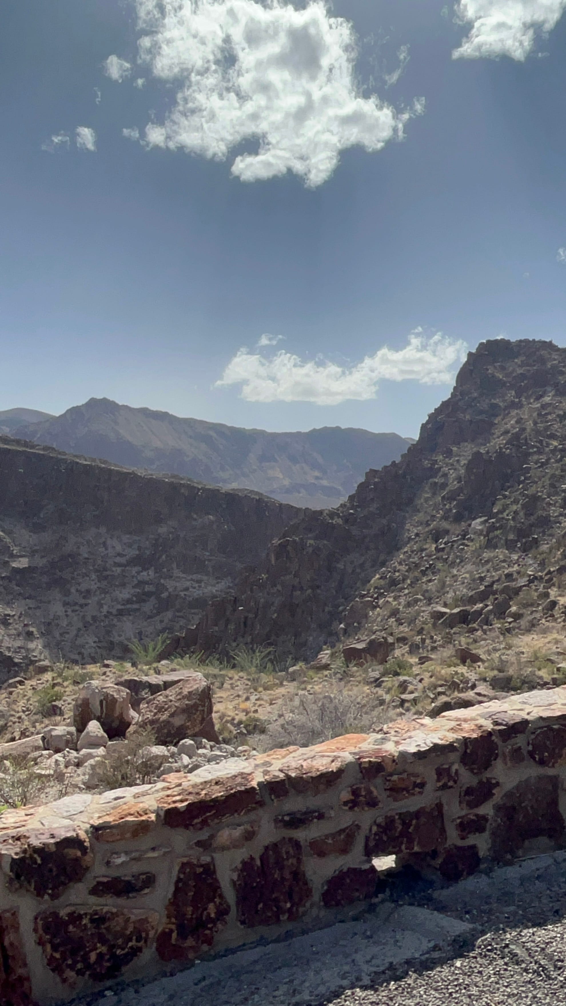
Big Bend Ranch State Park, TX - April 2025
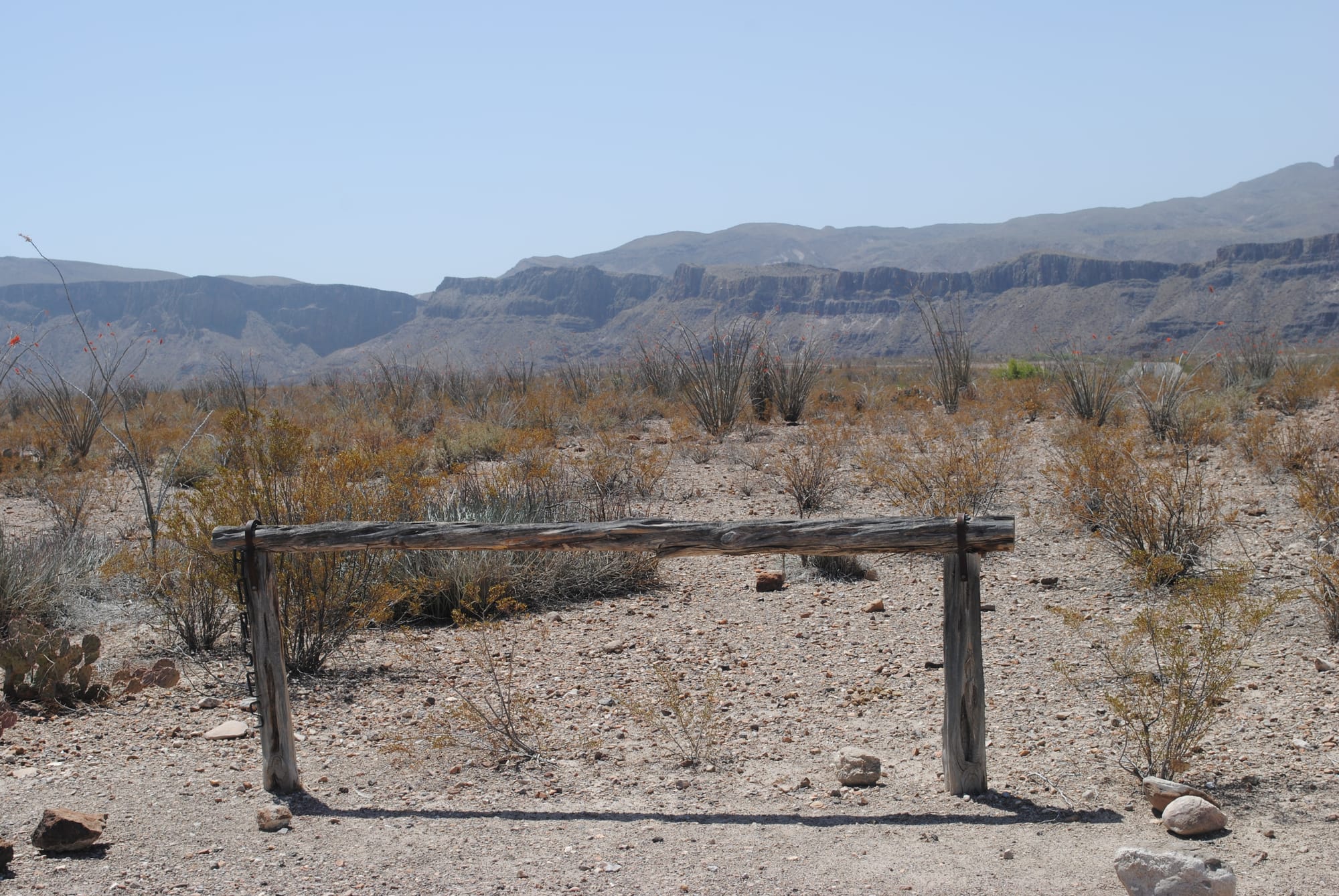
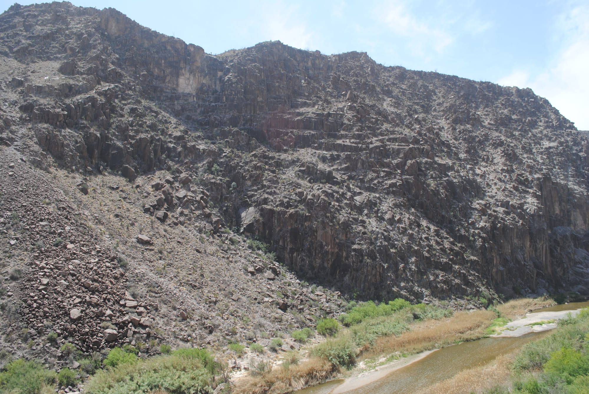
We took a drive from Maverick Campground at Lajitas Resort across the southern portion of Big Bend Ranch State Park along Hwy 170 which basically follows the Rio Grand river and therefore the US/Mexico border. The region is filled with beautiful mountains that start out relatively small and then proceed to get huge with sharp drops into magnificent canyons that the Rio Grand winds through and ultimately created!
We started off our journey by returning to the location of our son and daughter-in-law's wedding the year before and went up to the parking area where they held the ceremony to see the views from there again. After that, we continued westward driving very slowly since the mountains and canyons were so beautiful that we kept stopping to take photos. In places the mountains seemed to be layered with ever taller mountains behind the closer ones! Sometimes the road ran through wide canyons and then it would abruptly climb through very narrow areas with steep drops on the river side. You had to keep your head on a swivel because there were spectacular views on both sides of the road! It made driving a challenge that's for sure!
The "Hitching Post" from our son's wedding and other views
In some places the Rio Grand seemed to be completely dry but in other sections there was standing water and even some sections with running water. It made me wonder if there were sections where the water was flowing underground through these apparent dry sections. As we drove we could easily track the path of the Rio Grand because all along it's path there was green trees and brush. It was very different from the rest of the brown of the desert and mountains surrounding it. There was also evidence of run off from recent rains. Throughout the park just about every low lying area was marked with a flood gauge and there was still dirt on the road showing where water had been flowing across it recently. I sure wouldn’t want to be anywhere near those low spots if it were raining, the erosion on the sides showed the power of the running water.
The Rio Grand
The photos we took don’t do it justice. You just can’t get the majesty of the mountains out of 2D photos! We stopped at a campground along the way and had a picnic lunch on a hilltop that had amazing views of the upcoming canyon and the very big mountains beyond. The biggest mountains in the area are on the Mexican side of the Rio Grand but the scenery is still pretty awesome on the US side as well but if you drive it, you’ll find yourself looking south a lot!
Our picnic site
As we continued onwards, the mountains decreased in size and the valley widened out permanently and we drove the last 15 miles or so into the town of Presidio located on the far side of the state park and a total of 40 miles away from our campsite in Lajitas. The town is larger than Terlingua and Lajitas but still doesn’t have much to offer. We found a Dollar General and picked up some supplies and a snack for the return trip and headed back to see the majesty of the park from the other direction.
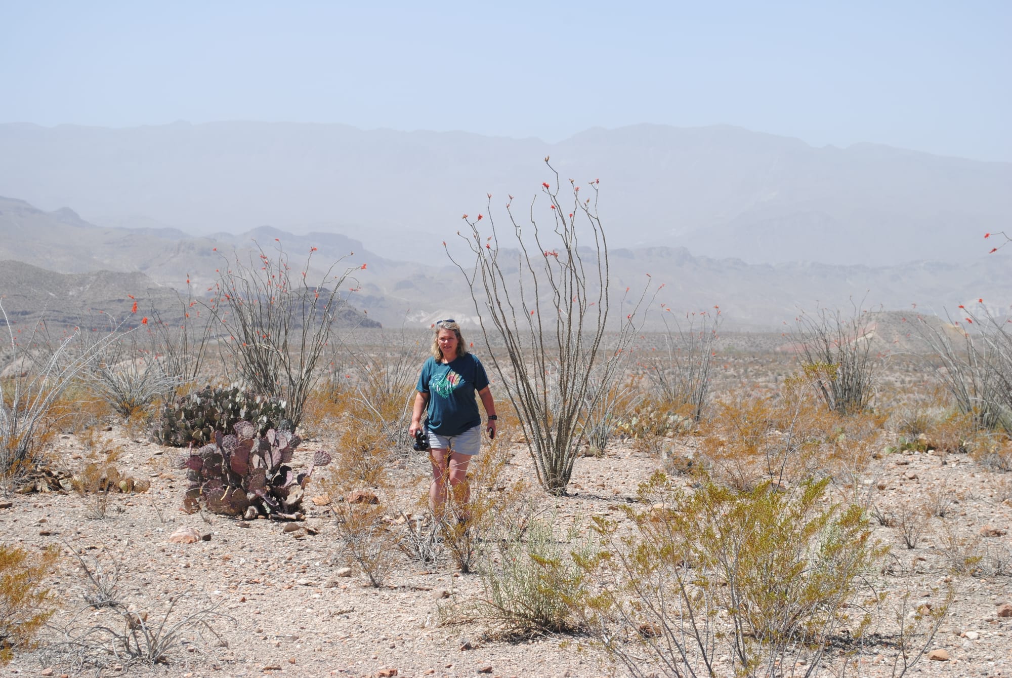
As we have learned on this trip from Saguaro NP and Joshua Tree NP, different regions of the desert SW have different flora prevalent. In this region, it is the Ocotillo cactus that is everywhere and is very beautiful! They are currently blooming with bright red flowers at the tips.

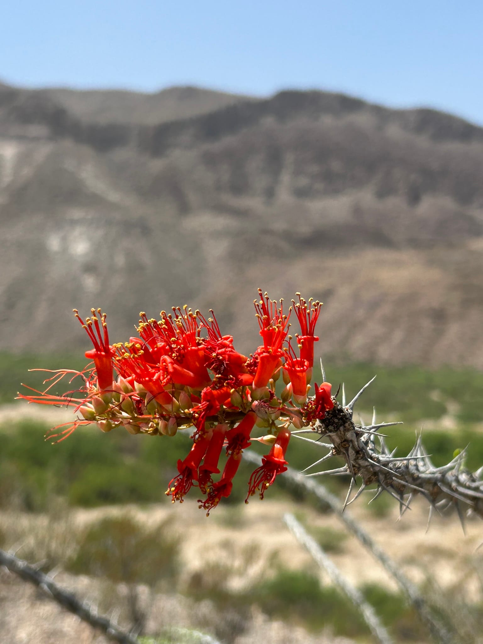
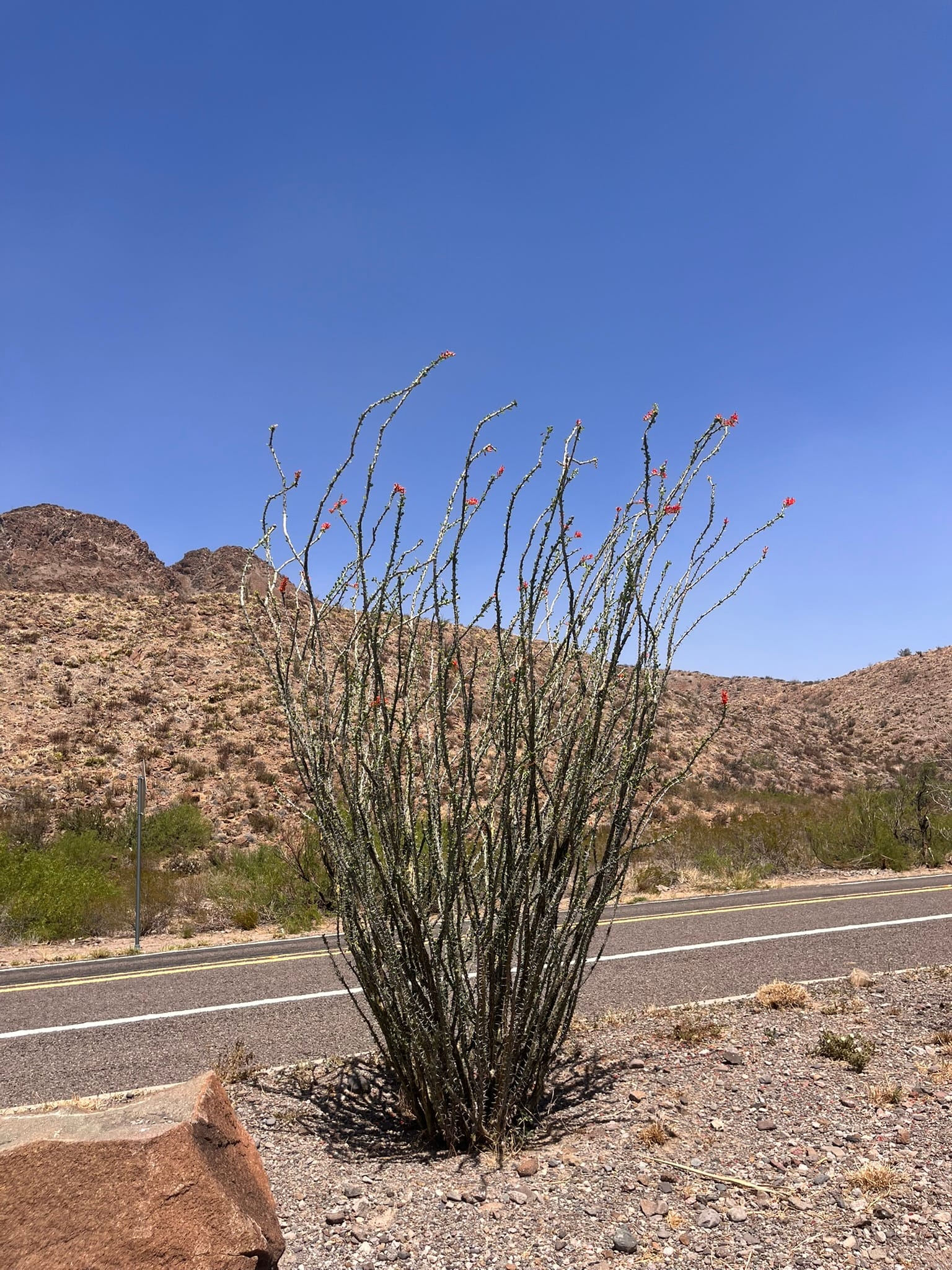
Ocotillo Cactus Blooming
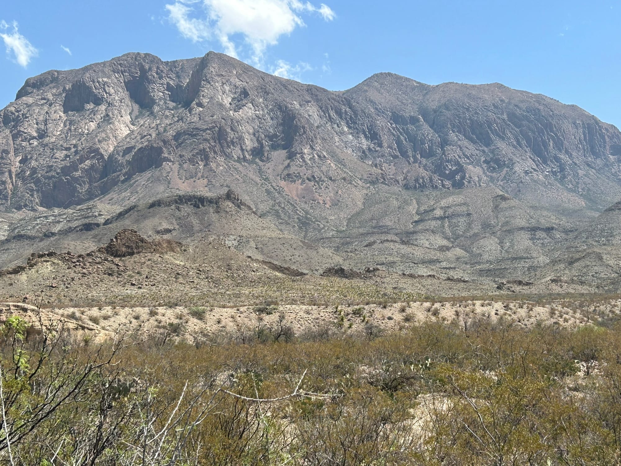
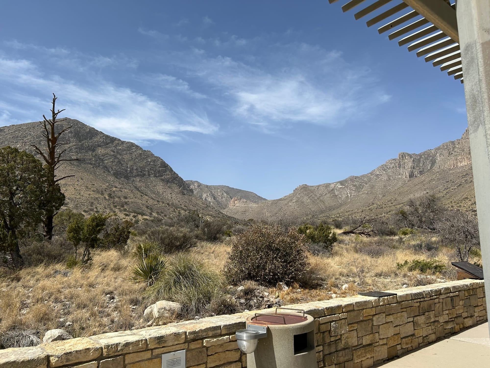
Guadalupe Mountains National Park, TX - March 2025
We drove about 55 miles due north of Van Horn where we camped to Guadalupe Mountains National Park, one of only two national parks in Texas. It was a pretty boring drive. Kim’s phone had been trying to switch back to Mountain Time Zone ever since we arrived but mine had gotten it right on CDT. Turns out as we approached the national park, both iPhones switched to Mountain Time. We never saw a sign on the way but at the Ranger Station there was a sign that the park is on Mountain Time! I guess that’s why the iPhones were messing up.
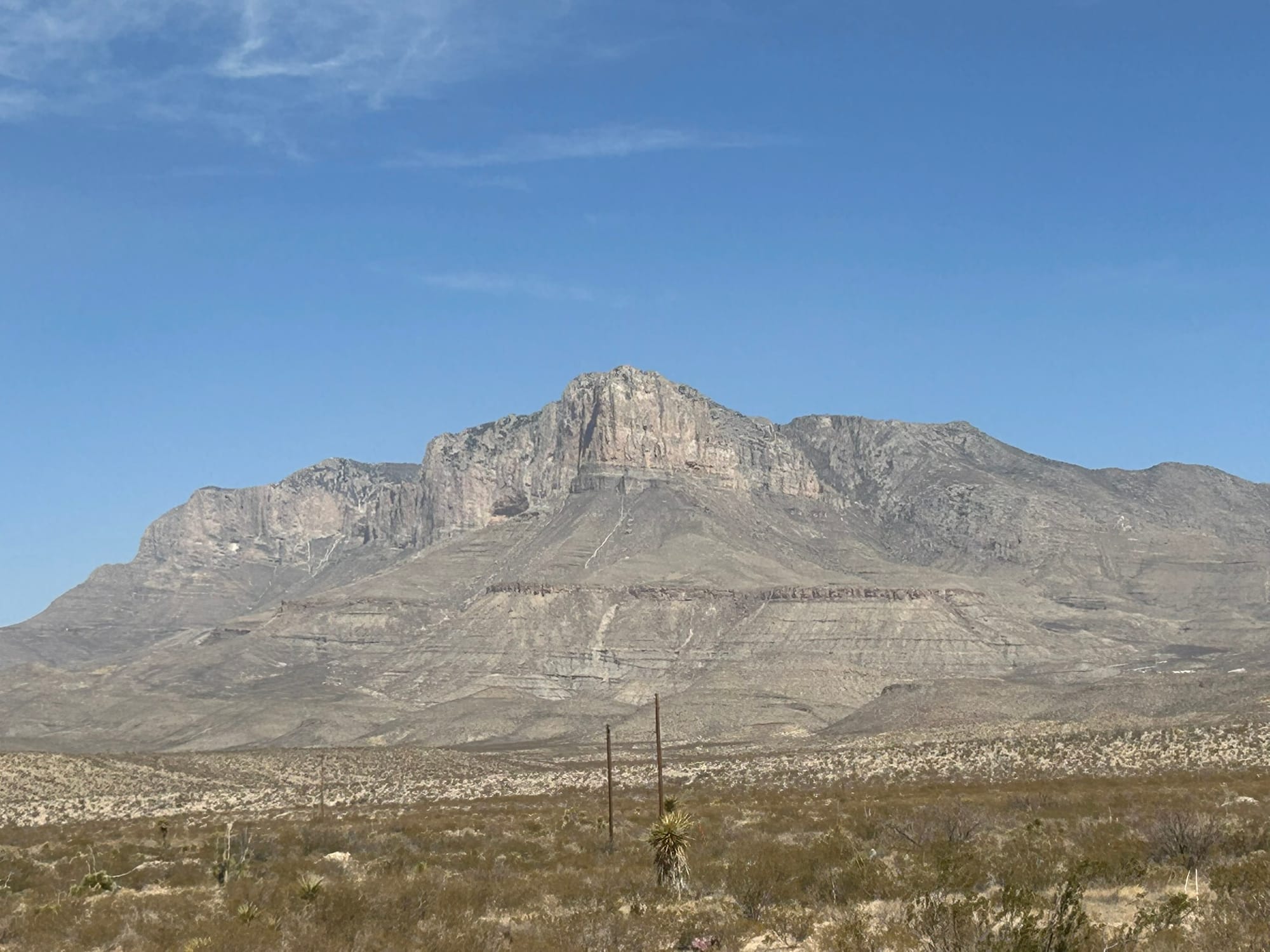
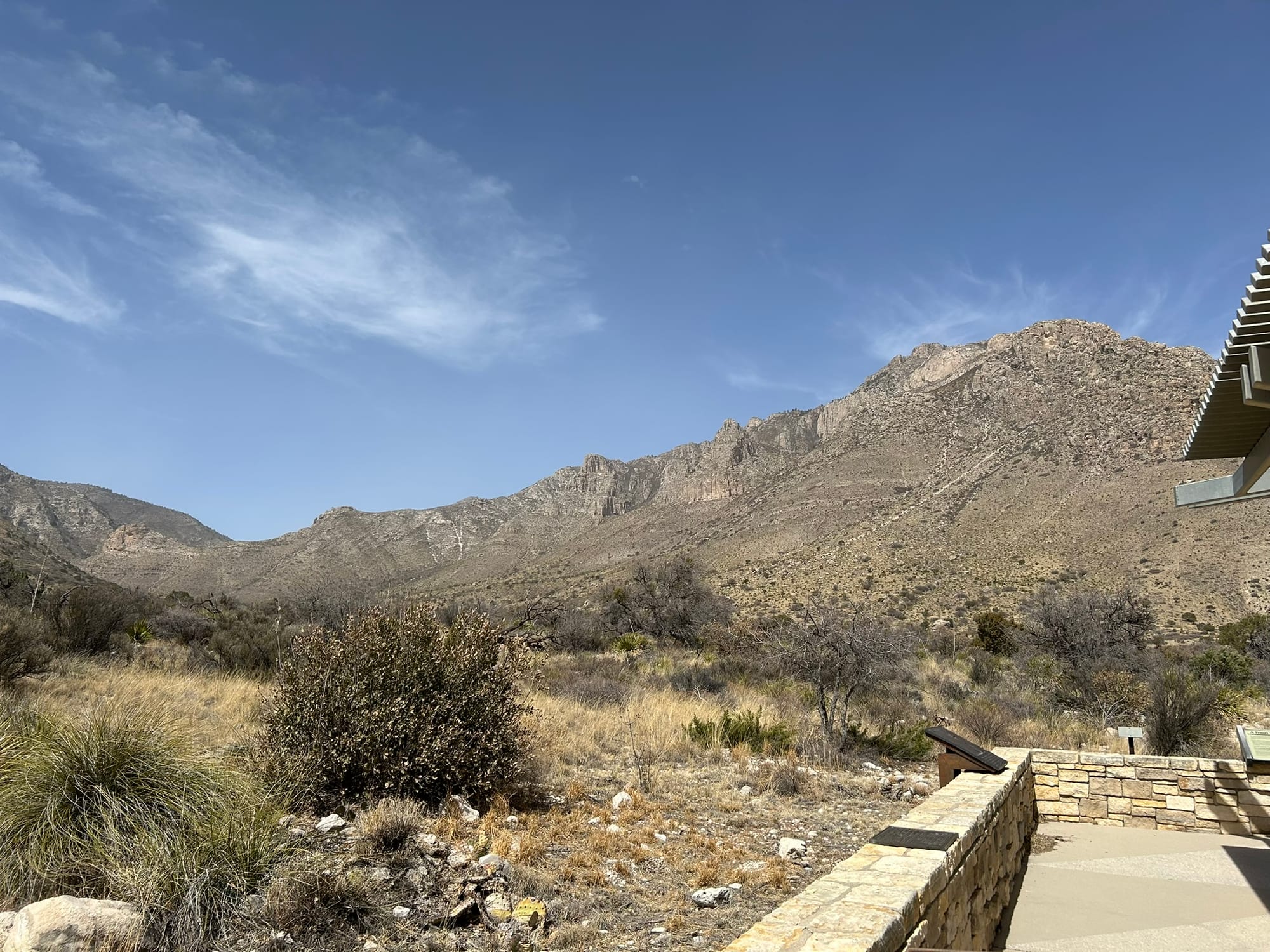
As you approach the park the first thing you see is the highest mountain in Texas, Guadalupe Peak, which is the backbone of the park. It is so large that you can see it for 20 miles or more and the details slowly emerge as you get closer to the park! It’s really an impressive sight jutting up from the desert floor.
We went into the first Ranger station at Pine Springs to check in and see what the park offers. The station has a nice display of local wildlife and plants. We picked up a map and discovered that the park is basically all about hiking. As we left the station, the winds had picked up tremendously and we had heard a ranger warning hikers and campers that they were expecting high winds and dangerous wind chills tonight. We went up the highway to the next ranger station just to see what else there was to see and then headed back to the campsite.
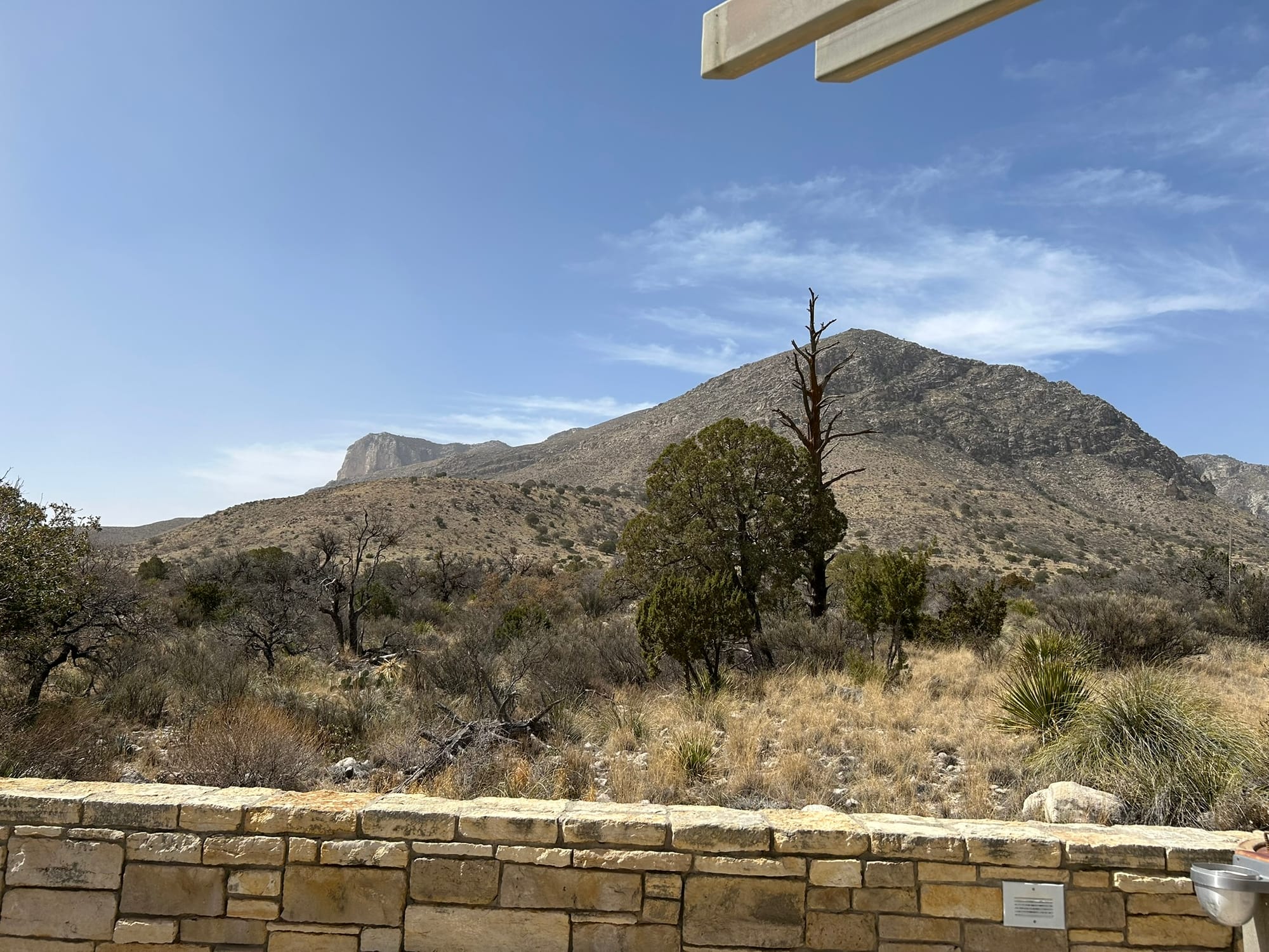
The View from Pine Springs' Ranger Station (back side of Guadalupe Peak)
Glad we didn’t go hiking because that wind was pushing our huge truck around on the way back to Van Horn! The dust was flying across the road so bad that it was white-out conditions for short distances!
That night before dinnertime a true dust storm kicked up and everything got a weird yellow-brown look to it! Remind me to clean our truck’s air filter in the morning! The late afternoon was pretty much a bust and we stayed indoors for the evening.
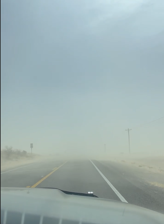
The "White-out" on the drive back
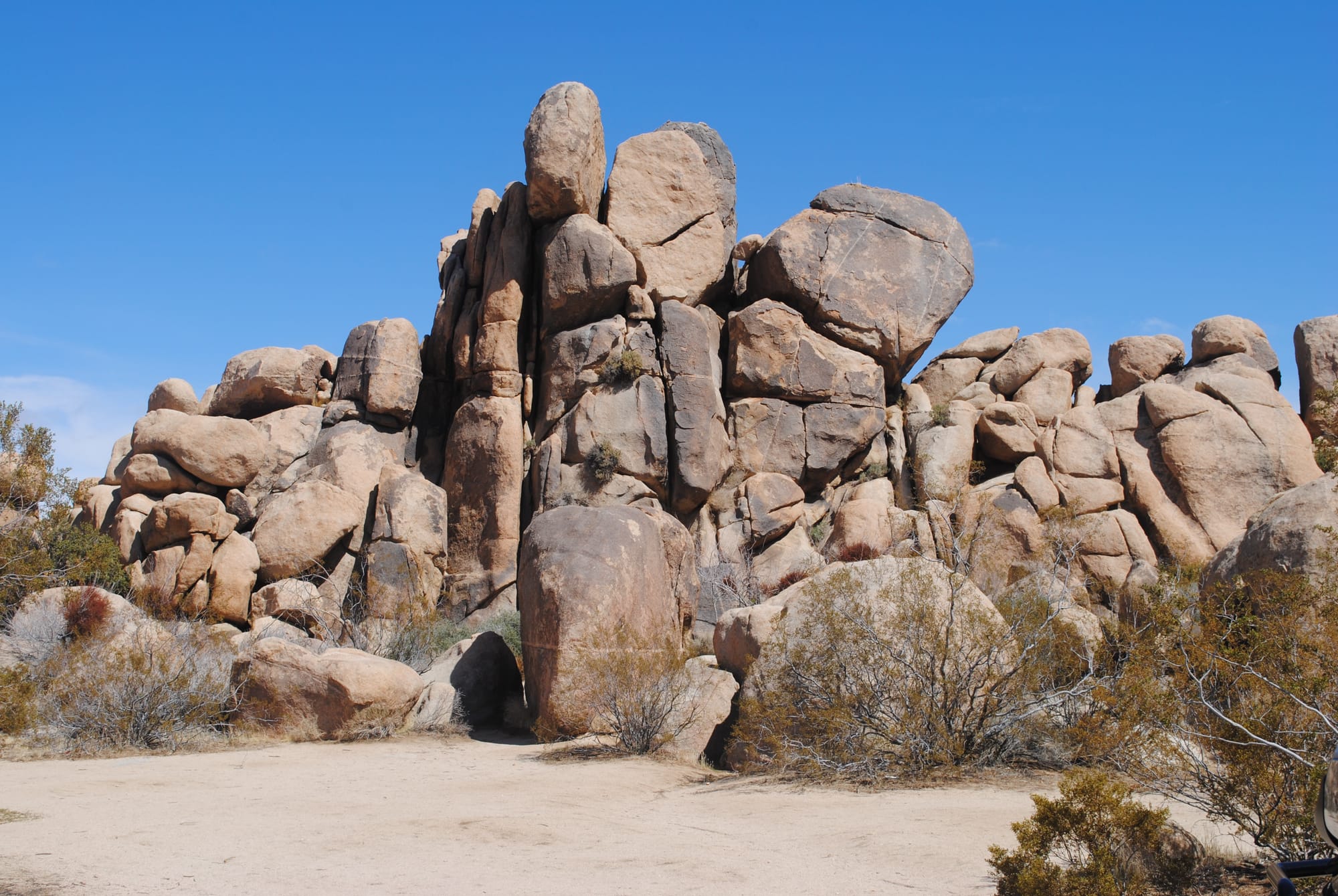
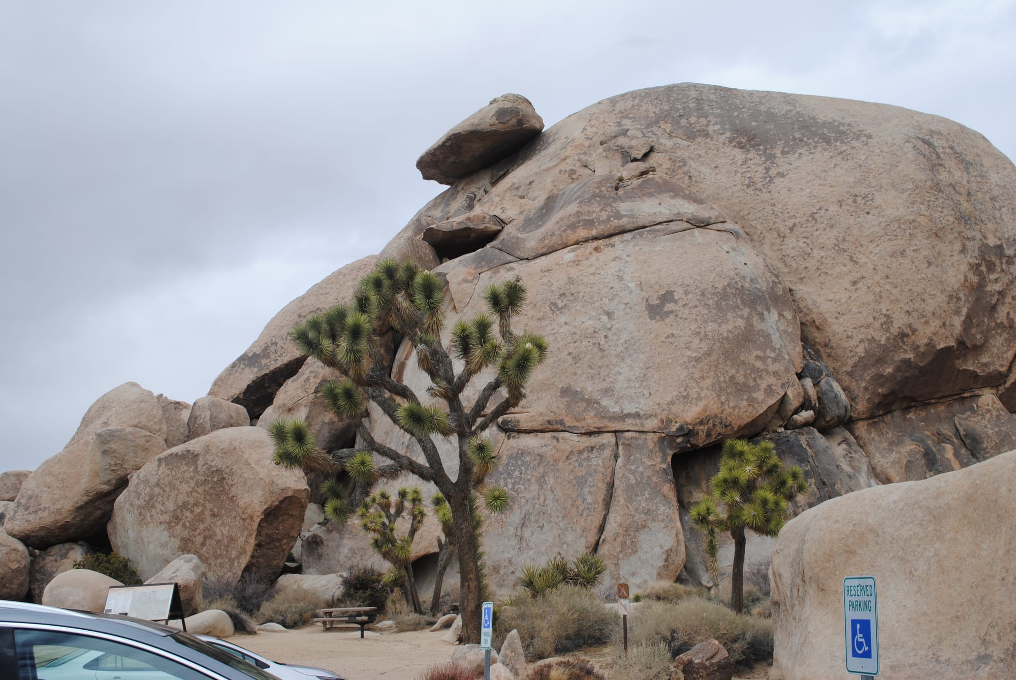
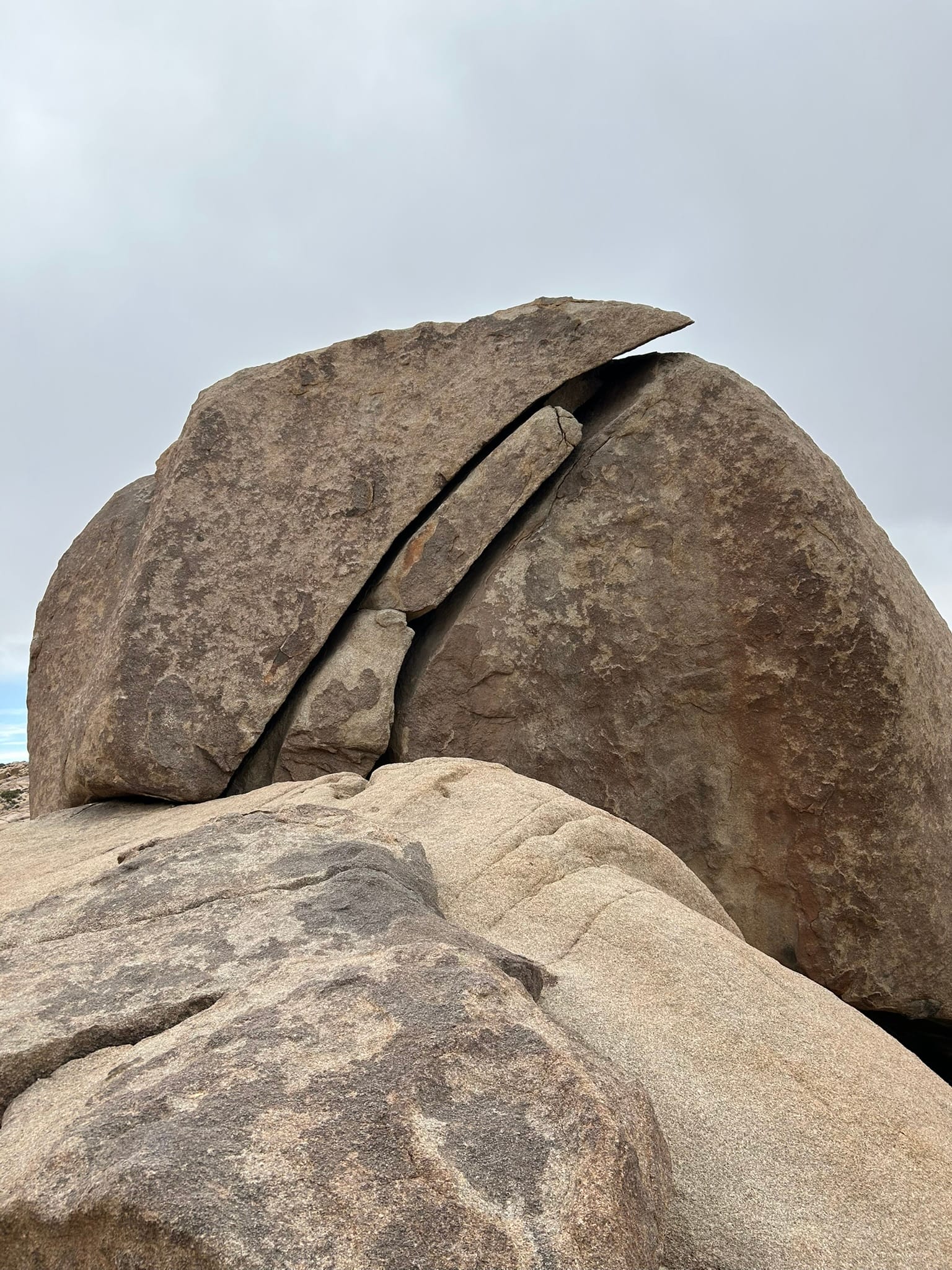
Joshua Tree National Park, CA
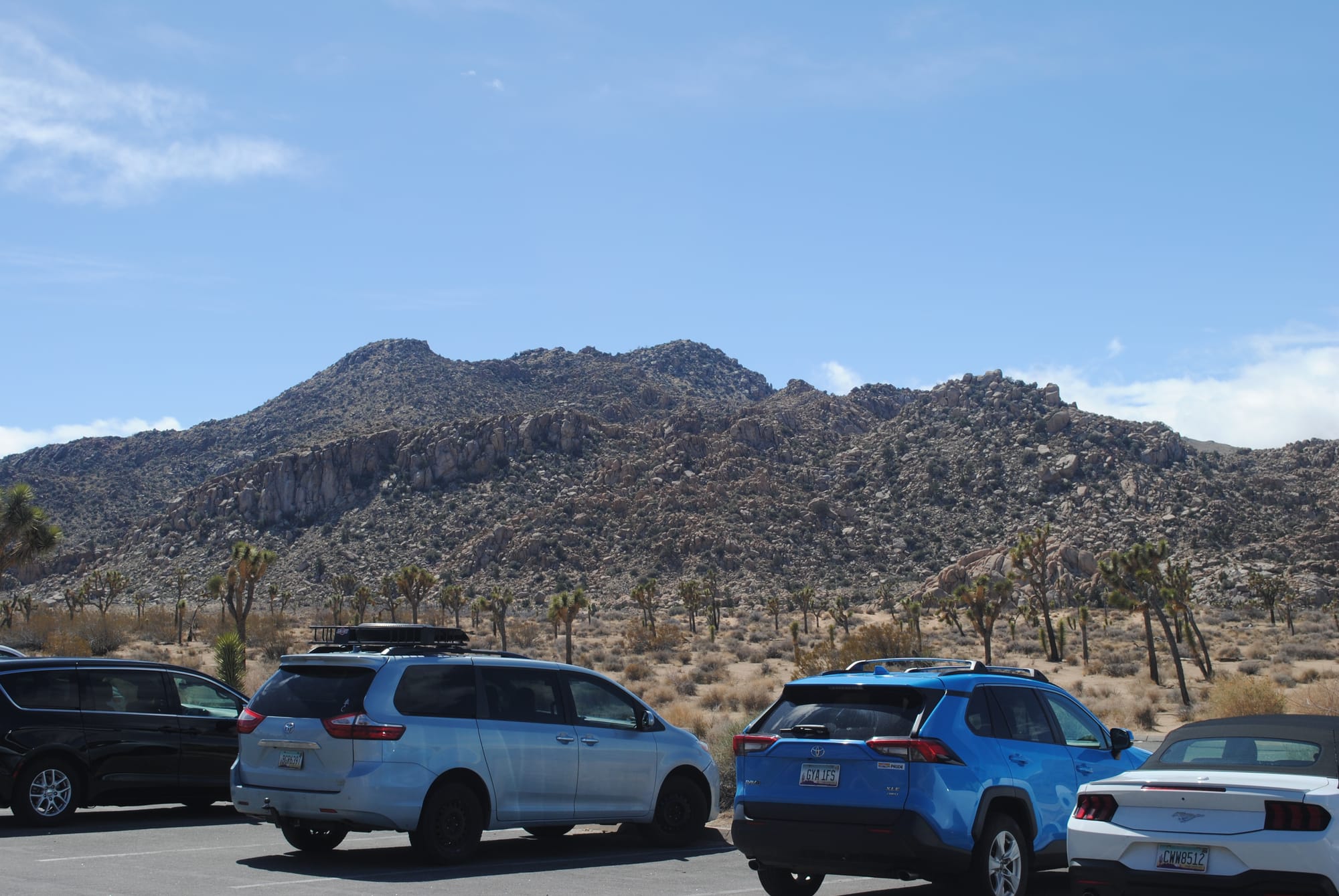
As the name would suggest, Joshua Tree National Park is filled with Joshua trees but it’s also filled with all sorts of crazy rock formations. On one side of the road, you have sort of normal dirt covered mountains and hills and then all of a sudden you see piled up boulders like some giant kid's blocks. I can't help but wonder how they got there and how they were formed. There doesn’t seem to be any sign of erosion that exposed them. They’re just there, mountains of them. We visited a couple of the more famous formations – Cap Rock, Skull Rock and Split Rock for some photos of course! We also drove through what felt like a forest of Joshua Trees.
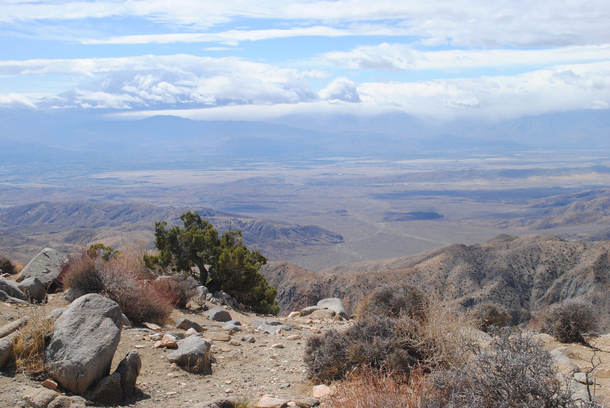
We went out to Key View in the park and it was eye opening! I didn’t realize how high the park actually is. It is around 4000 feet elevation and from Key View you really get that perspective first hand! You can see all the way down to Palm Springs and the Salton Sea. Amazing view! The rest of the drive through the park was pretty much more boulders and mountains and we exited at the northeast gate into Twentynine Palms and headed back. Other than the scenery, some camping and climbing on the boulders there isn’t much else to do in the park. It was definitely worth the drive through it though!
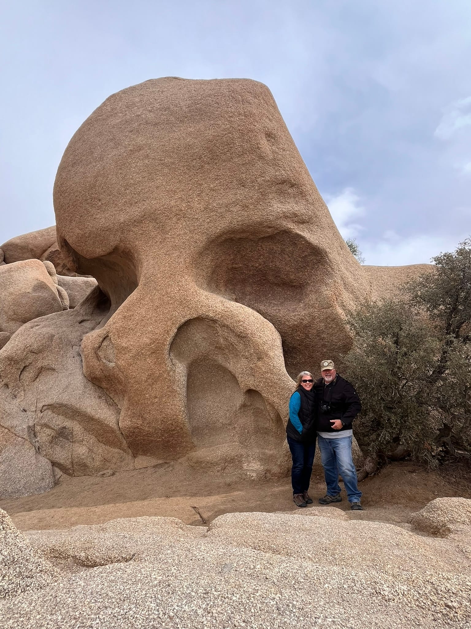
Joshua Tree National Park Views including Cap Rock, Split Rock and Skull Rock
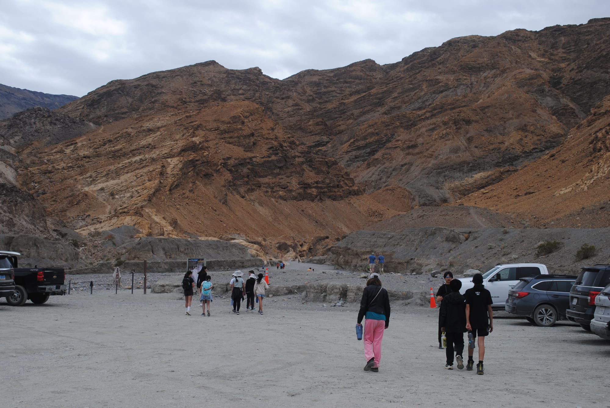
Death Valley National Park, CA
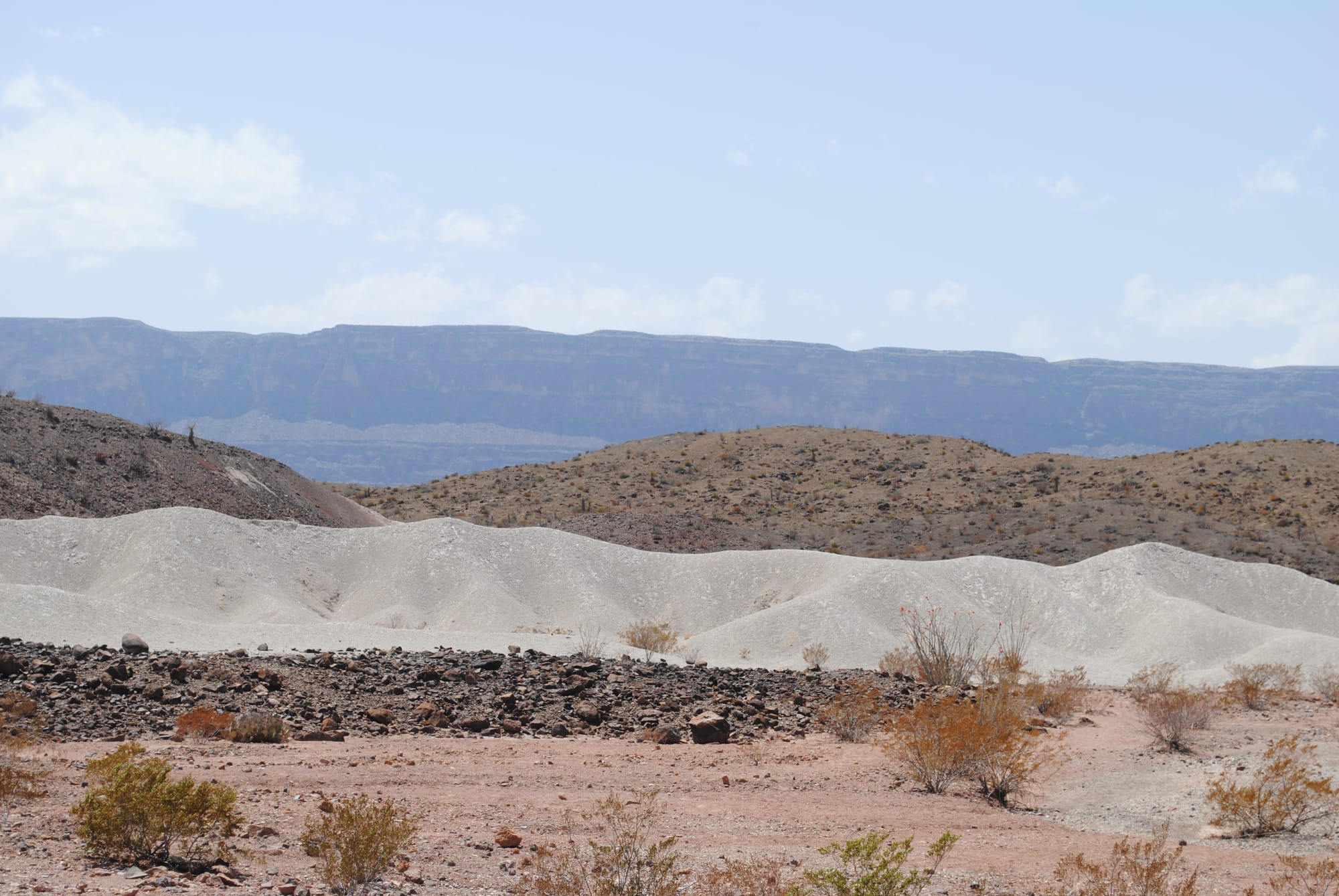
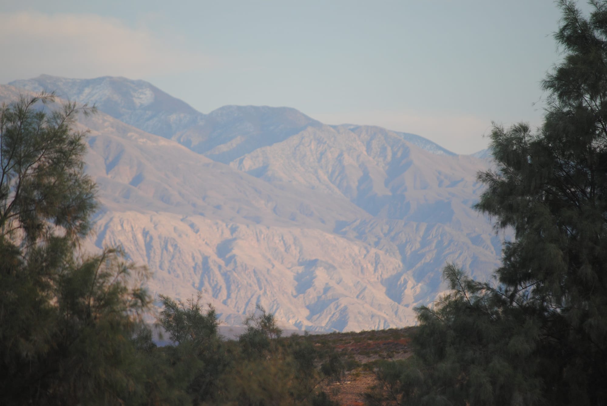
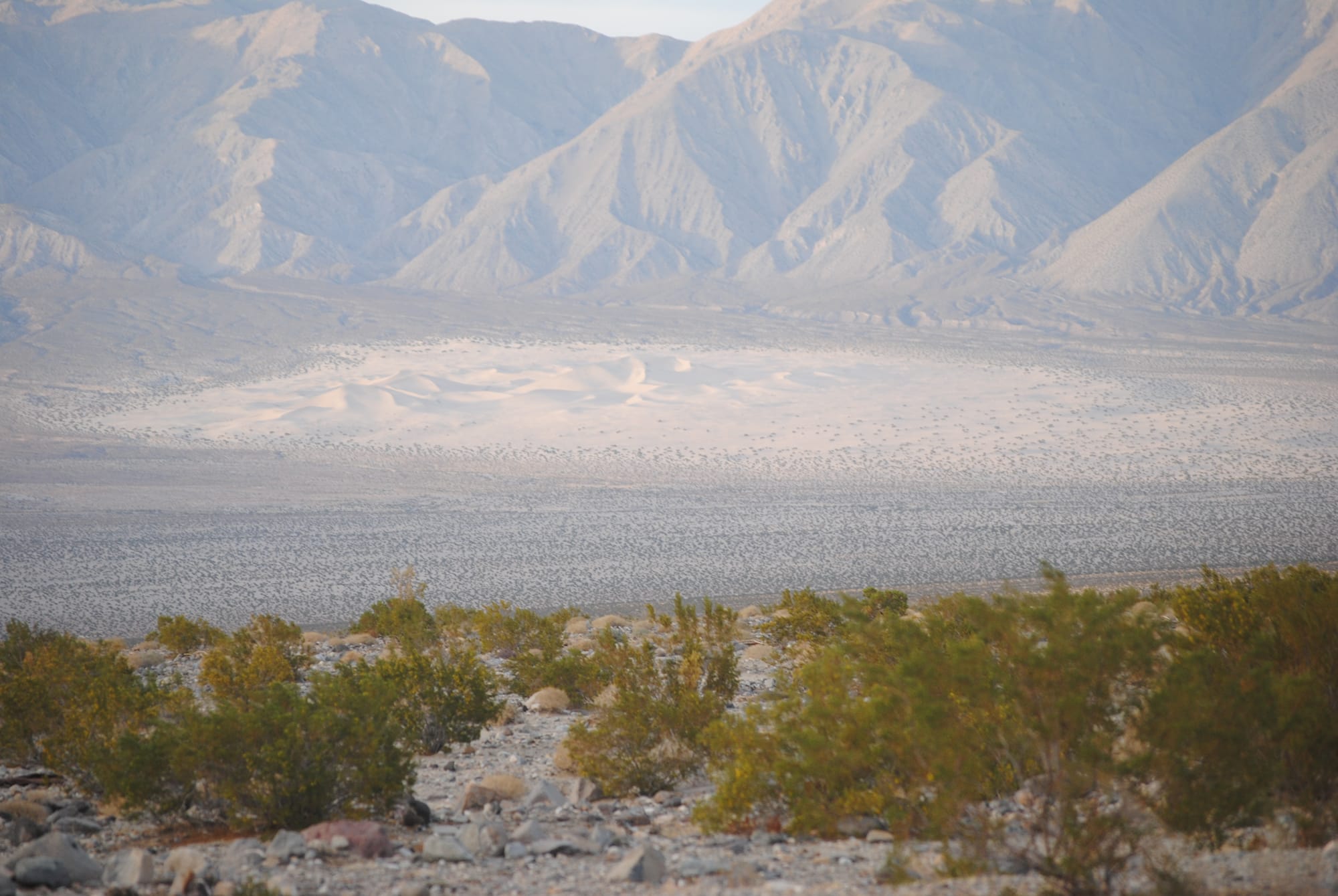
We drove from Las Vegas over to Panamint Springs in Death Valley National Park where we were going to camp for a couple of days. Basically, we drove east to west roughly across the center of the national park which gave us a really good look at a lot of the scenery there. On the one hand, Death Valley is just a very desolate low lying area between two mountain ranges in the desert. There’s not a lot of trees. It’s just desert scrub with rocks everywhere and some mountains and valleys. But on the other hand, it is amazing to see the long running mountain ranges, to cross through the mountain passes with their absolutely spectacular views, to be at 5000 feet one minute and at -250 feet a few minutes later as we drove across the park. There are areas of salt flats where water clearly had evaporated to create it. There’s random sections of sand dunes as if some giant toddler has poured out a bucket of sand and the mind wonders how that formed naturally!
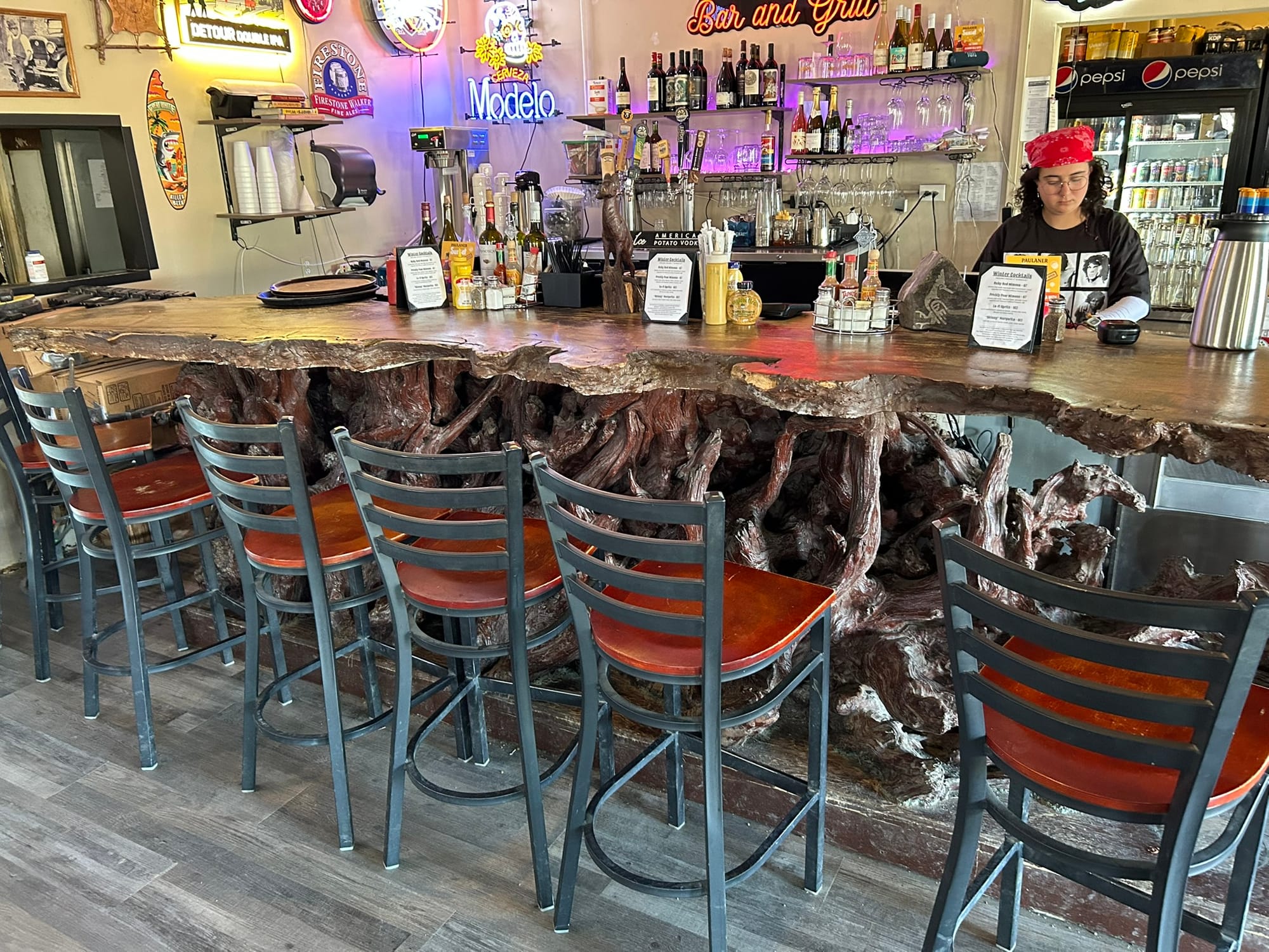
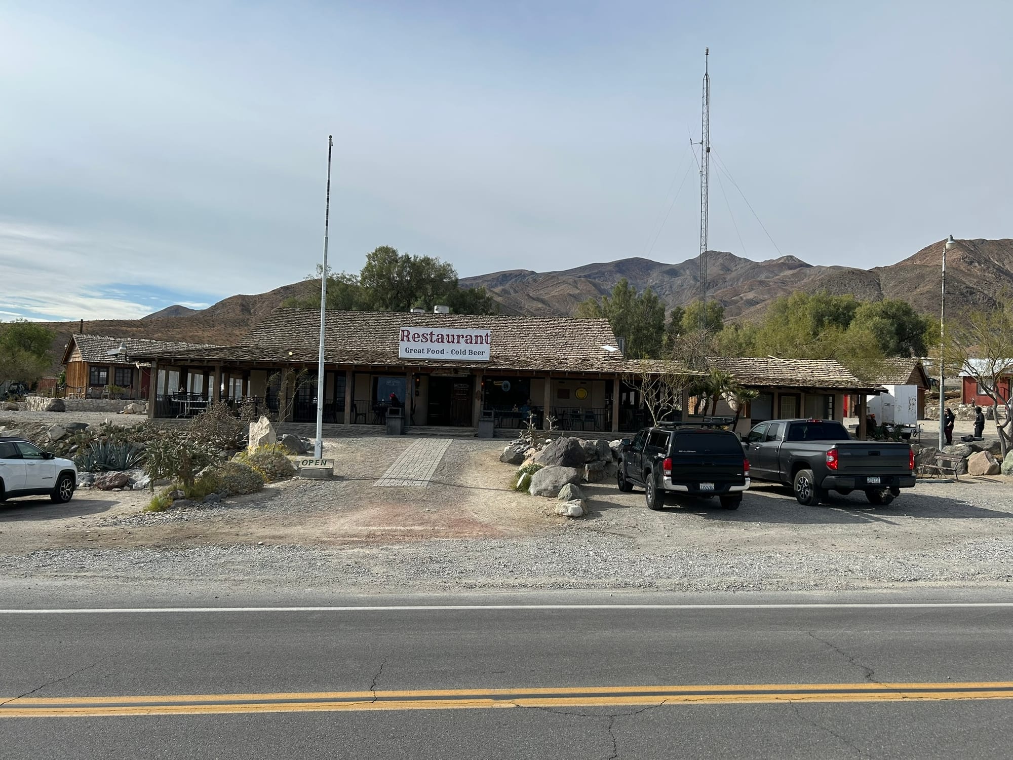
From our campsite in Panamint Springs, we can look across the valley floor and there is again a random pile of sand blown into dunes at the foot of the mountains on the other side. There’s a nice little restaurant here, a hotel and a gas station with six dollar gasoline (thanks California!). Inside the restaurant, there’s a huge Redwood bar that the employee told me had been there at least 45 years and was a hand cut piece of Redwood that has been intricately carved in all sorts of cool shapes. The workers at the restaurant are very nice and very informative. The restaurant has a decent selection of food and an amazing variety of beer most of which I had never heard of. The campsite has RV spots and tents and cabins for rent.
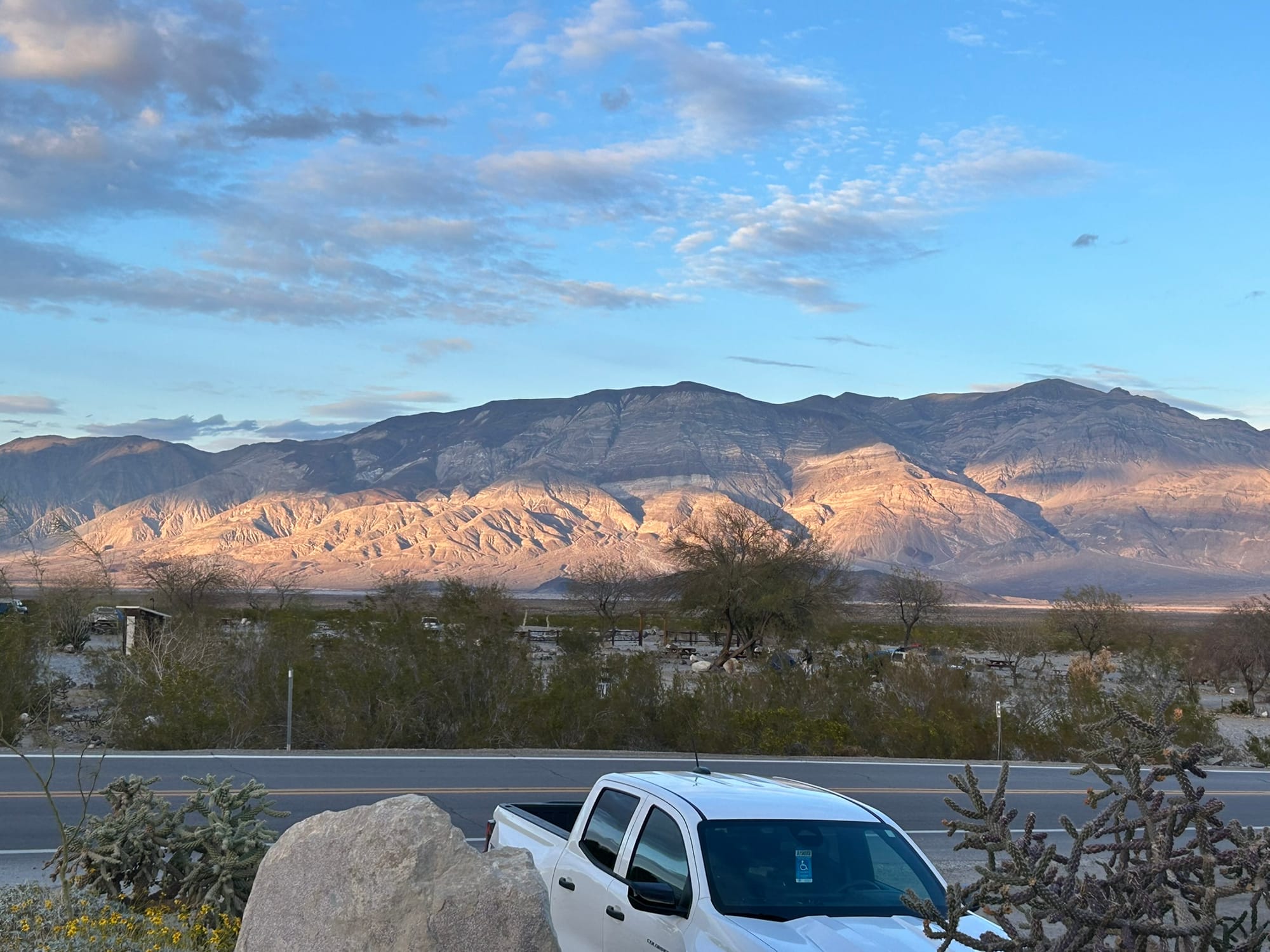
Views from Panamint Springs
There’s still a lot of roads in the park still closed from the flooding a couple years ago so some of the scenic places can't be reached yet.
On the way here from Las Vegas we followed signs for death Valley and very quickly came into some pretty rugged, desolate areas where we ran out of cell phone coverage long before entering the park. We went most of the day without any connectivity. At one point, we went through what appeared to be a mini ghost town at one intersection, and there was an abandoned motel, with one of the buildings labeled an "opera house". It was out in the middle of nowhere so it was very surprising to see something like that in that setting. I swear I could hear Eagles’ music playing! Luckily we WERE able to leave though!
Even in Panamint Springs, we had no cell phone coverage or Internet connectivity. Our T-Mobile hotspot we bought didn't work either because there just aren’t any cell towers for it to contact with, but there is Wi-Fi at the restaurant! A lot of folks hang out there in the evening and catch up on the news and the mail and we were able to make FaceTime phone calls and things like that. This is the trip that’s convincing us we need to get Starlink!
On our second trip over to the restaurant (because Kim was dying for some connectivity) we ran into a young British man who is here with a group of Brits who are doing a charity ride from somewhere on the California coast across death Valley to Las Vegas over the course of a week. They’re raising about 8 to $9000 for a Romanian charity which I thought was pretty amazing. Apparently, they do this annually and take a ride at various locations around the world. He said they’ve done Spain and some other locations so it seems like a good excuse to have a scenic bike ride. As he said “who can say that they have ridden a bike across Death Valley?" Certainly not me, especially given that from Panamint Springs there’s a small downhill run to a fairly level area across the valley floor and then about a 3000 foot climb up through the mountain pass! That’s a hell of a way to start your day on a bicycle!
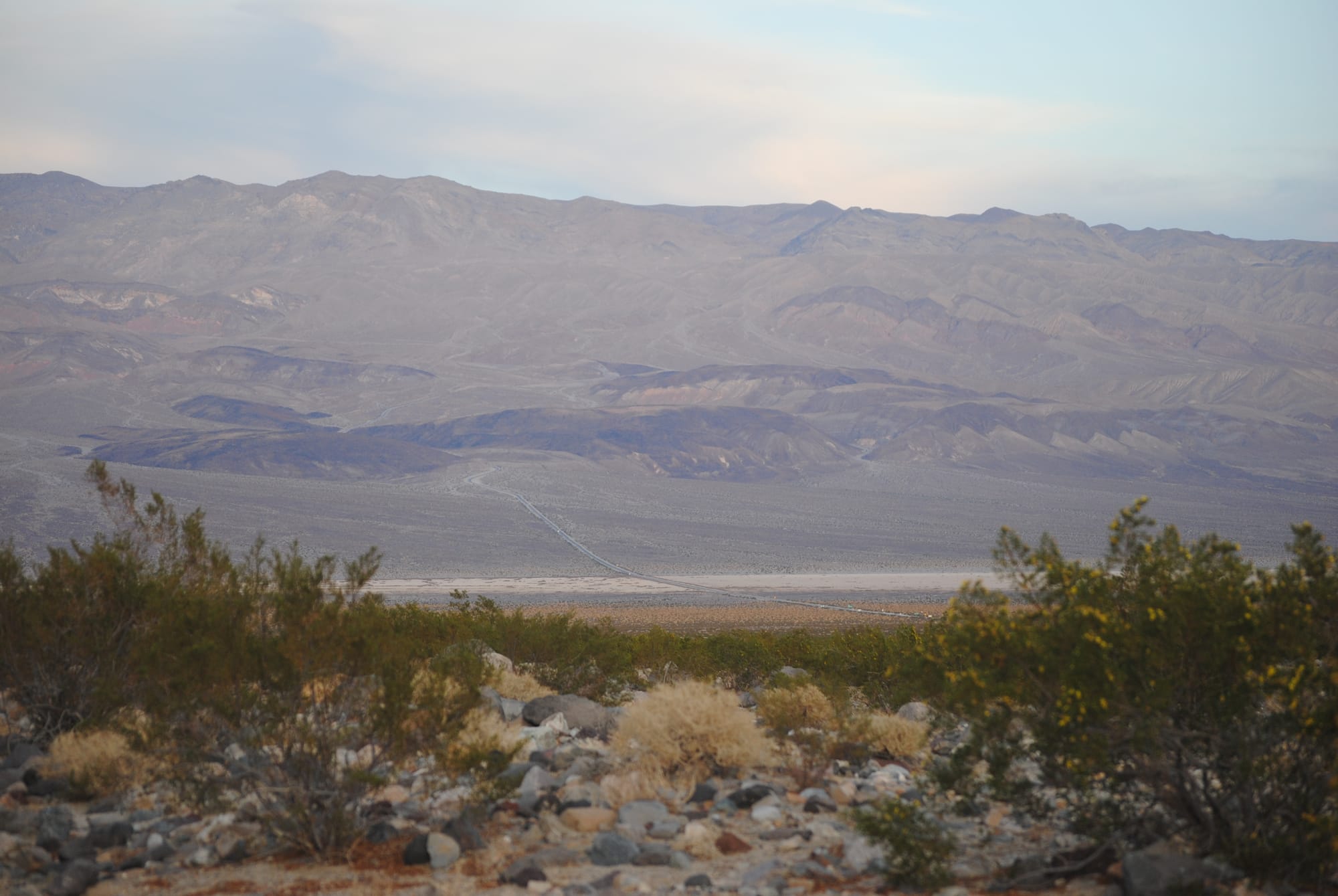
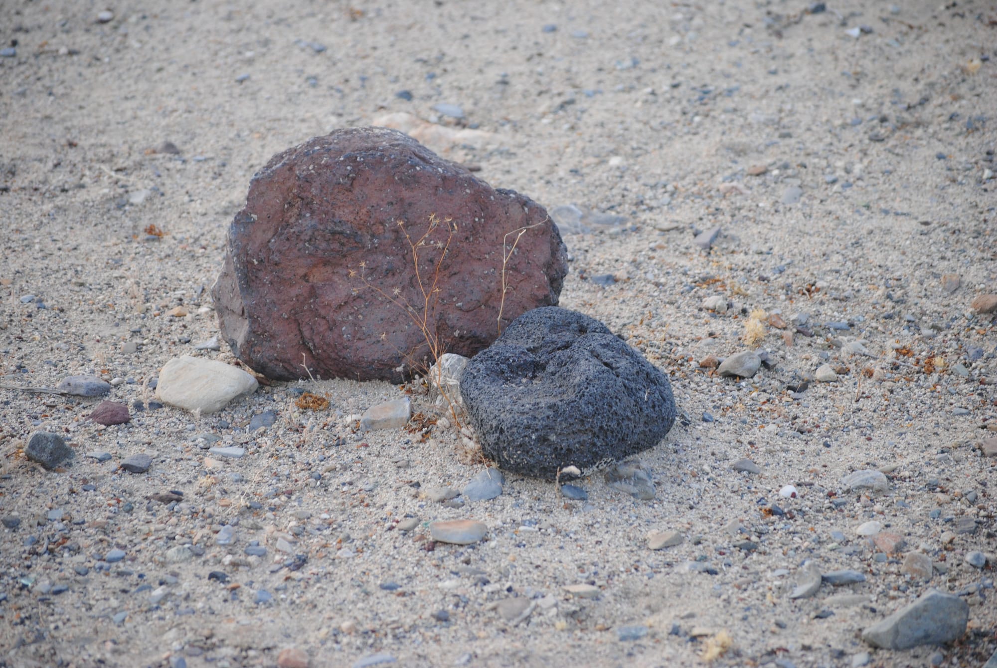
Distances are very hard to judge in the park because the scale is so large. You look ahead at the road and think "just a few minutes" and 30 minutes later you are still driving across it!
On our second day in the park, we headed out to explore some of the Valley with our dogs. We headed back the way we came and stopped at Mosaic canyon trailhead but no dogs are allowed on the trails so we piled back onto the truck and headed to the dunes we had seen on the way in. Kim and I took turns walking out on them due to the whole “no dog” thing. The dunes were made up of very fine tan sand piled up in dunes. We got on the road again and turned north towards Ubehebe volcanic crater which was amazing to see. The park experienced some volcanic eruptions following the tectonic actions that made the mountains and dropped the valley floor below sea level. When we were walking the dogs at the campground, I thought I was seeing pumice rocks and I was right! I didn’t know then that there were volcanoes in Death Valley. After visiting the volcano, we headed back to the campsite and had dinner at the restaurant which was very good!
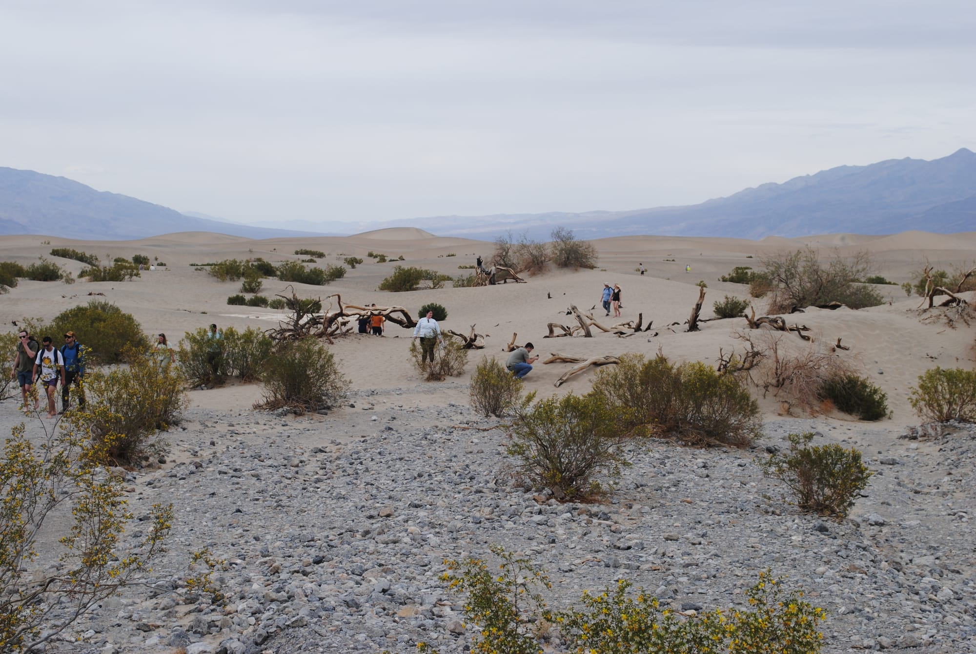
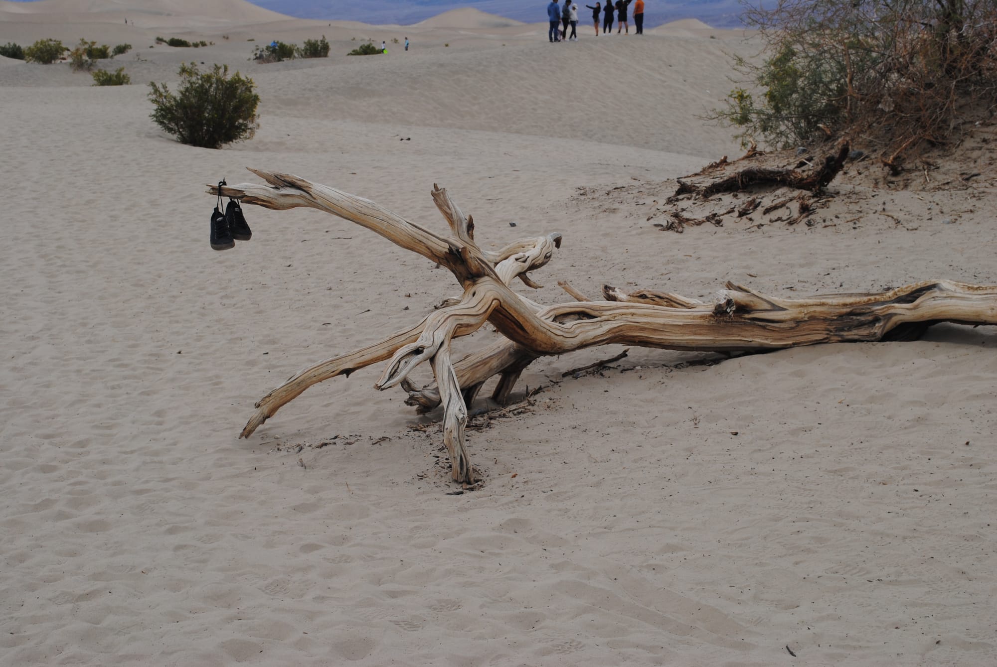
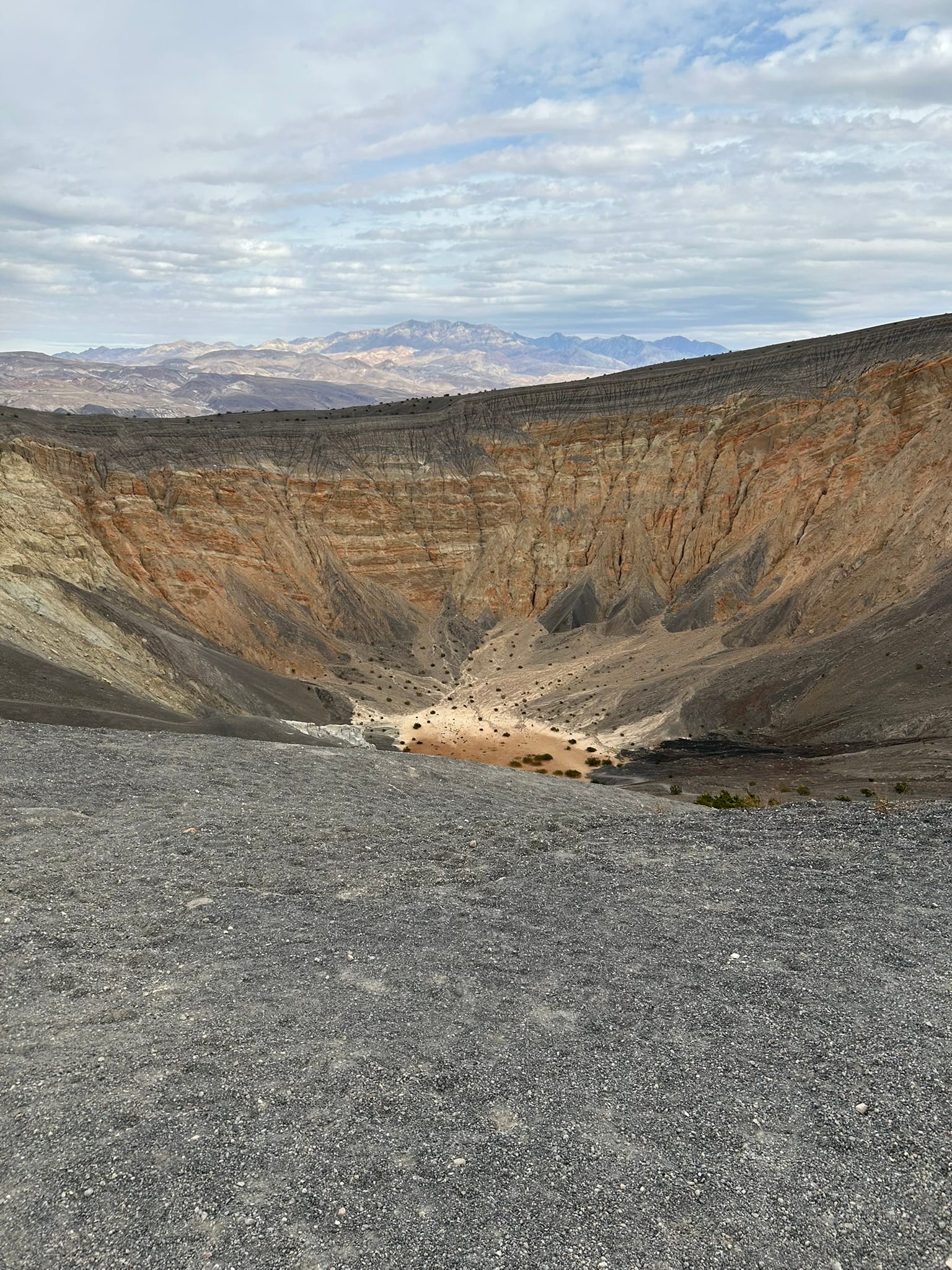
Mosaic Canyon, Mesquite Dunes and Ubehebe Crater
Hoover Dam and Lake Mead, NV
We decided to backtrack to the Hoover Dam and Lake Mead and see the sights there. It was only about 30 minute drive and we exited for the dam. The first thing we came up on was a scenic overlook for Lake Mead which was nice but you couldn’t see the dam or the new bridge from there so we moved on. We exited the highway for the dam and had to pass through security before we could get there.
I got a little nervous because I had my pistol, 5 gallons of gasoline for the generator and about 50 gallons of diesel in the reserve tank. I probably looked like I could be trouble but we got through no problem. He asked if we had a gun or drone and I told him I had a pistol and was a concealed carry holder. He told me to leave it in the truck and sent us on our way. We went down the hill to the first stop which was for the bridge walkway, parked and climbed up to the path out on the bridge. It was incredibly high off the ground! I’m not too proud to say it spooked me a bit especially when I got close to the rail to look down! Man, what a view though! The hills/mountains in that area are a geologist’s dream! They are so amazing and seemed so raw and unweathered with sharp corners like they were newly minted. It was cool to see!
After we walked back from the bridge we went back to the truck and continued down the hill to drive across the Hoover Dam which was really cool to see close up and gave us a spectacular view of what little was holding us up just a few minutes ago on the bridge! The construction of that bridge is amazing to see!
After driving across the dam and back we drove into Boulder City and almost immediately saw a bunch of wild Big Horn Sheep along the road so we stopped to take some pictures. They didn’t seem to be afraid of humans and some were tagged. We also drove through historic downtown Boulder City which was very cool to see. Overall, it was a really interesting day!
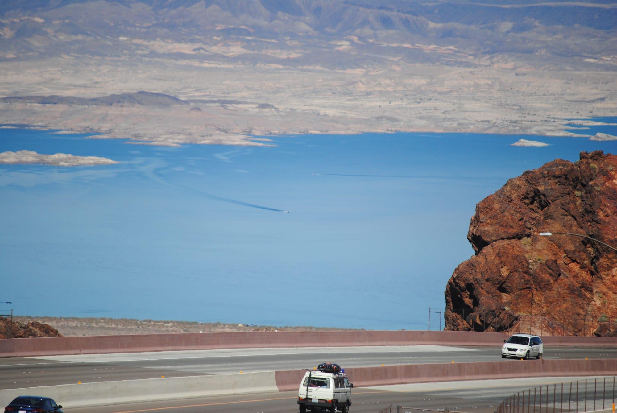
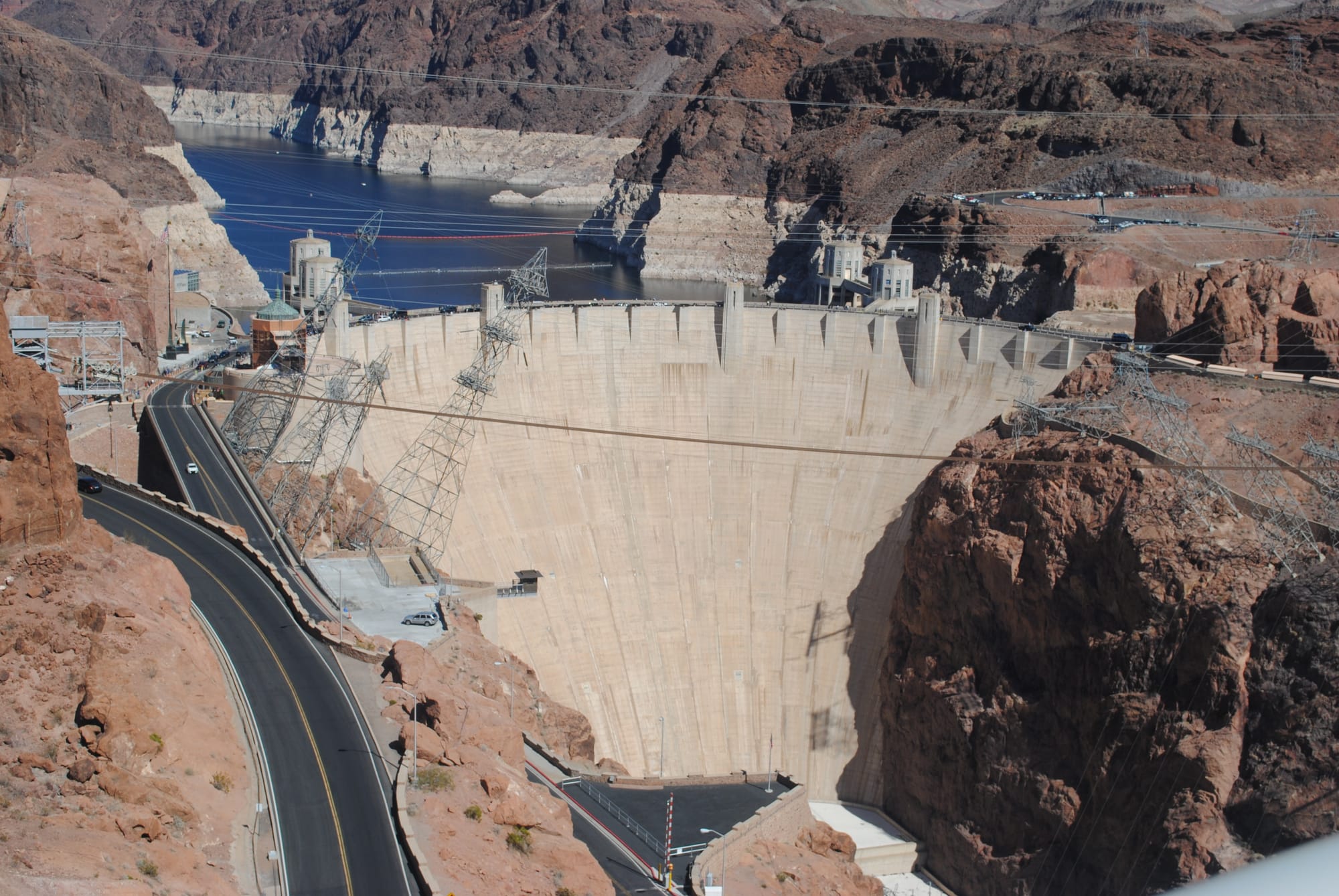
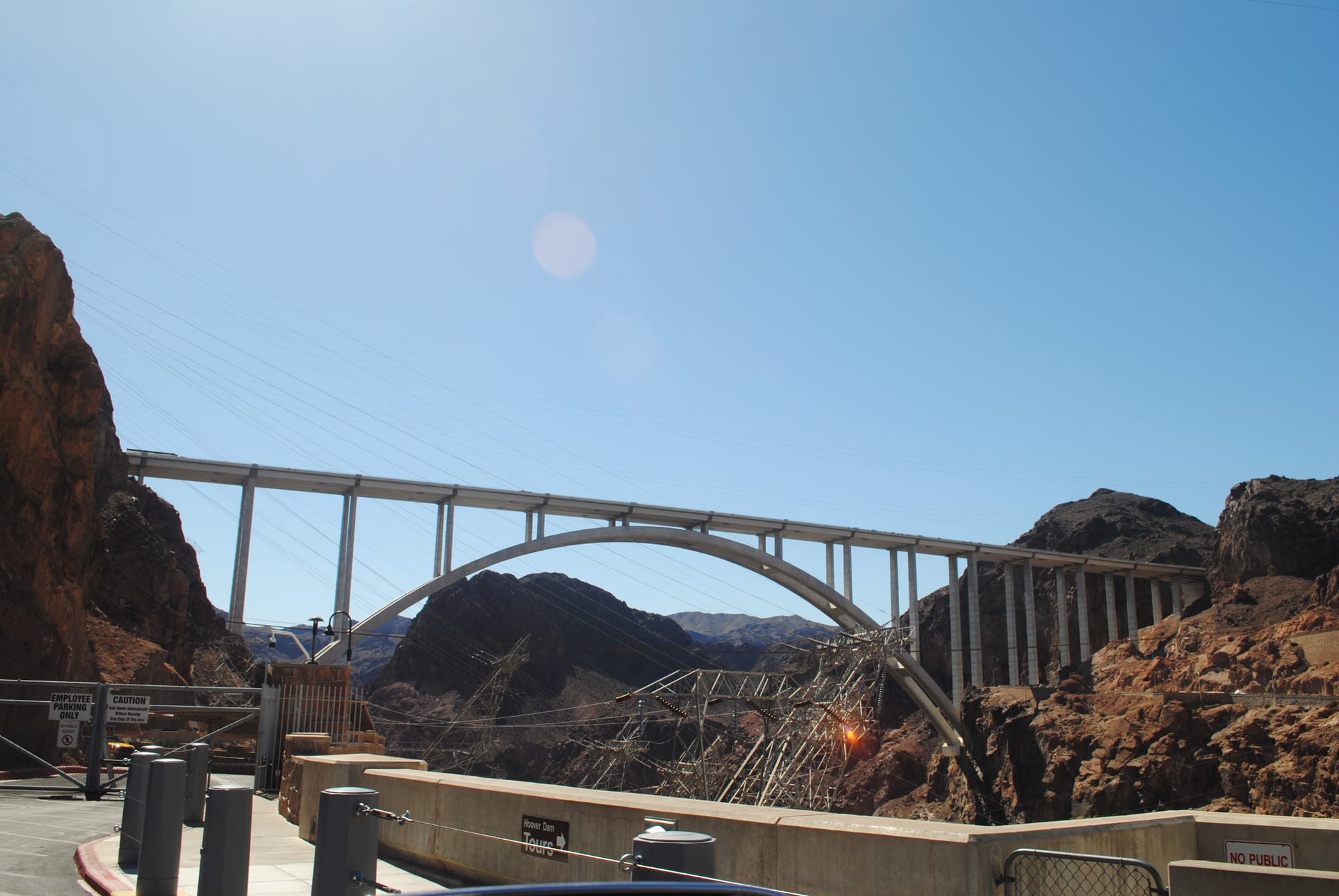
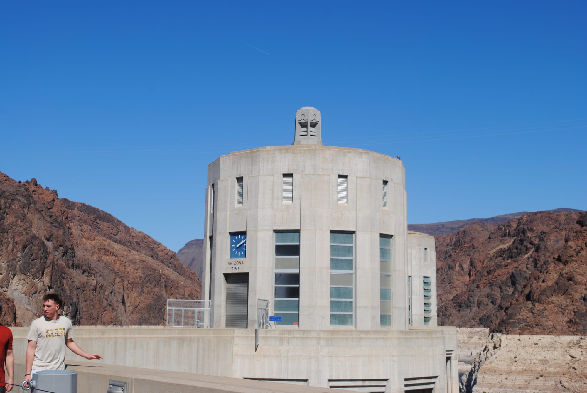
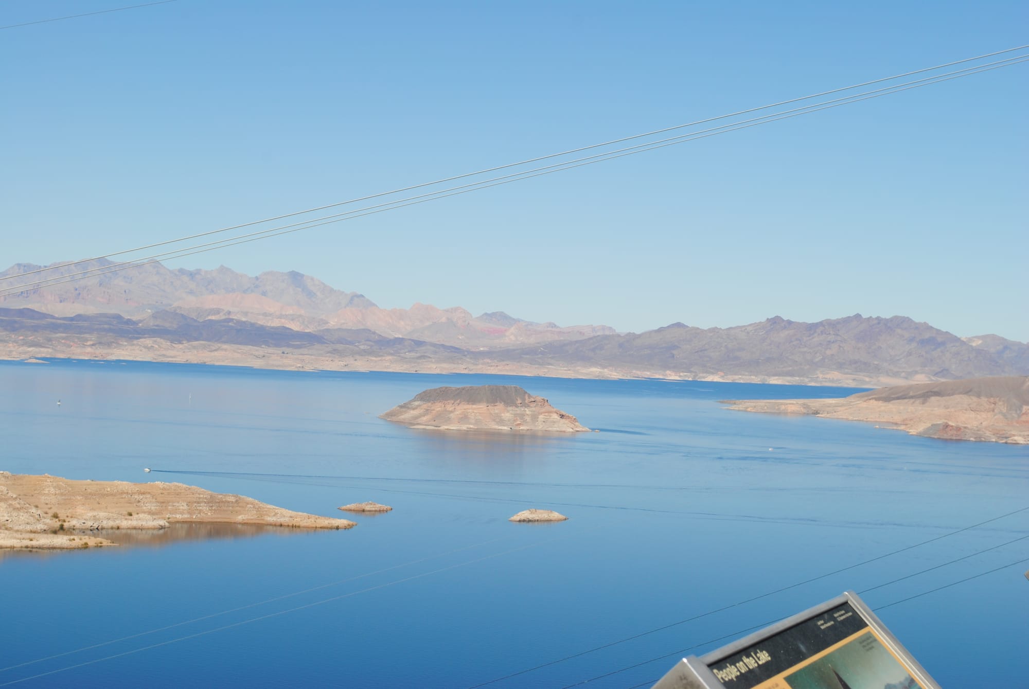
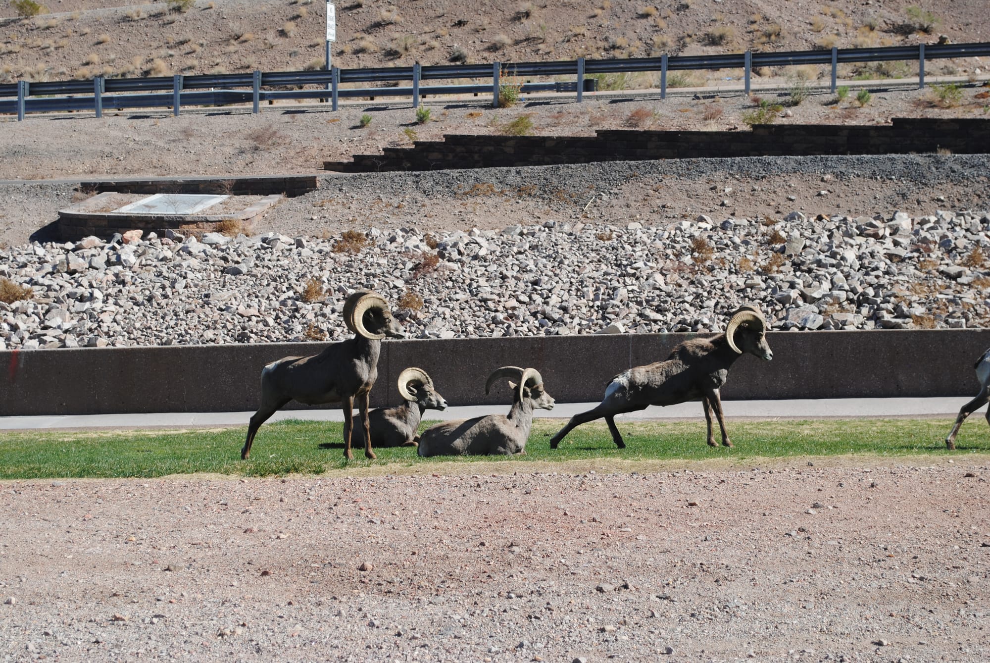
Hoover Dam and Lake Mead
Red Rock Canyon National Conservation Area and Spring Mountain Ranch State Park, NV
Today we thought we would go to Red Rock Canyon National Conservation Area to go on the scenic drive that a friend had told us about. Red Rock Canyon is a portion of the mountains due west of Las Vegas. As you approach the mountains, you can see a large area of red rock that has been uncovered by erosion much like Sedona, AZ. The mountains backstopping the red rocks are amazing in and of themselves. They look like they shot up out of the ground and have amazing sheer cliffs. It’s all amazing to see if you are into geology like I am!
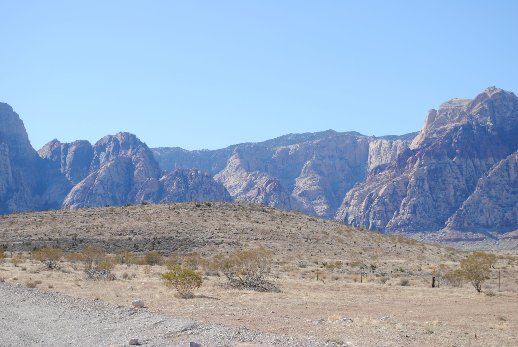
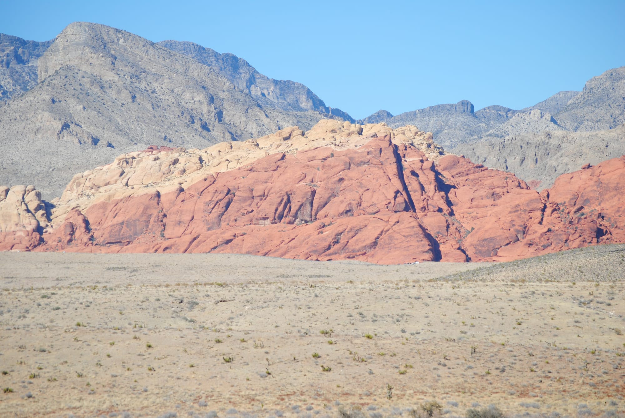
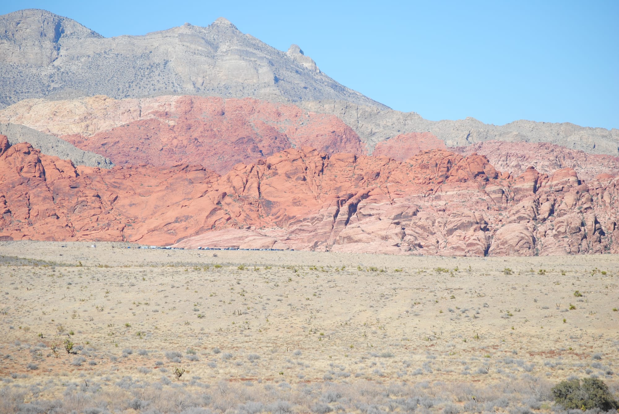
Red Rock Canyon
Unfortunately, we found out after arriving that you have to have a reservation to go through the scenic drive and there weren't any available for several days. Instead, we took a drive further out the road to Spring Mountain Ranch State Park which is snuggled up right next to the beautiful mountains we had been admiring the whole drive. It’s an old ranch previously owned by a German actress that used to be part of the old Spanish Trail going west. It was a beautiful site and the photos don’t do it justice. There are several moderate hikes around the foothills of the mountains to explore.
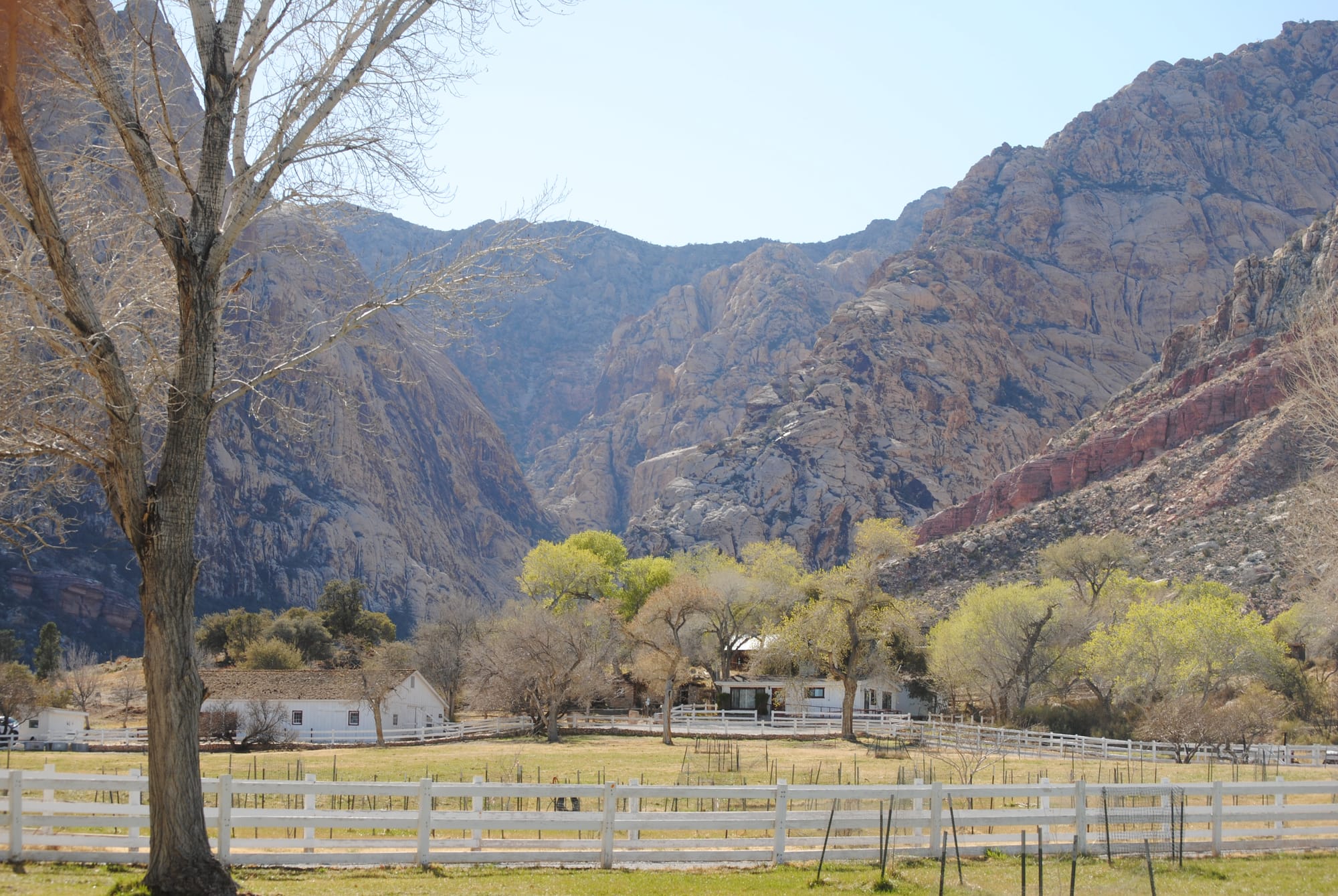
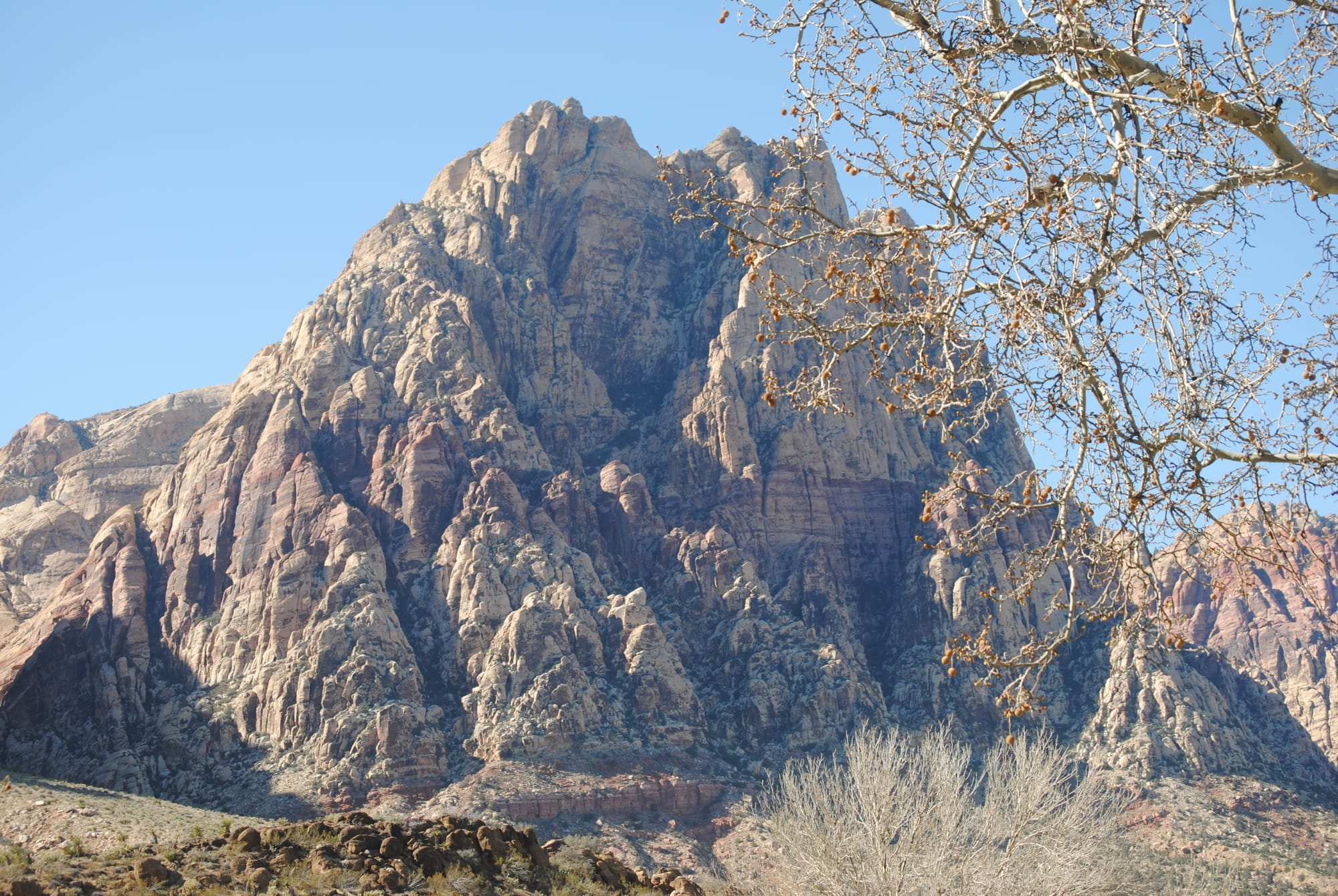
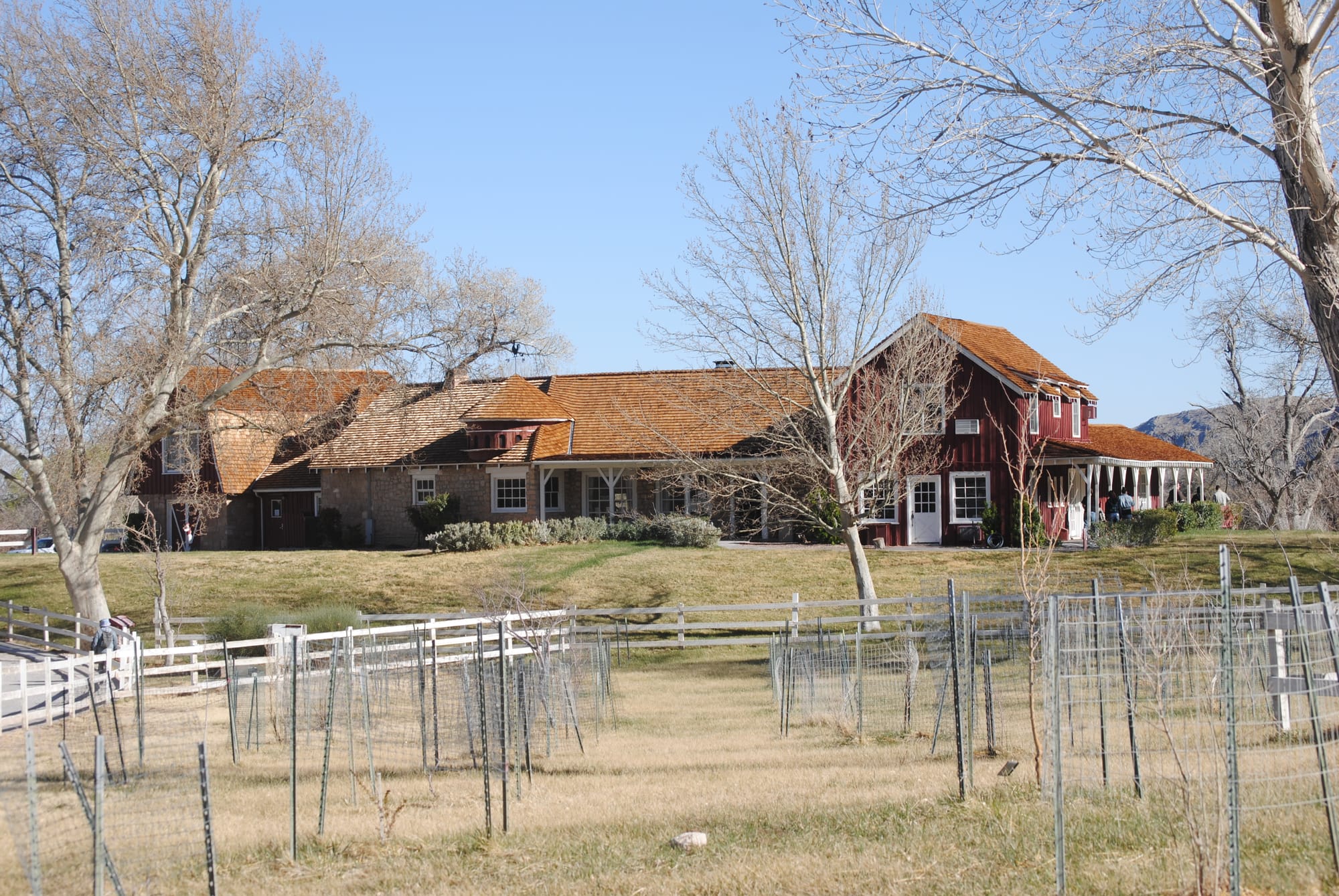
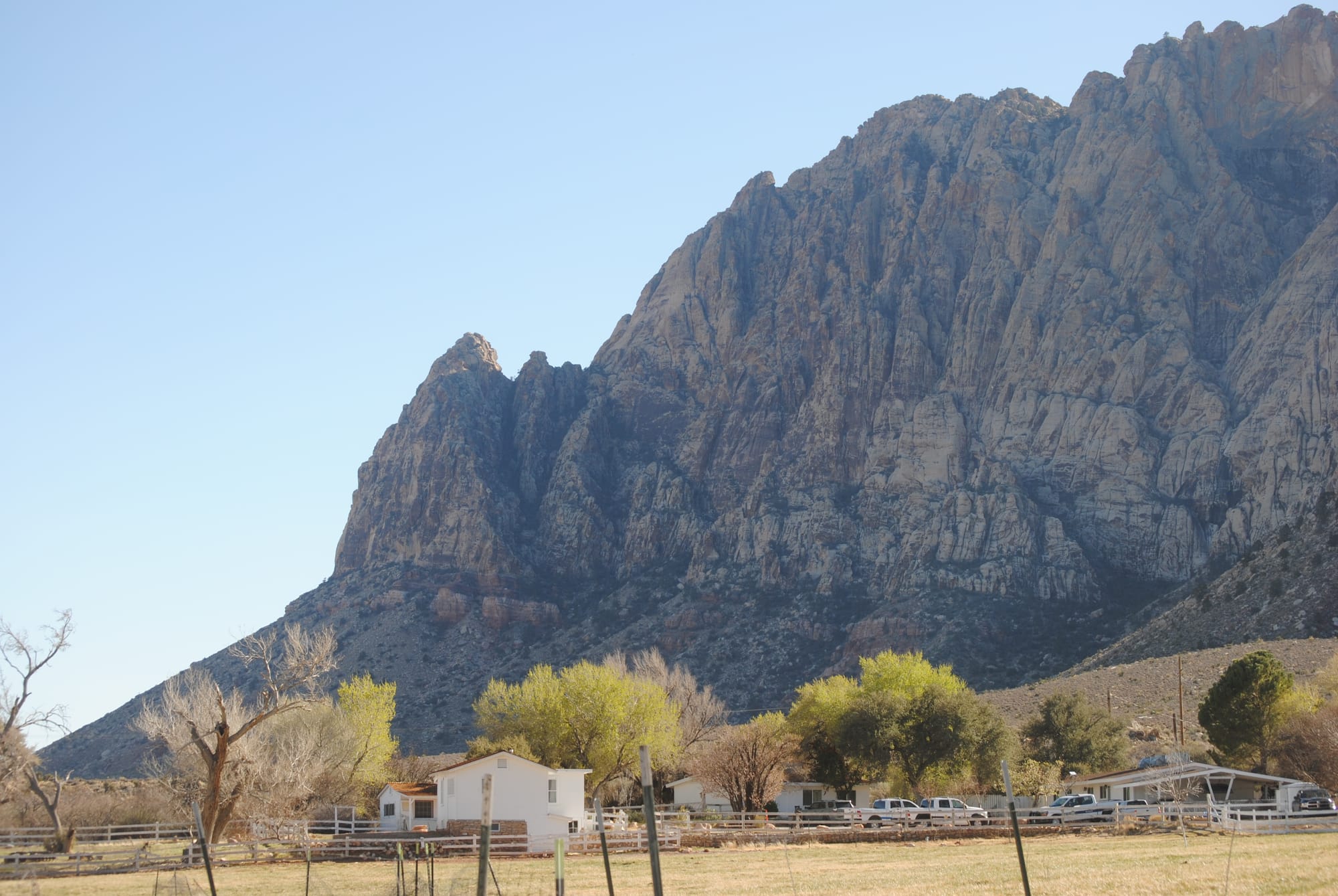
Spring Mountain Ranch State Park
Las Vegas, NV
We awoke this morning to light rain that began about 3 am and it continued all morning. For the first time, we had to pack up everything in the rain for our trip to Las Vegas. I broke out our rain ponchos and cleaned everything up outside. Right as we were getting ready to hook up the truck the rain turned to snow. While that was an improvement in being outside, it didn't portend well for the drive.
We had heard that Flagstaff was supposed to get up to a foot of snow and Prescott area was supposed to get 1-3 inches so we decided to go southwest to Prescott and then northwest to pick up I-40 for the journey into Las Vegas hopefully going around the worst of the weather. As we climbed the hills on I-17 outside Camp Verde the ground began to get covered with snow and as we continued towards Prescott the snow was coming down very heavily. It made for a beautiful drive but we couldn’t see more than about a quarter of a mile in any direction. For the most part the roads remained wet but not slippery as the temperature hovered around 32 degrees the whole drive but there was enough retained heat from previous warm days to keep the road from icing over. We did hit patches of thick slush that slowed us down a lot. This was my first time driving in real snow. I had driven in some flurries on our Pennsylvania trip but only for an hour or so and it never stuck to anything.
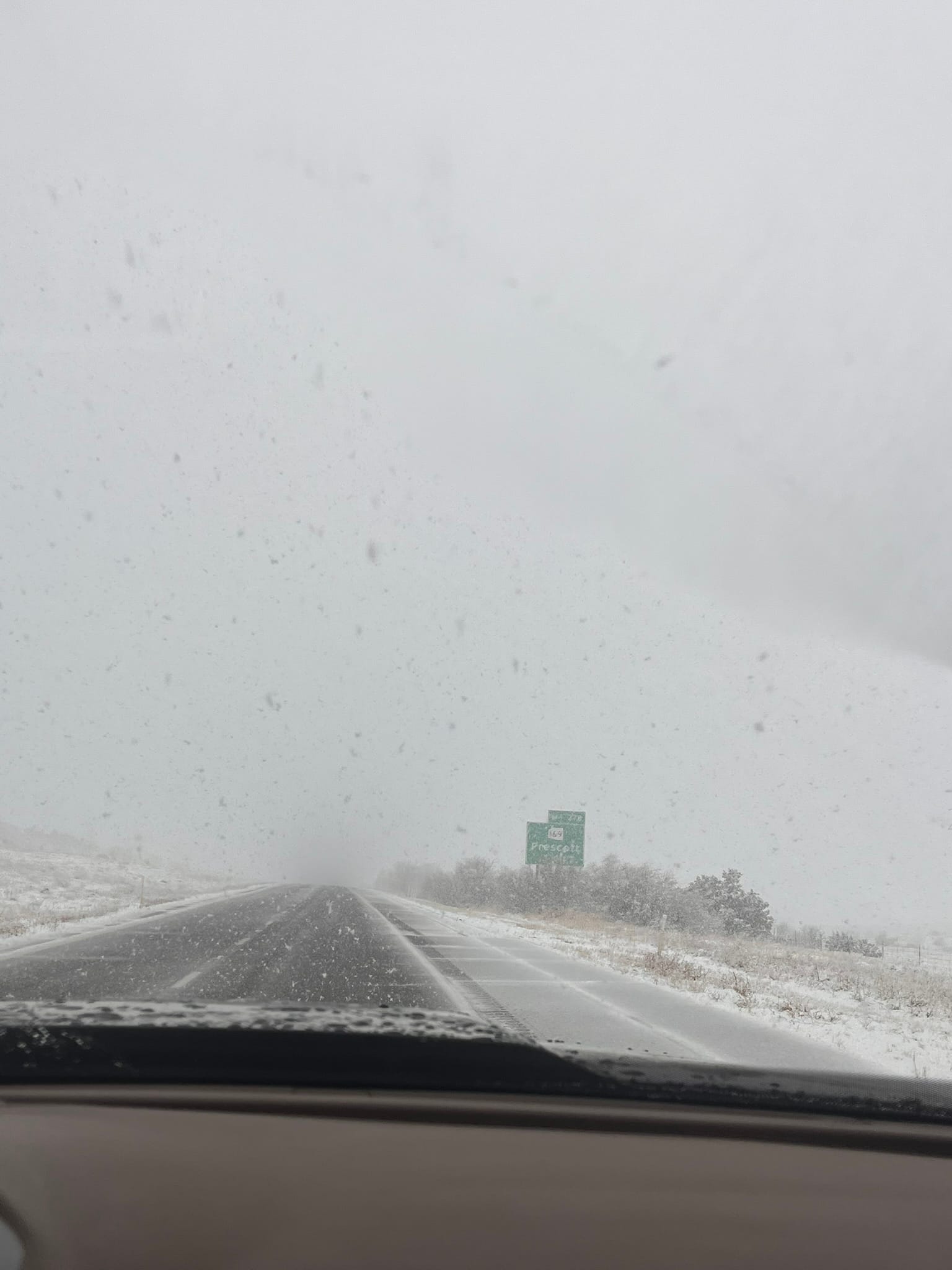
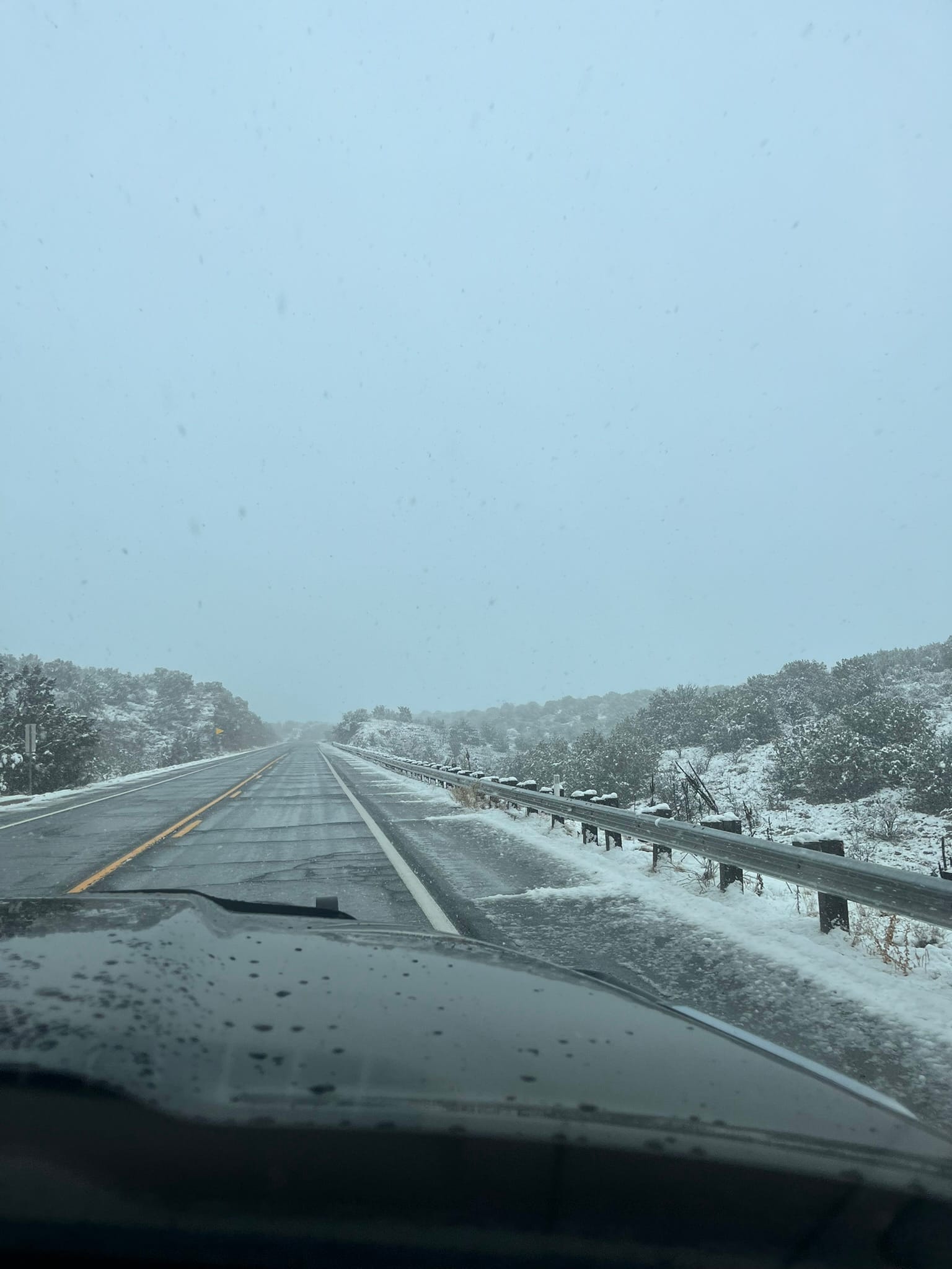
In Prescott, we turned north on Hwy 89 and the snow continued to come down. Most of the roads were wet with some areas being snow covered but still not slippery. We got to I-40 and turned west only to discover that parts of I-40 only vaguely resembled a road. By the time we got to Seligman the snow had stopped and we drove out of the rain shortly thereafter. In Kingman, we turned off I-40 on Hwy 93 towards Las Vegas which took us across the new bridge near the Hoover Dam which actually makes it impossible to see the dam. The first 20 miles or so of Hwy 93 was like a reverse form of Frogger where we had to dodge the never ending potholes! What a pain!
We got into the Oasis RV Resort just off I-15 and while Kim went in to finish registering us, I heard one of our water sensors going off so we had water leaking in the rig somehow. We got to our site and set up camp and pulled everything out of the pass-through compartment so we could get back in to see what had happened and noticed that some water had dripped on top of the sensor. We still don’t know where that water came from. We also had water dripping out from under the RV where we had cut the Coroplast to put up some insulation. We've seen that before after driving in the rain so we thought might have blown up on the bottom and may have gotten inside. After we had hooked everything up, the alarm went off again this time due to a leak where the hose connects to the control panel. Once again, everything came out and we had to dry the inside to prevent any damage. Note to self: be sure there’s no drip dummy! On a positive note, the Govee water sensors were paying for themselves!
We took an Uber to the strip which is just a couple miles due north of our campsite. We walked around a few casinos, gambled a little and got some food. We walked through Luxor, Excalibur, New York, and Paris. We walked up the strip for a bit to watch the fountain show at the Bellagio and then walked over to see the Sphere after which we got a taxi ride back to the campsite.
Las Vegas sure has changed since the last time I was there nearly 26 years ago. Last time we visited, the road was only 4 lanes wide and there was room between the casinos. Now it feels like every inch is filled and the road is 6-8 lanes wide and completely filled with vehicles! There are stores and restaurants filling the gaps between casinos. There’s a Ross and an Outback Steakhouse for example filling in the block and lit up like casinos! We came around one corner in front of Ole Red and off to the right was a low concrete, very plain looking building filled with food vendors that looked very out of place there. I guess not everyone can eat at casinos all the time!
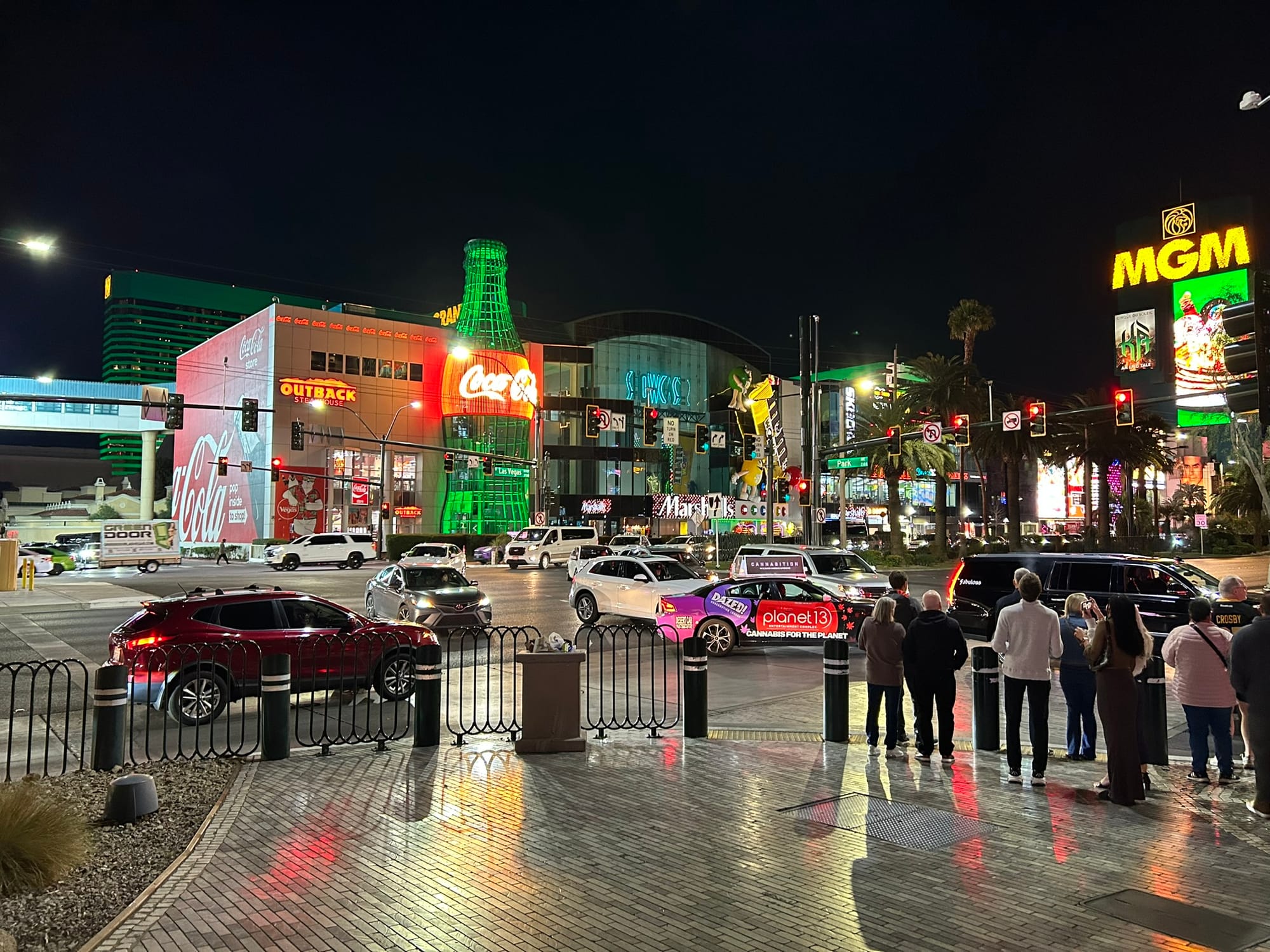
Tuzigoot National Monument, AZ
Today, we did some chores around the RV in the morning and then decided to go over to Tuzigoot National Monument near Cottonwood and Clarkdale, AZ. Tuzigoot is a pueblo “town” on top of a small hill near the Tuzigoot river. Tuzigoot is an Apache word for “crooked water”. The pueblo is a two story, many roomed homestead inhabited for several hundred years from about 1200 to 1400 before it was abandoned for some reason.
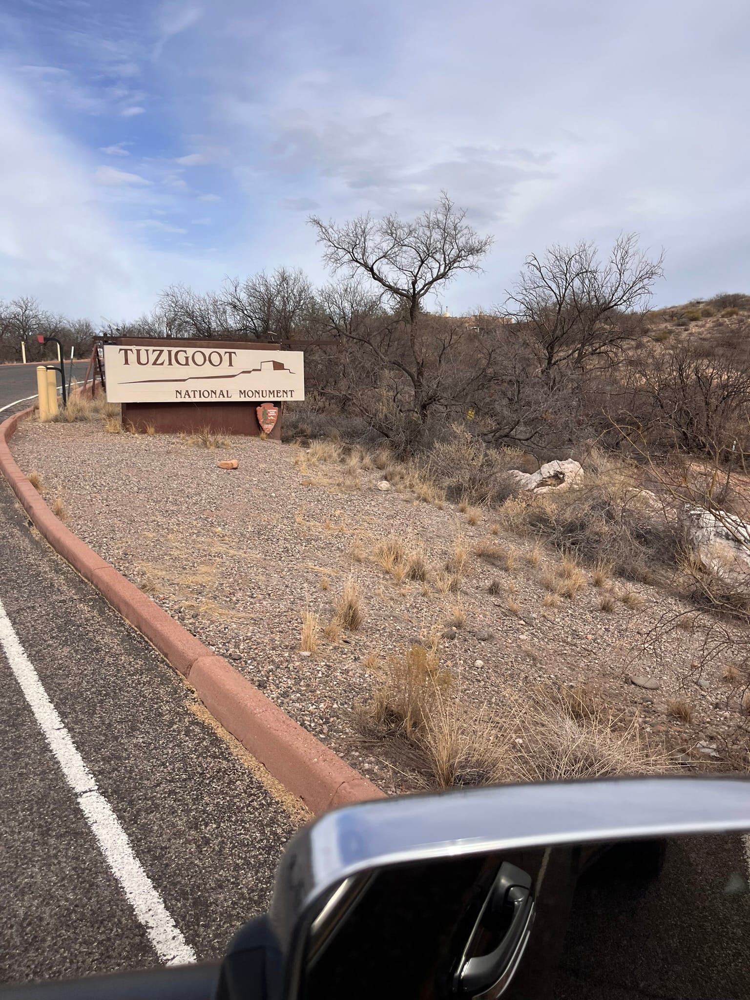
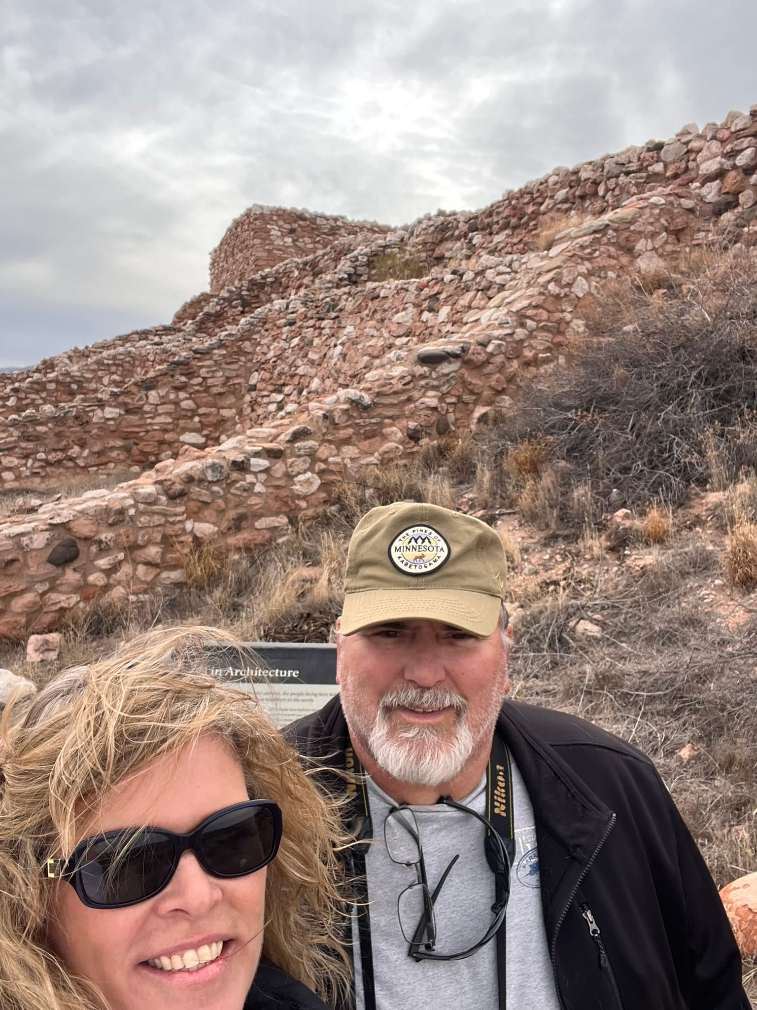
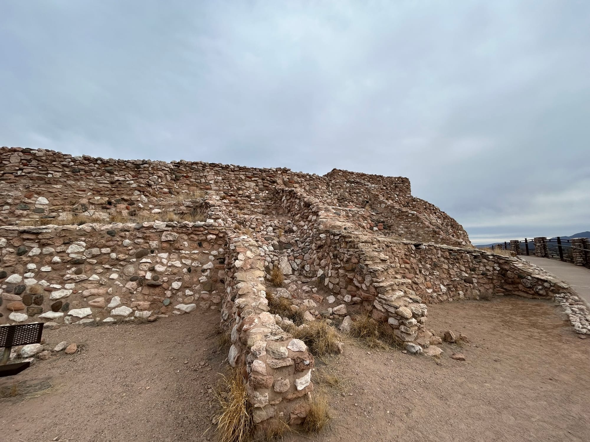
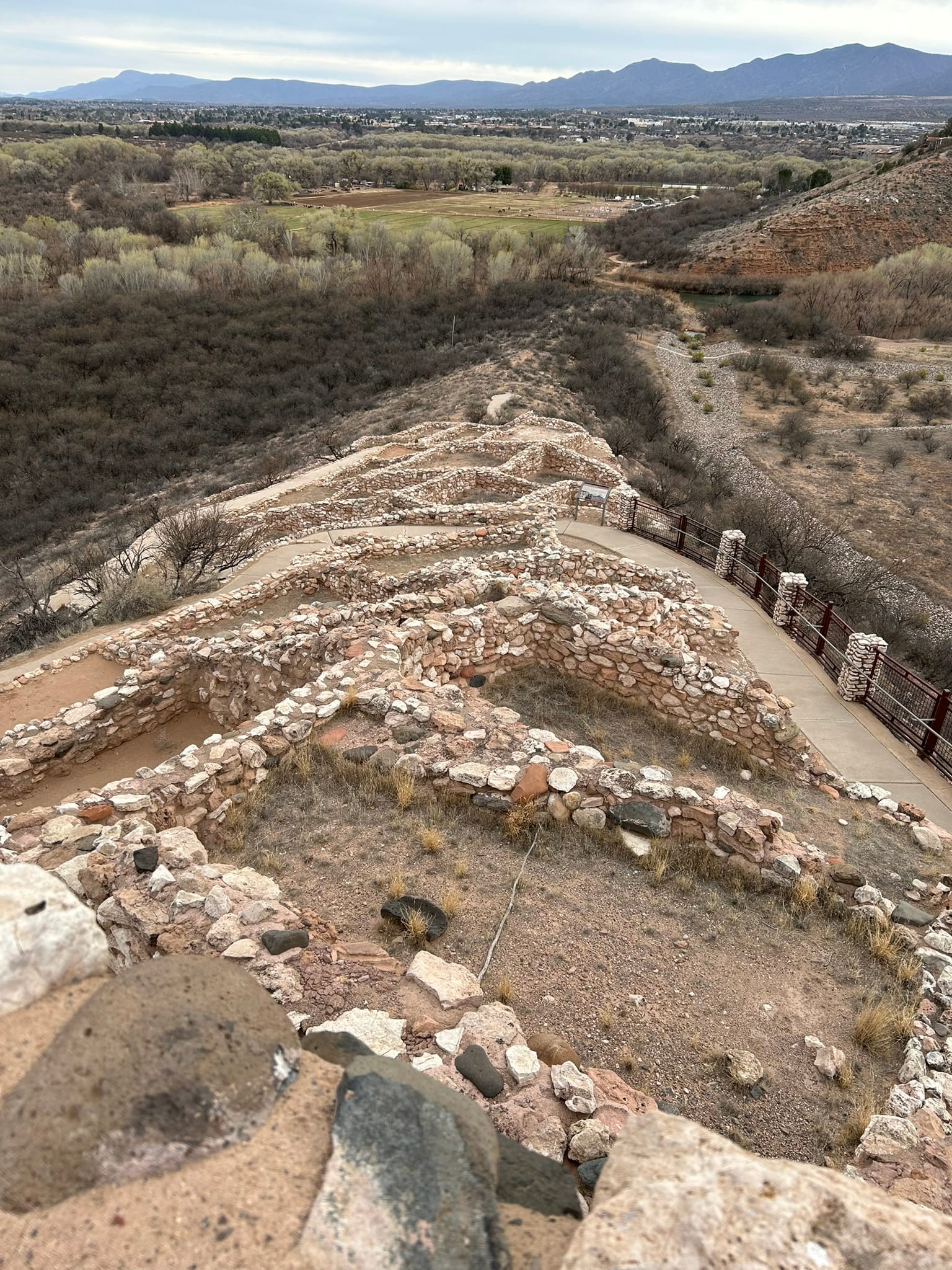
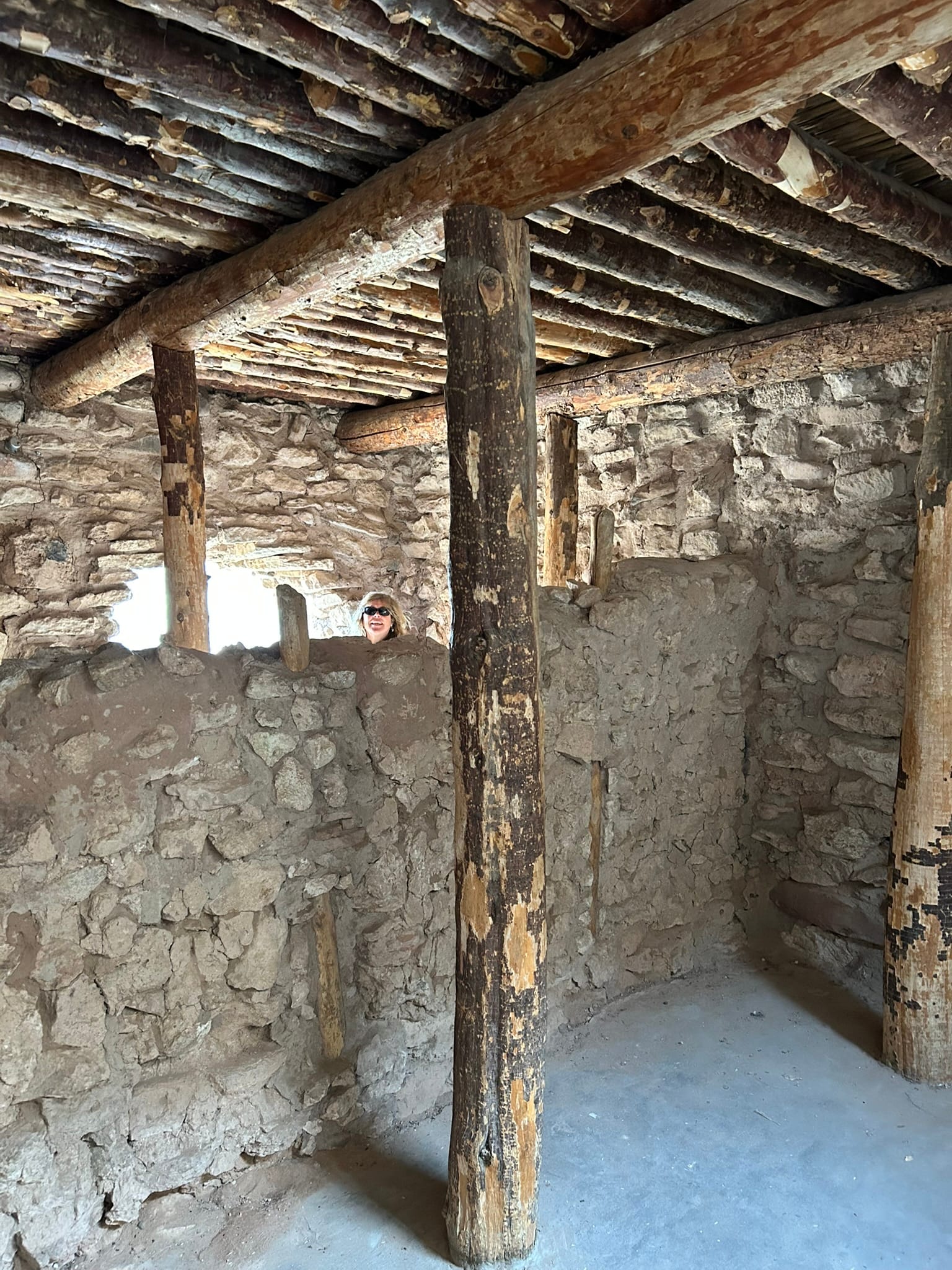
Tuzigoot National Monument
Sedona, AZ
Today we drove into Sedona and rented an ATV to drive some of the local trails. The drive into Sedona was very picturesque. It’s amazing how beautiful Sedona is compared to the surrounding desert. As you approach Sedona, you can begin to see a thick red layer of rock in the cliff walls in the distance but when you get closer the overlying rock has been stripped away and beauty of the red rock is revealed in all it’s glory. It appears to have thrust up from the desert floor in magnificent shapes and bizarre columns. My mind reels trying to figure out how the beautiful shapes came to be and what it must have been like for the first people to stumble upon the sights! I can see why so many people love it here and why so many feel like there’s something mystical about this place!
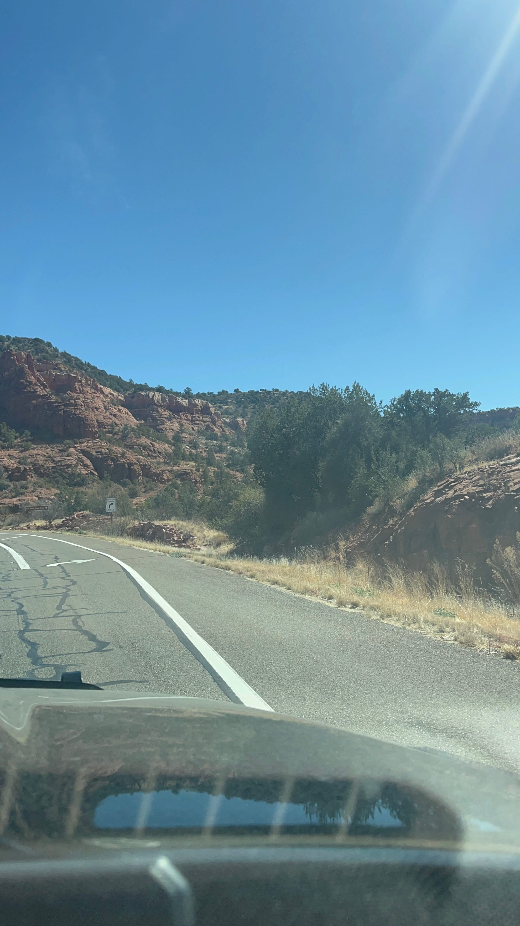
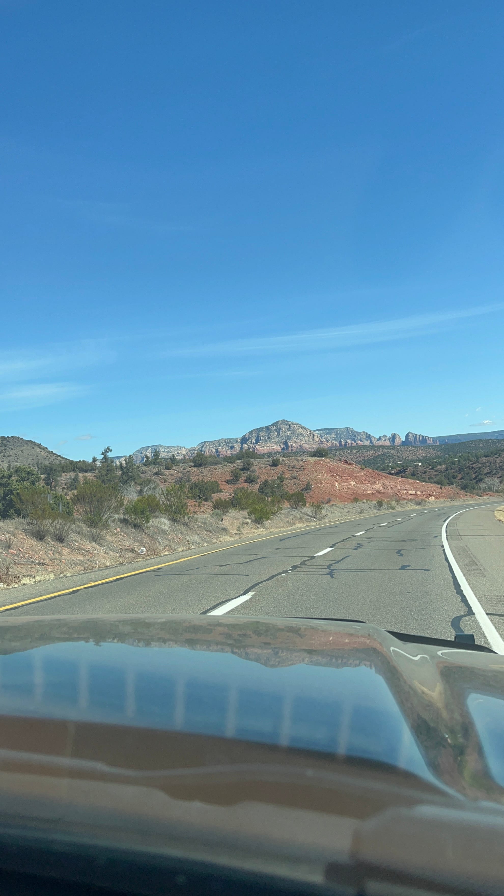
The drive into Sedona
We rented an ATV from Outback ATV Rentals for 4 hours and were able to go down 2 trails they recommended. It was weird to drive on the city streets until we got out of town and on to the dirt road and then the trails. The first trail meandered in front of some large red stone cliffs and was a little rough. It ended at an archaeological site called the Hononki Heritage Site with an ancient home built into the cliff similar to Montezuma Castle.
The second trail was very rough and was known for its "rock crawling". It went down into a steep creek bed and back out. It looked like there was no way we’d make it but the little Kawasaki ATV went right up and handled the rough ride very well. That's not to say the ride was smooth at all inside!
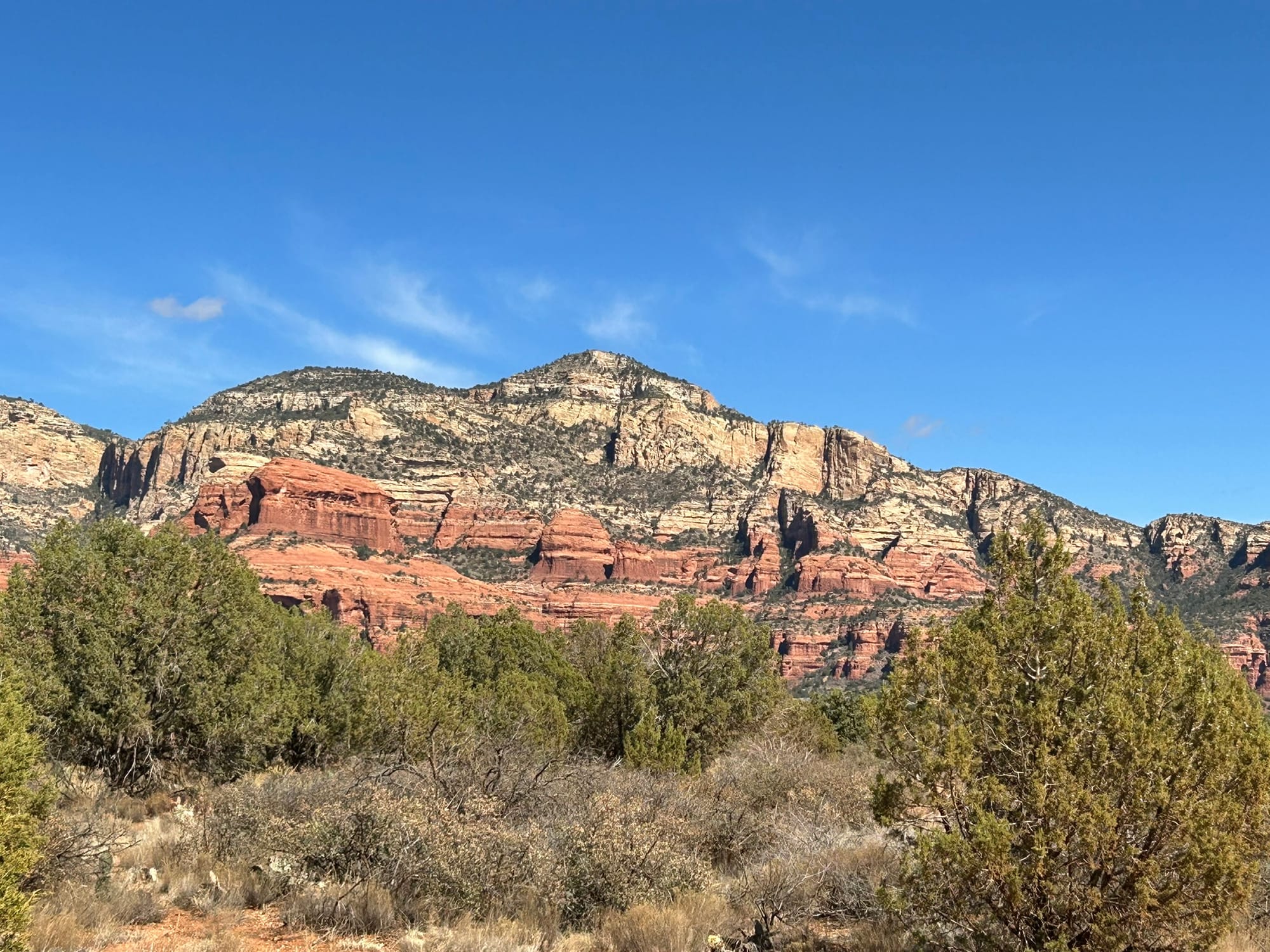
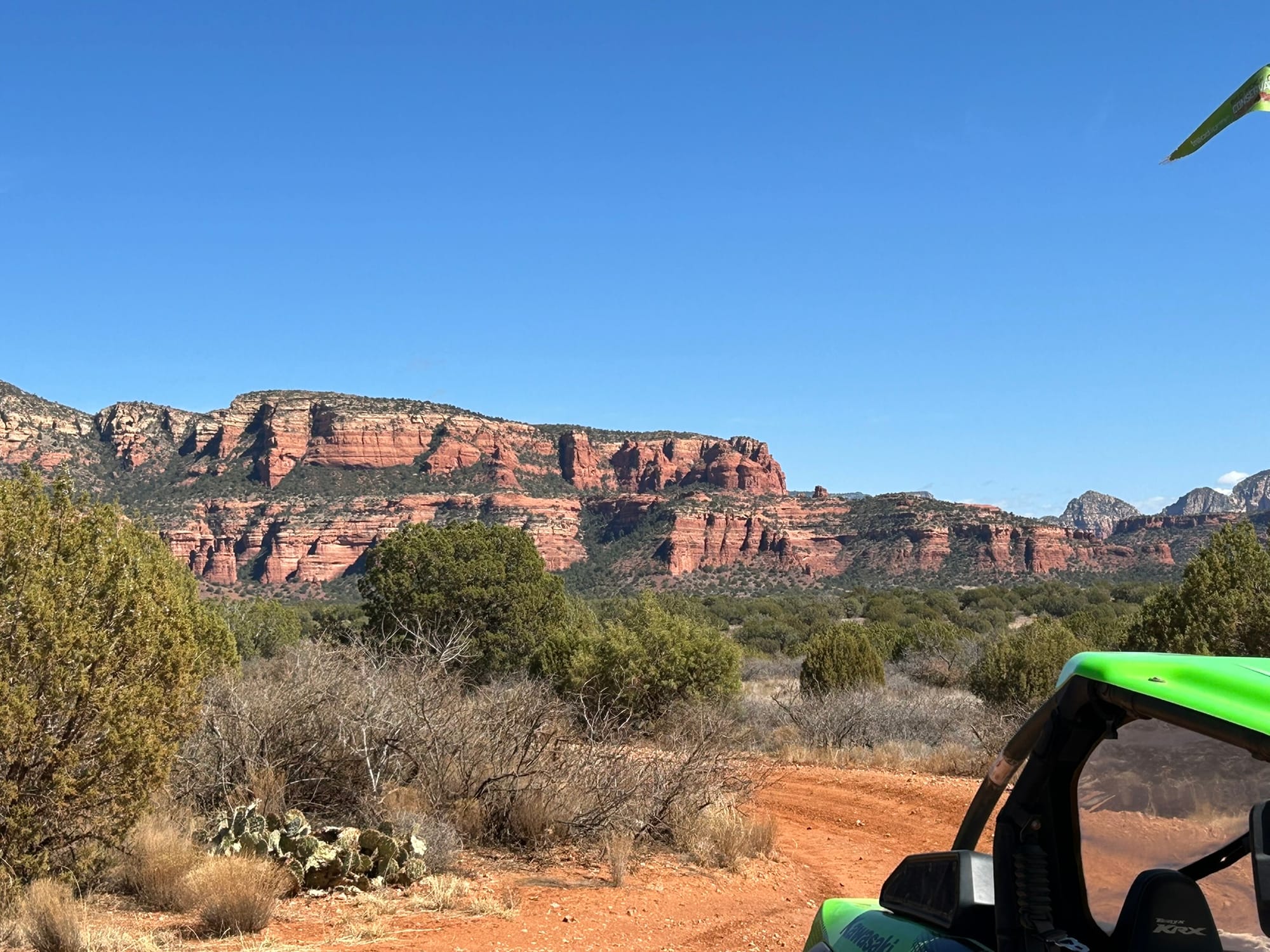
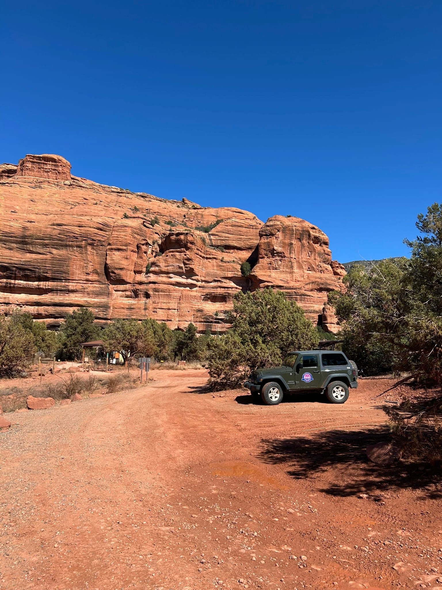
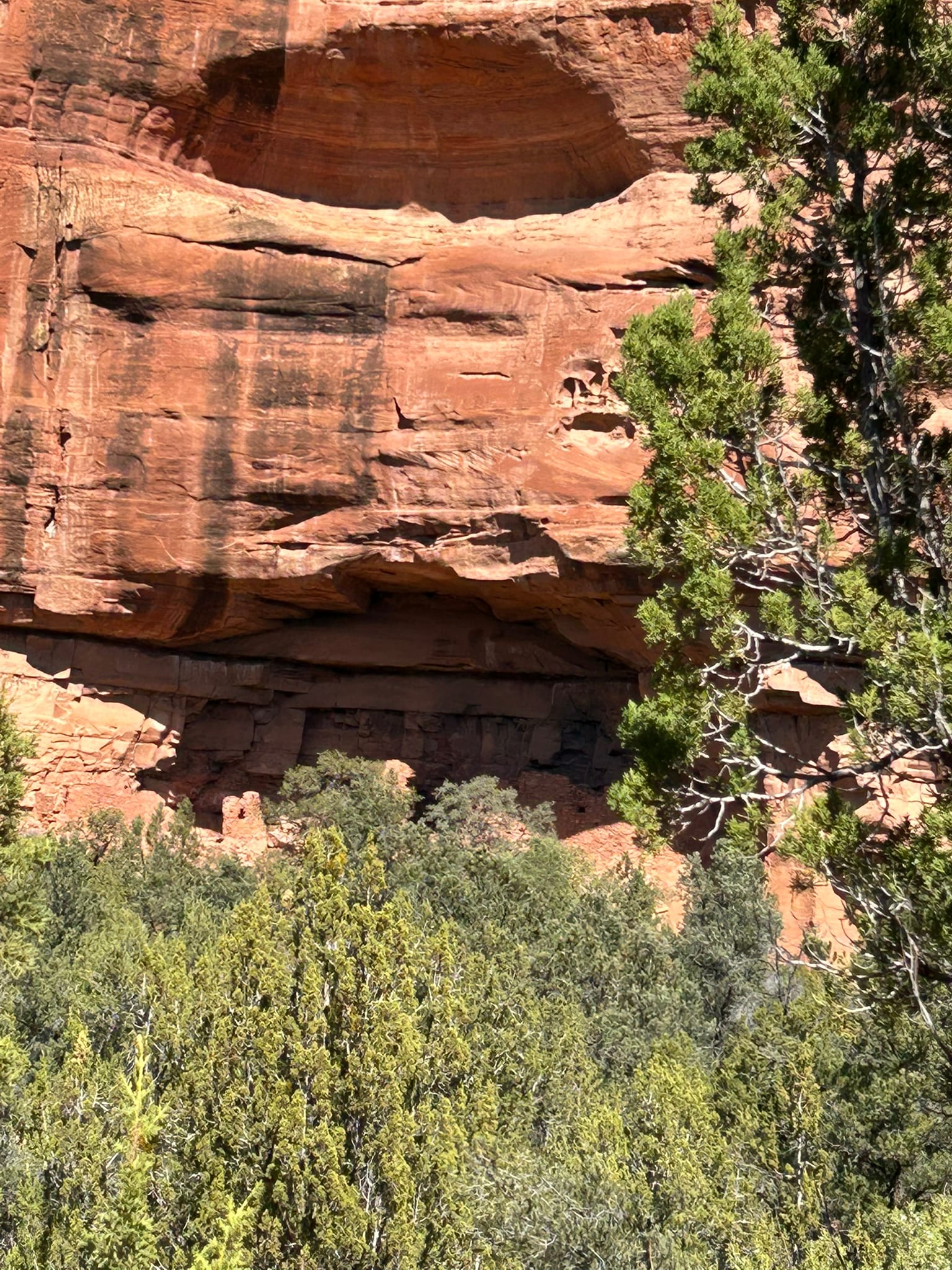
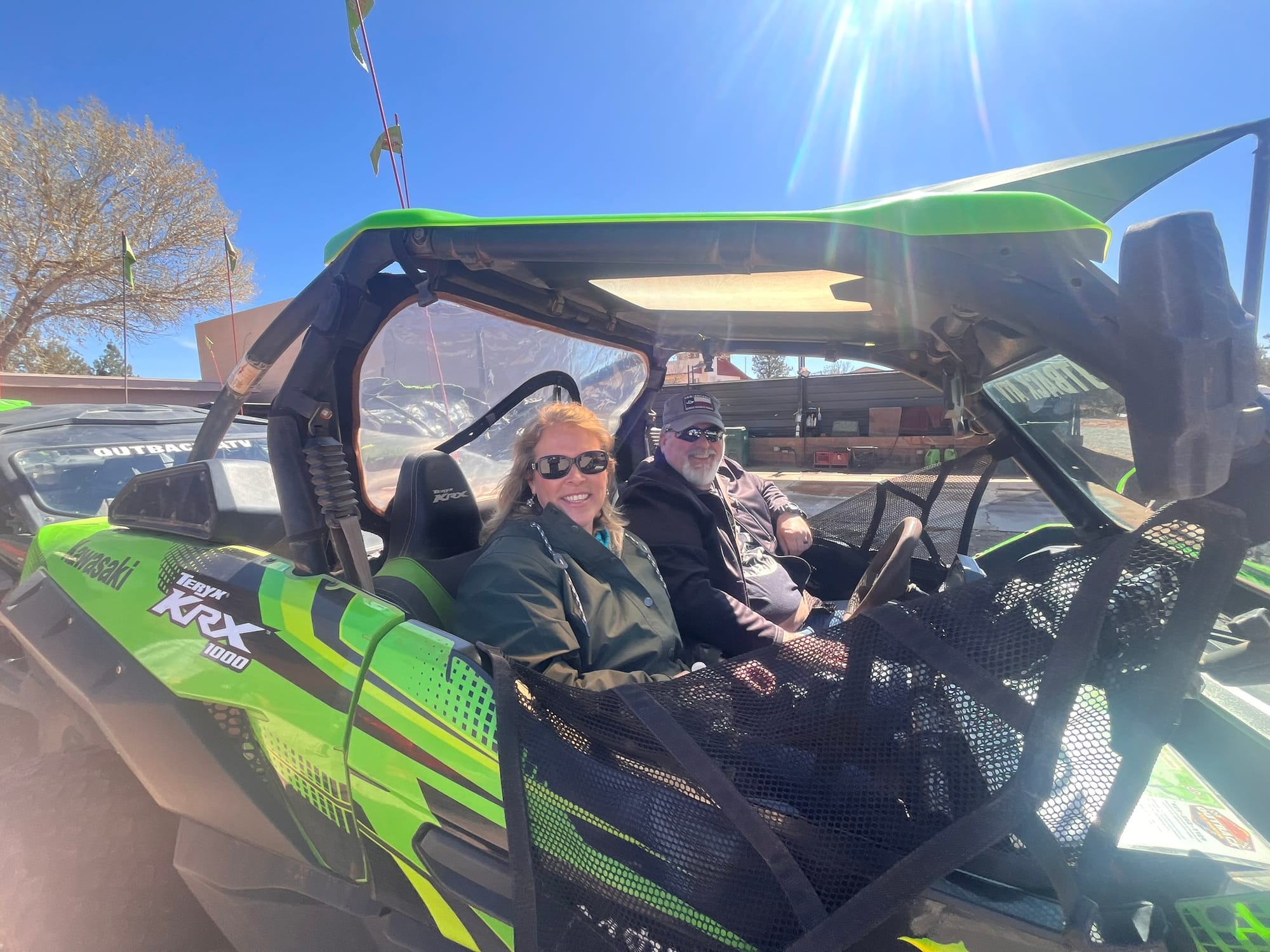
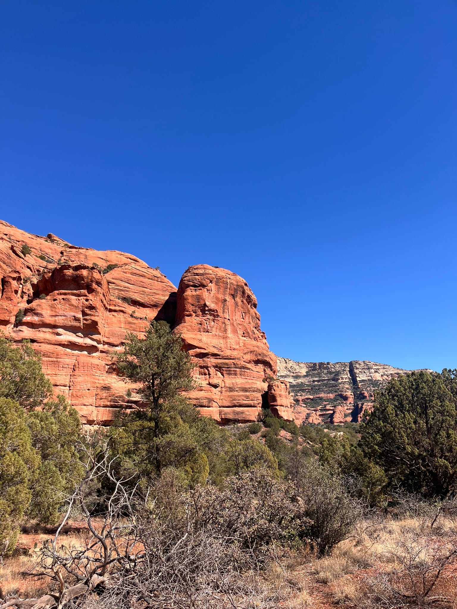
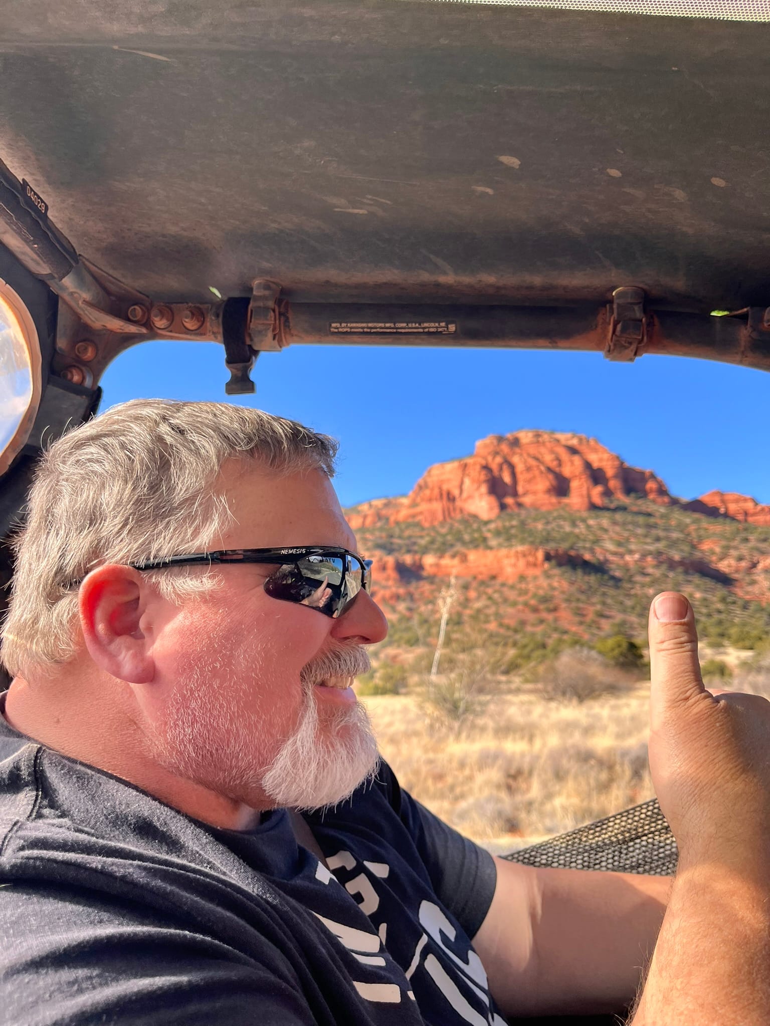
Sights along the ATV trails
When we got back, we decided to drive through town on 89A and check things out. On the north side of town we turned on 179 which is also the Red Rock Scenic Byway. It passes by a lot of the iconic monuments in the Sedona area. Truly a beautiful ride! We got back to Camp Verde and had dinner at Filiberto’s Mexican Restaurant. We had their steak fajitas and chicken tacos. The fajitas were amazing!
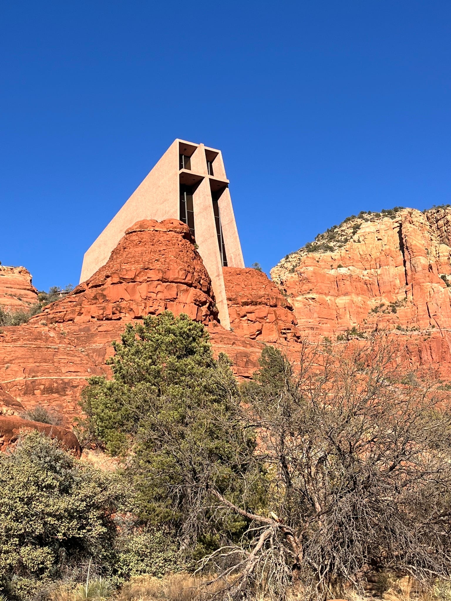
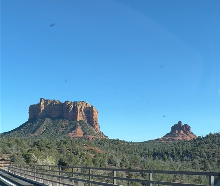
Famous Sedona sights
Jerome to Prescott, AZ, Scenic Drive
Today dawned nicer than expected so we decided to drive over to Jerome and then on to Prescott. We met a couple of folks from Prescott in the hot tub last night and they told us the drive to Jerome and on to Prescott on 89A was amazing and they weren’t kidding! First we drove over to Cottonwood where we picked up 89A south and started climbing up to Jerome, an old copper mining town perched in the mountains. The road wound around a bit getting there. The road is very unforgiving as there’s steep drop-offs all along the route. It’s a small town but seems to have a lot of artisans working there. The road through town continues the switchback motif of getting there. We drove around a bit but didn’t see anything we wanted to visit other than the State Park. The park is comprised of the Douglas Mansion and contains artifacts from the Douglas mine right below it and from the Douglas family. The roads in and around Jerome were very tight especially for a Ram 3500 Dually! We had to pull over at times to let another wide truck get by.
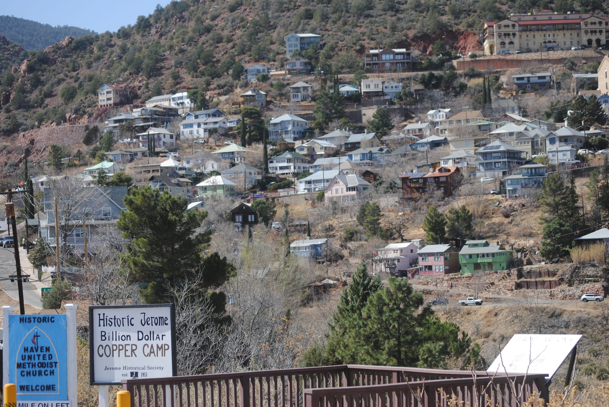
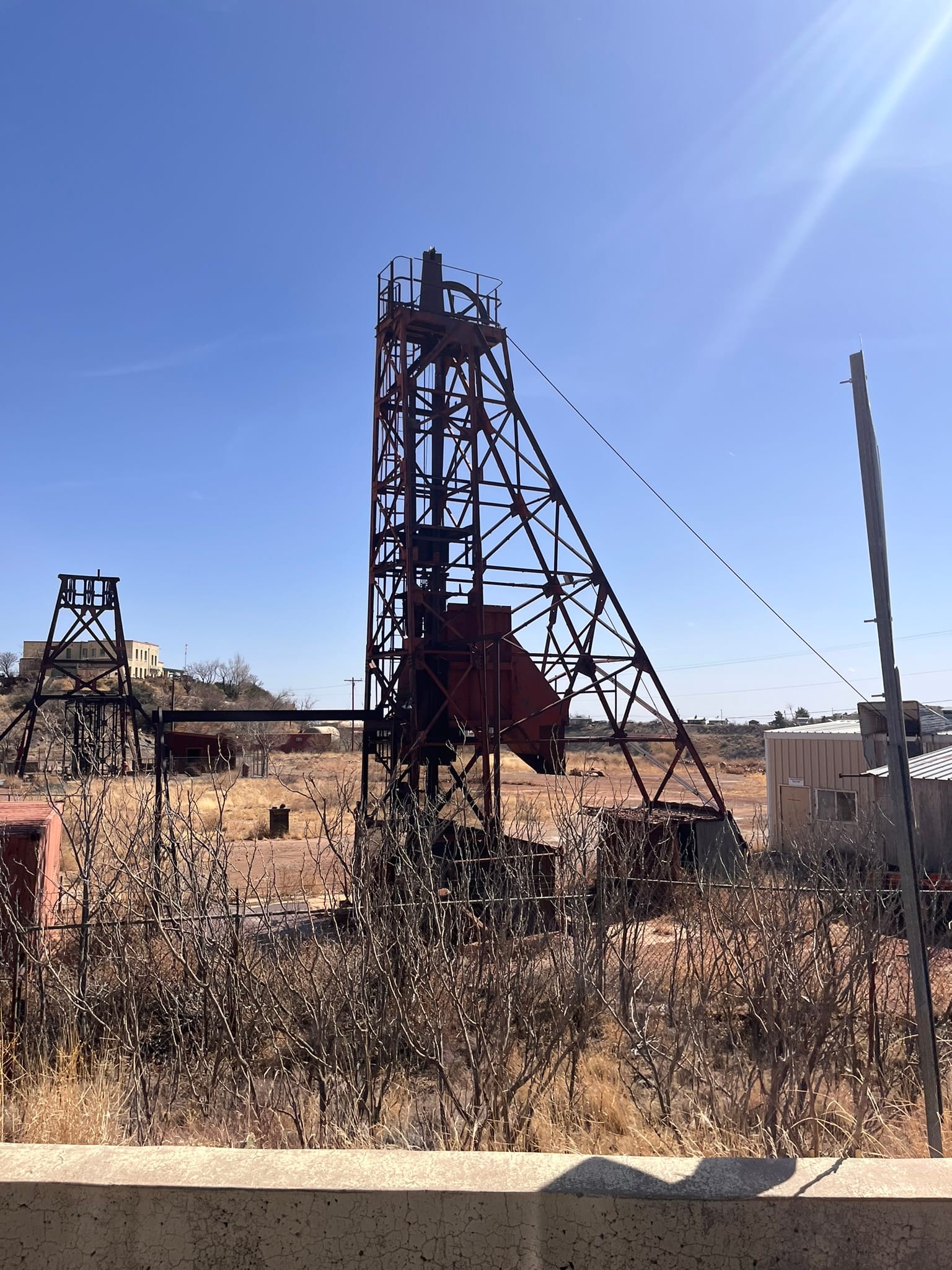
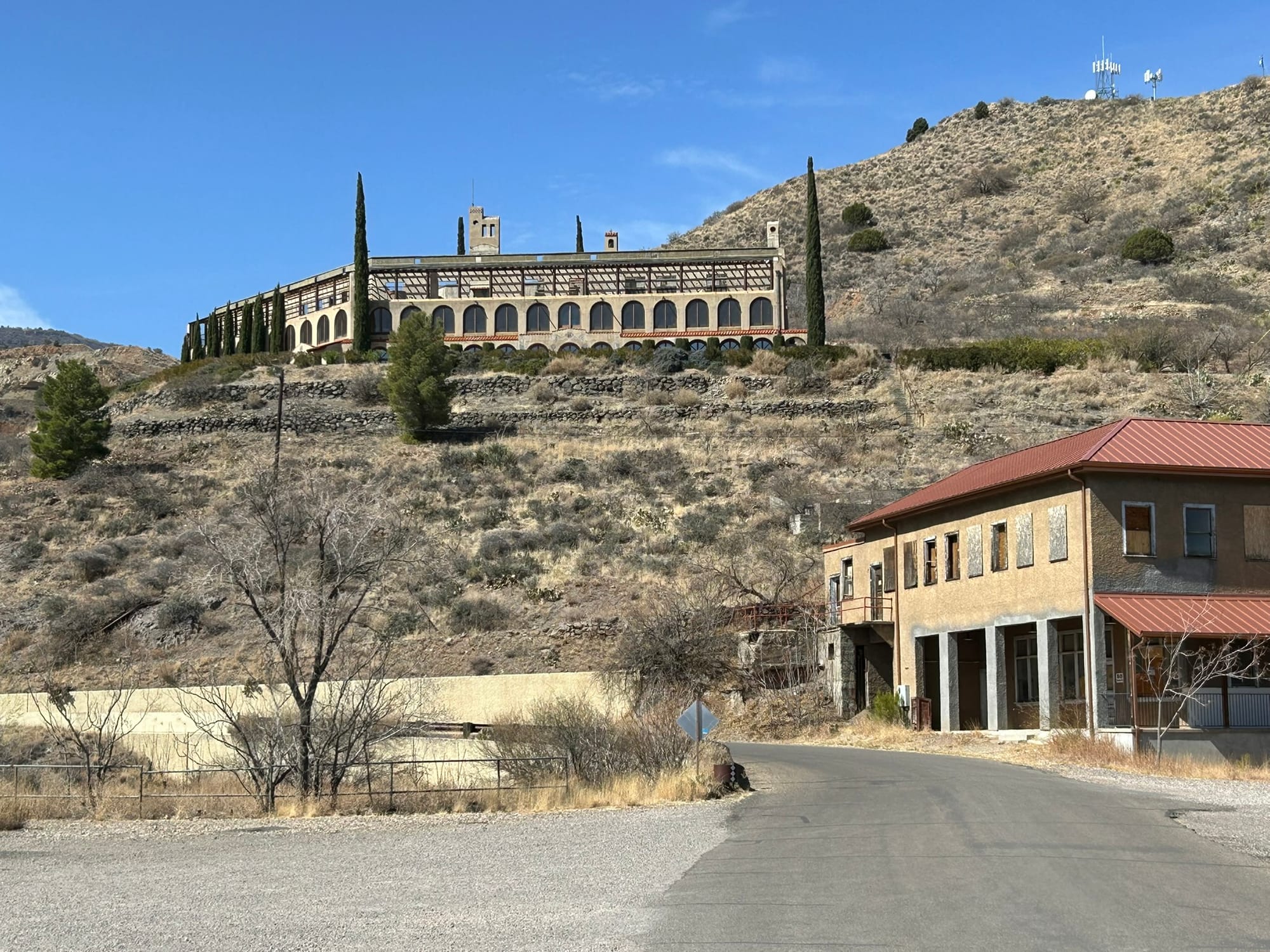
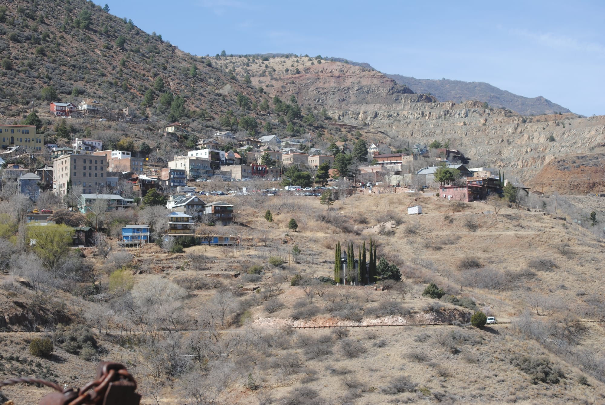
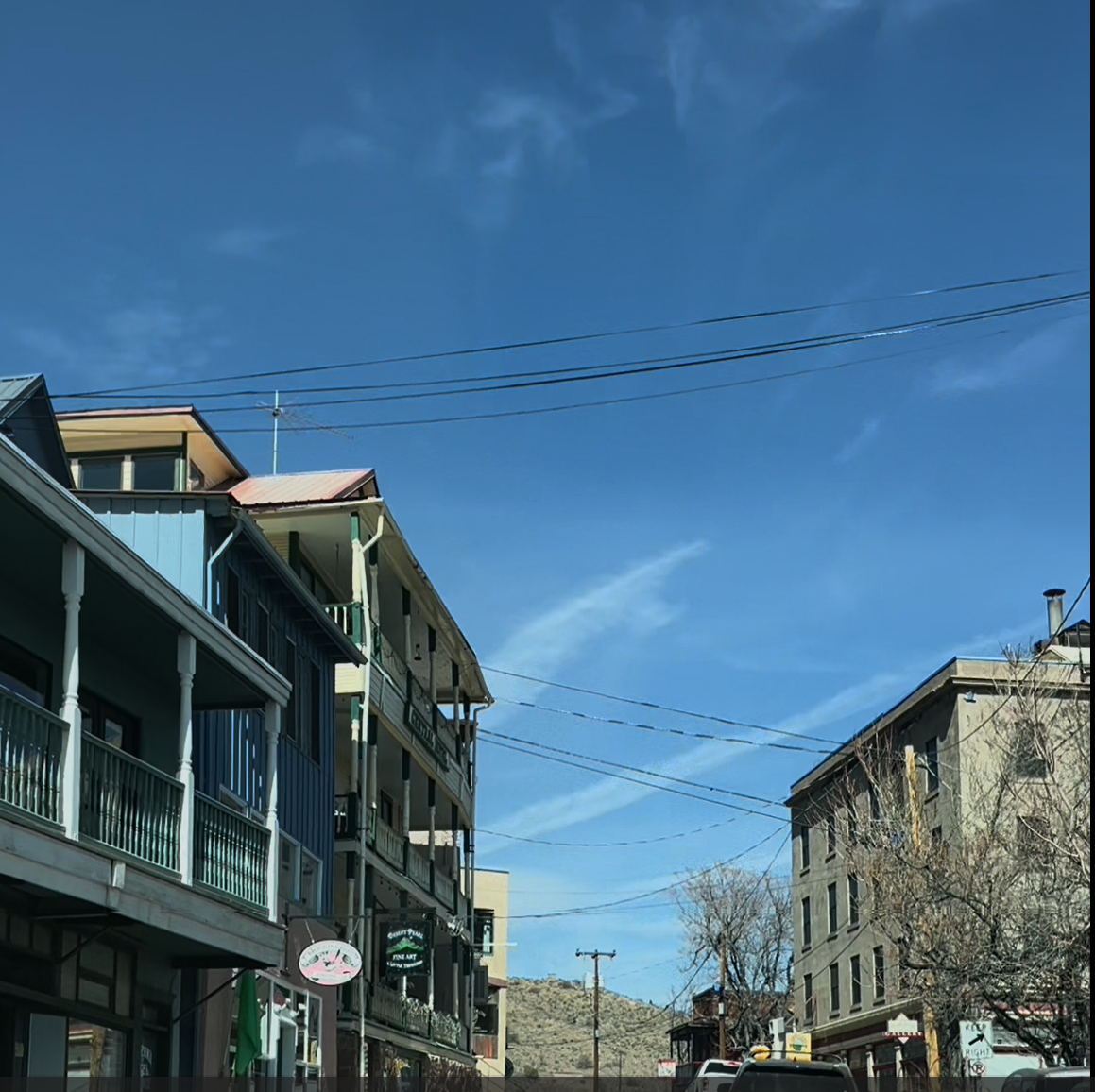
Historic Jerome, AZ
We left town and continued heading south on 89A which meant switchbacks higher into the mountains. We stopped at a couple of scenic turnoffs to take some photos and the views were spectacular! You can see for miles up there! The drive took us up into the Prescott National Forest where the scrub brush of the desert valley changed to lush green forest! We continued south until we hit the summit and then headed down the other side into Prescott Valley which was a wide relatively flat area and then on into Prescott proper. It was an odd feeling because Prescott sits at 5,319 feet and is higher than Jerome at 5,066 feet but doesn’t look it because it sits in an wide elevated valley. The mountain pass topped out at 7,200 feet.
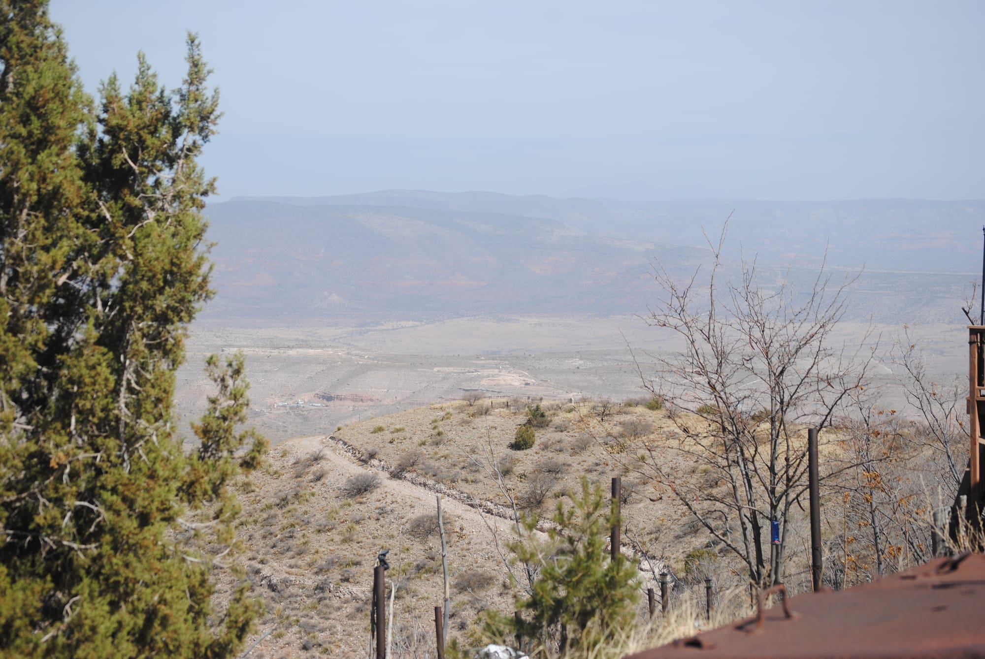
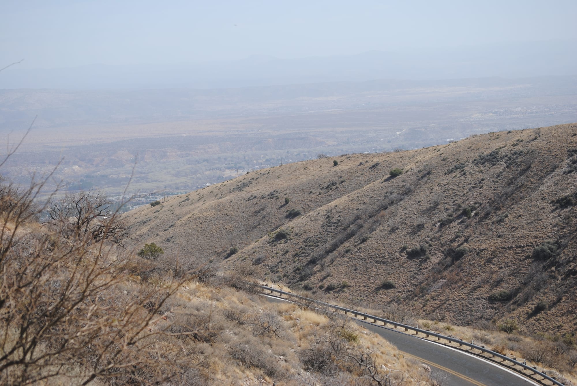
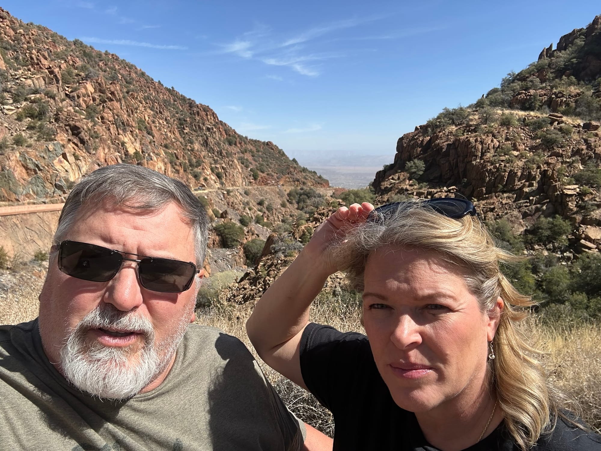
As we neared Prescott, we passed through some amazing rock formations called the Granite Garden and then to Watson Lake Park. We stopped at the park to look around because the geology of the area was stunning! Half the lake is in and around the granite rocks that we had been traveling through and then the rocks give way to smoother ground along the second half of the lake. The combination of rock formations and the lake water was spectacular!
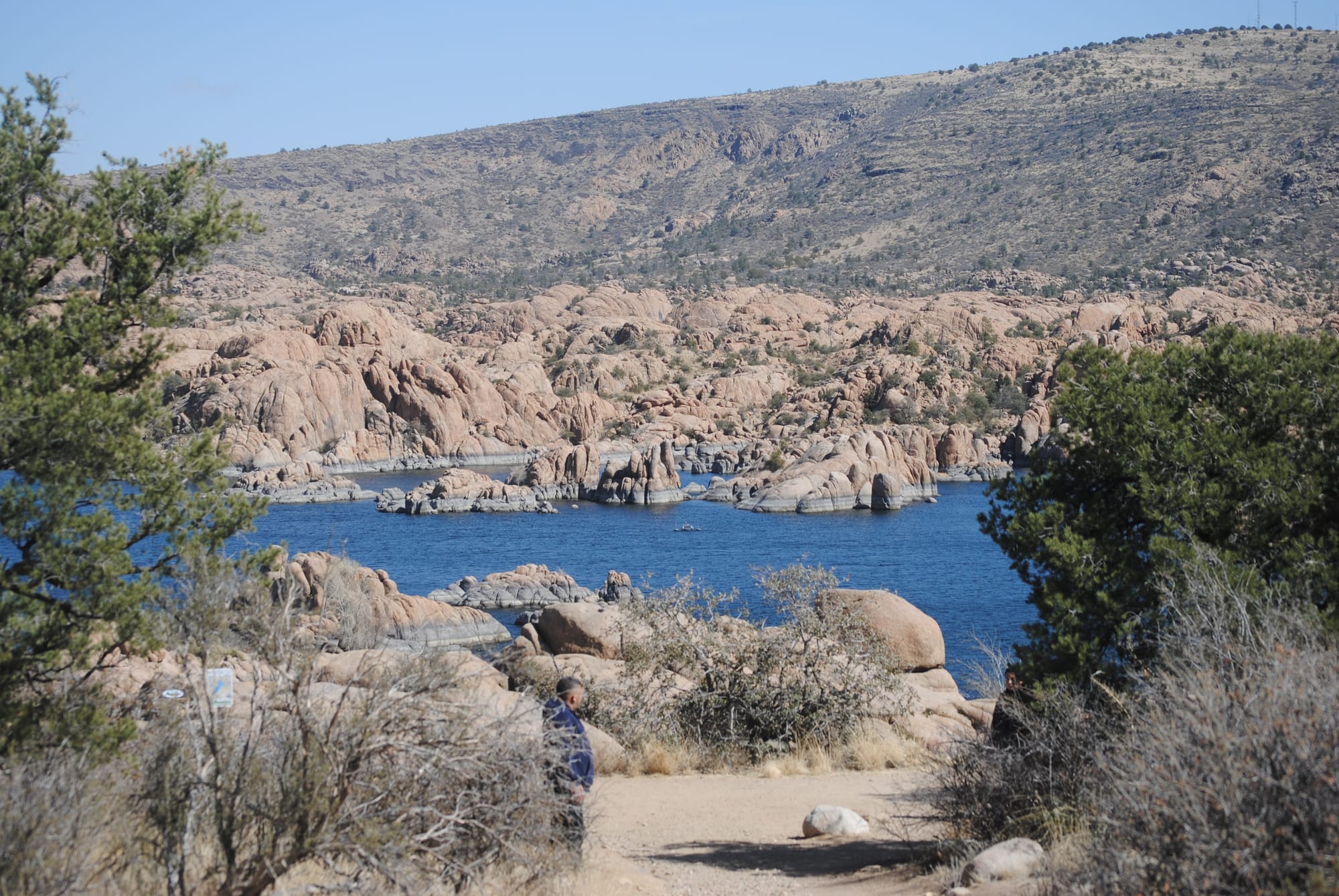
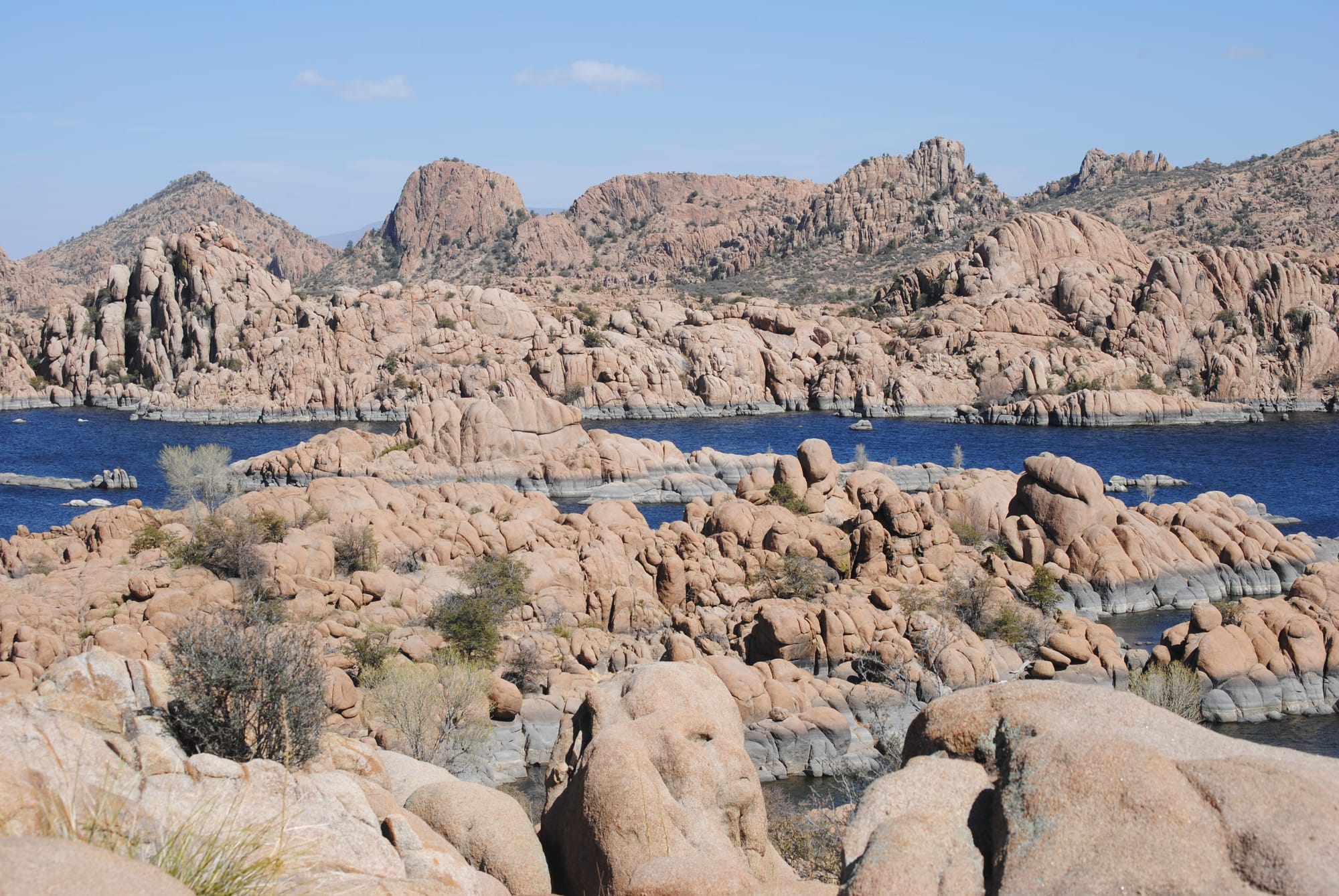
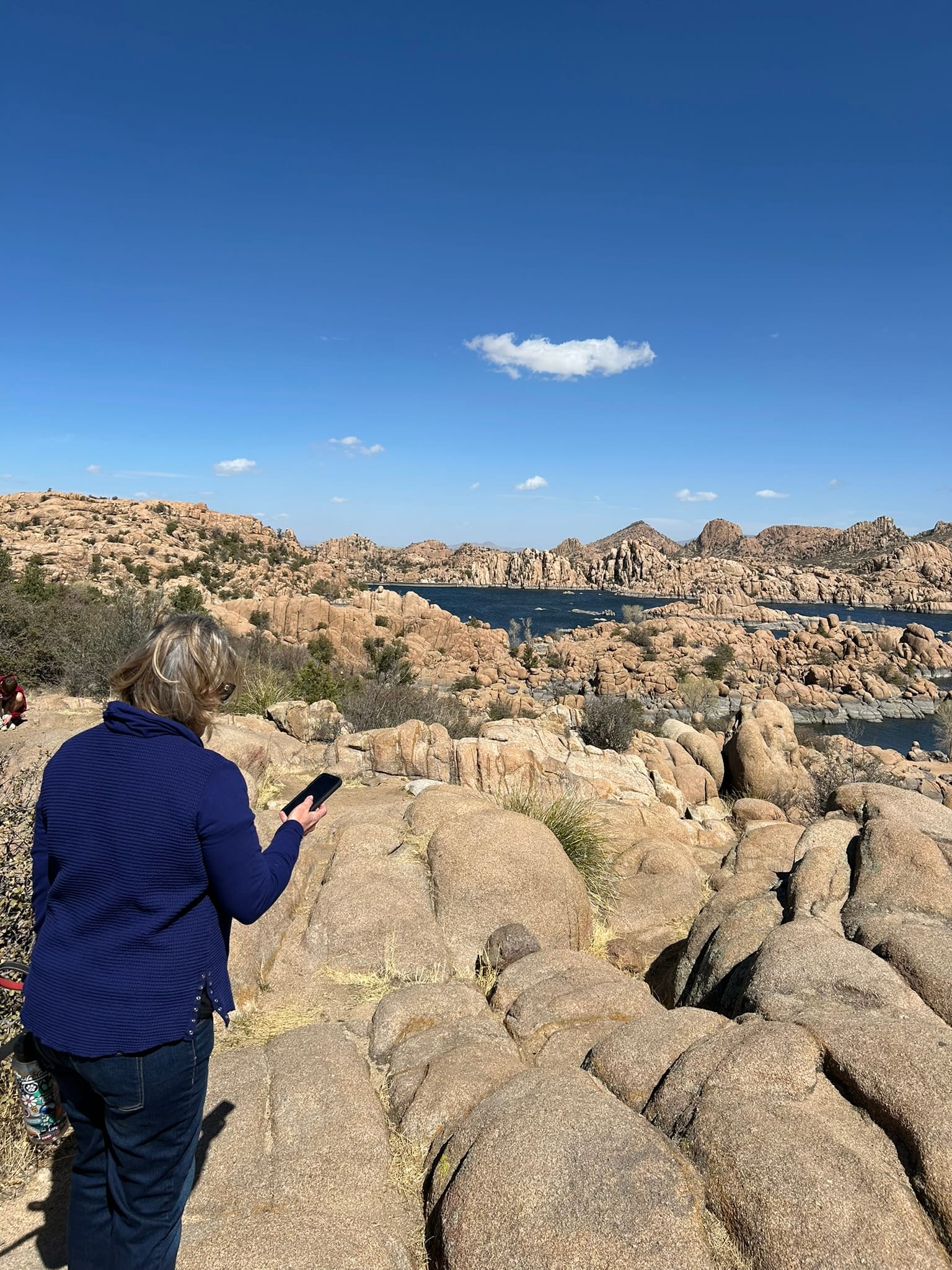
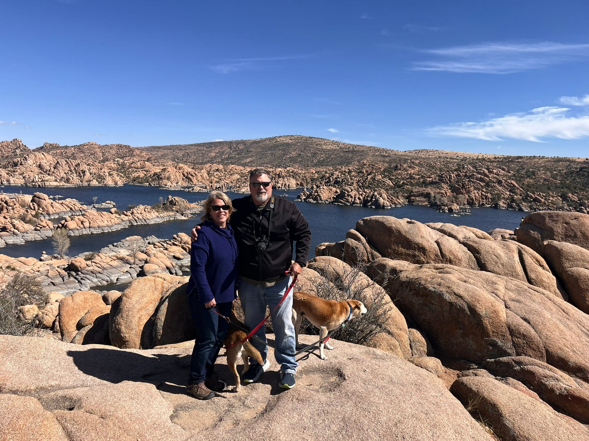
We went into historic downtown Prescott and checked out Whiskey Row which is famous for it’s bars and then found a dog friendly area with some food trucks and got some Hawaiian Teriyaki Chicken for lunch. The entire day’s drive was extremely scenic! The only downside for the day was how windy it had become.
Montezuma Castle and Well National Monuments, Camp Verde, AZ
Today we both felt good enough to head out to some of the local landmarks. We headed over to Montezuma Castle National Monument and then on to Montezuma Well both within 2 exits of our campground. Montezuma Castle was very reminiscent of Mesa Verde but on a much smaller scale and easier to reach. It’s a cliff dwelling up off the valley floor overlooking a river a short hike down a paved path from the visitor’s center. Being up high, it has a very defensive look to it, but the Park Ranger said there wasn’t much evidence of violence in the area. No mass graves etc. but then said “I’m going to contradict myself, but Castle A just down the way shows signs of being burned in a hostile manner." So there was some competition in the area but not particularly a lot. He said they built higher due to flooding of the river that happened a lot more back then and that they took advantage of the natural caves that provided back and side walls as well as a roof. This made construction much easier.
This location also had a southern exposure for warmth in the winter and shade in the summer for natural cooling. There was a second homesite a little further down the walk that was much smaller and built near the base of the cliffs that they called Castle A. It was apparently older and had been attacked at some point.
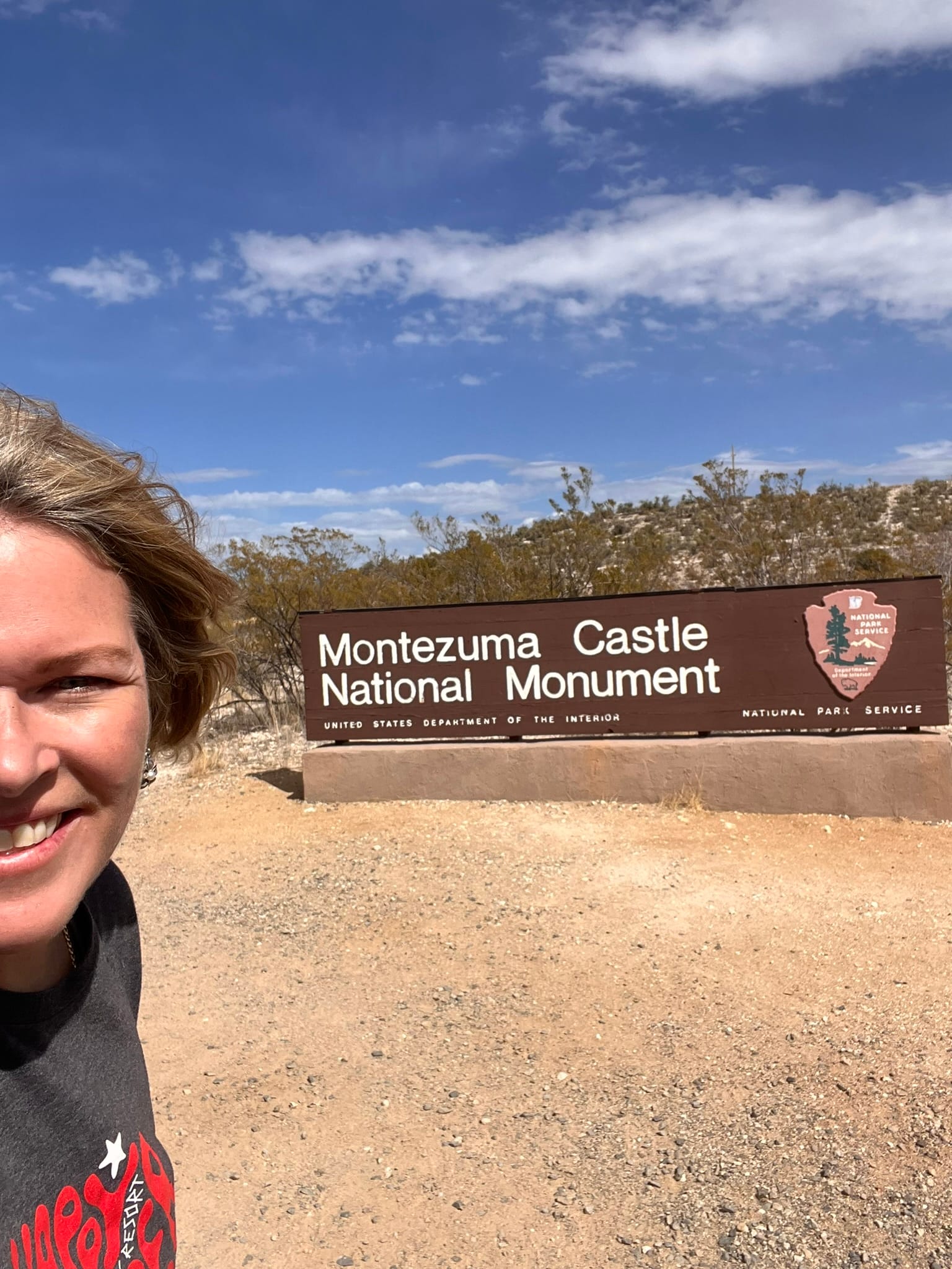
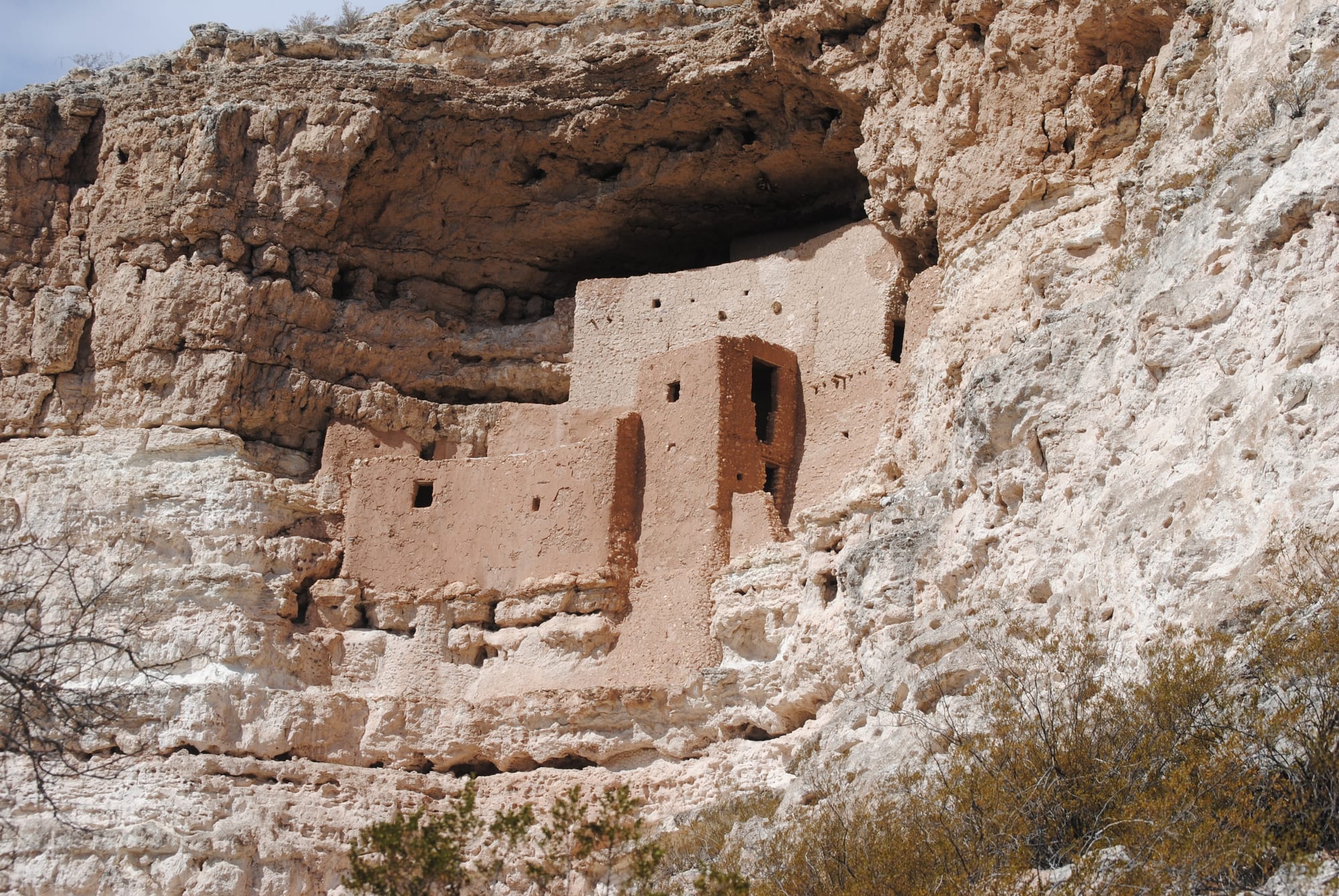
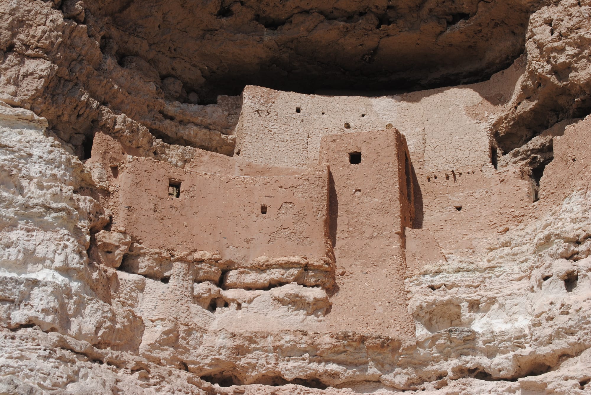
Montezuma's Castle National Monument
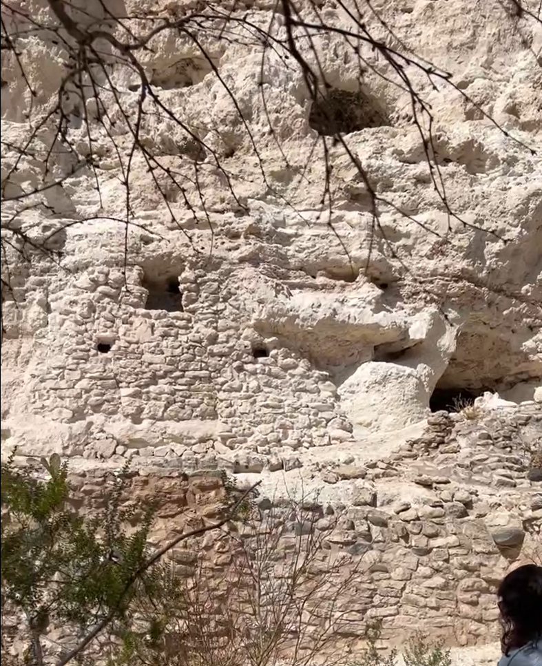
Castle "A" nearby
After that visit we went on to Montezuma Well National Monument which is a natural depression in the rocks from which huge springs feed water. The sign said that about 1.5 million gallons of water flow from the springs daily. The cliffs around the edges also hosted dwellings at one point. The path led on to the river's edge nearby where the water from the springs joins the river. At some point someone built a little aqueduct along the bank to divert at least some of the water to another destination.
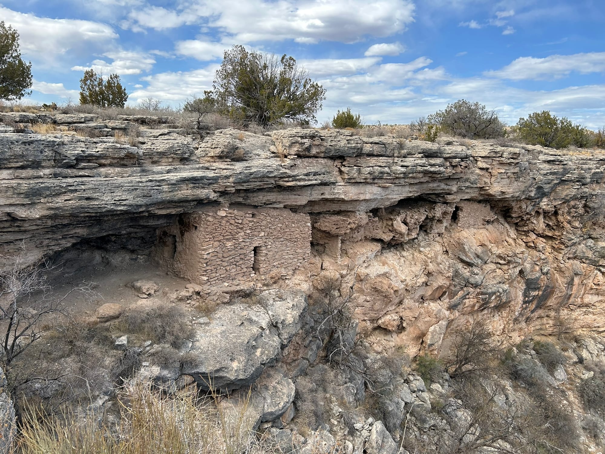
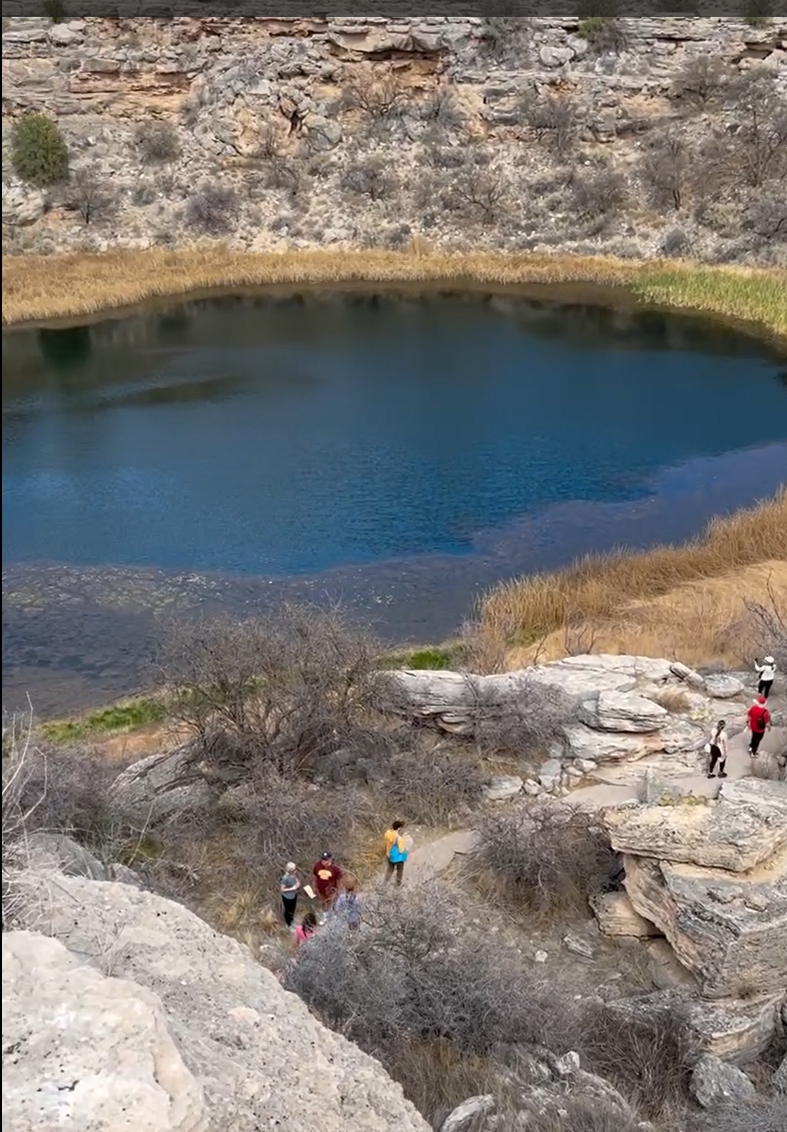
Montezuma Well National Monument
Lost Dutchman State Park, Phoenix, AZ
The Lost Dutchman State Park is located northwest of Phoenix, AZ. Since we are camping on that side of Phoenix, we decided to start there with our explorations. The tale of the Lost Dutchman Mine was of course foremost on our mind. The park is located at the base of the Superstition Mountains which rise precipitously and majestically from the valley floor. The park has a lot of hiking, biking and even horseback riding trails around the base of the mountains. We hiked a mile or so around the base of the mountain taking pictures and worked our way back to the truck. We saw a lot of hikers and someone riding horseback along the trail. It was pretty cool to see!
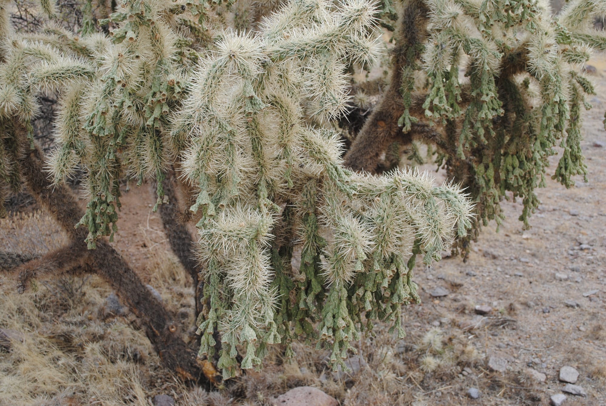
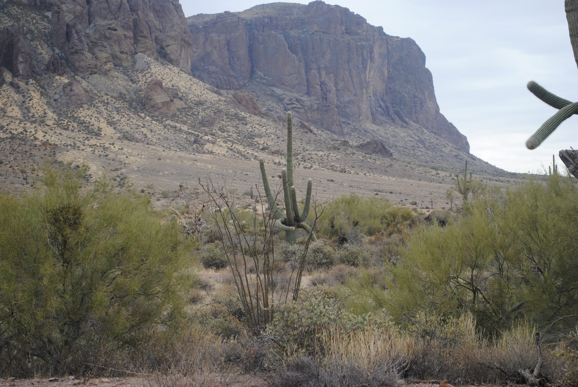
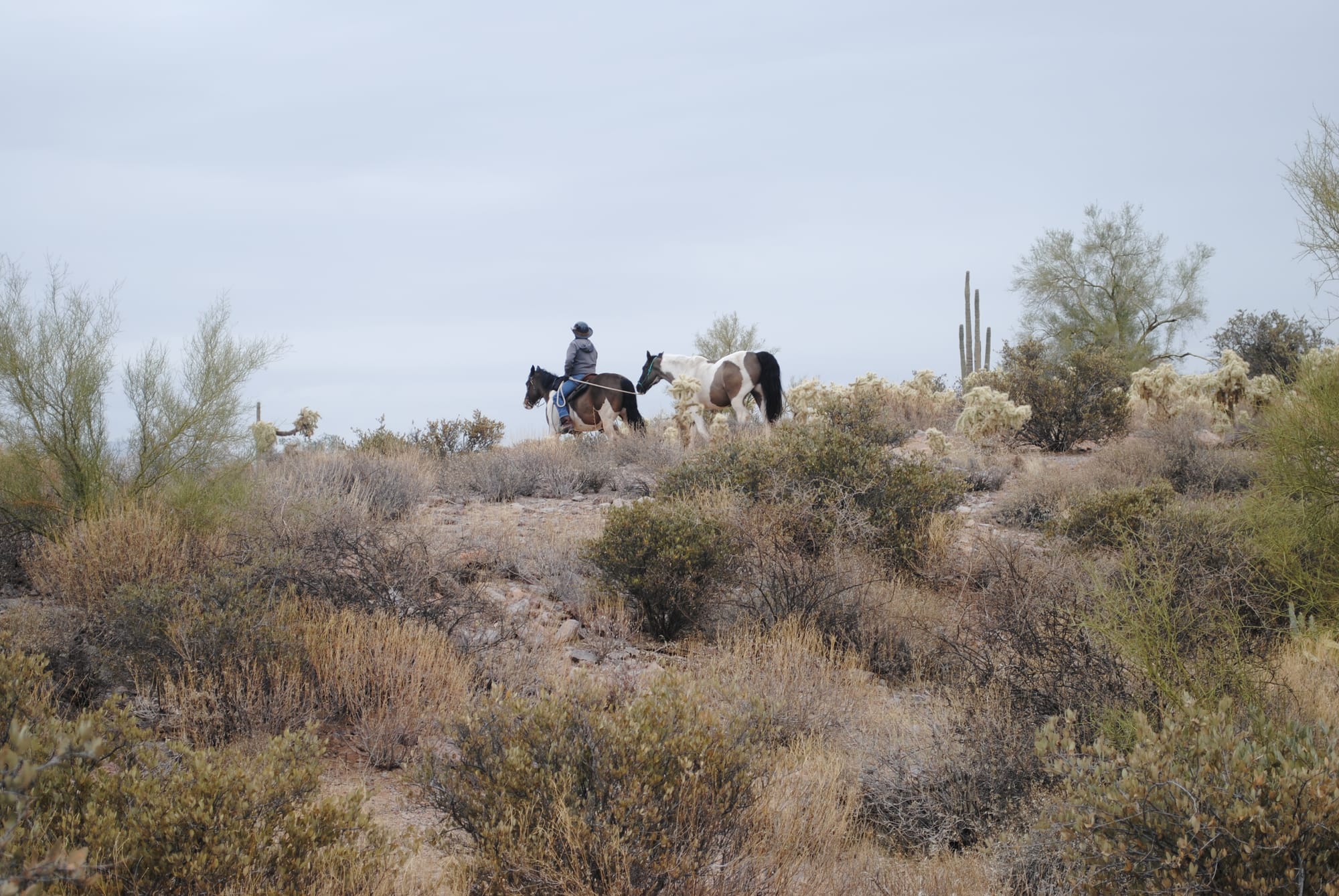
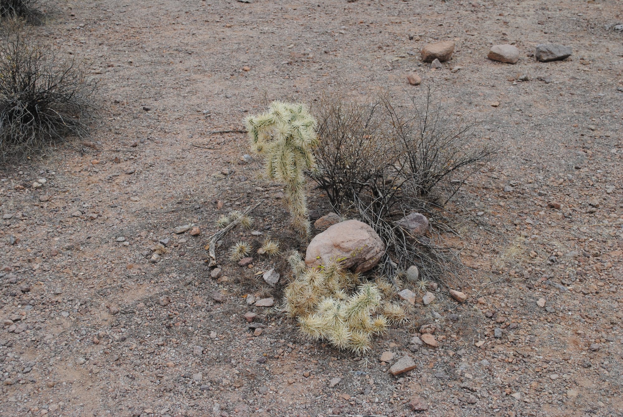
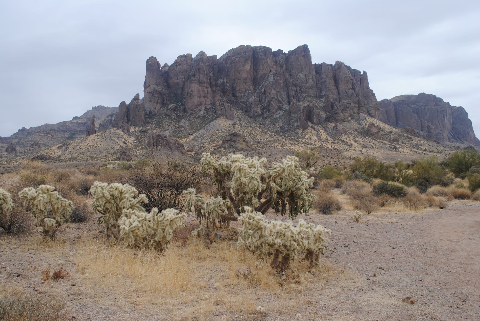
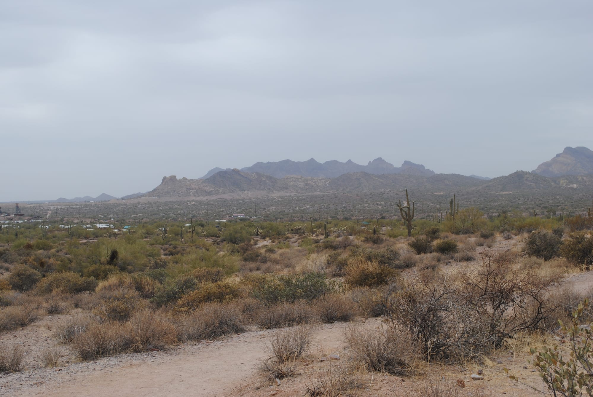
Lost Dutchman State Park Views, Phoenix, AZ
Saguaro National Park, Tucson, AZ
After Tombstone we headed to Saguaro National Park East located near Tucson, AZ. It took a bit to find it because the signs leading to the park are very confusing. We only had about an hour to visit once we arrived because we were meeting an old friend from my flying days for dinner. The main thing to do at Saguaro East is drive the Cactus Forest Loop which was beautiful. The area is teeming with different types of cactus but especially Saguaro. We took our time driving around the loop at least at first, stopping at many of the pull-offs to take photos. I brought our DSLR to practice some photography. There were plenty of subjects to work with! As the 8 mile drive wore on we tended to speed up a bit as the views began feeling repetitive.
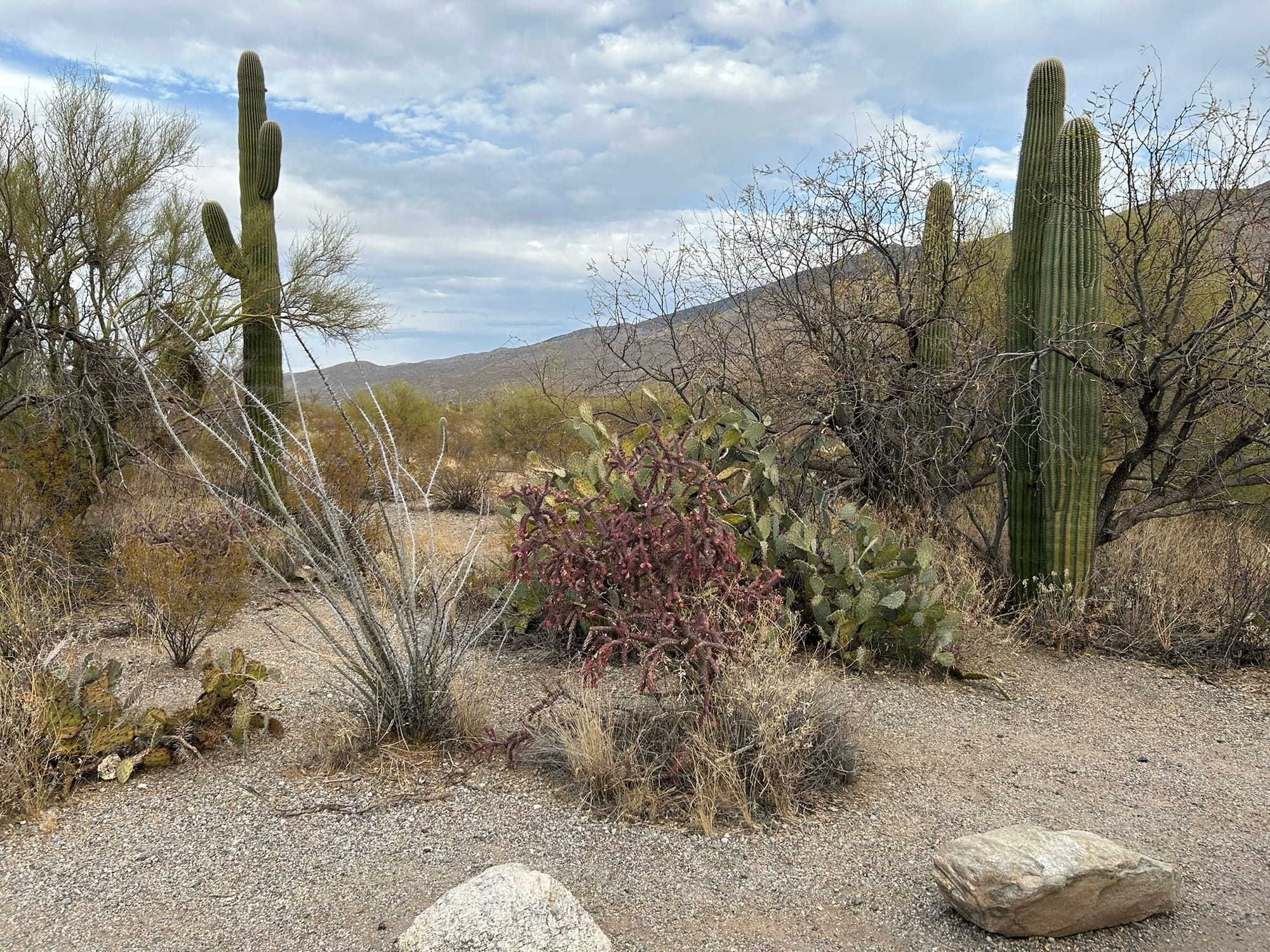
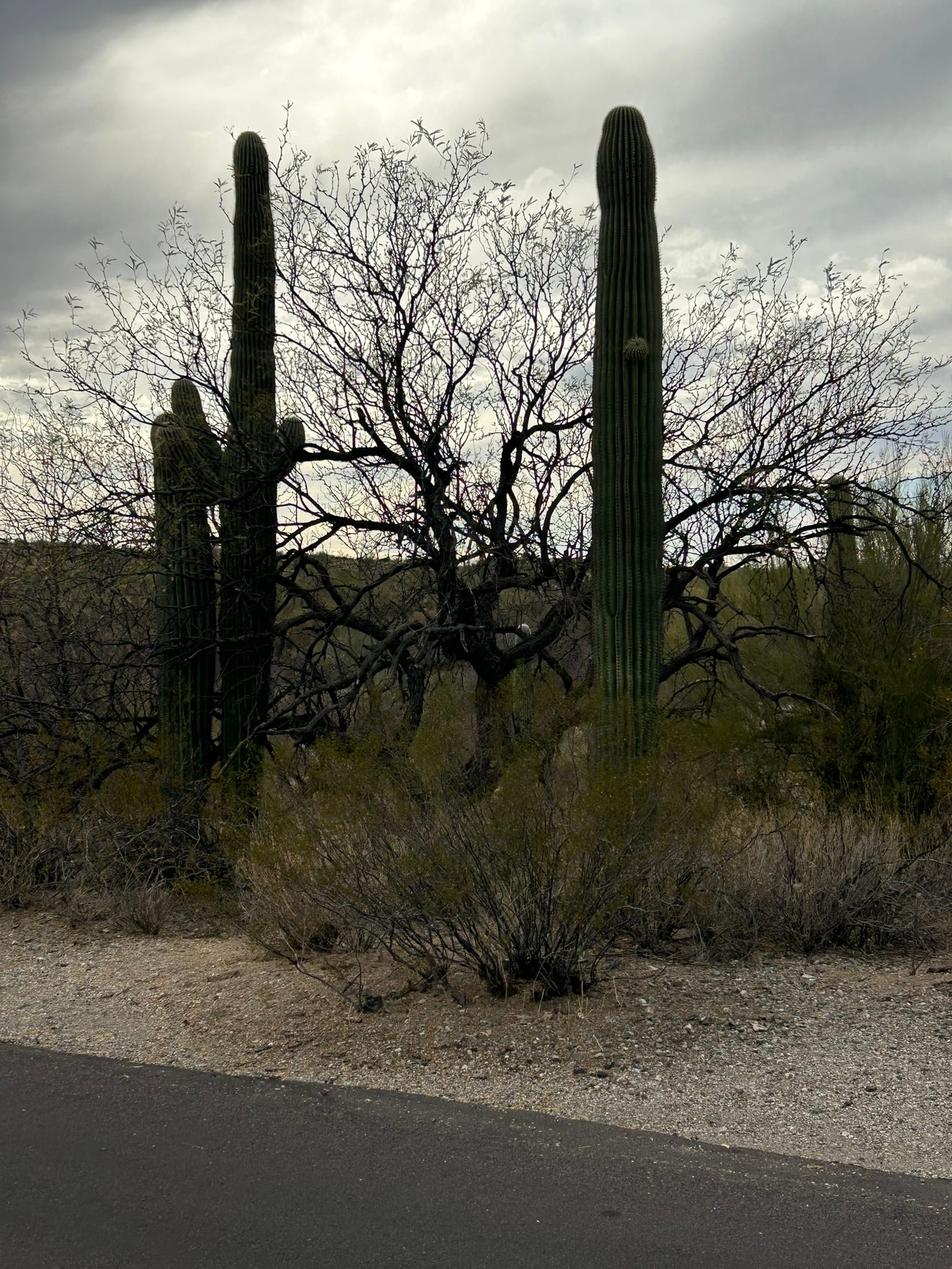
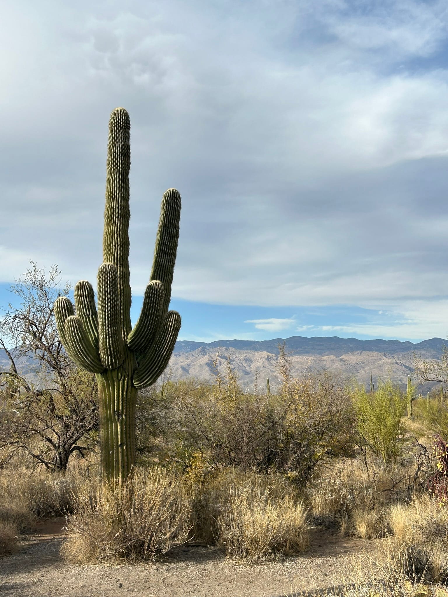
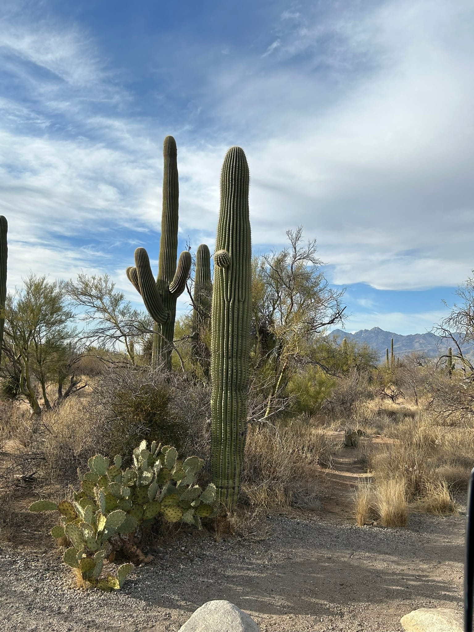
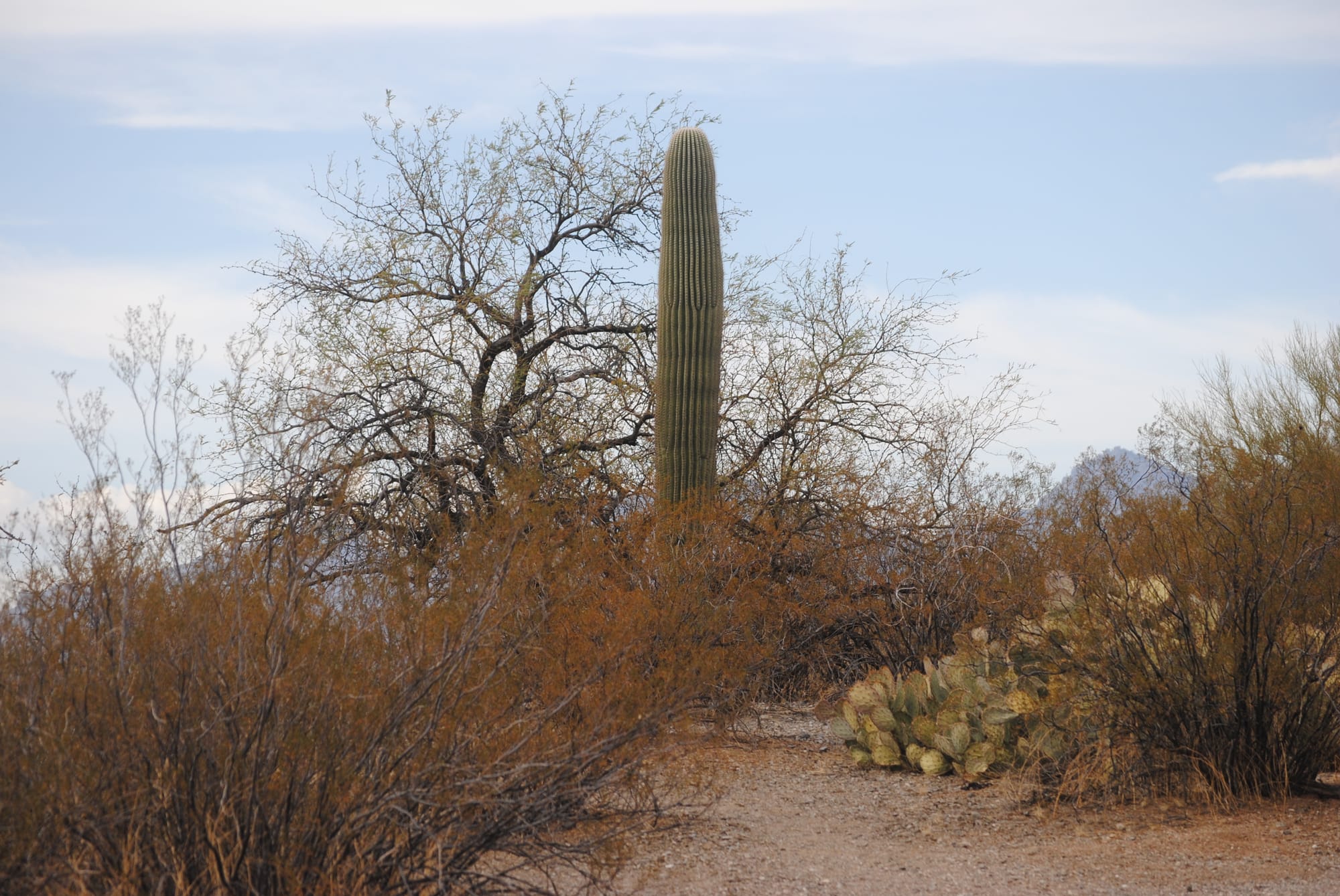
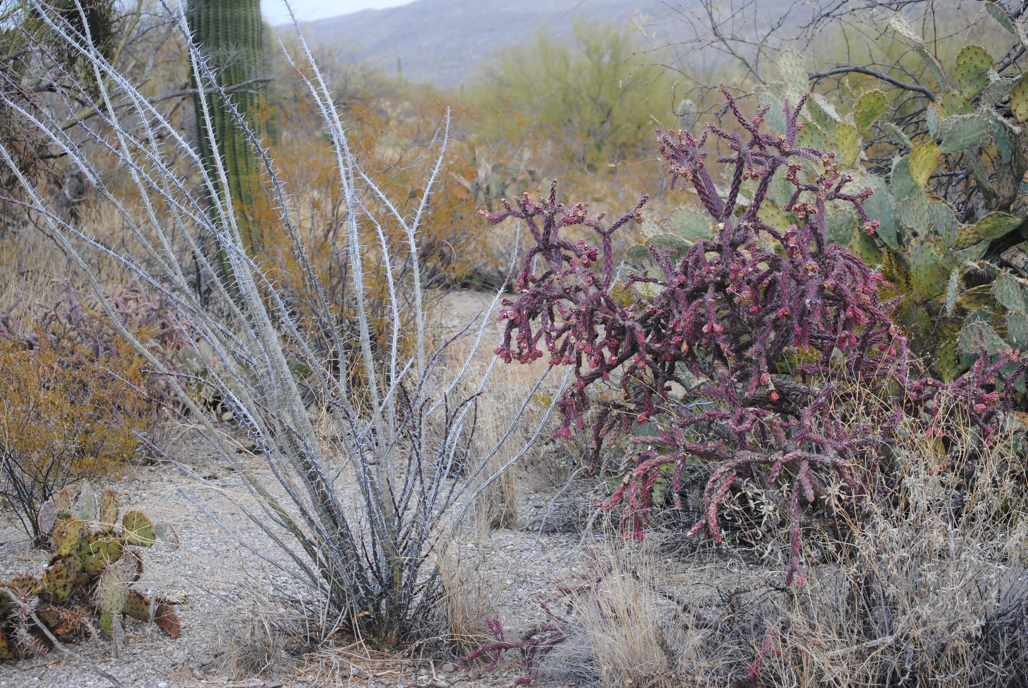
Saguaro National Park East
Tombstone, AZ
We headed out from the state park in the morning to see Tombstone which I had visited many years earlier but Kim had never seen before. It was fun to walk the dirt streets and boardwalk along the shops with actors roaming around in period outfits, a live stage coach giving tours and reenactments of the famous shoot out. We went on a self guided tour of the Birdcage Theater which is supposed to be haunted. I didn’t see or hear anything unfortunately. The woman working there gave about a 10 minute history lesson of the history of the theater which was very interesting and a bit risque!
We also bought tickets to a Vincent Price narrated history of Tombstone that included a detailed discussion of the famous shootout. The shops around the old town section had lots of clothing, jewelry, artwork and just about anything else you could want for sale. The prices were steep so we didn't spend a lot but did take a lot of photos where we could. It was lunchtime as we finished up our walk about the town so we dropped into Mom and Pops Sandwich shop for an Italian sub. I have to admit they give you your money's worth - that sub was loaded!
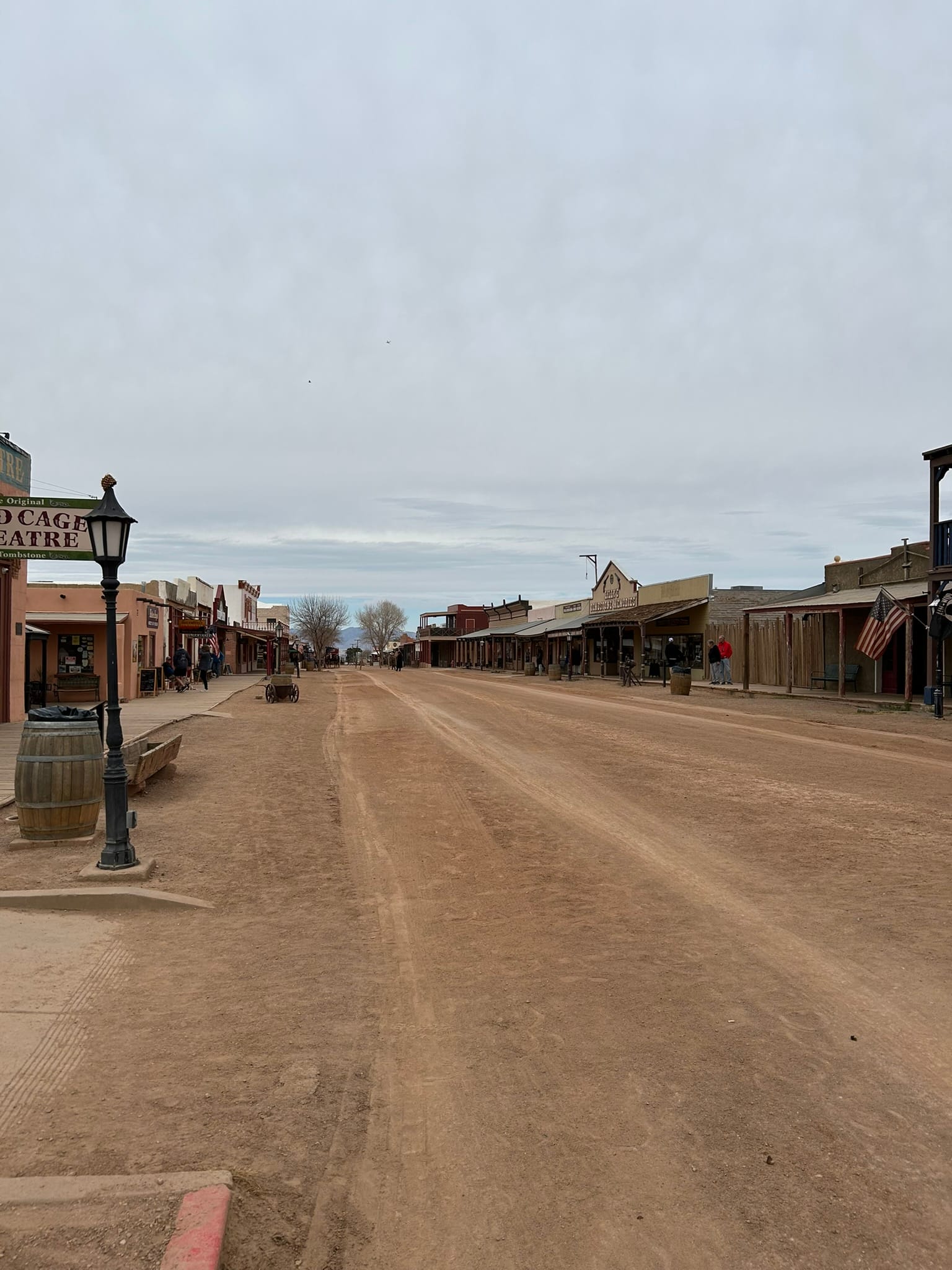
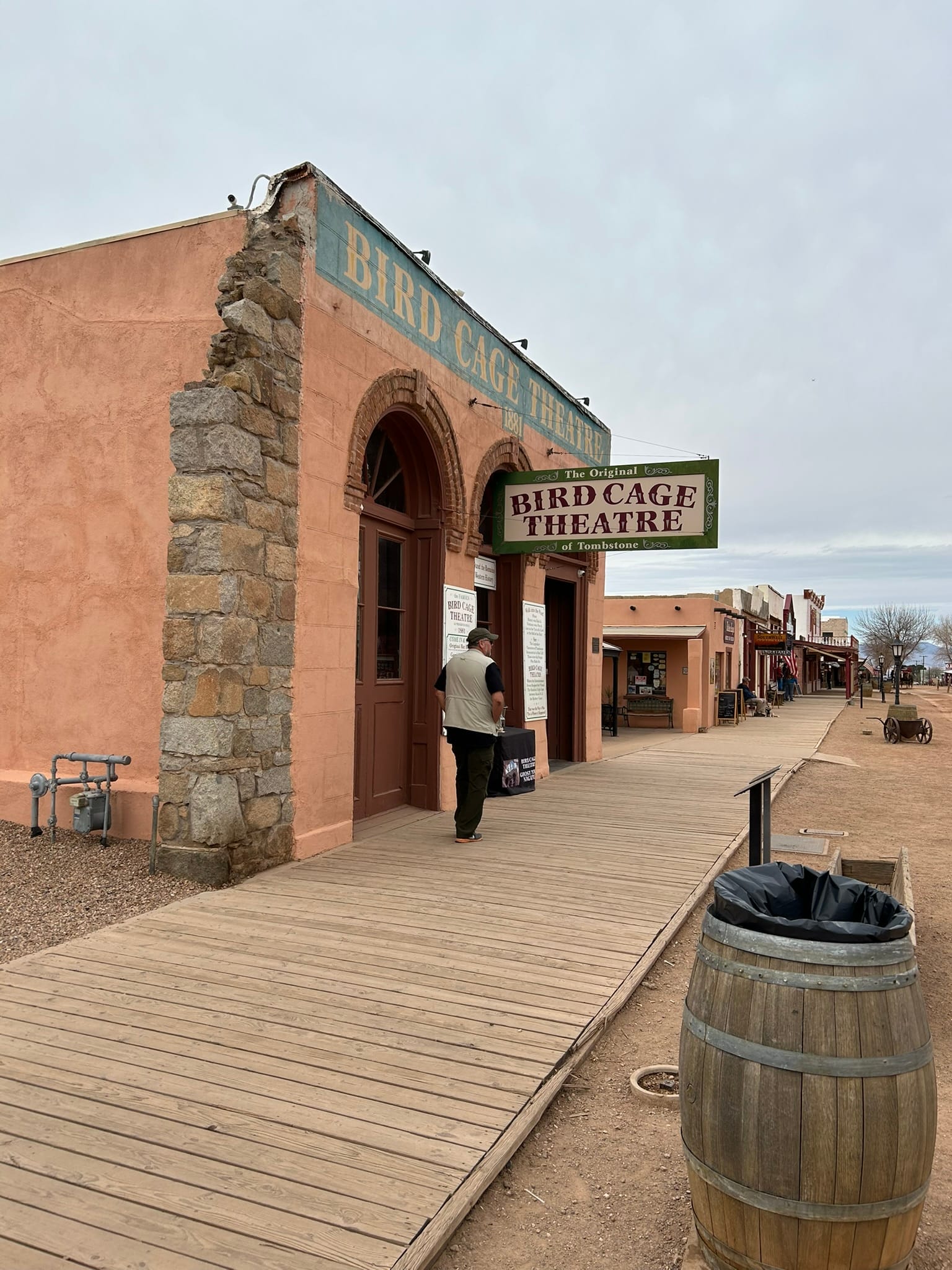
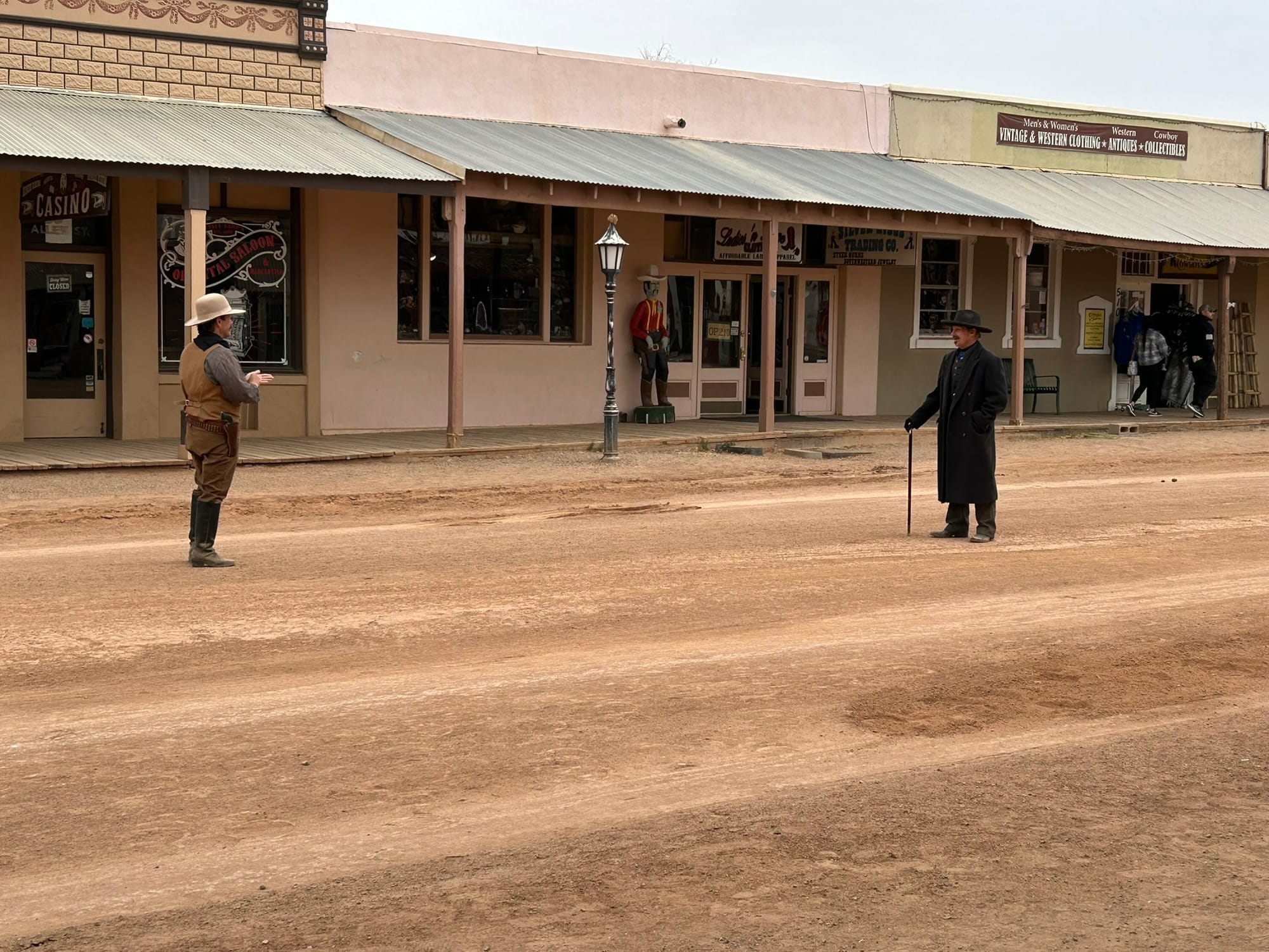
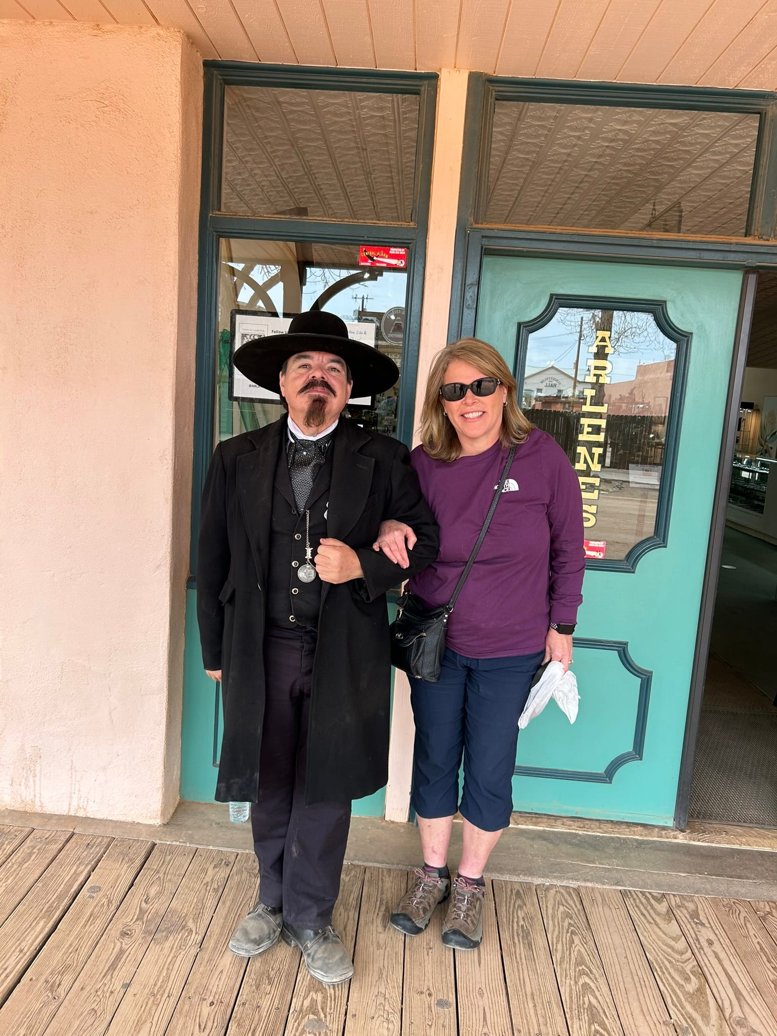
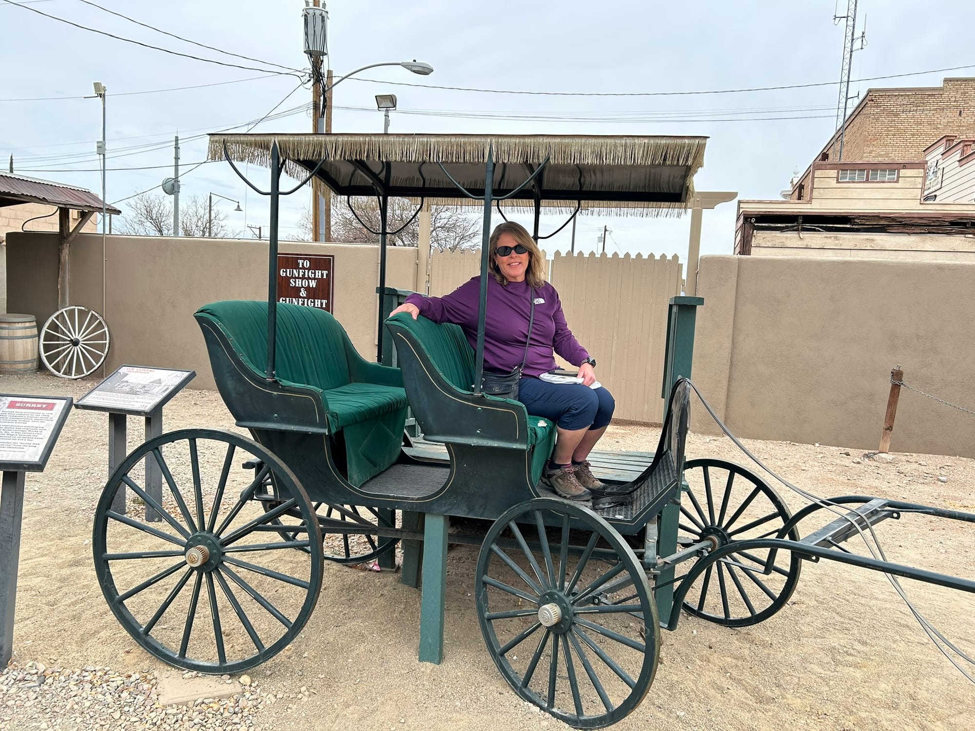
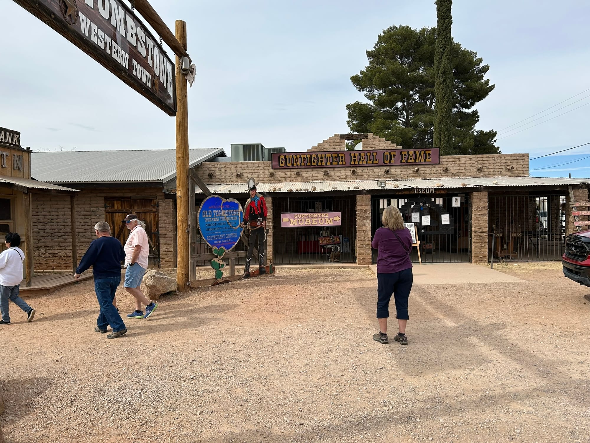
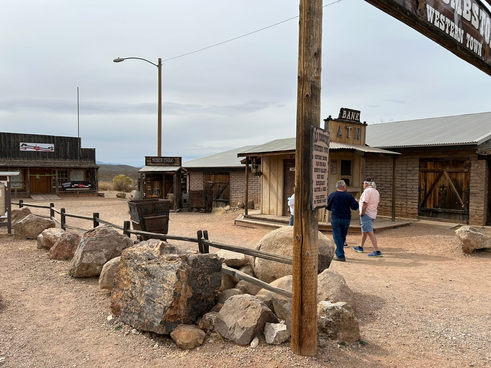
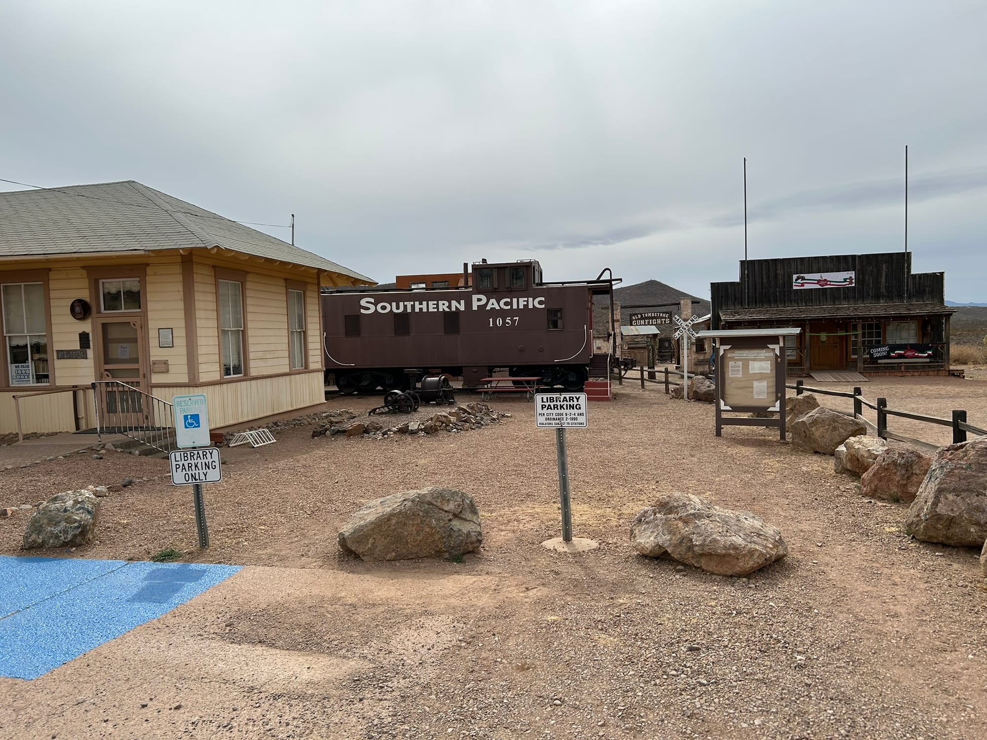
Tombstone, AZ
Kartchner Caverns State Park, AZ
We headed out from the winery and proceeded along I-10 to our next destination at Kartchner Caverns State Park south of Tucson in Arizona. The desert southwest drive was mostly the same as previous days but we did cross what looked like 10 miles of salt flats with all sorts of warnings about sand storms and what to do in one. We also passed by a section of mountains that were completely different from the others we had seen so far. Most of the mountains were fairly smooth in shape but this section was all stacks of giant boulders! It was so different and cool that I hated to leave that section of road.
We got to our turn off and headed south to Kartchner to check in. Kartchner is a nice little park mostly famous for it’s cave that sits along a slope up the mountains. We didn’t get tickets to the cave since we had a bunch of other things planned. They have two loops of RV / Camping spots along the slope and ours was a back-in up the hill so our rig is very nose high just to be level. They have several buildings with toilets but the park seems to have very low water pressure around 19 psi. That's enough to shower but not by much! Each site was rather spacious particularly those on the outside of the curved roads as ours was. They also have a visitor's center with trinkets for sale though they were completely out of shot glasses and trails up around the mountains. During the night you can hear the coyotes howling. It's supposed to be dark sky country but we were getting close to a full moon so no amazing sky for us. For the price, it was a very nice place to stay especially if they push up the water pressure.
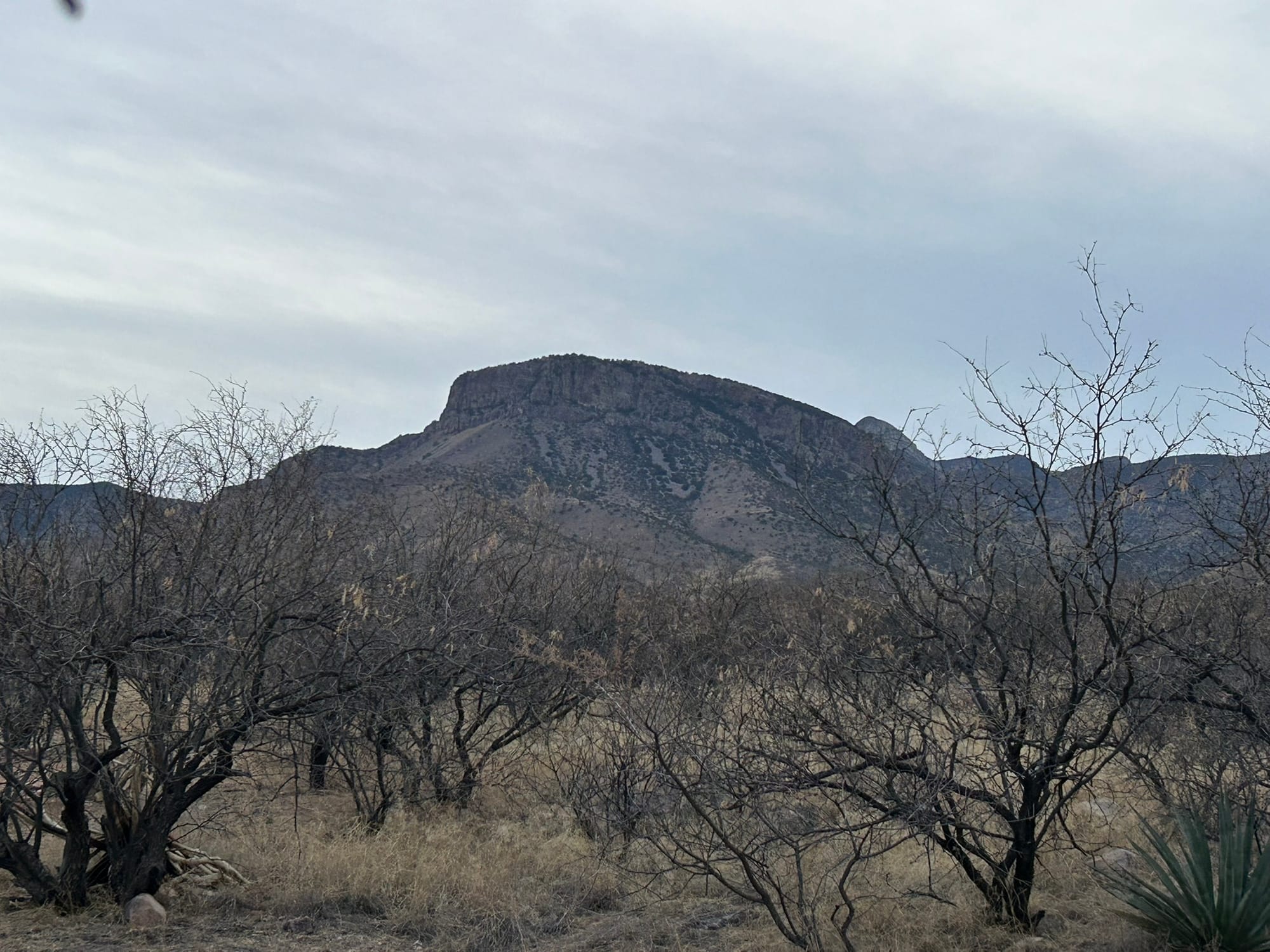
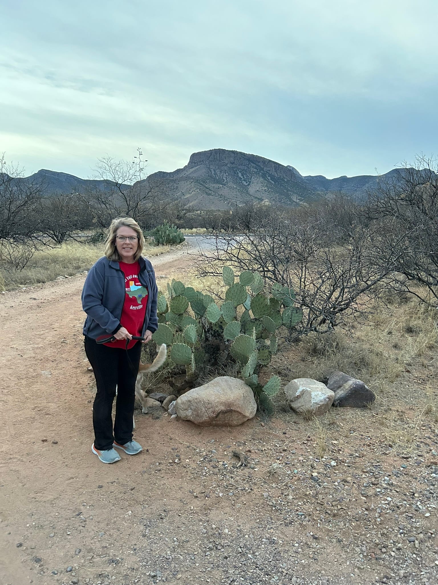
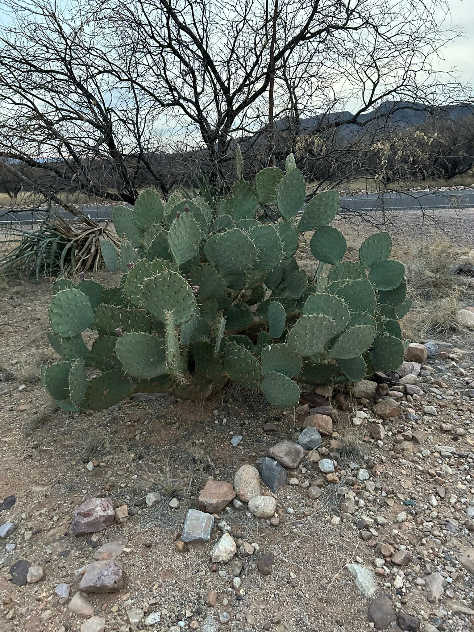
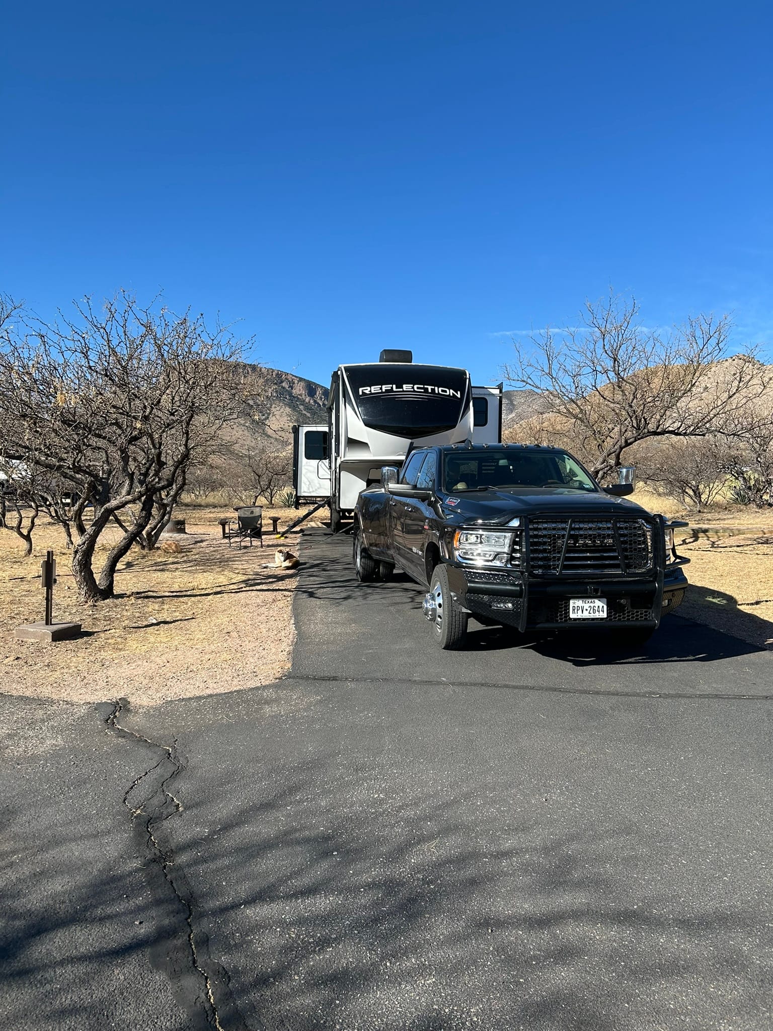
Kartchner Caverns State Park, AZ
Rio Grande Winery, Harvest Host, NM
We headed out along I-10 again on a beautiful cloudless day for our next destination near Las Cruces where we would be camping at the Rio Grand Winery (RGW). The drive was very pleasant through the various mountains of west Texas. The scenery had that brown, rocky desert southwest look but the craggy beautiful mountains made up for the lack of other scenery. Even so, the drive dragged on a bit. As any map will show you, as we approached and passed through El Paso I-10 passes close to the border with Mexico. It was surreal to look across the desert mile after mile and see the Rio Grande valley and occasionally get a glimpse of the Rio Grande itself. All the while we were admiring the beautiful mountains that were across the river in Mexico.
I-10 through El Paso was completely closed and we were directed around north loop 375 which took us well out of town to the north up through the Franklin Mountains State Park and then back down the mountains on the other side and back into El Paso. It was 27 miles of mostly beautiful mountain drive. When we got back down and managed to get onto I-10 west again, the highway was completely torn up and under construction just about into New Mexico.
We continued the next 20 minutes or so to our exit and proceeded back off the main drag south of Las Cruces to the winery. When we pulled in we found a spot along the back row with other campers. As the evening wore on 2 more campers came in and parked in another side of the parking lot. The winery is a popular destination for users of Harvest Host in this area! The view from the winery is spectacular. They are circled by farmland there are amazing views of mountains backstopping the ambiance of the place. We highly recommend coming to this remarkable facility if you get the chance.
Since we were staying at a Harvest Host they request we support the host with our patronage. They had a nice selection of wines and Kim and I tried a bottle of sweet white. It was a Saturday night and the winery had live music and a food truck that we enjoyed with our fellow campers!
We are totally boondocking this trip and I was concerned because the battery hadn't been recharging well since the last power issue. It did finally reach 100% but only a day before we left LMRV. By the time we came inside the RV at midnight with only the refrigerator pulling current for the last several hours, the battery was down to 54% which I think indicates the battery is damaged. We didn’t think it would last all night just powering the fridge so we didn’t want to turn on the heat. The outside temp dropped to 41 overnight and we huddled under the covers like puppies to keep warm! I kicked on the heater in the morning with the battery down to 34% and in less than 10 minutes it was down to 31 and was dropping fast.
We definitely need to make the jump to Lithium technology for the battery and may need to look at adding some more solar panels to extend our stay. We don’t really need 120V overnight as I can run a generator when we decide we need it for A/C, charging, or microwave and we have a Jackery for portable A/C.
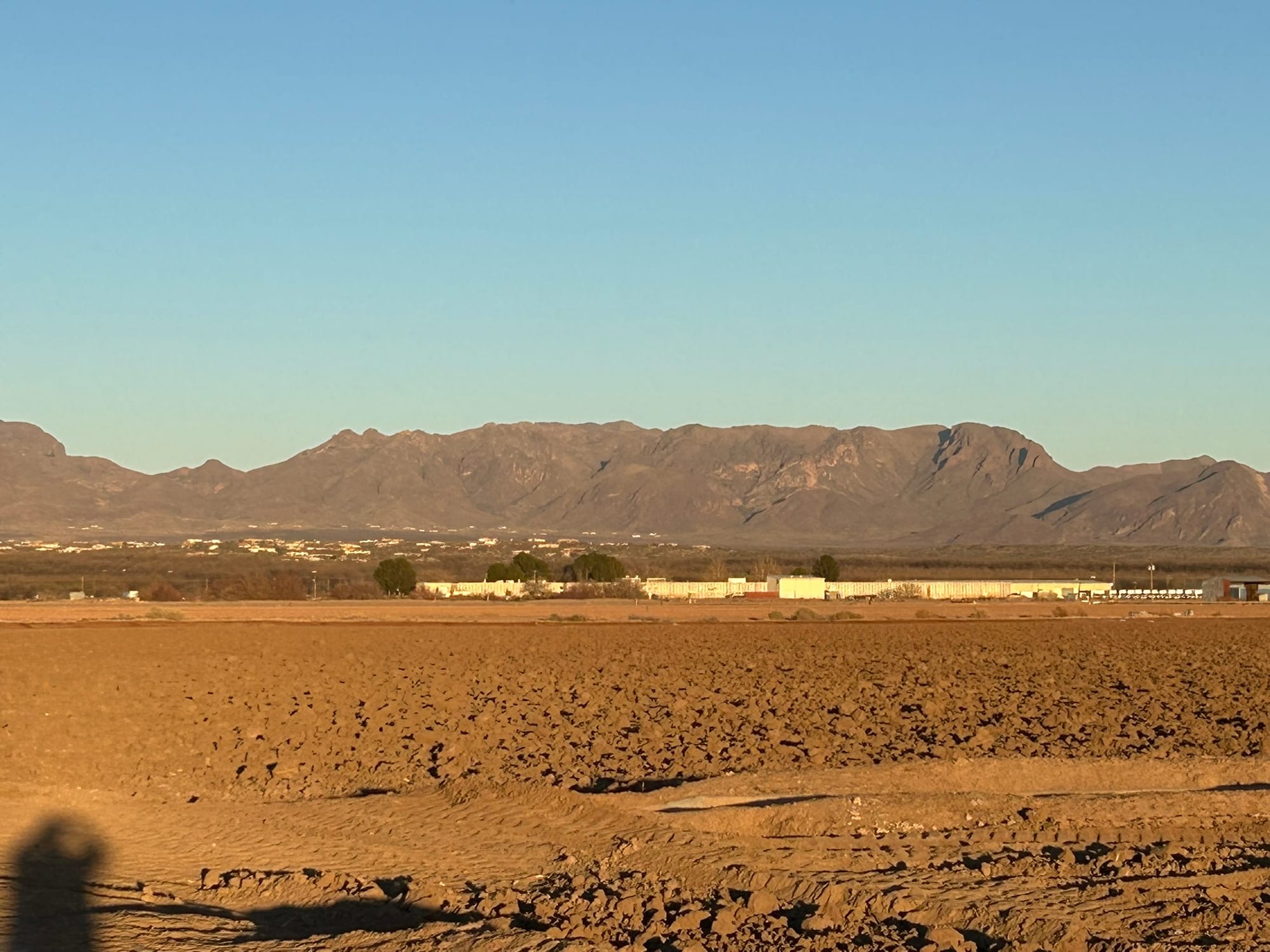

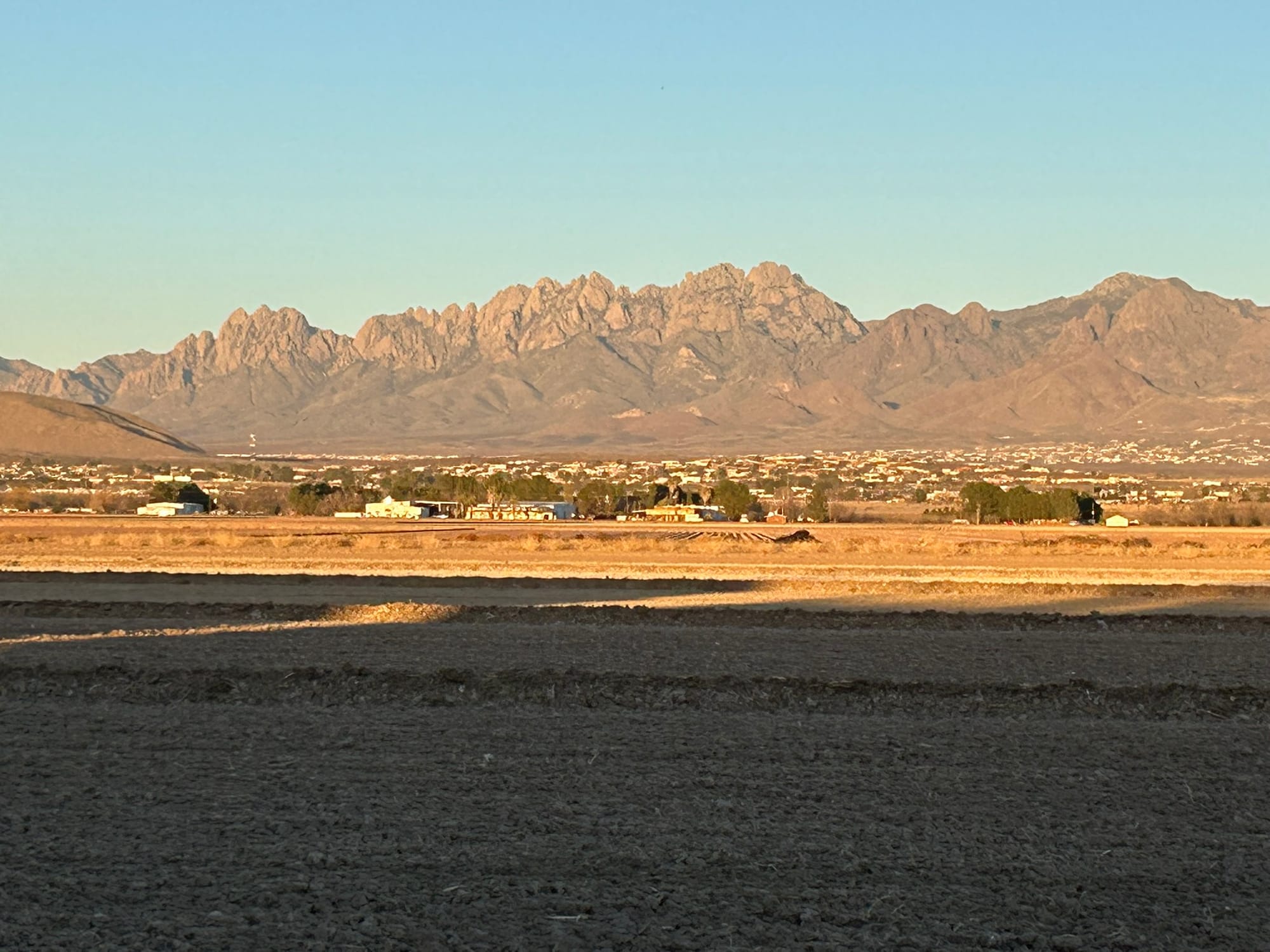
Rio Grande Winery, Los Cruces, NM
Balmorhea State Park, TX
We went out west from Medina Lake through the Hill Country over the not-quite-mountainous terrain and passed down into the valley where Junction is. After that the geology changed into huge wide valleys with mesas at the edges. The Mesa's rocky base falling away gradually to the floor in sweeping arcs that left me wondering where the rest of the rock and dirt had gone over the millennia. There didn’t seem to be a river or anything else to erode and carry it away but clearly these valleys were carved by some force of nature. The trees fell away and scrubby brush took over and the Davis Mountains hove into view as we approached our turn off I-10.
We turned off the highway and headed southwest towards Balmorhea State Park through a couple of small towns and turned left into the park. It’s a very small park known for the CCC created, spring-fed pool, that also has cabins and a relatively small campground. They have two loops for RV camping and as we came into our spot we saw a young family tent camping in front of us with two young kids that reminded us of ourselves nearly 30 years ago!
This is dark sky country but the moon is out at this time of the month. We are planning to come back this way at the end of March to enjoy the New Moon and amazing skies. Even though it was 94 degrees when we arrived, the heat wasn’t really oppressive like it is at LMRV because there is so little humidity. There really is a “dry heat” effect. I never felt sweaty or miserable like I usually do at that temperature and above. As the sun set, the temperature dropped precipitously and a cool breeze popped up that was quite chilling. The dry cool air felt almost magical after the warmth of the day and the long drive. For the first time since buying our RV 3 years ago, we slept with the windows open to enjoy the desert cool air!
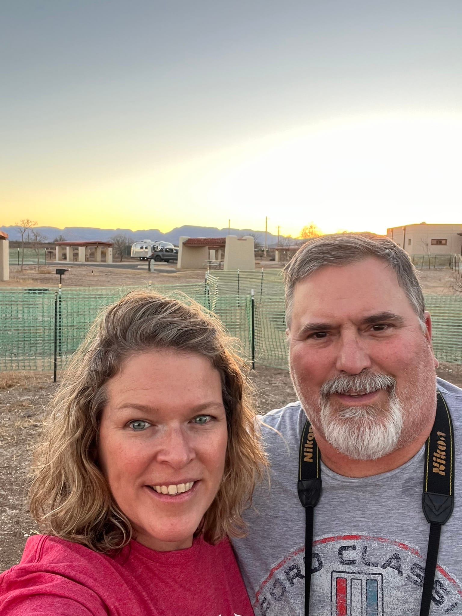
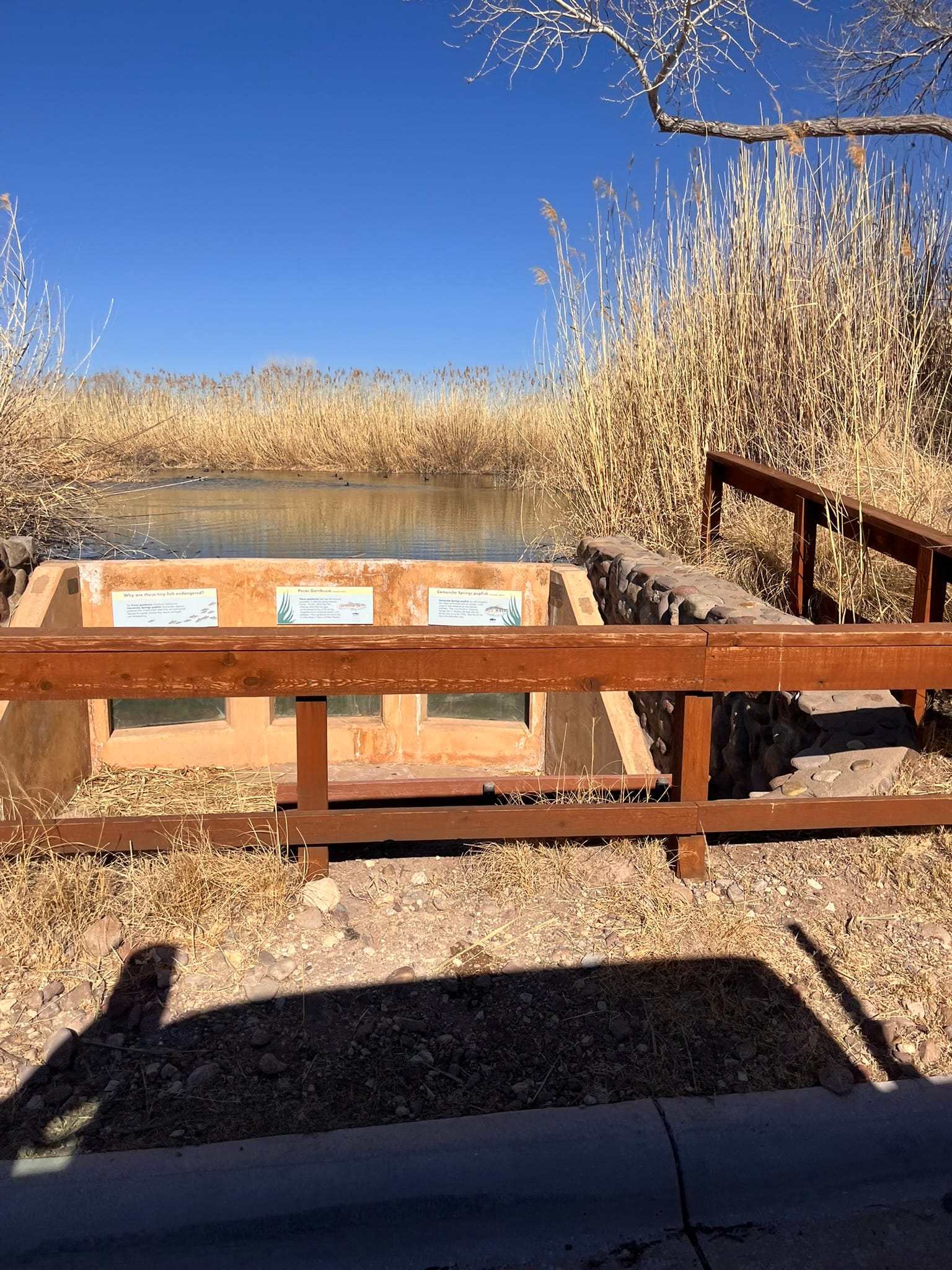
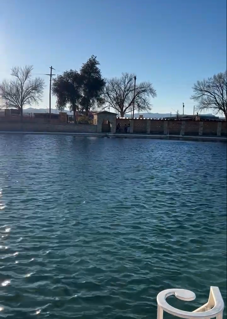
Balmorhea State Park, TX
The Stockyards, Fort Worth, Tx
We went to the Stockyards in Fort Worth in time to see the cattle drive. It was interesting to see though a bit underwhelming really. Just a few longhorns and 6-8 cowboys riding through the street. The area itself was very crowded. Kim's cousin and our guide for the night, said he had never seen it so crowded and we learned later that there had been a bowl game at TCU’s stadium and these were likely the attendees rolling into that area after the game. The place was mobbed!
The Stockyards area was all decked out for Christmas and was really beautiful to see. There’s a ton of bars, restaurants and shopping and you could walk around with open containers of alcohol in the streets. We walked around the area and went over to the Hotel Drover that has a very nice patio area and hung out along the river catching up and then went to find some dinner. It was still crowded in that area so we went “up the hill” a block or two and found a cool little burger joint.
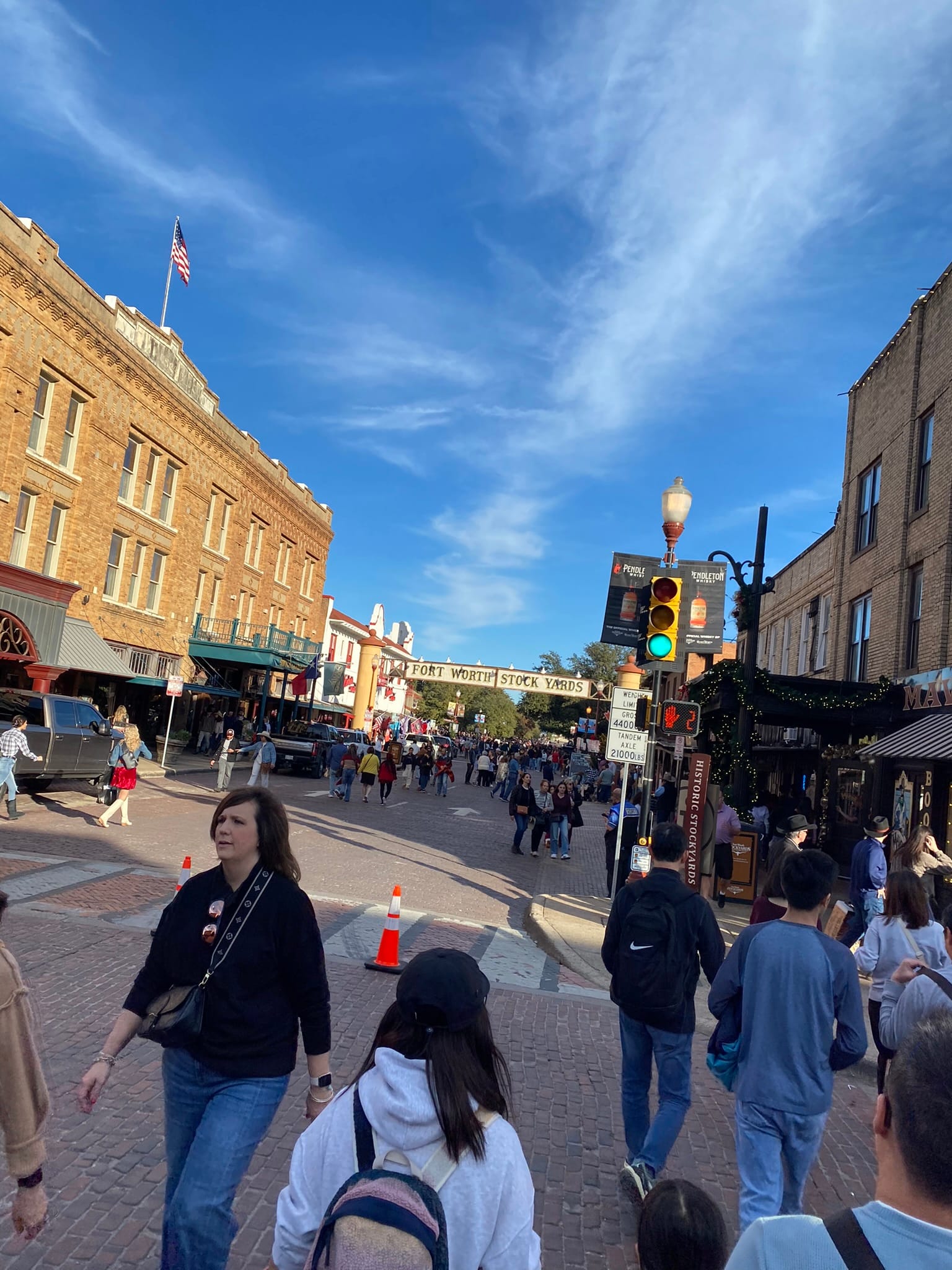
RV Hall of Fame and Museum, Elkhart, Ind
We arose to a windy, very cool day in Elkhart where we had boondocked at the RV Hall of Fame and Museum. One half of the museum houses a huge array of historical RVs from the very early days to modern times. It was really interesting to walk through the museum and poke our heads into the RVs, especially the really early ones to see how far technology has come. Some of the really early ones would barely hold a person.
The other side has example Manufactured Homes which were pretty nice inside! It also hosted a library and Hall of Fame featuring some of the major players in RV manufacturing and design.
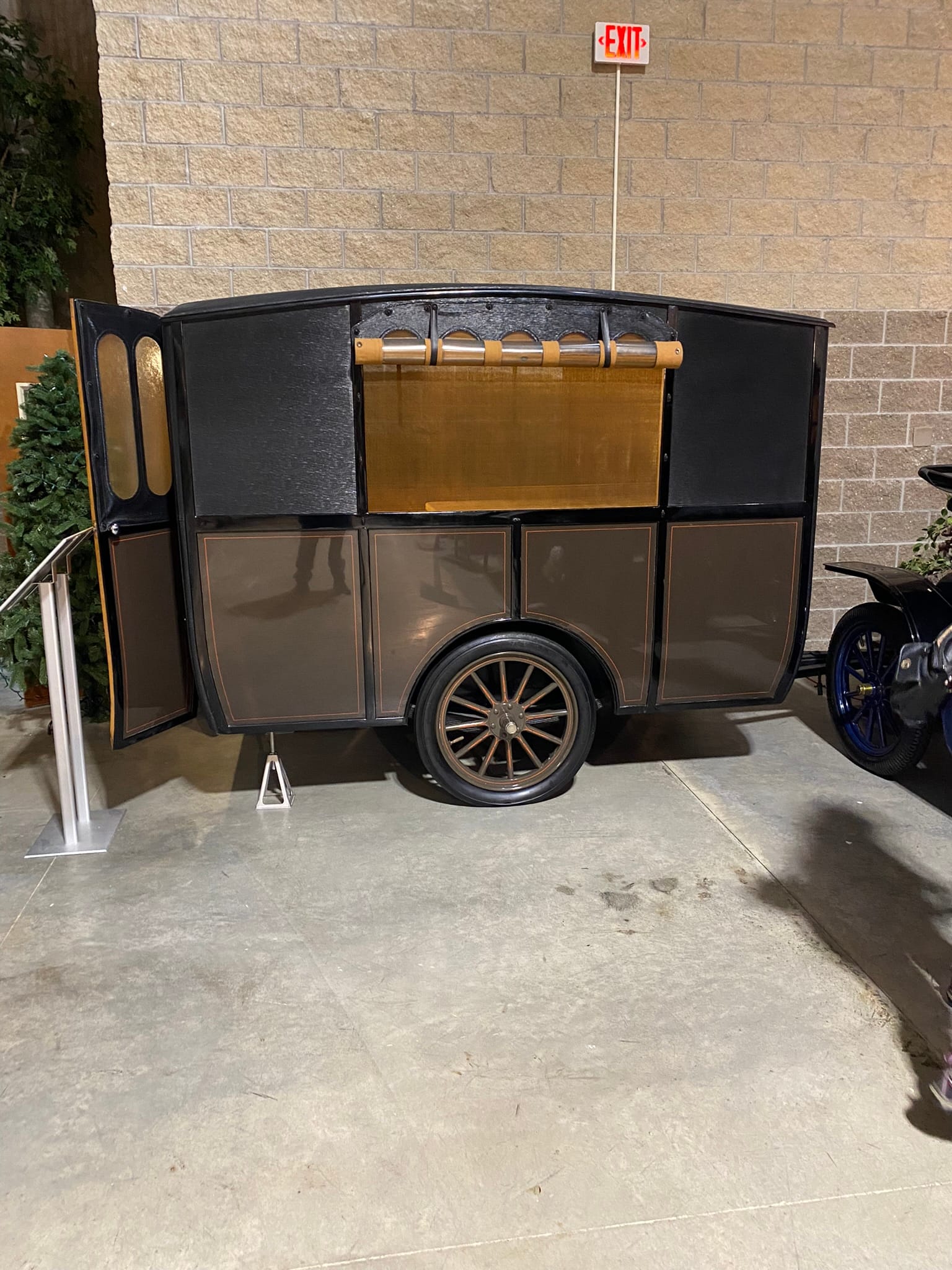
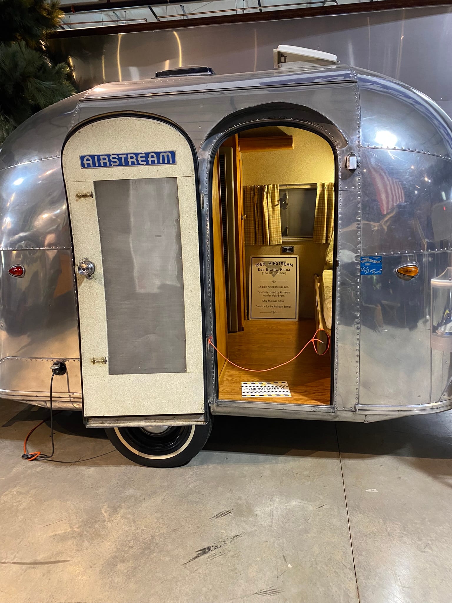
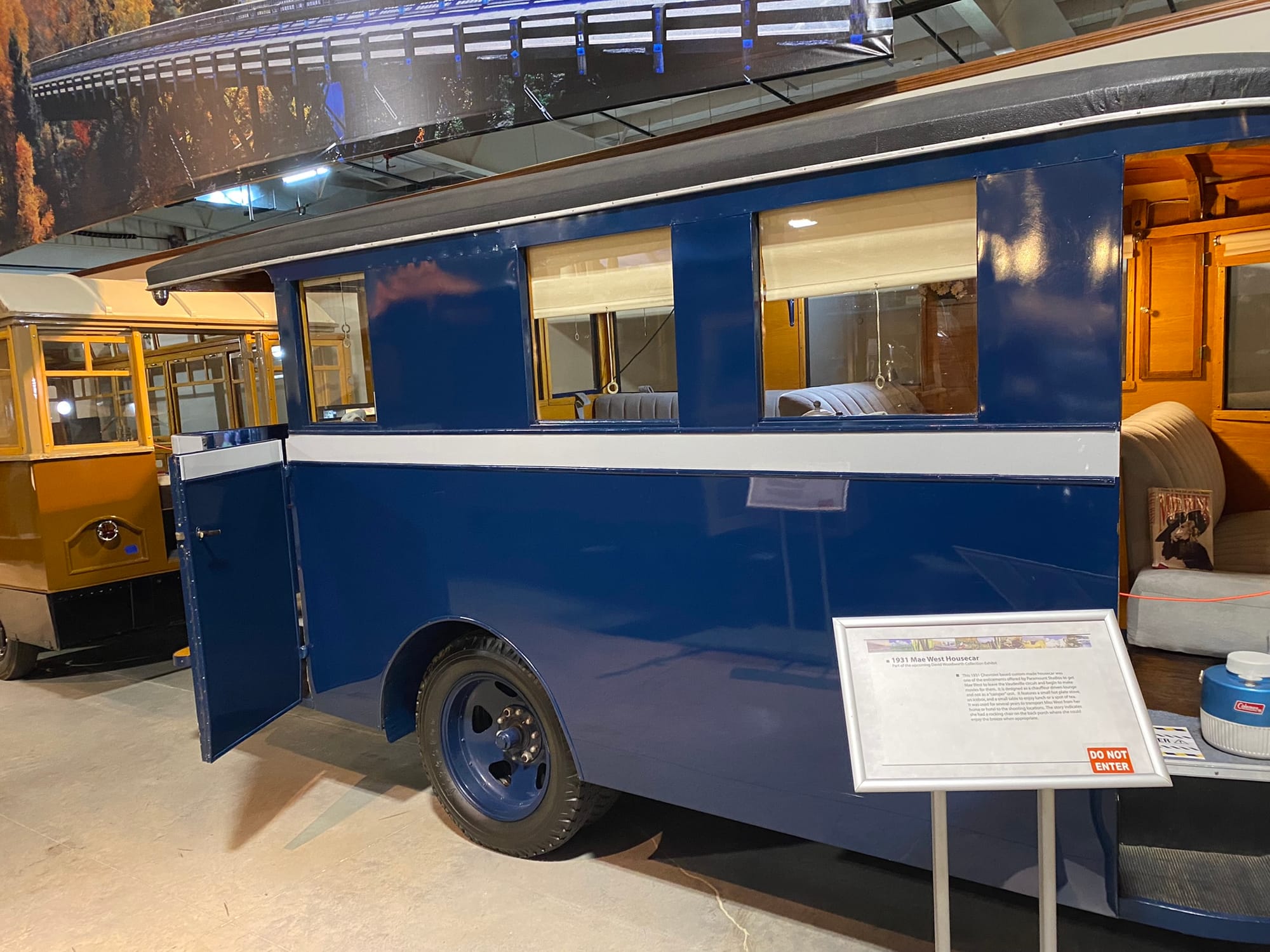
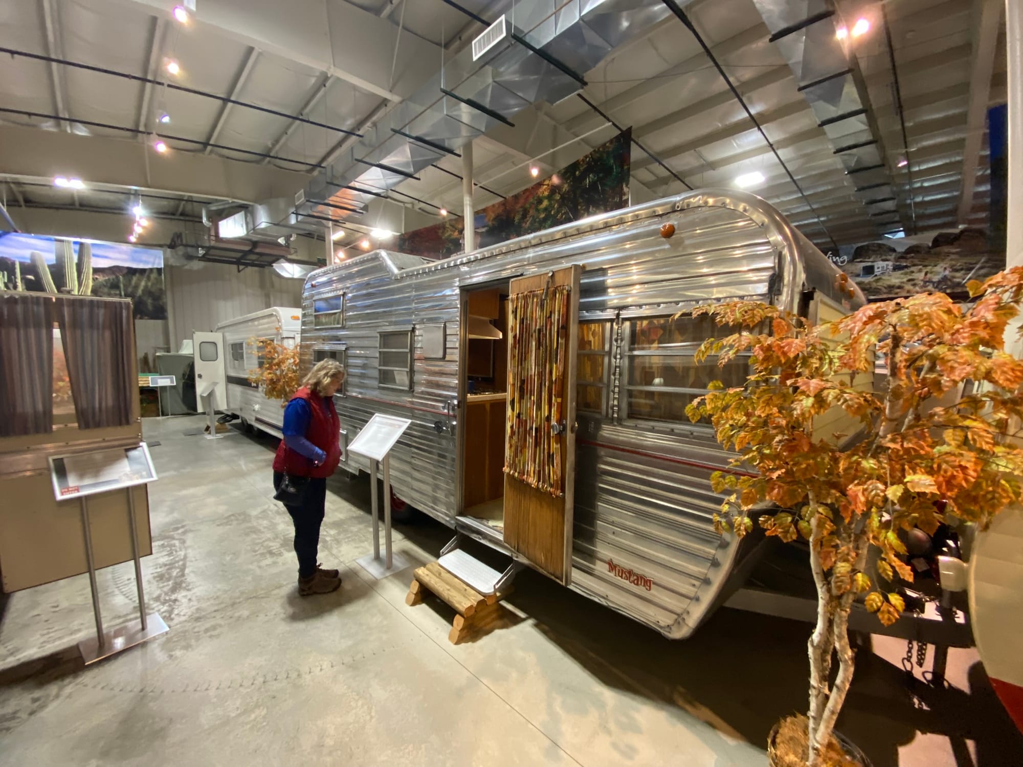
RV Hall of Fame and Museum, Elkhart, Ind
Casey, Illinois
During a trip to Pennsylvania to spend Thanksgiving with family, we stopped in the little town of Casey, Illinois, not long after we got on interstate 70. That town is known as the home of several “worlds largest“ including a huge rocking chair, windchimes, teeter totter, wooden pitchfork, wooden coin, golf tee, and antlers just to name the ones we saw. It was a cool little town! If you are passing by it’s worth the stop!
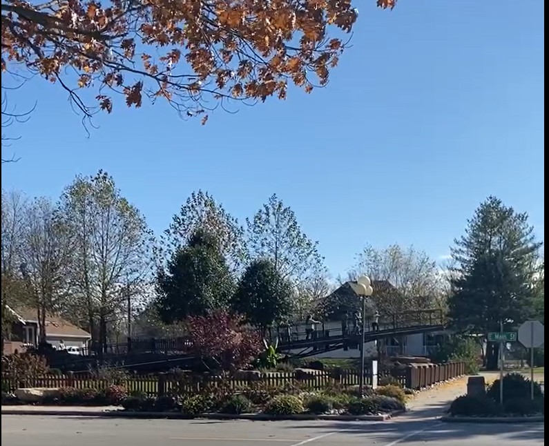
"World's Largest" Examples in Casey, Ill
Riverside, Iowa and The Voyage Home Museum
We were on our third travel day in a row and these turn and burn one nighters are hard on us. We were heading back from Minnesota and Wisconsin and were traveling through eastern Iowa which was actually rather hilly and as you’d guess mostly farms all the way. We like to take the back roads and see some sights along the way as you've probably surmised. On this day, we had one “fun” stop and it was a surprise to Kim, not FOR Kim. It was for me! I had noticed that we were passing close by The Voyage Home Star Trek Museum in Riverside, Iowa. Riverside claims to be “the future birthplace of Captain James T. Kirk”. I guess if you claim it, it can become lore!
Driving into town, you first notice that all the power poles have photos of Star Trek characters especially from the original series. The park across from the museum has a Kirk statue and the local post office has murals of the Star Trek stamps. I wish they had been open that day so I could have bought some!
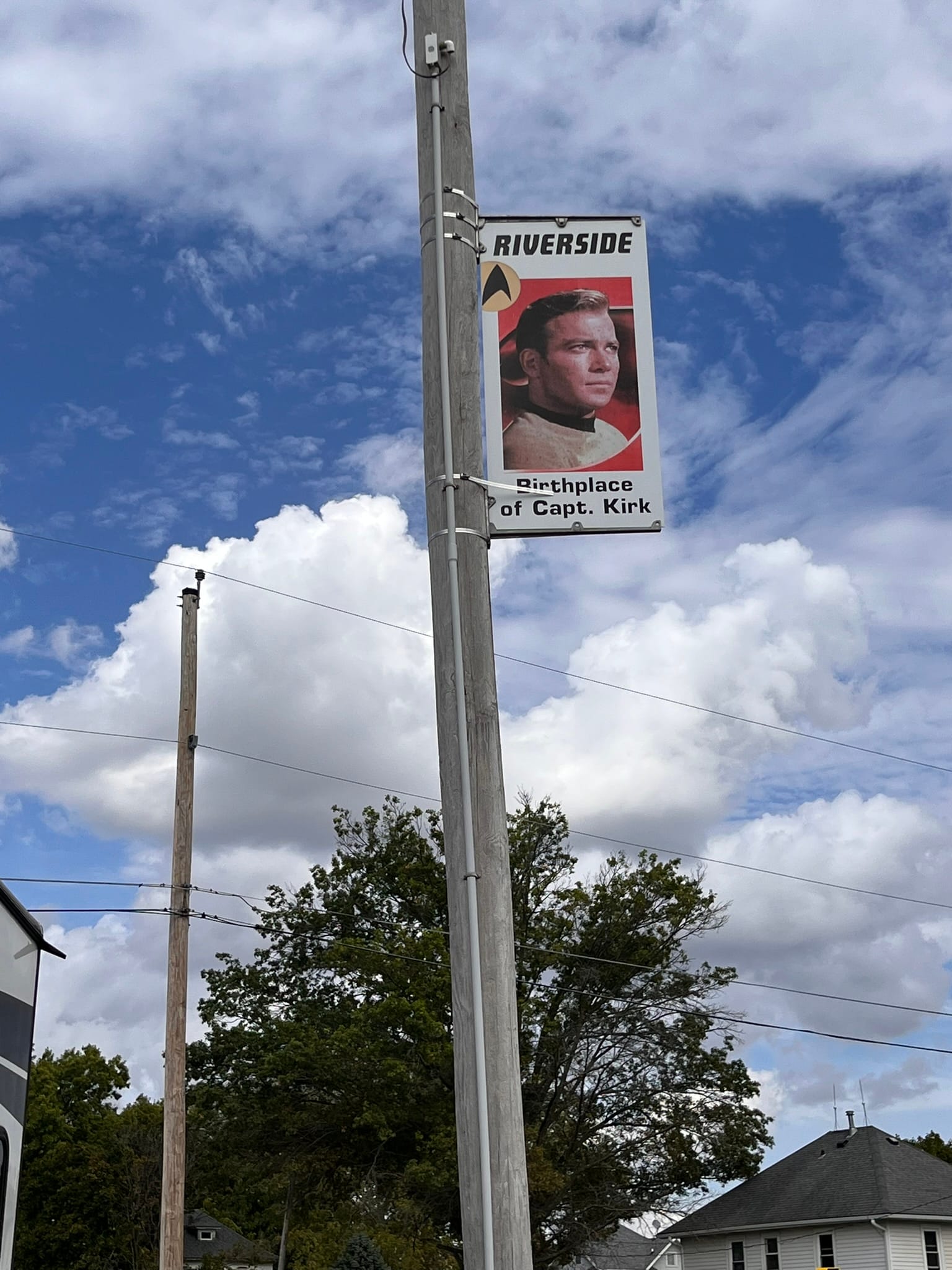
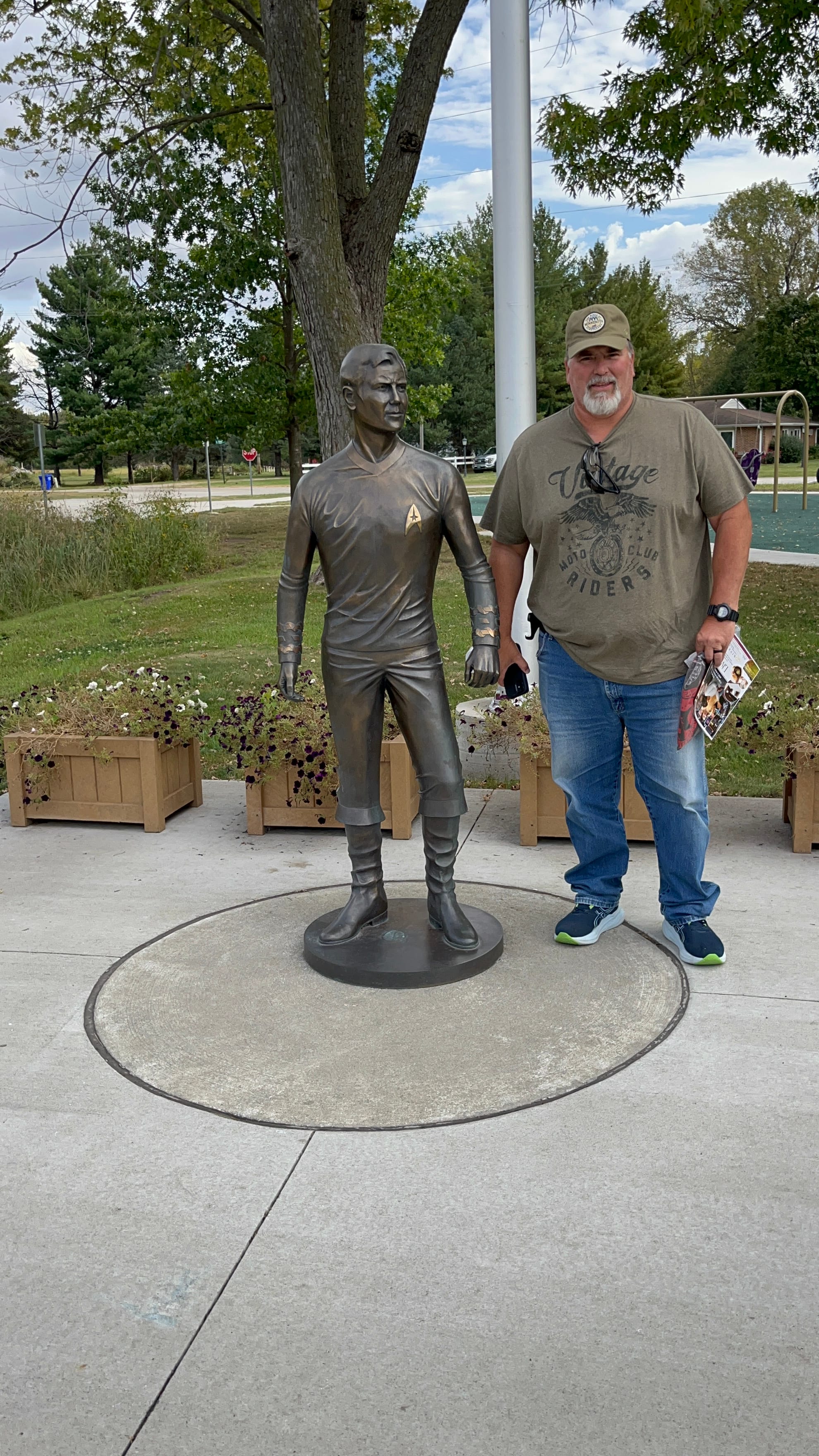
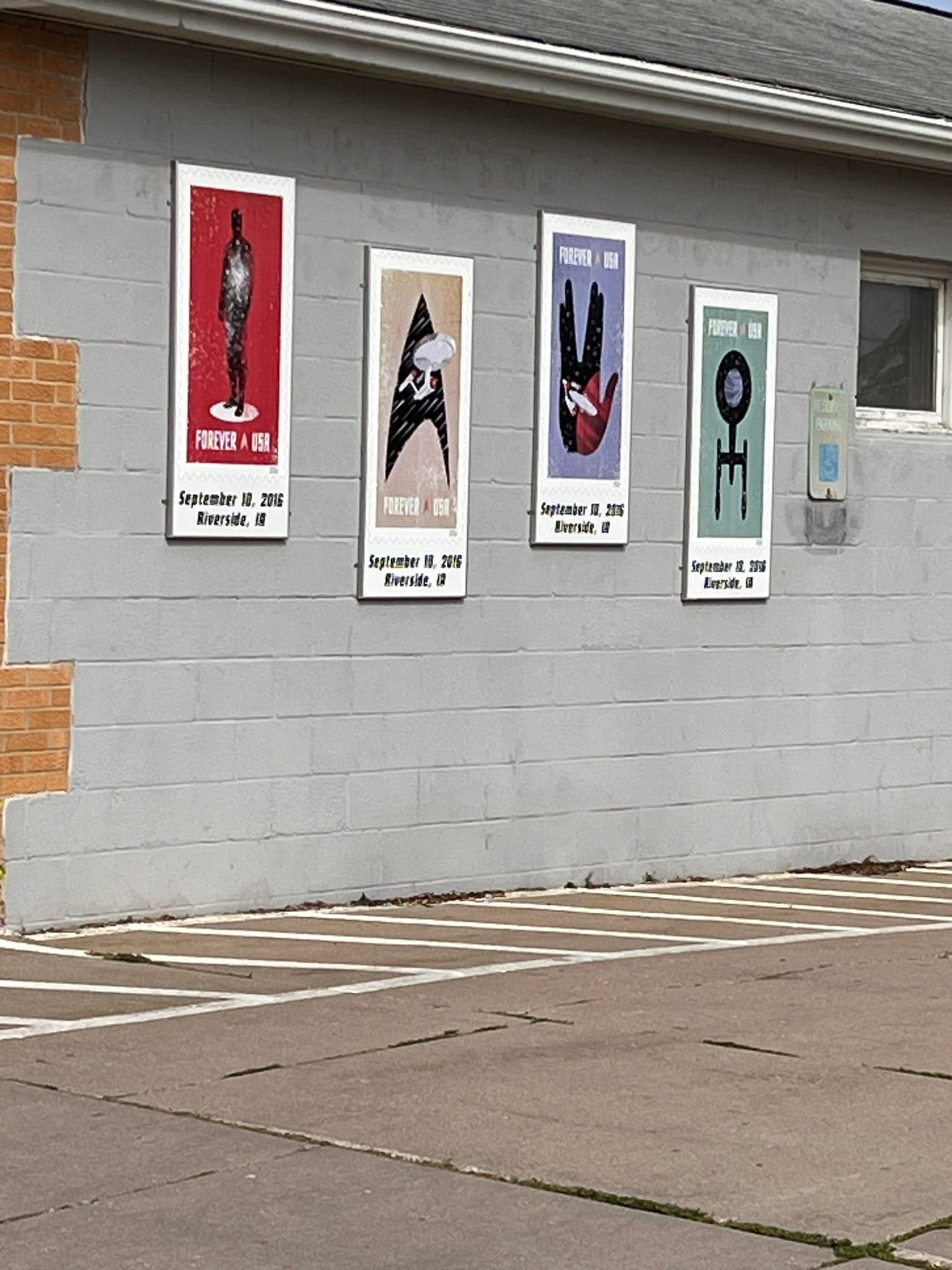
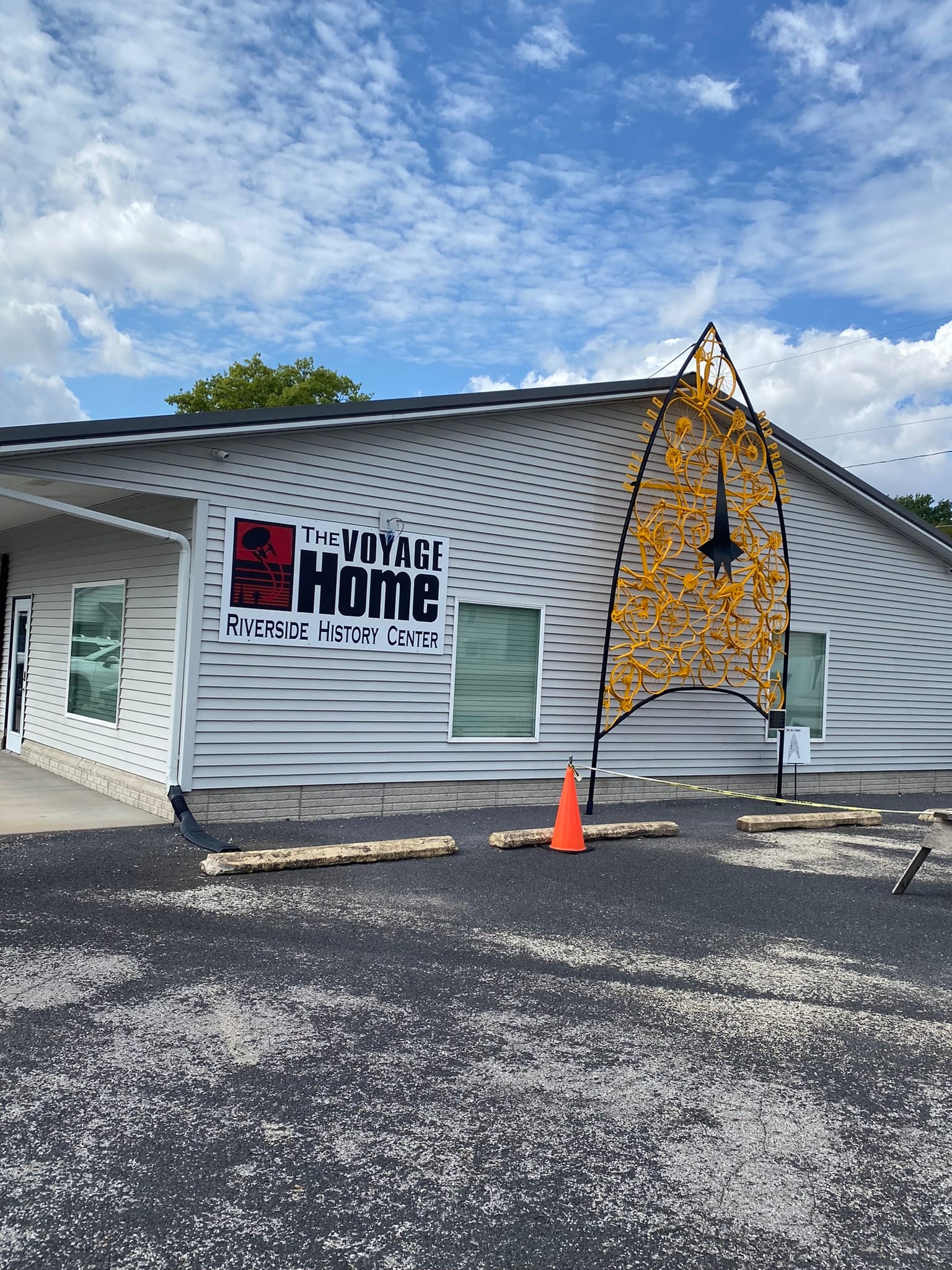
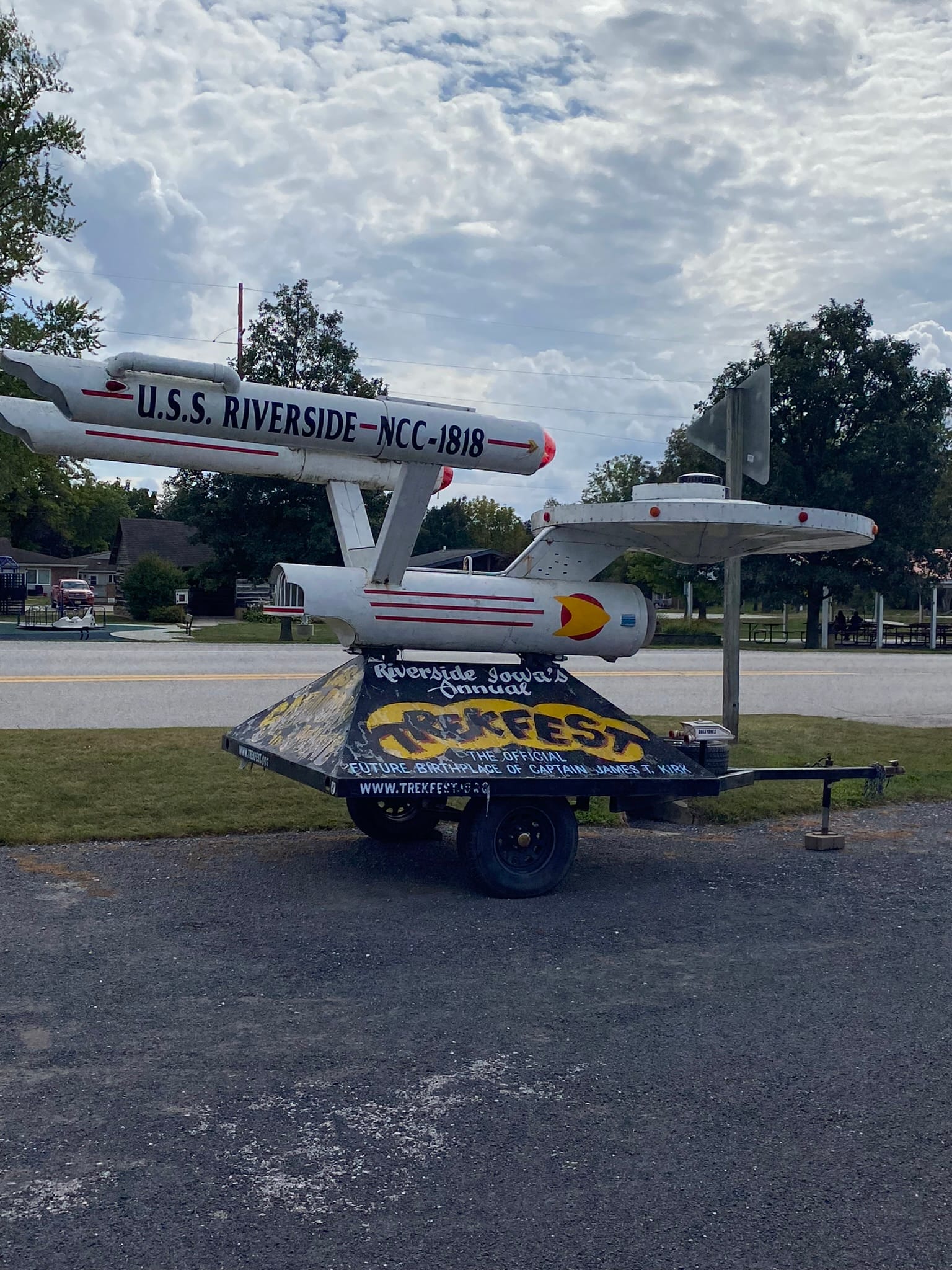
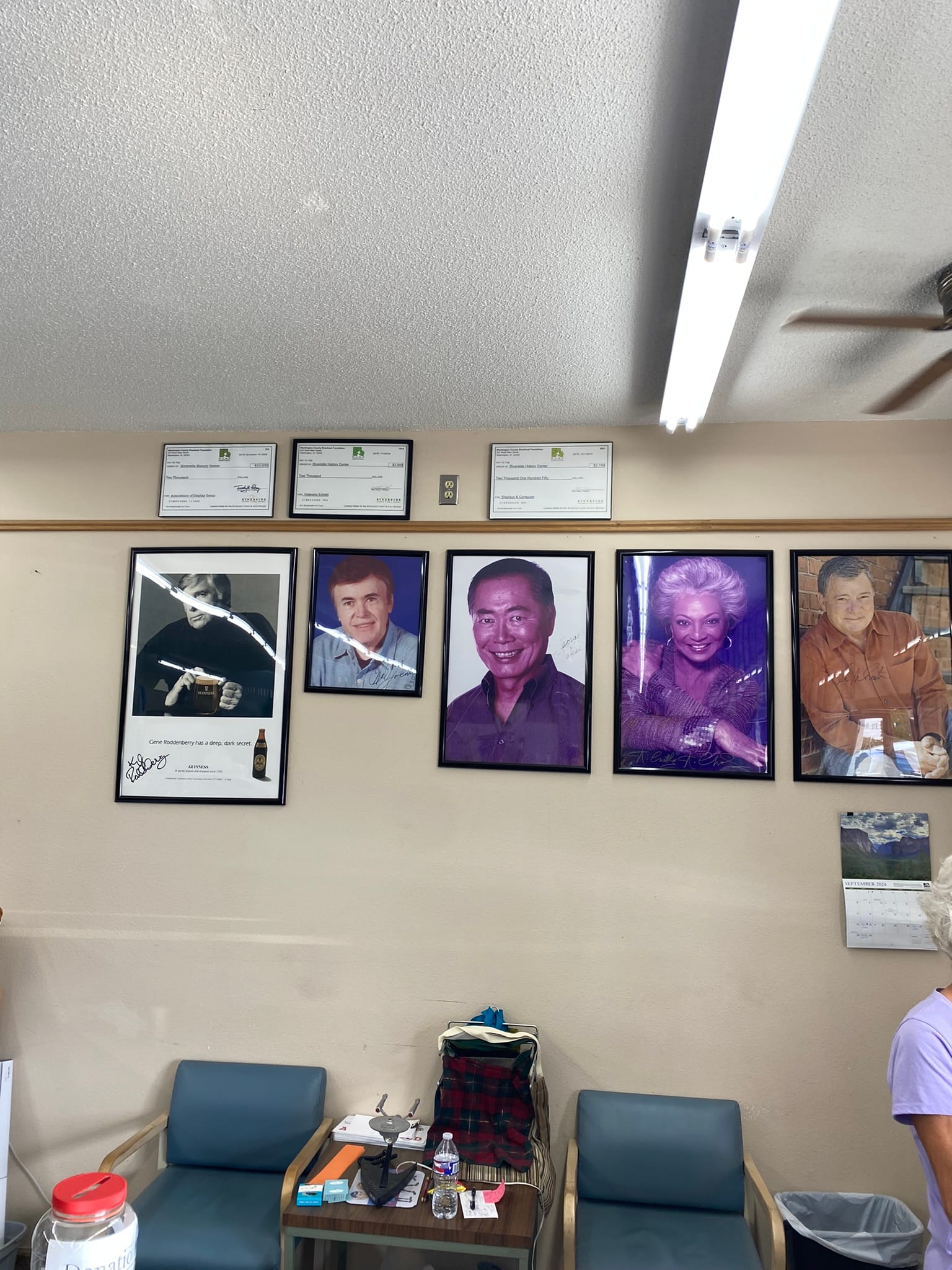
The museum was small but had a lot of movie stuff in it as well as autographed memorabilia from various stars from all the Star Trek shows. They had an Enterprise like model spaceship out front that appeared to be a parade piece and a miniature shuttle craft also. For someone like me whose childhood revolved around Star Trek and other Sci Fi stuff it was pretty fun to see! I got a T-shirt and pin for the road. By the way, the restroom is a must experience! I won't spoil it for you but I quite literally laughed out loud at the door and the mural inside. I love the quirky little towns and stops we find along the way!
Spook Caverns and Effigy Mounds National Monument
It worked fine this afternoon when we got to Spook Cave Campground in NE Iowa.
The drive along the Mississippi was extremely beautiful, with majestic bluffs overlooking the Mississippi River. We saw several Corps of Engineers Locks and spillways along the way and soon enough we reached Spook Cave Campground in NE Iowa. We had deliberately planned to stay in this area since Effigy Mounds National Monument was nearby.
Since we had arrived rather early we headed over to Effigy Mounds National Monument before they closed. I don’t know what I was expecting but a two mile round trip hike with the first half mile being switchbacks to the top of the bluff wasn’t it! Anyway, that’s what we did – a forced march up the bluff to see the mounds at the top. It wasn’t bad once you got to the top but that first section was a killer! The mounds weren’t really spectacular at this site. They were all mostly low mounds and the shapes were rather nondescript especially as viewed from ground level but it was still impressive to see. I know there are other mounds around the US that I’ll have to try to visit. Some of those are really high!
Spook Cave Campground was pretty sweet! It was set in a wooded valley of Iowa farmland snuggled up against a bluff in a roughly crescent shape. It had a waterfall just inside the park coming out of the wall of the bluff and they host a cave from which they get their name. They provide boat tours but not for the faint of heart as the head clearance is very low and they warn that “excessive bending” was required to get through the low areas. We passed on the boat tour. The opening of the cave is in a pond from which the water flows down a sluice for panning and runs an old waterwheel in a very old, historic rock building. They’ve done a great job of blending it all together! They also have basketball court and volleyball court and some nice looking restrooms and showers.
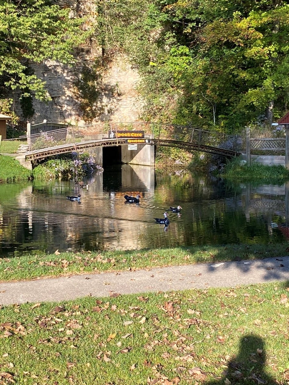
There was only one downside – on the other side of the campground ran a train track that was rather picturesque itself running across a bridge over the stream running through the campground. Luckily, unlike other train tracks we have recently camped near, this one wasn’t very active and we only heard 4 trains the whole time we were there but you can walk right up to the tracks and get amazing pictures of the train coming around the bend and appearing out of the trees! Very cool actually! Our grandsons loved the video I took of the train running right beside me.
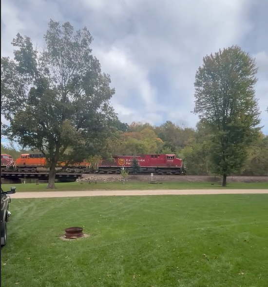
Great River Route, Wisconsin
From Bayfield, we made our way down to Prescott, WI, where we picked up the Wisconsin Great River Road that winds its way down along the Mississippi river through a lot of very picturesque towns. Unfortunately, we couldn’t really stop in many of them as the road was narrow and there weren’t many places to pull off and park an RV. The road wound through farmland and along some bluffs adjacent to the river. The river is HUGE even up this far! The bluffs overlooking the banks were amazing to see also. Very picturesque!
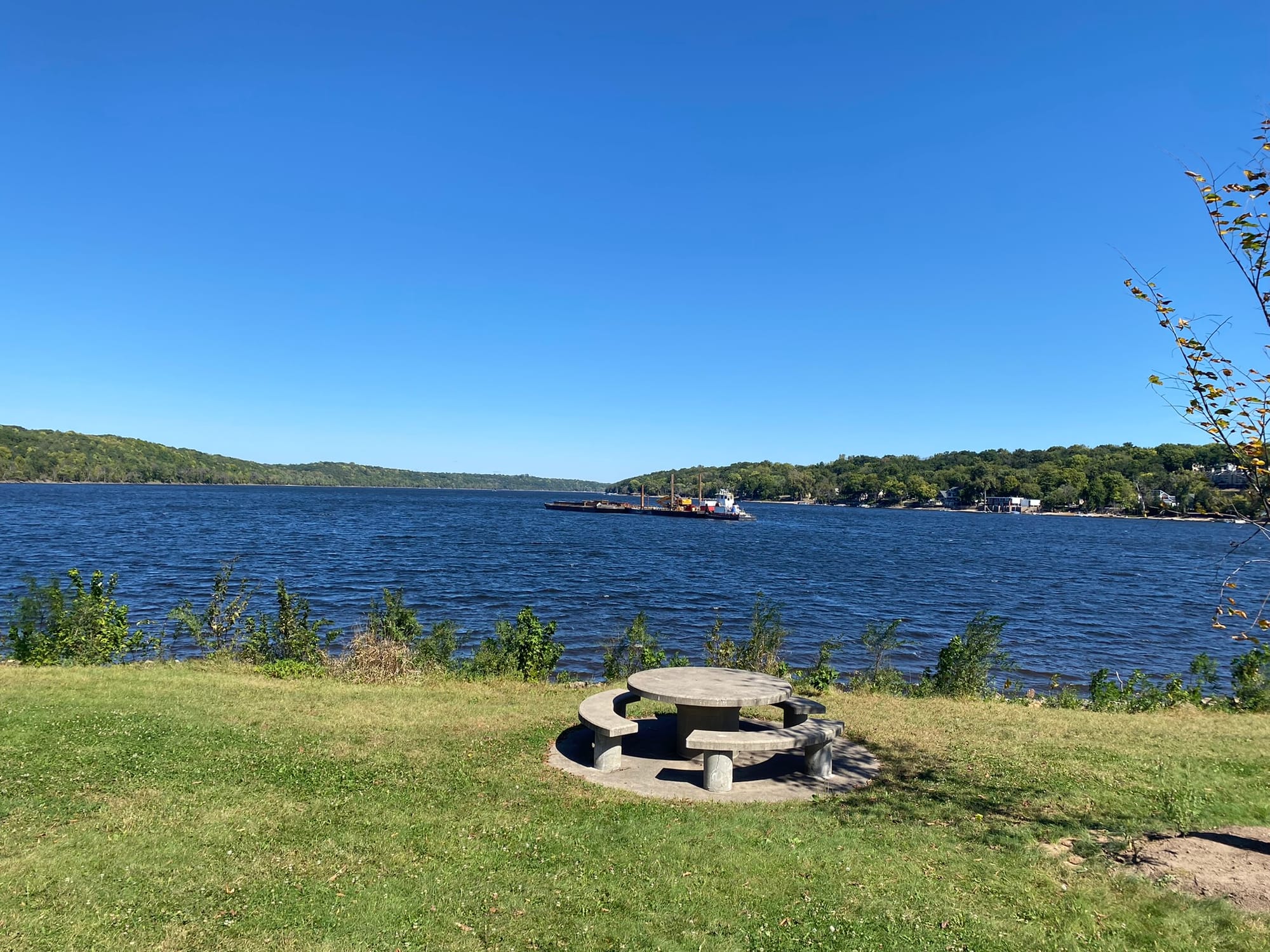
We got to Pla-Mor campground where we are spending the night and set up the RV. The campground is actually on the Minnesota side of the river. One of our fellow campers told us where to find food in the next two towns – La Crosse and La Crescent - one on each side of the river. Since he had mentioned an Apple Festival in La Crescent, we decided to go there and find the Festival. We were directed to the community grounds where it was being held. It was a nice little, small town fair with pony rides and jumping houses, various ice cream and popcorn vendors, Brats and most important – Cheese Curds having been scolded by our daughter for not already trying! The cheese curds were great (they’re just cheese sticks!) and the brat was amazing!
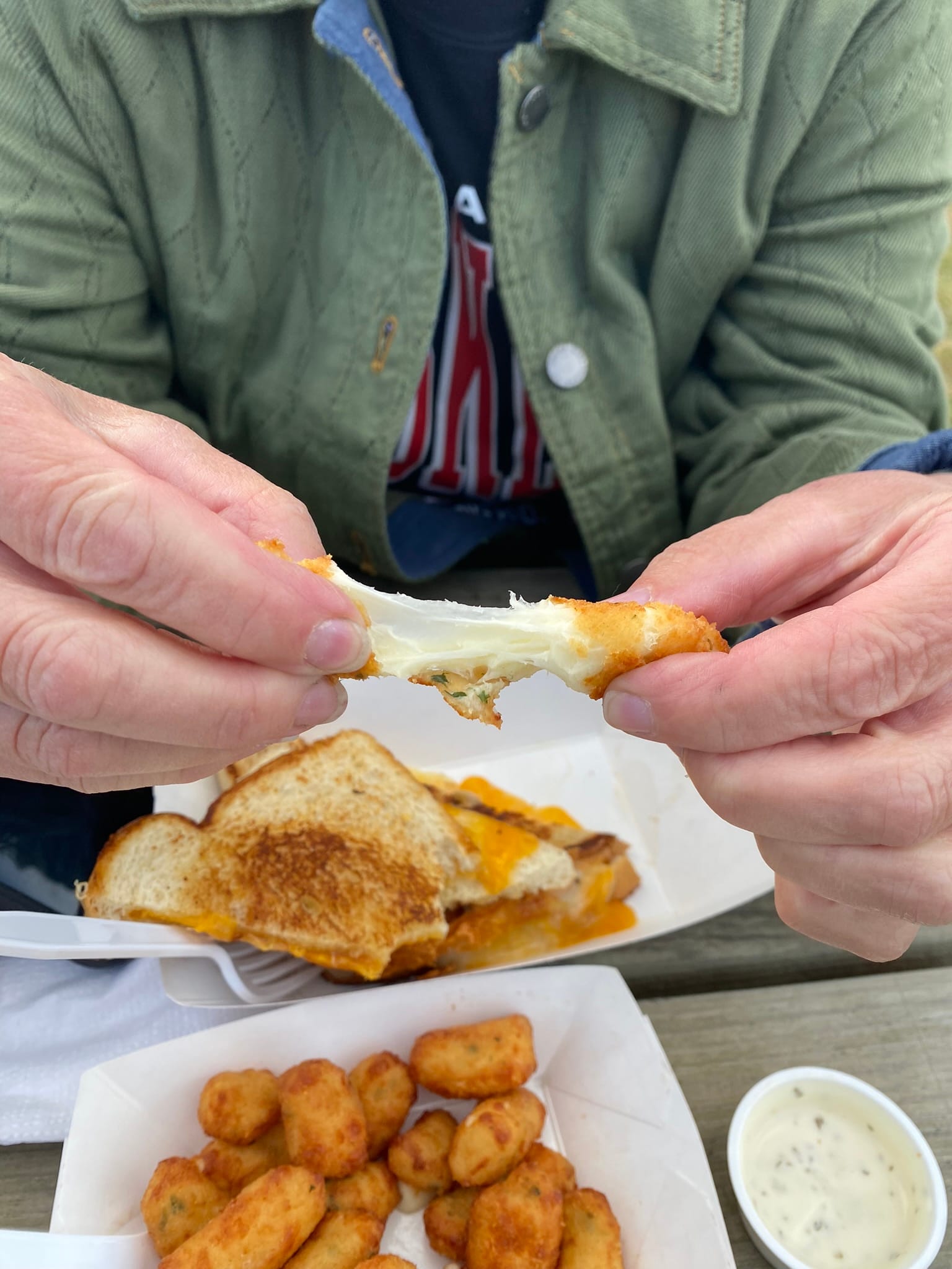
I was looking around for apples and they were surprisingly hard to find at the Apple Festival in the town called “the Apple Capital of Minnesota”. We did find a caramel apple but it was split up and covered in caramel and whipped cream but it counts! We met the hometown Apple Princess, not the queen but we were still honored! On the way out of town we did find a farmers market loaded with Apples so I guess the "Apple Capital" name fits.
We spent another day driving down the Great River Road on the Wisconsin side though the view on the Minnesota side is just as spectacular and the road is much wider but there is something special about traveling slowly through the old towns and seeing the sights along the way!
Lake Superior and Bayfield, Wisconsin
We reluctantly packed up and headed south out of Voyageurs National Park for our next destination along the shores of Lake Superior in Wisconsin. I had read about a couple of the “best things to see” in Wisconsin and one was the town of Bayfield up near the Apostle islands. We hit Duluth and dropped down towards the harbor and it was pretty spectacular to see all the shipping and terminals laid out before us. They are truly HUGE!
We rounded the corner of Lake Superior and drove northeast to Herbster City Campground for two nights. The campsite sits right across the access road from the lake. It has pretty spectacular views of Lake Superior and from there you can watch the sunset over the lake! The campsite doesn’t have sewer hookups but it does have a dump station but the sites are relatively nice but not completely flat. It’s located on a gently sloping hill down towards the water and all the sites have an amazing view.
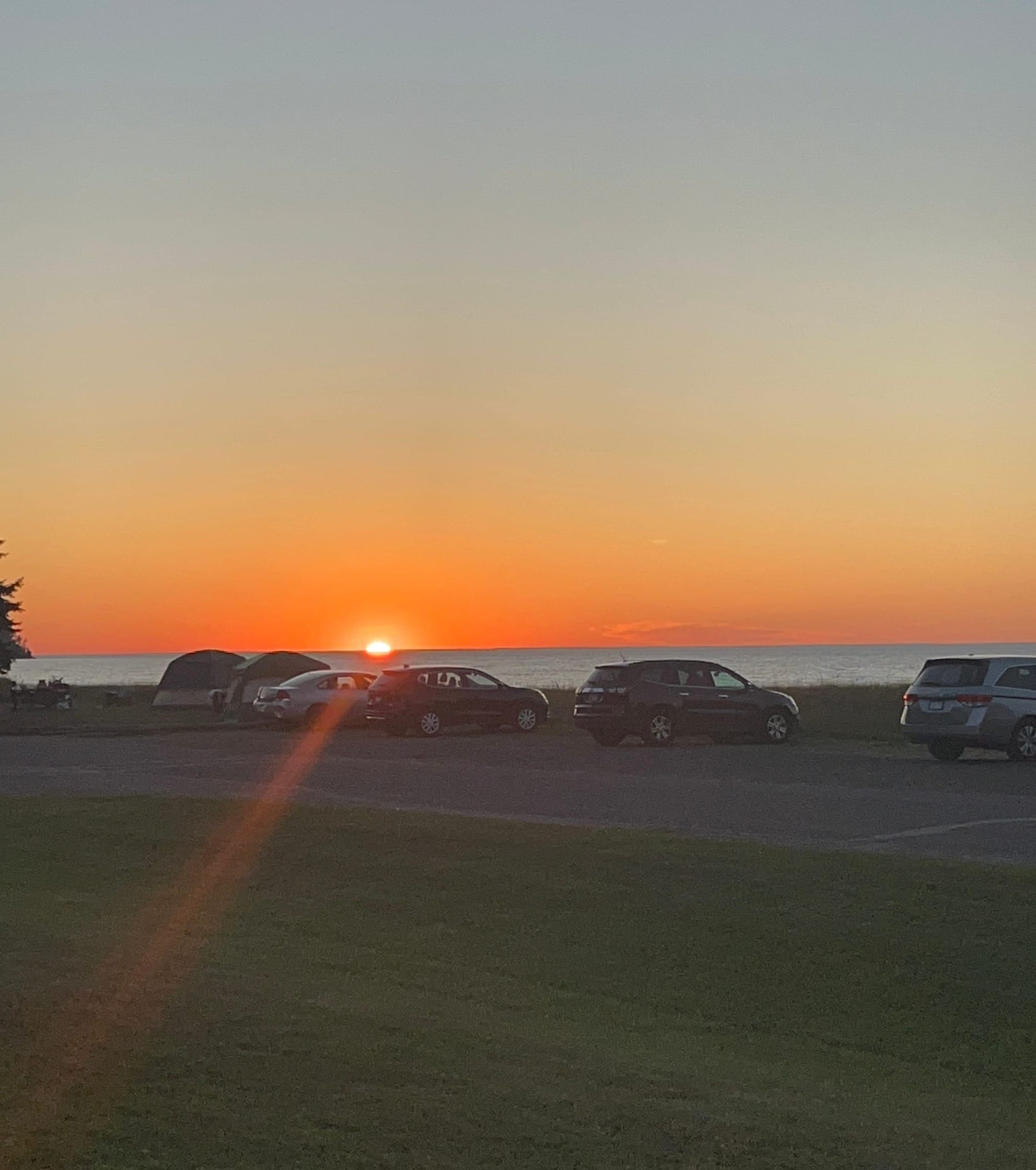
The next morning we headed out to see the sights in the area. We drove around the point on hwy 13 and stopped at two recreational areas along the Apostle Islands National Seashore to take some photos and look around. Both parks were very beautiful. You couldn’t see the Apostle Islands from the first one, but the second one has some in view. We continued east and curved around towards Bayfield which had been listed as one of the best places to visit in Wisconsin. The town is very picturesque with the Apostle Islands visible offshore and harbors filled with boats including some very large ships operating in the vicinity and a French cruise line from France that was on a Great Lakes tour.
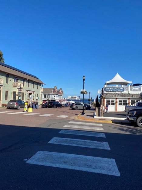
We had been told about two places to eat in town by some folks we met on the beach last night and I spotted one of them called “Hoops Fish”. The restaurant is on it’s own pier. The only thing they serve is fresh White Fish caught from the lake. We had Fish and Chips basket for $15 each and a beer to wash it down. The fish was very good and for deep fried battered fish it wasn’t oily at all! While we were in town we visited the Bayfield Maritime Museum and checked out their exhibits about various wrecks on the lakes including the Edmund Fitzgerald! We also did some light shopping in the downtown area.
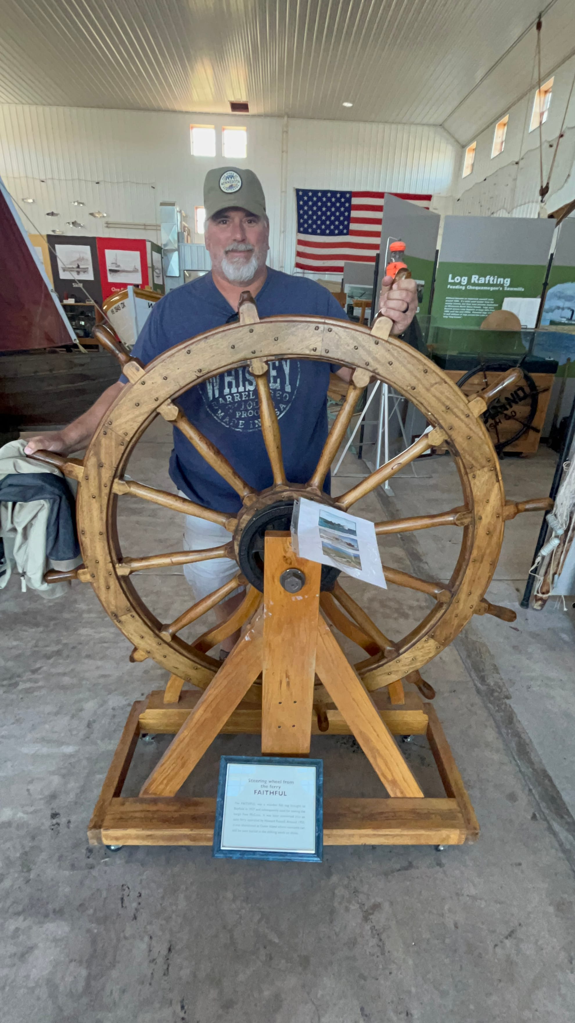
Voyageurs National Park, Minnesota
We packed up in the morning and got underway from Mille Lacs Lake on the final leg of our journey to Voyageurs National Park. It was a fairly long 4-hour drive through some very beautiful countryside. As we went north, we saw less and less farms and a change in the trees in some places. Certain areas looked like I’d imagine the Tundra would look with very scraggly pine trees. Other areas looked like what we had been seeing so far – a mix of pines and deciduous trees some of whose leaves were changing for the fall. Mostly yellows but some reds were starting to show.
We finished our drive to Voyageurs and finally got to see some of the massive lakes and islands that make up this area. Voyageurs is made up of 4 large lakes and over 500 islands according to the locals. It was impressive! Our campsite was called The Pines of Kabetagama and was located on the southwest edge of Lake Kabetagama. They have boat rentals right on the campground, cabins and RV sites including some on the cliffs overlooking the lake. We were lucky enough to have been able to reserve a site up on the cliff with an amazing view of the lake! I can highly recommend that campground. The owners are amazing to work with and really helpful!
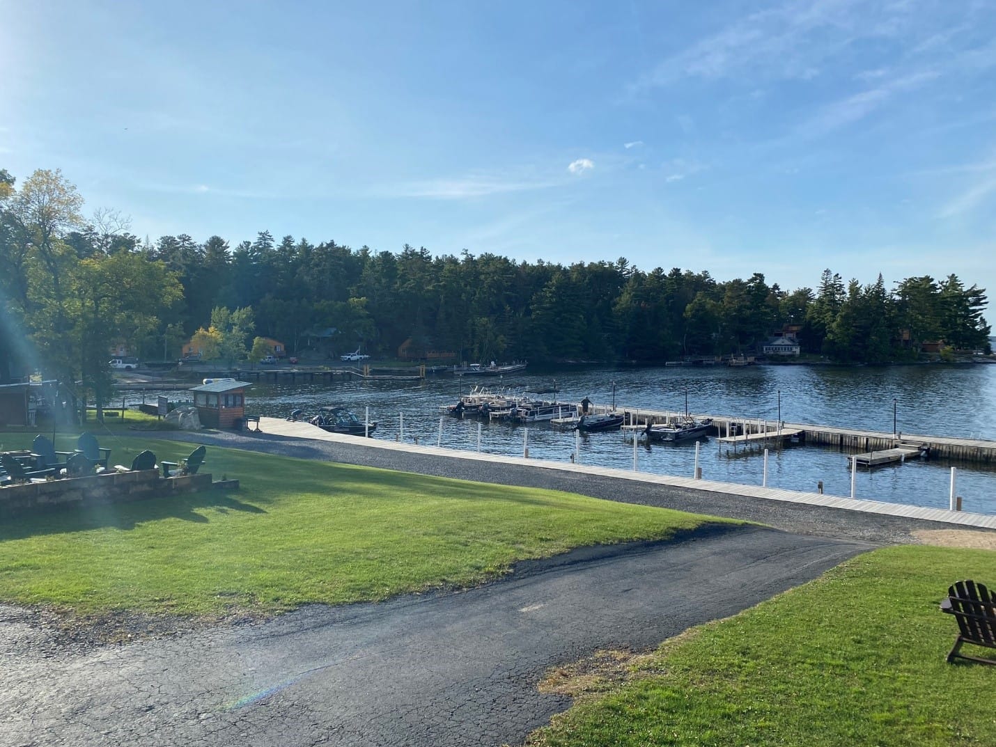
And now a rant about the beast in those parts that preys upon human flesh and from which everyone is running and hiding. You may think I am speaking of bears, or maybe the fabled Sasquatch, but they are tame compared to the wild, indigenous Minnesota Mosquito! I’m not kidding! These things aren’t so nice and polite as the Texas variety that show up 1 or 2 at a time and provide only a minor annoyance. These buggers attack like killer bees or red ants seemingly by the thousands. Our neighbor took one look at our attire last night (shorts and Tees) and said, "you are probably ok around here, but if you go near the woods you need long pants, long sleeve shirts, tons of DEET and a special hat with mosquito netting to have a chance of survival." Ok, I added the survival part, but the rest was nearly verbatim and as it turns out, he’s absolutely correct! Those little vermin attack in such swarms that you can’t even breath for fear of ingesting two or three with each breath!
That first night, we could see lightning off in the distance and had been chased off the dock and kept from fishing by a storm nearby that didn’t actually hit us. At about 1 AM the line of thunderstorms we had been watching hit and they just trained right over us for well over an hour. It would rain thunderously and then die down and then the thunder would start again and so would the rain. I heard at least 4 cells come over us directly before the whole line moved enough east to begin missing us.
Our second morning, we grabbed our fishing gear and headed out to the docks to try our hand again at catching the elusive Walleye and again, we were skunked without even a nibble. At about this point, we realized that we weren't going to really "visit" Voyageurs without a boat so we rented a small pontoon boat and headed out with our fishing gear to explore the area and see if we could hook something more than ourselves.
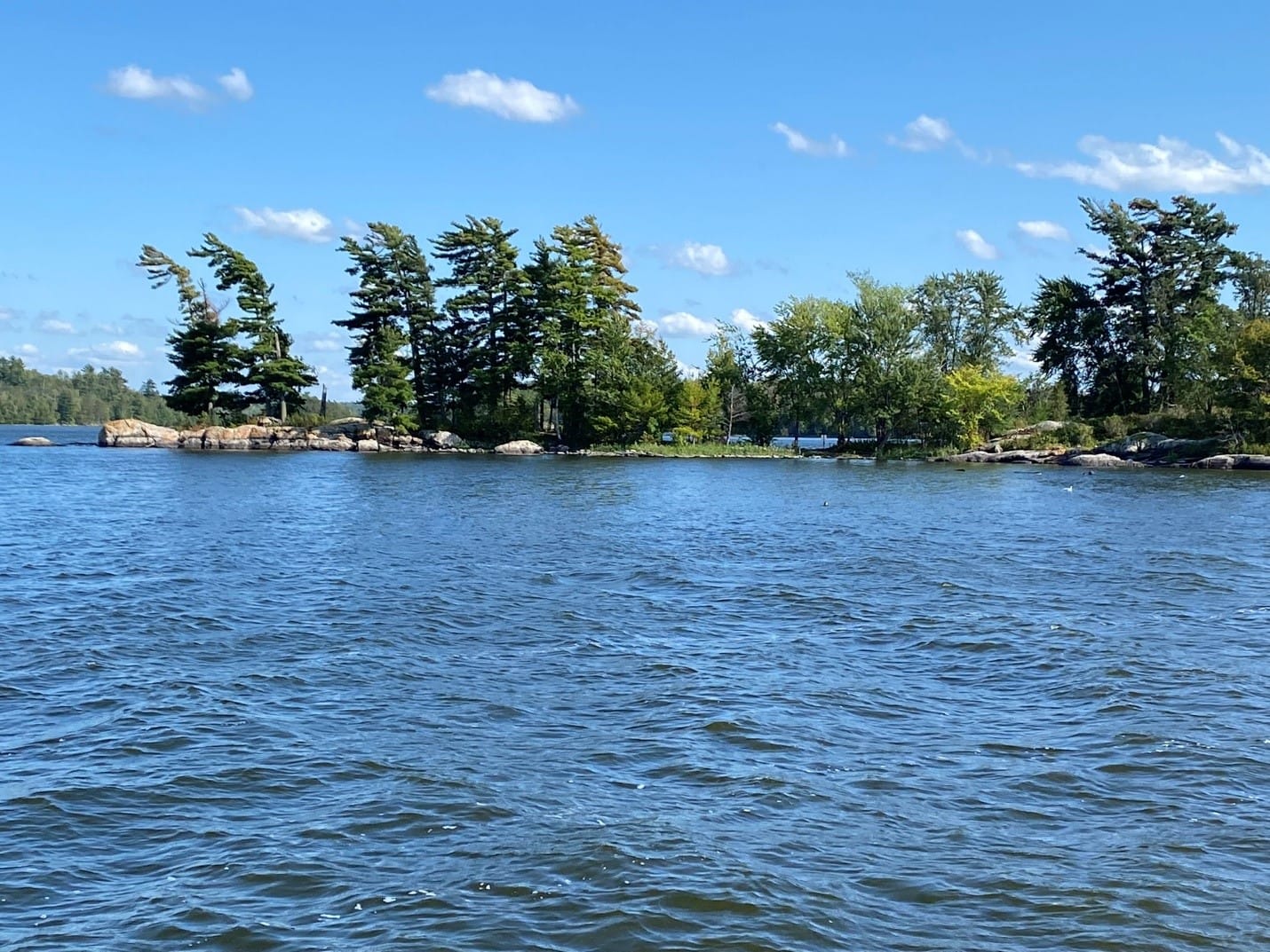
One sight we visited that was fairly close was called Stone Garden and it was someone's rock sculptures on the far shore of the lake that covered a hillside. We headed over there for a look and decided not to climb up the whole thing but walked around down at the bottom for a good look and headed back out to fish.
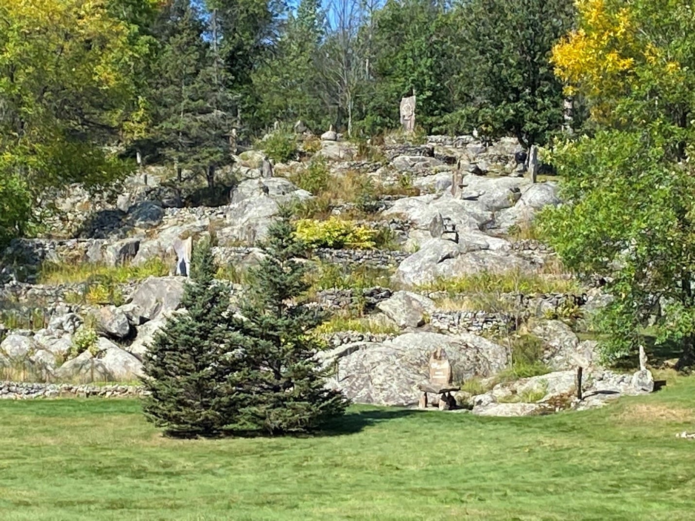
As the day wore on the winds picked up and we headed back to the campground to check the boat back in and spent another rough night due to another line of thunderstorms.
Mille Lacs Lake, Minnesota
The next leg of our journey took us to Mille Lacs lake and our intended campsite at Rocky Reef Resort on the southern coast of the lake. Upon arrival, we realized that this lake is immense some 22 miles x 12 miles across. You can’t even see across it at the widest since 12 miles or so is the naval horizon. We also realized that while the campsite is nice enough it’s not what I would call a resort. There are somewhere between 20 and 25 sites with a large number of those rented out annually to people who keep their campers here all year around but only come up during the summer and they’ve already gone back home for the winter. There aren’t many amenities, but the view is pretty spectacular. Minnesota is pretty flat overall and we saw little else but farms on our drive up. Nothing wrong with any of that, it’s just a description. I really enjoyed the drive actually, though I preferred the mountains of Colorado to the many lakes of Minnesota. Definitely, a fisherman’s paradise!
It turns out that the campsite didn’t have our reservations but had room for us and the owner/operator, Patty, is very nice once you get to know her. Another lesson learned - always double check reservations! We settled into our site and went to the restaurant/office for some dinner. The food was great! I had a Philly Cheese Steak that was more of a Philly Cheesesteak burger but it was tasty. She shared some of their home-grown HUGE tomatoes with us on the burgers! Speaking of which, we took the opportunity to buy some fishing poles and lures that the local fish are supposed to like and gave fishing a go.
Darwin, Minnesota
We continued our journey towards Voyageurs National Park after a light breakfast and a quick pack up. We drove north on hwy 71 into Minnesota to merge onto I-90 east. We then turned off onto MN Hwy 15 through Truman, Lewisville, Madelia, Linden and into New Ulm. We continued north and turned onto CSAH-14 or Tagus Ave which is a winding country road that leads into Darwin, Mn, home of the World’s Largest Ball of Twine made by one man! Yes, there’s a caveat but we diverted into Darwin to see it just to be silly.
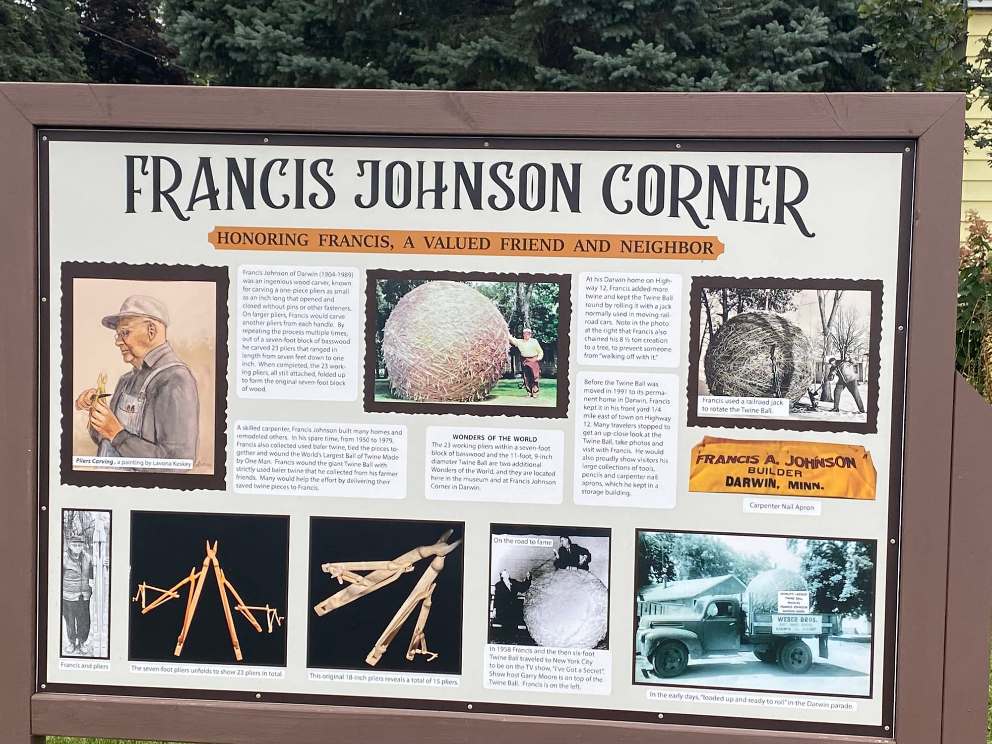
Lake Okoboji, Iowa
Before we could leave Omaha for Lake Okoboji, our next stop, we had to find a place to dump our gray and black tanks. We’d been living on them for nearly two weeks and they were getting pretty ripe! We thought the tanks were too full to drive around much due to the weight, so we purchased a dump tank from Walmart and took a load of $%^& to a campground in Papillion, our old stomping grounds, to dump.
I can’t believe how that area has changed but it has been 24 years since we last lived here. The road we used to live off, Lincoln, now goes all the way through and is 3 lanes most of the way. There are several new neighborhoods along the road beyond where we lived that used to be farm fields. The entire flats along the bottom between the creek and Lincoln is now all built up with incredible new gym and athletic facilities. They’ve also really bought into the whole “round about” concept in the new areas!
Anyway, we headed back down that way to dump and rinse the tanks before hitting the road. We accomplished that task and by “we” I mean “me”. We then backtracked to Hwy 370 and followed it into Bellevue to see the growth there and then jumped on 75 north and across the bridge on I-80 to catch I-29 north.
I deliberately decided to exit off I-29 at the earliest convenience and after fighting with Apple’s maps that kept changing me to interstate all the way up to north Iowa, I shut it down and pulled up RoadTrippers to guide me because that software doesn’t think it’s smarter than me. I’m not concerned about saving 15 minutes, I want to take the scenic path! It's a "thing" for me!
Our course took us through a lot of scenic small Iowa towns including Turin, Castana, Mapleton, Danbury, Battle Creek, Holstein, Storm Lake, Sioux Rapids, Spencer and Milford. It was a nice drive and the roads were for the most part smooth but there were some sections that were rough. Spencer was a very nice little town with flags flying, a section of divided road in town called Grand Ave that had all the state flags flying and things like that. Sweet looking little town!
We continued our journey after a pit stop for gas and a break and finally pulled into Lake Okoboji and found our campsite on the far side. We are camping at Cenla Campground in Spirit Lake, IA. We settled in quickly and headed out to a local Tiki Bar called Barefoot Bar for a drink. The bar is very different. We drove over and there was no parking around it which puzzled us since the bar was very well reviewed. Once we walked around to the lake side of the bar we realized that there was a large marina attached and almost all customers were boat-up not drive-up. Later in the evening we went further into town along the Promenade to enjoy the sunset over the lake with a drink at Pirate Jack’s Bar. This is definitely a seasonal tourist town, and things are winding down for the winter.
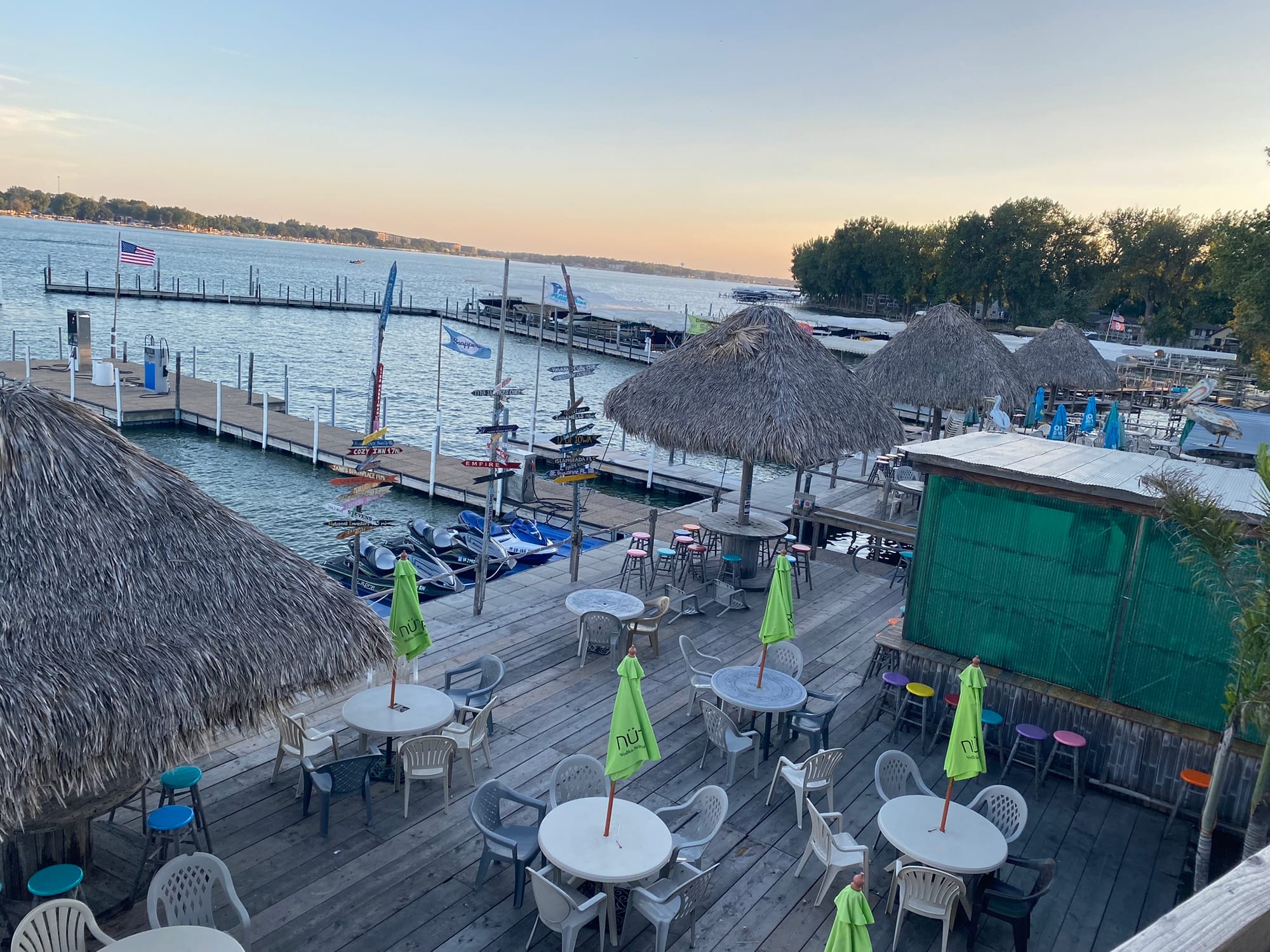
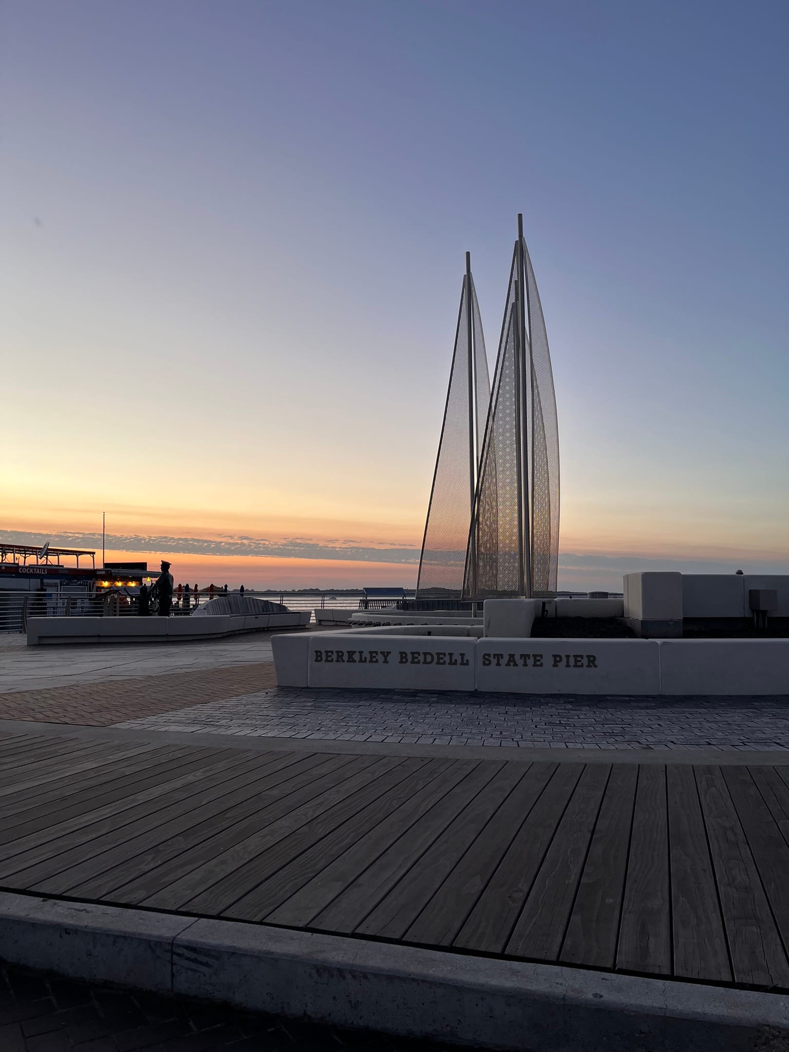
Omaha, NE and Tire Issues
Anyway, as we approached Kim’s Mom’s house, we noticed the tire pressure in the back left wheel of the RV was dropping significantly and every time we looked at it, it had dropped a PSI or two. I'm thankful for the Tire Linc system that Grand Design installed that allowed me to keep an eye on the pressures while we were on the road. If you don't have one, I highly suggest you buy one. Had I not noticed that the tire was getting low and continued driving, we would certainly have had a tire disintegrate and probably damage our rig.
We decided to get the RV parked in her mom's driveway as fast as possible and then would take the tire in for repair. The length of our rig, the lack of length of her driveway, a narrow street AND driveway, some trees on each side of driveway entrance, some mailboxes and a retaining wall made it particularly difficult to get the rig parked where we wanted it. After what felt like a very long time while I am sure the neighbors were making rude comments about my diving ability, I finally got it close enough to what we wanted so we could disconnect and set up shop in Mom’s driveway.
The next day, I popped the tire off to discover that, not only was it going flat, but it was nearly completely bald on the inside edge. We decided that between that flat and the nail that messed up our tread on another tire a few days earlier, that was questionably repaired, we should replace them all. So much for the maintenance line in our budget!
Denver, Co
After visiting Mesa Verde, we wrapped up our visit to Durango and drove east across Colorado towards our next campsite in Howard, Colorado. The drive over the Wolfe Creek Pass and through Pagossa Springs was amazing and then the drive from Solida to Howard was along cliffs on the right and a rushing river on the left. it was a beautiful, scenic drive into town. The campsite was along the river and we were lucky enough to get a back-in site along the river so our windows and door opened onto the river. Just sitting there watching the water pass by was Heavenly!
After 2 nights in Howard we headed into Aurora to stay at the Chatfield State Park. As it turns out, that month was Military Appreciation month and as a military retiree, our entrance fee was waived. That kept the cost down and the park was very beautiful. It has a large lake in the middle with a marina full of boats that looked too big for the lake at least from a distance. There were trees in the water which made it look like the lake level was high but the area around the edges looked like the lake level was low so I’m not sure which is true. The campsite was all the way around the lake on the far side from the entrance.
We visited with family and friends who live in the area and after 2 nights headed up to visit more family in Loveland south of Fort Collins, Colorado and from there to Kim's Mom's house in Omaha for a couple of weeks stay.
Mesa Verde National Park, CO
We visited Mesa Verde where I hoped to get a reasonably close look at the cliff dwellings that the park is so famous for. It was only about an hour’s drive to the park and as we headed back in, it began to rain lightly. You had to wind your way back up on top of the mesas and 20 miles back into the park to get to the two loops that allow you to either look across the canyon at the Cliff Palace or to park above it and climb down to an observation station where you can get amazing views of the dwellings. It was pretty amazing to see how big and remote it was!
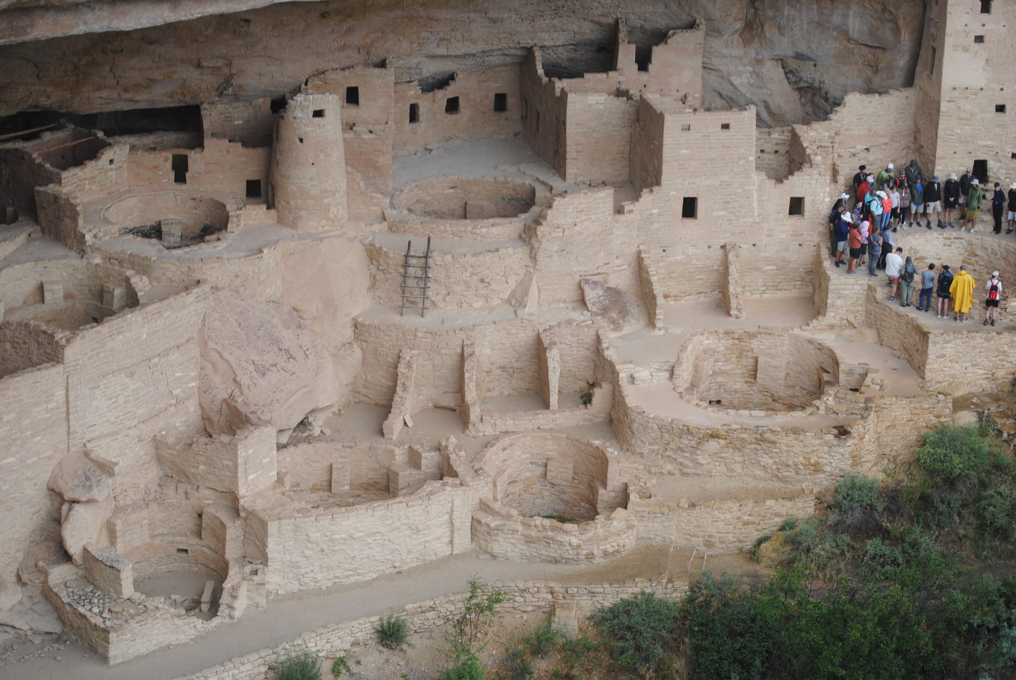
There are a lot of early pit homes around the mesa to check out as well but nothing quite so spectacular as the cliff dwellings. There are several other, smaller cliff dwellings there also, but they don’t get the same great press as the Palace.
Durango, Silverton, and Ouray, Colorado!
We stayed at the Durango Ranch RV Resort just south of Durango. The view was pretty amazing even though we weren't really into the high mountains. We set out to drive the so called Million Dollar Road that runs from Durango through Silverton and on to Ouray.
We drove down into Durango on Hwy 550 and followed signs for Historic Downtown Durango. It’s a very cute area with lots of shops and dining as you’d expect for a high tourist town. Kim and I didn’t stop anywhere as having too much stuff already is our problem! We picked Hwy 550 up on the other side of town and headed up into the mountains towards Silverton.
The drive to Silverton started out fairly plain. The mountains were initially like those in Durango, not very majestic and more of the foothills of the Rockies. The road climbed for a while rather slowly and the mountains started getting more majestic but weren’t as impressive as I had expected. We passed over a couple of > 10K passes and started descending into Silverton on some more switchbacks. We again followed signs into the center of town to see the historic portions.
Silverton felt like an old mining town and some of the buildings were clearly very old. There were only two “main” streets running down the length of the town and those were filled with shops and restaurants as you’d expect. It was a beautiful setting down in a valley between the mountains. We found a place to park and since it was approaching 1:30 or so we found a BBQ place called “Thee Pitts Again”. I had the chopped sandwich with cornbread and Kim had a pork sandwich with cornbread and potato salad. We sat outside to take in the cooler air and sights of the town.
While we ate, there were a huge number of Jeeps and motorcycles running up and down the main street we were on. Riding mountain trails is a huge recreation activity in this area. We saw many trails branching off the highway as we drove around.
After about an hour in Silverton we decided we might as well head the rest of the way to Ouray and boy, am I glad we did! It was a fairly long drive to Silverton and we thought we had seen “all there was” really in terms of mountains but we were SOOO wrong. The drive to Ouray got better and better with every mile we went and with every turn in the road! The mountains got taller and rockier with sheer drops all around us. There were waterfalls seeming to come from the sides of mountains and cut their way down into deep slit like canyons on the side of the road.
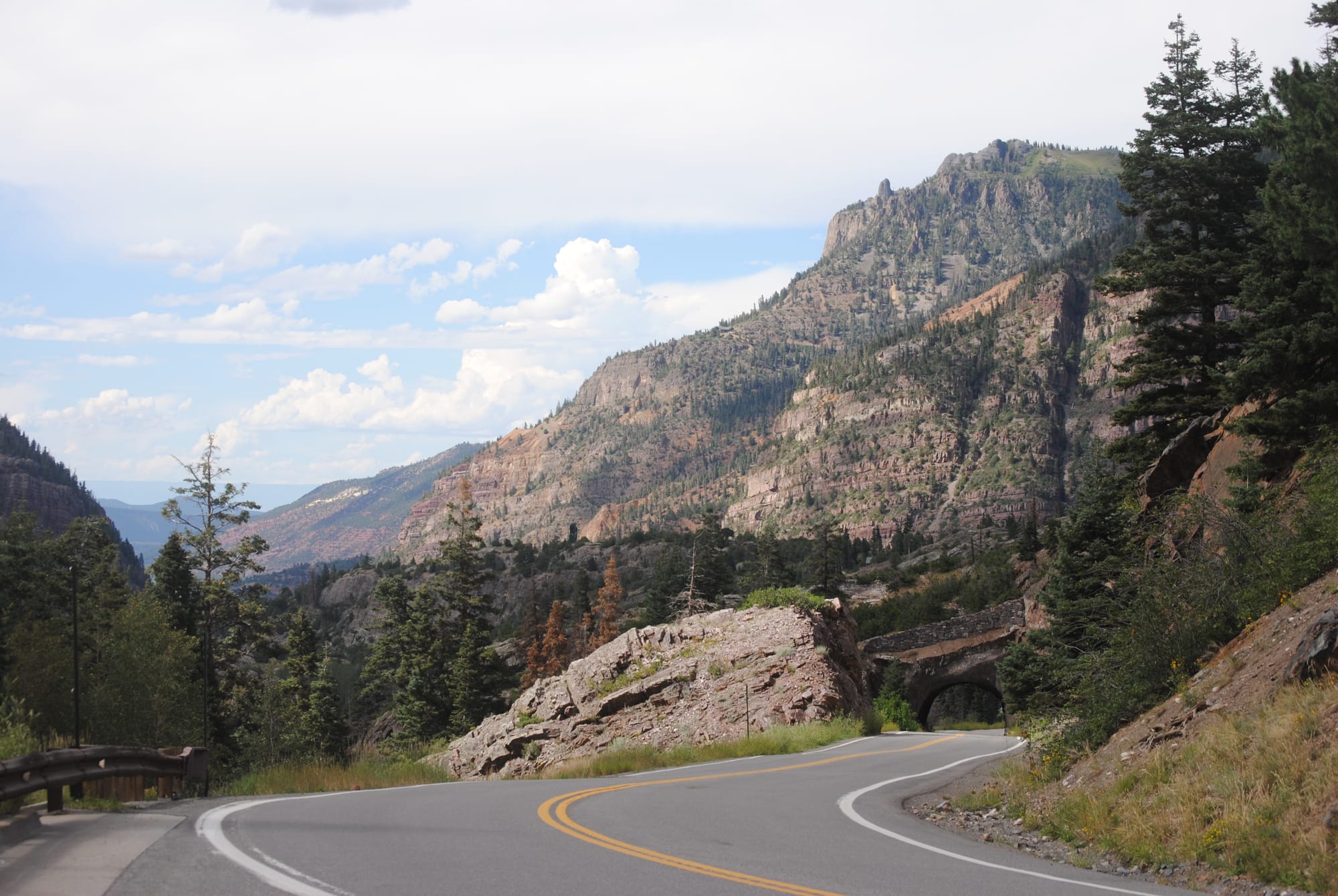
There was evidence of mining in many places and steep drop-offs on the side of the road almost never protected by guardrails! I have to admit that I was white-knuckling it a bit at times when we were on the side with the sheer drop. This drive is not for the faint of heart or anyone with issues about heights! By far the most rugged and beautiful drive I have ever seen! We were frantically trying to capture every vista on film but I know film will not do it justice! It was the most beautiful place I’ve ever been geologically speaking. The little town was kind of old and a bit drab in places but the scenery around it was mind-blowing!
Aztec Ruins National Monument
Our next destination was Aztec Ruins National Monument which has nothing to do with Aztecs but was apparently named by Spanish Conquistadors by mistake. The ruins are in fairly good shape for their age with lots of rooms to see and a nice paved trail. Entrance is free but it is not pet friendly. Kim wasn’t interested in it, so I went through alone. They had several Kivas with one large one that’s been completely resurrected that the tour path takes you through. There is a brochure for $3 or a free QR code that takes you to a website with a guided audio tour. It was pretty cool to see how some of our American ancestors lived.
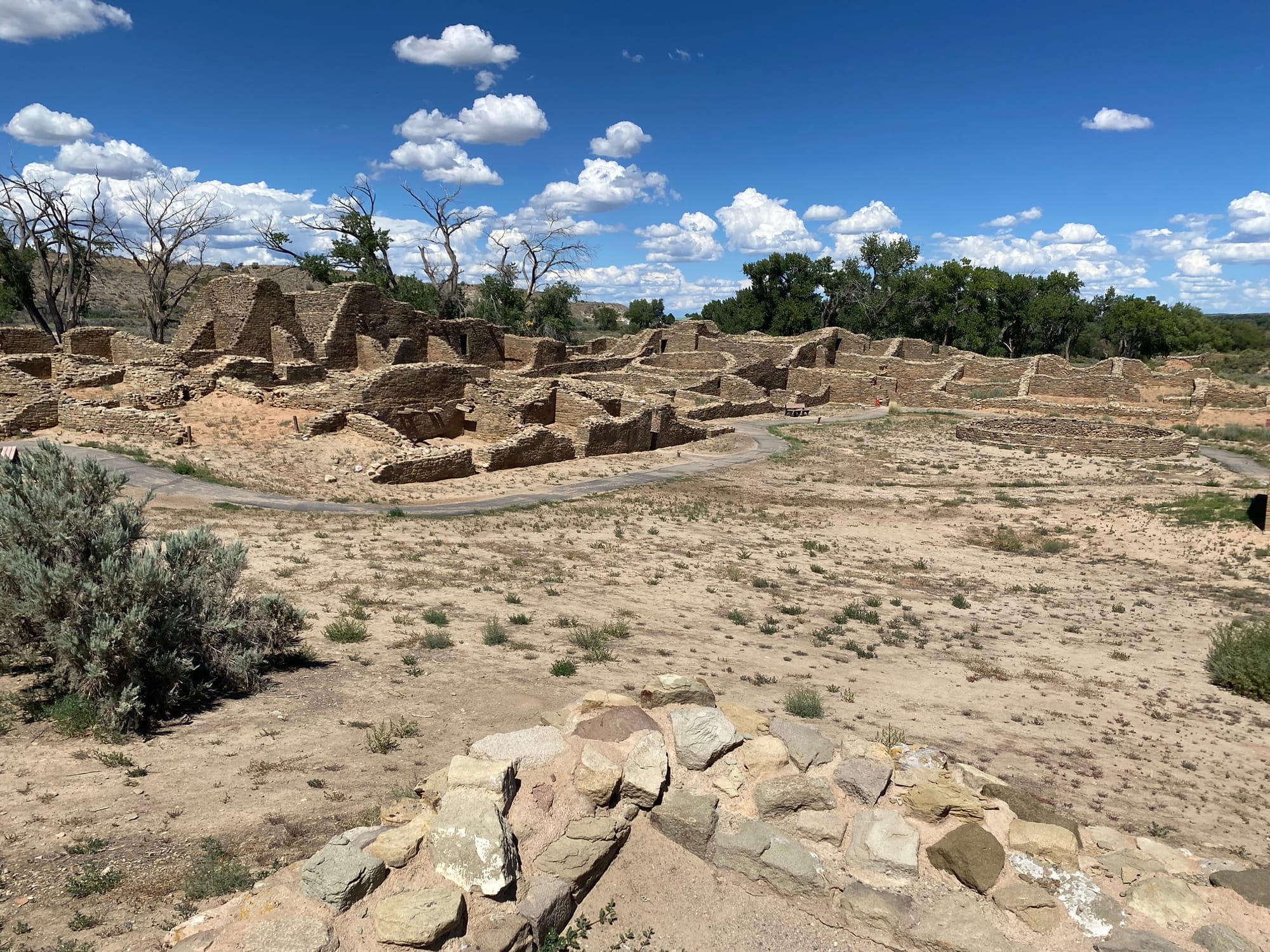
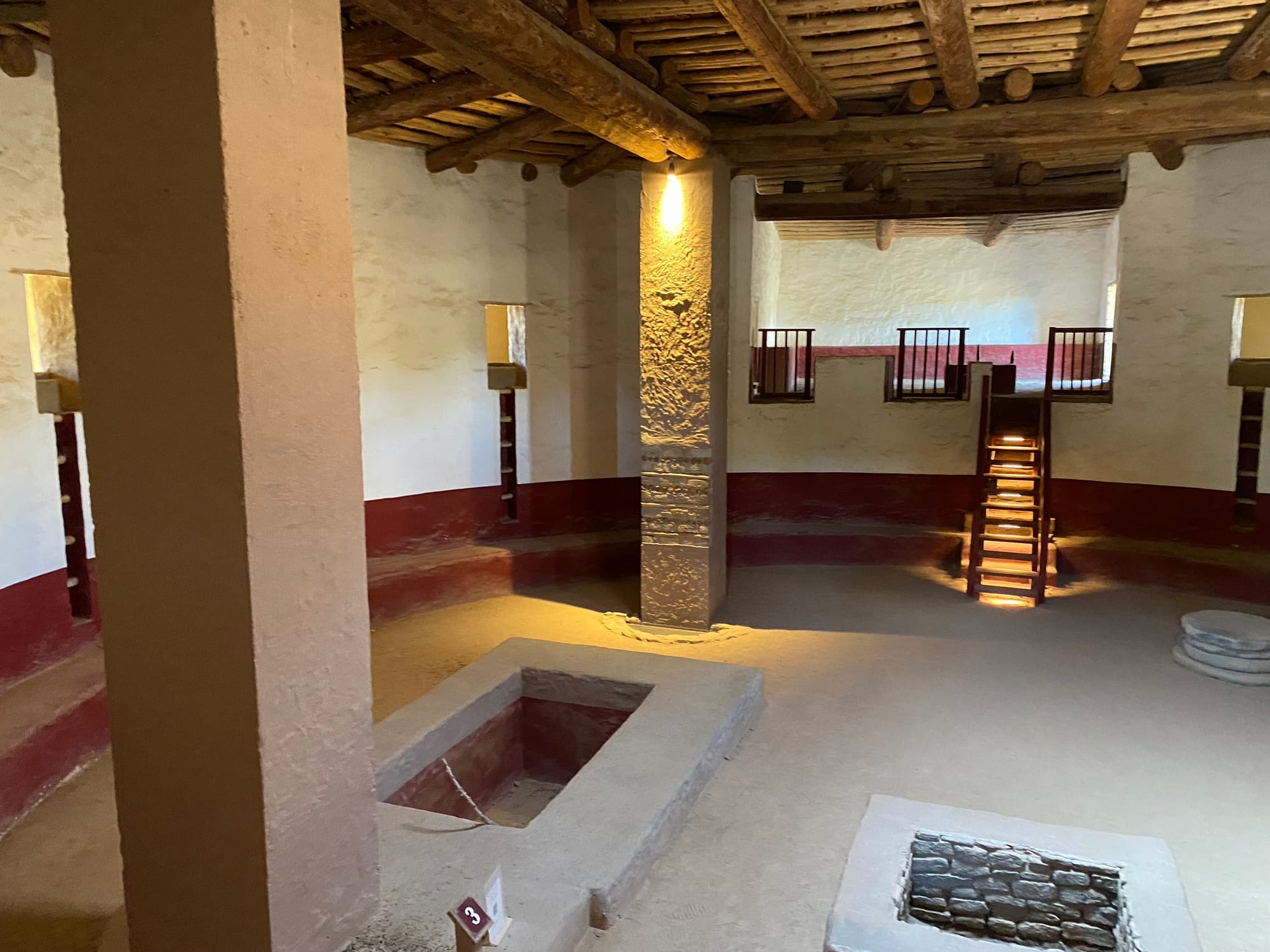
Albuquerque, NM
We headed on from Fort Sumner towards Albuquerque on Hwy 84 which runs northwest. I had thought the road from Midland, Texas to Roswell, New Mexico, was the most boring drive on the planet when we drove to Ruidoso. Hwy 84 from Lubbock up to Fort Sumner through Clovis, New Mexico, and Cannon Air Force Base was by far the most boring drive I’ve ever seen. It was lacking the glorious vistas of oil pumps the trip to Ruidoso had. (Sarcasm intended.) However, not long after leaving Fort Sumner we started seeing a lot more interesting geography and scrub brush changed to more green brush. The beautiful Sandia mountains started coming into view about the time we turned onto I 40 W.
The drive from where 84 hits I 40 down into Albuquerque is probably one of the most scenic drives I’ve made so far in my life. I know I’ve driven that stretch of road probably three times now, but I didn’t remember any of the sights. The mountains were absolutely gorgeous. We went through Albuquerque and out the other side where we’re camping at Route 66 RV Resort and Casino which is right on the old Route 66. On the way here, we saw a lot of signs off of I 40 for Route 66 and I’m chomping at the bit to go see some of them, but Kim won’t let me! There’s a long story there and it had to do with some very rough roads a few years back that basically broke our motorhome. Somehow, I’m still going to get out and check out some of this stuff. There are spots in Albuquerque were two different routes that were called Route 66 at one point in history come down into Albuquerque along I 25 basically and along I 40 and they meet in downtown Albuquerque and it’s supposed to be pretty terrific.
We camped at the Route 66 Casino and RV Park. It's a very nice park with really nice landscaping, a pool, hot tub, laundry, and of course the Casino with decent food. We enjoyed a down day there before heading out again and the nights were beautiful with a full moon lighting up the desert southwest landscape!
As we rolled into the campsite, there were some nasty wind gusts and several RVs' awnings were damaged. We took that as a strong warning and didn't leave our awnings out when we weren't right there to quickly bring them back in!
Fort Sumner and Billy The Kids Gravesite
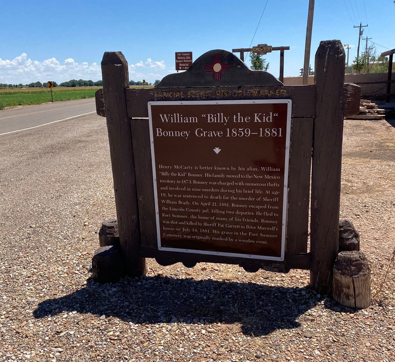
Our first major major stop on our first full-time trip was Billy The Kid's grave in Fort Sumner, Tx. It was a fairly small cemetery and a couple of the graves were fenced off to prevent vandalism. Billy’s grave was covered in loose change people threw in. It surprised me that people would do that and Kim asked why people were venerating a criminal. It’s a good question and probably would make an amazing subject for a PHD candidate in Psychology. We took some time to stop and see the gravesite, but we didn’t go into town for the museum. It was an interesting stop since the old west bandits are a big part of the story of the American West.